Archaeology in the Post-Truth Era
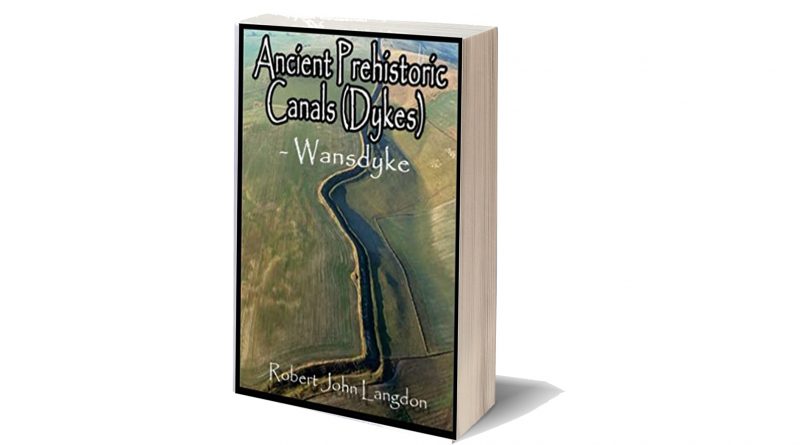
Over the last decade I have been challenged in my views that Linear Earthworks are Prehistoric Canals and consequently undertook substantial surveys of the 1500 Historic England’s Scheduled and archaeologically accepted Linear Earthworks, which has culminated in publishing the first book of a quadrilogy of my findings about a small section of Dykes commonly called ‘East Wansdyke’ to support my theory(Post-Truth Era).
This was the first book in the history of archaeology to survey in detail all East Wansdyke and achievements not equalled by any University or research team to date. The context of this book proves ‘scientifically’ that the existing archaeological hypotheses about Wansdyke and Linear Earthworks are fundamentally flawed.
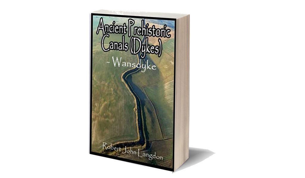
Consequently, one would imagine that the information contained within the publication would have created a ‘talking workshop’ in which questions would be asked and thoroughly discussed in minute detail as it is new to the world and previous undiscovered – but at best, all it received as a ‘Conspiracy Theory’ label even though it was based on research using the most up to date 21st Century software through LIDAR (Light Detection and Ranging) data collected by the government through is Defra (Department for Environment, Food & Rural Affairs) website, which has yet to be embraced by the archaeological profession, who still rely more upon dated Satellite technology and crop marks for information.
So, the professionals were reticent, and the only noise from social media was the usual archaeological ‘Jihads’ who refused to accept that the books and courses they attended and read in the last century are no longer relevant or correct as they were then ‘peer reviewed’ and therefore (in their mind) absolute in accuracy, for the rest of time no doubt?
This kind of ‘blind obedience’ is sadly commonplace and can be seen by religious fundamentalists, who take the words from a book and turn them into a test of faith rather than knowledge. ‘Intelligent design’ is a classic response to scientific proof of evolution, and the tactics used by these people are similar to what I see in my work – attempting to disprove a substantial theory by seeking a show that all aspects of evolution have been fully explained (although subjective in nature) and there cancels the hypothesis by default.

One of these ‘diehards ‘ came back at me in the hope that if he could show doubt in just one site – then the whole hypothesis would come tumbling down, even though a book covering every single metre of East Wansdyke has proven beyond any reasonable doubt that Wansdyke was neither a defensive wall nor a boundary marker. He’s claim was that Wansdyke was built on a ‘late iron age’ fortification and therefore must be Saxon.
So to prove his point, he named a site not actually covered within East Wansdyke book but in an area called West Wansdyke, which I questioned its relevance within the book as I concluded it was connected at a later date to the original prehistoric canal system (probably by the Roman’s) as it was incomplete, sporadic and of a different specification to East Wansdyke.
The reason I have dismissed West Wansdyke I made clear in my book in its conclusion:
West Wansdyke
We have a problem with West Wansdyke – it’s not part of East Wansdyke. This has always been a historical debate over the last 100 years. If we look at the limited archaeological evidence, we find that although it may have been a much later Canal/Dyke it is not contemporary with the East Wansdyke canal and was not built at the same time.
Excavations conclusively show that the Ditches on the East side of Wansdyke are much more profound and twice as broad. In contrast, the Banks on the East Side are much wider. We see that East Dyke was built first, as our River height model shows that most of West Wansdyke would have been flooded or marshland at the time of use.
| Location | Wansdyke | |||||||
| Bank | Ditch | Excavator notes | ||||||
| Materials | Width | Height | Berm | Width | Depth | Counterscarp | ||
| EAST | ||||||||
| Red Shore | Clay/Flints | 9.5 | 2 | N | 10 | 3.9 | Y | Green 1966 |
| Sheppard’s shore | 10 | 2.3 | N | 10 | 3.9 | Y | Pitt Rivers 1888 | |
| Brown’s Barn | 9 | 2.3 | N | 10 | 3.9 | Y | Pitt Rivers 1891 | |
| WEST | ||||||||
| Binces Lane West | Stoney | 12.5 | ?? | ?? | 3.5 | 1.7 | Y | Erskine 1990s |
| Binces Lane East | Stoney | ? | 5? | N | 6 | 2.4 | ? | Erskine 1990s |
| Compton Green | Clay marl | 13 | 0.8 | Y | 5.8 | 2.8 | Y | Erskine 1990s |
| Blackrock Lane | Silty Clay | 12.5 | 1.7 | Y | 4.8 | 2.7 | ? | Erskine 1990s |
| Park farm | Stones | 10 | 0.4 | Y | 5.5 | 2.4 | Y | Erskine 1990s |
| Fairy Hill | 13 | ? | Y | 6.5 | ? | Erskine 1990s |
When the waters receded (possibly Early Iron Age period), it is possible that the Dyke was extended, or the more probable event of East Wansdyke after it dried up was turned into a roadway and what we see in West Wansdyke is the extension of the road, and hence it is wider than in the East.
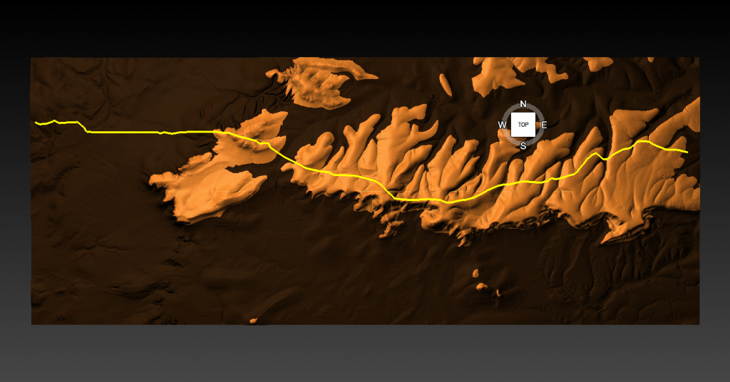
We also see more shallow ditches as they were not used for water but to obtain soil for the walkway and become drainage ditches.
Indeed, we know the Romans used this as a road and always had drainage ditches, usually on both sides. This is supported by carbon dating at Erskine’s excavation at Blackrock Lane, where the section appeared to have been sealed by the primary bank material. One of these layers contained significant concentrations of woody oak charcoal.
Samples of this material were submitted to the Ancient Monuments Laboratory for radiocarbon dating to provide a possible construction of the bank. Unfortunately, as shown in the table below – sadly, as standard when scientific evidence disproves the current archaeological narrative – it is ignored and classified as an error.
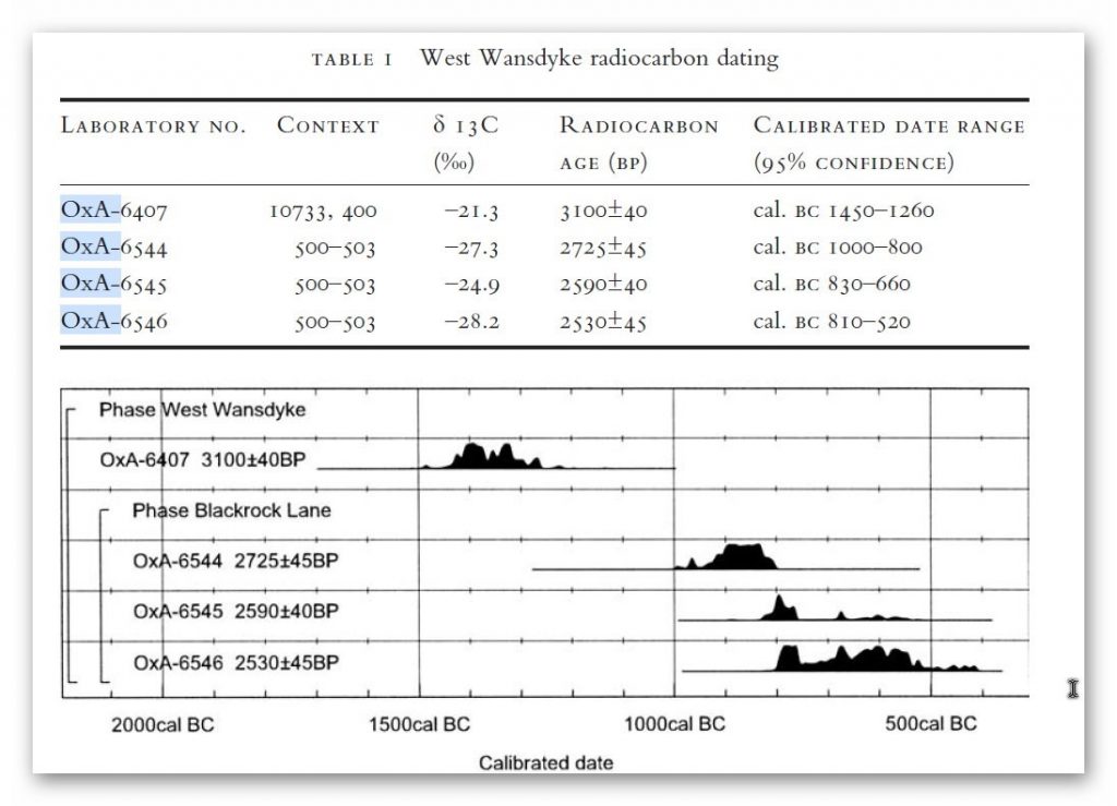
Table 1. Erskine, Jonathan. (2007). The West Wansdyke: an appraisal of the dating, dimensions and construction techniques in the light of excavated evidence. Archaeological Journal. 164. 80-108.
The other missing aspect shown in East Wansdyke and not West Wansdyke was the massive connection to Barrows and Flint Pits. Again, this connection is not seen on West Wansdyke, which may help date this monument as the barrows were of the Bronze Age or earlier and as we have seen from the carbon dating evidence at Blackrock Lane much earlier than its 1500 BCE date.
Statonbury Camp near Bath – an example of West Wansdyke
If we look at the Scheduled parts of the Wansdyke – we see that the East is very much intact, but the West is sporadic at best, and it’s hard to find a logical link to all the Dykes that seem to only appear over hills and not in the valley’s – which in my view would have been flooded in the Mesolithic and hence the west sections addition after East Wansdyke’s construction – probably by the roman’s who may have utilised the Dyke system for their own transportation reasons.
But for the sake of scientific curiosity, let’s take a detailed look at Stantonbury Hill site, which is classified as an Iron Age Camp, with Wansdyke making up one of the defensive banks – but before we delve deeper into the field archaeology of the site – I feel I must clarify the use of the classification of ‘Iron Age Fort’ by archaeologists.
All sites that sit on top of hills and have ditches are called Iron Age Forts – sadly I have yet to find a single location that is either ‘Iron Age’ or a ‘Fortification’ as not a single dead body from slaying has ever been found and all the so called defensive ditches EVER!! Yet the archaeology world continues to use this misleading classification that confuses the public as if it has been qualified and proven. So, back to Statonbury camp.
The only investigation of this site was made by Fox and Fox in 1956 as part of their survey of Wansdyke in the publication ‘Wansdyke reconsidered.’ It should be noted that Historic England does not have an account with their scheduling as no excavation work has ever been undertaken, and so only field walking has been undertaken, and so the results are subjective to the field walker.
In Fox’s publication they also question this linkage of East and West Wansdyke through other even older publications and field surveys that resulted in questioning the logic of dating this linear earthwork.
That great antiquary, Sir Richard Colt Hoare, had his doubts about the identification, which he endeavoured to suppress in his account of the earthwork in Ancient Wiltshire,
‘ Hitherto we have been enabled to trace the course of Wansdyke with certainty and success through Somersetshire, but on approaching the neighbouring county of Wiltshire we enter upon a new and doubtful field of inquiry respecting the direction as well as the formation of this celebrated rampart.’
His own observations in the field had shown him that in this central sector ‘ it bears the decided appearance of a Roman causeway, not of a Belgic or Saxon boundary and yet he felt obliged to support the current view that road and dyke were identical because he was convinced that the Wansdyke was continuous and he could find no alternative course for it in the area.
Sir R. C. Hoare also observes, the camps appear to have been added to the Dyke, not the Dyke formed to connect the camps ; which may be noticed especially at Stantonbury Camp, the second on the line of the course of Wansdyke through Somersetshire.
They continue
General Pitt-Rivers, also had misgivings,
‘ the Dyke he comments, in the Heddington region,’ is of very low relief everywhere on this line and it has often been questioned whether it is a dyke or a road’, and his suspicions were again aroused at a point west of Morgan’s Hill and on Bowden Hill near Lacock’.
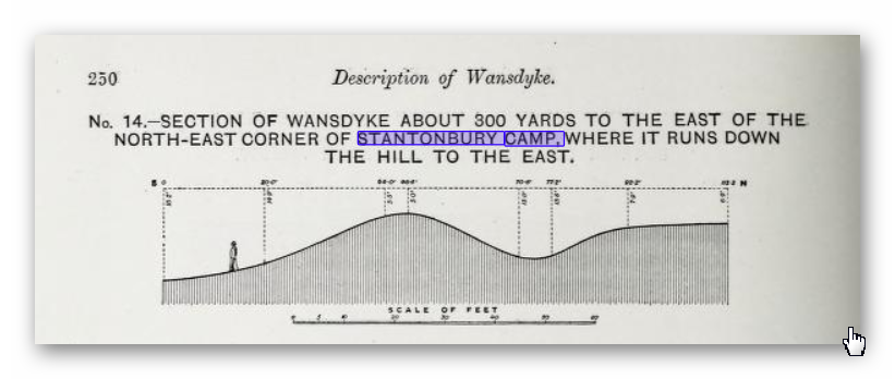
On Statonbury Camp there are not very helpful and report that:
Stantonbury is a univallate Iron Age hill-fort enclosing some 30 acres on the crest of the hill : until very recently it was waste ground going back to thorn scrub and islanded in dense woodland, as can be seen on the air-photo (Pl. VIIIB). The hill top (580 ft.) commands a wide view : from here the whole of the countryside traversed by West Wansdyke can be seen, Maes Knoll to the west. Odd Down to the east, as well as an uninterrupted stretch northwards to the Avon valley and the Cotswolds beyond. From here, the major alignment was probably planned (fig. 19 and p. 37).
In 1956-7 the hill top has been ploughed again, and the much reduced Iron Age defences are visible on the edge of the cultivation. It appears to us that Wansdyke was not constructed along the north-facing hill slope, and that as at Old Oswestry hill-fort, on Wat’s Dyke in Montgomery, the Iron Age defences were deemed sufficient. There is, however, as General Pitt-River’s level section shows, a steep scarp below the traces of the ploughed-in Iron Age ditch, which may be artificial and post-date the hill-fort, but this is uncertain.
East of the fort, in field 20, which is now occupied by a plantation and a pheasantry, the Dyke continues as a scarp for as far as we were able to trace it through the nettles and undergrowth. Below the 500 ft. contour, the large bank and ditch reappear in the dense woodland, and emerge beside the lane leading to the road to Stanton Prior, where the earthwork measures 75 ft. overall.
So according to Fox and Fox Wansdyke stops short and accepts the North Face is the Iron Age Site – therefore if the Wansdyke had been cut to the north of the site – the Iron Age fort replaced it – which is not as the Jihad had claimed?
So where did he get this ‘ground-breaking’ revelation? For this we must go not a peer reviewed book but a web site ‘wansdyke21.org.uk’ by Robert Vermaat
He suggests that:
It has been suggested by Fox & Fox that Wansdyke did not actually use Stantonbury Camp, the ditch stopping short of the Iron Age defences by several metres. However, Burrow showed in 1982 that this was incorrect.
Although the western slope is much disturbed by quarrying and the lower slopes by cultivation, Wansdyke can still be traced quite well at several points on the hill. As with Maes Knoll, the northern defences are more prominent than those on the south side.
As Wansdyke joins the defences here, it can be argued that, as was the case at Maes Knoll, the northern defences were refurbished when Wansdyke was constructed, neglecting the south side which was without use for the builders of Wansdyke.
If only we had £64 to see this so called evidence from Field walking by burrows (as we know it was not excavated and LiDAR was not in use)!!
Fortunately, we have now obtained high resolution LiDAR images of Statonbury Camp and we can see that Wansdyke goes over the hill in a strange ‘wibbly wobbly’ way rather than a straight line – which we see either side of the hill from much shallower ditches. This suggests that this area was not built completely at the same time and the Hill Dyke is older than the flat ground levels that surround the hill.
My estimation from the evidence found in the smaller ditches is that they are Roman (and hence straight) in origin that connected to the earlier prehistoric Dyke over Statonbury Hill the archaeologists call West Wansdyke (part of). The path over the hill indicates that the builders were attempting to locate natural springs as they built the Dyke to supply it with water and hence the strange pathway.
Closer inspection of the Dyke as it approaches the ‘Iron Age Site’ suggest that it splits and moves the bank from north facing to south facing which Fox had seen as a terminus of the Dyke for it reached the Fort. LiDAR clearly shows that the ditch moves to the south side of the bank and continues to create the East side of the fort finally terminating in the South.
Also the shape of the fort is not consistent as it has rounded edges in the SE and SW regions but flat T-Junctions in the NE and NW where it meets Wansdyke – indicating it was added to the existing Wansdyke canal either at the time of construction or a later date.
Further Reading
For information about British Prehistory, visit www.prehistoric-britain.co.uk for the most extensive archaeology blogs and investigations collection, including modern LiDAR reports. This site also includes extracts and articles from the Robert John Langdon Trilogy about Britain in the Prehistoric period, including titles such as The Stonehenge Enigma, Dawn of the Lost Civilisation and the ultimate proof of Post Glacial Flooding and the landscape we see today.
Robert John Langdon has also created a YouTube web channel with over 100 investigations and video documentaries to support his classic trilogy (Prehistoric Britain). He has also released a collection of strange coincidences that he calls ‘13 Things that Don’t Make Sense in History’ and his recent discovery of a lost Stone Avenue at Avebury in Wiltshire called ‘Silbury Avenue – the Lost Stone Avenue’.
Langdon has also produced a series of ‘shorts’, which are extracts from his main body of books:
For active discussions on the findings of the TRILOGY and recent LiDAR investigations that are published on our WEBSITE, you can join our and leave a message or join the debate on our Facebook Group.

