Section F – NY46SE & NY45NE
Contents
Section F – NY46SE & NY45NE- this is a section of Hadrian’s Wall showing the LiDAR, Google Earth and 1800 Maps of the Area covered by Historic England
Historic England Sections:
Hadrian’s Wall – Laversdale to Oldwall and the Cottage 57, 58, 59 and 60
List UID: 1017989, 101990, 1010988
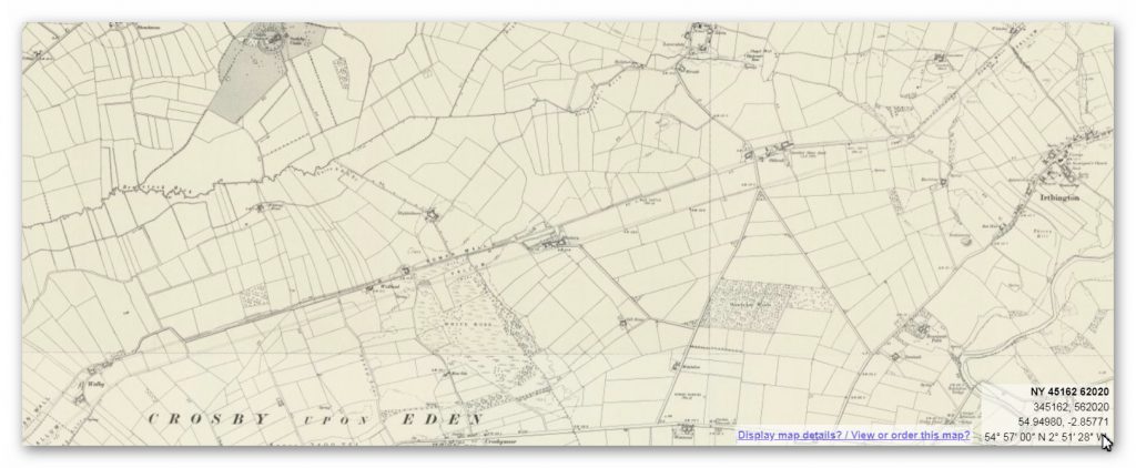
Old OS Map
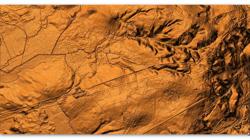
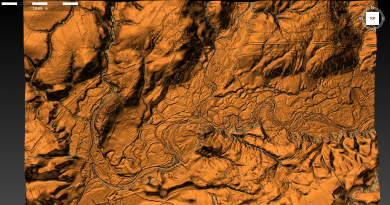
LiDAR Map
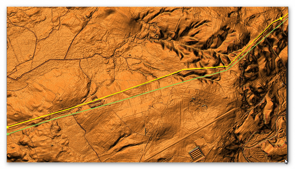
Google Earth Map
Historic England Scheduled Monuments within Section F
Name: Hadrian’s Wall between the road to Laversdale at Oldwall and Baron’s Dike in wall miles 59 and 60
Designation Type: Scheduling
Grade: Not Applicable to this List Entry
List UID: 1010989
Name: The vallum between the road to Laversdale at Oldwall and Baron’s Dike in wall miles 59 and 60
Designation Type: Scheduling
Grade: Not Applicable to this List Entry
List UID: 1010990
Name: Hadrian’s Wall and vallum from A6071 to The Cottage in the case of the Wall, and to the road to Oldwall, for the vallum, in wall miles 57, 58 and 59
Designation Type: Scheduling
Grade: Not Applicable to this List Entry
List UID: 1010988
Analysis of the GE map and English Heritage scheduled monuments confirms the termination point of the Vallum. Their report of these monuments suggests that:
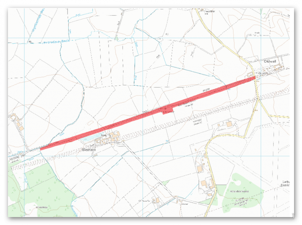
The monument includes the section of Hadrian’s Wall and its associated features between the road to Laversdale at Oldwall in the east and Baron’s Dike in the west. The Wall survives as a buried feature throughout this section with no upstanding remains visible above ground, apart from a low scarp 0.2m high in the area to the north of Bleatarn. Its course has been confirmed in places by excavation by Haverfield in 1894.
North of Bleatarn an excavation across the Wall line uncovered the core of the Wall and much red sandstone debris from it. The wall ditch survives as an earthwork visible on the ground throughout this section, between 1m and 1.6m deep with a modern drain occupying its base for most of its course. The ditch upcast mound, usually referred to as the glacis, does not survive as a feature visible on the ground in this section.
The exact location of milecastle 60 has not yet been confirmed. There are no features visible above ground. On the basis of the usual spacing it is expected to be located about 450m north east of Bleatarn Farm on the line of the Wall. The exact locations of turrets 59b, 60a and 60b have not yet been confirmed. There are no upstanding remains visible above ground.
The course of the Roman road known as the Military Way, which ran along the corridor between the Wall and vallum linking turrets, milecastles and forts, has not been confirmed in this section.
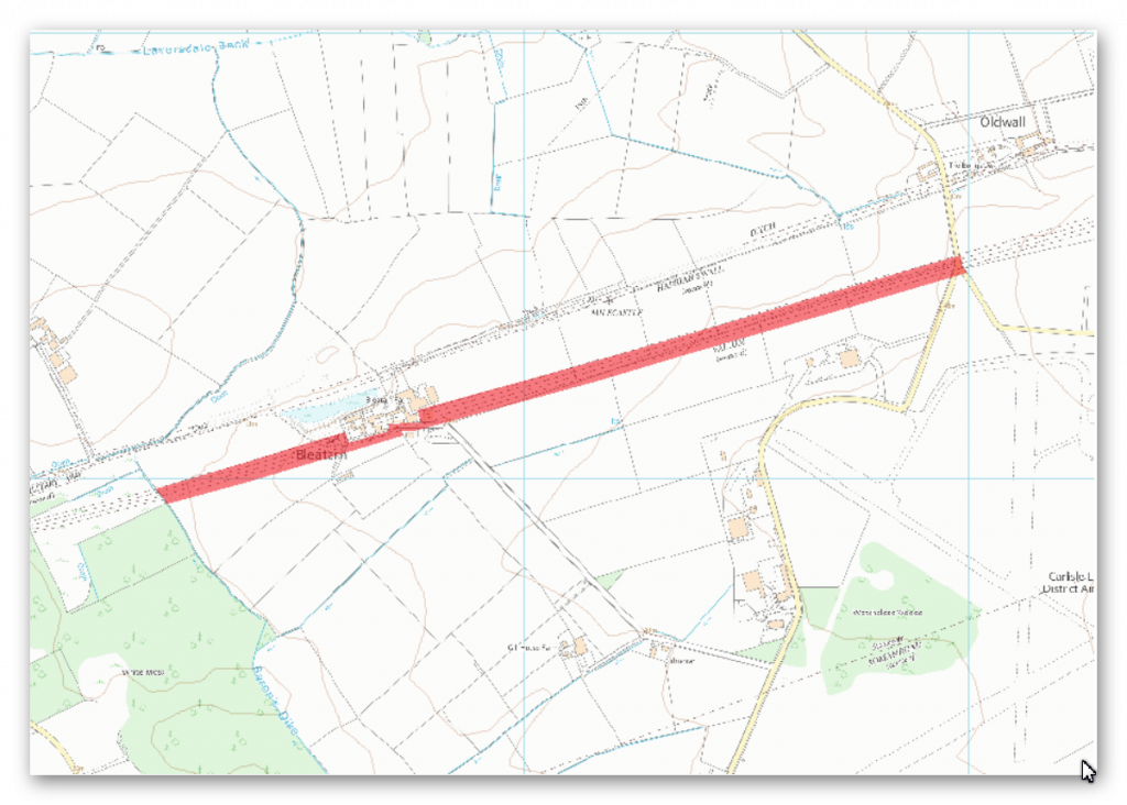
The monument includes the section of vallum and its associated features between the road to Laversdale at Oldwall in the east and the west side of Baron’s Dike in the west. The vallum survives as a buried feature throughout most of this section. Its course is recognisable on the ground as slight depressions in fields and as distinct depressions in hedgelines which cross its course in the eastern half of this section.
East of Baron’s Dike the vallum survives as a slight earthwork visible as four parallel flat topped mounds, 0.7m high. Excavations at Bleatarn by Haverfield in 1894-5 recovered remains of the vallum. This area is now partly built over. Archaeological remains have not been confirmed to survive below the modern buildings. Consequently the ground beneath the buildings is not included in the scheduling. Elsewhere there are no surface traces of the vallum. The excavations at Bleatarn suggested the existence of quarries here, possibly of Roman date, but the confusing nature of the reports questions the reliability of such an assertion
There is no information about any evidence found in this area on the Scheduled Monument site – from another site was have:
Milecastle 67 (Stainton) is a conjectured – Milecastle of the Roman Hadrian’s Wall. The location of the mile fort was determined by measuring the distance from neighboring mile forts. In 1861, some Roman coins were recovered from this point at the southern end of the railway viaduct over the Eden. However, upon follow-up, no remains or other evidence of its existence could be found.
This clearly supports our hypothesis.
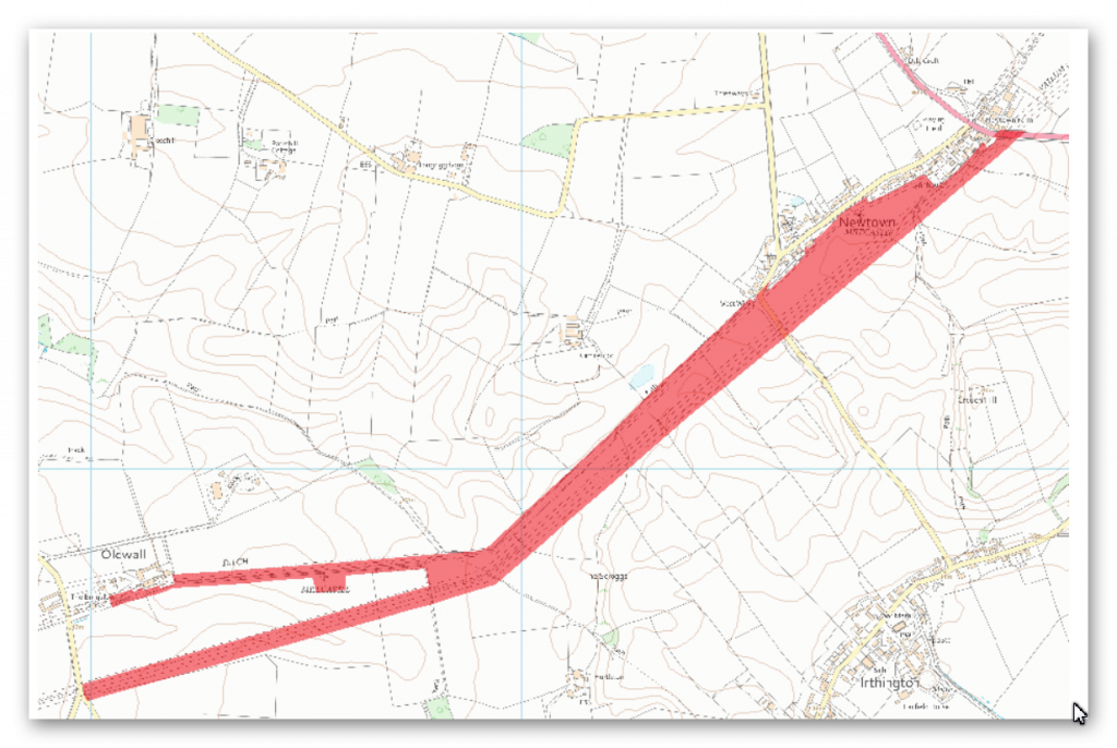
The monument includes the section of Hadrian’s Wall and vallum and their associated features between the A6071 road in the east to The Cottage at Oldwall in the case of the Wall and to the road to Laversdale at Oldwall in the case of the vallum, the road to Laversdale at Oldwall in the west. Hadrian’s Wall survives as a buried feature throughout this section with no upstanding remains. Occasional rises in hedge lines and field walls are the only traces left on the surface. Excavations by Haverfield in 1902 located the course of the Wall to the south west of Newtown where it runs parallel to a modern field boundary. A geophysical survey in 1981 indicated that masonry still survives in situ on the line of the Wall to the immediate south west of Newtown. It also suggested that there may be traces of the earlier Turf Wall on a slightly different alignment to the Stone Wall.
A centurial stone was discovered in this section of the Wall to the south of Cumrenton. Another centurial stone is known to be incorporated into the wall of Cumrenton farmhouse (not included in the scheduling). Between Chapel Field and Oldwall the course of the Wall is overlain by a hedge on top of an earth and stone bank, almost 2.5m wide. The wall ditch survives as an intermittent earthwork visible on the ground throughout this section. In the north east half of this section the ditch survives as a slight depression traceable on the surface. Further to the south west the ditch survives in better condition, averaging 1.6m-1.8m deep. A modern drain runs along the base of the ditch here and a hedge runs along the north edge. The ditch upcast mound, usually referred to as the glacis, does not survive as a feature visible above ground in this section. Milecastle 58 is situated about 180m south west of Newtown on the north side of a hedge which has traces of a platform below it and contains a large quantity of masonry. The milecastle’s remains survive as buried features below the turf cover. Milecastle 59 is situated about 450m east of Oldwall on almost level ground. It survives as a buried feature with no remains visible above ground. Excavations in 1894 by Haverfield yielded stone foundations and a pottery assemblage.
A geophysical survey in 1981 indicated that remains of the south wall still survive in situ, but that this milecastle is slightly to the east of the position depicted by the Ordnance Survey. The exact position of turret 58a has not yet been confirmed as there are no upstanding features visible above ground. However, on the basis of the usual spacing it is expected to be located about 300m east of Cumrenton. The exact position of turret 58b has not been confirmed in recent times. It was apparently located in 1894 by the Society of Antiquities of Newcastle but its precise location was not recorded. On the basis of the usual spacing it is expected to be situated in the field immediately north east of Chapel Field. The exact position of turret 59a has not yet been confirmed as there are no upstanding features visible above ground. On the basis of the usual spacing it is expected to be located immediately east of Oldwall.
The exact course of the Roman road known as the Military Way, which ran along the corridor between the Wall and the vallum linking turrets, milecastles and forts, has not been confirmed in this section. It probably lies parallel to the Wall line, but 20m-30m to the south. Where the Wall line changes course near Chapel Field the Wall and vallum run close together and it is likely that the Military Way occupies the north mound of the vallum.
The vallum survives as a buried feature for most of its course in this section with few remains visible on the ground. The ditch is visible as a depression enhanced by a modern drain to the north east of Chapel Field. Around Chapel Field the ditch is visible as a slight depression, averaging 0.5m deep. Elsewhere its remains survive as buried features below the turf cover, with the only visible traces being slight depressions and rises in the hedgelines which cross its course. Excavations in 1902 by Haverfield located the course of the vallum west of Newtown and a section across the vallum ditch was recorded during widening of the road 500m east of Cumrenton farmhouse around 1970.
Investigation
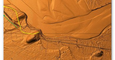
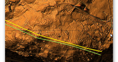
Analysis of this section shows that the Wall and Vallum in close proximity (unlike many areas) with the Wall avoiding the valley areas in the East of this section and the Vallum heading into them.
The Vallum in this section fades against in comparison with the Wall ditch which seems to indicate that it was built sometime before the Wall or even the Roman occupancy? This can best be seen where the Vallum goes into and exits from Paleochannels and river valleys.
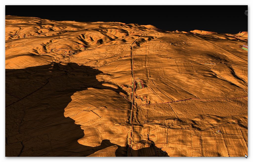
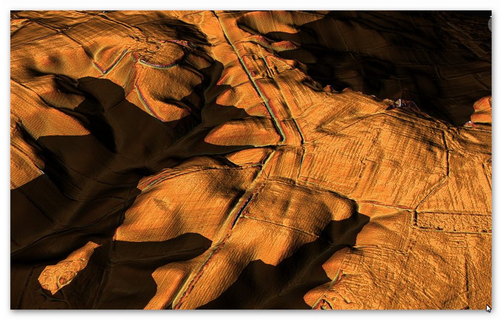
Within part of this section of The Wall and Vallum we find a very interesting and little noticed feature. A large mound can be seen on Both the OS and LiDAR maps.
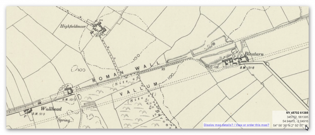
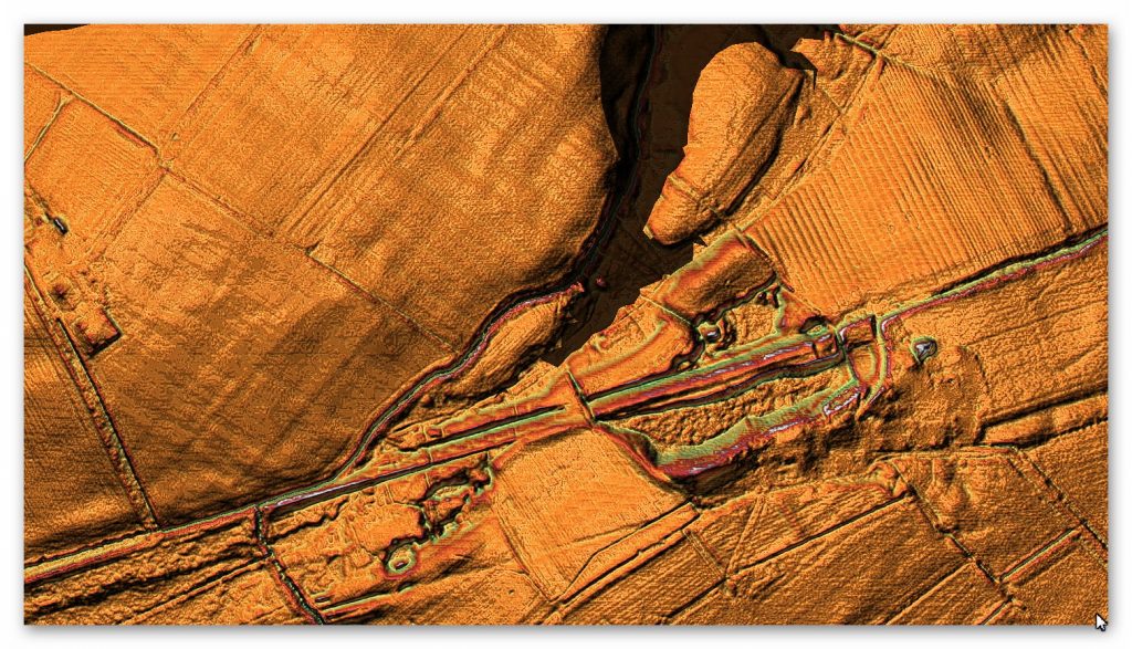
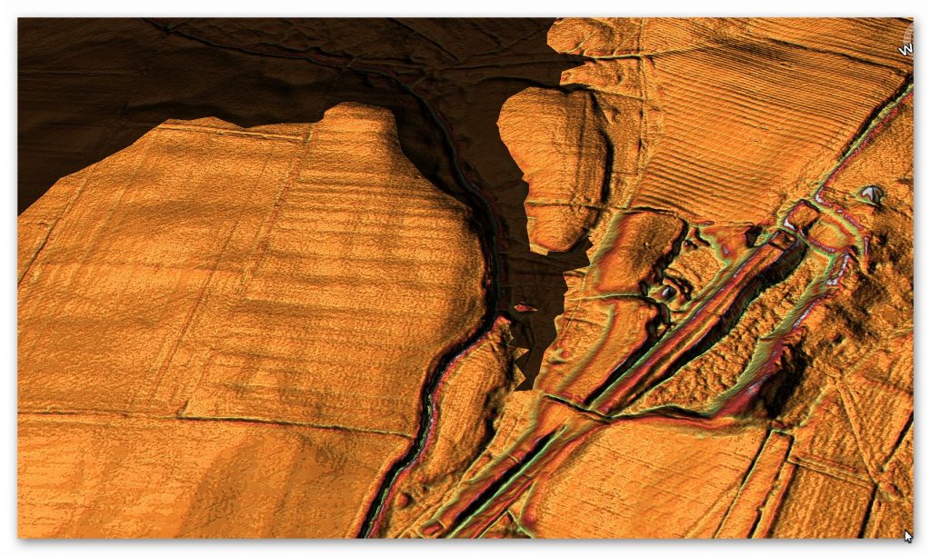
The mound (which most archaeologists normally refer to as a motte) is 12m in diameter even today. It has been suggest that this area was used to quarry stone for the Wall – but our water layer clearly shows the disruption to the surface was through Mesolithic waters long before the wall was built and only the section that connected to the Wall may have been quarried. This is confirmed in the Scheduled monument details of this section.
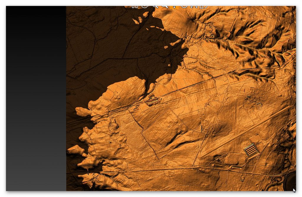
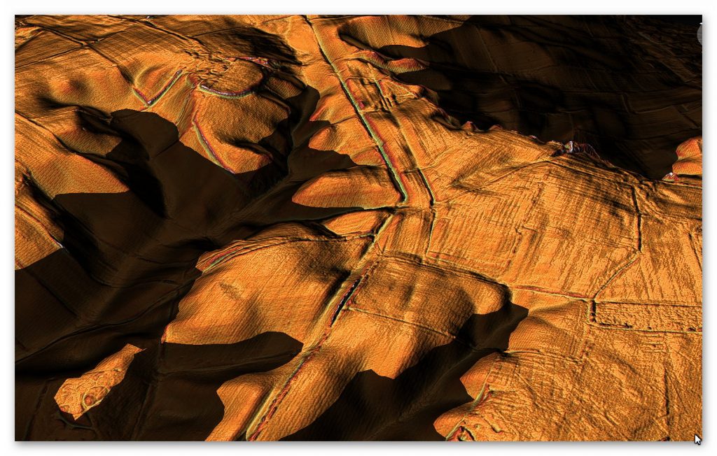
Vallum in Section F showing that it was made long before the Wall
To understand the problem with Hadrian’s Walls history read our article HERE.
Further Reading
For information about British Prehistory, visit www.prehistoric-britain.co.uk for the most extensive archaeology blogs and investigations collection, including modern LiDAR reports. This site also includes extracts and articles from the Robert John Langdon Trilogy about Britain in the Prehistoric period, including titles such as The Stonehenge Enigma, Dawn of the Lost Civilisation and the ultimate proof of Post Glacial Flooding and the landscape we see today.
Robert John Langdon has also created a YouTube web channel with over 100 investigations and video documentaries to support his classic trilogy (Prehistoric Britain). He has also released a collection of strange coincidences that he calls ‘13 Things that Don’t Make Sense in History’ and his recent discovery of a lost Stone Avenue at Avebury in Wiltshire called ‘Silbury Avenue – the Lost Stone Avenue’.
Langdon has also produced a series of ‘shorts’, which are extracts from his main body of books:
For active discussions on the findings of the TRILOGY and recent LiDAR investigations that are published on our WEBSITE, you can join our and leave a message or join the debate on our Facebook Group.

Pingback: Hadrian’s Wall LiDAR investigation - Prehistoric Britain