Section H – NY56NE & NY56SE
Contents
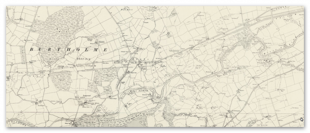
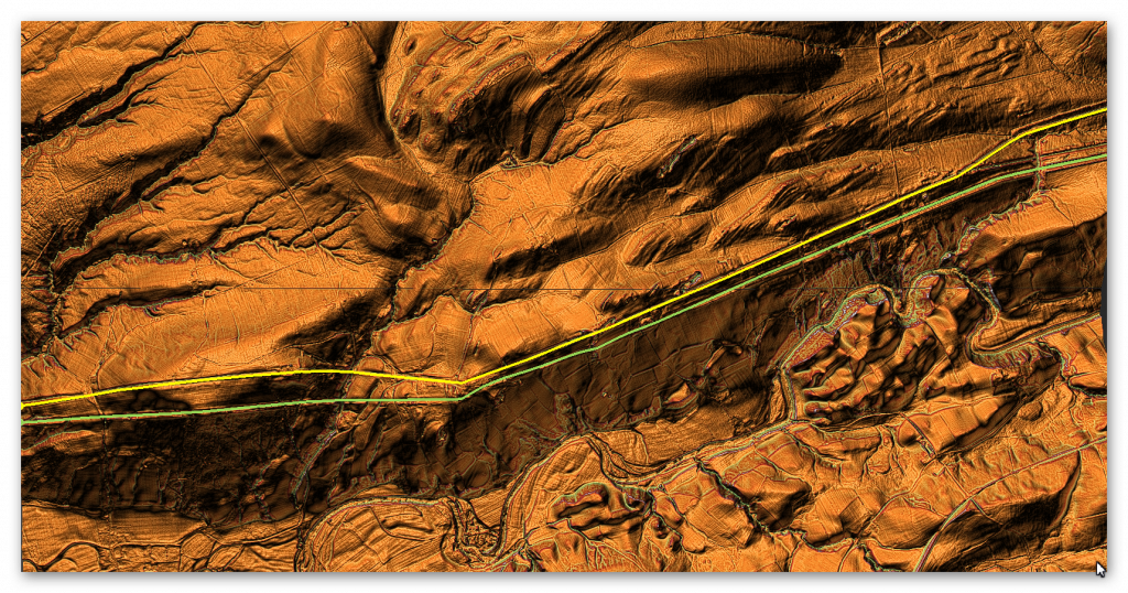
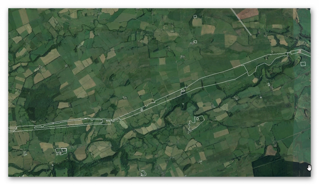
Section H – NY56NE & NY56SE – this is a section of Hadrian’s Wall showing the LiDAR, Google Earth and 1800 Maps of the Area covered by Historic England
Historic England Sections:
Hadrian’s Wall – Between Banks Green Cottage and the road to Lanercost at Banks and the road to boundary west of Coombe Crag in wall miles 50, 51, 52, 53 and 54
List UID: 1010995, 1010996, 1010997
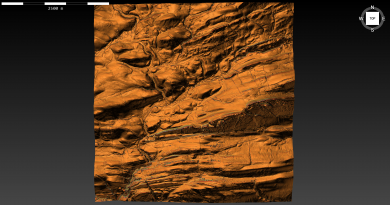
Old OS Map
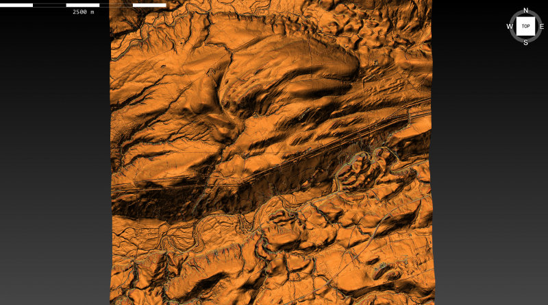
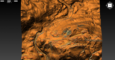
LiDAR Map
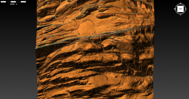
Google Earth Map
Historic England Scheduled Monuments within Section H
Name: Hadrian’s Wall and vallum between Banks Green Cottage and the road to Lanercost at Banks and the road to Garthside in wall miles 52, 53 and 54
Designation Type: Scheduling
Grade: Not Applicable to this List Entry
List UID: 1010997
Name: Hadrian’s Wall and vallum between the field boundary west of Coombe Crag and Banks Green Cottage and the road to Lanercost at Banks in wall miles 51 and 52
Designation Type: Scheduling
Grade: Not Applicable to this List Entry
List UID: 1010996
Name: Hadrian’s Wall and vallum between the field boundaries east of milecastle 50 and the boundary west of Coombe Crag in wall miles 50 and 51
Designation Type: Scheduling
Grade: Not Applicable to this List Entry
List UID: 1010995
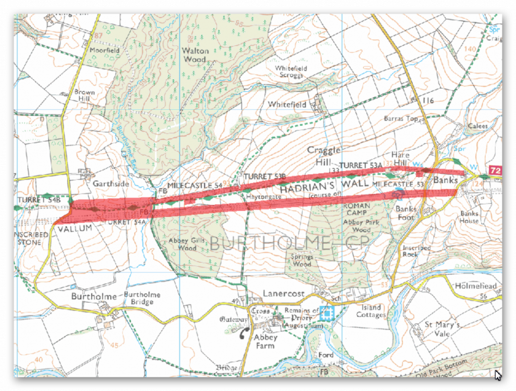
The monument includes the section of Hadrian’s Wall and vallum and their associated features between Banks Green Cottage and the road to Lanercost at Banks in the east and the minor road to Garthside in the west. Hadrian’s Wall survives as a buried feature throughout most of this section overlain in parts by the modern road, fields given to pasture, gardens and field walls. A few remains are visible above ground including the well preserved section of Wall at Hare Hill. Here the core of the Wall is original but part of the face has been reconstructed. It stands to a maximum height of 3.6m and is 2.3m wide. It is consolidated and in the care of the Secretary of State. West of Burtholme Beck there is a length of mortared wall core which stands 1.7m high.
Further west there is a shorter stretch of wall core on the same hedge line, 1.3m high. To the east of turret 54a the Wall survives as a substantial turf covered bank at the base of a mature hedge. The wall ditch survives intermittently as an earthwork in this section. It is best preserved between Hare Hill and Haytongate where it averages 2m deep throughout. It has a maximum depth of 3.2m in parts. Elsewhere the ditch averages 1.8m where extant, but otherwise lies buried below the turf cover or is visible as a slight depression. The ditch upcast mound, usually referred to as the glacis, survives in places to the north of the ditch as an amorphous low mound. Milecastle 53 is situated at the base of an east facing slope on the west bank of the Banks Burn. It survives as a buried feature partly beneath and surrounding the house known as Banks Burn with no remains visible above ground. Excavation by Simpson in 1932 found that the milecastle had been much robbed of its masonry and the original floor had been removed so that no internal buildings remained. The north wall abutted Hadrian’s Wall and some turf work of the earlier turf milecastle remained in the north east corner. It measured 23.5m north to south by 22.2m. Milecastle 54 is situated on a west facing slope overlooking the Burtholme Beck 230m to the west. It survives as a slight turf covered platform with its remains buried below the surface.
Excavations in 1933-4 by Simpson and Richmond showed that the milecastle measured 23.8m north to south by 19.85m across. The western barrack block comprised two rooms, one fitted with stone benches, a hearth and millstone. Below the stone milecastle were found remains of the earlier turf milecastle built in beaten clay. Turret 53a is situated almost on the crest of Craggle Hill with wide views in all directions. It survives as a slight platform, 0.15m high, at the edge of the field. Its remains are buried below the turf cover with nothing visible above ground. First located in 1854-5, it was later partly excavated by Simpson in 1932. It measures 4.46m in length internally being rectilinear in plan. Unusually this turret projects 1m north of the Wall. On excavation the interior was found to be full of ashes. Turret 53b is situated on a west facing slope about 200m east of Haytongate. It survives as a slight turf covered platform on the Wall line, 0.1m high. It was located and excavated in 1932 by Simpson who found it was built from red sandstone. Turret 54a is situated on an east facing slope overlooking Burtholme Beck to the east. It survives as a buried feature below the turf cover with no remains visible above ground. It was located and excavated in 1933 by Simpson who found that there were two independent turrets one behind the other.
The excavations showed that the earlier Turf Wall turret had partly collapsed into the wall ditch, and so the decision had been taken to construct a new free- standing turret, also of Turf Wall type, immediately to the south. The Turf Wall and its ditch were reconstructed slightly to the north of the former line. Later, when the Turf Wall was replaced in stone, the new Stone Wall was connected to the second turret, thus leaving a short length where the lines of the Turf and Stone walls diverge.
The exact course of the Roman road known as the Military Way, which ran along the corridor between the Wall and vallum linking turrets, milecastles and forts, is not yet confirmed in this section. The only traces visible on the ground are two stretches of a low slight swelling, one west of milecastle 54 and the other about 200m east of turret 53b. Elsewhere it survives as a buried feature with no remains visible above ground.
The vallum survives as an earthwork visible on the ground throughout most of this section. The ditch averages between 1.6m and 2m deep where extant. Elsewhere it is silted up and is overlain by the turf cover. The north mound averages between 0.3m and 0.9m high and the south mound 0.3m and 1.3m high. The vallum was trenched in two places on Hare Hill, first in 1894 and again in 1903 by Haverfield. The north and south mounds were found together with the marginal mounds.
The supposed Roman camp shown to the immediate south of the vallum in Abbey Park Wood is no longer identified as Roman. Only its northern section where it overlies the vallum is included in the scheduling.
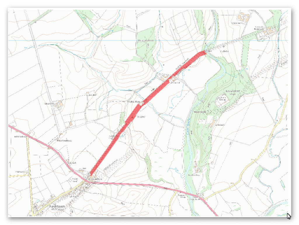
The monument includes the section of Hadrian’s Wall and vallum and their associated features between the field boundary west of Coombe Crag in the east and Banks Green Cottage and the road to Lanercost at Banks in the west. Hadrian’s Wall survives mostly as a buried feature throughout this section except for short lengths of exposed Wall either side of the turrets and Pike Hill Tower. Where exposed the Wall measures 2.35m wide and up to 1.25m high. Elsewhere the Wall survives as a buried feature below the surface of the modern road or as a turf covered discontinuous robber trench east of turret 51a. Between turrets 51a and 51b the course of the Wall is overlain by the roadside wall. The wall ditch survives as a well preserved earthwork visible on the ground throughout most of this section. However, it is overlain by the modern road around Banks Post Office and by Leahill farmyard west of turret 51b. Elsewhere the ditch averages between 1.3m and 2.5m in depth. The ditch was trenched in two places opposite Pike Hill Tower by Richmond and Simpson in the 1930s.
It was established that the ditch made a double turn around this tower, which is positioned 45 degrees away from the Wall line, indicating that the tower is earlier than the ditch. The ditch upcast mound, usually referred to as the glacis, which lies to the north of the wall ditch has been reduced by ploughing throughout this section. A small stretch of the Wall line to the west of Pike Hill is in the care of the Secretary of State. Milecastle 52 is overlain by Bankshead House, there being no remains visible above the ground surface. It was partly excavated by Simpson and Richmond in 1933-4. This milecastle is exceptionally large, measuring 23.6m north to south by 27.8m east to west internally. The south gate was remodelled in the fourth century AD by the insertion of large stone jambs and the north gate was modified four times. A hypocaust pillar found at the south gate of the milecastle suggests this milecastle could have been more elaborate than usual.
It is thought that the larger size of this milecastle is accounted for by the presence of the Pike Hill Tower in this section which meant it was necessary to have a garrison 1.5 times the normal strength because there are three towers in this section rather than the normal two. Two altars were discovered here in 1808, dedicated to the local deity Cocidius, both of which are now at Lanercost Priory. Turret 51a is situated 20m east of the stream known as Piper Sike. It survives as an upstanding stone feature visible on the ground. Its walls stand to a maximum height of 0.8m.
Excavations were carried out in 1970 by Charlesworth who discovered the doorway in the east wall and a substantial platform against the north wall. Cooking hearths and rubbish were spread over the rest of the turret. Occupation did not continue later than the second century AD. Turret 51b is situated 120m east of Leahill farm immediately to the north of the modern road. It survives as an upstanding stone feature. Its walls stand to a maximum height of 1.1m. Excavations in 1958 by Woodfield found that the turret measured 4.2m north to south by 4.5m across internally. The turret had been robbed though it still stood nine courses high. A platform was found in the centre of the north side and the doorway was in the east wall. Pike Hill Tower is situated on the highest point along the ridge occupied by the Wall with extensive views in all directions. The turret survives as an exposed stone feature. It is positioned at 45 degrees to the Wall line which zig-zags to accommodate it. Its exceptionally deep foundations suggest that it was higher than the average turret. Consequently this tower is believed to be a signal tower built before the Wall system and later incorporated into it.
The tower was partly destroyed in 1870 when the road was drastically lowered. Excavation in 1931 by Simpson revealed the one remaining corner and a ground floor door together with Roman pottery of various dates. Turret 52a, known as Banks East Turret, is situated 170m west of Pike Hill Tower. It survives as an upstanding stone feature. Its walls stand up to 14 courses giving a maximum height of 1.75m. Excavations in 1933 by Simpson and Richmond found remains of the demolished Turf Wall abutting its east wall. It was used continuously until at least the end of the third century AD. The exact location of turret 52b has not yet been confirmed. There are no upstanding remains visible above ground. On the basis of the usual spacing it is expected to survive about 15m east of Glen View below the surface of the modern road.
The exact course of the Roman road known as the Military Way, which ran along the corridor between the Wall and the vallum linking the turrets, milecastles and forts, is known intermittently throughout this section where it survives as an earthwork feature. Opposite the disused quarry west of Bankshead Farm the Military Way survives as a terrace, 3m-5m wide, on the north side of an old hedge line. Occasional rises in hedgelines denote traces of its course.
The vallum survives intermittently as an upstanding earthwork visible on the ground throughout this section. It is best preserved at the east end of this section where the ditch averages 2.5m deep to the north, and the north and south mounds are nowhere more than 0.6m high. Elsewhere the vallum survives either as a ploughed down scarp up to 0.9m high and the ditch 0.8m deep, or there are no surface traces at all. Excavations in the vicinity of Pike Hill Tower in 1932 by Simpson found the ditch to be rock cut for at least 46m and crossings were noted at 41.5m intervals in the south mound. Excavations in advance of construction work at Banks in 1977 by Austen identified the north edge of the vallum ditch.
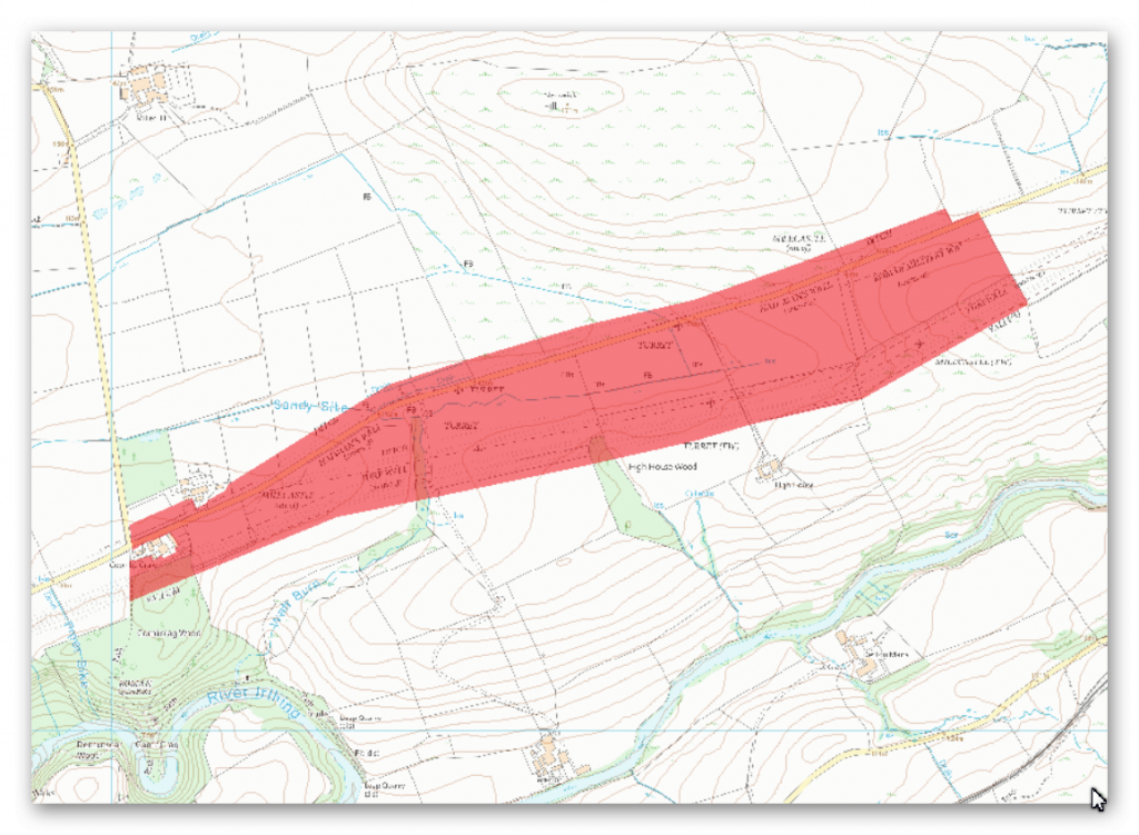
The monument includes the section of Turf and Stone Walls and vallum between the field boundaries east of milecastle 50 in the east and the field boundary west of Coombe Crag in the west.
The Turf Wall survives as a buried feature below grassland throughout this section. At the west end of this section its course is defined by a low broad mound, with a maximum height of 0.4m. Elsewhere there are no visible remains above ground. The Turf Wall ditch survives as an earthwork visible on the ground. It averages between 1.1m and 2m deep throughout this section. The ditch upcast mound, usually referred to as the glacis, also survives as a low mound to the north of the ditch. It measures up to 1.6m high in places. Milecastle 50 on the Turf Wall is situated on a gentle west facing slope with the steep gorge of the Irthing to the south. The south part of the milecastle is marked out in the turf, but otherwise there are no remains visible on the ground. Its remains however survive as buried features below the turf cover.
Excavations were carried out by Simpson in 1934 which identified a causeway across the Turf Wall ditch to the north. Turret 50a on the Turf Wall survives as a buried feature below the turf cover with no remains visible above ground. It is situated about 180m north west of High House. It was located in 1934 by Simpson. Turret 50b on the Turf Wall also survives as a buried feature below the turf cover with no remains visible above ground. It is situated about 120m east of the Wall Burn. It was located and partly excavated by Simpson and Richmond in 1928. The Stone Wall in this section survives as a buried feature below the ground immediately south of the modern road at the east end of this section and below the road surface itself throughout the rest of the section. The ditch survives well as an earthwork visible on the ground immediately north of the modern road. It is well preserved measuring between 1.7m and 2.5m deep. The ditch upcast mound, or glacis, is visible to the north of the ditch. It survives as a low sinuous mound averaging 1m in height. Milecastle 50 on the Stone Wall is situated about 170m north of milecastle 50 on the earlier Turf Wall. It survives as a ploughed down turf covered platform bounded on the east and the west sides by a spread scarp with a maximum height of 0.2m. Two distinct rises in the roadside wall define the position of the east and west walls. Excavations by Simpson took place in 1911. It measured 23.4m internally north to south by 18.5m across.
Its walls were of narrow type measuring 2.3m across. The original internal buildings appear to have been timber structures. These were later replaced by stone buildings. Fragments of three legionary inscriptions were also found; two referring to the sixth legion and one to the second legion. Milecastle 51 is situated 150m east of Wall Bowers and survives as a series of turf covered remains mostly on the south side of the modern road. The east and west walls survive as animal trampled robber trenches, 3m wide and with a maximum depth of 0.15m. The north wall is buried below the modern road. An outer ditch is discernible on the east side, curving around to the south side before fading. It survives up to 4.5m wide and 0.3m deep. It is at this milecastle that the Turf Wall and Stone Wall converge before continuing west on the same alignment. Excavations of the milecastle by Simpson in 1927 revealed the gateway and two stone barracks, one either side of the central space. Turret 50a on the Stone Wall is situated about 50m west of the track to High House. There are no remains visible above ground.
The north half survives below the road surface whereas the south half is recognisable as an amorphous swelling at the edge of the adjoining field. It was partly excavated by Simpson in 1911 who recovered two inscriptions to the sixth legion, who it seems were responsible for rebuilding the first five miles of the Turf Wall in stone. Turret 50b on the Stone Wall is situated to the east of Appletree. It survives as a buried feature partly below the modern road and partly below the adjoining field to the south. The turret was located and partly excavated by Simpson in 1911. It was shown to have remained in use after the second century, and fragments of window glass imply that the turret’s windows were glazed.
The course of the Roman road known as the Military Way, which ran along the corridor between the Wall and vallum linking turrets, milecastles and forts, is known throughout this section. It survives as a vague but detectable intermittent terrace or mound visible on the ground. It is best preserved to the west of Wall Burn where it survives as a linear causeway, 0.4m high.
The Vallum survives well as an upstanding earthwork in all but the easternmost part of this section where it survives as a shallow ditch and ploughed down earthwork. Elsewhere the ditch averages 1.5m deep, the north mound 2m high and the south mound 0.9m high. West of Turf Wall milecastle 50 the north mound reappears again abutting the west wall of the milecastle.
Excavations at the milecastle in 1936 have shown that there is no north mound between milecastle 50 and Birdoswald fort, but rather a south mound twice the usual size. Outside Turf Wall milecastle 50 the south mound and ditch bend around the milecastle with a paved access road opposite the south gateway and a paved track along the south berm.
Investigation
The Vallum in this section fades in and out especially coming out of the Valley floor – The area is full of quarries of unknown date with sparadic Vallum ditch cut in some areas and singe litch aspect to the Vallum until the eastern side were it returns.
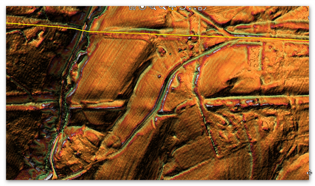
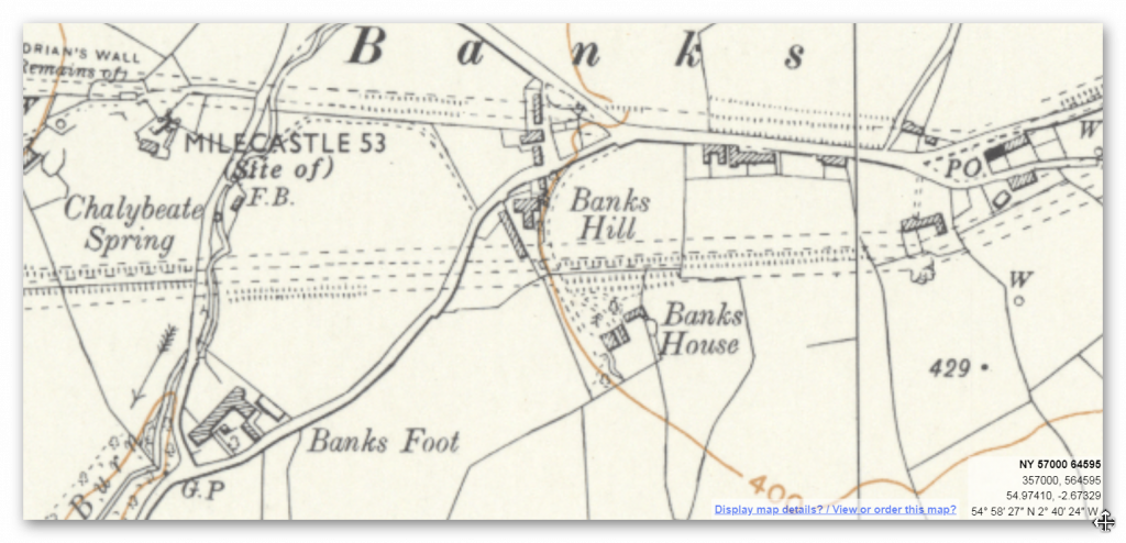
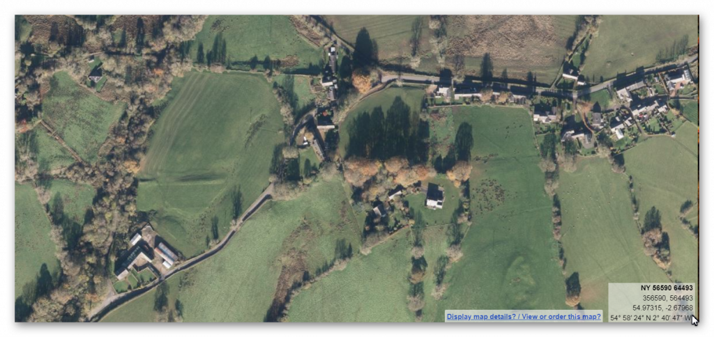
The above three maps and satellite images show that there is no obvious reason for the change in structure when coming out of the Paleochannel (river valley) unless it was full of water during the construction of the Vallum. There is also another feature which could help date the Vallum as it intersects a suspected Roman Fort.
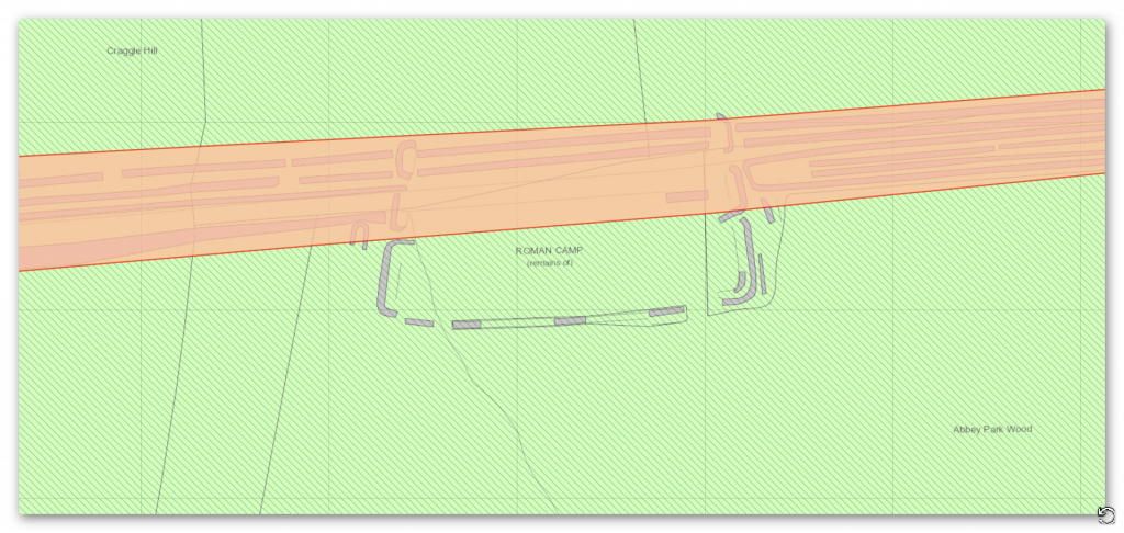
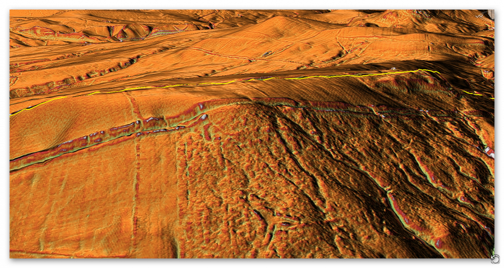
The Vallum cuts through the feature, but so does a double Paleochannel, which seems to extend beyond the Vallum towards the Wall ditch and down the side to another River Valley. I would suggest it was prehistoric cross dyke passing through a prehistoric site as no roman findings have been discovered to date.
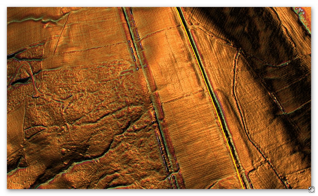
To the East side of Section H was see the wall ditch split away from the Vallum going north for reasons to date unexplained!!
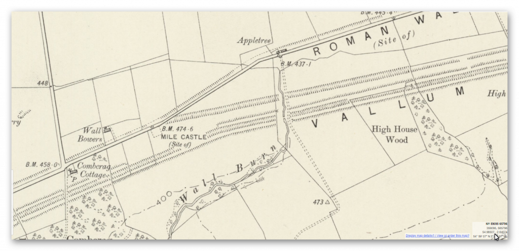
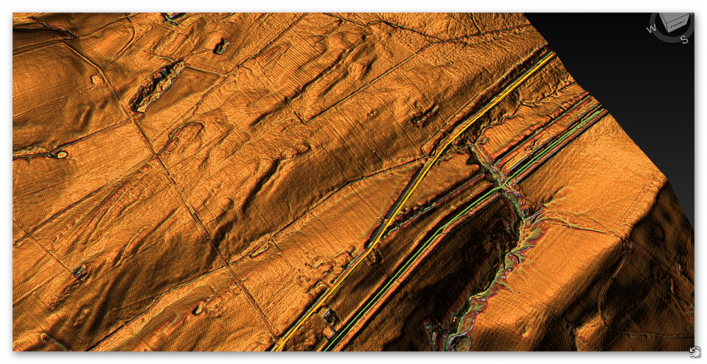
The only logical conclusion to this anomaly is that the paleochannel was still running at the construction date of the Wall and caused problems as the remake avoids the river valley.
To understand the problem with Hadrian’s Walls history read our article HERE.
Further Reading
For information about British Prehistory, visit www.prehistoric-britain.co.uk for the most extensive archaeology blogs and investigations collection, including modern LiDAR reports. This site also includes extracts and articles from the Robert John Langdon Trilogy about Britain in the Prehistoric period, including titles such as The Stonehenge Enigma, Dawn of the Lost Civilisation and the ultimate proof of Post Glacial Flooding and the landscape we see today.
Robert John Langdon has also created a YouTube web channel with over 100 investigations and video documentaries to support his classic trilogy (Prehistoric Britain). He has also released a collection of strange coincidences that he calls ‘13 Things that Don’t Make Sense in History’ and his recent discovery of a lost Stone Avenue at Avebury in Wiltshire called ‘Silbury Avenue – the Lost Stone Avenue’.
Langdon has also produced a series of ‘shorts’, which are extracts from his main body of books:
For active discussions on the findings of the TRILOGY and recent LiDAR investigations that are published on our WEBSITE, you can join our and leave a message or join the debate on our Facebook Group.

Pingback: Hadrian’s Wall LiDAR investigation - Prehistoric Britain