Section P – NY96NE
Contents
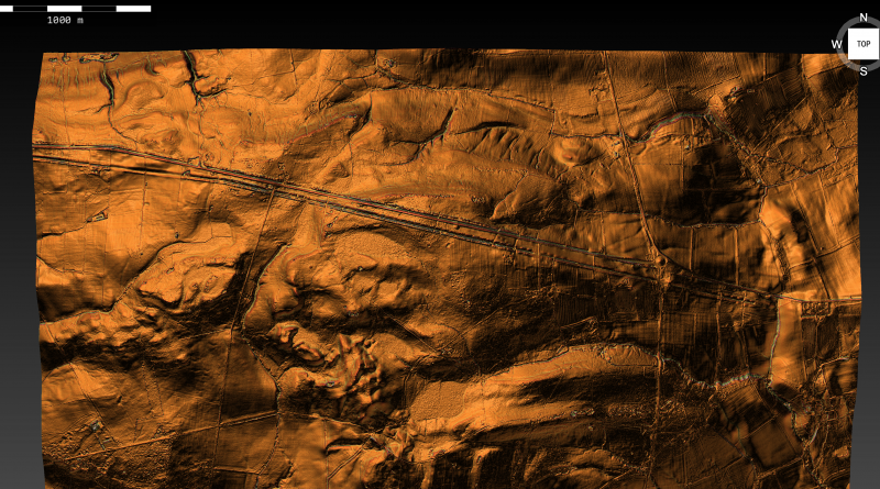
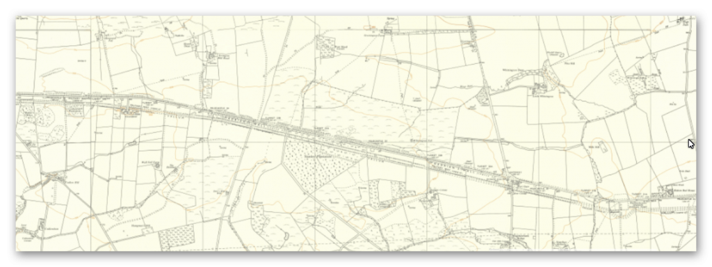
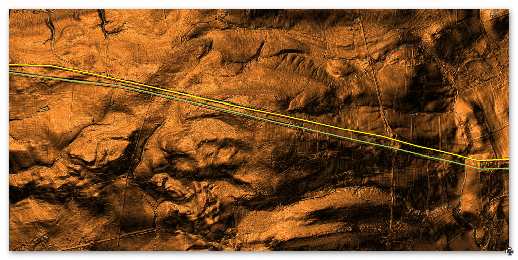
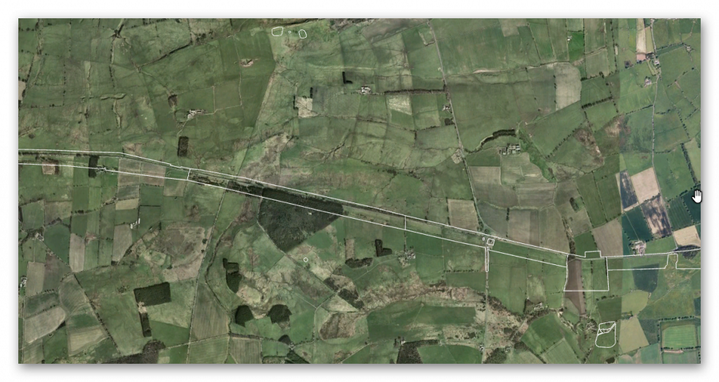
Section P – NY96NE – this is a section of Hadrian’s Wall showing the LiDAR, Google Earth and 1800 Maps of the Area covered by Historic England
Historic England Sections:
Name: Name: Hadrian’s Wall and vallum between Sunnybrae at Halton Shields and field boundary east of milecastle 24; wall miles 20, 21, 22 23, and 24
List UID: 1010958, 1010626, 1010625, 1010624, 1010623
Old OS Map
LiDAR Map
Google Earth Map
Historic England Scheduled Monuments within Section P
Name: Hadrian’s Wall and vallum between field boundary east of milecastle 24 and field boundary west of the site of turret 25b in wall miles 24 to 25
Designation Type: Scheduling
Grade: Not Applicable to this List Entry
List UID: 1010958
Name: Hadrian’s Wall and vallum between the track to Portgate Cottage and the field boundary east of milecastle 24 in wall miles 22 and 23
Designation Type: Scheduling
Grade: Not Applicable to this List Entry
List UID: 1010626
Name: Hadrian’s Wall and vallum between the Fence Burn and the track to Portgate Cottage in wall miles 21 and 22
Designation Type: Scheduling
Grade: Not Applicable to this List Entry
List UID: 1010625
Name: Haltonchesters Roman fort, settlement and Hadrian’s Wall and vallum between the field boundary east of Haltonchesters fort and the Fence Burn in wall mile 21
Designation Type: Scheduling
Grade: Not Applicable to this List Entry
List UID: 1010624
Name: Hadrian’s Wall and vallum between Sunnybrae at Halton Shields and Haltonchesters Roman fort in wall miles 20 and 21
Designation Type: Scheduling
Grade: Not Applicable to this List Entry
List UID: 1010623
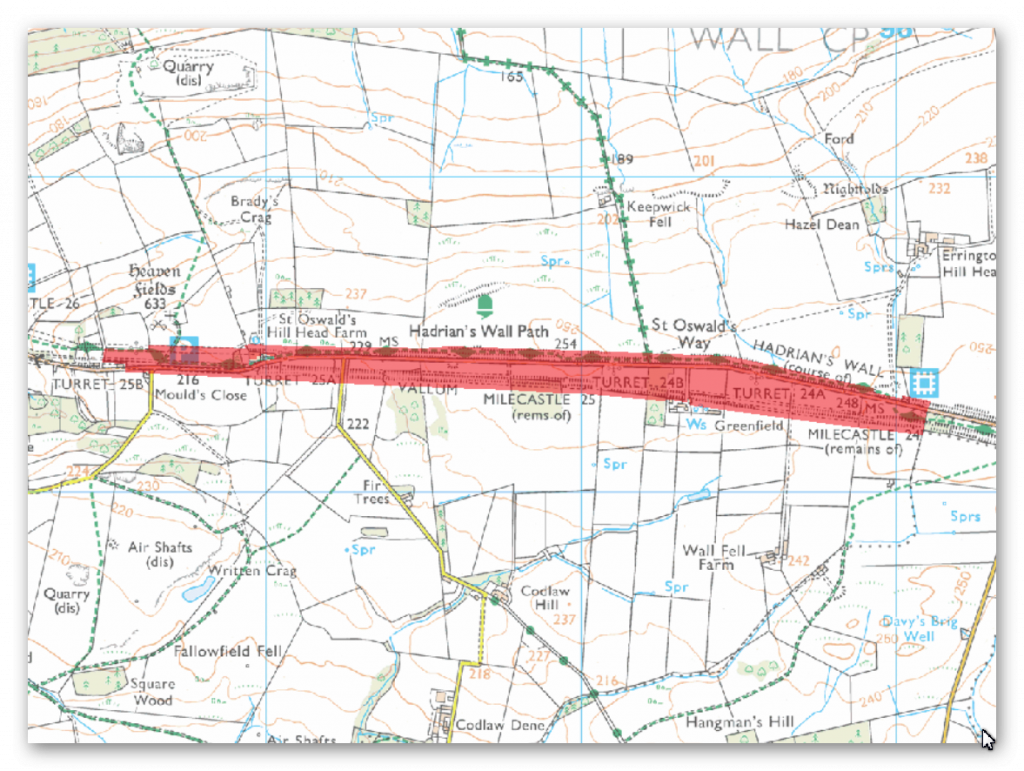
The monument includes the section of Hadrian’s Wall and its associated features between the field boundary east of milecastle 24 and the field boundary west of the site of turret 25b east of Brunton Gate. Throughout most of this section there are wide views to the north and south with undulating ground to the east and west restricting the outlook.
The Wall survives as a series of buried remains below the course of the B6318 road throughout most of this section. Where the B6318 road changes direction east of St Oswald’s Hill Head Farm the line of the Wall runs below St Oswald’s Hill Head Farm itself. Beyond the farm it survives as a turf covered mound 0.5m high, spread by ridge and furrow cultivation. The wall ditch survives well as an earthwork visible on the ground for most of this section. It averages about 2.5m deep throughout, though it reaches a maximum of 3.6m deep in places. The upcast mound from the ditch, known as the glacis, is visible intermittently, usually in places where it has survived ploughing. Where extant it is generally irregular, sometimes containing much stony material, and averaging about 1m in height. Milecastle 24 is situated just below the crest of a west facing slope with views to the north and south. It was partly excavated in 1930 by Hepple and was shown to be just over 15m across with walls 3m thick. It survives as a turf covered mound with the remains of the excavation trenches and spoil heap still visible. Milecastle 25 is also situated on a west facing slope with views to the north and south. It survives as a turf covered platform about 1m high. A slight hollow on the south side may indicate an outer ditch.
This milecastle was also partly excavated during 1930 by Hepple. Turret 24a occupies a slight hollow which restricts views to the east and west. It survives as a buried feature below the B6318 road. It was located and partly excavated during 1930 by Hepple. Turret 24b is situated just below the crest of an east facing slope with wide views to the north and south. It survives as a buried feature below the surface of the B6318 road. As with turret 24a this turret was located and partly excavated by Hepple during 1930. Turret 25a is situated on a west facing slope in the short stretch of ground between the B6318 and St Oswald’s Hill Head Farm. It was located by Hepple during 1930, however there are no upstanding remains. Turret 25b is situated on a west facing slope to the south west of St Oswald’s Church. There are no upstanding remains but it will survive as a buried feature, below the line of the east-west field boundary to the west of St Oswald’s Church. It too was located and part excavated during 1930 by Hepple. The turret was again partly excavated during 1959 and there was no pottery recovered later than the second century AD.
The course of the Roman road known as the Military Way, which ran along the corridor between the Wall and the vallum linking turrets, milecastles and forts, is known for most of this section. It uses the north mound of the vallum as its base, certainly up to milecastle 25, along which it could be seen by Horsley who recorded it in his 1732 publication. A recent survey by the Royal Commission on the Historical Monuments of England shows that the Military Way probably continued along the north mound of the vallum beyond milecastle 25 where Horsley could no longer trace it.
The vallum survives as an upstanding earthwork for much of this section where it mirrors closely the line of the Wall. The north mound averages about 1m where extant with a maximum height of 1.6m in places. The south mound also averages about 1m, but has a maximum height of 4m in places. The ditch is generally between 1.5m and 2m in depth where extant. Elsewhere it survives as a buried feature that has silted up.
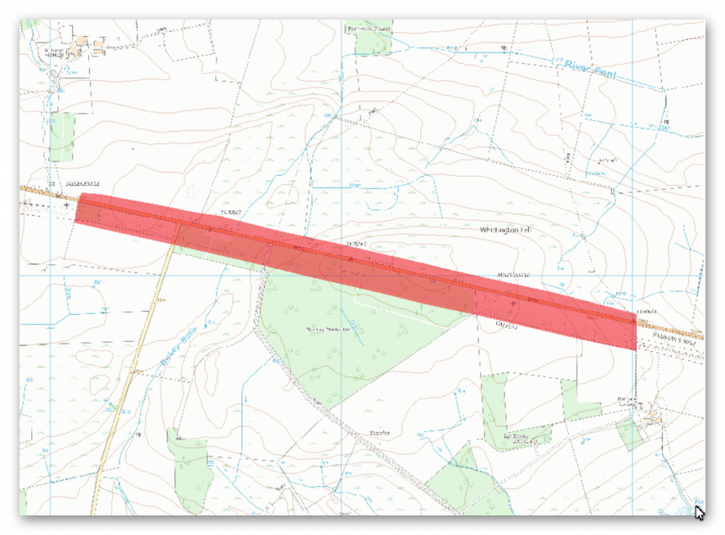
The monument includes the section of Hadrian’s Wall, vallum and associated features between the track to Portgate Cottage in the east and the field boundary to the east of milecastle 24 in the west.
This section follows a straight alignment throughout its length and links the crests of the high ground along this length. Hadrian’s Wall runs beneath the B6318 road for the entire length of this section. The wall ditch and upcast mound to the north survive well as upstanding earthworks for most of the length of this section. The ditch averages 2m deep throughout, though it reaches a maximum of 2.8m in places. The upcast mound from the ditch, usually known as the `glacis’, survives up to a maximum of 1m in height to the north of the ditch. Milecastle 23 is situated about 50m east of the Stanley Plantation on the south side of the B6318 road on an east facing slope. It survives as a turf covered platform about 1m high with traces of a ditch around it. It was partly excavated in 1930 and it was shown to have an internal width of 15m and walls 2.9m thick. Turret 22b is located about 10m west of the track to Portgate House and Cottage off the B6318 road. It survives as a buried feature beneath the B6318 road. It was partly excavated during 1930. Turret 23a is expected to be located about 260m east of the west edge of the Stanley Plantation on the basis of the normal spacing. Turret 23b is expected to be located about 100m east of the road to Oakwood on the basis of the normal spacing.
The Roman road known as the Military Way, which ran along the corridor between the Wall and the vallum linking turrets, milecastles and forts, occupies the north mound of the vallum throughout the whole length of this section. It survives well and is visible as an upstanding earthwork.
The vallum runs parallel to the Wall throughout this section. It survives very well for most of this section and is clearly visible as an upstanding earthwork. The north and south mounds reach a height of 1.8m, while the vallum ditch reaches a depth of 3m in places. There was limited excavation of the vallum during 1952 near milecastle 23 when it was shown that the north mound was broken by a gap giving access to the milecastle.
A causeway across the vallum ditch would also have been required at this point. The ditch, however, appeared to have been recut, indicating that the access route to the milecastle changed through the main period of use of the Wall.
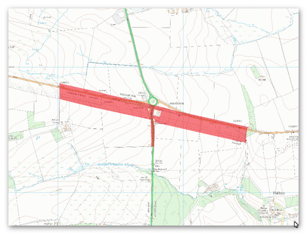
The monument includes the section of Hadrian’s Wall between the Fence Burn in the east and the west side of the track to Portgate Cottage in the west. This section of the Wall occupies an east facing slope with limited views in all directions.
The Wall survives as a buried feature below the B6318 road for most of this section. The stretch of Wall 220m east to 320m west of the course of the A68, where the B6318 swings north to a roundabout, lies below the 18th century metalled road which is now disused. The wall ditch survives as a buried feature for most of this section; however, towards the west end of the section it survives as a visible earthwork. The maximum height of its south scarp is 4m and the maximum height of its north scarp is 2m. There are slight traces of the upcast mound, known as the `glacis’, to the north of the ditch. Milecastle 22 is located about 220m east of the junction of the B6318 and the A68 on an east facing slope. It survives as a square turf covered platform, 0.5m high on its east side. The milecastle was partly excavated in 1930, when its internal width was shown to be about 17.5m, while the walls were 2.45m thick.
The north gateway had been blocked early on, probably because the gateway carrying Dere Street Roman road through the line of the Wall was near enough to serve all purposes for which a milecastle gateway could be used. Turret 21b occupies a prominent point 230m west of the Roman fort at Haltonchesters. There are no visible remains above ground, but it is expected to survive as a buried feature. Turret 22a is situated about 200m west of the Port Gate roundabout on an east facing slope. It was located and partly excavated in 1930. There are no upstanding remains.
The course of the Roman road known as the Military Way, which ran along the corridor between the Wall and the vallum linking the turrets, milecastles and forts, survives intermittently throughout this section.
East of milecastle 22 there is a 170m stretch of the road which survives as an upstanding ridge, in a field which also has extensive ridge and furrow earthworks. The road here survives to a maximum height of 0.3m. Further west its remains were traced as parchmarks in the soil during dry conditions. Elsewhere in this section its course has not yet been confirmed.
The vallum survives intermittently as an upstanding earthwork throughout this section. Where it is best preserved, between the Fence Burn and the A68, the ditch reaches a maximum depth of 0.9m, the north mound a height of 0.7m and the south mound a height of 0.3m. Elsewhere the mounds have been damaged and spread by ridge and furrow cultivation and the ditch has silted up to varying degrees.
The Roman road known as Dere Street which ran from York into Scotland crossed the line of the Wall in this section. The course of the A68 road follows that of Dere Street along this part of its course. Immediately south of the vallum, for 150m, there is an overgrown mound beside the west verge of the A68, representing part of the Roman road which was not built directly over. An excavation in 1966 revealed that where Dere Street crossed the Wall, a gatehouse, formed of massive masonry blocks which projected northwards from the Wall by 3.6m had been constructed. The site of the gateway lies within the protected area.
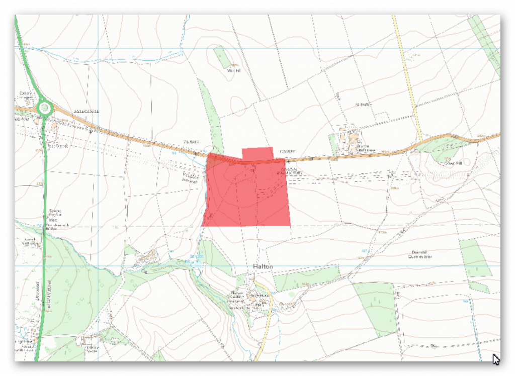
The monument includes the Roman fort at Haltonchesters, an associated settlement and an adjacent section of Hadrian’s Wall and vallum and its associated features between the field boundary to the east of Haltonchesters Roman fort in the east and the Fence Burn in the west.
The fort, known to the Romans as `Onnum’, occupies the crest on the east bank of the Fence Burn astride the line of Hadrian’s Wall. From the fort there are extensive views to the north where the ground rises gently, and southwards to the Tyne valley. To the west there are views along the course of the wall for 2km, whereas to the east the visibility is restricted by Down Hill 800m away. The fort survives as a turf covered platform up to 1.1m high in places. A number of surveys and excavations of the fort have been undertaken, the most recent being the survey by the Royal Commission on the Historical Monuments of England during 1989. All the surviving remains of the fort are buried below ground level. A unique feature of the fort is the western extension in the south half of the fort, which has been dated to the Severan period (third century AD).
An excavation in 1959 revealed that the west wall of the original Hadrianic fort was demolished to the south of Hadrian’s Wall when the fort was extended to the west. The fort enclosed an area of about 1.75ha in its early phase; increasing to 2ha after its extension. Excavations have shown that the fort was probably defended by two outer ditches in its Hadrianic phase and that these were replaced by a single more massive ditch in the later Severan phase. Aerial photographs and parchmarks show the location of a number of internal buildings and roads, as well as parts of the fort walls. The fort was probably initially garrisoned by a cohort of 500 men, part mounted, however in the Severan period it held an ala or cavalry wing of 500 men. The civil settlement outside the fort, known as the vicus, was located in the field to the south and south east of the fort. There are the remains of two buildings visible above ground, located in the only part of the field devoid of later ridge and furrow. The building to the east is 4.5m wide and at least 12m long. The less well preserved building to the west was also about 4.5m wide, but of indeterminate length. To the SSE of these buildings is a circular stone-lined well, 1.6m in diameter.
The course of the Roman road known as the Military Way, which ran along the length of the corridor between the Wall and the vallum linking turrets, milecastles and forts, survives as a buried feature. It was identified by the presence of parchmarks 300m west of the fort aligned with the postulated gateway to the Severan extension to the fort. To the east the road was also identified by parchmarks within 20m of the fort, aligned with the west gateway.
The course of the Wall on both the east and west sides of the fort lies beneath the B6318 road. Excavation on the west side showed that the junction of the Wall with the fort was on the south side of the west gateway. Excavation in the fort interior located the wall ditch, thus demonstrating that the Wall was built before the erection of Haltonchesters fort.
The vallum survives as a buried feature. Aerial photographs show the ditch of the vallum as a cropmark to the west of the fort, ascending the hill from Fence Burn and fading about 20m from the south west angle of the Severan extension. The vallum ditch on the east side of the fort is visible as a depression in the line of the field boundary 50m to the east of the fort. Its course south of the fort has not yet been confirmed.
Remains of surface quarrying are evident on the hill to the east of the fort. Here sandstone lies close to the surface and outcrops in places providing a ready source of building stone. These quarries survive as hollows and fissures in the area of Carr Crags and on Down Hill. These quarries probably have Roman origins but are likely to have been reworked in the 18th century.
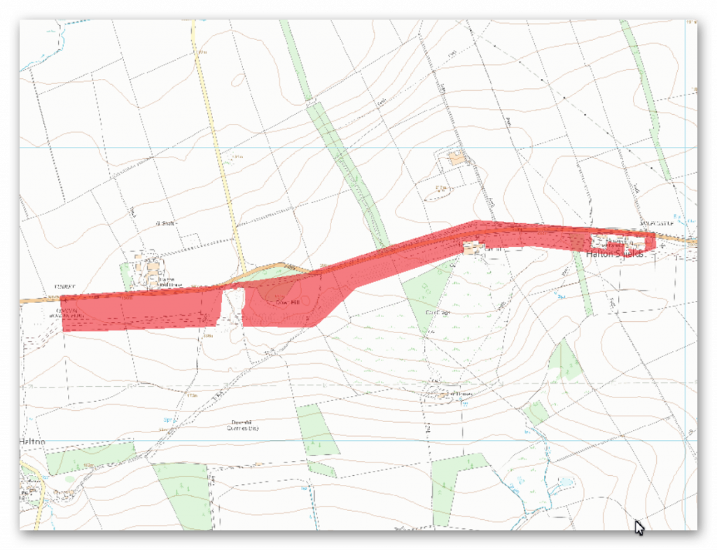
The monument includes the section of Hadrian’s Wall, vallum and associated features between Sunnybrae at Halton Shields in the east and the field boundary to the immediate east of Haltonchesters Roman fort in the west.
This section of the corridor follows an east-west ridge with slopes down to the north and south. Hadrian’s Wall survives as a buried feature beneath the B6318 road throughout most of this section. At Halton Shields the alignment of the Wall suggests that it runs below the houses and gardens, however, as there are no upstanding remains there, this area is not included in the scheduling. At Down Hill the Wall survives as a discontinuous bank of rubble, 3m wide and 0.4m high, within dense woodland. Quarrying has mutilated much of the east end of this bank. As with the Wall the wall ditch is in part overlain by the B6318, but in Down Hill Wood it is visible intermittently in the dense woodland up to a maximum of 3m deep. However, it too has been destroyed by quarrying in places. Elsewhere the ditch is traceable as an earthwork in the fields to the north of the B6318. Milecastle 20 is situated immediately north of Sunnybrae at Halton Shields. It was located and partly examined in 1935 and was found to have `type III’ gateways, which is a construction style usually associated with the work of the twentieth legion. During 1992 a 5.5m length of the south wall was exposed which measured 2.6m across, showing that the remains are well preserved under the existing house and garden.
Milecastle 21 has not yet been located, however on the basis of the usual spacing it would be expected to lie in the vicinity of Halton Red House. Turret 20a has also yet to be located, but also on the basis of the usual spacing it would be expected to lie about 70m east of the properties at Carr Hill. Turret 20b was located in 1935 by Hepple about 130m east of Down Hill Wood. The turret survives as a buried feature below the B6318 road. Turret 21a was also located by Hepple in 1935, 75m east of Haltonchesters fort. As with turret 20b it survives as a buried feature below the B6318 road.
The course of the Roman road known as the Military Way, which ran along the corridor between the Wall and vallum linking the turrets, milecastles and forts, survives intermittently throughout this section of the corridor. An excavation undertaken in 1893 revealed that it occupies the north berm of the vallum until the vallum swings south to the east of Down Hill where it resumes a course between the Wall and vallum. There are no upstanding remains west of Down Hill in this section.
The vallum runs parallel with the Wall to Down Hill where it takes a dog-leg to avoid the bedrock close to the surface. It is visible intermittently throughout this section of the corridor. It is best preserved to the south of Down Hill where the vallum ditch has a maximum depth of 2.7m and the north and south mounds reach a height of 1.5m and 1m respectively. Clear traces of crossings survive which are best preserved in the north mound.
Investigation
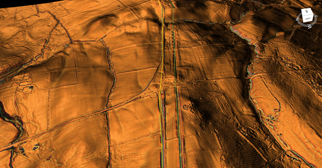
The Vallum in this section is quite stable and close to the Wall. At the east side of this section it disappears gain into a river valley and then reappears on the other side at a different angle suggesting they were cut at different stages or were independent from the main Vallum?
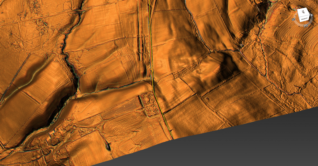
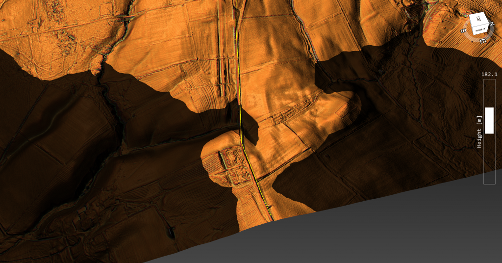
Military way is seen in small burst and very shallow in comparison to the Vallum – hence archaeologists suggesting its on the north bank of the vallum when they can’t find it?
Further Reading
For information about British Prehistory, visit www.prehistoric-britain.co.uk for the most extensive archaeology blogs and investigations collection, including modern LiDAR reports. This site also includes extracts and articles from the Robert John Langdon Trilogy about Britain in the Prehistoric period, including titles such as The Stonehenge Enigma, Dawn of the Lost Civilisation and the ultimate proof of Post Glacial Flooding and the landscape we see today.
Robert John Langdon has also created a YouTube web channel with over 100 investigations and video documentaries to support his classic trilogy (Prehistoric Britain). He has also released a collection of strange coincidences that he calls ‘13 Things that Don’t Make Sense in History’ and his recent discovery of a lost Stone Avenue at Avebury in Wiltshire called ‘Silbury Avenue – the Lost Stone Avenue’.
Langdon has also produced a series of ‘shorts’, which are extracts from his main body of books:
For active discussions on the findings of the TRILOGY and recent LiDAR investigations that are published on our WEBSITE, you can join our and leave a message or join the debate on our Facebook Group.

