Section Q – NZ06NW
Contents
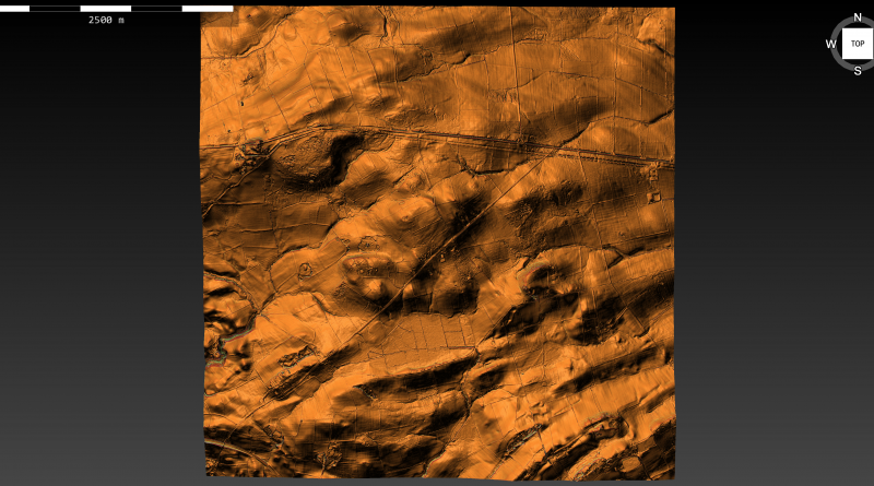
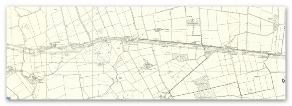
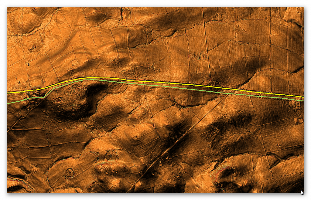
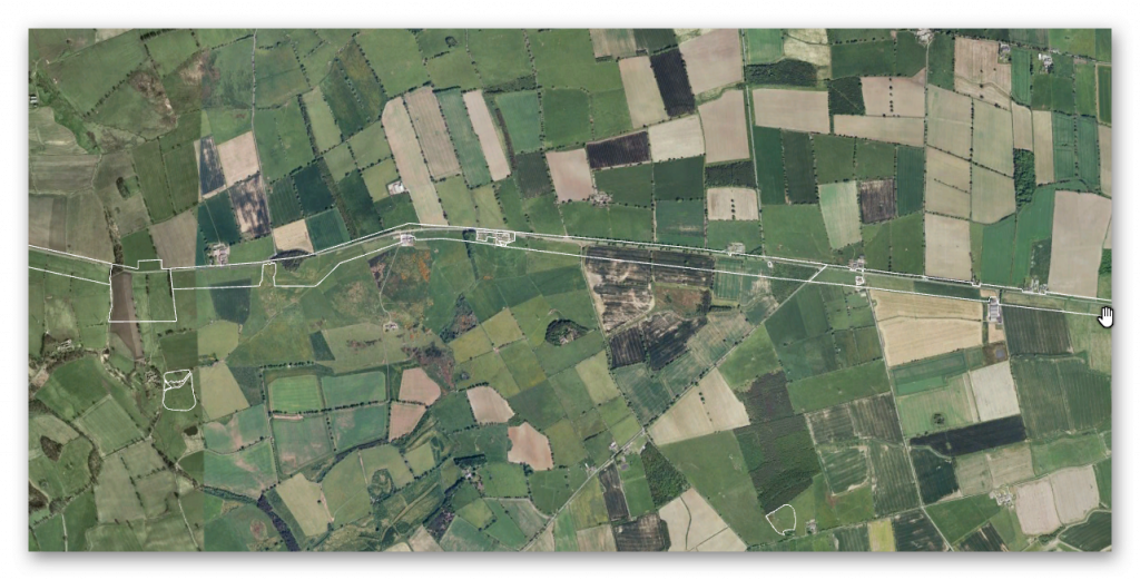
Section Q – NZ06NW – this is a section of Hadrian’s Wall showing the LiDAR, Google Earth and 1800 Maps of the Area covered by Historic England
Historic England Sections:
Name: Name: Hadrian’s Wall and vallum between the B6309 and Sunnybrae at Halton Shields in wall miles 16, 17, 18, 19, 20 and 21
List UID: 1010623, 1017534, 1010622
Old OS Map
LiDAR Map
Google Earth Map
Historic England Scheduled Monuments within Section Q
Name: Hadrian’s Wall and vallum between Sunnybrae at Halton Shields and Halton Chesters Roman fort in wall miles 20 and 21
Designation Type: Scheduling
Grade: Not Applicable to this List Entry
List UID: 1010623
Name: Hadrian’s Wall and vallum between the B6321 and Sunnybrae at Halton Shields, in wall miles 18 and 19
Designation Type: Scheduling
Grade: Not Applicable to this List Entry
List UID: 1017534
Name: Hadrian’s Wall and vallum between the B6309 and the B6321 in wall miles 16, 17 and 18
Designation Type: Scheduling
Grade: Not Applicable to this List Entry
List UID: 1010622
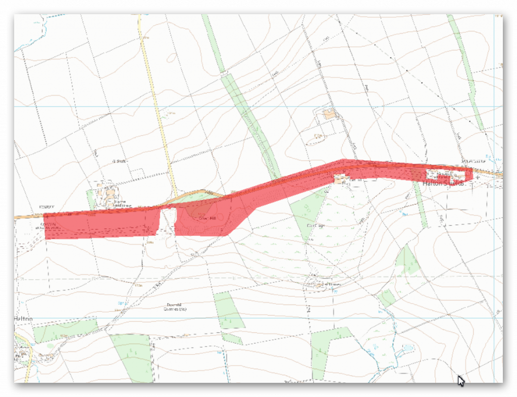
The monument includes the section of Hadrian’s Wall, vallum and associated features between Sunnybrae at Halton Shields in the east and the field boundary to the immediate east of Haltonchesters Roman fort in the west.
This section of the corridor follows an east-west ridge with slopes down to the north and south. Hadrian’s Wall survives as a buried feature beneath the B6318 road throughout most of this section. At Halton Shields the alignment of the Wall suggests that it runs below the houses and gardens, however, as there are no upstanding remains there, this area is not included in the scheduling. At Down Hill the Wall survives as a discontinuous bank of rubble, 3m wide and 0.4m high, within dense woodland. Quarrying has mutilated much of the east end of this bank. As with the Wall the wall ditch is in part overlain by the B6318, but in Down Hill Wood it is visible intermittently in the dense woodland up to a maximum of 3m deep. However, it too has been destroyed by quarrying in places. Elsewhere the ditch is traceable as an earthwork in the fields to the north of the B6318. Milecastle 20 is situated immediately north of Sunnybrae at Halton Shields. It was located and partly examined in 1935 and was found to have `type III’ gateways, which is a construction style usually associated with the work of the twentieth legion. During 1992 a 5.5m length of the south wall was exposed which measured 2.6m across, showing that the remains are well preserved under the existing house and garden.
Milecastle 21 has not yet been located, however on the basis of the usual spacing it would be expected to lie in the vicinity of Halton Red House. Turret 20a has also yet to be located, but also on the basis of the usual spacing it would be expected to lie about 70m east of the properties at Carr Hill. Turret 20b was located in 1935 by Hepple about 130m east of Down Hill Wood. The turret survives as a buried feature below the B6318 road. Turret 21a was also located by Hepple in 1935, 75m east of Haltonchesters fort. As with turret 20b it survives as a buried feature below the B6318 road.
The course of the Roman road known as the Military Way, which ran along the corridor between the Wall and vallum linking the turrets, milecastles and forts, survives intermittently throughout this section of the corridor. An excavation undertaken in 1893 revealed that it occupies the north berm of the vallum until the vallum swings south to the east of Down Hill where it resumes a course between the Wall and vallum. There are no upstanding remains west of Down Hill in this section.
The vallum runs parallel with the Wall to Down Hill where it takes a dog-leg to avoid the bedrock close to the surface. It is visible intermittently throughout this section of the corridor. It is best preserved to the south of Down Hill where the vallum ditch has a maximum depth of 2.7m and the north and south mounds reach a height of 1.5m and 1m respectively. Clear traces of crossings survive which are best preserved in the north mound.
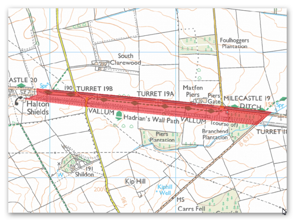
The monument includes the section of Hadrian’s Wall, vallum and their associated features between the B6321 in the east and Sunnybrae at Halton Shields in the west.
This section of the corridor occupies an east facing slope for most of its length with views to the north and east, but more restricted outlooks to the south and west. The Wall survives as a buried feature below the surface of the B6318 road. The wall ditch survives as an extant earthwork to the north of the road throughout this section except where it is overlain by access crossings. The average depth of the ditch is about 1.5m; however it reaches a maximum depth of 3m in places. For most of its length the ditch has a width of 12m. An open drain runs along the base of the ditch eastwards from East Wallhouses for 500m. Milecastle 19 is located 150m east of Matfen Piers on an east facing slope. It survives as a turf covered platform 0.15m high and measuring 27.8m east-west by 17m north-south.
Excavation of the milecastle took place in 1931 and uncovered an altar dedicated to `..the Mothers..’. Turret 19a is located 270m west of Matfen Piers below the B6318 road at the crest of an east facing slope. There are no upstanding remains apart from a 5m stretch of rough walling, 0.8m high contained within a hedge. Turret 19a was excavated in 1932 when it was found to be well preserved with its door located in its south west corner. The excavation also revealed that it had been dismantled early in the third century AD. Turret 19b survives as a buried feature located 170m east of the minor road which links Clarewood with the B6318. An excavation in 1932 produced many finds including a small altar. Unusually, the turret was bonded mainly with clay rather than mortar. The door was again located in the south west corner. This turret was found to have been abandoned at the turn of the second century AD.
The course of the Roman road known as the Military Way, which ran along the corridor between the Wall and the vallum linking the turrets, milecastles and forts, is not yet confirmed in this section of the corridor.
The vallum runs straight throughout this section on the same alignment as its neighbouring sections. It survives as an upstanding earthwork in varying states of preservation throughout the length of this section. The north and south mounds reach a maximum height of 0.8m while the ditch has a maximum depth of 0.6m.
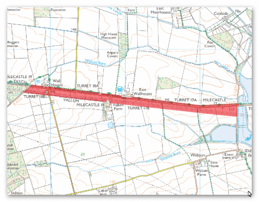
The monument includes the section of Hadrian’s Wall, vallum and associated features between the B6309 in the east and the B6321 in the west. The ground slopes gently upwards towards the west throughout this section of the monument.
There are wide views to the north, east and south. However, the rising ground to the west restricts the outlook in this direction. Hadrian’s Wall survives as buried remains below the road surface of the B6318 road throughout the length of this section. The wall ditch survives as an earthwork to the north of the road for most of the length of this section. It averages about 1.4m deep throughout, though it reaches a maximum of 3m in places. Milecastle 17 is positioned on sloping ground to the west of the Northern Reservoir. It survives as a low platform with a scarp to the east and a slight stone scatter. It was partly excavated in 1931 and its walls were shown to be about 2.5m thick. Milecastle 18 occupies a position on a gentle west facing slope on the south side of the B6318 road at East Wallhouses. There are no visible remains above ground; however, its site is known as it was partly excavated in 1931 when its walls were found to be almost 2.5m thick. Turret 17a survives as a buried feature located 310m to the east of the track which runs south to Welton from the B6318 road, on a ridge of level ground.
It was excavated in 1931 and was shown to have a door in the south west corner and a ladder platform in the south east corner. Turret 17b is located 320m east of the Robin Hood Inn, surviving as a buried feature beneath the B6318 road. The ground slopes upwards to the west while to the east the ground is fairly level. This turret was also partly excavated in 1931 and like turret 17a it was shown to have a door in the south west corner and a ladder platform in the south east corner. Turret 18a is located at the junction of the minor road to West Moorhouses off the B6318 on an east facing slope. There are no visible remains apart from a rise in the hedgeline. Part excavation in 1931 showed that the surviving buried remains are very well preserved. Its ladder platform stood to its full height with six stone steps. Turret 18b is located 50m to the east of Welton Burn on an east facing slope. There are no visible remains. It was partly excavated in 1959 when animal bones and pottery were found.
The course of the Roman road, known as the Military Way, linking turrets, milecastles and forts, which ran along the corridor between the Wall and the vallum, is not yet confirmed in this section. It is known to exist here as Horsley noted in the 1730s that it ran along the north mound of the vallum for a short distance where the Wall and vallum are very close and then, `A little after it has passed by the Wall houses, it runs almost parallel both to the Wall and the north agger’. Its remains now survive as buried features.
The vallum continues on the same straight alignment as its neighbouring sections throughout its course. It is visible as an upstanding earthwork except for the first kilometre west of the Northern Reservoir where it has been reduced by cultivation and its ditches silted up. The north mound averages about 0.25m in height whereas the south mound averages about 0.6m high. The vallum ditch averages about 0.8m in depth, though it reaches a depth of 1.4m in places.
Investigation
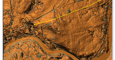
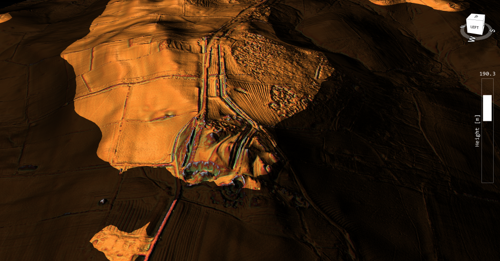
The Vallum in this section is non-existent in the East until it reaches Down Hill where both the wall and Vallum runs over. Prior to that start of the Vallum there is a quarry that is cut into were the Vallum would have existed – except there is no sign of the Vallum before the quarry, so it looks that the Vallum is terminated (start) by the quarry.
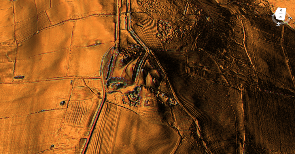
The only sense the path of the Vallum makes can only be seen if the raised waters of the prehistoric is added to the landscape and then we see that the quarry and Vallum start on the edge of the river shoreline.
Further Reading
For information about British Prehistory, visit www.prehistoric-britain.co.uk for the most extensive archaeology blogs and investigations collection, including modern LiDAR reports. This site also includes extracts and articles from the Robert John Langdon Trilogy about Britain in the Prehistoric period, including titles such as The Stonehenge Enigma, Dawn of the Lost Civilisation and the ultimate proof of Post Glacial Flooding and the landscape we see today.
Robert John Langdon has also created a YouTube web channel with over 100 investigations and video documentaries to support his classic trilogy (Prehistoric Britain). He has also released a collection of strange coincidences that he calls ‘13 Things that Don’t Make Sense in History’ and his recent discovery of a lost Stone Avenue at Avebury in Wiltshire called ‘Silbury Avenue – the Lost Stone Avenue’.
Langdon has also produced a series of ‘shorts’, which are extracts from his main body of books:
For active discussions on the findings of the TRILOGY and recent LiDAR investigations that are published on our WEBSITE, you can join our and leave a message or join the debate on our Facebook Group.

