Section S – NZ16NW
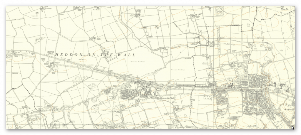
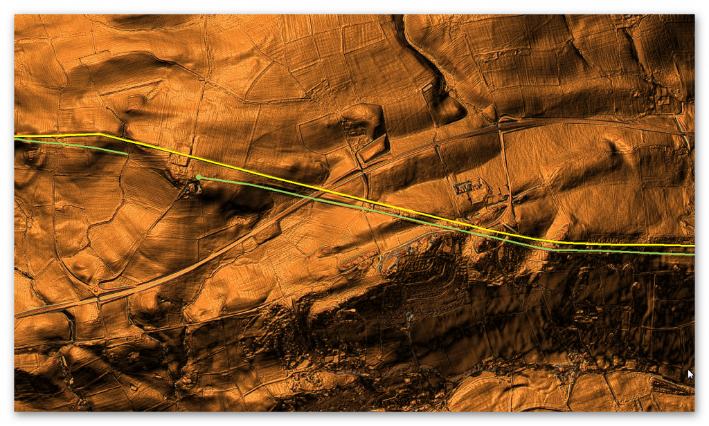
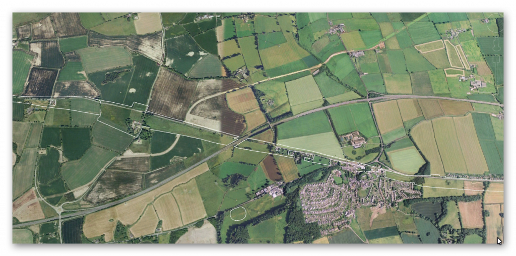
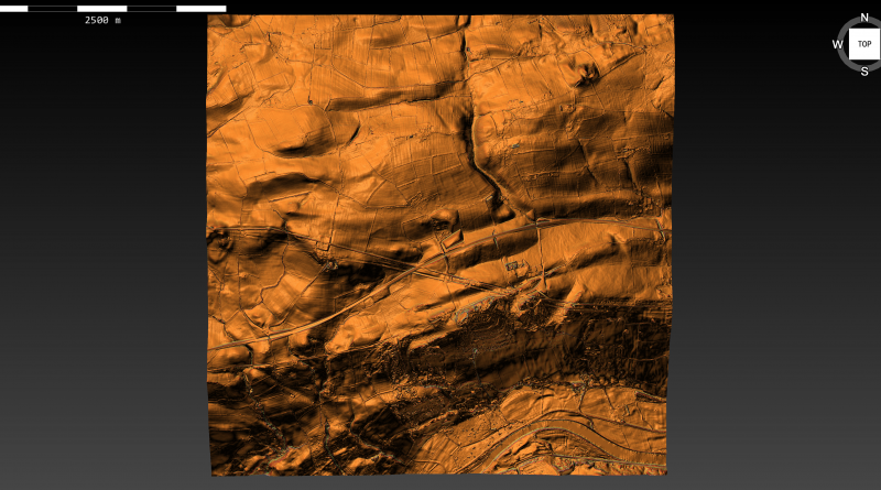
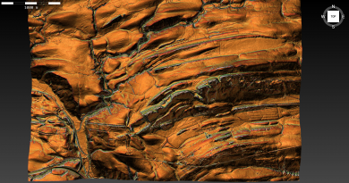
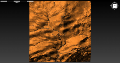
Section S – NZ16NW – this is a section of Hadrian’s Wall showing the LiDAR, Google Earth and 1800 Maps of the Area covered by Historic England
Historic England Sections:
Name: Name: Hadrian’s Wall and vallum from Throckley to Oatens Bank, Harlow Hill in wall mile 11, 12, 13, 14 and 15
List UID: 1010618, 1017533, 1010617, 1010616
Old OS Map
LiDAR Map
Google Earth Map
Historic England Scheduled Monuments within Section S
Name: Hadrian’s Wall and vallum between the March Burn and Oatens Bank, Harlow Hill in wall miles 13,14 and 15
Designation Type: Scheduling
Grade: Not Applicable to this List Entry
List UID: 1010618
Name: Rudchester Roman fort, associated civil settlement and a section of Hadrian’s Wall and vallum from the A69 to the March Burn in wall mile 13
Designation Type: Scheduling
Grade: Not Applicable to this List Entry
List UID: 1017533
Name: Hadrian’s Wall and vallum from East Town House, Heddon-on-the-Wall to the A69 trunk road in wall mile 12
Designation Type: Scheduling
Grade: Not Applicable to this List Entry
List UID: 1010617
Name: Hadrian’s Wall and vallum from Throckley to East Town House, Heddon-on-the-Wall in wall mile 11
Designation Type: Scheduling
Grade: Not Applicable to this List Entry
List UID: 1010616
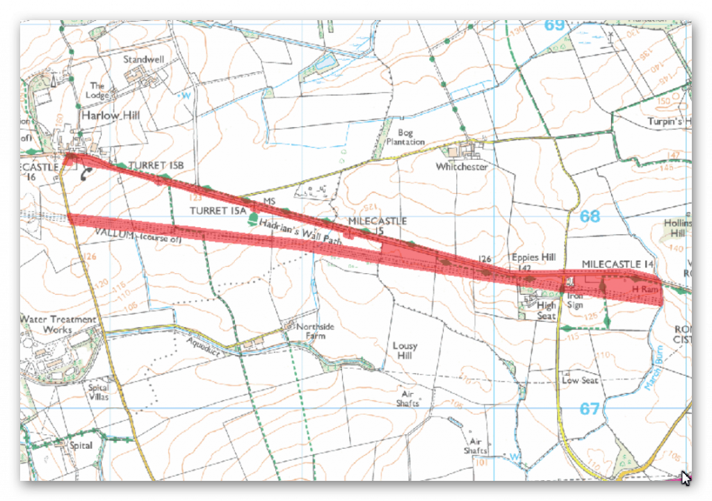
The monument includes Hadrian’s Wall and vallum and associated features between the March Burn in the east and the west side of Oatens Bank, Harlow Hill the west.
This section of the Wall runs gently downhill from the March Burn to milecastle 15 before running up a steep gradient to the summit of Harlow Hill. The Wall commands wide views to the north and south along this section, but the undulating terrain to the east and west means that views are restricted in these directions. Hadrian’s Wall aims for the high points throughout this section which includes the summits of Eppies Hill and Harlow Hill, unlike the vallum which takes a lower course skirting to the south of Harlow Hill. The Wall survives beneath the B6318 road throughout the whole length of this section. East of Harlow Hill antiquarians including Horsley, Brand and Skinner, recorded the width of the wall as being 7 feet and 4 inches, indicating that the Wall was of narrow type. The Wall ditch survives intermittently as an earthwork.
It survives best to the west of Eppies Hill to depths of between 2m and 3m. Elsewhere the ditch is silted up and survives only as a buried feature. Milecastle 14 is situated on the crest of a slight knoll to the west of the March Burn. It survives as a low, turf-covered platform 0.4m high. It has been heavily ploughed, which has resulted in the platform being spread. The site was partly excavated in 1946. Milecastle 15 is situated east of a stream on a gentle east-west slope with a restricted view to the north east. It survives as a turf-covered platform approximately 1m high over most of its area. There are robber trenches around the crest of the platform on the east, south and west sides. Milecastle 16 is situated on the crest of Harlow Hill with wide views in all directions. It survives as a buried feature in the field to the south of the road. The only upstanding feature is the scarp on the east side of the reduced platform.
The milecastle was excavated by Hepple and Richmond in the 1950s. The exact site of turret 14a is unknown. However, Horsley recorded that he saw the remains on top of the knoll known as Eppies Hill to the west of Iron Sign House. This would be a logical position for a turret as it would have commanded the best vantage between Rudchester and Harlow Hill. Similarly the exact site of turret 14b also remains unknown. Its presumed site is an area equidistant between the summit of Eppies Hill and milecastle 15. There are no visible remains of turret 15a which is located 115m east of the junction between the B6318 and the minor road to Whitchester. It was located during 1931 by Hepple, although little was found. Its remains lie partly below the surface of the B6318 road. There are no visible remains of turret 15b which is located 200m to the west of the minor road to the disused airfield at Ouston. As with turret 15a it was located during 1931 by Hepple. Its remains lie partly beneath the surface of the B6318 road.
The vallum runs in a straight line for most of this section. West of Eppies Hill, where the Wall and vallum are within about 30m of each other, the vallum diverges from the course of the Wall and takes a lower and straighter line to the south of Harlow Hill. It survives intermittently as an upstanding earthwork. The south mound is between 0.3m and 0.4m high where extant while the north mound is between 0.4m and 0.5m. Where extant the vallum ditch varies between 1m and 1.6m deep. Elsewhere it survives as a series of silted ditches buried below the turf.
The course of the Roman road known as the Military Way, which runs along the corridor between the Wall and the vallum linking the turrets, milecastles and forts, is not yet confirmed in this section of the corridor.
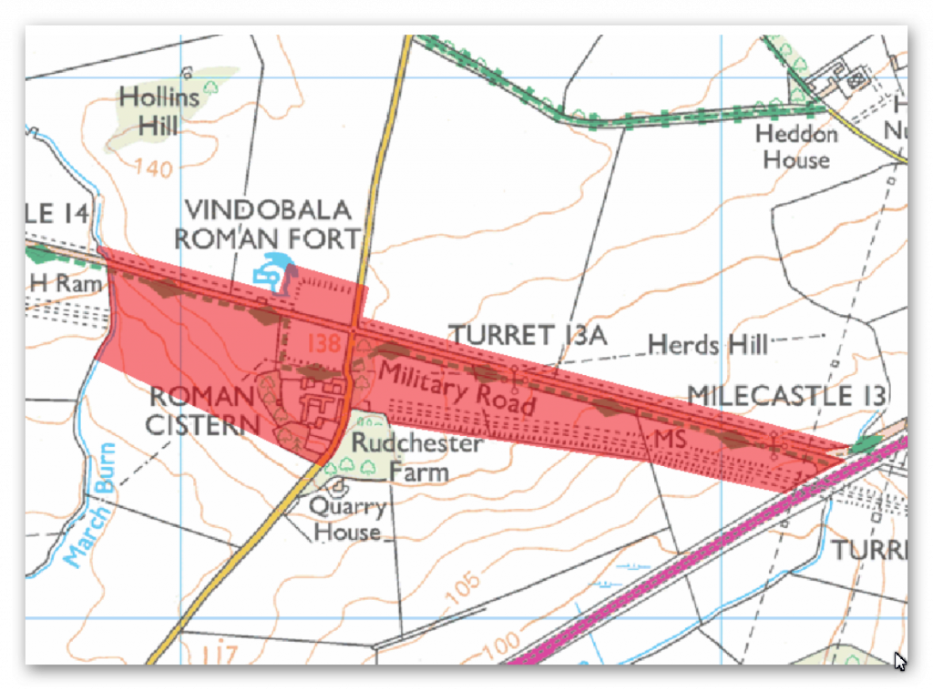
The monument includes the wall fort at Rudchester, the associated civil settlement and the stretch of Hadrian’s Wall and vallum between the A69 in the east and the March Burn in the west.
This section of wall corridor runs up the west side of the valley of the Rudchester Burn to the slight rise occupied by the fort before descending the slight depression to the March Burn. Throughout this section there are limited views to the north where the ground slopes gently away. In contrast there are wide views to the south over the Tyne Valley, while to the east and west the views are more restricted. In this section the Wall survives as a buried feature, lying below the course of the B6318 road. Excavations of milecastle 13 in 1930 demonstrated that the Wall was of broad type throughout this section. The wall ditch has entirely silted up throughout this section except for a slight scarp on the east bank of the March Burn. Milecastle 13, east of the Rudchester Burn, survives as a low mound 0.2m to 0.4m high. This milecastle measures 16.5m north to south by about 19m east to west. A large hoard of gold and silver coins was found here in 1776, the latest coins dating to AD 168. This milecastle was partly excavated in 1930 by Simpson. Turret 13a, east of Rudchester fort, survives as a buried feature beneath the B6318 road. Part excavation by Simpson in 1930 revealed the turret walls which were built to a thickness of about 1.25m. Turret 13b, which lies about 75m to the west of Rudchester fort, also survives as a buried feature beneath the B6318. The vallum survives as an upstanding earthwork throughout this section. However, to the west of the fort there are no upstanding remains of the vallum, although it survives as a series of buried features, which were located in 1987 during a seismic survey. It was revealed that the vallum makes a dog-leg to avoid the western and southern sides of the fort.
On the east side the north and south mounds of the vallum reach a maximum height of 1m, while the vallum ditch has a maximum depth of 1.4m. The course of the Roman road known as the Military Way, which ran along the corridor between the Wall and the vallum linking the turrets, milecastles and forts, is not yet confirmed in this section of the corridor.
The Roman fort at Rudchester, known to the Romans as `Vindovala’, survives as a turf-covered platform, up to 1.6m high, to the north of Rudchester Farm. It covers an area of 1.8ha and would have accommodated a part mounted cohort, 500 strong. The site was very well preserved until the 18th century when it was reduced by stone robbing. This was followed by ploughing and cultivation of the area, which accounts for the ridge and furrow overlying the southern part of the fort. It has been partly excavated on several occasions since 1897. Buildings identified as the Commanding Officer’s house, the Headquarters Building and a granary, were located. Finds from the site include a life-size statue of Hercules, five altars dedicated to Mithras and pottery. The east and west gateways were positioned to the north of where Hadrian’s Wall adjoined the fort. The outlying civil settlement, or `vicus’, is located to the south and south west of the fort partly below the Rudchester Farm buildings. Post-medieval quarrying to the south east of the fort has probably destroyed some of the remains. The terraces which stretch to the west of Rudchester Farm are identified as evidence of the attached Roman civil settlement. They include some probable building platforms. Although mostly between 0.3m and 1.5m high, these terraces reach a maximum height of 3.2m in places and contain considerable quantities of stone.
A rock-cut cistern known as the `Giants Grave’ measures 3.9m by 1.5m internally and is at least 0.5m deep. It is located in the area of woodland to the west of Rudchester Farm and probably supplied part of the vicus with water, as indicated by the presence of a drainage hole in its north west corner.
A Roman temple dedicated to the Persian god Mithras is located to the south west of the fort in the vicus area. It has been partly overlain by a lynchet and bank. The temple is almost rectangular in shape with a small apse at the north west end and an entrance hall at the south east end. The maximum internal dimensions of the building are approximately 7.3m by 16.4m. The surviving lower courses of the walls are made of stone. The building was excavated in 1953 by Gillam and MacIvor who were able to determine the plan of the temple, except for its south west corner which had been lost in a land slip. All road surfaces, road signs, field boundaries, buildings and overhead power line poles are excluded from the scheduling, but the ground beneath all these features is included.
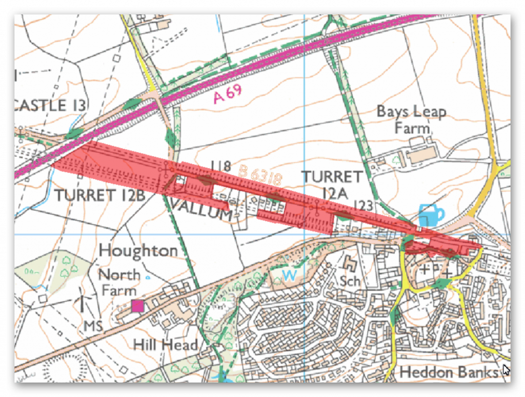
The monument includes a section of Hadrian’s Wall, its external ditch and the vallum from Heddon-on-the-Wall in the east to the A69 trunk road in the west.
This section of the Wall corridor has wide views overlooking the Tyne valley to the south and east, whereas to the north and west the ground rises gently giving a less extensive view. The Wall survives as a buried feature for the whole of this section of its course. It lies beneath the B6318 road except at the west end of this section where it continues in a field up to the A69 trunk road. The wall ditch survives as an earthwork for much of this section, to a maximum depth of 1.5m. The upcast counterscarp, usually known as the `glacis’, also survives up to 0.3m high in the area from north of the Three Tuns Inn to the north of North Lodge. Turret 12a survives as a buried feature below the B6318 road. The location of the turret is known from part excavation by Simpson in 1930. Turret 12b also survives as a buried feature below the B6318 road, probably extending south into the area of woodland to the west of North Lodge. As with turret 12a, part excavation by Simpson in 1930 located the site of this turret. The exact location of milecastle 12 has not yet been confirmed. In relation to the known sites of turret 12a and turret 11b, the site of milecastle 12 is expected to lie in the vicinity of Keeper’s Cottage at Heddon-on-the-Wall.
The vallum survives intermittently as an upstanding earthwork throughout this section. The mounds have been reduced by ploughing and the central ditch has silted up for most of its length. The south mound in this section reaches a maximum height of 1.5m, while the ditch has a maximum depth of 0.6m.
The course of the Roman road known as the Military Way, which ran along the corridor between the Wall and the vallum linking the turrets, milecastles and forts, has not yet been confirmed in this section of the corridor.
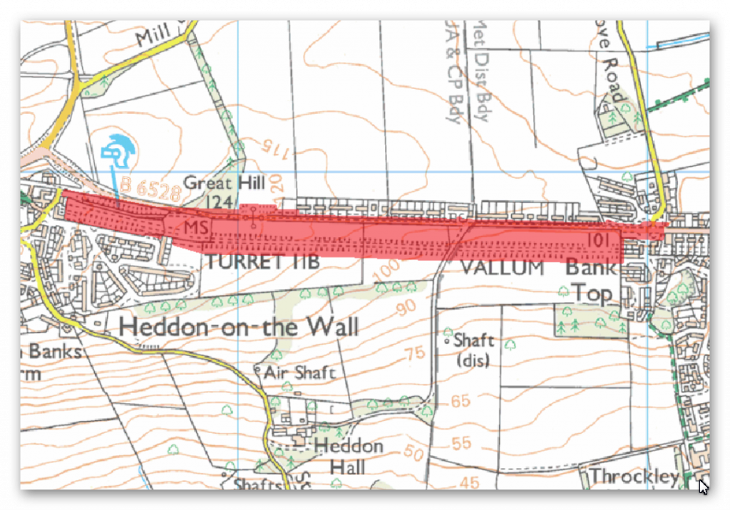
The monument includes a section of Hadrian’s Wall, its outer ditch and the vallum between Throckley and East Town House, Heddon-on-the-Wall. From various places in this section of the Wall corridor there are wide views northwards towards the Scottish Border and south west along Tynedale to the North Pennines.
At the east end of this section, the Wall survives as a buried feature below the course of the modern road, the B6528. Its line was recorded during roadworks in November 1926 and it was found to be of broad wall type. In the west end of this section there is a 255m stretch of upstanding consolidated wall between 2.8m and 3m in width, reaching a maximum height of 1.7m. The core was originally set in puddled clay, but is now reset in mortar to preserve the work. The upstanding section of the Wall is in the care of the Secretary of State. Turret 11b was located by excavation in 1919. It survives as a buried feature below the B6528. The location of Turret 11a has not yet been confirmed though it probably lies along the line of the wall somewhere opposite the Royal French Arms public house. During 1879 a hoard of over 5000 silver Roman coins was found just to the south of the Wall below the main road somewhere to the east of this turret site. The wall ditch is thought to survive as a buried feature underlying the gardens of the houses to the north of the Hexham Road (B6528), which are not included in the scheduling. However, west of the houses the ditch survives as an earthwork with a maximum depth of 1.9m and there is some rubble strewn over its scarps. In the west end of this section, opposite the consolidated stretch of wall, is a section of ditch, also in the care of the Secretary of State, which reaches a maximum depth of 1.4m.
The vallum survives as an earthwork in the field south of the B6528. It lies about 50m south of the wall line along this stretch of the corridor. In the east end of this section the vallum mounds have been reduced by ploughing, although the vallum ditch is still visible, reaching a depth of up to 1m. It is most evident in the east end in the small stand of trees at the entrance of the drive to Heddon Hall. On the summit of Great Hill, however, the works of the vallum are very well marked. The ditch is cut through the freestone rock and the south scarp shows Roman tool marks.
The course of the Roman road known as the Military Way, which ran along the corridor between the Wall and the vallum linking the turrets, milecastles and forts, is not yet confirmed in this section of the corridor.
Investigation
The Vallum in this section disappears in the west of the section into a river valley and seems to reappear as comes out of the river valley.
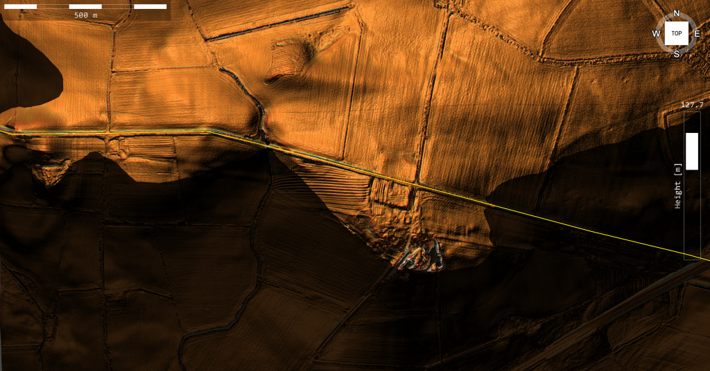
The line of the Vallum is different coming out of the river valley than when it enters. It is possible that the vallum over lapped at one point – but what must be kept in mind is that the construction is very different to what we have seen in previous sections and this maybe a consequence of the quarry the is at the start of the vallum leaving the River Valley. Not for the first time have we seen the vallum start at a quarry for obvious reasons and it would explain the strange course correction, as the Vallum is not straight. It is also possible that these shallow Vallum ditches were added at another date (when the river valley was dry?).
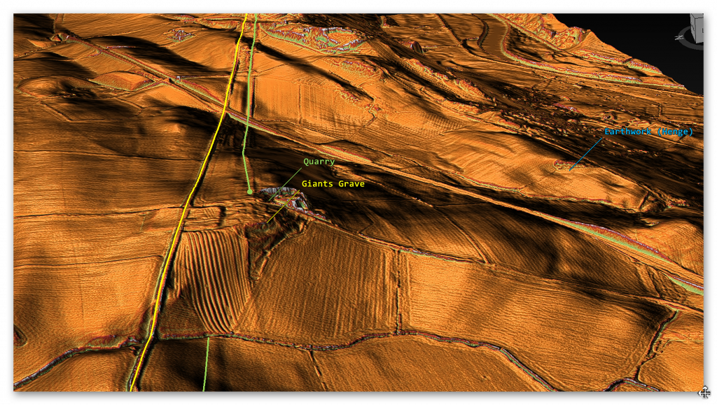
There is another feature the Vallum seems to meet on the edge of this river valley:
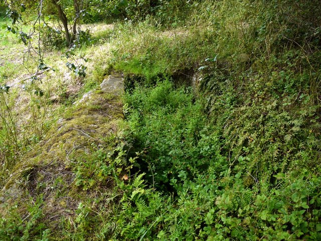
Some 90 yds south of the SW angle of the Fort (Vindovala) is a cistern, 12ft long, 5ft wide and 2ft deep, carved from rock, and known as the “Giant’s Grave”. It is generally regarded as Roman and, apart from the Mithraeum, is the only surviving structure of the vicus.
The “Giant’s Grave” (NZ 11183 67404) was discovered in the late eighteenth century. It is a unique survival in the northern frontier zone; a rock-cut cistern, it measures 3.9m by 1.5m internally and is at least 0.5m deep. It has a drainage hole in the NW corner. (3-4).
To be far the dating of this feature is unknown (current guess is done just by association) – but again this does associate the bedrock the Vallum is cut as being flooded. But the fact it is called the giants grave is of interest as most prehistoric features are generally named and associated by either the Devil or Giants.
This prehistoric connection continues in this area as there is another strange feature called ‘Broomy Hill Earthwork just 800m SE of these features. It is classified as an ‘Iron Age Fort’ which is incorrect as it is almost on the floor of the river valley – so it more of a henge that is connected and surrounded by Dykes, again not identified by archaeologists.
Further Reading
For information about British Prehistory, visit www.prehistoric-britain.co.uk for the most extensive archaeology blogs and investigations collection, including modern LiDAR reports. This site also includes extracts and articles from the Robert John Langdon Trilogy about Britain in the Prehistoric period, including titles such as The Stonehenge Enigma, Dawn of the Lost Civilisation and the ultimate proof of Post Glacial Flooding and the landscape we see today.
Robert John Langdon has also created a YouTube web channel with over 100 investigations and video documentaries to support his classic trilogy (Prehistoric Britain). He has also released a collection of strange coincidences that he calls ‘13 Things that Don’t Make Sense in History’ and his recent discovery of a lost Stone Avenue at Avebury in Wiltshire called ‘Silbury Avenue – the Lost Stone Avenue’.
Langdon has also produced a series of ‘shorts’, which are extracts from his main body of books:
For active discussions on the findings of the TRILOGY and recent LiDAR investigations that are published on our WEBSITE, you can join our and leave a message or join the debate on our Facebook Group.

Pingback: Hadrian’s Wall LiDAR investigation - Prehistoric Britain