The Giant’s Graves of Cumbria
During my current research into the Dykes (linear earthworks) of Britain using LiDAR, I have come across many strange and wonderful features (Giant’s Graves) lost to the archaeological world – either through uninterest or the lack of scientific investigation to understand the actual and historical meaning of these features – The Giant’s Graves of Cumbria.
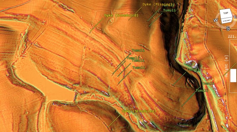
One of these areas is the ‘Ravenstonedale’ area of Cumbria, where over twenty of these unusual tumuli’s are present on the old 1800s OS maps and now can be investigated by LiDAR in detail.
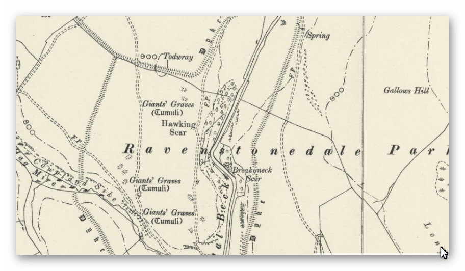
The dates of these graves are unknown as little to no excavation work has been scheduled, and so only scant accounts are available from historical books of little scientific discipline.
CROSBY GARROT, WESTMORLAND. [1793, Part I., pp. 116, 117]
However rude the monuments of our ancestors may appear to the eyes of a more civilised race, I doubt not but the humble tumulus will convey to posterity as deep an impression of the brace actions performed by its now mouldering contents as the magnificent and gorgeous marbles that decorate out noblest edifices; and that long after those are defaced by the unerring hand of Time, the green turfed mound and grey mossy stone, without the aid of sculpture, will say. “Here sleeps, on his humble bed, a warrior.” At what period one of the following description (lately discovered and opend by the Lord of the Manor of Crosby Garrot, in the county of Westmoreland has been raised, I know not; some of your correspondents more critically acquainted with such antiquities, may probably be able from the following account, to say what era produced it.
Six bodies were cased in stone coffins made of the slates common in that country. The bottom of each consisted of two or three stones well joined; every side had from two to four, which were rather obliquely placed, over which were laid stones, similar to the sides, all the length; there had not been any cement used, but each edge lay about an inch over the other. Over these six earth and stones had been throw about 6 inches higher than the coffins, and then four others exactly like the former (all due north and south) upon them, which were all covered about 2 feet; there appeared not to have been any distinction to any particular body, as in that opened at Halford Bridge. Around the whole (which was about 10 yards in circumference) a circle of flat stones was placed edgeway, with their tops but just appearing above the ground.
The bones of those that were opened were not much decayed; one skull had apparently been cloven half down by a sharp instrument, and other bones mutilated; the teeth in most of them were perfect. No armour or clothing appeared to have been inhumed with the bodies. The whole lay open a few days, and then was restored as nearly to its former state as could be. It is situated in a common pasture, called Bullflat, under a hill, around which the remains of a fosse are still in many places to be traced. At the top of the hill are two more mounds, like the other (though not so large) which have never been opened, and which I doubt not, are similar tumuli.
Yours, etc T.C. (3)
If we look at the GE map of these ‘tumuli’, we see that they are on the side of the hill pointing up (ESE) as strikingly rectangular. They are 60ft x 12ft (18.7m x 4.2m) with a 6ft moat/ditch (1.8m).
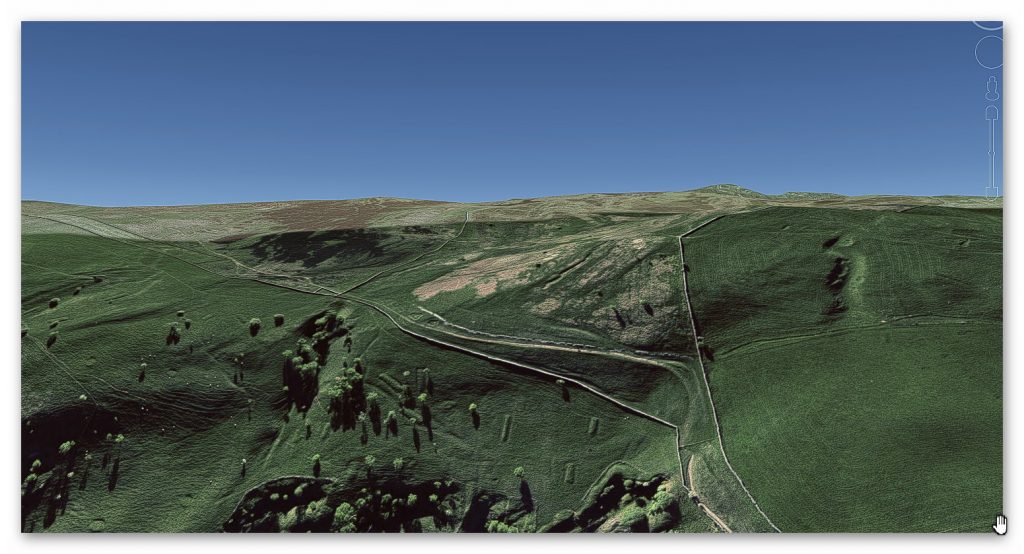
The measurements suggest that this civilisation is associated with the maths of ‘base 6’, which we have shown in previous blogs and books are directly connected to the measuring system of the megalithic builders (Stonehenge). So we would expect to find that these skeletons would be overly large in height and have ‘long skulls’ like the bones found in Long Barrows, which these look like later ‘single‘ version of replica boats – but on a single scale-like Viking burial.
Another way of identifying the date of these objects is the Dykes that interconnect the entire region. These graves make more sense when we add the waters of the Mesolithic as they then appear on the shorelines of the enlarged rivers, and Dykes (currently unscheduled) appear on the LiDAR map next to the Graves.
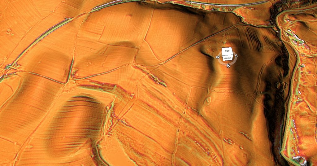
Finally, this site allows us to compare prehistoric Dykes against later Iron Age and Saxon boundary markers that archaeologists get somewhat confused. There is a substantial site in two parts with field boundary markers sub-dividing the land – these markers are tiny compared to the Dykes we observe now through LiDAR and are not ditched unless for drainage, and if so, again are small in size.
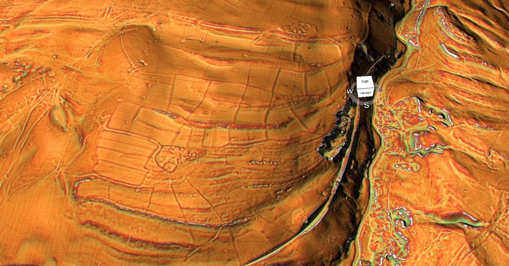
This can best be seen on the scheduled Dykes in this area which Historic England suggest are ’deer parks boundaries’. Sadly, they are not straight, they are inconsistent in design (the ditch is on one side then the other), and there are significant gaps or its incomplete, which is convenient but highly flawed scientific logic for clearly canals that once serviced the dead and their path to the afterlife.
For further information about Dykes see our website ot video channel.
Further Reading
For information about British Prehistory, visit www.prehistoric-britain.co.uk for the most extensive archaeology blogs and investigations collection, including modern LiDAR reports. This site also includes extracts and articles from the Robert John Langdon Trilogy about Britain in the Prehistoric period, including titles such as The Stonehenge Enigma, Dawn of the Lost Civilisation and the ultimate proof of Post Glacial Flooding and the landscape we see today.
Robert John Langdon has also created a YouTube web channel with over 100 investigations and video documentaries to support his classic trilogy (Prehistoric Britain). He has also released a collection of strange coincidences that he calls ‘13 Things that Don’t Make Sense in History’ and his recent discovery of a lost Stone Avenue at Avebury in Wiltshire called ‘Silbury Avenue – the Lost Stone Avenue’.
Langdon has also produced a series of ‘shorts’, which are extracts from his main body of books:
For active discussions on the findings of the TRILOGY and recent LiDAR investigations that are published on our WEBSITE, you can join our and leave a message or join the debate on our Facebook Group.

