The Stonehenge Hoax – Woodhenge
Conundrum 13 – The Builders / Woodhenge
I owe, I owe so off to work I go
The Problem
Stonehenge has also been a problem as there is no evidence of occupancy, and this causes problems as it is supposed to have been built by the first farmers of the Neolithic period (if the carbon dating is correct). The solution is that Durrington Walls and Woodhenge, so close to Stonehenge and houses, are reportedly found within the ‘henge’. But there are problems with this ‘simplistic’ solution, the distance being the first, as you can’t see Stonehenge from Durrington Walls, and the second is, why build a time-consuming structure such as Woodhenge if you’re busy with building Stonehenge?
The Solution
If you go to the original North East path break in the Stonehenge ditch, you find the Heel Stone, which was moated during the Mesolithic Period. You will also find a direct alignment to Stonehenge’s nearest neighbours, Woodhenge and Durrington Walls.
The Avenue is wider than the break in the ditch around Stonehenge and has always been a mystery to archaeologists. This mystery is compounded by the Heel Stone’s position to the right of the Avenue rather than in the centre. The Avenue was built after the Mesolithic ditch was created; therefore, these individual moated stones start to make some sense as alignment points.
The Heel Stone was positioned before the Avenue’s construction; the moated stone points to Stonehenge’s sister site Woodhenge and not, as is currently believed, to the midsummer sunrise.
In 2016 Durrington Walls hit the headlines with “Remarkable new archaeological discoveries are beginning to suggest that Stonehenge was built at a time of particularly intense religious and political rivalry.
Just two miles north-east of the World Heritage site, at an important archaeological complex known as Durrington Walls, archaeologists have just discovered what appears to have been a vast 500-metre diameter circle of giant timber posts. The find is of international significance.
Originally archaeologists, using geophysics rather than excavation, had thought that they had found buried standing stones, so the discovery has totally changed their understanding of the site – the largest ancient monument of its type in Britain.
However, the most significant revelation is the discovery that the newly identified timber circle complex was probably never fully completed – and that, just a few months or years after construction had started, there was a dramatic change in religious – and therefore almost certainly also political – direction. Work on the circle was stopped abruptly by around 2460BC – despite the fact that it was nearing completion. The 200-300 giant 6-7 metre long, 60-70 centimetre diameter timber posts were lifted vertically out of their 1.5 metre deep post holes – and were probably used to construct or expand other parts of the complex.
What’s more, within a few months or years, the post holes themselves were then deliberately filled with blocks of chalk and were covered up for most of the circuit by a bank made of similar chalk rubble. Two of the post holes have just been fully excavated – and, at the bottom of one, the prehistoric people who decommissioned and buried the site, formerly occupied by the giant timber circle, had placed one of their tools (a spade made of a cow’s shoulder blade) at the bottom of the post hole before it was filled in. It certainly hints at the ritual nature of how the change of religious direction was implemented.
It was as if the religious “revolutionaries” were trying, quite literally, to bury the past. The question archaeologists will now seek to answer is whether it was the revolutionaries’ own past they were seeking to bury – or whether it was another group or cultural tradition’s past that was being consigned to the dustbin of prehistory”.
In 2015 Sky News reported:
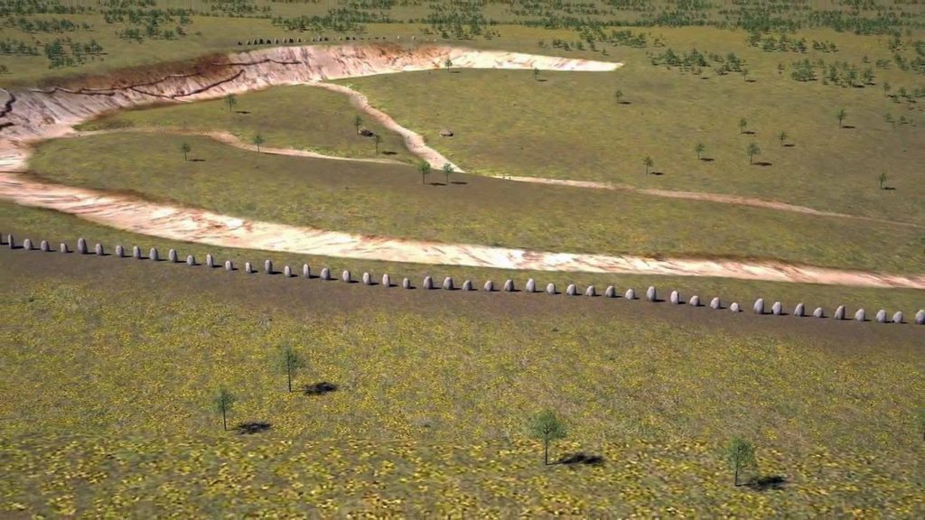
“Scientists have found a larger version of Stonehenge just one mile from the site of the famous Wiltshire stone monument. The Durrington Walls ‘superhenge’ is larger than Stonehenge and may include as many as 90 large stones. Built about 4,500 years ago, the stones lined an arena that was probably used for religious ceremonies or solstice rituals.
Using ground-penetrating radar on Salisbury Plain, scientists found the stones lying on their sides and buried under three feet of earth. Some of the stones are nearly 15ft and were originally placed along the southeastern edge of the circular enclosure that measured nearly a mile wide – making it the largest earthwork of its kind in the country.
The stones may not always have been part of the henge, possibly being toppled over before being incorporated into it – not an act of vandalism but an attempt to save whatever was thought to have been important about the stone, experts think”.
In 2015 the ground survey found “90 large stones, lying on their sides and measuring nearly 15ft” under the ground” – then, in 2016, we have “200 – 300 giant posts 6-7 metres long” – So was there another ground radar survey between the two claims or where the ‘experts’ caught guessing?
Sadly, the misinterpretation of the evidence doesn’t end the nonsense and gives us a clue to this deception – “However, the most significant revelation is the discovery that the newly identified timber circle complex was probably never fully completed“.
You could say that about the entire site – if you believe what the archaeologists tell you. Durrington Walls is a classic ‘half-moon’ shape, which is evident as the bank is missing towards the River Avon in the East, and there is no bank to the South where they found these anomalies. Now the bank is no small matter, unlike Stonehenge, as it is 30m – 40m wide and 3m high in the North-western sector of the site.
Archaeologists have yet to suggest why the banks are missing – if it were a ‘henge’, it would have had banks and ditches surrounding its entirety.
The first thing that strikes you when you look at Durrington Walls is that it seems incomplete; it looks like a half-circle from aerial photographs, and the ground, you get a sense of it only being half-finished. But most illustrations include the eastern section because magnetometer surveys of 2006 show more ditches under the surface, although you might question their purpose, as it is not apparent.
The site’s east side was clearly built much later than the original west side. As a result, the eastern bank is smaller and does not match the specifications of the original ditch and moat, which was roughly 5.5 m deep, 7 m wide at its bottom, and 18 m wide at the top.
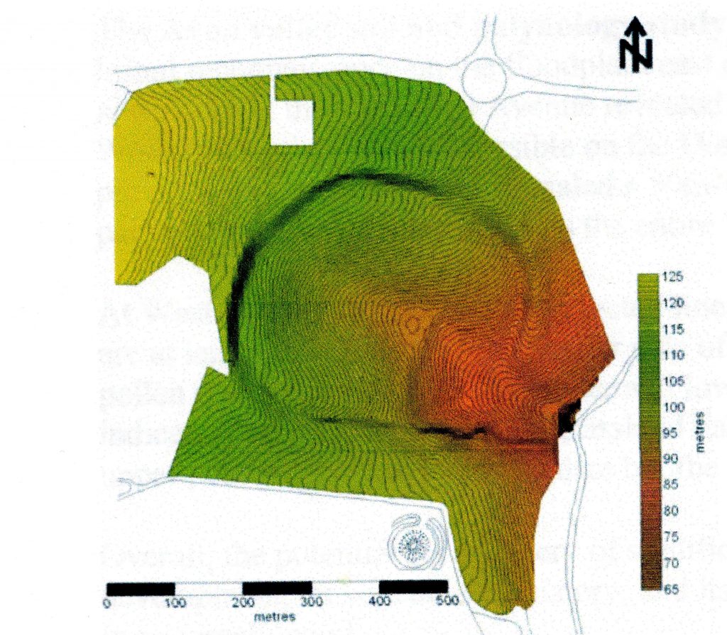
The bank was 30m wide in some areas. The bank and ditch indicated by the magnetometer surveys are less than half that depth; the bank is only about a third of the size of that on the northern side. The current theory and plan of Durrington Walls do not stand up to investigation, for it is clear that the Eastern side of the camp was added later when the prehistoric groundwater had started to recede. This would include the Southern circle found in the 1960s.
It would help if you looked at the site’s terrain, position, and layout to answer that question. The first thing that hits you is that the site is not flat – in fact, it’s a huge bowl. Archaeologists say that it is a settlement, but anyone who goes camping will tell you not to pitch your tent on a slope, and for an excellent reason: you will wake up one morning covered in water, as when it rains, the water runs downhill.
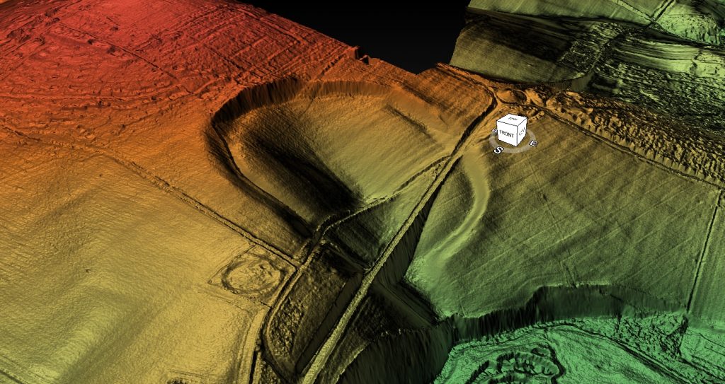
Archaeologists will insist that, because they have found a few postholes that they believe are the foundations of a couple of roundhouses, the site must unquestionably be a settlement because its position and shape dumbfound them.
If we now add the higher Mesolithic groundwater tables as presented in our hypothesis, as we had shown at the Stonehenge site when the river Avon was 30m more elevated in the Early Mesolithic period. This site (less than three river miles down the road from Stonehenge) becomes a perfect natural harbour, with shallow sides for pulling boats ashore and a 4-metre deep ravine in the centre of the sanctuary. Moreover, a northern and western bank would have provided shelter from gales.
Woodhenge (which lies to the South of Durrington Walls) has two entrances: one directed towards Durrington Walls’ harbour and, more importantly, a mysterious second entrance that trails to our Mesolithic shoreline. This clearly indicates that groundwater was present at Woodhenge during Mesolithic times. It would explain the strange shape of the camp and the magnetometer survey (Parker-Pearson, 2006) showing the continuation ditches to the east were dug after the groundwater had fallen in Neolithic times.
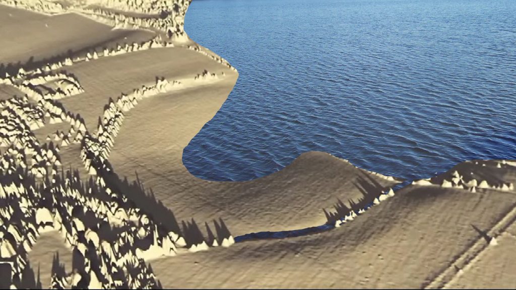
Even more impressive is how the landscape reflected the receding shoreline during the Neolithic when the waters receded (as we saw at Stonehenge and The Avenue). The present-day minor road runs along the course of the Neolithic shoreline circa 4000 BCE.
We should not be too surprised by this, as lakeshores and coastlines still have paths along with them today so that we can fully enjoy them. There is no reason to believe that prehistoric people did any different 5,000 years ago, and such a path would also have a practical purpose as the shorelines were used as a mooring site. If we are correct about the road and the mooring points, is it possible to find the same post holes here as we saw in the old car park at Stonehenge?
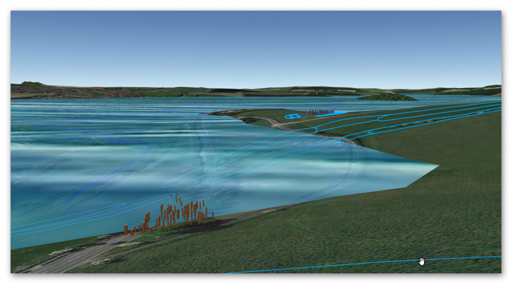
Wainwright, in his excavations of Durrington Walls, discovered lots of them. These postholes would make a natural landing area for boats, mooring up for Woodhenge when the waters fell in the Neolithic period.
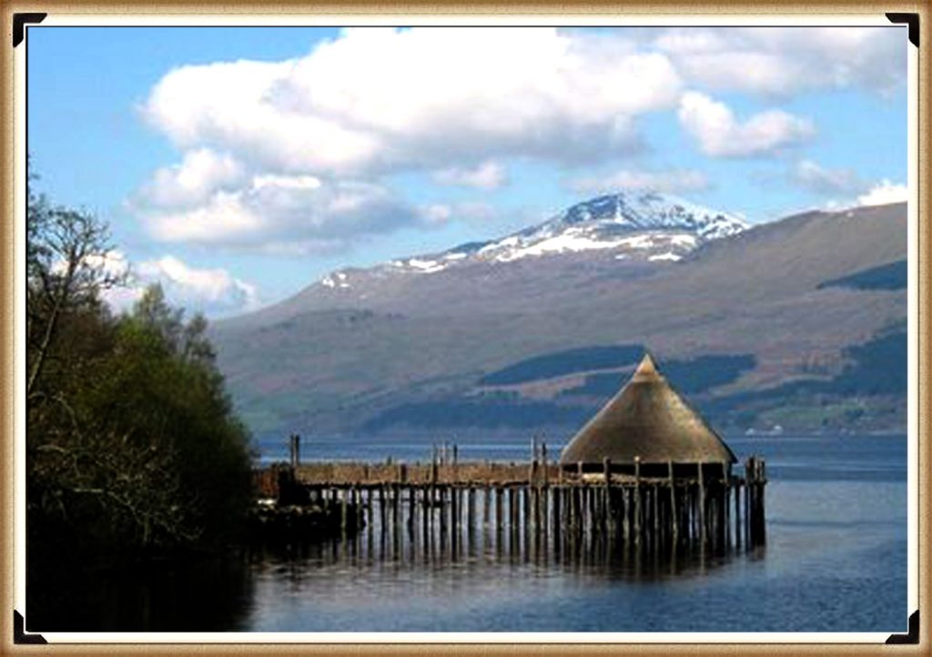
Water was also reported by Mike Parker-Pearson in his excavations of the site in 2009 when they located ancient springs in the centre of Durrington. A strange place to put a settlement, where you are building houses – unless, like Much Farm, these houses were on stilts and the waters were underneath the house. These ‘crannogs’ are found throughout Britain and are dated from the Bronze Age – but there is no reason not to believe that this boat society would have been the first to use these aquatic houses as the perfect mooring platform for their boats.
Furthermore, the authors of these press releases and reports failed to understand why these posts were eventually removed and backfilled. It doesn’t make sense to complete (as they suggest) a third to half the site, then stop and remove all the posts you planted if it’s for ‘ceremonial’ reasons unless the posts were there for a more practical purpose, as a windbreak for the harbour. This would logically result in them ‘slowly’ disappearing over a few decades through rot and removal.
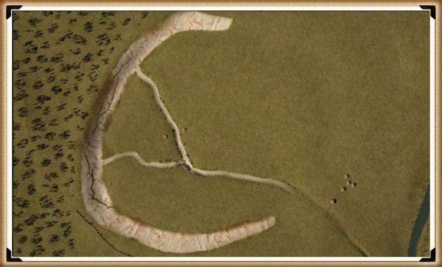
We should also remember that many posts were also found to the south of this site and at Woodhenge next door. So, the idea that they didn’t have enough posts to finish off (as suggested in their report) is merely archaeological guesswork and, therefore, nonsense.
Another survey by this group reported 2020 some findings and dates, which accidentally supported my Post-Glacial Flooding Hypothesis. They carbon tested pits in the landscape and came up with yet another ludicrous theory about a ‘late Neolithic pit structure’, as they have found clusters of pit features (of the same size and depth as we saw in the Stonehenge ditch), which they imagine was a giant ring 1.2miles in diameter surrounding Durrington Walls – which the authors suggested is a ‘marker’ to strangers not to approach!
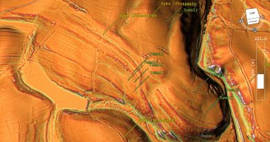
They found a ‘Dyke’ from the river Avon to a ‘Causewayed enclosure’ and a selection of pits on the shorelines of the river Avon in Palaeochannels (like Stonehenge Bottom) that was part of the expanded river Avon during the Mesolithic period.
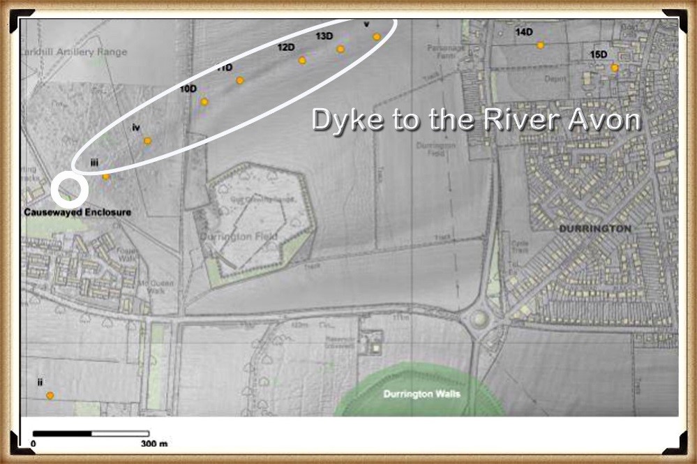
The Palaeochannel ditches are of most interest as we can get (like the old Stonehenge car park pits) accurate dates to the levels of the river Avon for future dating of other sites – like we have achieved at Durrington, knowing that the three Mesolithic pits at the old car park were dated around 8100 BCE for a recorded height of the river Avon of 98m. We can now add Borehole 9A BH 1 (SUERC-92464) at 7179 BP +/- 28 and 8A BH2 (SUERC-92465) at 5788 BP +/- 28 to this catalogue.
And this type of a Dyke was not the only one found at Durrington Walls, for the most obvious evidence of water and the high water table can be seen on the southern side of the site as a massive ditch. However, this enormous earthwork is currently either totally ignored or is dismissed as a ‘lynchet’ feature.
This ‘elephant in the room’ is a clear indication of the use at Durrington Walls in the past, and like the avenue at Stonehenge, this civilisation attempted to keep the monument working as the waters of the Neolithic retreated from the site.
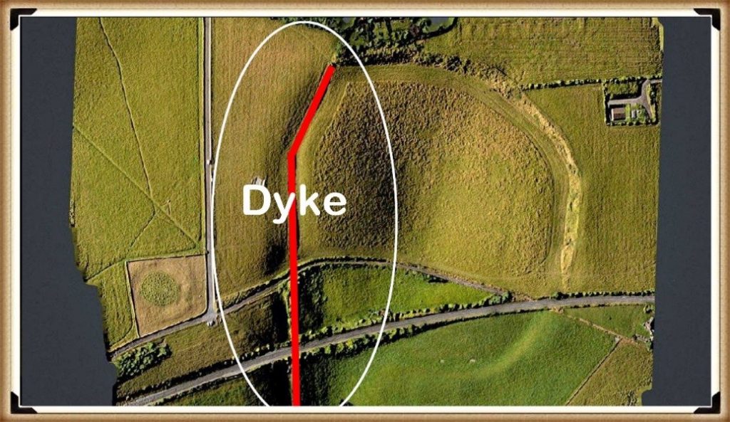
If you look closely at any satellite pictures you find a Dyke. This feature is not concave as they would like to tell you; it is like all Dykes, wholly straight and runs from the end of the western moat to the River Avon, which is impossible for a natural lynchet only runs parallel to hill contours.
This Dyke would have been added (and then extended) once the original moats failed, as the shoreline and water table dropped throughout the Neolithic period to follow the river Avon so that boats could access the site.
Woodhenge
This monument has a series of ‘massive’ wooden post holes – at this point, I need to explain that archaeologists don’t seem to understand the difference between a ‘Post Hole’ and a ‘Stake Hole’. You use stake holes for posts such as fences as they can be quickly buried in the ground as they have a sharp point – this point naturally compresses the surroundings (due to the shape and hammering from above), so they don’t move or wobble!
A ‘Post Hole’ is different as it has a flat bottom and needs rubble to stop it from rocking from side to side. Stake holes are easy as they are ‘self-burying’ while post holes are more work as you need to dig a hole for it. The only reason you would do all the extra work of digging a flat bottomed hole (especially in chalk) is if the wooden pole is to take some kind of weight from above, for a stake hole is useless for this type of structure as it would sink (overtime) under the weight pushing down on the point and probably fall over.
Therefore, if you have a round wooden single-storey building with a simple roof, as current archaeologists suggested for some of these post-hole structures, why use these massive posts as it is ‘over-engineering’ and time-consuming – especially with simple tools?
Cunnington’s excavations at Woodhenge in 1929 suggested that some posts are up to 60 inches in diameter:
“clear evidence was obtained in excavation that the six centric rings of holes once held posts or tree trunks varying from 1ft to 3ft in diameter according to the size of the hole…… the size and depth and distance varies in each circle…. In the outer circle holes are 6ft apart from centre to centre, from 1 1/2 ft to 2ft in depth and from 2ft to 3ft in diameter. In the second circle the holes are larger and further apart, averaging about 4ft in depth and 3 ½ to 4ft in diameter. The largest of all were those were those of the third circle, being about 6ft deep with a diameter at the top from 4ft to 5ft “ (Cunnington. M.E., ‘Prehistoric Timer Circles’, Antiquity A Quarterly Review Of Archaeology Vol.1, 1927)
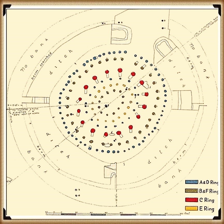
Sadly, Woodhenge shows us yet another illustration of flawed science in archaeology. Even with a ‘second rate’ excavation report from the 1920s, modern archaeologists conclude that this structure was a single-story house – a slightly grander feature than the traditional ‘iron age’ house. This is simply nonsense. If we look closely at the evidence presented here, we obtain a different and more accurate conclusion about the nature of this structure.
Firstly, if we look at the site’s layout (which lacks much detail), we can see from these original excavation plans the scale of this understatement, as the existing ‘concrete’ posts on the site are far too small. The most recent photo was from the excavation by Pollard in 2007, which indicates that these posts are at least five times larger than the current representations.
The following fact that goes unanswered is the reason for the large post-hole ramps. You don’t take time to put 32 ramps into the soil unless it is essential, as you just added at least another month to the building work for the site and 500 working hours. What archaeologists have missed (or failed to mention) is in which direction these ramps were cut – as it tells us more than the entire excavation report by Cunnington.
The massive 4 – 5 ft pine posts of the 16 postholes (known as the C Ring) would weigh 214kg per foot of length. Therefore, a sizeable healthy person could pick up one foot of pine and place it in a hole without assistance or a need for a ramp.
Consequently, an eight-foot pine tree trunk could easily be placed on the shoulders of 8 people and put straight into the hole, which is the current estimation by archaeologists for a single-storey structure. Therefore, the empirical evidence suggests they are wrong, and the pole was much more significant.
We have seen at Stonehenge similar ramps not by the 4-tonne bluestones but by the Sarsen stones that weighed an average of 25-tonnes (the trilithons are 35-tonnes) but half the size of these ramps.
A 25-tonne pine post of width between 4 – 5 ft would be 39m long or 128ft, and a 35-tonne pine tree is about 177ft long. But do Pine trees grow that tall? Longleat Forest is just down the road from Durrington Walls; there are pine trees within this forest. These trees grow to nearly 200ft tall.
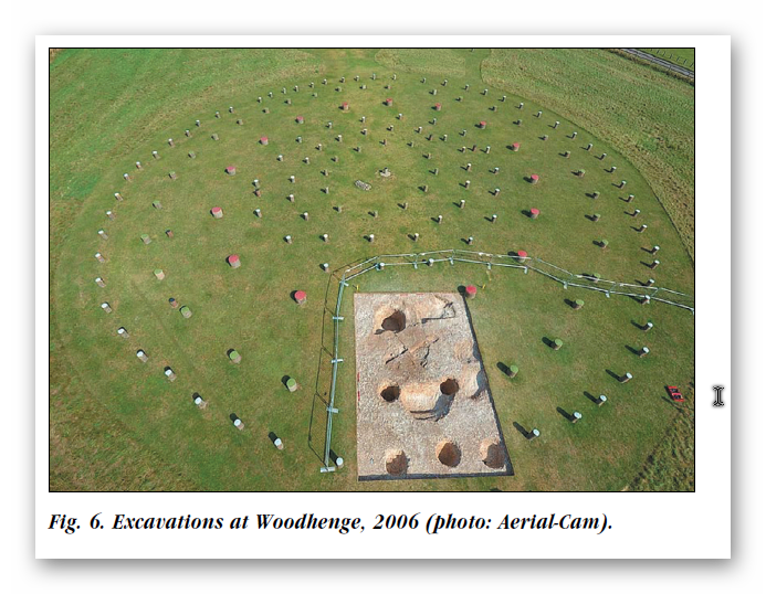
Moreover, the site plan also gives us another clue about the length of these poles. If to look carefully at the angle of the ramps into the giant postholes, you will notice that they are not all facing the same direction. The only logical reason for that is if you erect the pine poles in a set order so that they would not hit or interfere with each other when attempting to erect the posts.
This allows us to come to some remarkable conclusions about the construction and the process of how it was built:
- Holes were filled in an anti-clockwise direction starting at hole 1 (at four o’clock to the site)
- Poles must have been more than 100’ long; otherwise, you could erect them in any order and direction.
- The current ditch at the site was added later, as you would need to bring the poles through the ditch and, in some cases, be in the ditch to erect it.
- The 4 to 5ft diameter posts all entered the site from the south, as it has the minimal distance to travel – as these poles were either rolled or dragged on a sledge and therefore probably the direction of where the pine trees have initially been growing or unloaded, after being floated down the river.
Now the slopes for ‘Ring C’ (the most significant posts) are 5 to 8ft long, which are even longer than the Stone ramps (3 to 4ft) at Stonehenge (Fig.58). This probably shows the significant (Sarsens are only 13ft tall) leverage factor required to be pulled upright with an A-frame, allowing the posts to slide into position and then into the hole.
Ring B – the 3.5 to 4ft diameter trees also have ramps, but much smaller (3 to 4ft), indicating less leverage and, therefore, half the weight/height?
Moreover, they were placed into position after the C Ring, as their ramps point away from the centre with no common direction.
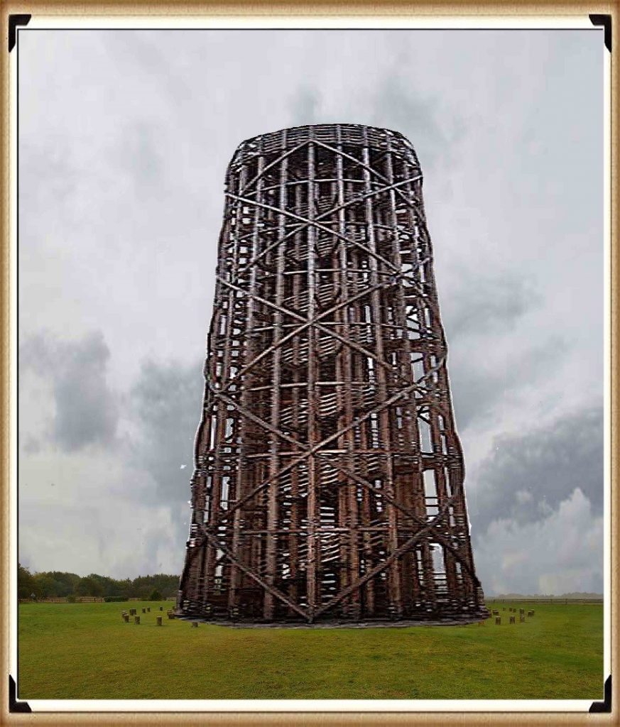
The last row of postholes (A), 1 to 3ft in diameter, do not have ramps and are sporadic in nature and size – which leads me to believe they have no structural significance and were probably more like a palisade covering, to either enclose the structure or allow mud or reed covering (wattle & daub) and protection from the elements.
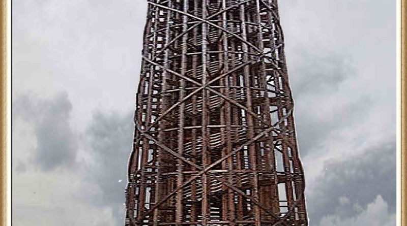
The internal posts (D to F) are superficial and probably were there to support the first-floor structure, as we see in their successors in British history the ‘broch’ – a stone version-built thousands of years later for the same purpose.
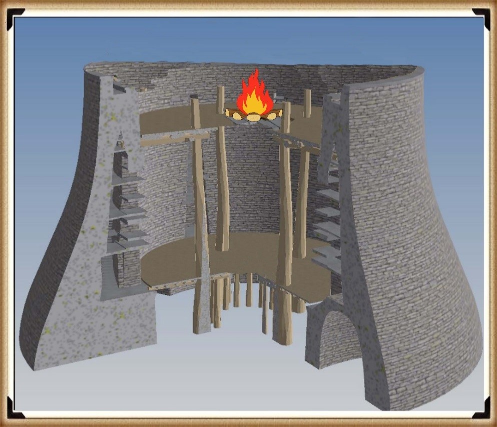
But my money would be on the tower being of a lower ratio of 1 to 1, with the base, making it 135ft high and the same height as Silbury Hill, a little further up the river Avon and its design I would suggest, would have been the exact ‘layer cake’ design as we will see at Avebury.
Therefore, what would you build next to a harbour to attract and direct boats – it’s obvious, isn’t it? A fire beacon (with a stone base), as we know from written history and the Pharos of Alexandria (280 – 247 BCE).
Furthermore, this link with the harbour is illustrated by the construction of the Moat, Bank and then a Dyke. As we have suggested, the Woodhenge ditch would not have existed at the original time (Phase I) of the construction of the C and then the B rings. It seems that it was added at the end of Phase I when the structure was complete and before Ring A was established, as it points to the shoreline of the Neolithic Avon River. This alignment disproves the current ‘expert’ theory about being an astronomical alignment with the Solstice Sunrise.
Evidence for the construction of the postholes (with gaps in the circle, which were later filled with smaller posts) indicates that the ditch had been filled from age or design. The central opening (in the A circle) to the northeast is not in line with the gap in the ditch, and the two other spaces in the circle would track across the ditch in the southeast and northwest.
As for the dating of Woodhenge (and Durrington Walls), like Stonehenge, unrelated antler and bone fragments have dated it to about 2400 BCE, which is very convenient. The problem is that most of the post hole samples at Woodhenge were either lost or have been stored away and not tested since the excavations between 1926 to 29, for reasons known best to the experts.
Moreover, like the samples taken from the old car park in 1966, pine charcoal was reported to be found “similar to the charcoal found at Woodhenge”, was the quote from the labs at the time, who failed to carbon date the samples as the experts had declared them Neolithic, supporting the antler pick dates. Although now, once this gross error was exposed, we know these pine charcoal wood dates to be Mesolithic 8100 BCE – which ‘begs the question’ so are the pine charcoal dates found at Woodhenge also Mesolithic?
Less than a mile down the river is ‘Blick mead’ (Vespasian’s Camp), which has also been found on dates ranging from 7900 BCE (remember our Bluestone estimation for Stonehenge is 8000 BCE), to 4050 BCE, with multiple RC dates from the 8th to the 5th BCE. Sadly, until someone finds these samples and carbon tests them to get an accurate date for Woodhenge and Durrington Walls, this unscientific archaeological ad hoc dating methodology will continue.
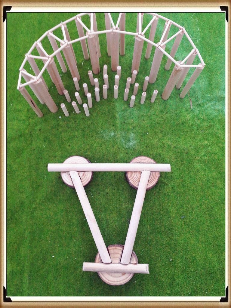
Furthermore, the engineering structure created by this civilisation – like the design at Stonehenge, has been overlooked by archaeologists looking for a more simplistic ‘hunter-gatherer’ solution for this superstructure, which has ended up with a single-storey roof, that is well over-engineered for that purpose. We can see at Woodhenge (and at The Sanctuary at Avebury) the ‘triangulation’ of wood joints using the mortice and tenon techniques we have seen on the Sarsen stones at Stonehenge. This structural technique (which is incorporated in modern towers today) allows the construction of extremely high wooden towers, which we see at Woodhenge.
For more information about British Prehistory and other articles/books, go to our BLOG WEBSITE for daily updates or our VIDEO CHANNEL for interactive media and documentaries. The TRILOGY of books that ‘changed history’ can be found with chapter extracts at DAWN OF THE LOST CIVILISATION, THE STONEHENGE ENIGMA and THE POST-GLACIAL FLOODING HYPOTHESIS. Other associated books are also available such as 13 THINGS THAT DON’T MAKE SENSE IN HISTORY and other ‘short’ budget priced books can be found on our AUTHOR SITE or on our PRESS RELEASE PAGE. For active discussion on the findings of the TRILOGY and recent LiDAR investigations that is published on our WEBSITE you can join our FACEBOOK GROUP.

