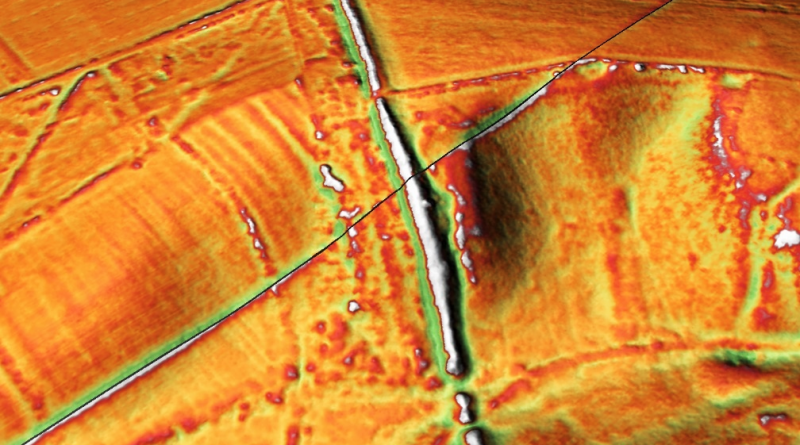
1020643 – North east of Buttington Farm
Historic England Scheduled Monument: 1020643 – Grid Tile: ST59NW – Gloucestershire
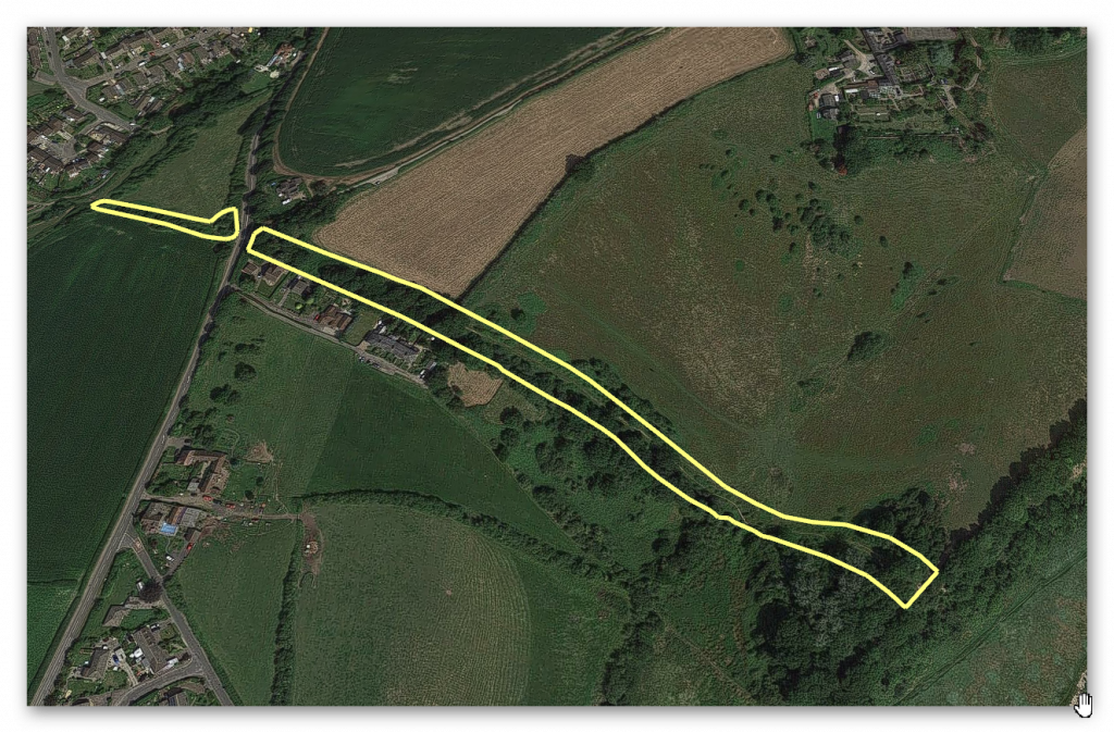
GE Map
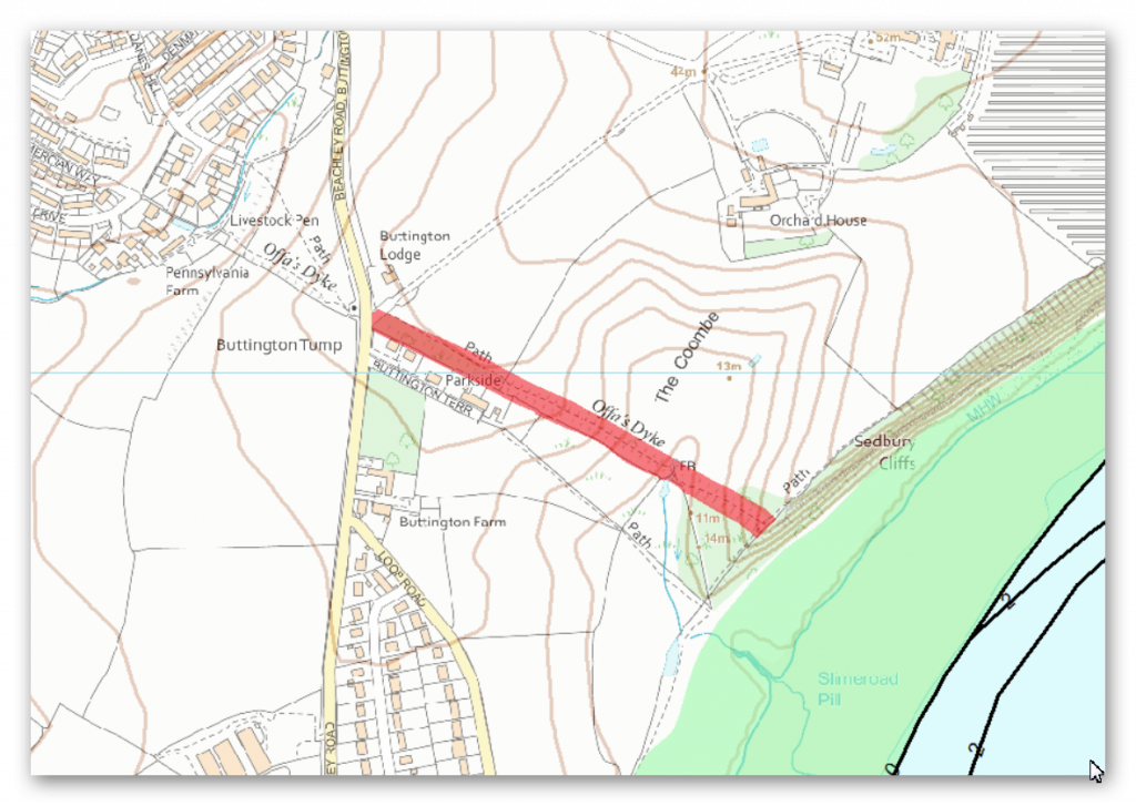
OS Map
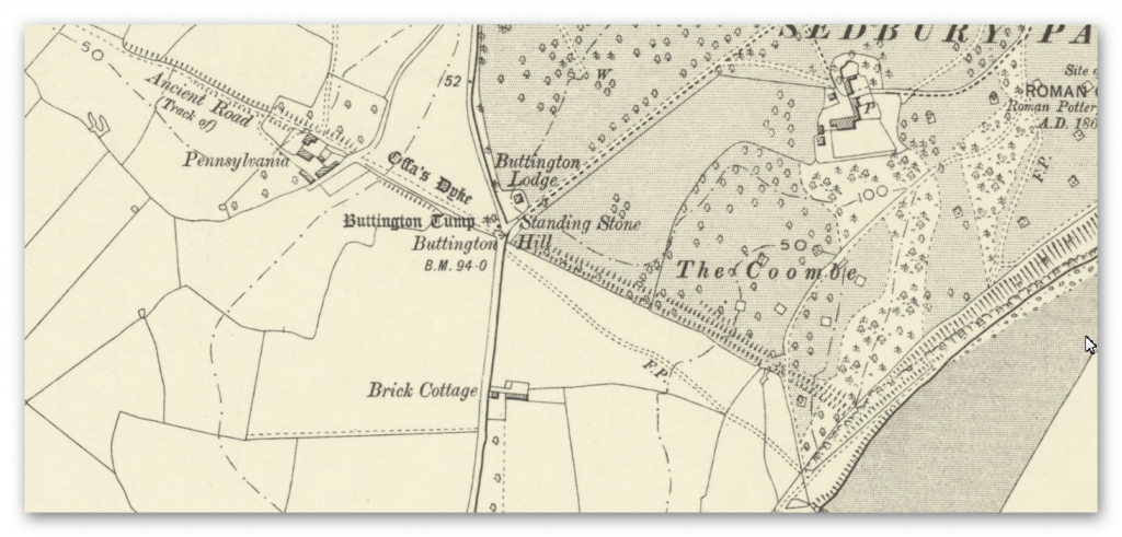
1800s Map
LiDAR Map
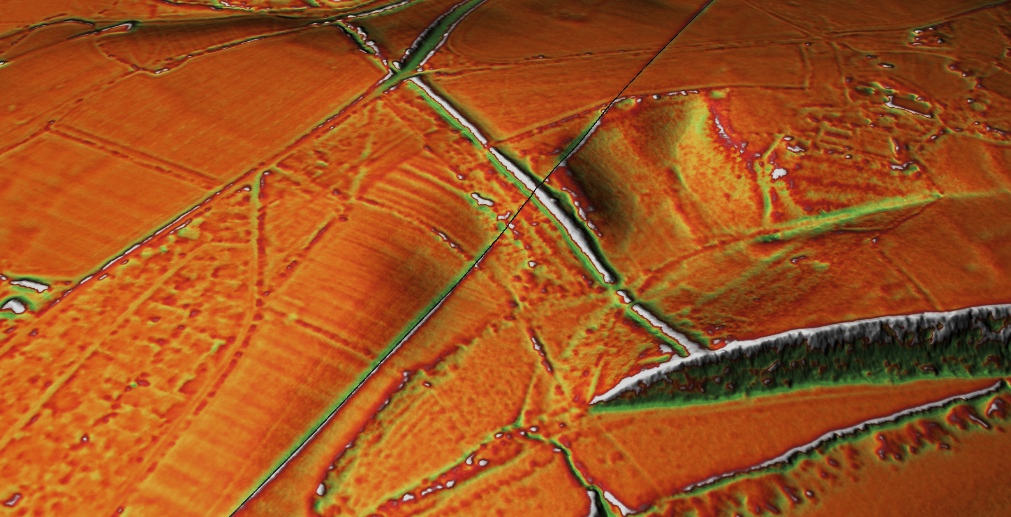
Dyke: ST 55009 92953
Length (m): 476
Orientation:SW – NE
Class Designation*:
Overall Width (m): 26
Ditch Width (m): 9
Bank Width (m): 17
Connectivity**: River
Ditch Shape: ?
Volume (cu.m): 5, 569 (@ 1.3 depth)
Man hours to complete: 16,707
Estimated Construction Date: ?
Springs*** (within 200m): 1
Quarries**** (within 200m): 0
“In this section, the Dyke turns from its usual alignment to run north west-south east. It is visible as a bank with a ditch to the south and quarry pits to the north.
At the western end of the section the bank is about 10m wide and stands to a height of 2m on its southern face and 0.6m on its northern face. At the eastern extent of the section, the scale of the construction becomes increasingly monumental, with the bank measuring up to 17m wide at the base and standing to between 2.8m and 5m high on its southern face and 1.5m to 2m high on its northern face.
The ditch to the south is up to 9m wide and increases in depth from 0.8m at the western end of the section to 2.85m at the east. The quarries lie to the north of the bank and range in size from 2m to 3m wide in the west to 0.3m to 1.5m deep in the east. This section forms the termination of Offa’s Dyke in Gloucestershire, which ends at Sedbury Cliffs.” – Historic England
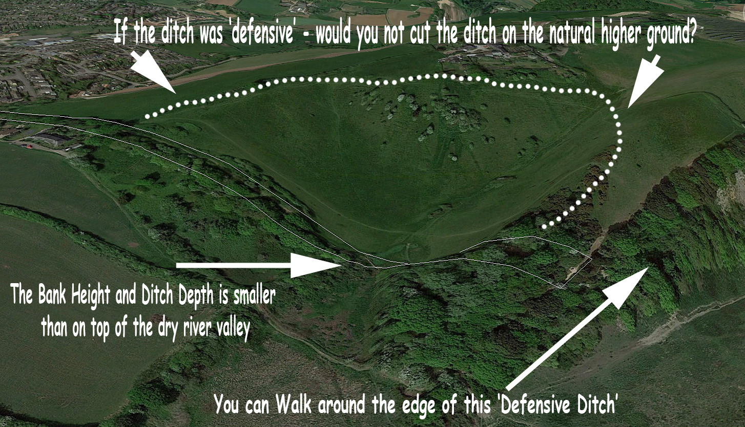
The dry river valley shows us that the idea that this was a defensive feature is sadly pure nonsense.
Not only could an attacked simply walk around the edge of the Dyke but they could also attack the smaller ditch and bank in the centre of the valley which has shrunk from 2.85m deep to just 0.8m, with the bank moving from 2m high to just 0.6m high.
Moreover, a better and more obvious landscape feature (the edge of the dry river valley) could have easily been chosen and would have secured the defensive position.
Furthermore, Sections A01 to A04 cut across a peninsula where the River Wye meets the Bristol Channel (River Seven). The easiest and best defensive structure therefore would have been along the river’s shoreline?

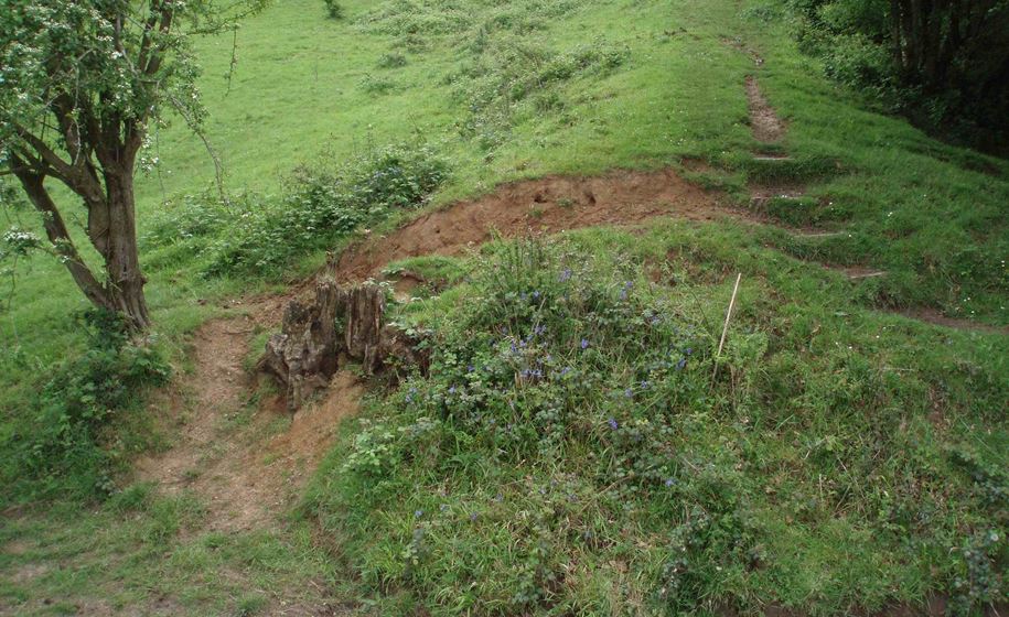
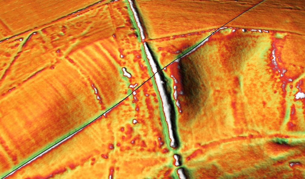
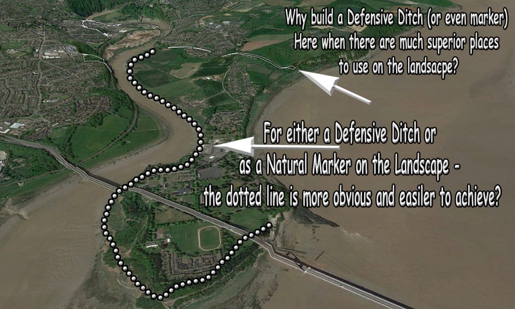
(1020643 – North east of Buttington Farm)
References:
https://historicengland.org.uk/listing/the-list/list-entry/1020643
https://prehistoric-britain.co.uk/dyke-construction-hydrology-101
(1020643 – North east of Buttington Farm)
Further Reading
For information about British Prehistory, visit www.prehistoric-britain.co.uk for the most extensive archaeology blogs and investigations collection, including modern LiDAR reports. This site also includes extracts and articles from the Robert John Langdon Trilogy about Britain in the Prehistoric period, including titles such as The Stonehenge Enigma, Dawn of the Lost Civilisation and the ultimate proof of Post Glacial Flooding and the landscape we see today. (1020643 – North east of Buttington Farm)
Robert John Langdon has also created a YouTube web channel with over 100 investigations and video documentaries to support his classic trilogy (Prehistoric Britain). He has also released a collection of strange coincidences that he calls ‘13 Things that Don’t Make Sense in History’ and his recent discovery of a lost Stone Avenue at Avebury in Wiltshire called ‘Silbury Avenue – the Lost Stone Avenue’. (1020643 – North east of Buttington Farm)
Langdon has also produced a series of ‘shorts’, which are extracts from his main body of books:
For active discussions on the findings of the TRILOGY and recent LiDAR investigations that are published on our WEBSITE, you can join our and leave a message or join the debate on our Facebook Group.
For in-depth information about British Prehistory, we invite you to explore www.prehistoric-britain.co.uk, an extensive resource featuring archaeology blogs and investigations. This collection includes modern LiDAR reports that shed light on ancient landscapes. Additionally, you will find extracts and articles from the Robert John Langdon Trilogy, offering fascinating insights into Britain during the Prehistoric period. Some notable titles from the trilogy include “The Stonehenge Enigma,” “Dawn of the Lost Civilisation,” and groundbreaking evidence of Post Glacial Flooding and its impact on the landscape we see today.
Robert John Langdon has further enriched the exploration of Prehistoric Britain through his YouTube web channel, boasting over 100 investigations and video documentaries that complement his classic trilogy. In addition to his extensive work, Langdon has unveiled a compilation of intriguing coincidences titled “13 Things that Don’t Make Sense in History.” He has also brought to light his recent discovery of a forgotten Stone Avenue in Avebury, Wiltshire, aptly named ‘Silbury Avenue – the Lost Stone Avenue.’
For those who wish to actively engage in discussions about the findings from the TRILOGY and recent LiDAR investigations, we invite you to join our community. You can participate by leaving messages and joining debates on our dedicated Facebook Group. We encourage open dialogue and the exchange of ideas to foster a deeper understanding of Prehistoric Britain and its fascinating mysteries.
As you embark on your journey through British Prehistory, we hope these resources provide valuable insights and inspire further exploration of this captivating field of study.
NB. Recent investigations have indicated the location of hundreds of Quarries and pits built around Wansdyke and how the Dykes were used to transport the minerals transported in these Dykes – see the main site for details of blogs and books on this new discovery.
(1020643 – North east of Buttington Farm)
