Ackling Dyke at Woodyates: Book content
For more than a century, the excavations carried out by General Augustus Pitt-Rivers at Woodyates and Bokerley have provided one of the principal archaeological foundations for identifying Ackling Dyke as a Roman road.
At first glance, the evidence appears convincing. Pitt-Rivers cut across the feature, found carefully constructed layers of flint, chalk and gravel, and interpreted them as the remains of a Roman agger. Later archaeological accounts have generally retained that interpretation.
But an important distinction has largely been lost.
The question is not whether the Romans used this route or constructed road surfaces upon it. Pitt-Rivers provides strong evidence that they did.
The question is much larger:
Did the Romans originally construct the whole linear monument now called Ackling Dyke, or were they rebuilding and resurfacing parts of an already existing transport corridor?
That distinction matters because a Roman road surface does not automatically date every bank, ditch and linear feature through which the road passes.
Pitt-Rivers himself encountered a complicated landscape of earlier occupation, multiple dykes, filled ditches, later ramparts and road surfaces that had been cut and relaid.
Modern LiDAR now allows us to take the investigation one step further.
Instead of looking at two or three archaeological trenches, we can follow the physical monument continuously through the landscape.
For this investigation, we analysed 7.56 km of Ackling Dyke using 1 m Digital Terrain Model LiDAR, producing 303 perpendicular cross-sections at 25 m intervals.
The results show something that Pitt-Rivers could never have seen from isolated trenches:
Ackling Dyke does not maintain one consistent physical design.
Its width changes.
Its height changes.
Its relationship with adjacent ditches changes.
Its form changes around valleys and palaeochannels.
And, in several places, the substantial earthwork itself changes into something quite different.
This does not disprove Roman road use.
It raises a different possibility:
The Roman road may represent one phase in the history of Ackling Dyke rather than the origin of the monument itself.
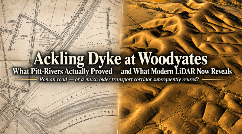
[HEADER IMAGE HERE]
Ackling Dyke at Woodyates
What Pitt-Rivers Actually Proved — and What Modern LiDAR Now Reveals
Suggested graphic: Split-screen 16:9 header.
Left: Pitt-Rivers’ nineteenth-century excavation drawing.
Right: modern 3D LiDAR of Ackling Dyke.
Subtitle:
Roman road — or a much older transport corridor subsequently reused?
1. What Are We Actually Testing?
The traditional interpretation begins with a seemingly simple statement:
Ackling Dyke is a Roman road.
But that statement actually contains several separate propositions.
A route crossed this landscape.
There were engineered road surfaces.
People used those surfaces during the Roman period.
The Romans originally constructed the entire monumental linear feature.
The first three propositions can be supported locally.
The fourth is much harder to demonstrate.
That distinction is critical because archaeological dating normally applies to the layer or construction phase actually excavated.
If a Roman road surface is laid across an older bank, the road surface may be Roman while the underlying bank is older.
If an existing route is widened, resurfaced or provided with drainage, the later construction dates the modification — not necessarily the first creation of the route.
And if a linear earthwork changes dramatically in width, relief and form along its course, we should not automatically assume that every part belongs to the same building programme.
This is therefore the central test of the Woodyates investigation:
Does the physical monument behave like one continuously constructed Roman road, or does it look like a multi-phase landscape in which particular sections were later engineered for road use?
Pitt-Rivers’ own excavations provide the starting point.
Modern LiDAR provides the test.
[FIGURE 1 HERE]
Figure 1 — The Woodyates Landscape
Suggested graphic: Wide LiDAR view showing Bokerley Junction and the Ackling alignment running north-east.
Mark only:
Ackling Dyke
Bokerley Dyke
Pitt-Rivers excavation area
Direction of route
Caption:
The Woodyates excavation did not take place on an isolated road. Pitt-Rivers was investigating a complex landscape of dykes, settlement remains, roads and earlier earthworks.
2. Pitt-Rivers’ Section 3 — The Famous “Roman Road”
The most important excavation for the road interpretation is Pitt-Rivers’ Section 3.
He located it 245 ft north of the Fore Dyke, approximately 74.7 m from the dyke crossing. pitt-rivers
Pitt-Rivers excavated the section down to undisturbed chalk to determine the road’s construction.
His recorded sequence, from top to bottom, consisted of:
- 4 inches of turf mould;
- 8 inches of fine gravel containing small rounded pebbles;
- 5 inches of rammed chalk rubble;
- a single 4-inch layer of large nodular flints;
- the original ground surface beneath the construction.
He also recorded a ditch running along each side of the road, with 49 ft — approximately 14.9 m — between their inner margins.
There is no need to dispute what Pitt-Rivers found.
This was a deliberately constructed surface.
The presence of gravel, rammed chalk and flint demonstrates substantial engineering at this location.
The problem begins when this single excavation is treated as a representative cross-section for Ackling Dyke as a whole.
Pitt-Rivers tells us something extremely important about why Section 3 was excavated where it was.
The road in this area was already badly damaged.
He recorded that the bank through the bottom of the valley had been removed, probably to provide material for the modern embankment.
He also stated that approximately 170 yards — around 155 m — of the centre of the road had been excavated for stone, making it difficult to obtain a satisfactory road section anywhere except at the position marked Section 3.
That means Section 3 was not simply one arbitrary sample from a visibly uniform road.
It was one of the better-preserved places available to Pitt-Rivers in a landscape where large portions had already been removed or heavily damaged.
That changes the question completely.
Section 3 demonstrates:
a substantial engineered road surface existed at this particular location.
It does not, by itself, demonstrate:
that every kilometre of Ackling Dyke was originally constructed in the same way.
That assumption requires independent evidence.
And even Pitt-Rivers’ next excavation begins to undermine it.
[FIGURE 2 HERE]
Figure 2 — Pitt-Rivers’ Section 3
Suggested graphic: Pitt-Rivers’ original Section 3 drawing enlarged.
Overlay labels:
Fine gravel — 8 in
Rammed chalk — 5 in
Nodular flints — 4 in
Original ground surface
49 ft / 14.9 m between ditch margins
Caption:
Pitt-Rivers’ Section 3 provides strong evidence for engineered road construction at Woodyates. The question is whether this profile represents the wider Ackling Dyke monument.
[FIGURE 3 HERE]
Figure 3 — Where Section 3 Was Actually Located
Suggested graphic: Pitt-Rivers’ larger excavation plan showing the Fore Dyke, settlement features and SECTION 3.
Highlight:
Fore Dyke
Section 3 — 245 ft / 74.7 m north
Roman Road
Settlement
Caption:
Section 3 lay immediately north-east of the complicated Bokerley junction and settlement landscape. Pitt-Rivers records that surrounding portions of the road were already substantially damaged or removed.
3. Section 4 — The Road Changes Before We Have Travelled Half a Kilometre
If Ackling Dyke represents one consistently engineered road, Pitt-Rivers’ second major section should provide an obvious comparison.
Section 4 was excavated 440 yards — approximately 402 m — north-east of Section 3.
Pitt-Rivers considered this part of the road particularly well preserved.
Its construction was again substantial.
He recorded successive layers of gravel, rammed chalk and flint, with the total road structure standing roughly three to three-and-a-half feet above the old ground surface.
But the surrounding geometry had changed dramatically.
At Section 3 the inner margins of the roadside ditches were:
49 ft apart or 14.9 m
At Section 4, Pitt-Rivers measured:
79 ft or 24.1 m
between their inner margins.
The drains themselves were approximately 4 ft 6 in wide and 2 ft 6 in deep. pitt-rivers excavationsincra03p…
So in just 402 m, the supposedly corresponding roadside corridor increased by:
30 ft or 9.2 m
That is approximately:
62%
This is not a trivial difference.
If these ditches define the road corridor, then the corridor width changes enormously over less than half a kilometre.
Pitt-Rivers himself recognised the difficulty.
When discussing the road, he wrote that the two parallel ditches:
appeared to include more than the intended width of the road.
That statement is remarkably important.
It means Pitt-Rivers himself was already separating two things that later descriptions tend to merge:
the actual engineered road surface
and
the much wider earthwork corridor surrounding it.
Once that distinction is recognised, the archaeological question changes again.
The existence of a Roman road surface does not necessarily explain the origin of the much larger monument through which it runs.
Sections 3 and 4 already show that this landscape does not conform to one simple engineering template.
[FIGURE 4 HERE]
Figure 4 — Pitt-Rivers’ Sections 3 and 4 Compared
Suggested graphic: Pitt-Rivers’ Sections 3 and 4 placed directly beside one another at the same visual scale.
Overlay:
SECTION 3
49 ft / 14.9 m
SECTION 4
79 ft / 24.1 m
Centre text:
+62% in only 402 m
Caption:
Pitt-Rivers’ own excavations demonstrate major variation between two supposedly corresponding sections of the same Roman road.
The First Warning Sign
At this point we have not even introduced the new LiDAR evidence.
We are still dealing entirely with Pitt-Rivers’ own nineteenth-century excavation record.
And already three important facts have emerged.
Section 3 was a genuine engineered road surface.
It was excavated at one of the relatively limited places where Pitt-Rivers believed a satisfactory section could still be obtained.
And Section 4, only 402 m away, already displays radically different overall geometry.
That does not mean either section is “not Roman”.
It means something more important:
Roman engineering at individual points cannot automatically be extrapolated into a claim that the entire Ackling Dyke monument had one Roman construction design.
The next stage of the investigation therefore asks the question Pitt-Rivers could not answer:
What happens to the monument between his trenches — and for kilometres beyond them?
That is where the 303 modern LiDAR profiles begin to transform the investigation.
Section 4 is not simply a repetition of Section 3. Its surviving raised cross-sectional area is more than twice as large, while Pitt-Rivers’ ditch spacing increases by approximately 62%.
4. Testing the Whole Route with Modern LiDAR
Pitt-Rivers had one enormous limitation that was unavoidable in the nineteenth century.
He could excavate individual trenches, survey visible earthworks and measure local sections, but he could not examine the entire landscape continuously at metre-scale resolution.
Modern LiDAR changes that.
For this investigation, we combined three 1 m Digital Terrain Model LiDAR tiles covering the Woodyates section of Ackling Dyke with a traced centreline following the surviving monument.
The resulting study route measured:
7,564.3 metres
Rather than selecting only obvious or well-preserved sections, we generated a perpendicular terrain profile across the route every:
25 metres
This produced:
303 independent cross-sections
along the 7.56 km alignment.
For every profile, we measured the dominant raised feature and its relationship with the surrounding terrain, including:
- local raised relief;
- approximate half-prominence width;
- neighbouring trough depth;
- positive raised cross-sectional area;
- negative/depressed cross-sectional area.
The purpose was not to decide in advance whether each feature was a road, canal bank, boundary or later earthwork.
The purpose was simpler:
Does Ackling Dyke repeatedly preserve the same physical construction?
If this were one continuous road built to broadly the same engineering concept, we should expect a recognisable, recurring cross-sectional relationship, even allowing for erosion, ploughing, and later damage.
Variation is inevitable.
Complete consistency would be unrealistic.
But large, repeated changes in the relationship between bank height, bank width, and neighbouring depressions would suggest something more complicated than one construction episode.
The data show precisely that.
[FIGURE 5 HERE]
Figure 5 — The 7.56 km Ackling Dyke LiDAR Survey
Suggested graphic: Wide plan or LiDAR view showing the complete analysed route.
Mark:
Bokerley Junction
Pitt-Rivers Section 3
Channel
Pitt-Rivers Section 4
Grim’s Ditch
Northern end of analysed route
Add along bottom:
7.56 km analysed
303 cross-sections
One profile every 25 metres
Caption:
Instead of relying on two selected nineteenth-century trenches, the modern analysis samples Ackling Dyke systematically along 7.56 km of the surviving route.
Why This Matters
This is effectively the same test we previously applied at Puddletown Forest.
There, LiDAR showed that Ackling Dyke did not retain one consistent cross-section.
Some sections were broad and shallow.
Others consisted of substantial bank-and-ditch arrangements.
Some were only slightly raised features.
Others contained large volumes of excavated material.
The question was therefore whether Woodyates — the location containing Pitt-Rivers’ strongest Roman-road evidence — would be different.
If Woodyates produced one repeated road profile, then the Puddletown variation might reasonably be blamed primarily upon preservation.
Instead, Woodyates again produces substantial variation.
And the first major change occurs almost immediately after Pitt-Rivers’ famous Section 3.
5. The 120-Metre Discovery
Pitt-Rivers tells us that Section 3 lay 245 ft — 74.7 m — north of the Fore Dyke.
Using that measurement against the supplied route and Bokerley reference point places reconstructed Section 3 at approximately:
598 m chainage
along our LiDAR survey.
At that point, the modern DTM still preserves a clearly raised feature.
The measured surviving morphology is approximately:
| Measurement | Section 3 |
|---|---|
| Chainage | 598 m |
| Local raised relief | 0.49 m |
| Half-prominence width | 8 m |
| Nearby trough depth | 0.25 m |
| Raised cross-sectional area | 3.34 m² |
These figures describe what survives today.
They are not intended to reproduce Pitt-Rivers’ excavated road thickness.
What matters is what happens when we continue along the alignment.
The strongest channel/depression signature in the immediate landscape occurs at approximately:
718 m chainage
That gives a distance from reconstructed Section 3 of:
120 metres
This result is particularly interesting because the LiDAR had already been visually examined before numerical processing.
From the 3D model, the surviving substantial feature appeared to continue for approximately:
124 m
before entering the channel.
The raw terrain analysis independently returned:
approximately 120 m
The difference is only around four metres.
That agreement gives us considerable confidence that we are looking at the same physical transition.
[FIGURE 6 HERE]
Figure 6 — Section 3 to the Channel: 120 Metres
Suggested graphic: Your 3D LiDAR image showing Bokerley, Section 3, the channel and the feature beyond.
Overlay:
Pitt-Rivers Section 3
598 m chainage
Arrow along Ackling:
120 m
Then mark:
Strongest channel signature — 718 m
On opposite side:
Narrower / pointed bank
Caption:
Visual examination suggested that the substantial Section 3 feature survived for roughly 124 m. Independent measurement of the raw 1 m DTM places the strongest channel signature approximately 120 m beyond reconstructed Section 3.
The Channel Is Not a Minor Dip
The cross-section at this transition does not simply show the same bank becoming slightly lower.
The strongest local depression reaches approximately:
0.83 m
compared with approximately:
0.25 m
near Section 3.
The negative cross-sectional area also increases substantially.
This indicates a genuine change in terrain morphology.
But this evidence needs to be handled carefully.
Pitt-Rivers himself records that the valley-bottom portion of the road had been badly damaged.
He wrote that the bank at the bottom of the valley had been removed, probably to provide material for the modern road, and that approximately 170 yards — around 155 m — of the road centre had been excavated for stone.
Therefore we cannot simply argue:
“The road disappears here, therefore no road ever crossed the valley.”
Pitt-Rivers provides direct evidence that later removal occurred.
But that creates a different archaeological problem.
His best road section was taken from a surviving fragment surrounded by substantial destruction.
That means Section 3 cannot automatically be treated as the standard form of the whole monument.
And the morphology that survives beyond the disturbed area makes the problem even more interesting.
6. Beyond the Channel — The Monument Changes Form
If the feature interrupted at the channel were simply one broad Roman road damaged by later quarrying, the obvious expectation would be that its surviving form should eventually reappear beyond the destroyed section.
But that is not what the LiDAR immediately shows.
On the opposite side of the channel, the surviving linear feature appears much narrower and more sharply crested.
Instead of another broad, relatively flattened raised platform, we see what is much closer to a:
pointed bank
This is important because destruction can explain why a section has disappeared.
It does not automatically explain why the surviving structure beyond it has a different cross-sectional form.
The landscape therefore presents a sequence that looks approximately like:
Engineered/broad Section 3 feature
↓
major channel or disturbed valley section
↓
narrower pointed bank
↓
later substantial Section 4 feature
That is not what we would expect from a simple model in which one road design was carried continuously through the landscape.
It looks much more like a corridor containing different structural elements.
[FIGURE 7 HERE]
Figure 7 — The Feature Beyond the Channel
Suggested graphic: Close LiDAR crop centred on the channel and opposite bank.
Use two labelled arrows:
Broad Section 3-type feature
and:
Narrow pointed bank beyond channel
Place across the channel:
MAJOR MORPHOLOGICAL CHANGE
Caption:
The interruption itself can partly be explained by Pitt-Rivers’ documented quarrying. More difficult to explain is the different surviving morphology beyond it, where the linear feature becomes much narrower and more sharply crested.
Could Erosion Alone Explain It?
Possibly in part.
Any ancient earthwork will have experienced:
ploughing;
soil movement;
track formation;
quarrying;
erosion;
later roads;
and agricultural modification.
So morphology alone cannot establish chronology.
But preservation cannot simply be invoked every time the monument fails to match a preferred template.
That would create an unfalsifiable argument:
Where the monument looks like a Roman road, the morphology is original.
Where it does not look like a Roman road, the morphology is assumed destroyed.
A scientific interpretation needs a test that can fail.
That is why the 303 cross-sections matter.
If the pointed bank were merely one isolated anomaly, it could reasonably be dismissed as local damage.
But the full 7.56 km analysis shows repeated and sustained changes in morphology.
The channel transition is therefore not an isolated problem.
It is the first obvious example of a pattern that continues throughout the route.
And approximately 280 metres farther north-east we reach Pitt-Rivers’ Section 4 — where the physical structure changes yet again.
7. Section 4 — Almost Twice the Surviving Relief of Section 3
Pitt-Rivers’ Section 4 lies approximately 440 yards — 402 m — north-east of Section 3.
His excavation showed another deliberately engineered surface containing gravel, rammed chalk and nodular flints.
But Section 4 was not simply a repeat of Section 3.
Pitt-Rivers recorded the roadside drains as approximately 4 ft 6 in wide and 2 ft 6 in deep, with their inner margins 79 ft — 24.1 m — apart.
At Section 3 the corresponding figure had been:
49 ft — 14.9 m
So the excavated corridor had widened by approximately:
62%
in only:
402 metres
Now we can add the modern LiDAR measurements.
Our reconstruction places Section 4 at approximately:
1,000 m chainage
The present-day terrain profile at the two excavation locations is:
| Measurement | Section 3 | Section 4 |
|---|---|---|
| Chainage | 598 m | 1,000 m |
| Local raised relief | 0.49 m | 0.97 m |
| Half-prominence width | 8 m | 8 m |
| Nearby trough depth | 0.25 m | 0.36 m |
| Raised cross-sectional area | 3.34 m² | 7.46 m² |
| Pitt-Rivers ditch spacing | 14.9 m | 24.1 m |
The important measurement here is not simply the width.
Although the half-prominence width of the surviving central raised feature is around 8 m at both points, Section 4 contains:
almost twice the surviving local relief
and:
more than twice the raised cross-sectional area
of Section 3.
So these are not two identical pieces of engineering.
The centre may preserve a similarly sized raised crest, but the overall volume and surrounding geometry differ considerably.
And this agrees with Pitt-Rivers’ nineteenth-century excavation measurements.
He himself recognised that the Section 4 ditches appeared to encompass more than the intended width of the actual road. pitt-rivers
That observation is critical.
It means the central road and the larger earthwork system surrounding it should not automatically be treated as the same construction.
The Roman road could have occupied an earlier corridor.
[FIGURE 8 HERE]
Figure 8 — Section 3 Versus Section 4: The Same Road?
Suggested graphic: Two LiDAR-derived cross-section diagrams beside one another, with Pitt-Rivers’ measurements underneath.
SECTION 3
Relief: 0.49 m
Raised area: 3.34 m²
Pitt-Rivers ditch spacing: 14.9 m
SECTION 4
Relief: 0.97 m
Raised area: 7.46 m²
Pitt-Rivers ditch spacing: 24.1 m
Centre label:
402 m apart — 62% change in ditch spacing
Caption:
Pitt-Rivers’ own measurements and the modern DTM both demonstrate substantial differences between Sections 3 and 4. The excavated Roman surfaces are real, but the surrounding monument does not preserve one identical cross-section.
A Roman Surface Does Not Date the Whole Corridor
This is an important distinction.
If an existing bank were resurfaced with chalk, flint and gravel, excavation would correctly reveal a Roman-period road.
But it would not tell us when the original bank beneath or beside that road was first created.
Likewise, if a road were inserted between two older linear features, the archaeological section would establish the road-building phase but not necessarily the origin of the wider corridor.
The correct conclusion from Sections 3 and 4 is therefore quite specific:
Pitt-Rivers demonstrated substantial engineered road construction at two locations.
What remains to be demonstrated is whether the landscape between and beyond those points represents the same construction.
The 303 LiDAR profiles allow us to test exactly that.
And they show that the differences continue.
8. The 303 Profiles Reveal Different Morphological Regimes
The major strength of the modern analysis is that we do not have to choose a handful of convenient locations.
The route was sampled every 25 m.
Across 7.56 km, this produced 303 cross-sections.
When those profiles are grouped into 500 m sections, a striking pattern appears.
| Route section | Median raised relief | Median feature width | Median trough depth | General morphology |
|---|---|---|---|---|
| 0–500 m | 0.13 m | 17 m | 0.19 m | Weak/complex junction |
| 500–1,000 m | 0.45 m | 10 m | 0.38 m | Section 3/channel zone |
| 1,000–1,500 m | 0.86 m | 9 m | 0.45 m | Strong narrow bank |
| 1,500–2,000 m | 0.85 m | 8.5 m | 0.41 m | Strong narrow bank |
| 2,000–2,500 m | 0.88 m | 8 m | 0.40 m | Strong narrow bank |
| 2,500–3,000 m | 0.65 m | 9 m | 0.33 m | Reduced form |
| 3,000–3,500 m | 0.88 m | 8 m | 0.31 m | Strong bank returns |
| 3,500–4,000 m | 0.61 m | 10.5 m | 0.31 m | Broader/lower |
| 4,000–4,500 m | 0.97 m | 8 m | 0.34 m | Strong high-relief feature |
| 4,500–5,000 m | 0.67 m | 11 m | 0.26 m | Transition |
| 5,000–5,500 m | 0.33 m | 15.5 m | 0.12 m | Broad lower feature |
| 5,500–6,000 m | 0.51 m | 15 m | 0.04 m | Broad/shallow |
| 6,000–6,500 m | 0.22 m | 17 m | 0.15 m | Broad low-relief form |
| 6,500–7,000 m | 0.36 m | 18.5 m | 0.09 m | Broad shallow structure |
| 7,000–7,500 m | 0.77 m | 20 m | 0.13 m | Wide/topographic interaction |
The pattern is much more informative than any single profile.
For much of the central route, the dominant raised structure is relatively narrow:
approximately 8–10 m
with median local relief frequently around:
0.8–1.0 m
Then, around the 5 km point, the proportions change.
The dominant feature becomes approximately:
15–20 m wide
while the neighbouring trough becomes dramatically shallower.
Between 5.5 and 6 km the median trough depth falls to only:
0.04 m
That is not simply one isolated eroded patch.
It is a sustained change across hundreds of metres.
The monument moves from a comparatively:
narrow / high-relief / strongly defined form
towards a:
broad / low-relief / weakly ditched form.
These are what we can reasonably call different morphological regimes.
That does not automatically mean different dates.
Agriculture and erosion undoubtedly contribute.
But it also means we cannot assume a single construction template.
[FIGURE 9 HERE]
Figure 9 — 303 Cross-Sections: Local Relief Along Ackling Dyke
Graph: Line graph using all 303 measurements.
X-axis: Distance along Ackling Dyke — 0 to 7,564 m
Y-axis: Local raised relief in metres
Add vertical markers:
Fore Dyke
Section 3 — 598 m
Channel — 718 m
Section 4 — ~1,000 m
Major widening begins — ~5,000 m
Caption:
The 303 profiles demonstrate repeated changes in the prominence of the surviving earthwork. There is no single relief value characteristic of the whole 7.56 km route.
[FIGURE 10 HERE]
Figure 10 — The Width of Ackling Dyke Changes Along the Route
Graph: Feature width measured every 25 m.
Highlight two broad regimes:
Approximately 1–4.5 km
Predominantly 8–10 m
Approximately 5–7 km
Predominantly 15–20 m
Add:
THE MONUMENT ALMOST DOUBLES IN TYPICAL WIDTH
Caption:
The later part of the investigated route becomes substantially broader and generally lower. This sustained proportional change is difficult to reconcile with the assumption of one uniform surviving road structure.
This Is Not Simply “Roman Engineering Varies”
Of course Roman engineers adapted roads to local terrain.
Nobody should expect every road to possess a mathematically identical width and height.
But that is not the issue here.
We are not seeing minor variation around a recognisable standard.
We are seeing changes in the relationship between the principal elements.
The bank becomes wider.
Its relative relief falls.
The neighbouring depression almost disappears in places.
Elsewhere substantial ditch-and-bank morphology returns.
That is why the interpretation must distinguish between:
the Roman road surface
and:
the larger linear earthwork through which that road travels.
The first can be demonstrably Roman-period engineering.
The second may have a more complicated construction history.
And at the northern end of the investigated landscape we encounter another problem that strengthens this distinction further.
The substantial earthwork itself appears to reach a junction and cease or change form — while routes through the landscape continue.
9. The Monument Ends — But the Route Does Not
One of the most revealing features occurs near the northern end of this investigated section.
On the LiDAR, the substantial Ackling earthwork approaches a junction with another linear feature.
At this point, the prominent form that we have been following does not simply continue northwards as the same large bank-and-ditch monument.
It reaches the junction and either terminates or undergoes a major change in form.
Yet movement through the landscape clearly continued.
Historic mapping shows tracks and roads connecting through the area, while the modern satellite view demonstrates that later road planning did not simply inherit the monumental Ackling alignment as the obvious main route.
This distinction is extremely important.
A route can continue even when a particular earthwork ends.
That means a Roman route across the landscape does not require every section of the underlying monumental feature to have been built as part of that road.
[FIGURE 11 HERE]
Figure 11 — The Northern End of the Substantial Ackling Earthwork
Use: uploaded LiDAR image showing the apparent termination/junction.
Highlight:
Ackling Dyke
Point where substantial earthwork terminates/changes form
Joining dyke / linear feature
Continuing route
Add headline annotation:
THE EARTHWORK CHANGES — THE ROUTE CONTINUES
Caption:
At the northern junction the substantial Ackling earthwork does not simply continue in the same form. The route network continues, but the monumental feature changes or terminates.
The Historic Map Makes the Distinction Clearer
The nineteenth-century mapping is useful because it predates many modern landscape alterations.
It shows the old route network around the junction but does not present the substantial Ackling bank as the inevitable line for later through-traffic.
That is significant.
If the large earthwork were simply an exceptionally well-engineered and continuously usable Roman road, we might reasonably expect later routes to favour it.
Instead, the later road system appears to use some portions, abandon others and reconnect elsewhere.
That cannot date Ackling Dyke.
Roads are diverted for countless reasons.
But it does demonstrate that:
the monumental earthwork and the practical through-route are not necessarily the same thing.
That is exactly the distinction emerging from Pitt-Rivers’ excavations.
[FIGURE 12 HERE]
Figure 12 — Historic Mapping of the Ackling Termination/Junction
Use: uploaded historic map showing the northern end.
Overlay lightly:
Ackling alignment
Joining dyke
Later track/road
Keep the original mapping visible.
Caption:
Historic mapping preserves the route relationships before the most recent landscape alterations. The substantial earthwork and the later road network do not behave as one inseparable structure.
[FIGURE 13 HERE]
Figure 13 — The Same Junction on Modern Satellite Imagery
Use: uploaded satellite image.
Use the same arrows as Figure 12 so the reader can compare them directly.
Mark:
Ancient earthwork alignment
Later road
Junction
Caption:
Modern roads continue to cross and reconnect with the ancient corridor without simply following the substantial Ackling earthwork throughout.
This Supports Reuse Rather Than Creation
This is not proof that Ackling Dyke is prehistoric.
But it fits extremely well with a reuse model.
Imagine an earlier landscape containing a major dyke or transport bank.
Later users need to travel through the same general corridor.
They use convenient parts of it.
They abandon inconvenient portions.
They connect it to other tracks.
They resurface particular lengths.
And where necessary, they construct entirely new sections.
After centuries of this process, the route can remain broadly continuous while the physical structures beneath it belong to several periods.
That is exactly what we should expect from long-lived infrastructure.
And it provides an important bridge into the next piece of evidence.
Because just beyond this changing route network we find something that we also discovered at Puddletown:
the supposed Roman road bends around an extraction landscape rather than simply cutting through it.
10. Why Does Ackling Dyke Detour Around the Quarry?
The next feature is one of the most visually striking in the whole Woodyates landscape.
On the historic mapping, a group of substantial extraction features is explicitly labelled:
OLD CHALK PITS
The LiDAR makes their relationship with the Ackling alignment much clearer.
Rather than continuing through the extraction area on a simple straight course, the linear feature appears to bend around the quarry landscape before returning towards its previous alignment.
That is important because we encountered a remarkably similar problem at Puddletown Forest.
There too, the mapped Roman-road corridor interacted repeatedly with large extraction hollows and quarry-like features rather than behaving as one straightforward engineered road driven independently through the landscape.
At Woodyates we therefore have a second location where:
Ackling Dyke + extraction landscape + route deviation
occur together.
[FIGURE 14 HERE]
Figure 14 — Ackling Dyke Detours Around the Quarry
Use: uploaded LiDAR image showing the quarry detour.
Mark:
Ackling Dyke
Quarry / extraction area
Route approaching quarry
Deviation around quarry
Route continuing beyond
Add headline:
WHY DOES THE “ROMAN ROAD” GO AROUND THE EXTRACTION SITE?
Caption:
The LiDAR shows the Ackling alignment making a pronounced deviation around a substantial extraction landscape rather than simply maintaining a constant course through it.
Which Came First?
The geometry immediately creates a chronological question.
There are at least two possibilities.
The quarry may have existed first, forcing the route around it.
Or the route may originally have continued differently, with later extraction destroying the original alignment and leaving what now appears to be a detour.
Both need to be considered.
The landscape alone cannot yet tell us which sequence is correct.
But either interpretation is important.
If the quarry predates the route, the road adapted to an already developed landscape.
If the quarry is later, then another significant section of the supposedly continuous Roman road has been destroyed or remodelled by later activity.
Either way, the surviving morphology cannot simply be treated as an untouched Roman design.
[FIGURE 15 HERE]
Figure 15 — Historic Mapping Confirms an Extraction Landscape
Use: uploaded historic-map image showing Old Chalk Pits and the Ackling alignment.
Highlight:
OLD CHALK PITS
Ackling Dyke
Route deviation
Caption:
Historic mapping confirms that the large hollows visible on LiDAR were recognised as extraction pits. The route’s relationship with them therefore deserves chronological investigation rather than being dismissed as an accidental irregularity.
The Puddletown Parallel
This matters because it is not unique.
At Puddletown Forest we found:
large pits;
quarry-like hollows;
linear earthworks;
and changing Ackling morphology
in the same landscape.
Woodyates now produces the same association.
That does not prove that the quarries created Ackling Dyke or that Ackling was built specifically to serve them.
But repeated associations are exactly what archaeological hypotheses should be built upon.
One occurrence may be accidental.
A recurring relationship in geographically separated sections of the same monument deserves testing.
The question therefore becomes:
Was Ackling Dyke simply passing through extraction landscapes, or did those extraction landscapes form part of the function of the corridor itself?
That question becomes still more interesting when we look beyond the recognised quarries.
Because the surrounding Woodyates landscape contains hundreds of smaller pits.
11. The Pit Fields Return — Just as at Puddletown
The wide LiDAR around the northern end of the Woodyates route reveals something we have already encountered elsewhere on Ackling Dyke.
The landscape is covered with pits.
Not one or two isolated hollows.
Large concentrations of depressions are spread across the surrounding fields, with some occurring in remarkably regular groups.
This strongly resembles the Puddletown Forest landscape.
At Puddletown, our LiDAR analysis identified hundreds of closed depressions around the Ackling corridor, ranging from small, simple hollows to much larger, more complex features.
The Woodyates landscape therefore gives us a second major pit concentration associated with Ackling Dyke.
That repetition is potentially significant.
[FIGURE 16 HERE]
Figure 16 — The Woodyates Pit Landscape
Use: uploaded LiDAR image showing the dense pit field around the northern termination/junction.
Do not label every pit.
Instead outline two or three representative concentrations and mark:
Pit concentration
Ackling Dyke
Junction / termination
Other linear earthwork
Add:
THE PIT FIELDS RETURN
Caption:
Hundreds of depressions surround the Ackling corridor at Woodyates, closely paralleling the pit-rich landscape previously identified at Puddletown Forest.
Are They Sinkholes?
We must consider a natural explanation.
On chalk landscapes, solution hollows, dolines and other natural depressions certainly occur.
So it would be wrong to classify every visible pit automatically as artificial.
But that explanation becomes less satisfactory if the same morphology repeatedly occurs in different geological settings or if the pits show regular spacing, clustering or direct relationships with known extraction features.
That is where the comparison between Puddletown and Woodyates becomes important.
At Puddletown we found more than 500 robust closed depressions within the core study area.
They were not all identical.
Some were simple bowl-shaped features.
Others were irregular.
Some were compound.
Their diameters and depths varied considerably.
That analysis never proved that every depression was artificial.
It showed that the pit landscape itself was real and extensive.
Woodyates now provides another pit-rich Ackling landscape.
The Geology Test
This gives us a useful new test.
If both pit fields occurred only under exactly the same bedrock and superficial geology, a single natural geological explanation would remain attractive.
But if comparable pit fields occur in significantly different substrates, then a blanket explanation such as:
“they are simply natural sinkholes”
becomes much harder to sustain.
The correct procedure is therefore to compare:
bedrock geology
superficial deposits
pit diameter
pit depth
spacing
clustering
proximity to mapped quarries
and:
relationship with Ackling Dyke
between Puddletown and Woodyates.
If the geology differs substantially while the pit morphology and spatial relationship remain comparable, that would strengthen the case for a substantial artificial component.
Until that geology comparison is completed, the safest conclusion is:
the pit fields cannot simply be dismissed as random natural hollows without testing their morphology and geological context.
[FIGURE 17 HERE]
Figure 17 — Puddletown and Woodyates: Two Pit-Rich Ackling Landscapes
Suggested graphic: split-screen LiDAR comparison.
LEFT — PUDDLETOWN FOREST
Show representative pit concentrations and Ackling Dyke.
Add:
513 measured closed depressions in the core analysis
RIGHT — WOODYATES
Show the dense pit field from the new LiDAR.
Add:
Second major pit concentration along Ackling Dyke
Across the bottom:
COINCIDENCE — GEOLOGY — OR AN EXTRACTION LANDSCAPE?
Caption:
Two widely separated Ackling Dyke landscapes contain extensive fields of pits. Their origin should be tested quantitatively rather than assumed.
Why Extraction Matters
The recognised Old Chalk Pits provide an important control.
They establish beyond doubt that substantial extraction occurred immediately beside the route.
The smaller pits may have many origins.
Some may be natural.
Some may be historic extraction.
Some may belong to entirely different periods.
But the presence of known quarrying demonstrates that human excavation was already an important part of this landscape.
That means the repeated association:
dyke → quarry → pit field
cannot be ignored.
And if Ackling originated partly as a transport corridor for extracting and moving raw materials, the presence of extensive quarry landscapes along its line becomes much easier to understand.
Again, this does not prove the canal hypothesis.
But it provides another independent observation that the simple concept of an isolated Roman road fails to explain.
12. Ackling Dyke Meets an Older Linear Landscape
The next piece of evidence is the relationship between Ackling Dyke and other major linear earthworks.
Farther along the route, Ackling approaches and interacts with Grim’s Ditch.
This matters because Grim’s Ditch belongs to the prehistoric linear landscape.
The Roman route was therefore not being constructed through empty countryside.
It moved through a landscape already divided and engineered by large banks, ditches, trackways, and settlement systems.
That creates another important possibility:
Roman road builders may have reused existing linear infrastructure rather than creating an entirely new corridor.
This is hardly an extraordinary suggestion.
Reuse is exactly what Pitt-Rivers’ own excavations at Bokerley demonstrate on a smaller scale.
Ditches were filled.
New dykes were constructed.
Roads were cut.
Surfaces were relaid.
Old alignments remained influential.
The landscape was repeatedly recycled.
[FIGURE 18 HERE]
Figure 18 — Ackling Dyke and Grim’s Ditch
Suggested graphic: wide LiDAR showing the relationship between the two linear monuments.
Mark:
Ackling Dyke
Grim’s Ditch
Junction / interaction
Change in Ackling morphology
Avoid drawing speculative extensions unless clearly visible.
Caption:
Ackling Dyke does not cross an empty landscape. It interacts with other major linear earthworks, including prehistoric systems such as Grim’s Ditch.
The Change in Scale Is Important
The LiDAR suggests that the Ackling earthwork does not retain precisely the same monumental form through this landscape.
Before the interaction, the feature can be substantial.
Beyond particular junctions and terrain changes, its expression weakens or shifts in form.
This reinforces what the 303-profile analysis has already demonstrated numerically.
The name remains:
Ackling Dyke
But the physical structure beneath that name changes.
That is exactly what we should expect if a later route was stitching together several earlier landscape features.
A road does not necessarily require every metre of its route to have the same ancestry.
Roman engineers could exploit:
existing banks;
older tracks;
prehistoric dykes;
dry canal banks;
river terraces;
and newly constructed sections
within the same route.
On a modern map, the result would appear as one continuous road.
The archaeology underneath could be much older and much more complicated.
A Network Rather Than a Single Line
This may be one of the larger conceptual problems with how Ackling Dyke has traditionally been presented.
Modern maps encourage us to think in lines.
A line is drawn from one Roman centre to another and everything beneath that line becomes:
the Roman road.
But ancient landscapes were networks.
At Woodyates we see:
a major dyke;
multiple earlier defensive or boundary works;
settlement;
pits;
quarries;
former watercourses;
later roads;
and intersections with other linear earthworks.
The evidence therefore invites a different way of thinking.
Instead of imagining one engineer drawing one line across virgin countryside, perhaps we should imagine successive communities joining together useful pieces of existing infrastructure.
That interpretation immediately explains why Ackling Dyke can appear Roman in one excavation yet very different only a few hundred metres away.
[FIGURE 19 HERE]
Figure 19 — A Landscape Network, Not Just a Roman Line
Suggested graphic: widest available LiDAR view containing Ackling, Grim’s Ditch, the quarry area, pit concentrations and major palaeochannels.
Use restrained annotations:
Ackling corridor
Grim’s Ditch
Quarry landscape
Pit fields
Palaeochannel
Later road
Across the bottom:
ONE MODERN LINE — MANY ANCIENT FEATURES
Caption:
Viewed at landscape scale, Ackling Dyke forms part of a much larger network of earthworks, extraction sites and former waterways. The Roman route may have incorporated this existing infrastructure rather than creating every element from scratch.
The Pattern Is Becoming Difficult to Ignore
By this stage of the investigation we have encountered:
a Roman-engineered surface at Section 3;
a substantially different Section 4;
a major channel only about 120 m beyond Section 3;
a pointed bank beyond that interruption;
large changes across the 303-profile sequence;
a northern termination or major change in the substantial earthwork;
a detour around a recognised quarry landscape;
another extensive field of pits;
and an interaction with prehistoric linear monuments.
None of these features individually proves that Ackling Dyke began as a prehistoric canal.
But together they create a serious problem for the simpler proposition that the entire monument represents a single Roman road-building project.
And Pitt-Rivers’ own Section 5 now becomes crucial.
Because his excavation shows directly that the road and dykes at Bokerley were being cut, filled and rebuilt.
That provides archaeological evidence for the reuse process that the wider LiDAR now appears to reveal.
13. Pitt-Rivers’ Section 5 — Direct Evidence of Reuse
At Bokerley Junction, Pitt-Rivers finally had an opportunity to examine the relationship between the supposed Roman road and two different phases of dyke construction.
This is one of the most important parts of his entire excavation because it demonstrates something that is often lost in later summaries:
the road itself had a history.
It was not simply constructed once and left untouched.
Pitt-Rivers traced the flint pitching of the road beneath part of the Fore Dyke rampart.
Following it southwards, he then found the road lying across the filled ditch of the earlier Rear Dyke.
That established that the road was being used after the Rear Dyke had gone out of use.
But Pitt-Rivers immediately added an important warning.
He wrote that this did not prove the road itself was constructed after the Rear Dyke was filled.
His explanation was perfectly straightforward:
The earlier road could have been cut when the ditch was excavated and subsequently laid again across the filling. pitt-rivers excavationsincra03p…
That is enormously important.
Pitt-Rivers himself therefore accepted the sequence:
existing road
↓
dyke cuts across it
↓
dyke goes out of use
↓
ditch filled
↓
road relaid across it
This is not theoretical reuse.
It is a process Pitt-Rivers thought entirely plausible from his own excavation.
[FIGURE 20 HERE]
Figure 20 — Pitt-Rivers’ Section 5: The Road Was Cut and Relaid
Suggested graphic: Pitt-Rivers’ Section 5 drawing across the Fore and Rear Dykes.
Highlight:
Earlier Rear Dyke
Filled Rear Dyke ditch
Road laid across filling
Fore Dyke
Road beneath later rampart
Add:
ROAD → CUT → FILLED → RELAID
Caption:
Pitt-Rivers explicitly recognised that the road could pre-date the filling of the Rear Dyke and have been laid again afterwards. His excavation therefore demonstrates reuse rather than requiring one construction episode.
The Road Layers Were Not Even Constant at the Excavated Sites
Pitt-Rivers’ more detailed description of Section 5 makes the picture still more complicated.
He found the Fore Dyke ditch cutting across the road.
Three of the lower road layers survived beneath a small portion of the rampart.
The lowest nodular-flint layer also appeared to overlie the filling of the Rear Dyke.
But the upper road layers were absent.
Most significantly, Pitt-Rivers observed that those upper layers appeared to have been absent at Section 3 as well, despite Section 3 being selected because it appeared relatively undisturbed.
So even within Pitt-Rivers’ own supposedly diagnostic road sections, the construction sequence was not identical.
That supports precisely what the modern LiDAR is now showing on a much larger scale.
The road changed.
The surrounding earthwork changed.
And different phases of construction had been superimposed upon one another.
Bokerley Was Already a Used Landscape Before the Later Dyke
The wider excavation provides another powerful clue.
Pitt-Rivers discovered extensive Romano-British occupation beside the road.
When he excavated Section II through Bokerley Dyke, he found 584 Roman coins incorporated into the rampart, extending into the late Roman period.
A further extension produced another 73 coins.
Most importantly, Pitt-Rivers found that much of this material came from the old occupation surface that had been dug through and thrown up when the later rampart was constructed.
This establishes a clear sequence:
Romano-British settlement
↓
occupation debris accumulates
↓
later dyke construction cuts through it
↓
Roman coins and artefacts become incorporated into the new bank
Again, the important lesson is methodological.
Finding Roman artefacts in a dyke does not necessarily mean:
Romans built the original dyke.
It can mean:
a later construction phase cut through an already Romanised landscape.
This is exactly why individual finds must be related to their stratigraphy rather than simply attached to the monument as a whole.
[FIGURE 21 HERE]
Figure 21 — Bokerley: Roman Settlement Beneath a Later Dyke Landscape
Suggested graphic: Pitt-Rivers’ Bokerley plan showing the settlement, road, Fore Dyke and Rear Dyke.
Mark:
Romano-British settlement
Ackling road
Rear Dyke
Fore Dyke
Add text box:
Section II: 584 Roman coins in rampart
Extension: another 73
Caption:
Pitt-Rivers found that later dyke construction had cut through an already occupied Romano-British landscape, incorporating hundreds of coins and other occupation material into the rampart.
14. Puddletown and Woodyates — Two Different Places, the Same Pattern
The Woodyates discoveries would be easier to dismiss if they occurred in isolation.
They do not.
Our earlier investigation of Ackling Dyke at Puddletown Forest produced a remarkably similar set of problems.
There too, the feature mapped as a single Roman road did not preserve a consistent physical design.
Measured profiles included:
| Puddletown profile | Approx. relief | Approx. width | Raised area |
|---|---|---|---|
| A | 0.17 m | ~15 m | 2.15 m² |
| B | 0.56 m | ~15 m | 5.59 m² |
| C | 0.50 m | ~16 m | 4.39 m² |
| F | ~1.4 m | ~9–10 m | 9.28 m² |
Those are not minor variations around one standard cross-section.
They are substantially different earthworks.
And just as at Woodyates, the surrounding landscape contained:
large pit fields
quarry-like extraction features
palaeochannels
changing bank morphology
and:
connections with older linear earthworks.
Now Woodyates gives us the same suite of associations again.
[FIGURE 22 HERE]
Figure 22 — Puddletown and Woodyates: The Same Problem Appears Twice
Suggested graphic: split-screen comparison.
LEFT — PUDDLETOWN
Show:
Ackling Dyke
quarry/pit field
palaeochannel
representative cross-section
RIGHT — WOODYATES
Show:
Ackling Dyke
Old Chalk Pits
pit field
channel
representative cross-section
Across bottom:
TWO LANDSCAPES — REPEATED MORPHOLOGY AND ASSOCIATIONS
Caption:
Puddletown and Woodyates are geographically separate parts of Ackling Dyke, yet both contain changing earthwork profiles, major pit concentrations, extraction features and relationships with former drainage systems.
The Repetition Matters
One quarry beside a road may be coincidence.
One field of pits may be geological.
One palaeochannel interaction may result from unavoidable topography.
One change in bank width may result from agriculture.
But repeated combinations of the same features in separate landscapes deserve investigation.
At both Puddletown and Woodyates we repeatedly encounter:
dyke + pits + extraction + palaeochannel + changing morphology
That does not tell us automatically what Ackling Dyke was built for.
But it does suggest that we are looking at something more complicated than a single-purpose road.
The surrounding landscape appears to have mattered to the design.
And that is exactly what we would expect from infrastructure connected with the extraction and movement of material.
A Quarry and a Road Can Be Related in More Than One Way
There is another important point.
Roman roads certainly needed stone.
So a quarry beside a Roman road is not evidence against Roman road construction.
They could have quarried material specifically to build or maintain the road.
But our hypothesis predicts something different.
If the corridor existed before the Roman road phase as a transport route — particularly a water-assisted transport system — then extraction sites could have developed because the corridor provided an efficient way to move heavy material.
The causal relationship would therefore be reversed:
not simply:
quarry created to supply road
but potentially:
quarry located beside existing transport corridor
The landscape alone cannot distinguish those two histories.
But the repeated association makes chronology critical.
15. Road or Canal? Perhaps Ackling Dyke Became Both
At this point it becomes necessary to return to the wider hypothesis.
The conventional interpretation asks a binary question:
Road or not a road?
Our investigation suggests that may be the wrong question.
The same piece of infrastructure can serve different purposes at different times.
A bank constructed beside water can later become a track.
A canal bank can become a road after the channel dries.
A natural watercourse can replace part of an artificial channel.
A dry palaeochannel can later be crossed by an engineered causeway.
And a pre-existing land route can subsequently receive a properly metalled Roman surface.
There is therefore no reason to assume that Ackling Dyke had one function throughout its history.
The Water-Level Hypothesis
Under the post-glacial flooding hypothesis we are testing, prehistoric water tables were substantially higher than today.
Valleys now dry or seasonally wet would have carried considerably more water.
Under those conditions, an artificial transport system would not need to be a single continuous excavated canal.
Artificial channels could terminate at:
natural rivers
flooded valleys
wetlands
and:
palaeochannels
before continuing again on the opposite side.
That produces an important prediction.
Where the artificial earthwork reaches former open water, the ditch or canal should:
stop
because there would have been no reason to excavate a channel through a body of water that already provided navigation.
And that is exactly the kind of relationship we keep encountering.
[FIGURE 23 HERE]
Figure 23 — A Mixed Water-and-Land Transport Model
Suggested graphic: simple conceptual reconstruction in three panels.
PANEL 1 — HIGHER WATER LEVELS
Artificial channel reaches flooded valley.
Boat crosses natural water.
Artificial channel resumes opposite side.
PANEL 2 — FALLING WATER LEVELS
Channel extended towards retreating shoreline.
Banks begin to provide dry routes.
Some sections become marshy or unusable.
PANEL 3 — LATER DRY LANDSCAPE
Old bank reused as road.
Ditches partly filled.
Roman flint/chalk/gravel surface added to useful sections.
Caption:
Under the working hypothesis, Ackling did not need to be continuously either canal or road. Its function could change as water levels fell and later communities adapted the inherited infrastructure.
This Could Explain the Woodyates Channel
The feature immediately north-east of Section 3 becomes particularly interesting under this model.
The substantial earthwork approaches the low channel and changes.
If this valley once contained significantly more water, there may originally have been no requirement for the artificial feature to continue across its floor.
Transport could simply move onto the natural waterway.
As water levels subsequently fell, the surrounding banks could increasingly become useful as dry tracks.
Later still, a proper road might be needed through the former wet ground.
That would naturally produce a complicated archaeological sequence.
And Pitt-Rivers actually records exactly the kind of repeated cutting and relaying that such a long-lived corridor would generate.
This interpretation remains hypothetical.
But unlike a single-build model, it provides a mechanism for explaining why the physical monument repeatedly changes where it encounters former waterways.
The Pointed Bank Makes More Sense in a Changing Landscape
The pointed bank surviving beyond the Section 3 channel is another example.
If the entire feature were constructed as one Roman road, we must explain why this portion has a substantially different morphology.
Under a multi-phase model, that is less surprising.
One section may preserve an older bank.
Another may have been widened.
Another may have carried a Roman road surface.
Another may have been quarried.
Another may have been incorporated into a later dyke.
The different shapes become evidence of history rather than inconvenient imperfections in one supposedly uniform design.
16. A Possible Construction Sequence
We can now assemble a working sequence to test against future excavation.
It should not be treated as established chronology.
It is a model designed to explain the physical evidence.
Phase 1 — Earlier water-rich landscape
Natural rivers, flooded valleys and palaeochannels dominate transport.
Artificial cuts and banks connect useful waterways and extraction zones.
Phase 2 — Falling water levels
Formerly navigable connections become shallower.
Artificial channels are extended or modified.
Banks become increasingly useful for overland movement.
Phase 3 — Mixed transport corridor
Some sections remain wet.
Others are dry tracks.
Natural waterways replace artificial construction where convenient.
Quarries and extraction sites exploit the transport corridor.
Phase 4 — Pre-Roman terrestrial reuse
Older banks and channels increasingly function as land routes.
New sections may connect older pieces of infrastructure.
Phase 5 — Roman engineering
Strategically useful portions are reconstructed as proper roads using:
flint
rammed chalk
and:
gravel
Pitt-Rivers’ Sections 3 and 4 belong to this clearly engineered road phase.
Phase 6 — Bokerley reconstruction
Road and dykes repeatedly intersect.
Ditches are filled.
New ramparts are constructed.
Road surfaces are cut and relaid.
Phase 7 — Later landscape modification
Quarrying removes road material.
Agriculture flattens banks and fills ditches.
Modern tracks and roads use some sections and abandon others.
The result is the complicated monument visible today.
[FIGURE 24 HERE]
Figure 24 — A Working Chronology for Ackling Dyke
Suggested graphic: vertical timeline.
Higher prehistoric water levels
↓
Water-linked transport corridor
↓
Water levels fall
↓
Mixed canal / bank / track system
↓
Increasing terrestrial use
↓
Roman road engineering added
↓
Bokerley reconstruction and relaying
↓
Later quarrying, agriculture and modern roads
Across bottom:
WORKING HYPOTHESIS — TO BE TESTED
Caption:
The observed morphology can be explained by a long-lived transport corridor repeatedly modified as both landscape and transport requirements changed.
17. What the Evidence Now Establishes
After combining Pitt-Rivers’ excavations with the new LiDAR analysis, we can separate observation from interpretation much more clearly.
What is strongly supported
Pitt-Rivers excavated deliberately engineered road surfaces at Woodyates.
Roman-period occupation and road use in this landscape are beyond serious dispute.
Sections of the road were cut, buried and subsequently relaid.
Bokerley itself underwent multiple phases of dyke construction.
The surrounding settlement existed before significant later dyke construction.
Modern LiDAR shows that the wider Ackling earthwork does not maintain a single, consistent cross-sectional design.
The substantial Section 3-type feature encounters a major morphological interruption only about 120 m beyond the reconstructed excavation point.
Sections 3 and 4 differ substantially despite being only about 402 m apart.
Across 7.56 km, the 303 profiles reveal sustained changes between narrow/high-relief and broad/low-relief earthwork forms.
The route interacts repeatedly with:
palaeochannels
quarries
pit fields
and:
other ancient linear earthworks.
These are observations.
18. Conclusion — Ackling Dyke Looks Like a Network, Not a Single Roman Construction
After combining Pitt-Rivers’ excavation record with the modern LiDAR analysis, the most important conclusion is not that Ackling Dyke was “not Roman”.
That would replace one oversimplification with another.
The evidence demonstrates something much more interesting.
The Romans unquestionably used Ackling Dyke
Pitt-Rivers excavated deliberately engineered road surfaces at Woodyates containing gravel, rammed chalk and substantial flint construction.
Roman-period occupation of the surrounding landscape is equally clear.
There is therefore no serious reason to dispute that this corridor functioned as a road during the Roman period or that substantial engineering took place upon it.
But that is not the question this investigation set out to answer.
The question was:
Did the Romans create the entire monumental linear feature now called Ackling Dyke, or were they adapting an older transport landscape?
On that question Pitt-Rivers’ evidence is much less conclusive.
Indeed, parts of his excavation point in the opposite direction.
Pitt-Rivers Actually Demonstrated Reuse
His Section 5 at Bokerley is particularly important.
Pitt-Rivers found the road interacting with more than one phase of Bokerley Dyke. The road survived beneath part of the later Fore Dyke, while farther south it crossed the filling of the earlier Rear Dyke.
Crucially, Pitt-Rivers himself warned that finding the road over the filled Rear Dyke did not prove the road had originally been constructed afterwards.
He explicitly allowed the possibility that an earlier road had been cut by the ditch and subsequently laid again over the filling.
So Pitt-Rivers’ own interpretation allows:
road → ditch cuts road → ditch filled → road relaid
That is a multi-phase transport corridor.
It is not evidence for a single untouched construction.
His detailed Section 5 description strengthens the point further. Lower road strata survived beneath the Fore Dyke rampart, while the lowest flint pavement crossed the filled Rear Dyke. He also noted that some upper road layers were absent even at Section 3, which had appeared comparatively undisturbed.
Roman road engineering is therefore demonstrated.
A single Roman origin for every element of the corridor is not.
Modern LiDAR Shows What Pitt-Rivers Could Never See
Pitt-Rivers could investigate individual trenches.
We can now examine the landscape between them.
Our study followed approximately:
7.56 km of Ackling Dyke
using 1 m DTM LiDAR and generated:
303 cross-sections
at 25 m intervals.
Those profiles do not reveal one consistently preserved monument.
They reveal repeated changes.
Near reconstructed Section 3, the surviving raised feature has approximately 0.49 m of local relief.
At Section 4, only about 402 m farther along, that rises to approximately 0.97 m, with more than twice the raised cross-sectional area.
Pitt-Rivers’ own excavation measurements independently reveal a comparable change: the spacing between the roadside ditch margins increased from:
14.9 m at Section 3 Drawing/Excavation
to:
24.1 m at Section 4 Drawing/excavation
— an increase of approximately:
62%
Pitt-Rivers himself recognised that the wider ditches at Section 4 appeared to enclose more than the actual intended road width. pitt-rivers excavationsincra03p…
That distinction is critical.
The engineered road and the larger monumental corridor need not be the same structure.
Then Comes the 120-Metre Problem
Only about 120 m beyond reconstructed Section 3, the DTM identifies the strongest channel/depression signature in this immediate landscape.
That independently reproduces our original visual estimate of approximately 124 m.
Pitt-Rivers recorded substantial later destruction in this area, so this cannot simply be used to claim that a road never crossed the valley. He wrote that the valley-bottom bank had been removed and that around 170 yards of the road centre had been excavated for stone. pitt-rivers excavationsincra03p…
But that creates another problem.
If Section 3 survived precisely because surrounding sections were already heavily damaged, then it cannot automatically be treated as the normal construction of Ackling Dyke.
And beyond the channel, the surviving feature does not immediately return in the same form.
It becomes a narrower, more sharply defined bank.
Then Section 4 produces another substantial profile again.
So within only a few hundred metres we already have:
engineered raised surface → channel/disturbance → pointed bank → larger engineered earthwork
That looks much more like a corridor with different histories than one repeated road specification.
Across 7.56 km the Difference Becomes Impossible to Ignore
The 303 profiles show that this is not simply a local anomaly around Bokerley.
For several kilometres the dominant raised feature is commonly around:
8–10 m wide
and comparatively prominent.
Farther along the route it changes towards:
15–20 m wide
while becoming much lower and more weakly associated with neighbouring depressions.
In places the median trough depth falls to only around:
0.04 m.
That does not date the various forms.
Ploughing, erosion and later modification undoubtedly contribute.
But it does show that the present monument does not preserve a single, constant cross-sectional template.
The assumption that it began as one uniform road therefore remains an interpretation — not something demonstrated by the physical morphology.
The Most Important Evidence May Be the Connections
However, there is an even larger landscape pattern.
Ackling Dyke does not exist as an isolated line.
At Woodyates it physically interacts with:
Bokerley Dyke
and farther along the investigated corridor it meets the prehistoric linear landscape represented by:
Grim’s Ditch
This is important because the two junctions approach the problem from different directions.
At Bokerley we have excavation.
Pitt-Rivers demonstrated that different dykes and the road repeatedly interacted, with one ditch being filled, another dyke constructed, and the road capable of being relaid across earlier works.
At Grim’s Ditch we currently have landscape morphology rather than equivalent excavation.
We therefore cannot yet use that junction to establish the relative chronology of the structures.
But its existence is still significant.
The Ackling corridor is physically integrated into a landscape already containing other substantial ancient linear earthworks.
So at one part of the investigated landscape we have:
ACKLING DYKE + BOKERLEY DYKE
and elsewhere:
ACKLING DYKE + GRIM’S DITCH
Between them we encounter former channels, different bank forms, quarry landscapes and extensive fields of pits.
That looks increasingly like a network.
[FIGURE 25 HERE]
Figure 25 — Ackling Dyke Is Part of a Network
Suggested graphic: Wide landscape LiDAR or composite showing both relationships.
Left panel:
BOKERLEY DYKE + ACKLING DYKE
Label:
Excavated multi-phase junction
Right panel:
GRIM’S DITCH + ACKLING DYKE
Label:
Prehistoric linear-earthwork interaction
Centre text:
ONE ROUTE — CONNECTED TO OTHER ANCIENT LINEAR SYSTEMS
Caption:
Ackling Dyke is not an isolated road across an empty landscape. At Bokerley, excavation demonstrates repeated interaction and rebuilding between road and dyke. Farther along the route, Ackling also connects with the prehistoric landscape of Grim’s Ditch.
The Quarry and Pit Landscapes Add Another Layer
The route also interacts with recognised extraction landscapes.
Historic mapping explicitly identifies Old Chalk Pits, while the LiDAR shows the Ackling alignment deviating markedly around one of these areas.
The chronology remains unresolved.
The quarry could pre-date the surviving route.
Or later quarrying could have removed an earlier alignment.
Either sequence shows that the present landscape is not an untouched Roman construction.
More strikingly, the surrounding fields contain extensive concentrations of pits.
The same phenomenon appeared during our earlier investigation at Puddletown Forest.
One pit field might be natural.
One quarry beside a road may be coincidental.
One change of bank morphology may result from agriculture.
But when the same combinations recur along separate parts of Ackling Dyke, they deserve explanation.
The repeated landscape package now includes:
linear earthwork
major pits and extraction
palaeochannels
changes in bank morphology
and:
connections with other ancient dykes
That is much more difficult to explain simply by drawing a Roman-road line across a modern map.
The Northern End Creates the Same Problem Again
Near the northern end of our study area, the substantial Ackling earthwork reaches another junction where its monumental form appears to terminate or change markedly.
Yet routes through the landscape continue.
That is a crucial distinction.
A route can continue after a particular earthwork ends.
The line people travel does not have to share the construction history of every structure beneath it.
Later travellers can join an older bank.
Leave it.
Cross a valley.
Reuse another dyke.
Build a new connection.
Then return to an earlier route.
Over centuries or millennia, the result could appear on a modern map as one continuous road even though its individual components have completely different histories.
This Is Exactly What a Multi-Period Transport Network Should Look Like
Our working hypothesis therefore becomes increasingly straightforward.
Ackling may originally have formed part of a much older transport landscape.
Under higher prehistoric water levels, artificial channels, banks and natural waterways could have worked together.
As water levels fell, the balance between water transport and terrestrial movement would change.
Former canal banks could become tracks.
Previously flooded valleys could require new connections.
Extraction sites could exploit the established transport corridor.
Older dykes could become incorporated into later routes.
Eventually Roman engineers could improve strategically useful parts with substantial layers of flint, chalk and gravel.
That would produce exactly the kind of archaeology Pitt-Rivers found:
old structures
↓
cut by later structures
↓
ditches filled
↓
roads relaid
↓
new banks constructed
↓
earlier routes reused
It would also produce exactly the kind of landscape the LiDAR now reveals:
different widths
different heights
different bank forms
interruptions at channels
connections to other dykes
quarry relationships
and:
later routes separating from monumental earthworks
The model remains a hypothesis.
But importantly, it is a testable hypothesis.
What We Can Say — and What We Cannot
The evidence now permits a much more precise conclusion.
We can say with considerable confidence that:
Pitt-Rivers excavated genuine engineered road surfaces at Woodyates.
Roman-period use of Ackling Dyke is strongly established.
Different portions of that road were cut, buried and relaid.
Bokerley contains demonstrable multiple construction phases.
The modern Ackling earthwork varies substantially across 7.56 km.
The surviving feature interacts with major channels, quarry landscapes, pit concentrations and other substantial ancient earthworks.
We cannot yet say that the earliest Ackling feature was definitely a prehistoric canal.
LiDAR cannot provide that date.
Nor can morphology alone establish function.
That will require excavation, palaeoenvironmental evidence and secure dating from contexts directly related to the earliest construction.
But the opposite proposition deserves the same standard of proof.
A Roman road surface does not automatically establish Roman construction of the entire underlying monument.
The Real Conclusion
Pitt-Rivers proved that the Romans engineered Ackling Dyke.
He did not prove that they invented it.
That distinction becomes increasingly important when viewed at landscape scale.
The most revealing discovery may therefore not be any individual trench, ditch, quarry, pit or LiDAR profile.
It is the:
PATTERN OF CONNECTIONS
Ackling changes physical form while repeatedly joining other substantial landscape features.
At Woodyates it meets Bokerley Dyke — a junction where Pitt-Rivers actually demonstrated repeated destruction and reconstruction.
Farther along it interacts with Grim’s Ditch — part of an unquestionably older prehistoric linear landscape.
Between them lie channels, changing bank forms, extraction areas and extensive fields of pits.
The route therefore appears less like an isolated piece of Roman engineering and more like one component of a much larger, repeatedly modified system.
[FINAL COMPOSITE GRAPHIC HERE]
Figure 26 — One Monument — or an Ancient Transport Network?
Suggested six-panel composite:
1 — Pitt-Rivers Section 3
Roman engineered surface
2 — 120 m channel transition
Morphology interrupted
3 — Bokerley junction
Excavated reuse and relaying
4 — Grim’s Ditch junction
Connection with prehistoric linear landscape
5 — Quarry and pit fields
Extraction landscape
6 — Northern termination/change
Earthwork changes while route continues
Centre title:
ACKLING DYKE
ONE ROMAN ROAD — OR MANY PHASES OF AN OLDER NETWORK?
Bottom text:
7.56 km analysed | 303 LiDAR profiles | Pitt-Rivers re-examined
Ackling Dyke May Not Have One Date Because It May Never Have Been One Thing
That may ultimately be the most important result of this investigation.
Archaeology traditionally asks:
When was Ackling Dyke built?
But perhaps that question contains an assumption that should itself be tested.
Perhaps there was never one moment when the whole structure was “built”.
Different sections may have originated at different times.
Different parts may have served different purposes.
Water route.
Bank.
Track.
Boundary.
Quarry access.
Road.
And later Roman highway.
A transport network surviving for thousands of years would not necessarily have a single construction date because it would continually evolve with the landscape and the people using it.
The Romans clearly became one of those users.
They engineered substantial portions of the route.
They may have straightened, resurfaced and connected sections.
Their work is archaeologically conspicuous and therefore became the historical identity attached to the entire monument.
But the new evidence raises a considerably larger possibility:
The Roman road may represent one highly visible phase in the history of an already ancient transport network.
That proposition is not yet proven.
But after Pitt-Rivers, the 303 LiDAR profiles, the palaeochannels, the quarry and pit landscapes, the changing earthwork morphology and — critically — the physical relationships with Bokerley Dyke and Grim’s Ditch, it can no longer reasonably be dismissed without being tested.
The Romans used Ackling Dyke.
They engineered it.
They rebuilt parts of it.
But did they create it?
That remains the real archaeological question.