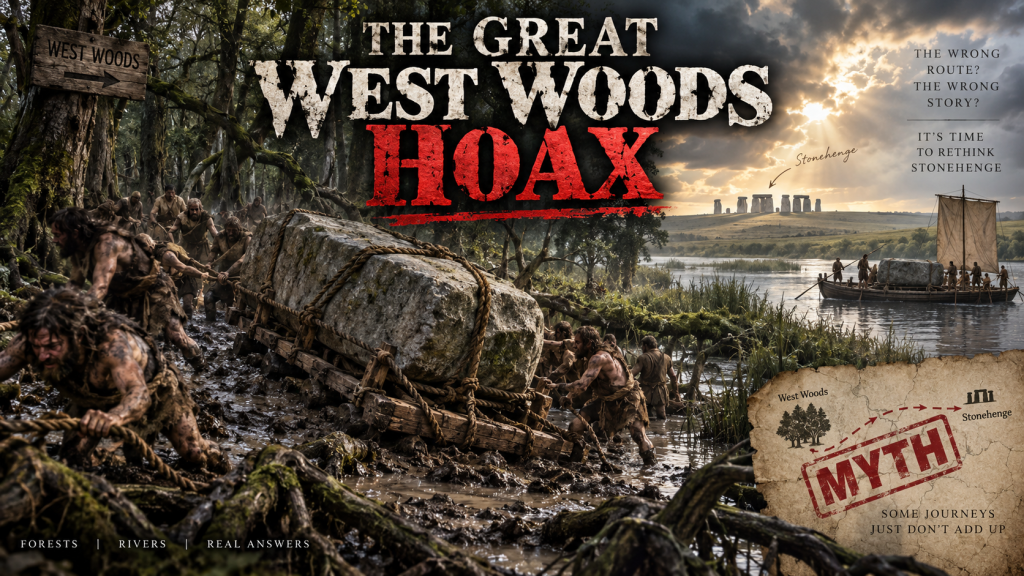
THE GREAT WEST WOODS HOAX — WHEN ONE STONE BECOMES FIFTY
AN EXERCISE IN FUTILITY — TRY A BOAT 
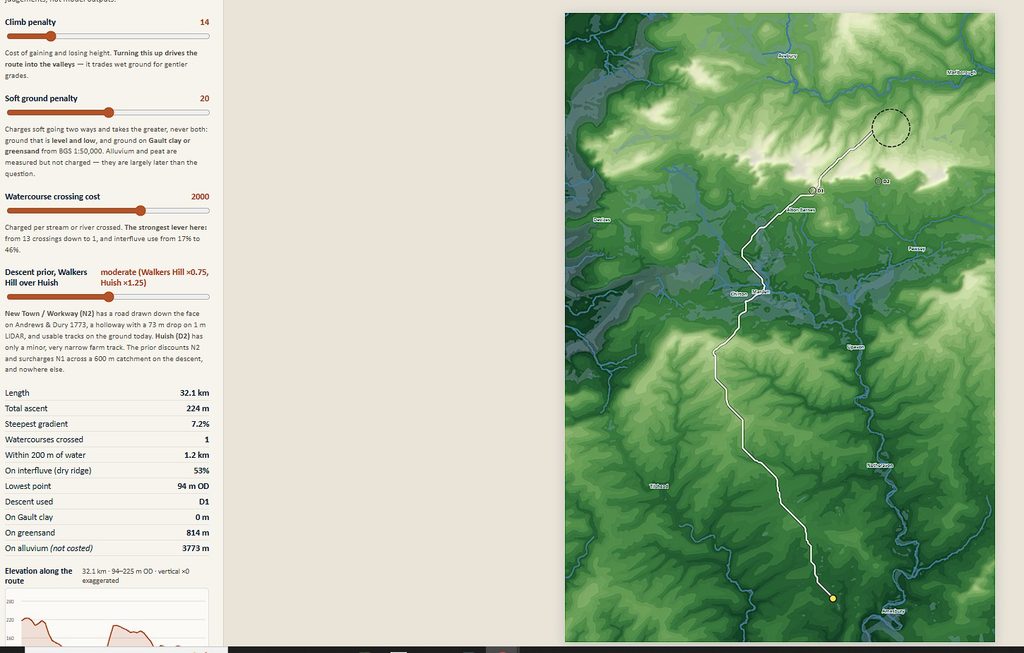
A new interactive model claims to calculate the most likely overland route used to haul the great Stonehenge sarsens from West Woods to Stonehenge:
https://sarsenroute.netlify.app
It is technically clever.
It calculates hundreds of least-cost routes using terrain, gradient, geology, wet ground and watercourse crossings.
But as a reconstruction of what prehistoric people actually did, there is a fundamental problem:
It solves a prehistoric transport problem using the wrong landscape — and then assumes the answer must be overland.
That makes the beautiful computer map rather less impressive than it first appears. 
 PROBLEM 1 — WHERE ARE THE FORESTS?
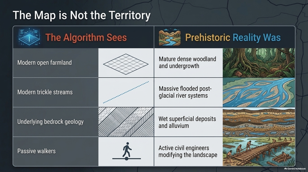
Look at the landscape today, and you see enormous areas of open farmland and grassland.
But that is largely a modern landscape.
During the prehistoric period, huge areas of southern Britain were woodland, scrub, marsh and wet valley floor.
So the model sees a nice dry ridge and says:
 easy route
But the builders may have seen:
mature trees roots undergrowth fallen timber uneven forest floor
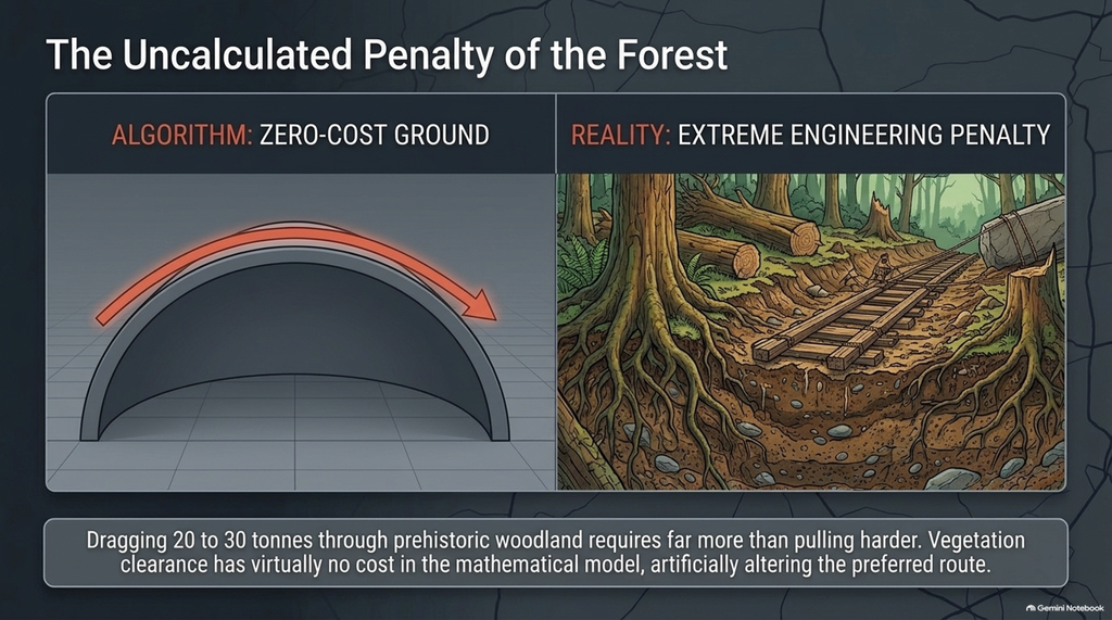
Dragging a 20–30 tonne stone through woodland requires far more than pulling harder.
You would need to:
 fell trees remove stumps clear a corridor
 build or reinforce a track maintain that track for repeated journeys
Yet vegetation clearance appears to have virtually no cost in the model.
That alone could completely change the preferred route.
 PROBLEM 2 — THE RIVERS WERE NOT THE LITTLE MODERN CHANNELS SHOWN ON THE MAP
Our Post-Glacial Flooding research argues that prehistoric rivers and floodplains were substantially larger and wetter than those visible today.
So drawing modern streams onto a modern terrain model does not reconstruct the hydrology when the stones were moved.
River width changes.
Depth changes.
Floodplain width changes.
Marshes move.
Groundwater changes.
Channels migrate.
Fords appear and disappear.
Yet the model’s single most powerful control is apparently:
WATERCOURSE CROSSING COST
Turn that dial and the preferred route changes dramatically.
That should ring alarm bells.
The factor exerting the greatest influence on the answer is also one of the features of the prehistoric landscape that has been reconstructed least adequately.
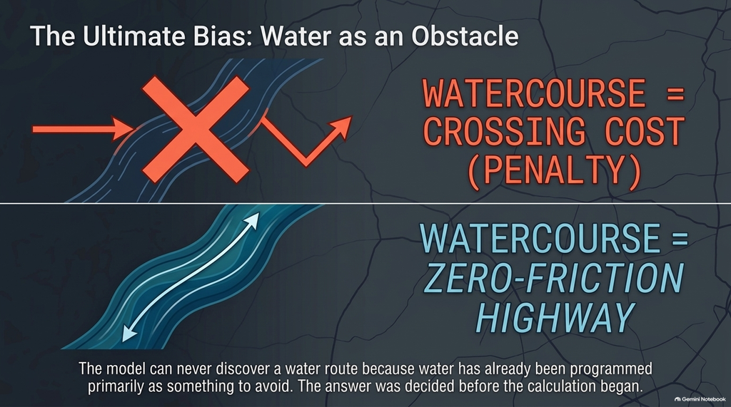
 PROBLEM 3 — IT ASSUMES WATER IS AN OBSTACLE
This may be the biggest conceptual mistake of all.
The computer assumes:
river = penalty
But what if prehistoric people regarded rivers as:
river = road
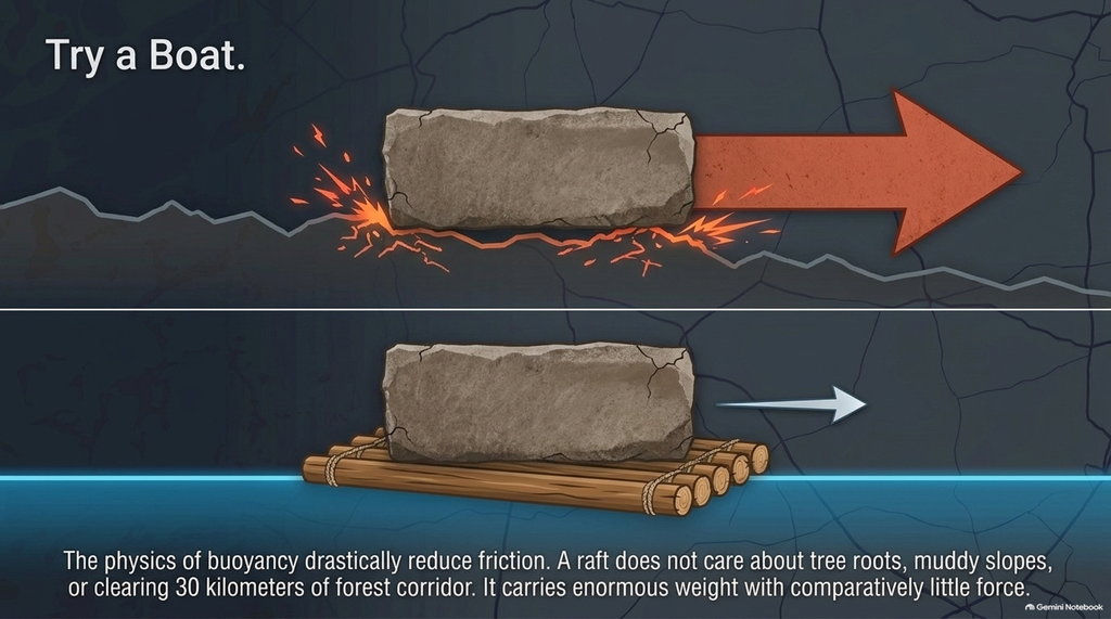
A boat or raft:
does not care about tree roots does not need a 30 km forest corridor cleared does not have to drag 20 tonnes uphill drastically reduces friction can transport enormous weights with comparatively little force
If prehistoric river systems were larger than today’s, that would potentially make water transport more attractive, not less.
Yet the algorithm can never discover a water route because water has already been programmed primarily as something to avoid.
The answer has therefore been partially decided before the calculation begins.
 PROBLEM 4 — THE “PREFERRED” ROUTE IS BASED ON ANALYST-CHOSEN NUMBERS
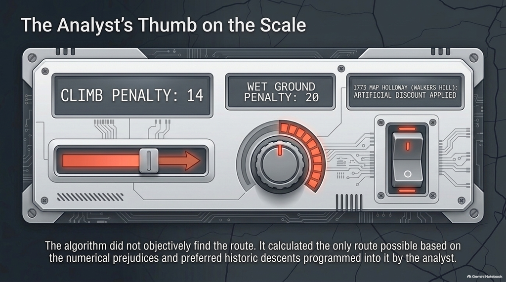
The model itself tells us that its preferred settings are things such as:
climb penalty 14
wet-ground penalty 20
water crossing penalty
These are not archaeological discoveries.
They are analyst judgements.
Change the values and the route changes.
So the computer is not saying:
“This is where prehistoric people travelled.”
It is saying:
“Given these particular numerical assumptions, this is the cheapest line produced by the algorithm.”
Those are very different statements.
 PROBLEM 5 — ONE DESCENT IS ACTUALLY GIVEN A PREFERENCE
The model favours the Walkers Hill/New Town route partly because:
 a road appears there on a 1773 map
 there is a holloway
 tracks remain there today
Interesting.
But what does that prove?
It proves people used that route much later.
It does not prove prehistoric builders dragged gigantic sarsens down it thousands of years earlier.
Worse still, once you give that corridor an artificial discount and then the computer chooses it, you cannot use the result as independent evidence that the corridor was preferred.
You’ve partly told the computer where to go.
 PROBLEM 6 — BEDROCK GEOLOGY IS NOT THE SAME AS HOW EASY THE GROUND WAS TO CROSS
The model penalises Gault Clay and Greensand as proxies for poor going.
But what actually matters to a sledge is the surface, not merely what the geological map says lies beneath it.
You need to know:
 moisture
 soil depth vegetation groundwater surface preparation superficial deposits
 possibly season
A dry Greensand slope and a saturated Greensand slope are not the same transport problem.
Likewise, a supposedly difficult soil might become straightforward if people deliberately constructed a timber or gravel trackway.
 PROBLEM 7 — PREHISTORIC PEOPLE WERE ENGINEERS, NOT PASSIVE WALKERS
Least-cost algorithms tend to assume people move through the landscape they are given.
But moving dozens of enormous stones is already a major civil-engineering operation.
If you can organise hundreds of people to move 20-tonne blocks, you can also:
lay timber tracks cut ramps fill depressions
 construct crossings
 build landing places prepare haul roads
The “natural” cheapest route may therefore have been irrelevant.
People could alter the route.
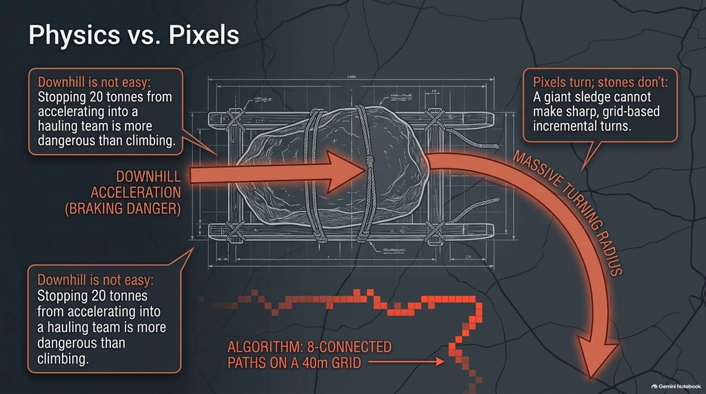
 PROBLEM 8 — THE HAULAGE PHYSICS ARE TOO SIMPLE
An enormous sarsen is not a walker.
It does not simply incur a generic “climb penalty”.
Moving 20–30 tonnes involves:
load sledge design ropes
ropes number of pullers
 gradient
 braking
 turning radius friction track construction
And downhill movement is particularly important.
Going down a steep slope isn’t necessarily “easy”.
With a gigantic stone, it can be more dangerous than climbing, because now you have to stop 20 tonnes accelerating into the hauling team.
Yet uphill and downhill costs in these models are necessarily simplified abstractions.
PROBLEM 9 — A 20-TONNE STONE CANNOT TURN LIKE A COMPUTER PIXEL
The model uses grid connections allowing routes to change direction in fixed increments.
A digital path can make sharp little turns whenever the mathematics likes.
A giant stone on a long sledge cannot.
Turning radius should matter enormously.
So should:
 length of the stone width of the track manoeuvring room
 cross-slope stability
If these are not physically modelled, the calculated path can look wonderfully precise while describing movements that would have been impractical on the ground.
 PROBLEM 10 — EVEN THE GRID DESCRIPTION APPEARS INCONSISTENT
The description refers to:
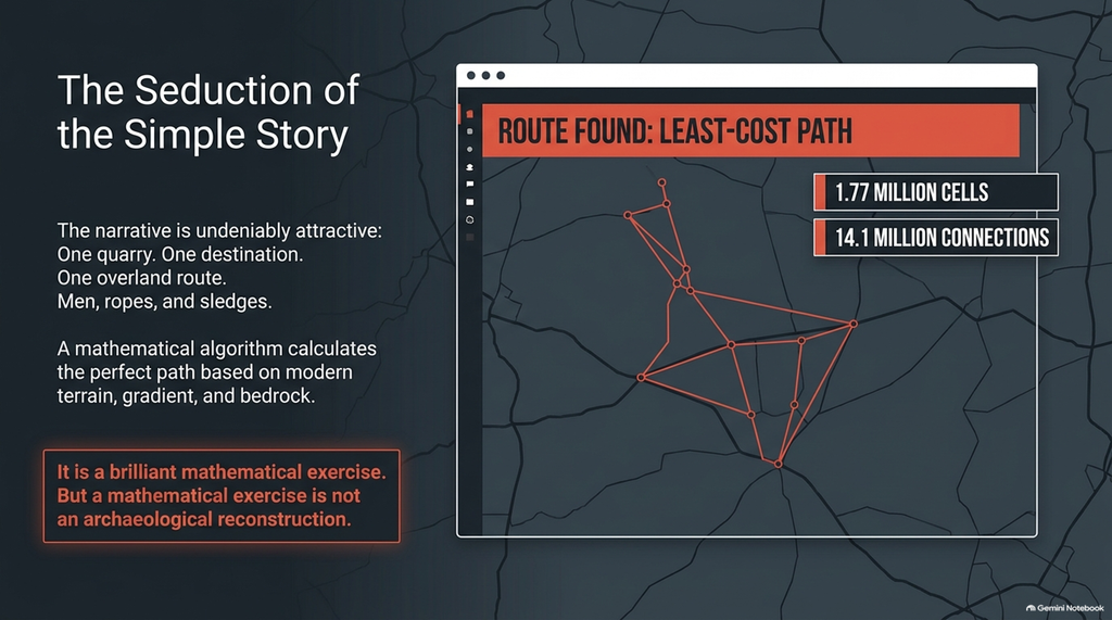
1.77 million cells and 14.1 million connections on a 20 m grid
but elsewhere describes:
8-connected paths on a 40 m grid.
Those numbers differ by roughly the amount expected when the grid cell size is doubled.
Perhaps the model was updated.
Perhaps different calculations are being described.
But before treating the route as archaeological evidence, it would be useful to know exactly which calculation produced the route we’re looking at.
 PROBLEM 11 — ALLUVIUM IS MEASURED BUT NOT PENALISED
The model reportedly records several kilometres of alluvium along its preferred route, but it does not incur costs because much of that material is considered later.
But that is precisely the palaeoenvironmental question that needs answering.
Was that route:
 dry ground?
wooded?
marsh?
active floodplain?
seasonally inundated?
You cannot simply remove an inconvenient landscape component because its modern deposits accumulated later.
You have to reconstruct the surface that was there before them.
 PROBLEM 12 — WHAT DATE ARE WE ACTUALLY MODELLING?
The conventional Stonehenge story assumes most of the great sarsens arrived around 2500 BCE.
Our Stonehenge Enigma work questions that chronology and proposes a substantially earlier monumental phase.
If the stones were actually transported centuries or millennia earlier than the conventional model assumes, then:
vegetation was different groundwater was different rivers were different wetlands were different navigability was different
So before calculating a route, surely we first need to establish:
WHEN ARE WE MODELLING?
Otherwise we are merely feeding modern geography into a computer and attaching a prehistoric date afterwards.
 AND FINALLY — WHY ASSUME THEY DRAGGED THEM 32 KM AT ALL?
This is the central problem.
A land-only least-cost model can discover only a land route.
It cannot discover:
boat transport raft transport river haulage mixed river-and-land transport
short portages between navigable waterways
because those possibilities are excluded by the structure of the model.
So what has actually been demonstrated?
Not:
“This is how the Stonehenge sarsens were transported.”
But:
“If we assume they were dragged overland, approximate the prehistoric landscape using mostly modern terrain, ignore much of its prehistoric vegetation, treat rivers largely as obstacles, apply our own cost penalties and favour one descent, this is the route the computer prefers.”
That’s an interesting mathematical exercise.
It is not an archaeological reconstruction of the prehistoric transport system.
Before producing another beautifully coloured line across Salisbury Plain, perhaps reconstruct the actual prehistoric landscape first.
Put the forests back.
Put the larger rivers back.
Put the floodplains back.
Put the wetlands back.
Allow water transport into the model.
Then ask the computer again.
The answer might be rather different.
AN EXERCISE IN FUTILITY — TRY A BOAT.
Stonehenge Sarsen Route — Part Two
In the previous article, “An Exercise in Futility — Try a Boat,” we examined the new computer model claiming to identify the likely route by which Stonehenge’s giant sarsens were hauled from West Woods to Stonehenge.
We showed that the model could only find an overland route because water transport had effectively been excluded before the calculation began. Modern terrain replaced the prehistoric landscape, rivers were treated primarily as obstacles, woodland was missing, arbitrary cost values were applied, and a later historically used descent was eventually given its own preferential weighting.
The associated video then took this much further, suggesting that we now knew the “exact valley” from which Stonehenge’s sarsens originated and implying that the resulting calculations placed us within metres of their actual prehistoric route.
But we deliberately left another problem largely untouched.
It is potentially much more serious than the route itself.
What if West Woods is not the secure starting point the video tells its audience it is?
Because once we examine the geological evidence rather than the simplified story built around it, something remarkable happens.
The supposed certainty disappears.
 WHAT DID THE 2020 WEST WOODS STUDY ACTUALLY PROVE?
The popular version goes something like this:
Scientists tested the Stonehenge sarsens, discovered that fifty of the fifty-two came from West Woods, and therefore we now know where the stones started their journey.
Nice.
Simple.
Memorable.
And rather misleading.
The actual 2020 scientific paper is considerably more careful.
Researchers conducted non-destructive surface analysis of the surviving Stonehenge sarsens using portable X-ray fluorescence (pXRF).
They found that 50 of the 52 stones displayed broadly consistent chemistry.
That is important evidence.
But it did not identify those fifty stones as coming from West Woods.
The authors themselves wrote that the similarity indicated “by inference” that they probably originated from a common source area.
Those two words matter:
BY INFERENCE.
So where did West Woods come from?
From one stone.
Stone 58.
 ONE CORE FROM ONE STONE
During restoration work in 1958, workers drilled Stone 58 so they could insert metal ties through it.
One of those drill cores — the Phillips Core — eventually resurfaced decades later.
This provided researchers with something extremely valuable: material from the interior of a Stonehenge sarsen rather than merely its weathered outer surface.
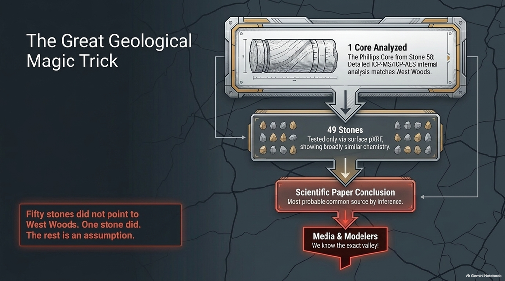
A 67 mm section of that core was subjected to detailed ICP-MS and ICP-AES whole-rock geochemical analysis.
That detailed chemical signature was then compared against sarsens sampled from twenty areas across southern Britain.
And Stone 58 produced its best permissible match with:
West Woods.
That is good science.
But notice what has happened.
The chain of reasoning is:
Stone 58 → detailed internal analysis → West Woods
then:
49 other stones → similar surface chemistry to Stone 58
therefore:
the other 49 probably came from the same general source as Stone 58.
The original researchers consequently described West Woods as the “most probable source area for the majority” of the sarsens.
They did NOT claim to have individually matched fifty Stonehenge megaliths to West Woods.
Indeed, they explicitly said that further archaeological investigation and more detailed sampling around West Woods was required to constrain the source more precisely.
Compare that scientific caution with the clickbait version:
“We know the exact valley.”
We don’t.
One deeply analysed Stonehenge stone matched West Woods.
The remainder are an extrapolation from that result.
That distinction somehow gets lost when a complicated scientific paper has to be turned into a dramatic YouTube story.
 THE GREAT GEOLOGICAL MAGIC TRICK
This is how fifty stones apparently become West Woods stones.
Take:
ONE internally analysed stone.
Establish that:
forty-nine others have broadly similar surface chemistry.
Then change:
“probably from a common source”
into:
“all from West Woods.”
And finally turn:
“most probable source area”
into:
“the exact valley.”
That is not merely simplifying science for a general audience.
It materially changes the evidence’s certainty.
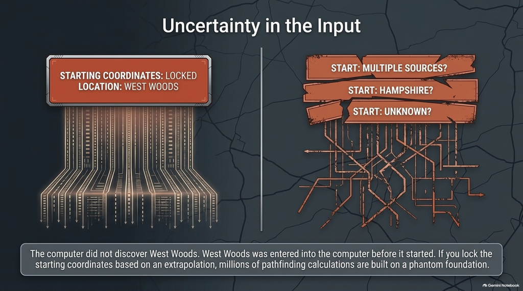
And it matters enormously when somebody then builds an entire transportation model whose starting coordinates depend upon that interpretation.
The computer is not discovering West Woods.
West Woods was entered into the computer before it started.
 THEN CAME SOME RATHER INCONVENIENT SAMPLES
Here is the evidence that should have been prominent in any serious discussion about the source of the Stonehenge sarsens.
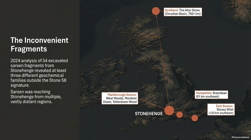
In 2024, researchers published another geochemical study.
This time they examined excavated sarsen fragments actually recovered from Stonehenge.
They initially studied more than 1,000 pieces.
Fifty-four representative fragments then underwent detailed whole-rock ICP-AES and ICP-MS analysis.
And the result was fascinating.
None of those 54 fragments matched material produced from dressing Stone 58 or its 49 chemically similar Stonehenge equivalents.
Instead, 22 fragments fell into three different geochemical families.
Those families did not overlap with Stone 58.
The researchers concluded that Stonehenge included sarsen from at least three additional geographical sources.
It gets better.
Fifteen fragments could be associated with known source areas.
Eleven were associated with:
West Woods
Monkton Down
and
Totterdown Wood
on the Marlborough Downs.
But three others matched:
Bramdean, Hampshire — approximately 51 km southeast of Stonehenge.
And another matched:
Stoney Wish, East Sussex — approximately 123 km southeast of Stonehenge.
Now the neat little story has become considerably messier.
As archaeology generally does when you actually excavate it.
 LET’S NOT MAKE THEIR MISTAKE IN REVERSE
It is important to be scientifically accurate here.
Those Hampshire and Sussex fragments do not prove that one of the giant surviving uprights was brought from Hampshire or Sussex.
The researchers themselves acknowledge several possibilities.
The fragments might derive from missing megaliths.
They might derive from Stones 26 or 160, which already have chemistry different from the other surviving sarsens.
They could be remnants of earlier dismantled stones.
Some might have been hammerstones or smaller blocks deliberately brought to Stonehenge.
But one fragment from Monkton Down could actually be refitted as part of a large flake removed from the surface of a substantial sarsen boulder during dressing.
The authors therefore specifically state that this provides a second likely source area for Stonehenge megaliths in addition to West Woods.
So let us state only what the evidence warrants.
The 2024 study demonstrates beyond the simplistic West Woods story that:
Sarsen stone was reaching Stonehenge from multiple geological source areas.
That is a fact.
What each piece was used for remains open to investigation.
And that is precisely how the evidence should be presented.
 BUT HERE IS THE REALLY INTERESTING PART
Could the people promoting the West Woods transport story simply be unaware of this inconvenient 2024 research?
Apparently not.
Because Sarsen.org itself published an article about it in January 2024.
The article specifically reported the three Bramdean fragments, the Stoney Wish fragment and the evidence for multiple sarsen sources at Stonehenge.
Yet the 2026 least-cost transport exercise is built around a single source region:
West Woods → Stonehenge.
Now, we cannot climb inside another person’s head and prove why inconvenient information was excluded.
But we can establish something much simpler.
The contradictory evidence was:
published;
available;
and
previously discussed on the same website.
So it cannot reasonably be dismissed as obscure information nobody knew about.
When a later public presentation tells people we know the “exact valley” but fails to explain that the detailed geographical provenance depends on extrapolating from one internally sampled standing stone, while previously published excavated material identifies several different geological sources, the audience has not been given the full evidential picture.
Call that whatever you wish.
I call it misleading.
 AND EVEN WEST WOODS ITSELF IS NOW BEING QUESTIONED
There is an additional twist.
A subsequent reassessment published in Archaeometry re-examined the Stone 58 geochemistry and concluded that the claimed connection between Stone 58 and West Woods was not nearly as clear-cut as the original interpretation suggested.
That analysis found other Wiltshire locations—including Clatford Bottom and Piggledene—remained plausible, depending on how the elemental data were compared.
That does not prove West Woods is wrong.
Again, that would simply substitute one unjustified certainty for another.
But it most certainly demonstrates that:
“West Woods was settled in 2020”
is not an appropriate description of the present scientific position.
Science has moved on.
The clickbait apparently hasn’t.
 SO WHAT EXACTLY IS THE COMPUTER MODELLING?
This changes our criticism of the route model considerably.
In the previous article, we asked whether the computer was reconstructing the correct prehistoric landscape.
Now we have to ask an even more fundamental question:
IS IT EVEN STARTING FROM THE RIGHT PLACE?
Think about that.
The model calculates hundreds of routes with remarkable apparent precision.
Distances.
Gradients.
Water crossings.
Soft-ground penalties.
Preferred descents.
Kilometres of route.
Tiny differences between alternative paths.
And all those calculations begin with:
WEST WOODS.
But West Woods was never independently proven for fifty stones.
Researchers identified it through detailed analysis of Stone 58 and extrapolated it to the chemically similar group.
Excavated material subsequently revealed a more complicated supply pattern.
At least one additional Marlborough Downs source appears associated with a large dressed megalith.
Hampshire appears.
Sussex appears.
And even the detailed geochemical interpretation linking Stone 58 uniquely to West Woods has now been challenged.
So what happens to the beautiful route calculation if the starting coordinates change?
The answer is obvious.
The route changes.
Garbage in, garbage out may be rather harsh.
But in modelling there is an unavoidable principle:
uncertainty in the inputs produces uncertainty in the output.
A computer cannot magically turn an archaeological assumption into an archaeological fact.
 HAVEN’T WE JUST LEARNED THIS LESSON FROM THE ALTAR STONE?
You would imagine Stonehenge researchers would be particularly cautious about claiming precise stone origins after what happened with the Altar Stone.
For years, the six-tonne Altar Stone was associated with Wales.
Why?
Largely because other Stonehenge bluestones were Welsh.
It fitted the established story nicely.
Then the geology refused to cooperate.
Increasingly detailed investigation eliminated the Welsh source.
And in 2024 an extraordinary Nature study demonstrated that the Altar Stone’s mineral fingerprint was instead consistent with the Orcadian Basin of northeast Scotland.
Not Wales.
Not somewhere slightly farther north.
SCOTLAND.
At least 750 kilometres from Stonehenge.
The researchers themselves pointed out how formidable an overland journey would have been through the Grampians, Southern Uplands, Pennines and heavily wooded prehistoric Britain.
Their conclusion?
Long-distance maritime transportation becomes an obvious serious possibility.
This is not some alternative historian saying:
“Try a boat.”
This is the geological evidence forcing mainstream archaeology to consider exactly the same logistical problem.
The Altar Stone is not a sarsen, so its geology should not be confused with the sarsen debate.
But methodologically it should be a gigantic flashing warning light.
An origin story repeated confidently for years turned out to be wrong by hundreds of kilometres.
Therefore, perhaps proclaiming an “exact valley” from one internally analysed sarsen is not the wisest hill upon which to die.
 AND NOW WE HAVE THE STONEHENGE BOTTOM BOREHOLES
Our previous article concluded:
Still think they should try a boat.
At that stage we were primarily attacking the logic of treating prehistoric waterways exclusively as obstacles.
But our latest analysis of the Stonehenge Bottom boreholes takes this significantly further.
This is no longer simply:
“perhaps there was more water around.”
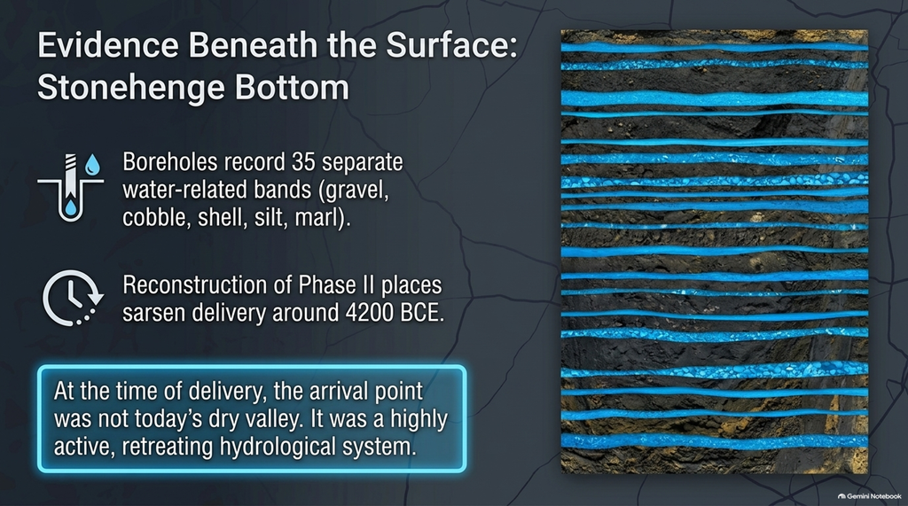
The geological records beneath Stonehenge Bottom contain repeated gravel, cobble, shell, silt, marl and chalk-dissolution horizons.
One lower borehole alone records 35 separate water-related bands, including seven shell-bearing horizons and repeated gravel and cobble deposits. The sequence represents a declining but still active hydrological environment rather than a single flood event.
Across the wider borehole dataset, the pattern is repeated at multiple elevations.
Stonehenge Bottom was not simply today’s dry valley occasionally becoming damp.
Under our Post-Glacial Flooding model, it was a long-lived water system progressively retreating as groundwater levels fell.
And critically, our reconstruction of Stonehenge Phase II places the main sarsen phase at approximately 4200 BCE, considerably earlier than the conventional chronology.
By that stage, our reconstruction has the Avenue reaching Stonehenge Bottom and providing a new access and landing point as the earlier higher water system retreated.
That is our interpretation and chronology; it should not be confused with the conventional archaeological date of around 2500 BCE.
But it produces a testable consequence:
At the date we propose for sarsen delivery, Stonehenge Bottom must still show evidence of substantial hydrological activity.
The boreholes do.
That is precisely why this new evidence matters.
 THE STARTING ASSUMPTION IS COLLAPSING AT BOTH ENDS
We now have two completely separate problems with the fashionable West Woods dragging story.
At the northern end:
We cannot simply assume every major sarsen began at West Woods.
At the southern end:
We cannot assume Stonehenge Bottom was the dry landscape shown by modern terrain mapping.
So the computer is potentially simplifying both ends of the journey.
It fixes an uncertain geological source.
Then sends stones across an inadequately reconstructed prehistoric landscape.
Then treats water predominantly as a cost.
Then excludes water transportation.
And finally produces a wonderfully precise answer.
The precision is mathematical.
The archaeology isn’t.
 SIMPLE STORIES ARE ATTRACTIVE — BUT PREHISTORY WASN’T SIMPLE
This is perhaps why the West Woods story has become so attractive.
One quarry.
One group of stones.
One destination.
One route.
Men.
Ropes.
Sledges.
Done.
It makes wonderful television.
It makes wonderful YouTube.
It makes wonderful computer graphics.
Unfortunately, the archaeological evidence now tells us something considerably more interesting.
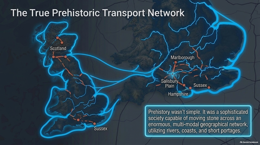
Stonehenge contains material from:
the Marlborough Downs;
multiple sarsen source areas;
Hampshire;
East Sussex;
west Wales;
and, astonishingly,
northeast Scotland.
That does not look like an isolated community walking to its nearest convenient rock pile.
It looks like a society capable of moving stone across an enormous geographical network.
And once you recognise that, perhaps the waterways running through prehistoric Britain stop looking like irritating obstacles that need to be crossed.
Perhaps they become the obvious explanation.
 SCIENCE REQUIRES ALL THE EVIDENCE — NOT JUST THE CONVENIENT BITS
There is nothing wrong with proposing West Woods as an important sarsen source.
The geological evidence makes it a serious candidate.
There is nothing wrong with modelling a hypothetical land route from West Woods.
Provided it is clearly labelled as exactly that:
a hypothetical route from an assumed source.
What is wrong is allowing those assumptions to mutate into:
“We know where fifty stones came from.”
then:
“We know the exact valley.”
then:
“Here is the route they took.”
The original scientific literature does not justify that progression.
Science Advances said:
“by inference.”
It said:
“most probable.”
It requested:
further detailed sampling.
Those cautious scientific qualifications somehow disappeared on the journey to YouTube.
Perhaps they were too heavy to drag across Salisbury Plain.

THE REAL STONEHENGE TRANSPORT QUESTION
Our previous article asked:
Why aren’t boats included in the model?
After looking more closely at the provenance evidence, the question is now much larger:
Why are we modelling a single route at all?
If Stonehenge received stone from multiple parts of Britain, then there may never have been a single Stonehenge stone route.
There may have been:
multiple sources,
multiple routes,
different transportation methods,
river sections,
coastal sections,
short land portages,
different landing places,
and different construction phases stretching across thousands of years.
That is considerably less convenient than drawing one coloured line between West Woods and Stonehenge.
But archaeology is supposed to reconstruct the evidence.
Not simplify the evidence until it fits the drawing.
The first computer model asked:
How did they drag the stones from West Woods?
Perhaps the question should have been:
Where did the stones actually come from, what did the landscape look like at the time, and what transportation network connected all those sources to Stonehenge?
Only after answering those questions should anyone press:
CALCULATE ROUTE.
Until then, the colourful line across the Vale of Pewsey remains exactly what we said it was in Part One:
AN EXERCISE IN FUTILITY.
Except now we discover they may not have merely chosen the wrong transportation method.
They may not even know where to start.
PODCAST

Author’s Biography

Robert John Langdon, a polymathic luminary, emerges as a writer, historian, and eminent specialist in LiDAR Landscape Archaeology.
His intellectual journey has included stints as an astute scrutineer in government and major corporate bastions, spanning British Telecommunications, Cable and Wireless, British Gas, and the esteemed University of London.
A decade hence, Robert’s transition into retirement unfurled a chapter of insatiable curiosity. He immersed himself in Politics, Archaeology, Philosophy, and the enigmatic realm of Quantum Mechanics. His academic odyssey took him through the venerable corridors of knowledge hubs such as the Museum of London, University College London, Birkbeck College, The City Literature Institute, and Chichester University.
In the symphony of his life, Robert is a custodian of three progeny and a pair of cherished grandchildren. His sanctuary lies ensconced in the embrace of West Wales, where he inhabits an isolated cottage, its windows framing a vista of the boundless sea – a retreat from the scrutinising gaze of Her Majesty’s Revenue and Customs, an amiable clandestinity in the lap of nature.
Exploring Prehistoric Britain: A Journey Through Time
My blog delves into the fascinating mysteries of prehistoric Britain, challenging conventional narratives and offering fresh perspectives grounded in cutting-edge research, particularly LiDAR technology. I invite you to explore some key areas of my research. For example, I re-examine the Wansdyke, often cited as a defensive structure, in light of new evidence. I’ve presented my findings in my blog post Wansdyke: A British Frontier Wall – ‘Debunked’, and a Wansdyke LiDAR Flyover video further visualises my conclusions.
My work also often challenges established archaeological dogma. I argue that many sites, such as Hambledon Hill, commonly identified as Iron Age hillforts, are not what they seem. My posts Lidar Investigation Hambledon Hill – NOT an ‘Iron Age Fort’ and Unmasking the “Iron Age Hillfort” Myth explore these ideas in detail and offer an alternative view. Similarly, I re-evaluated sites like Cissbury Ring and White Sheet Camp through LiDAR analysis in my posts “Lidar Investigation Cissbury Ring through time” and “Lidar Investigation White Sheet Camp,“ revealing fascinating insights into their true purpose. I have also examined South Cadbury Castle, often linked to the mythical Camelot56.
My research also extends to ancient water management, including the role of canals and other linear earthworks. I have discussed the true origins of Car Dyke in multiple posts, including Car Dyke – ABC News Podcast and Lidar Investigation Car Dyke – North Section, which suggest a Mesolithic origin 2357. I also explore the misidentification of Roman aqueducts, as seen in my posts on the Great Chesters (Roman) Aqueduct. My research has also been greatly informed by my post-glacial flooding hypothesis, which has helped explain landscape transformations over time. I have discussed this hypothesis in several posts, including AI now supports my Post-Glacial Flooding Hypothesis and Exploring Britain’s Flooded Past: A Personal Journey
Finally, my blog also investigates prehistoric burial practices, as seen in Prehistoric Burial Practices of Britain and explores the mystery of Pillow Mounds, often mistaken for medieval rabbit warrens, but with a potential link to Bronze Age cremation in my posts: Pillow Mounds: A Bronze Age Legacy of Cremation? and The Mystery of Pillow Mounds: Are They Really Medieval Rabbit Warrens?. My research also includes astronomical insights into ancient sites, for example, in Rediscovering the Winter Solstice: The Original Winter Festival. I also review new information about the construction of Stonehenge in The Stonehenge Enigma.
Yes. I’d make this far tighter, more inviting and more obviously a gateway into the rest of your work. The present version repeats the website several times and reads more like an author biography than a “what next?” section.
I’d also make the three routes immediately obvious: Explore the Research → Watch the Videos → Read the Books, with Facebook as the discussion/community route.
Further Reading — Explore the Evidence
The investigation doesn’t end with this article.
Prehistoric Britain brings together hundreds of articles, LiDAR investigations, field discoveries, archaeological studies and original research exploring Britain’s prehistoric landscape from a different perspective.
Follow the evidence across ancient waterways, lost landscapes, Stonehenge and Avebury, prehistoric engineering, submerged Britain, ancient DNA and the effects of post-glacial flooding — comparing established archaeological interpretations with alternative explanations suggested by the physical evidence.
🎬 Watch the Investigations
Prefer to watch rather than read?
The Robert John Langdon YouTube channel has more than 200 documentaries, investigations, and video presentations that bring the research to life through maps, LiDAR, archaeological evidence, and landscape reconstruction.
Discover investigations including 13 Things That Don’t Make Sense in History, Silbury Avenue – The Lost Stone Avenue, Stonehenge, prehistoric waterways, submerged landscapes and many more.
📚 Explore the Book Library
Go deeper into the evidence through Robert John Langdon’s growing collection of books and specialist studies, including:
- The Stonehenge Hoax – 13 Things That Don’t Make Sense in History
- Car Dyke – Prehistoric Dyke
- Wansdyke – Prehistoric Dyke
- Offa’s Dyke – Prehistoric Dyke
- Silbury Avenue – The Lost Stone Avenue
- The Vallum – At Hadrian’s Wall
- Stonehenge: The World’s First Computer
- Avebury’s Lost Stone Avenue
Many of these investigations connect directly with the evidence discussed throughout the website, allowing individual discoveries to be examined as part of the much wider prehistoric landscape.
🔎 Read the Main Trilogy
Three major works bring together the central strands of the research:
The Post-Glacial Flooding Hypothesis — investigates the evidence for radically different water levels, waterways and landscapes in prehistoric Britain.
The Stonehenge Enigma — re-examines the chronology, landscape and purpose of one of the world’s most famous prehistoric monuments.
Dawn of the Lost Civilisation — explores the evidence for sophisticated communities, technology and maritime connections far earlier than traditionally assumed.
💬 Join the Investigation
New discoveries, LiDAR surveys and research are discussed as they happen in the Prehistoric Britain Facebook Group.
Join the discussion, challenge the evidence, offer alternative interpretations and follow new investigations as they develop.
Don’t just read the accepted story. Explore the evidence, compare the interpretations, and decide for yourself.
Other Blogs
1
a
- Ackling Dyke – Facts and the Archaeological Fiction
- Ackling Dyke – Part II – Puddletown Forest: When a Roman Road Becomes an Assumption
- Ackling Dyke – Part III – The Roman Road Mystery Finally Makes Sense
- AI now Supports – Homo Superior
- AI now supports my Post-Glacial Flooding Hypothesis
- Alexander the Great sailed into India – where no rivers exist today
- Ancient Secrets of Althorp – debunked
- Antler Picks built Ancient Monuments – yet there is no real evidence
- Antonine Wall – Prehistoric Canals (Dykes)
- Archaeological ‘pulp fiction’ – has archaeology turned from science?
- Archaeological Pseudoscience
- Archaeology in the Post-Truth Era
- Archaeology: A Bad Science?
- Archaeology: A Harbour for Fantasists?
- Archaeology: Fact or Fiction?
- Archaeology: The Flaws of Peer Review
- Archaeology’s Bayesian Mistake: Stop Averaging the Past
- Are Raised Beaches Archaeological Pseudoscience?
- Atlantis Found: The Mathematical Proof That Plato’s Lost City Was Doggerland
- ATLANTIS: Discovery with Dan Snow Debunked
- Avebury Ditch – Avebury Phase 2
- Avebury through time
- Avebury’s great mystery revealed
- Avebury’s Lost Stone Avenue – Flipbook
b
- Battlesbury Hill – Wiltshire
- Beyond Stone and Bone: Rethinking the Megalithic Architects of Northern Europe
- BGS Prehistoric River Map
- Blackhenge: Debunking the Media misinterpretation of the Stonehenge Builders
- Brain capacity (Cro-Magnon Man)
- Britain’s Changing Funeral Traditions
- Britain’s First Road – Stonehenge Avenue
- Britain’s Giant Prehistoric Waterways
- British Roman Ports miles away from the coast
c
- Caerfai Promontory Fort – Archaeological Nonsense
- Car Dyke – ABC News PodCast
- Car Dyke – North Section
- Cardigan Bay: The Holocene Evidence the Old Geological Story Has Missed
- CASE STUDY – An Inconvenient TRUTH (Craig Rhos Y Felin)
- Case Study – River Avon
- Case Study – Woodhenge Reconstruction
- Chapter 2 – Craig Rhos-Y-Felin Debunked
- Chapter 2 – Stonehenge Phase I
- Chapter 2 – Variation of the Species
- Chapter 3 – Post Glacial Sea Levels
- Chapter 3 – Stonehenge Phase II
- Chapter 7 – Britain’s Post-Glacial Flooding
- Cissbury Ring through time
- Clement Reid, Doggerland, and the Archaeological Establishment
- Cro-Magnon Brain Capacity
- Cro-Magnon Megalithic Builders: Measurement, Biology, and the DNA
- Cro-Magnons – An Explainer
d
- Darwin’s Children – Flipbook
- Darwin’s Children – The Cro-Magnons
- Dawn of The Lost Civilisation – 1/10
- Dawn of the Lost Civilisation – Flipbook
- Dawn of the Lost Civilisation – Introduction
- Digging for Britain – Cerne Abbas
- Digging for Britain Debunked – Cerne Abbas 2
- Digging Up Britain’s Past – Debunked
- DLC Chapter 1 – The Ascent of Man
- Durrington Walls – Woodhenge through time
- Durrington Walls Revisited: Platforms, Fish Traps, and a Managed Mesolithic Landscape
- Dyke Construction – Hydrology 101
- Dykes Ditches and Earthworks
- DYKES of Britain
e
f
g
h
- Hadrian’s Wall – Military Way Hoax
- Hadrian’s Wall – the Stanegate Hoax
- Hadrian’s Wall Vallum – Prehistoric Canals – FREE Online Book
- Hadrian’s Wall LiDAR investigation
- Hambledon Hill – NOT an ‘Iron Age Fort’
- Hayling Island Lidar Maps
- Hidden Sources of Ancient Dykes: Tracing Underground Groundwater Fractals
- Historic River Avon
- Hollingsbury Camp Brighton – A Hillfort… or a Forgotten Harbour?
- Hollows, Sunken Lanes and Palaeochannels
- Homo Superior – Flipbook
- Homo Superior – History’s Giants
- How Lidar will change Archaeology
- Hydrology 101 Simplified: Why Britain’s Dykes Worked Without Rivers
i
l
m
- Maiden Castle through time
- Mathematics Meets Archaeology: Discovering the Mesolithic Origins of Car Dyke
- Mesolithic River Avon
- Mesolithic Stonehenge
- Minerals found in Prehistoric and Roman Quarries
- Mining in the Prehistoric to Roman Period
- Mount Caburn through time
- Mysteries of the Oldest Boatyard Uncovered
- Mythological Dragons – a non-existent animal that is shared by the World.
o
- Offa’s Dyke Flipbook
- Old Sarum Lidar Map
- Old Sarum Through Time…………….
- On Sunken Lands of the North Sea – Lived the World’s Greatest Civilisation.
- OSL Chronicles: Questioning Time in the Geological Tale of the Avon Valley
- Oswestry LiDAR Survey
- Oswestry through time
- Oysters in Archaeology: Nature’s Ancient Water Filters?
p
- Pillow Mounds: A Bronze Age Legacy of Cremation?
- Pinkery Canal
- Plato Was Right: The Archaeological Evidence the Academics Never Expected
- Post Glacial Flooding – Flipbook
- Prehistoric Burial Practices of Britain
- Prehistoric Canals – Wansdyke
- Prehistoric Canals – Wansdyke
- Prehistoric Canals (Dykes) – Great Chesters Aqueduct (The Vallum Pt. 4)
- Prehistoric Canals (Dykes) – Offa’s Dyke (Chepstow)
- Prehistoric Canals (Dykes) – Offa’s Dyke (LiDAR Survey)
- Prehistoric Canals (Dykes) – Offa’s Dyke Survey (End of Section A)
- Prehistoric Canals (Dykes) – Wansdyke (4)
- Prehistoric Canals Wansdyke 2
- Professor Bonkers and the mad, mad World of Archaeology
r
- Real-World Confirmation of Post-Glacial Flooding
- Rebirth in Stone: Decrypting the Winter Solstice Legacy of Stonehenge
- Rediscovering the Winter Solstice: The Original Winter Festival
- Rethinking Ancient Boundaries: The Vallum and Offa’s Dyke”
- Rethinking Ogham: Could Ireland’s Oldest Script Have Begun as a Tally System?
- Rethinking The Past: Mathematical Proof of Langdon’s Post-Glacial Flooding Hypothesis
- Revolutionising History: Car Dyke Unveiled as Prehistoric & the Launch of FusionBook 360
- Rising Evidence, Falling Rivers: The Real Story of Europe’s First Farmers
- Rivers of the Past Were Higher: A Fresh Perspective on Prehistoric Hydrology
s
- Sea Level Changes
- Section A – NY26SW
- Section B – NY25NE & NY26SE
- Section C – NY35NW
- Section D – NY35NE
- Section E – NY46SW & NY45NW
- Section F – NY46SE & NY45NE
- Section G – NY56SW
- Section H – NY56NE & NY56SE
- Section I – NY66NW
- Section J – NY66NE
- Section K – NY76NW
- Section L – NY76NE
- Section M – NY87SW & NY86NW
- Section N – NY87SE
- Section O – NY97SW & NY96NW
- Section P – NY96NE
- Section Q – NZ06NW
- Section R – NZ06NE
- Section S – NZ16NW
- Section T – NZ16NE
- Section U – NZ26NW & NZ26SW
- Section V – NZ26NE & NZ26SE
- Silbury Avenue – Avebury’s First Stone Avenue
- Silbury Hill
- Silbury Hill / Sanctuary – Avebury Phase 3
- Sky Maps of Prehistoric Britain
- Somerset Plain – Signs of Post-Glacial Flooding
- South Cadbury Castle – Camelot
- Statonbury Camp near Bath – an example of West Wansdyke
- Stone me – the druids are looking the wrong way on Solstice day
- Stone Transportation and Dumb Censorship
- Stonehenge – Monument to the Dead
- Stonehenge Hoax – Dating the Monument
- Stonehenge Hoax – Round Monument?
- Stonehenge Hoax – Summer Solstice
- Stonehenge LiDAR tour
- Stonehenge Phase 1 — Britain’s First Monument
- Stonehenge Phase I (The Stonehenge Landscape)
- Stonehenge Solved – Pythagorean maths put to use 4,000 years before he was born
- Stonehenge Through Time
- Stonehenge, Doggerland and Atlantis connection
- Stonehenge: Borehole Evidence of Post-Glacial Flooding
- Stonehenge: Discovery with Dan Snow Debunked
- Stonehenge: The World’s First Computer – FREE Book
- Stonehenge: The Worlds First Computer
- Stonehenge’s The Lost Circle Revealed – DEBUNKED
- Stonehenge’s Chronological Mirage
t
- Ten Reasons Why Car Dyke Blows Britain’s Earthwork Myths Out of the Water
- Ten Things You Didn’t Know About Britain’s Prehistoric Flooded Past
- Ten thousand year old boats found on Northern Europe’s Hillsides
- Ten thousand-year-old boats found on Northern Europe’s Hillsides
- Testing Plato’s Atlantis Against Reality
- The “Hunter-Gatherer” Myth: Why It’s Time to Bury This Outdated Term
- The Ackling Dyke Smoking Gun
- The Ancient Mariners – Flipbook
- The Ancient Mariners – Prehistoric seafarers of the Mesolithic
- The Ascent of Man — From Survival to Systems
- The Beringian Migration Myth: Why the Peopling of the Americas by Foot is Mathematically and Logistically Impossible
- The Bluestone Enigma
- The Bulford Hoax: The “Simpler, Older Stonehenge” That Wasn’t
- The Cheddar Man Hoax
- The Cro-Magnon Cover-Up: How DNA and PR Labels Erased Our Real Ancestry
- The Dolmen and Long Barrow Connection
- The Durrington Mega-Monument Hoax: What Lies Beneath? – Debunked
- The Durrington Walls Hoax – it’s not a henge?
- The Dyke Myth Collapses: Excavation and Dating Prove Britain’s Great Dykes Are Prehistoric Canals
- The First European Smelted Bronzes
- The Fury of the Past: Natural Disasters in Historical and Prehistoric Britain
- The Giant’s Graves of Cumbria
- The Giants of Prehistory: Cro-Magnon and the Ancient Monuments
- The Great Ancient DNA Illusion: How Statistical Models Became Archaeological “Facts”
- The Great Antler Pick Hoax
- The Great Bell Beaker Migration Myth
- The Great Chichester Hoax – A Bridge too far?
- The Great Dorchester Aqueduct Hoax
- The Great Farming Hoax – (Einkorn Wheat)
- The Great Farming Migration Hoax
- The Great Hadrian’s Wall Hoax
- The Great Iron Age Hill Fort Hoax
- The Great Offa’s Dyke Hoax
- The Great Prehistoric Migration Hoax
- The Great Stone Transportation Hoax
- The Great Stonehenge Hoax
- The Great Wansdyke Hoax
- THE GREAT WEST WOODS HOAX — WHEN ONE STONE BECOMES FIFTY
- The Henge and River Relationship
- The Logistical Impossibility of Defending Maiden Castle
- The Long Barrow and Dolmen Enigma
- The Long Barrow Mystery
- The Long Barrow Mystery: Unravelling Ancient Connections
- The Lost Island of Avalon – revealed
- The Maiden Way Hoax – A Closer Look at an Ancient Road’s Hidden History
- The Maths – LGM total ice volume
- The Mystery of Pillow Mounds: Are They Really Medieval Rabbit Warrens?
- THE ODYSSEY PROBLEM: WHY DID A WEEK-LONG VOYAGE BECOME A TEN-YEAR EPIC?
- The Old Sarum Hoax
- The Oldest Boat Yard in the World found in Wales
- The Perils of Paradigm Shifts: Why Unconventional Hypotheses Get Branded as Pseudoscience
- The Post-Glacial Flooding Hypothesis – 1/11
- The Post-Glacial Flooding Hypothesis – Flipbook
- The Post-Glacial Flooding Theory
- The Problem with Hadrian’s Vallum
- The Rise of the Cro-Magnon (Homo Superior)
- The Roman Military Way Hoax
- The Silbury Hill Lighthouse?
- The Stone Money – Credit System
- The Stonehenge Avenue
- The Stonehenge Avenue
- The Stonehenge Code: Unveiling its 10,000-Year-Old Secret
- The Stonehenge Crescent: A Monument to a Lost World
- The Stonehenge Enigma – Flipbook
- The Stonehenge Enigma: Part 1/6
- The Stonehenge Hoax – Bluestone Quarry Site
- The Stonehenge Hoax – Flipbook
- The Stonehenge Hoax – Moving the Bluestones
- The Stonehenge Hoax – Periglacial Stripes
- The Stonehenge Hoax – Station Stones
- The Stonehenge Hoax – Stonehenge’s Location
- The Stonehenge Hoax – The Ditch
- The Stonehenge Hoax – The Slaughter Stone
- The Stonehenge Hoax – The Stonehenge Layer
- The Stonehenge Hoax – Totem Poles
- The Stonehenge Hoax – Woodhenge
- The Stonehenge Hospital
- The Stonehenge Transportation Mystery
- The Subtropical Britain Hoax
- The Troy, Hyperborea and Atlantis Connection
- The Vallum @ Hadrian’s Wall – it’s Prehistoric!
- The Vallum at Hadrian’s Wall (Summary)
- The Woodhenge Hoax
- Thirty Years of CAU Archaeology Going Nowhere?
- Three Dykes – Kidland Forest
- Thurnam’s 137 Skulls: The Forgotten People Behind Britain’s Megaliths.
- Top Ten Misidentified Fire Beacons in British History
- Troy Debunked – Troy did not exist in Asia Minor, but in fact, the North Sea island of Doggerland
- TSE – DVD Barrows
- TSE DVD – An Inconvenient Truth
- TSE DVD – Antler Picks
- TSE DVD – Avebury
- TSE DVD – Durrington Walls & Woodhenge
- TSE DVD – Dykes
- TSE DVD – Epilogue
- TSE DVD – Stonehenge Phase I
- TSE DVD – Stonehenge Phase II
- TSE DVD – The Post-Glacial Hypothesis
- TSE DVD Introduction
- TSE DVD Old Sarum
- Twigs, Charcoal, and the Death of the Saxon Dyke Myth
w
- Wansdyke – Short Film
- Wansdyke East – Prehistoric Canals
- Wansdyke Flipbook
- Wansdyke LiDAR Flyover
- Wansdyke: A British Frontier Wall – ‘Debunked’
- Was Columbus the first European to reach America?
- What Archaeology Missed Beneath Stonehenge
- White Sheet Camp
- Why a Simple Fence Beats a Massive Dyke (and What That Means for History)
- Windmill Hill – Avebury Phase 1
- Winter Solstice – Science, Propaganda and Indoctrination
- Woodhenge – the World’s First Lighthouse?