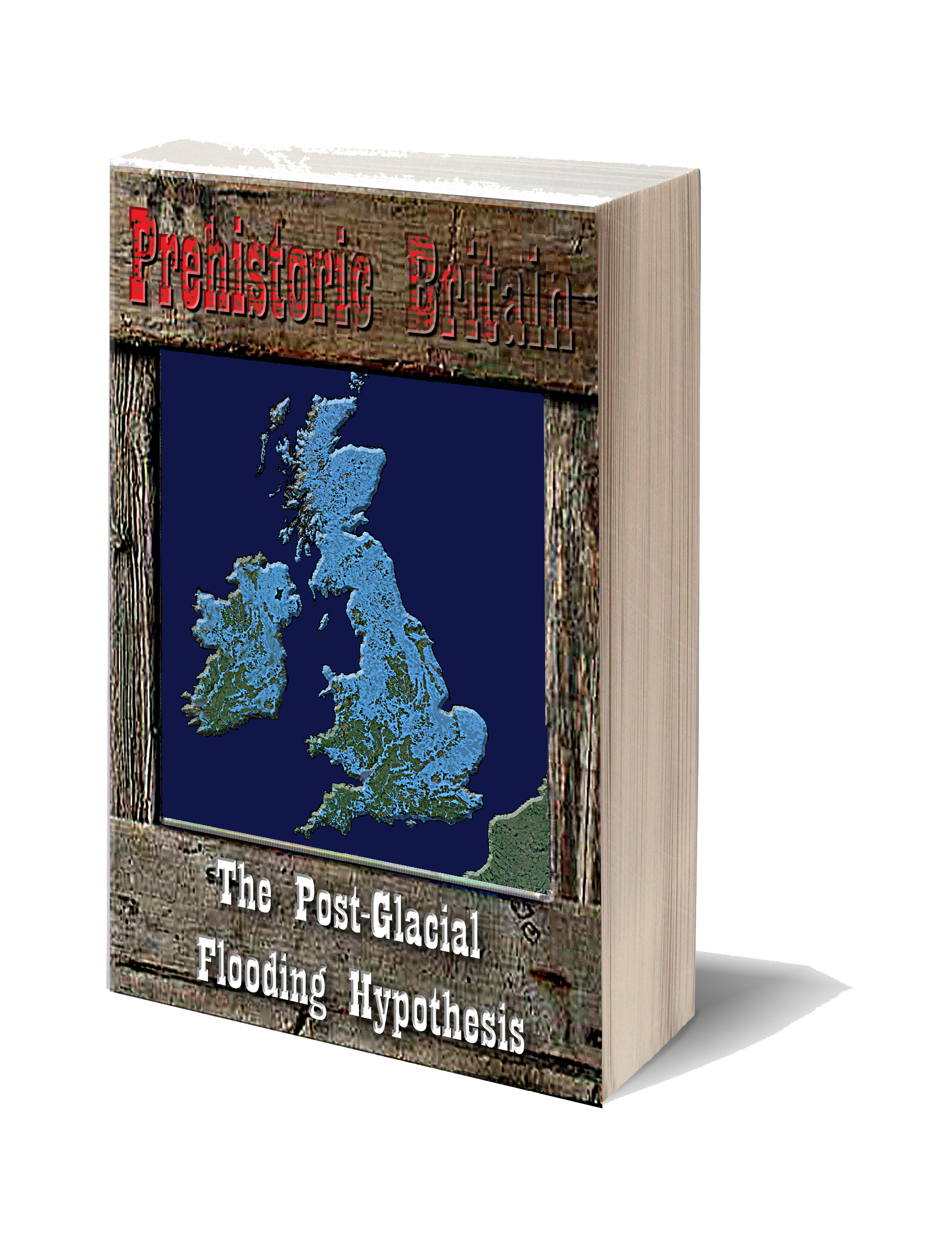
The Post-Glacial Flooding Hypothesis – Flipbook
Unearth the Astonishing Secrets of a Flooded Post-Glacial Britain (Post-Glacial Flooding Hypothesis)
Synopsys
Some twelve millennia in the past, a significant chapter in Earth’s history unfolded as the glaciers from the last Ice Age gracefully retreated, unveiling the foundation of the Britain we recognize today.
For over a staggering 100,000 years, the Pleistocene Epoch held Britain captive beneath the colossal weight of two miles of ice, an immense force that compressed the land, driving it approximately 2000 feet below its original level. In the aftermath of this glacial epoch, the gradual rebound of the land commenced, shaping the contours of the present-day British landscape.
The conventional geological narrative attributes the melting of these glaciers to a warming trend in climatic conditions, resulting in a succession of ‘meltwater pulses.’ However, this explanation falls short of constructing a realistic model that accounts for the comprehensive discharge of meltwater, responsible not only for forming the North and Irish Seas but also for initiating significant sea-level rises that continue to shape our coastlines.
A perusal of any British Geological Society (BGS) map unveils a subterranean network of features, resembling canals and colossal waterways, concealed beneath the visible bedrock, sediments, and superficial deposits. These intricate formations represent the remnants of Palaeochannels from the last ice age, offering a glimpse into the past when rivers surged at their peak discharge levels.
These ‘Dry River Valleys,’ as they are commonly known, manifest on the surface and can be observed in the cliffs and valleys of the South Downs. The distinct concave profiles of these ancient rivers are marked by the remnants of superficial subsoil, comprised of sand, silt, and clay.
However, past geological interpretations have often misidentified these features, failing to recognize their riverine nature and the significance of associated river terraces formed during the Last Glacial Maximum (LGM). The misinterpretation is compounded by the puzzling proximity of sandy silt to contemporary topsoil and the presence of silt and sand at elevations purportedly higher than earlier river terracing. Some geologists have attributed these deposits to ‘windblown Loess,’ suggesting that prevailing winds transported the materials into position rather than the action of past rivers.
This book embarks on a journey to unravel this geological mystery, drawing upon existing scientific evidence documented in peer-reviewed publications and leveraging modern mathematical models. The aim is to provide readers with a comprehensive understanding of the Holocene landscape, empowering archaeologists with valuable insights to uncover fresh discoveries and attain a nuanced comprehension of our intricate history. (Post-Glacial Flooding Hypothesis)
Robert John Langdon (2023) – (Post-Glacial Flooding Hypothesis)
Video
Langdon’s journey was marked by meticulous mapping and years of research, culminating in a hypothesis that would reshape our understanding of prehistoric Britain. He proposed that much of the British Isles had once been submerged in the aftermath of the last ice age, with these ancient sites strategically positioned along the ancient shorelines. His groundbreaking maps offered a fresh perspective, suggesting that Avebury had functioned as a bustling trading hub for our ancient ancestors. This audacious theory challenged the prevailing notion that prehistoric societies were isolated and disconnected, instead highlighting their sophistication in trade and commerce.
In the realm of historical discovery, it is often the audacious thinkers, the mavericks who dare to question established narratives, who propel our understanding forward. Robert John Langdon is undeniably one of these thinkers. With a deep passion for history and an unyielding commitment to his research, he has unearthed a hidden chapter in the story of Avebury—one that transcends the boundaries of time and offers fresh insights into our shared human history.
As Langdon’s trilogy, ‘The Stonehenge Enigma,’ continues to explore these groundbreaking theories, it beckons us to embark on a journey of discovery, to challenge our assumptions, and to embrace the possibility that the past is far more complex and interconnected than we ever imagined. Avebury, with its ancient stones and enigmatic avenues, continues to whisper its secrets to those who dare to listen, inviting us to see history through a new lens—one illuminated by the audacious vision of Robert John Langdon.
(Post-Glacial Flooding Hypothesis)
Book

Further Reading
For more information about British Prehistory and other articles/books, go to our BLOG WEBSITE for daily updates or our VIDEO CHANNEL for interactive media and documentaries. The TRILOGY of books that ‘changed history’ can be found with chapter extracts at DAWN OF THE LOST CIVILISATION, THE STONEHENGE ENIGMA and THE POST-GLACIAL FLOODING HYPOTHESIS. (Post-Glacial Flooding Hypothesis)
Other associated books are also available such as 13 THINGS THAT DON’T MAKE SENSE IN HISTORY and other ‘short’ budget priced books can be found on our AUTHOR SITE. For active discussion on the findings of the TRILOGY and recent LiDAR investigations that is published on our WEBSITE you can join our FACEBOOK GROUP.
(Post-Glacial Flooding Hypothesis)
Other Blogs
1
a
- AI now Supports – Homo Superior
- AI now supports my Post-Glacial Flooding Hypothesis
- Alexander the Great sailed into India – where no rivers exist today
- Ancient Prehistoric Canals – The Vallum
- Ancient Secrets of Althorp – debunked
- Antler Picks built Ancient Monuments – yet there is no real evidence
- Antonine Wall – Prehistoric Canals (Dykes)
- Archaeological ‘pulp fiction’ – has archaeology turned from science?
- Archaeological Pseudoscience
- Archaeology in the Post-Truth Era
- Archaeology: A Bad Science?
- Archaeology: A Harbour for Fantasists?
- Archaeology: Fact or Fiction?
- Archaeology: The Flaws of Peer Review
- Archaeology’s Bayesian Mistake: Stop Averaging the Past
- Are Raised Beaches Archaeological Pseudoscience?
- Atlantis Found: The Mathematical Proof That Plato’s Lost City Was Doggerland
- ATLANTIS: Discovery with Dan Snow Debunked
- Avebury Ditch – Avebury Phase 2
- Avebury Post-Glacial Flooding
- Avebury through time
- Avebury’s great mystery revealed
- Avebury’s Lost Stone Avenue – Flipbook
b
- Battlesbury Hill – Wiltshire
- Beyond Stone and Bone: Rethinking the Megalithic Architects of Northern Europe
- BGS Prehistoric River Map
- Blackhenge: Debunking the Media misinterpretation of the Stonehenge Builders
- Brain capacity (Cro-Magnon Man)
- Brain capacity (Cro-Magnon Man)
- Britain’s First Road – Stonehenge Avenue
- Britain’s Giant Prehistoric Waterways
- British Roman Ports miles away from the coast
c
- Caerfai Promontory Fort – Archaeological Nonsense
- Car Dyke – ABC News PodCast
- Car Dyke – North Section
- CASE STUDY – An Inconvenient TRUTH (Craig Rhos Y Felin)
- Case Study – River Avon
- Case Study – Woodhenge Reconstruction
- Chapter 2 – Craig Rhos-Y-Felin Debunked
- Chapter 2 – Stonehenge Phase I
- Chapter 2 – Variation of the Species
- Chapter 3 – Post Glacial Sea Levels
- Chapter 3 – Stonehenge Phase II
- Chapter 7 – Britain’s Post-Glacial Flooding
- Cissbury Ring through time
- Cro-Magnon Megalithic Builders: Measurement, Biology, and the DNA
- Cro-Magnons – An Explainer
d
- Darwin’s Children – Flipbook
- Darwin’s Children – The Cro-Magnons
- Dawn of the Lost Civilisation – Flipbook
- Dawn of the Lost Civilisation – Introduction
- Digging for Britain – Cerne Abbas 1 of 2
- Digging for Britain Debunked – Cerne Abbas 2
- Digging Up Britain’s Past – Debunked
- DLC Chapter 1 – The Ascent of Man
- Durrington Walls – Woodhenge through time
- Durrington Walls Revisited: Platforms, Fish Traps, and a Managed Mesolithic Landscape
- Dyke Construction – Hydrology 101
- Dykes Ditches and Earthworks
- DYKES of Britain
e
f
g
h
- Hadrian’s Wall – Military Way Hoax
- Hadrian’s Wall – the Stanegate Hoax
- Hadrian’s Wall LiDAR investigation
- Hambledon Hill – NOT an ‘Iron Age Fort’
- Hayling Island Lidar Maps
- Hidden Sources of Ancient Dykes: Tracing Underground Groundwater Fractals
- Historic River Avon
- Hollingsbury Camp Brighton
- Hollows, Sunken Lanes and Palaeochannels
- Homo Superior – Flipbook
- Homo Superior – History’s Giants
- How Lidar will change Archaeology
i
l
m
- Maiden Castle through time
- Mathematics Meets Archaeology: Discovering the Mesolithic Origins of Car Dyke
- Mesolithic River Avon
- Mesolithic Stonehenge
- Minerals found in Prehistoric and Roman Quarries
- Mining in the Prehistoric to Roman Period
- Mount Caburn through time
- Mysteries of the Oldest Boatyard Uncovered
- Mythological Dragons – a non-existent animal that is shared by the World.
o
- Offa’s Dyke Flipbook
- Old Sarum Lidar Map
- Old Sarum Through Time…………….
- On Sunken Lands of the North Sea – Lived the World’s Greatest Civilisation.
- OSL Chronicles: Questioning Time in the Geological Tale of the Avon Valley
- Oswestry LiDAR Survey
- Oswestry through time
- Oysters in Archaeology: Nature’s Ancient Water Filters?
p
- Pillow Mounds: A Bronze Age Legacy of Cremation?
- Post Glacial Flooding – Flipbook
- Prehistoric Burial Practices of Britain
- Prehistoric Canals – Wansdyke
- Prehistoric Canals – Wansdyke
- Prehistoric Canals (Dykes) – Great Chesters Aqueduct (The Vallum Pt. 4)
- Prehistoric Canals (Dykes) – Hadrian’s Wall Vallum (pt 1)
- Prehistoric Canals (Dykes) – Offa’s Dyke (Chepstow)
- Prehistoric Canals (Dykes) – Offa’s Dyke (LiDAR Survey)
- Prehistoric Canals (Dykes) – Offa’s Dyke Survey (End of Section A)
- Prehistoric Canals (Dykes) – Wansdyke (4)
- Prehistoric Canals Wansdyke 2
- Professor Bonkers and the mad, mad World of Archaeology
r
- Rebirth in Stone: Decrypting the Winter Solstice Legacy of Stonehenge
- Rediscovering the Winter Solstice: The Original Winter Festival
- Rethinking Ancient Boundaries: The Vallum and Offa’s Dyke”
- Rethinking Ogham: Could Ireland’s Oldest Script Have Begun as a Tally System?
- Rethinking The Past: Mathematical Proof of Langdon’s Post-Glacial Flooding Hypothesis
- Revolutionising History: Car Dyke Unveiled as Prehistoric & the Launch of FusionBook 360
- Rising Evidence, Falling Rivers: The Real Story of Europe’s First Farmers
- Rivers of the Past Were Higher: A Fresh Perspective on Prehistoric Hydrology
s
- Sea Level Changes
- Section A – NY26SW
- Section B – NY25NE & NY26SE
- Section C – NY35NW
- Section D – NY35NE
- Section E – NY46SW & NY45NW
- Section F – NY46SE & NY45NE
- Section G – NY56SW
- Section H – NY56NE & NY56SE
- Section I – NY66NW
- Section J – NY66NE
- Section K – NY76NW
- Section L – NY76NE
- Section M – NY87SW & NY86NW
- Section N – NY87SE
- Section O – NY97SW & NY96NW
- Section P – NY96NE
- Section Q – NZ06NW
- Section R – NZ06NE
- Section S – NZ16NW
- Section T – NZ16NE
- Section U – NZ26NW & NZ26SW
- Section V – NZ26NE & NZ26SE
- Silbury Avenue – Avebury’s First Stone Avenue
- Silbury Hill
- Silbury Hill / Sanctuary – Avebury Phase 3
- Somerset Plain – Signs of Post-Glacial Flooding
- South Cadbury Castle – Camelot
- Statonbury Camp near Bath – an example of West Wansdyke
- Stone me – the druids are looking the wrong way on Solstice day
- Stone Money – Credit System
- Stone Transportation and Dumb Censorship
- Stonehenge – Monument to the Dead
- Stonehenge Hoax – Dating the Monument
- Stonehenge Hoax – Round Monument?
- Stonehenge Hoax – Summer Solstice
- Stonehenge LiDAR tour
- Stonehenge Phase 1 — Britain’s First Monument
- Stonehenge Phase I (The Stonehenge Landscape)
- Stonehenge Solved – Pythagorean maths put to use 4,000 years before he was born
- Stonehenge Stone Transportation
- Stonehenge Through Time
- Stonehenge, Doggerland and Atlantis connection
- Stonehenge: Discovery with Dan Snow Debunked
- Stonehenge: The Worlds First Computer
- Stonehenge’s The Lost Circle Revealed – DEBUNKED
t
- Ten Reasons Why Car Dyke Blows Britain’s Earthwork Myths Out of the Water
- Ten Things You Didn’t Know About Britain’s Prehistoric Flooded Past
- Ten thousand year old boats found on Northern Europe’s Hillsides
- Ten thousand-year-old boats found on Northern Europe’s Hillsides
- The “Hunter-Gatherer” Myth: Why It’s Time to Bury This Outdated Term
- The Ancient Mariners – Flipbook
- The Ancient Mariners – Prehistoric seafarers of the Mesolithic
- The Beringian Migration Myth: Why the Peopling of the Americas by Foot is Mathematically and Logistically Impossible
- The Bluestone Enigma
- The Cro-Magnon Cover-Up: How DNA and PR Labels Erased Our Real Ancestry
- The Dolmen and Long Barrow Connection
- The Durrington Walls Hoax – it’s not a henge?
- The Dyke Myth Collapses: Excavation and Dating Prove Britain’s Great Dykes Are Prehistoric Canals
- The First European Smelted Bronzes
- The Fury of the Past: Natural Disasters in Historical and Prehistoric Britain
- The Giant’s Graves of Cumbria
- The Giants of Prehistory: Cro-Magnon and the Ancient Monuments
- The Great Antler Pick Hoax
- The Great Chichester Hoax – A Bridge too far?
- The Great Dorchester Aqueduct Hoax
- The Great Farming Hoax – (Einkorn Wheat)
- The Great Farming Migration Hoax
- The Great Hadrian’s Wall Hoax
- The Great Iron Age Hill Fort Hoax
- The Great Offa’s Dyke Hoax
- The Great Prehistoric Migration Hoax
- The Great Stone Transportation Hoax
- The Great Stonehenge Hoax
- The Great Wansdyke Hoax
- The Henge and River Relationship
- The Logistical Impossibility of Defending Maiden Castle
- The Long Barrow and Dolman Enigma
- The Long Barrow Mystery
- The Long Barrow Mystery: Unravelling Ancient Connections
- The Lost Island of Avalon – revealed
- The Maiden Way Hoax – A Closer Look at an Ancient Road’s Hidden History
- The Maths – LGM total ice volume
- The Mystery of Pillow Mounds: Are They Really Medieval Rabbit Warrens?
- The Old Sarum Hoax
- The Oldest Boat Yard in the World found in Wales
- The Perils of Paradigm Shifts: Why Unconventional Hypotheses Get Branded as Pseudoscience
- The Post-Glacial Flooding Hypothesis – Flipbook
- The Post-Glacial Flooding Theory
- The Problem with Hadrian’s Vallum
- The Rise of the Cro-Magnon (Homo Superior)
- The Roman Military Way Hoax
- The Silbury Hill Lighthouse?
- The Stonehenge Avenue
- The Stonehenge Avenue
- The Stonehenge Code: Unveiling its 10,000-Year-Old Secret
- The Stonehenge Enigma – Flipbook
- The Stonehenge Enigma: What Lies Beneath? – Debunked
- The Stonehenge Hoax – Bluestone Quarry Site
- The Stonehenge Hoax – Flipbook
- The Stonehenge Hoax – Moving the Bluestones
- The Stonehenge Hoax – Periglacial Stripes
- The Stonehenge Hoax – Station Stones
- The Stonehenge Hoax – Stonehenge’s Location
- The Stonehenge Hoax – The Ditch
- The Stonehenge Hoax – The Slaughter Stone
- The Stonehenge Hoax – The Stonehenge Layer
- The Stonehenge Hoax – Totem Poles
- The Stonehenge Hoax – Woodhenge
- The Stonehenge Hospital
- The Subtropical Britain Hoax
- The Troy, Hyperborea and Atlantis Connection
- The Vallum @ Hadrian’s Wall – it’s Prehistoric!
- The Vallum at Hadrian’s Wall (Summary)
- The Woodhenge Hoax
- Three Dykes – Kidland Forest
- Top Ten misidentified Fire Beacons in British History
- Troy Debunked
- TSE – DVD Barrows
- TSE DVD – An Inconvenient Truth
- TSE DVD – Antler Picks
- TSE DVD – Avebury
- TSE DVD – Durrington Walls & Woodhenge
- TSE DVD – Dykes
- TSE DVD – Epilogue
- TSE DVD – Stonehenge Phase I
- TSE DVD – Stonehenge Phase II
- TSE DVD – The Post-Glacial Hypothesis
- TSE DVD Introduction
- TSE DVD Old Sarum
- Twigs, Charcoal, and the Death of the Saxon Dyke Myth
w
- Wansdyke – Short Film
- Wansdyke East – Prehistoric Canals
- Wansdyke Flipbook
- Wansdyke LiDAR Flyover
- Wansdyke: A British Frontier Wall – ‘Debunked’
- Was Columbus the first European to reach America?
- What Archaeology Missed Beneath Stonehenge
- White Sheet Camp
- Why a Simple Fence Beats a Massive Dyke (and What That Means for History)
- Windmill Hill – Avebury Phase 1
- Winter Solstice – Science, Propaganda and Indoctrination
- Woodhenge – the World’s First Lighthouse?


Pingback: Wansdyke LiDAR Flyover - Prehistoric Britain
Pingback: Antonine Wall - Prehistoric Canals (Dykes) - Prehistoric Britain
Pingback: Mesolithic Stonehenge - Prehistoric Britain
Pingback: Why a Simple Fence Beats a Massive Dyke (and What That Means for History) - Prehistoric Britain
Pingback: Case Study - River Avon - Prehistoric Britain
Pingback: Extreme Weather & Ancient Subterranean Shelters - Prehistoric Britain
Pingback: Blackhenge: Debunking the Media misinterpretation of the Stonehenge Builders - Prehistoric Britain
Pingback: Archaeology: The Flaws of Peer Review - Prehistoric Britain
Pingback: Prehistoric Canals (Dykes) - Offa's Dyke (Chepstow) - Prehistoric Britain
Pingback: Newgrange - Monument or Disneyland? - Prehistoric Britain
Pingback: Prehistoric Canals (Dykes) - Wansdyke (4) - Prehistoric Britain
Pingback: The Rivers of the Past were Higher – an Idiot’s Guide - Prehistoric Britain
Pingback: From the Rhône to Wansdyke: The Case for a Standardised Canal Boat in Prehistoric Britain - Prehistoric Britain
Pingback: Britain's Giant Prehistoric Waterways - Prehistoric Britain
Pingback: Dyke Construction - Hydrology 101 - Prehistoric Britain
Pingback: Ten Reasons Why Car Dyke Blows Britain’s Earthwork Myths Out of the Water - Prehistoric Britain
Pingback: Stonehenge Hoax – Summer Solstice - Prehistoric Britain
Pingback: The Stonehenge Code: Unveiling its 10,000-Year-Old Secret - Prehistoric Britain
Pingback: Silbury Avenue - Avebury's First Stone Avenue - Prehistoric Britain
Pingback: Rethinking The Past: Mathematical Proof of Langdon's Post-Glacial Flooding Hypothesis - Prehistoric Britain
Pingback: The “Hunter-Gatherer” Myth: Why It’s Time to Bury This Outdated Term - Prehistoric Britain
Pingback: The Beringian Migration Myth: Why the Peopling of the Americas by Foot is Mathematically and Logistically Impossible - Prehistoric Britain
Pingback: Ten Things You Didn’t Know About Britain’s Prehistoric Flooded Past - Prehistoric Britain
Pingback: - Prehistoric Britain
Pingback: Stonehenge Phase 1 — Britain's First Monument - Prehistoric Britain
Pingback: Cro-Magnons - An Explainer - Prehistoric Britain
Pingback: Archaeology’s Bayesian Mistake: Stop Averaging the Past - Prehistoric Britain
Pingback: The Great Farming Migration Hoax - Prehistoric Britain
Pingback: The Subtropical Britain Hoax - Prehistoric Britain
Pingback: Atlantis Found: The Mathematical Proof That Plato’s Lost City Was Doggerland - Prehistoric Britain
Pingback: The Perils of Paradigm Shifts: Why Unconventional Hypotheses Get Branded as Pseudoscience - Prehistoric Britain
Pingback: Prehistoric Canals - Wansdyke - Prehistoric Britain
Pingback: The Problem with Hadrian's Vallum - Prehistoric Britain
Pingback: Stonehenge Solved - Pythagorean maths put to use 4,000 years before he was born - Prehistoric Britain
Pingback: Caerfai Promontory Fort - Archaeological Nonsense - Prehistoric Britain
Pingback: Stonehenge: The Worlds First Computer - Prehistoric Britain
Pingback: Rising Evidence, Falling Rivers: The Real Story of Europe’s First Farmers - Prehistoric Britain
Pingback: First Hillforts, Then Mottes — Now Roman Forts? A Century of Misidentification - Prehistoric Britain
Pingback: The Dyke Myth Collapses: Excavation and Dating Prove Britain’s Great Dykes Are Prehistoric Canals - Prehistoric Britain
Pingback: Cro-Magnon Megalithic Builders: Measurement, Biology, and the DNA - Prehistoric Britain
Pingback: Durrington Walls Revisited: Platforms, Fish Traps, and a Managed Mesolithic Landscape - Prehistoric Britain
Pingback: The Lost Island of Avalon – revealed - Prehistoric Britain
Pingback: What Archaeology Missed Beneath Stonehenge - Prehistoric Britain
Pingback: The Long Barrow and Dolman Enigma - Prehistoric Britain