Prehistoric Hampshire Canals (Dykes)
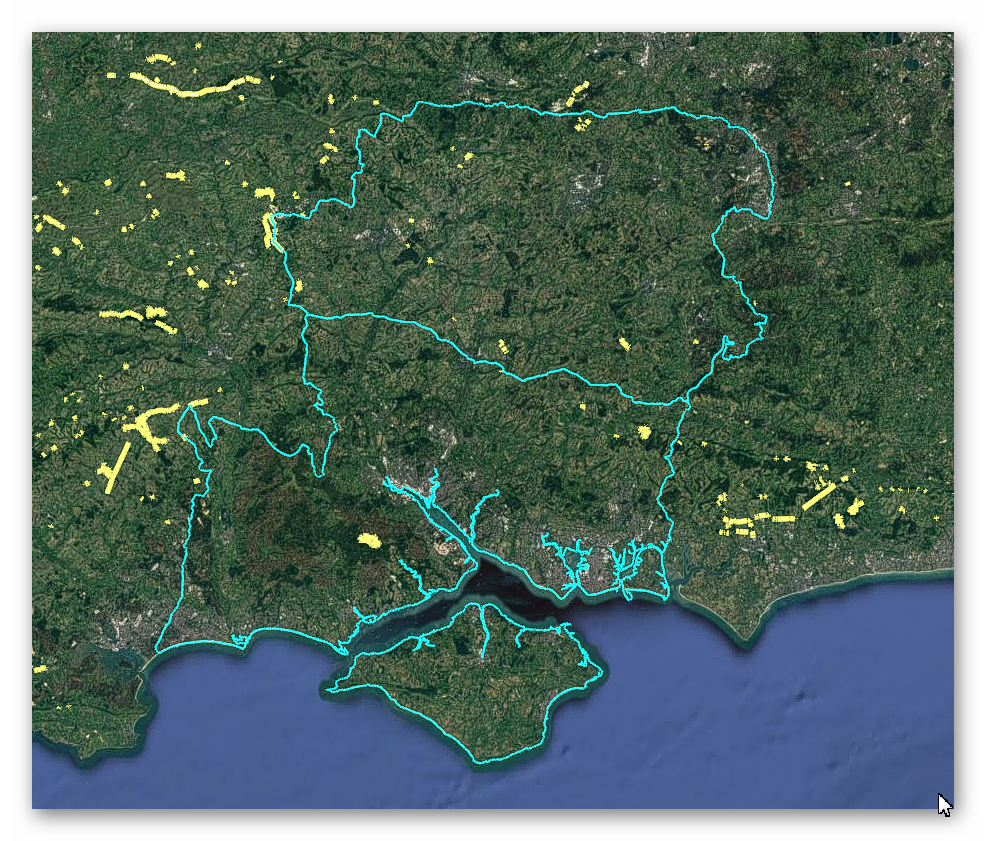
GE Map of Prehistoric Hampshire Canals (Dykes)

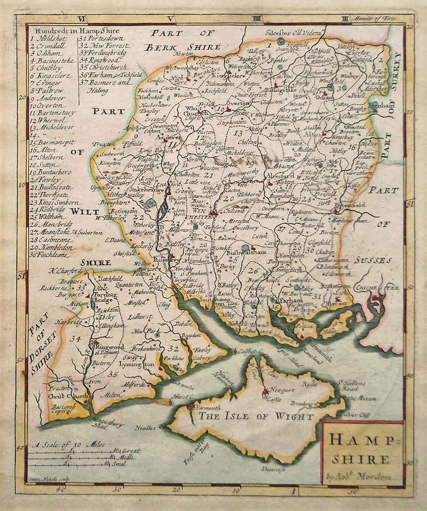
Old Map

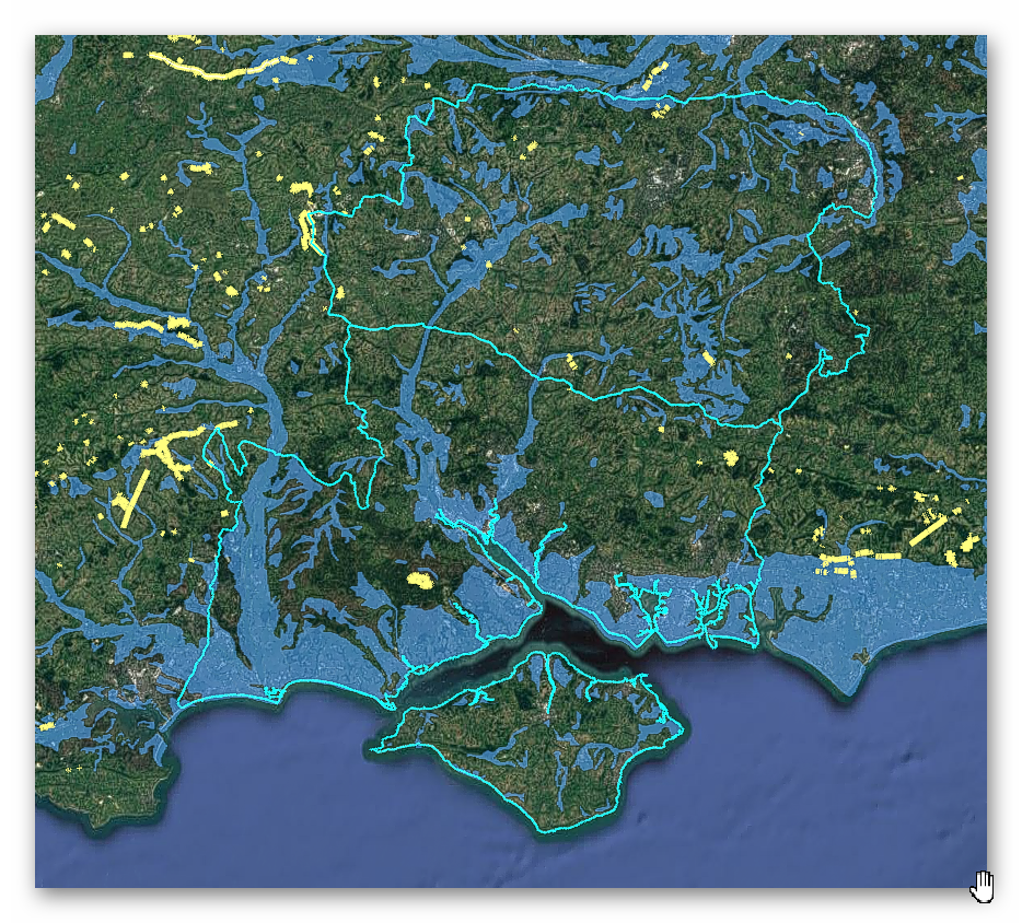
Geological Landscape

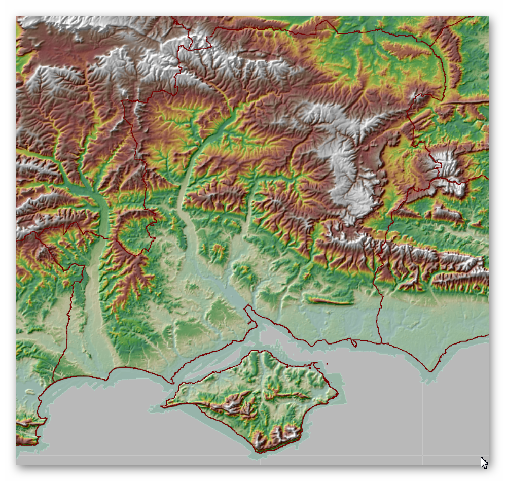
Landscape/Terrain

Database of DYKES (Linear Earthworks) in Hampshire
(Click the ‘HE Entry Ref: Number’ (if blue) for more details and Maps)
| Name | HE Entry Ref: | NGF | Length (m) | Overall Width (m) | Ditch Width (m) | Bank Width (m) |
|---|---|---|---|---|---|---|
| The Dykes | 1001782 | SU 69206 31085 | ||||
| Linear earthwork known as the Festaen Dic | 1001806 | SU 79658 58531 | ||||
| Worthy Down ditch | 1001907 | SU 45956 34805 | ||||
| Alresford Drive earthworks, Avington | 1001910 | SU 52358 31835 | ||||
| Old Pound Copse earthwork | 1001917 | SU 39632 44650 | ||||
| Grim's Ditch: Old Lodge Copse to Toyd Clump | 1003457 | SU 06059 22154 | ||||
| Boundary earthwork and barrow at Sheepbridge | 1003562 | SU 63327 23022 | ||||
| Grim's Ditch | 1004753 | SU 11368 23288 | ||||
| Leydene Ditches | 1005542 | SU 67906 19351 | ||||
| A hilltop enclosed by Iron Age cross dykes, an associated field system and Bronze Age barrows at Butser Hill | 1008692 | SU 71652 19141 | ||||
| Roman road along the south side of Vernditch Chase: part of the Roman road between Sorviodunum (Old Sarum) and Vindocladia (Badbury) | 1008707 | SU 03890 20628 | ||||
| Flex Ditch | 1008725 | SU 62620 61708 | ||||
| Linear earthwork in Gravelpit Copse and near Byes Lane, south west of Silchester | 1008727 | SU 62223 60646 | ||||
| Linear earthwork in Bridle's Copse, south west of Silchester | 1008728 | SU 62512 60497 | ||||
| Park pale known as Bishop's Dyke, and a Bronze Age bowl barrow, to the south and west of Furzy Brow | 1009324 | SU 34258 05012 | ||||
| Two linear earthworks, two barrows and Iron Age and Romano-British settlements on Tidpit Common Down | 1010762 | SU 06506 18090 | ||||
| Two linear earthworks in Vernditch Chase | 1010763 | SU 03808 21060 | ||||
| Knoll Camp hillfort, cross dyke, linear earthwork and hollow ways near Damerham Knoll | 1010764 | SU 09549 18844 | ||||
| Bowl barrow 520m north east of the shoulder angle of Bokerley Dyke on Martin Down | 1010869 | SU 03899 20103 | ||||
| Bowl barrow 210m north east of the junction of Grim's Ditch and Bokerley Dyke on Blagdon Hill | 1011003 | SU 05783 18194 | ||||
| Bowl barrow 120m north east of the junction of Grim's Ditch and Bokerley Dyke on Blagdon Hill | 1011004 | SU 05736 18117 | ||||
| Three adjoining linear earthworks and three bowl barrows north of Bokerley Dyke on Martin Down | 1011006 | SU 04250 20719 | ||||
| A linear earthwork and two bowl barrows east of Bokerley Dyke on Blagdon Hill | 1011007 | SU 05628 18174 | ||||
| Three sections of a linear earthwork between Churchlane Copse and Early Bridge Copse, south of Silchester | 1011956 | SU 63650 61440 | ||||
| A cross dyke and bowl barrow on the northern spur of Beacon Hill | 1012033 | SU 45593 57624 | ||||
| An unfinished hillfort, a saucer barrow, a disc barrow and sections of two linear earthworks on Ladle Hill | 1012038 | SU 47633 56628 | ||||
| A section of a linear earthwork south west of Great Litchfield Down | 1012039 | SU 46596 55386 | ||||
| Three associated linear earthworks on Martin Down | 1012137 | SU 05939 18396 | ||||
| Roman road north east of Vernditch Chase: part of the Roman road between Sorviodunum (Old Sarum) and Vindocladia (Badbury) | 1013203 | SU 04922 21777 | ||||
| Devil's Ditch within Pepper Hill Firs | 1015677 | SU 40080 47998 | ||||
| The Andyke, Bransbury | 1015678 | SU 42487 42797 | ||||
| Flint mines, linear boundary and two bowl barrows at Martin's Clump, Porton Down | 1017168 | SU 25001 38715 | ||||
| Cross dyke 720m west of Cheesefoot Head | 1020320 | SU 52415 27843 | ||||
| Round barrow cemetery, Roman road and hollow ways 200m south west of Woolmer Cottages | 1020502 | SU 78467 31999 |
Dykes Ditches and Earthworks
Indeed, the modern term “dyke” or “dijk” can be traced back to its Dutch origins. As early as the 12th century, the construction of Dykes in the Netherlands was a well-established practice. One remarkable example of their ingenuity is the Westfriese Omringdijk, stretching an impressive 126 kilometres (78 miles), completed by 1250. This Dyke was formed by connecting existing older ‘dykes’, showcasing the Dutch mastery in managing their aquatic landscape.
The Roman chronicler Tacitus even provides an intriguing historical account of the Batavi, a rebellious people who employed a unique defence strategy during the year AD 70. They punctured the Dykes daringly, deliberately flooding their land to thwart their enemies and secure their retreat. This historical incident highlights the vital role Dykes played in the region’s warfare and water management.
Originally, the word “dijk” encompassed both the trench and the bank, signifying a comprehensive understanding of the Dyke’s dual nature – as both a protective barrier and a channel for water control. This multifaceted concept reflects the profound connection between the Dutch people and their battle against the ever-shifting waters that sought to reclaim their land.
The term “dyke” evolved as time passed, and its usage spread beyond the Dutch borders. Today, it represents not only a symbol of the Netherlands’ engineering prowess but also a universal symbol of human determination in the face of the relentless forces of nature. The legacy of these ancient Dykes lives on, a testament to the resilience and innovation of those who shaped the landscape to withstand the unyielding currents of time.
Upon studying archaeology, whether at university or examining detailed ordinance survey maps, one cannot help but encounter peculiar earthworks scattered across the British hillsides. Astonishingly, these enigmatic features often lack a rational explanation for their presence and purpose. Strangely enough, these features are frequently disregarded in academic circles, brushed aside, or provided with flimsy excuses for their existence. The truth is, these earthworks defy comprehension unless we consider overlooked factors at play.
One curious observation revolves around the term “Dyke,” inherently linked to water. It seems rather peculiar to apply such a word to an earthwork atop a hill unless an ancestral history has imparted its actual function through the ages. Let us consider the celebrated “Offa’s Dyke,” renowned for its massive linear structure, meandering along some of the present boundaries between England and Wales. This impressive feat stands as a testament to the past, seemingly demarcating the realms of the Anglian kingdom of Mercia and the Welsh kingdom of Powys during the 8th century.
However, delving further into the evidence and historical accounts challenges this seemingly straightforward explanation. Roman historian Eutropius, in his work “Historiae Romanae Breviarium”, penned around 369 AD, mentions a grand undertaking by Septimius Severus, the Roman Emperor, from 193 AD to 211 AD. In his pursuit of fortifying the conquered British provinces, Severus constructed a formidable wall stretching 133 miles from coast to coast.
Yet, intriguingly, none of the known Roman defences match this precise length. Hadrian’s Wall, renowned for its defensive prowess, spans a mere 70 miles. Could Eutropius have referred to Offa’s Dyke, which bears remarkable similarity to the Roman practice of initially erecting banks and ditches for defence?
For more information click HERE
Further Reading
For information about British Prehistory, visit www.prehistoric-britain.co.uk for the most extensive archaeology blogs and investigations collection, including modern LiDAR reports. This site also includes extracts and articles from the Robert John Langdon Trilogy about Britain in the Prehistoric period, including titles such as The Stonehenge Enigma, Dawn of the Lost Civilisation and the ultimate proof of Post Glacial Flooding and the landscape we see today.
Robert John Langdon has also created a YouTube web channel with over 100 investigations and video documentaries to support his classic trilogy (Prehistoric Britain). He has also released a collection of strange coincidences that he calls ‘13 Things that Don’t Make Sense in History’ and his recent discovery of a lost Stone Avenue at Avebury in Wiltshire called ‘Silbury Avenue – the Lost Stone Avenue’.
Langdon has also produced a series of ‘shorts’, which are extracts from his main body of books:
For active discussions on the findings of the TRILOGY and recent LiDAR investigations that are published on our WEBSITE, you can join our and leave a message or join the debate on our Facebook Group.
