Prehistoric Lincolnshire Canals (Dykes)
GE Map of Prehistoric Lincolnshire Canals (Dykes)

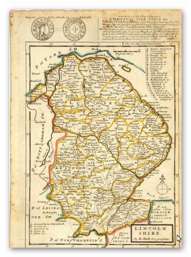
Old Map

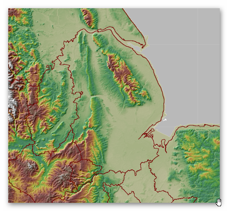
Geological Landscape

Landscape/Terrain

Database of DYKES (Linear Earthworks) in Lincolnshire
(Click the ‘HE Entry Ref: Number’ (if blue) for more details and Maps)
| Name | HE Entry Ref: | NGF | Length (m) | Overall Width (m) | Ditch Width (m) | Bank Width (m) |
|---|---|---|---|---|---|---|
| Car Dyke between Washingborough and Common Square | 1004923 | TF 03932 70539 | ||||
| Car Dyke in Nocton Wood | 1004924 | TF 08596 64284 | ||||
| Car Dyke at Linwood Hall | 1004925 | TF 12272 60621 | ||||
| Car Dyke W of Martin Wood | 1004926 | TF 12560 58848 | ||||
| Dogdyke Pumping Station | 1004942 | TF2057455826 | ||||
| Car Dyke, Roman canal at Helpringham | 1004946 | TF 14663 39102 | ||||
| Car Dyke, Roman canal N of Washingborough | 1004947 | TF 02384 70757 | ||||
| Car Dyke, Roman canal adjoining Glebe Farm | 1004948 | TF 04096 70567 | ||||
| Car Dyke, S of Dyke | 1004959 | TF 10505 21709 | ||||
| Car Dyke | 1004960 | TF 12684 58315 | ||||
| Roman wall and ditch on Motherby Hill | 1004970 | SK 97360 71689 | ||||
| Roman wall, ditch and gate adjoining and under The Park | 1004986 | SK 97314 71416 | ||||
| Newport Earthworks | 1005025 | SK 97538 72902 | ||||
| Section of Roman town wall and ditch N of East Bight | 1005057 | SK 97771 72115 | ||||
| Section of Roman town wall S of the Bishop's Palace | 1005059 | SK 97823 71655 | ||||
| Section of Roman town wall and ditch N of Eastgate | 1005479 | SK 97858 72020 | ||||
| Car Dyke SE of Blankney Wood | 1005484 | TF 11741 61790 | ||||
| Medieval boundary earthworks at Queen's Bank, 100m south east of Providence House | 1009980 | TF 29926 14147 | ||||
| Earthworks of Car Dyke in Park Wood, 175m east of King Street (A15) | 1009999 | TF 10522 16116 | ||||
| Boundary cross, Old Fen Dike | 1010672 | TF 38103 17293 | ||||
| Neolithic long barrow 290m south of Cowdyke Plantation | 1013906 | TF 15137 94594 | ||||
| Castle Dyke moated site | 1019097 | TF 00801 14255 |
Dykes Ditches and Earthworks
Indeed, the modern term “dyke” or “dijk” can be traced back to its Dutch origins. As early as the 12th century, the construction of Dykes in the Netherlands was a well-established practice. One remarkable example of their ingenuity is the Westfriese Omringdijk, stretching an impressive 126 kilometres (78 miles), completed by 1250. This Dyke was formed by connecting existing older ‘dykes’, showcasing the Dutch mastery in managing their aquatic landscape.
The Roman chronicler Tacitus even provides an intriguing historical account of the Batavi, a rebellious people who employed a unique defence strategy during the year AD 70. They punctured the Dykes daringly, deliberately flooding their land to thwart their enemies and secure their retreat. This historical incident highlights the vital role Dykes played in the region’s warfare and water management.
Originally, the word “dijk” encompassed both the trench and the bank, signifying a comprehensive understanding of the Dyke’s dual nature – as both a protective barrier and a channel for water control. This multifaceted concept reflects the profound connection between the Dutch people and their battle against the ever-shifting waters that sought to reclaim their land.
The term “dyke” evolved as time passed, and its usage spread beyond the Dutch borders. Today, it represents not only a symbol of the Netherlands’ engineering prowess but also a universal symbol of human determination in the face of the relentless forces of nature. The legacy of these ancient Dykes lives on, a testament to the resilience and innovation of those who shaped the landscape to withstand the unyielding currents of time.
Upon studying archaeology, whether at university or examining detailed ordinance survey maps, one cannot help but encounter peculiar earthworks scattered across the British hillsides. Astonishingly, these enigmatic features often lack a rational explanation for their presence and purpose. Strangely enough, these features are frequently disregarded in academic circles, brushed aside, or provided with flimsy excuses for their existence. The truth is, these earthworks defy comprehension unless we consider overlooked factors at play.
One curious observation revolves around the term “Dyke,” inherently linked to water. It seems rather peculiar to apply such a word to an earthwork atop a hill unless an ancestral history has imparted its actual function through the ages. Let us consider the celebrated “Offa’s Dyke,” renowned for its massive linear structure, meandering along some of the present boundaries between England and Wales. This impressive feat stands as a testament to the past, seemingly demarcating the realms of the Anglian kingdom of Mercia and the Welsh kingdom of Powys during the 8th century.
However, delving further into the evidence and historical accounts challenges this seemingly straightforward explanation. Roman historian Eutropius, in his work “Historiae Romanae Breviarium”, penned around 369 AD, mentions a grand undertaking by Septimius Severus, the Roman Emperor, from 193 AD to 211 AD. In his pursuit of fortifying the conquered British provinces, Severus constructed a formidable wall stretching 133 miles from coast to coast.
Yet, intriguingly, none of the known Roman defences match this precise length. Hadrian’s Wall, renowned for its defensive prowess, spans a mere 70 miles. Could Eutropius have referred to Offa’s Dyke, which bears remarkable similarity to the Roman practice of initially erecting banks and ditches for defence?
For more information click HERE
Further Reading
For information about British Prehistory, visit www.prehistoric-britain.co.uk for the most extensive archaeology blogs and investigations collection, including modern LiDAR reports. This site also includes extracts and articles from the Robert John Langdon Trilogy about Britain in the Prehistoric period, including titles such as The Stonehenge Enigma, Dawn of the Lost Civilisation and the ultimate proof of Post Glacial Flooding and the landscape we see today.
Robert John Langdon has also created a YouTube web channel with over 100 investigations and video documentaries to support his classic trilogy (Prehistoric Britain). He has also released a collection of strange coincidences that he calls ‘13 Things that Don’t Make Sense in History’ and his recent discovery of a lost Stone Avenue at Avebury in Wiltshire called ‘Silbury Avenue – the Lost Stone Avenue’.
Langdon has also produced a series of ‘shorts’, which are extracts from his main body of books:
For active discussions on the findings of the TRILOGY and recent LiDAR investigations that are published on our WEBSITE, you can join our and leave a message or join the debate on our Facebook Group.
