Prehistoric Shropshire Canals (Dykes)
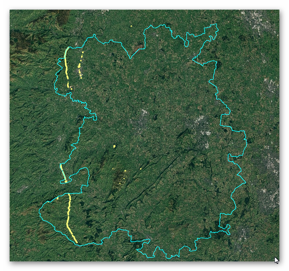
GE Map of Prehistoric Shropshire Canals (Dykes)

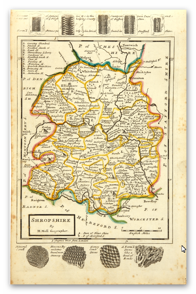
Old Map

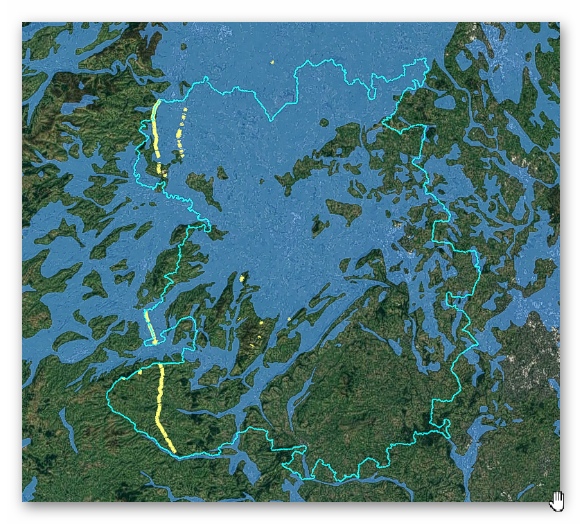
Geological Landscape

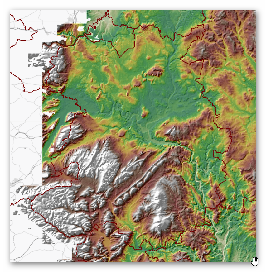
Landscape/Terrain

Database of DYKES (Linear Earthworks) in Shropshire
(Click the ‘HE Entry Ref: Number’ (if blue) for more details and Maps)
| Name | HE Entry Ref: | NGF | Length (m) | Overall Width (m) | Ditch Width (m) | Bank Width (m) |
|---|---|---|---|---|---|---|
| Offa's Dyke: section 550yds (500m) long, on Bakers Hill | 1002933 | SJ 25286 31648 | ||||
| Offa's Dyke: section 2/3 mile (1170m) long, N from southern boundary of Rownal Covert | 1003013 | SO 23234 98771 | ||||
| Offa's Dyke: section 360yds (330m) long, Llynclys Hill | 1003014 | SJ 26995 23611 | ||||
| Offa's Dyke: section 300yds (270m) long, N of Pentre-Shannel | 1003019 | SJ 25648 28001 | ||||
| Upper Short Ditch Also in Powys: Wales | 1003244 | SO 19238 86927 | ||||
| Offa's Dyke: section 1600yds (1460m) long, N from St John the Baptist's Church to River Unk | 1003246 | SO 26289 88355 | ||||
| Offa's Dyke: section one mile 750yds (2290m) from Dudston Covert to a point 300yds (274m) N of Lack Brook Also in Powys: Wales | 1003797 | SO 24229 95679 | ||||
| Offa's Dyke: section one mile 1000yds (2520m) long, N of Llanforda Mill | 1004766 | SJ 25451 28726 | ||||
| Offa's Dyke: section 380m west of Pottery Cottages | 1004767 | SJ2578527498 | ||||
| Offa's Dyke: section 220yds (200m) long, N from Royal Oak Inn, Treflach Wood | 1004768 | SJ 25935 25613 | ||||
| Offa's Dyke: section 330yds (300m) S from Treflach Wood | 1004769 | SJ 25816 25193 | ||||
| Offa's Dyke: section 1/2 mile (800m) long, SE from county boundary to River Unk Also in Powys: Wales | 1004777 | SO 25997 89119 | ||||
| Offa's Dyke: section 200yds (180m) long, at Careg-y-Big | 1006238 | SJ 25263 32280 | ||||
| Three Roman camps NW of Brompton Mill including tumulus and section of Offa's Dyke | 1006247 | SO 24956 93423 | ||||
| Offa's Dyke: section 400yds (370m) long, E of Llawnt | 1006250 | SJ 25534 30897 | ||||
| Offa's Dyke: section NW of Ditches Farm Also in Powys: Wales | 1006257 | SO 24758 94156 | ||||
| Offa's Dyke: section 400yds (370m) long S of Rownal Covert | 1006258 | SO 23457 97624 | ||||
| Offa's Dyke: two sections running 400yds (370m) S of Camlad Stream Also in Powys: Wales | 1006259 | SO 23213 98939 | ||||
| Offa's Dyke: section 200yds (180m) long, S of The Royal Oak Inn | 1006260 | SJ 25884 25315 | ||||
| Offa's Dyke: section 50yds (45m) long, SW of Crane Rock | 1006261 | SJ2593126030 | ||||
| Offa's Dyke: section 170m south-east of Fron | 1006262 | SJ2591627065 | ||||
| Offa's Dyke: section 410m long, E of Llawnt | 1006263 | SJ 25393 31173 | ||||
| Offa's Dyke: section 250yds (230m) long, S of Careg-y-Big | 1006264 | SJ 25281 32011 | ||||
| Offa's Dyke: section 300yds (270m) long, S of Pen-y-Bryn Also in Clwyd: Wales | 1006265 | SJ 26196 37328 | ||||
| Offa's Dyke: section 1300yds (1190m) long, N from Careg-y-Big | 1006266 | SJ 25189 32858 | ||||
| Offa's Dyke: section 430yds (390m) in length S of Chirbury-Montgomery road | 1006271 | SO 23596 97285 | ||||
| Bowl barrow on Grindle Nills Hill, the northern of two 400m south-east of Barrister's Plain cross dyke. | 1007351 | SO 42900 92442 | ||||
| Bowl barrow on Grindle Nills Hill, the southern of two 400m south-east of Barrister's Plain cross dyke. | 1007352 | SO 42858 92404 | ||||
| Cross-dyke on Ratlinghope Hill, 740m north of Brow Farm | 1007699 | SO 40355 97520 | ||||
| Cross-dyke on Barrister's Plain, 800m south east of Narnell's Rock | 1007703 | SO 42594 92742 | ||||
| Cross-dyke at Devil's Mouth, west of Burway Hill | 1007704 | SO 43966 94232 | ||||
| Cross dyke and hut platform on the summit of The Lawley, 100m south west of OS trig pillar. | 1008490 | SO 49439 97408 | ||||
| Cross-dyke, field bank, ridge and furrow and hut structures 400m south of High Park House | 1009316 | SO 44372 96765 | ||||
| Motte and bailey castle and line of Offa's Dyke adjacent to Brompton Mill | 1013496 | SO 25108 93153 | ||||
| Old Oswestry hillfort, and two adjacent sections of Wat's Dyke | 1014899 | SJ 29574 31019 | ||||
| Bryn-y-Castell and a section of Wat's Dyke adjacent to Preeshenlle United Reformed Church | 1019835 | SJ 30434 34061 | ||||
| Earl's Hill Camp: a small multivallate hillfort and an adjacent cross dyke on Pontesford Hill | 1020152 | SJ 40837 04670 | ||||
| Wat's Dyke: 140m long section, 370m south west of Gobowen Station | 1020559 | SJ 30167 33080 | ||||
| Wat's Dyke: 180m long section, 170m east of Pentre-wern | 1020560 | SJ 30122 32898 | ||||
| Wat's Dyke: 110m long section, 620m south east of Henlle Home Farm | 1020561 | SJ 30606 34854 | ||||
| Wat's Dyke: section 350m long, 540m east of Weston Farm | 1020562 | SJ 30005 28129 | ||||
| The Lower Short Ditch | 1020563 | SO 22289 88215 | ||||
| Wat's Dyke:80m long section and adjacent cultivation terraces 540m east of Oswestry Castle | 1020564 | SJ 29600 29875 | ||||
| Wat's Dyke, 490m long section, immediately north and south of Preeshenelle Bridge | 1020615 | SJ 30791 35599 | ||||
| Wat's Dyke, 380m long section, immediately east of the Sewage Works | 1020616 | SJ 30209 27309 | ||||
| Wat's Dyke, 420m long section, 190m west of the junction between Preeshenlle Lane and St Martin's Road | 1020617 | SJ 30487 34294 | ||||
| Wat's Dyke: 365m long section, extending from 45m north east of Gate House on Shrewsbury Road | 1020618 | SJ 29793 28978 | ||||
| Wat's Dyke: 375m long section immediately south of Middleton Road and west of Laburnum Drive | 1020619 | SJ 29679 29344 | ||||
| Offa's Dyke: section 430m north east of Middle Knuck Farm | 1020896 | SO 26217 86974 | ||||
| Offa's Dyke: section 400m east of Cwm Farm | 1020897 | SO 26130 85471 | ||||
| Offa's Dyke: section 575m north west of Myndtown | 1020898 | SO 25914 84466 | ||||
| Offa's Dyke: section 175m east of Cefn Bronydd | 1020899 | SO 25828 83822 | ||||
| Offa's Dyke: section 730m south east of The Yew Tree | 1020900 | SO 25687 82141 | ||||
| Offa's Dyke: section 400m south west of Springhill Farm | 1020901 | SO 25389 80431 | ||||
| Offa's Dyke: section on the western slope of Llanfair Hill, 1.4km south west of Burfield | 1020902 | SO 25401 78627 | ||||
| Offa's Dyke: section 890m north west and 320m west of Little Selley | 1020903 | SO 26244 77230 | ||||
| Offa's Dyke: section 400m north and 170m east of Selley Hall | 1020904 | SO 26605 76641 | ||||
| Offa's Dyke: section 90m south of Brynorgan | 1020905 | SO 26807 76247 | ||||
| Offa's Dyke: section 650m east of Cwm-sanaham | 1020906 | SO 27205 75470 | ||||
| Offa's Dyke: section 475m north east of Nether Skyborry | 1020907 | SO 27983 74118 | ||||
| Offa's Dyke: section 90m east of Ty Gwyn | 1020948 | SJ 25931 24378 |
Dykes Ditches and Earthworks
Indeed, the modern term “dyke” or “dijk” can be traced back to its Dutch origins. As early as the 12th century, the construction of Dykes in the Netherlands was a well-established practice. One remarkable example of their ingenuity is the Westfriese Omringdijk, stretching an impressive 126 kilometres (78 miles), completed by 1250. This Dyke was formed by connecting existing older ‘dykes’, showcasing the Dutch mastery in managing their aquatic landscape.
The Roman chronicler Tacitus even provides an intriguing historical account of the Batavi, a rebellious people who employed a unique defence strategy during the year AD 70. They punctured the Dykes daringly, deliberately flooding their land to thwart their enemies and secure their retreat. This historical incident highlights the vital role Dykes played in the region’s warfare and water management.
Originally, the word “dijk” encompassed both the trench and the bank, signifying a comprehensive understanding of the Dyke’s dual nature – as both a protective barrier and a channel for water control. This multifaceted concept reflects the profound connection between the Dutch people and their battle against the ever-shifting waters that sought to reclaim their land.
The term “dyke” evolved as time passed, and its usage spread beyond the Dutch borders. Today, it represents not only a symbol of the Netherlands’ engineering prowess but also a universal symbol of human determination in the face of the relentless forces of nature. The legacy of these ancient Dykes lives on, a testament to the resilience and innovation of those who shaped the landscape to withstand the unyielding currents of time.
Upon studying archaeology, whether at university or examining detailed ordinance survey maps, one cannot help but encounter peculiar earthworks scattered across the British hillsides. Astonishingly, these enigmatic features often lack a rational explanation for their presence and purpose. Strangely enough, these features are frequently disregarded in academic circles, brushed aside, or provided with flimsy excuses for their existence. The truth is, these earthworks defy comprehension unless we consider overlooked factors at play.
One curious observation revolves around the term “Dyke,” inherently linked to water. It seems rather peculiar to apply such a word to an earthwork atop a hill unless an ancestral history has imparted its actual function through the ages. Let us consider the celebrated “Offa’s Dyke,” renowned for its massive linear structure, meandering along some of the present boundaries between England and Wales. This impressive feat stands as a testament to the past, seemingly demarcating the realms of the Anglian kingdom of Mercia and the Welsh kingdom of Powys during the 8th century.
However, delving further into the evidence and historical accounts challenges this seemingly straightforward explanation. Roman historian Eutropius, in his work “Historiae Romanae Breviarium”, penned around 369 AD, mentions a grand undertaking by Septimius Severus, the Roman Emperor, from 193 AD to 211 AD. In his pursuit of fortifying the conquered British provinces, Severus constructed a formidable wall stretching 133 miles from coast to coast.
Yet, intriguingly, none of the known Roman defences match this precise length. Hadrian’s Wall, renowned for its defensive prowess, spans a mere 70 miles. Could Eutropius have referred to Offa’s Dyke, which bears remarkable similarity to the Roman practice of initially erecting banks and ditches for defence?
For more information click HERE
Further Reading
For information about British Prehistory, visit www.prehistoric-britain.co.uk for the most extensive archaeology blogs and investigations collection, including modern LiDAR reports. This site also includes extracts and articles from the Robert John Langdon Trilogy about Britain in the Prehistoric period, including titles such as The Stonehenge Enigma, Dawn of the Lost Civilisation and the ultimate proof of Post Glacial Flooding and the landscape we see today.
Robert John Langdon has also created a YouTube web channel with over 100 investigations and video documentaries to support his classic trilogy (Prehistoric Britain). He has also released a collection of strange coincidences that he calls ‘13 Things that Don’t Make Sense in History’ and his recent discovery of a lost Stone Avenue at Avebury in Wiltshire called ‘Silbury Avenue – the Lost Stone Avenue’.
Langdon has also produced a series of ‘shorts’, which are extracts from his main body of books:
For active discussions on the findings of the TRILOGY and recent LiDAR investigations that are published on our WEBSITE, you can join our and leave a message or join the debate on our Facebook Group.
