Prehistoric Wiltshire Canals (Dykes)
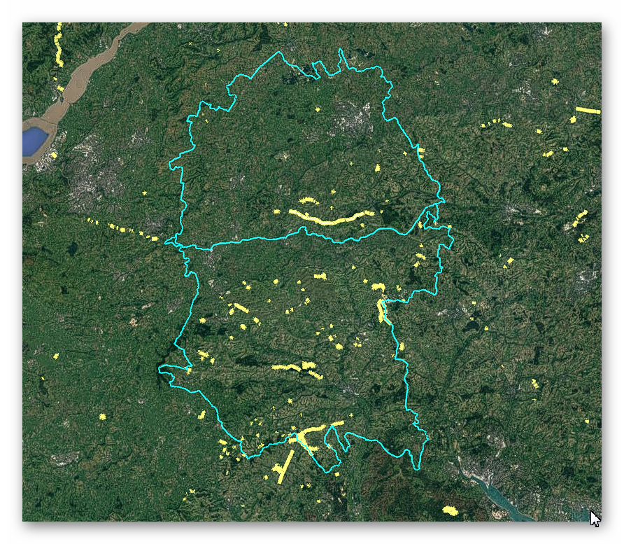
GE Map of Prehistoric Wiltshire Canals (Dykes)

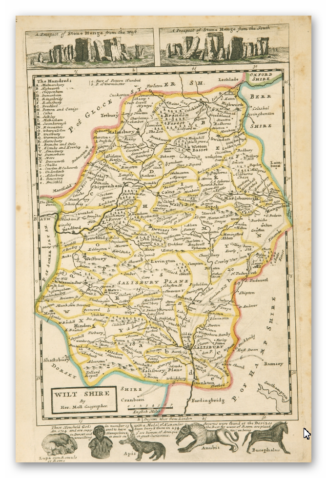
Old Map

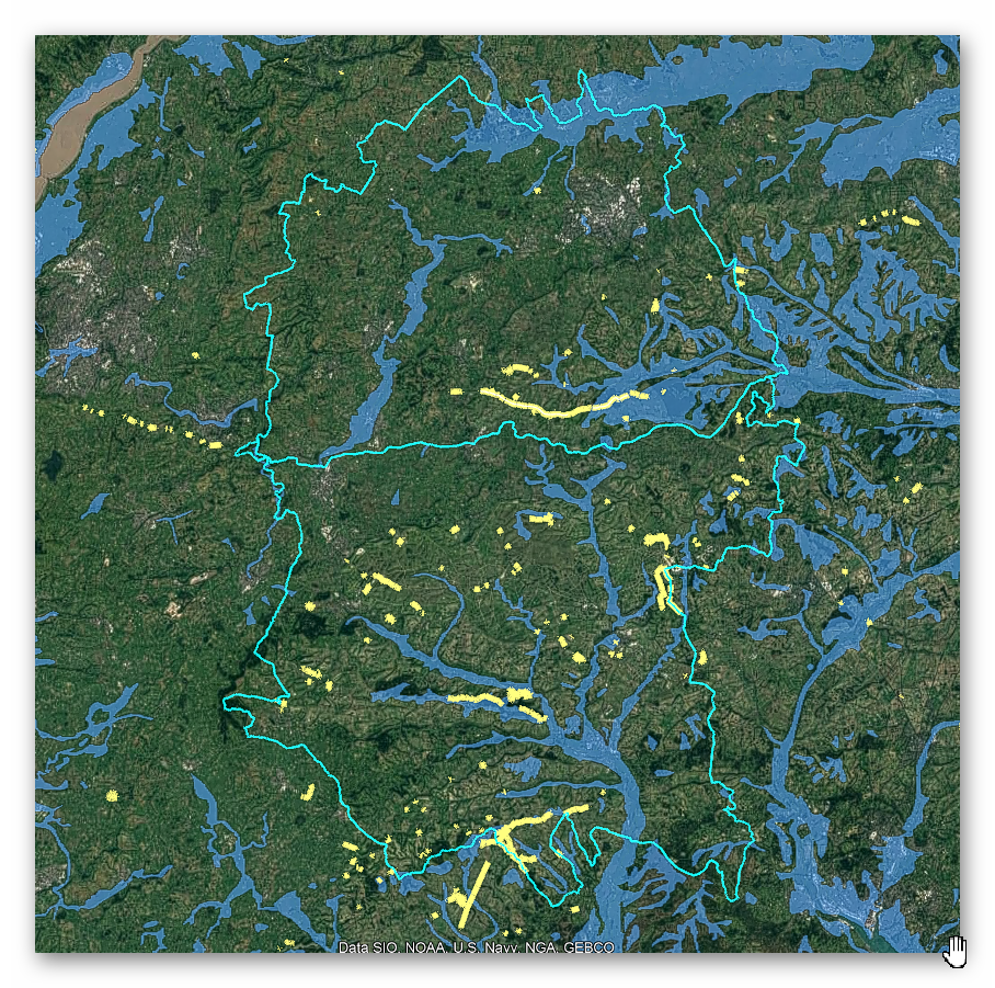
Geological Landscape

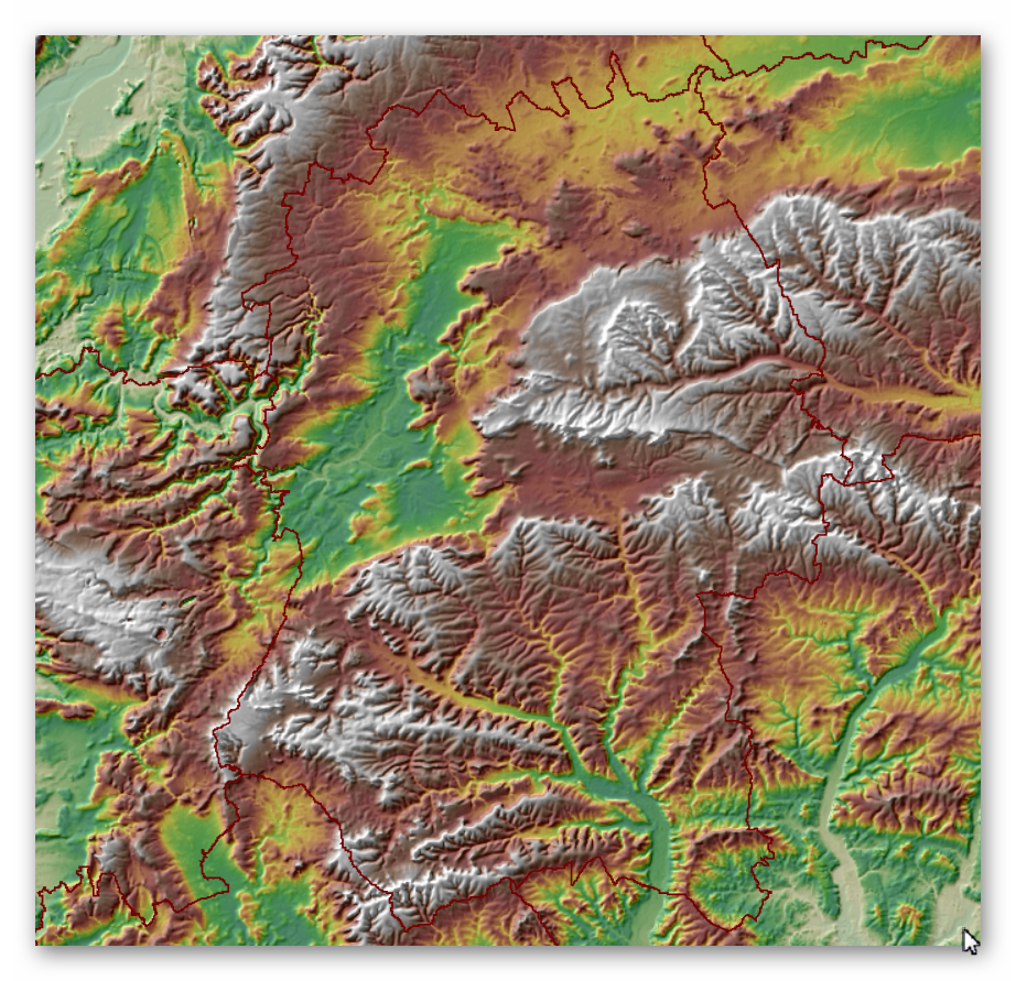
Landscape/Terrain

Database of DYKES (Linear Earthworks) in Wiltshire
(Click the ‘HE Entry Ref: Number’ (if blue) for more details and Maps)
| Name | HE Entry Ref: | NGF | Length (m) | Overall Width (m) | Ditch Width (m) | Bank Width (m) |
|---|---|---|---|---|---|---|
| Ditch 530yds (484m) SW of Stitchcombe Farm | 1003037 | SU 22278 69134 | ||||
| Linear earthwork NW of Sidbury camp | 1003254 | SU 21324 50701 | ||||
| Earthwork 360yds (328m) NW of Warren Copse | 1003726 | ST 94770 24303 | ||||
| Middle Chase Farm ditch | 1003730 | SU 00292 20956 | ||||
| Marleycombe Hill earthworks | 1003731 | SU 02430 22536 | ||||
| Great Ditch banks | 1003733 | SU 01661 21167 | ||||
| Wansdyke: section 610yds (560m) NW of Wernham Farm to 250yds (230m) SW of New Buildings | 1003784 | SU 18215 66762 | ||||
| Wansdyke: 460yds (420m) SE of Broads Green to 266yds (240m) NE of Paddock Farm | 1003785 | ST 99292 67194 | ||||
| Ditch between Rag Copse and Scotspoor Plantation | 1003792 | SU 28356 56054 | ||||
| Linear earthwork 500yds (460m) S of Sidbury camp | 1004699 | SU 21358 49750 | ||||
| Earthwork on Paven Hill | 1004701 | SU 08096 88247 | ||||
| Earthwork 200yds (180m) W of parish church | 1004703 | ST 85060 86028 | ||||
| Linear earthwork in Savernake Forest, S of Great Lodge Bottom | 1004705 | SU 21182 66919 | ||||
| Linear earthwork on West Down | 1004707 | SU 05263 48179 | ||||
| Cross-ridge dyke on Buxbury Hill | 1004711 | ST 98421 26633 | ||||
| Wansdyke: section from S of Furze Hill to Marlborough-Pewsey road | 1004719 | SU 16995 66482 | ||||
| Ditch W of Tanhill Fair | 1004721 | SU 07545 64937 | ||||
| Linear earthwork on Tidcombe Down | 1004729 | SU 28511 58019 | ||||
| Linear earthwork on Maccombe Down | 1004730 | SU 29771 57377 | ||||
| Whitefield Hill ditch | 1004732 | SU 20418 75550 | ||||
| Section of the Wansdyke | 1004736 | SU 09966 64698 | ||||
| Botley Hill ditch | 1004745 | SU 29340 60019 | ||||
| Sections of Wansdyke in Jockey Copse and Round Copse | 1004751 | SU 28992 64445 | ||||
| Withy Copse ditch | 1004760 | SU 17179 64219 | ||||
| Odstock Copse earthwork | 1004775 | SU 14462 25064 | ||||
| Wansdyke, section 530yds (490m) on W side of Old Dyke Lane | 1005386 | SU 35170 63746 | 520 | 17 | 9 | 4 |
| Grovely Ditch | 1005584 | SU 06602 33636 | ||||
| Winkelbury Hill earthworks | 1005585 | ST 95056 21025 | ||||
| Berwick Coombe ditch | 1005587 | ST 93763 23508 | ||||
| Wansdyke: Daniel's Lane section | 1005594 | SU 32284 64415 | ||||
| White Sheet Hill ditch | 1005596 | ST 80372 35054 | ||||
| Bury Orchard ditch | 1005603 | SU 04121 25223 | ||||
| Grovely Castle and earthworks N of Grovely Wood | 1005604 | SU 05839 35539 | ||||
| Ditch, 343yds (310m) ENE of East Farm Cottages to 800yds (730m) NW of St Martin's Chapel | 1005606 | ST 99358 35116 | ||||
| Woodland Down ditch | 1005617 | ST 95617 23509 | ||||
| Long barrow and Old Ditch linear earthwork, on Tilshead Down | 1009297 | SU 02422 46881 | ||||
| The Weather Hill multiperiod landscape and associated linear earthworks | 1009337 | SU 20300 51739 | ||||
| Boundary earthwork across the Bulford Ranges | 1009503 | SU 20856 44339 | ||||
| Boundary earthwork running south from Dunch Hill, through Brigmerston Plantation and Milston Down. | 1009656 | SU 20647 46944 | ||||
| Cross ridge dyke on Warminster Down | 1009810 | ST 89585 48032 | ||||
| Boundary earthwork on Upavon Down | 1009812 | SU 15139 55508 | ||||
| Two boundary earthworks on the west of Rushall Down | 1009813 | SU 09285 53426 | ||||
| Boundary earthwork on Lamb Down | 1009833 | SU 25476 48608 | ||||
| Trackway, ditch and bell barrow on Longstreet Down | 1009927 | SU 17617 52608 | ||||
| Strip lynchet system north of Cotley Hill | 1009937 | ST 92223 43467 | ||||
| Combe lynchet system on Oxendean Down | 1010067 | ST 89851 46527 | ||||
| Strip lynchet system east of Cotley Hill Woods | 1010089 | ST 92493 43186 | ||||
| Boundary feature 700m south-west of The Plantation, West Lavington Down | 1010096 | ST 97697 48736 | ||||
| Boundary earthworks on Wilsford Down | 1010177 | SU 08812 53761 | ||||
| Boundary feature on Ball Down | 1010247 | SU 04770 50983 | ||||
| Boundary earthwork from East Down to Orcheston Down | 1010251 | SU 05533 48922 | ||||
| Strip lynchets south of Westdown Farm | 1010260 | ST 93414 51595 | ||||
| Boundary feature, western section of Long Ditch across Wilsford Down | 1010262 | SU 07695 53727 | ||||
| Enclosure and linear earthworks between Bishopstrow Down and South Down Sleight | 1010283 | ST 91942 47399 | ||||
| Boundary earthwork and associated bowl barrow on Windmill Hill | 1010288 | SU 24277 51395 | ||||
| Linear earthwork on Knook Down | 1010665 | ST 95707 44017 | ||||
| Linear boundary from south east of Winterbourne Stoke crossroads to south west of The Diamond on Wilsford Down | 1010837 | SU 10297 41054 | ||||
| Linear boundary within Normanton Gorse | 1010838 | SU 11292 41412 | ||||
| Ten round barrows forming the Lake Down round barrow cemetery and a section of linear boundary crossing Lake Down | 1010875 | SU 11846 39056 | ||||
| Section of a linear boundary from 350m north east of Westfield Farm on Lake Down to Lake Bottom | 1010881 | SU 12092 39303 | ||||
| The Lesser Cursus and a triple bowl barrow forming part of a linear round barrow cemetery south east of Greenland Farm on Winterbourne Stoke Down | 1010901 | SU 10511 43486 | ||||
| Linear earthworks forming part of a field system on Bishop's Cannings Down | 1013233 | SU 05655 66557 | ||||
| Pair of bowl barrows 150m north of the Wansdyke on All Cannings Down | 1013755 | SU 10337 64856 | ||||
| Three sections of a linear earthwork south west of New Barn | 1013771 | SU 10888 71024 | ||||
| Pair of round barrows and section of linear earthwork NE of the gallops on West Down | 1014028 | SU 07248 69220 | ||||
| Cross ridge dyke on Morgan's Hill | 1014033 | SU 03185 67113 | ||||
| Linear round barrow cemetery 200m ENE of West Kennett long barrow | 1014034 | SU 10765 67827 | ||||
| Harepit Way linear boundary | 1014559 | SU 07788 68819 | ||||
| Winterbourne Stoke West round barrow cemetery, The Coniger enclosure and section of linear boundary earthwork | 1015019 | SU 07727 41971 | ||||
| Bowl barrow and section of linear boundary earthwork on Winterbourne Stoke Down | 1015023 | SU 08694 42918 | ||||
| Linear boundary earthwork on Amesbury Down west of Stock Bottom | 1015218 | SU 15549 39504 | ||||
| Lynchets at Southmill Hill | 1015220 | SU 15930 40808 | ||||
| Devil's ditch: boundary earthwork | 1015434 | SU 21330 47793 | ||||
| Boundary earthwork across Dunch Hill Golf Course | 1015480 | SU 21280 48486 | ||||
| Boundary feature south of Clarendon Hill Reservoir | 1015482 | SU 22435 48615 | ||||
| Linear boundary earthwork 250m west of Stockport | 1015689 | SU 16294 39460 | ||||
| Two earthwork enclosures and a linear earthwork 625m north of Barbury Castle | 1016362 | SU 14923 76917 | ||||
| Linear boundary earthwork west of Liddington Castle | 1016391 | SU 20678 79618 | ||||
| Medieval strip lynchets 280m west of Hill Barn | 1016902 | ST 85792 36454 | ||||
| Linear boundary on Bidcombe Down and Whitepits Down | 1016904 | ST 84435 37752 | ||||
| Cross dyke 920m north east of Dairy Farm | 1016905 | ST 83766 38274 | ||||
| Four lynchets 610m west of Kingston Dairy | 1016910 | ST 83706 36985 | ||||
| Bronze Age enclosure and linear boundary earthwork on Boscombe Down East | 1017273 | SU 23212 37235 | ||||
| Section of Wansdyke and associated monuments from east of The Firs to the eastern side of Tan Hill | 1017288 | SU 04374 66344 | 6,720 | 28 | 14 | 14 |
| Hillfort, two bowl barrows, medieval strip lynchets and a cross dyke on Cley Hill | 1017296 | ST 83870 44869 | ||||
| Medieval strip lynchets 370m south of Greater Lane Farm | 1017302 | ST 92569 52587 | ||||
| Two cross dykes 580m and 610m north east of Wood Farm | 1017709 | ST 80752 34072 | ||||
| Cross dyke on Mere Down, east of White Sheet Hill hillfort | 1017710 | ST 81036 34699 | ||||
| Strip lynchet system east of Three Corner Firs | 1017862 | ST 99125 52735 | ||||
| Boundary earthwork east of Church Hill | 1017928 | SU 03821 52632 | ||||
| Cross dyke 520m north east of Cherhill Monument | 1018421 | SU 05138 69673 | ||||
| Cross dyke 230m south west of Cherhill Monument | 1018422 | SU 04551 69246 | ||||
| Cross dyke 450m west of Cherhill Monument | 1018423 | SU 04273 69347 | ||||
| Linear boundary earthwork and associated field system on Cherhill Down | 1018431 | SU 05167 69600 | ||||
| Oldbury Camp hillfort, bowl barrow and cross dyke on Cherhill Down | 1018611 | SU 04890 69244 | ||||
| Cross dyke and field banks in Peaks Wood 210m east of Hellscomb Cottages | 1019191 | SU 26082 78923 | ||||
| Cross dyke 870m north west of Burton Farm | 1019197 | ST 84761 38008 | ||||
| Strip lynchets immediately south west of Woodcombe Cleve | 1019383 | ST 89835 41240 | ||||
| Chiselbury Camp hillfort, cross dykes and site of turnpike toll house | 1020262 | SU 01826 28122 | ||||
| Two cross ridge dykes 710m and 790m east of Wellhead Farm | 1020372 | ST 87739 49570 | ||||
| Cross ridge dyke on Charlton Down, 1250m and 1350m south west of Higher Berry Court Cottages | 1020632 | ST 91765 20377 | ||||
| Cross ridge dyke 1000m south west of Higher Berry Court Cottages | 1020633 | ST 91931 20632 | ||||
| The Carrion Tree Rack:a linear boundary in Rushmore Park, south west, south and north east of Park Cottage | 1020727 | ST 95287 18681 | ||||
| Linear boundary and section of Roman road, 550m south east of Ashmore Farm | 1020728 | ST 92246 17026 | ||||
| A cross-ridge dyke on South Down 500m north east of Chase Barn | 1020958 | ST 99016 21704 |
Dykes Ditches and Earthworks
Indeed, the modern term “dyke” or “dijk” can be traced back to its Dutch origins. As early as the 12th century, the construction of Dykes in the Netherlands was a well-established practice. One remarkable example of their ingenuity is the Westfriese Omringdijk, stretching an impressive 126 kilometres (78 miles), completed by 1250. This Dyke was formed by connecting existing older ‘dykes’, showcasing the Dutch mastery in managing their aquatic landscape.
The Roman chronicler Tacitus even provides an intriguing historical account of the Batavi, a rebellious people who employed a unique defence strategy during the year AD 70. They punctured the Dykes daringly, deliberately flooding their land to thwart their enemies and secure their retreat. This historical incident highlights the vital role Dykes played in the region’s warfare and water management.
Originally, the word “dijk” encompassed both the trench and the bank, signifying a comprehensive understanding of the Dyke’s dual nature – as both a protective barrier and a channel for water control. This multifaceted concept reflects the profound connection between the Dutch people and their battle against the ever-shifting waters that sought to reclaim their land.
The term “dyke” evolved as time passed, and its usage spread beyond the Dutch borders. Today, it represents not only a symbol of the Netherlands’ engineering prowess but also a universal symbol of human determination in the face of the relentless forces of nature. The legacy of these ancient Dykes lives on, a testament to the resilience and innovation of those who shaped the landscape to withstand the unyielding currents of time.
Upon studying archaeology, whether at university or examining detailed ordinance survey maps, one cannot help but encounter peculiar earthworks scattered across the British hillsides. Astonishingly, these enigmatic features often lack a rational explanation for their presence and purpose. Strangely enough, these features are frequently disregarded in academic circles, brushed aside, or provided with flimsy excuses for their existence. The truth is, these earthworks defy comprehension unless we consider overlooked factors at play.
One curious observation revolves around the term “Dyke,” inherently linked to water. It seems rather peculiar to apply such a word to an earthwork atop a hill unless an ancestral history has imparted its actual function through the ages. Let us consider the celebrated “Offa’s Dyke,” renowned for its massive linear structure, meandering along some of the present boundaries between England and Wales. This impressive feat stands as a testament to the past, seemingly demarcating the realms of the Anglian kingdom of Mercia and the Welsh kingdom of Powys during the 8th century.
However, delving further into the evidence and historical accounts challenges this seemingly straightforward explanation. Roman historian Eutropius, in his work “Historiae Romanae Breviarium”, penned around 369 AD, mentions a grand undertaking by Septimius Severus, the Roman Emperor, from 193 AD to 211 AD. In his pursuit of fortifying the conquered British provinces, Severus constructed a formidable wall stretching 133 miles from coast to coast.
Yet, intriguingly, none of the known Roman defences match this precise length. Hadrian’s Wall, renowned for its defensive prowess, spans a mere 70 miles. Could Eutropius have referred to Offa’s Dyke, which bears remarkable similarity to the Roman practice of initially erecting banks and ditches for defence?
For more information click HERE
Further Reading
For information about British Prehistory, visit www.prehistoric-britain.co.uk for the most extensive archaeology blogs and investigations collection, including modern LiDAR reports. This site also includes extracts and articles from the Robert John Langdon Trilogy about Britain in the Prehistoric period, including titles such as The Stonehenge Enigma, Dawn of the Lost Civilisation and the ultimate proof of Post Glacial Flooding and the landscape we see today.
Robert John Langdon has also created a YouTube web channel with over 100 investigations and video documentaries to support his classic trilogy (Prehistoric Britain). He has also released a collection of strange coincidences that he calls ‘13 Things that Don’t Make Sense in History’ and his recent discovery of a lost Stone Avenue at Avebury in Wiltshire called ‘Silbury Avenue – the Lost Stone Avenue’.
Langdon has also produced a series of ‘shorts’, which are extracts from his main body of books:
For active discussions on the findings of the TRILOGY and recent LiDAR investigations that are published on our WEBSITE, you can join our and leave a message or join the debate on our Facebook Group.
