Section B – NY25NE & NY26SE
Contents
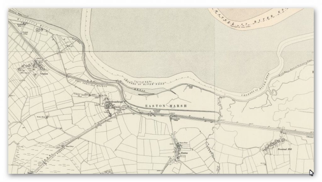
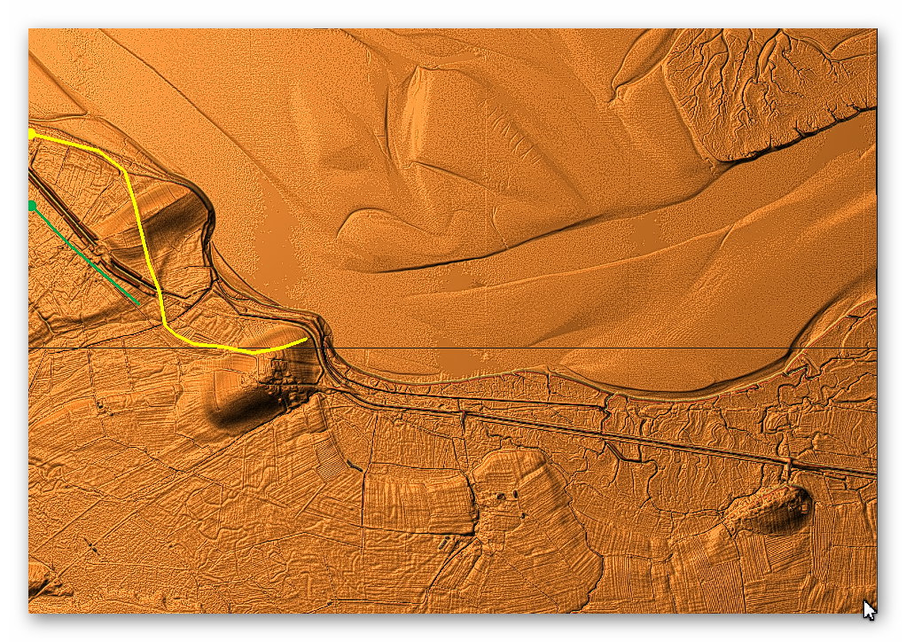
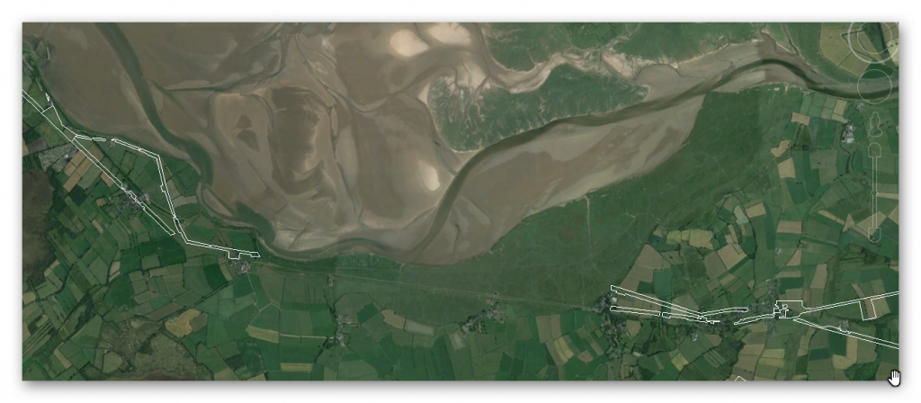
Section B – NY25NE & NY26SE – this is a section of Hadrian’s Wall showing the LiDAR, Google Earth and 1800 Maps of the Area covered by Historic England
Historic England Sections: Hadrian’s Wall – Drumburgh Roman fort between Burgh Marsh and Westfield House in wall miles 76 and 77 and vallum between the watercourse 400m south east of Glasson and the access road to Glendale caravan park in wall miles 76 and 77
List UID: 1014699, 1014700
Old OS Map
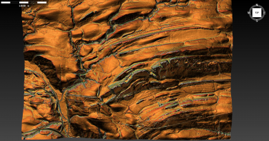
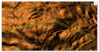
LiDAR Map
Google Earth Map
Historic England Scheduled Monuments within Section B
Name: Drumburgh Roman fort and Hadrian’s Wall between Burgh Marsh and Westfield House in wall miles 76 and 77
Designation Type: Scheduling
Grade: Not Applicable to this List Entry
List UID: 1014699
Name: Hadrian’s Wall vallum between the watercourse 400m south east of Glasson and the access road to Glendale caravan park in wall miles 76 and 77
Designation Type: Scheduling
Grade: Not Applicable to this List Entry
List UID: 1014700
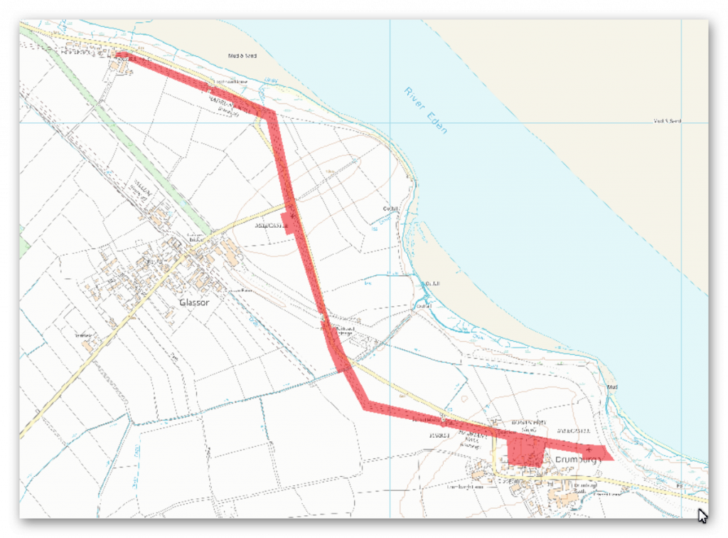
The monument includes Drumburgh Roman fort and the section of Hadrian’s Wall and its associated features between Burgh Marsh in the east and Westfield House in the west.
Hadrian’s Wall survives as a buried feature throughout the whole of this section. Excavations by Haverfield in 1899 located the Wall between Burgh Marsh and Drumburgh fort. The Wall measured 2.95m wide and the wall ditch was 8.9m wide and lay 8m north of the wall. Excavations by Charlesworth in 1973 confirmed the course of the Wall north of Glasson. Geophysical survey has also located the line of the Wall or wall ditch to the north east of Glasson.
The exact location of milecastle 76 has not yet been confirmed. A faint irregular platform 200m east of Drumburgh Roman fort amongst ridge and furrow could possibly be the remains of the milecastle platform, however this is not certain and its position still needs confirmation.
The exact location of milecastle 77 has not yet been confirmed. Excavations by Charlesworth in 1973 proved inconclusive in determining its position. On the basis of the usual spacing it is expected to be situated about 50m south of the junction of the Glasson road with the Bowness-Carlisle road.
Turret 76a was located in 1948 just east of Drumburgh schoolhouse by Simpson, Hodgson and Richmond. Its remains survive as buried features with no traces visible above ground.
The exact locations of turrets 76b, 77a and 77b have not yet been confirmed. On the basis of the usual spacing turret 76b is expected to be located about 90m south of where the dismantled railway crosses Hadrian’s Wall east of Glasson and turret 77a approximately 140m south east of Lowtown House. Turret 77b is believed to be beneath Westfield House or its yard, but it is not included in the scheduling.
The course of the Roman road known as the Military Way, which ran along the corridor between the Wall and vallum linking turrets, milecastles and forts, has not been confirmed in this section. It is expected to run parallel to the course of the Wall set back a few metres to the south.
Drumburgh Roman fort, known to the Romans as Congavata, commanded an outlook to the north and east over the Inner Solway. There has been very little archaeological work carried out on this fort, and it remains one of the least well known Wall forts. Small scale excavations were carried out in 1899 by Haverfield who located the remains of a small stone fort. A subsequent excavation in 1947 by Simpson and Richmond showed that the stone fort lay within an earlier and larger turf and timber fort with ramparts made from the readily available alluvial clay. Pottery finds attested an occupation continuing into the late Roman period. The remains of the fort survive as buried features. The right angled ditch west of Drumburgh House is was at one time thought to be the ditch of the Roman fort. The excavations in 1899 however discovered it to be a medieval ditch, although its association has not been confirmed.
Evidence suggests that Hadrian’s Wall did originally pass through the Burgh Marsh to the east. No remains however have been identified here and hence this area is not included in the scheduling.
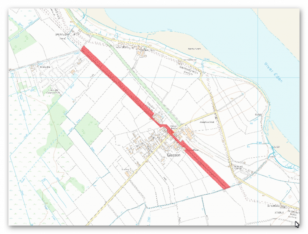
The monument includes the section of Hadrian’s Wall vallum between the watercourse 400m south east of Glasson in the east and the east side of the access road to Glendale caravan park in the west. The vallum survives as a feature visible on the ground throughout most of this section.
At the eastern end of the monument the vallum ditch is utilised by a modern drainage ditch 5.7m wide and 2m deep. The course of the vallum between the watercourse 400m south east of Glasson and Burgh Marsh has not yet been confirmed and is therefore not included in the scheduling. West of Glasson the line of the vallum ditch is visible as a faint shallow depression but at the west end of the monument it survives in the field immediately east of the access track to Glendale caravan park as a more obvious earthwork up to 0.8m in depth.
Investigation
Video – showing the River Esk during the Roman Period
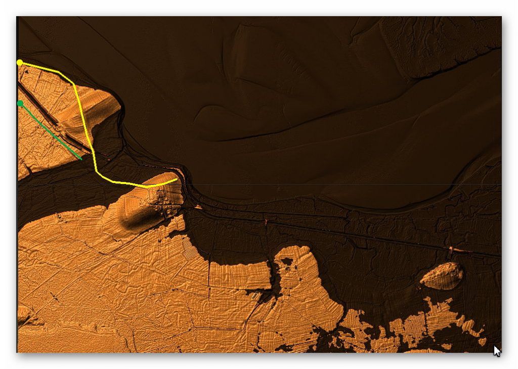
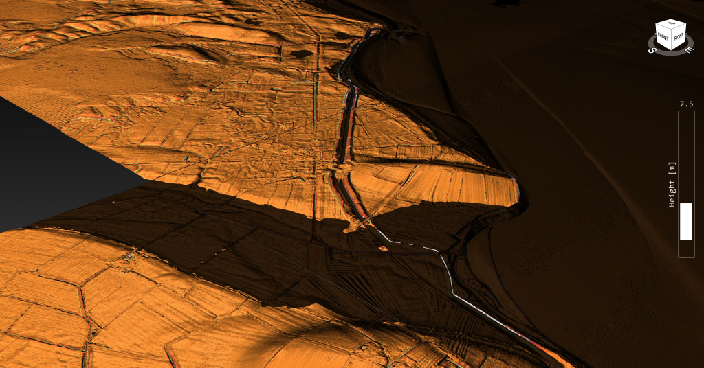
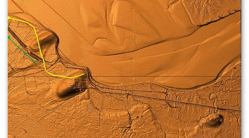
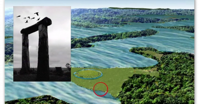
Analysis of this section shows that the Wall and Vallum disappear for a 2.6 mile stretch without explanation until we add the probably river shorelines as we did with section A. Once these shorelines are added at 8m above todays Esk river height we find a simple explanation for the lost of both the Wall and Vallum – the area is flooded.
This gives us real data to the size of the Esk river during the Roman period and the possible size at an earlier dates such as in the Bronze Age, Neolithic and Mesolithic periods.
It should also be noted that the Vallum would be connected directly into the Esk River by this encroachment into the mainland – indicating that it could have been used as a canal (Dyke) which could be used to transport the Stone to the Wall because of the absence of any Roman road. There is also a possibility that the Vallum was built before the Wall or that the Wall was extended once the water levels fell and consequently would show as a different specification (width) as noted in other areas of the Wall.
To understand the problem with Hadrian’s Walls history read our article HERE.
Further Reading
For information about British Prehistory, visit www.prehistoric-britain.co.uk for the most extensive archaeology blogs and investigations collection, including modern LiDAR reports. This site also includes extracts and articles from the Robert John Langdon Trilogy about Britain in the Prehistoric period, including titles such as The Stonehenge Enigma, Dawn of the Lost Civilisation and the ultimate proof of Post Glacial Flooding and the landscape we see today.
Robert John Langdon has also created a YouTube web channel with over 100 investigations and video documentaries to support his classic trilogy (Prehistoric Britain). He has also released a collection of strange coincidences that he calls ‘13 Things that Don’t Make Sense in History’ and his recent discovery of a lost Stone Avenue at Avebury in Wiltshire called ‘Silbury Avenue – the Lost Stone Avenue’.
Langdon has also produced a series of ‘shorts’, which are extracts from his main body of books:
For active discussions on the findings of the TRILOGY and recent LiDAR investigations that are published on our WEBSITE, you can join our and leave a message or join the debate on our Facebook Group.

Pingback: Hadrian’s Wall LiDAR investigation - Prehistoric Britain