Section C – NY35NW
Contents
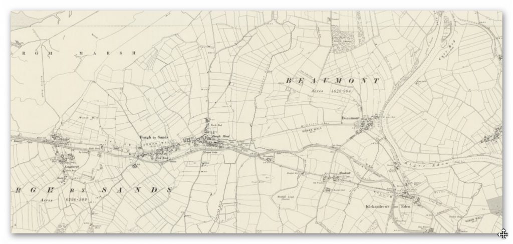
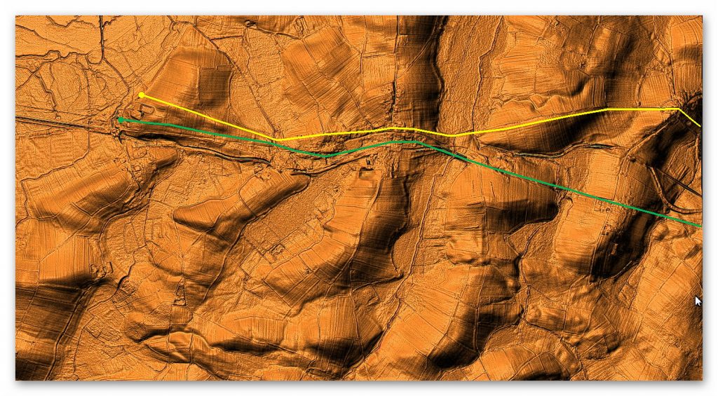
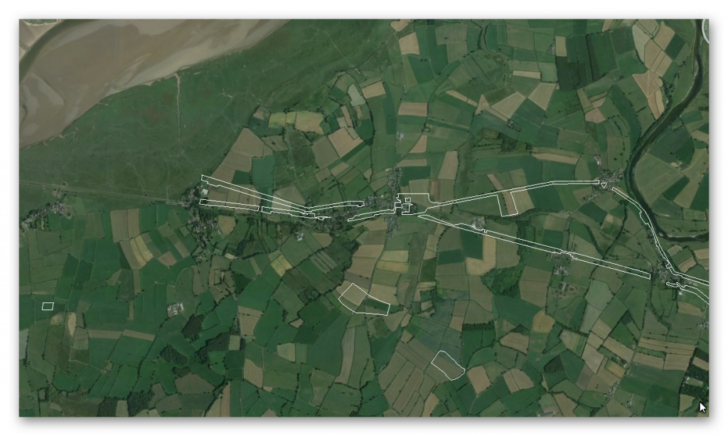
Section C – NY35NW – this is a section of Hadrian’s Wall showing the LiDAR, Google Earth and 1800 Maps of the Area covered by Historic England
Historic England Sections:
Hadrian’s Wall – between Fulwood House, Burgh by Sands, Dykesfield and Monkhill in wall miles 70, 71,72 and 73
List UID: 1014698, 1018308, 1018457, 1014697
Old OS Map
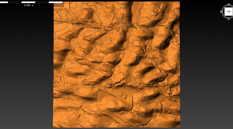
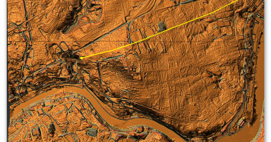
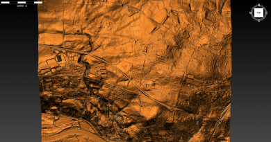
LiDAR Map
Google Earth Map
Historic England Scheduled Monuments within Section C
Name: Hadrian’s Wall between Fulwood House at Burgh by Sands and Burgh Marsh in wall miles 72 and 73
Designation Type: Scheduling
Grade: Not Applicable to this List Entry
List UID: 1014698
Name: Hadrian’s Wall Vallum between West End, Burgh by Sands and the eastern boundary of Dykesfield
Designation Type: Scheduling
Grade: Not Applicable to this List Entry
List UID: 1018308
Name: Burgh by Sands Roman fort, Beaumont camp, Burgh Castle and Hadrian’s Wall from boundary west of churchyard, Beaumont to Burgh Head in wall miles 70 and 71
Designation Type: Scheduling
Grade: Not Applicable to this List Entry
List UID: 1018457
Name: Hadrian’s Wall vallum between the dismantled railway west of Kirkandrews Farm and the dismantled railway south east of Burgh by Sands in wall miles 70 and 71
Designation Type: Scheduling
Grade: Not Applicable to this List Entry
List UID: 1014697
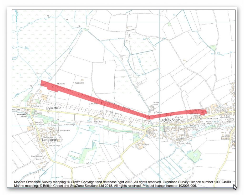
The monument includes the section of Hadrian’s Wall and its associated features between Fulwood House at Burgh by Sands in the east and Burgh Marsh in the west. Hadrian’s Wall survives as a buried feature throughout the whole length of this section with no features visible above ground.
Excavations by Austen at West End in 1986 and subsequent geophysical survey in 1991, north of Rindle House demonstrated that the wall ditch ran approximately 11m north of the wall, a wider distance than is usual. The excavation across the ditch found the expected V-shaped profile, 10m wide at the top and 2.5m deep in the centre. The Wall was initially built of turf in the whole of this sector. The 1986 excavations and further excavations in 1989 by Austen at the site of milecastle 72 found that in the eastern part of the monument, from a point 50m east of the lane crossing the Wall at West End, the turf wall was built on a raft of cobbles 6.1m wide, a previously unrecorded method of construction on Hadrian’s Wall, whereas the rest of the Turf Wall in this section was found in the same excavations by Austen and at the site of turret 72b in 1948 by Simpson to have been constructed by the better known method of stacking turves directly on the soil.
When the Turf Wall was rebuilt in stone at the east end of this monument, the turf superstructure was entirely removed down to the cobble base, which was used as a foundation for the Stone Wall, whereas elsewhere a small amount of the base material of the Turf Wall remained sealed below the Stone Wall. In the vicinity of turret 72a and at turret 72b, the Stone Wall was placed 1.2m from the front of the Turf Wall, presumably to align with the side doors of the turrets to give access onto the wall-top, whereas at milecastle 72 the north face of the Stone Wall coincided with the northern edge of the base of the Turf Wall. The course of the Wall between Fulwood House and West End is now known as a result of these excavations to run a little to the north of the line depicted by the Ordnance Survey, with a slight change in direction southwards indicated 150m west of Fulwood House.
There is no evidence to suggest that Hadrian’s Wall was carried across Burgh Marsh west of Dykefield. No remains have been identified here and hence this area is not included in the scheduling. Milecastle 72 was initially located in 1960 by Bartle and its position was confirmed during excavations by Austen in 1989, its north wall (and the line of Hadrian’s Wall) being found 13m north of the line depicted by the Ordnance Survey. The east wall of the milecastle was found below the farm access track immediately to the west of Fulwood House.
The milecastle was originally built with turf walls, like the adjoining lengths of Hadrian’s Wall on a base of cobbles 6.2m wide. The internal buildings and gateways have not been examined but would have been timber structures. The entire milecastle was replaced in stone, probably in the second half of the second century at the same time as the replacement of the Turf Wall by a stone wall. The north, east and west stone walls of the milecastle were found in the 1989 excavations to survive as buried features and were constructed using a mixture of red and white sandstones. The walls were built 2.2m wide on flag footings, and the east and west walls were placed exactly in the centre of the former turf walls, whereas the north wall of the stone milecastle ran on the northern edge of the former turf north wall. The stone milecastle measured 24.3m across its overall width, with an internal width between the walls of 19m.
The south side of the milecastle has not been identified, but its length was at least 13m. Milecastle 73 was located and partly excavated by Simpson and others in 1948. It measured 18.7m wide and 19.2m long internally. However, the locational information from the excavation is not precise and the exact position of the milecastle has not been confirmed since. Its remains survive as buried features. The exact location of turret 72a has not yet been confirmed. On the basis of the usual spacing it is expected to be located approximately 50m east of West End Cottage. Roman pottery has been found in this area which appears to confirm the location.
The turret probably lies at the junction between the length of Turf Wall constructed on a cobble base and the length built with turves stacked directly on the subsoil. Its remains are expected to survive as buried features. Turret 72b was located by Simpson in 1948 in the north east corner of the field to the north of Rindle House. It was found to be from the original Turf Wall series and it projected 1.2m north of the line of the later Stone Wall. Its remains survive as buried features. The course of the Roman road known as the Military Way, which ran along the corridor between the Wall and vallum linking turrets, milecastles and forts, has not yet been confirmed in this section. It is expected to be located parallel to the course of the Wall a short distance south of it. All field boundaries, buildings and road surfaces are excluded from the scheduling, but the ground beneath them is included.
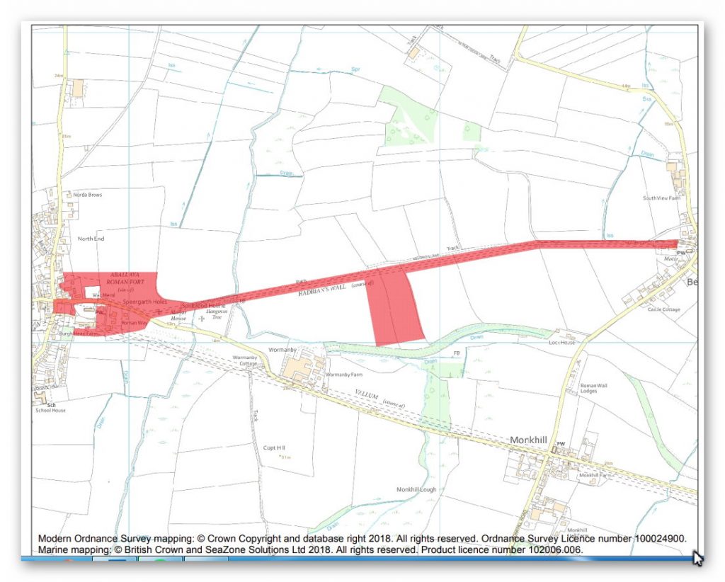
The monument includes Hadrian’s Wall and its associated features between the field boundary at the west side of the churchyard belonging to St Mary’s Church at Beaumont in the east and Burgh Head in Burgh by Sands in the west, as well as Burgh by Sands Roman fort, Beaumont temporary camp south of Hadrian’s Wall and the site of a medieval earthwork castle known as Burgh Castle.
Hadrian’s Wall survives as a buried feature throughout the whole of this section. Its course in the area of Burgh Castle, south east of Speergarth Holes, has been confirmed by excavation by Hogg in 1950. The wall ditch was also confirmed to survive as a buried feature north of the Wall in the 1950 excavation. In addition a further length of the Wall line was confirmed west of Burgh Castle by geophysical survey in 1991. The results of this survey indicate that there are two lines taken by the Wall, the southern one representing the primary Turf Wall running close to the modern road, while the second line heads north west from Burgh Castle and meets the north east corner of the fort, also identified in the geophysical survey.
This more northern line is thought to represent a realignment of the Wall when the fort was built so that the fort lay wholly to the rear of the Wall and did not partly project north of it. This realignment may have been carried out as late as the third century AD. Milecastle 71 survives as a buried feature. Its position was located in 1960 by Bartle although this has not been confirmed since.
According to Bartle it is situated south east of the western end of Milldikes Lane. The precise locations of turrets 70b, 71a and 71b have not yet been confirmed. On the basis of the usual spacing, turret 70b is expected to be located about 540m west of St Mary’s Church to the south of Milldikes Lane, turret 71a near to the footbridge over Greathill Beck, and turret 71b is probably under the site of Burgh fort in the area of the modern graveyard which is totally excluded from the scheduling.
The course of the Roman road known as the Military Way, which ran along the corridor between the Wall and vallum linking turrets, milecastles and forts, has not yet been confirmed in this section. A length of road, 8m wide, is known approximately 60m east of the fort from excavations in 1980 by Jones, but it is uncertain if this was the Military Way or another street within the extra-mural civil settlement.
A Roman temporary camp has been identified 80m to the south of the west end of Milldikes Lane 40m south of the course of Hadrian’s Wall on the gently sloping south facing side of a spur overlooking the Powburgh Beck. Although only the eastern segment of the camp was recorded from crop marks visible on aerial photographs, sufficient remains were identified to allow the full extent of the site to be postulated. The only complete side identified is the east side. The site of the camp is overlain by narrow ridge and furrow, the product of medieval or later cultivation on the site.
The Wall fort at Burgh, known to the Romans as Aballava, lies astride the southern of the two lines of Hadrian’s Wall. Excavation in 1922 by Collingwood confirmed the position of the east wall and gateway as well as observing the stone footings of barrack blocks. Geophysical survey in 1991 provided further confirmation of the north and east sides of the fort as well as indicating that Hadrian’s Wall was realigned to meet the north east corner of the fort. Excavations in 1993 by Flynn confirmed the primary line of the wall ditch at Demesne Farm, 6m wide and 2.2m deep, which was later infilled and buildings associated with the fort constructed on clay and cobble foundations. A Roman altar found at Beaumont in 1934 shows that in the third century the fort was garrisoned by Aurelian Moors.
The full extent of the fort is unknown as the west and south sides of its defences have not been confirmed. The remains of an extra-mural settlement, usually known as a vicus, were discovered beyond the east side of the fort during in 1980 and 1982 by Jones in the garden of the former vicarage. The remains included the foundations of buildings fronting onto a road running east-west. The recovery of large quantities of slag and charcoal indicate that metalworking was taking place. Further indications of vicus buildings were revealed by the geophysical survey in 1991 east of the fort, north of the modern road in the area between the primary wall ditch and the realignment of the Wall to meet the north east corner of the fort. It is likely that the vicus was extensive and extended round both the southern and eastern sides of the fort. As the full extent of the vicus is not yet fully understood, only those remains which have been confirmed to survive are included in the scheduling.
The course of the vallum in this section is known both from observations in the adjacent sections of Hadrian’s Wall to the east and west. A substantial ditch to the south of the former vicarage was discovered in excavations in 1980 by Jones, and, although its full extent was not examined, it is likely to have been the ditch of the vallum. If this is so, the vallum in this section of the monument runs slightly to the north of the line depicted by the Ordnance Survey.
There are no indications of the earthwork visible on the ground and it survives entirely as buried remains. The site of the medieval Burgh Castle was investigated in 1950 and was shown to retain evidence of four phases of activity during the medieval period. A first earthwork motte and bailey was built during the Norman period. Later this evolved into a medieval grange site which in turn was replaced in the late 12th century by a stone-built castle. In the 13th century a hall-building was constructed. This was destroyed c.1339.
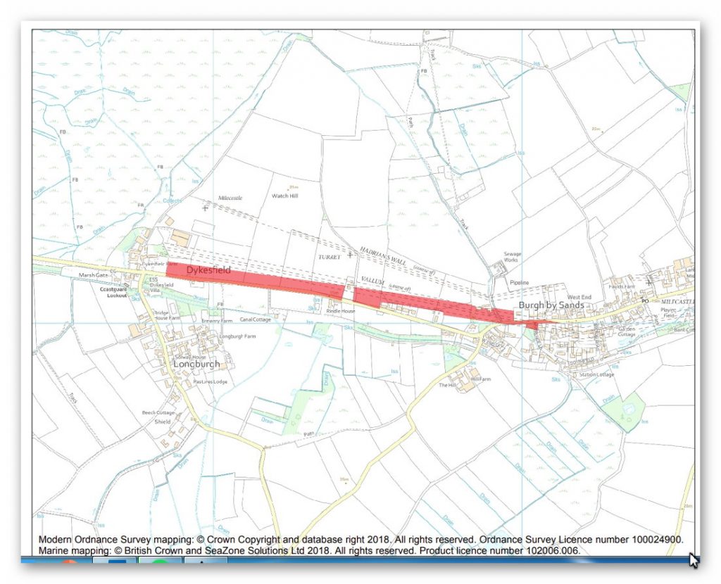
In 1994 and 2007 small excavations within the village of Burgh by Sands revealed the presence of the central broad ditch of the Vallum, thus confirming its location at the eastern end of this scheduled section. During the course of a geophysical survey in 2002, the very slight earthwork of a broad ditch was noted to the south of the currently scheduled area; this lay immediately north of and parallel to the modern road in fields between Vallum House and Dykesfield.
An excavation at Dykesfield Farm in 2015 confirmed the location of the Vallum on the same alignment as the geophysical signals noted in 2002 and revealed the levelled top of the Vallum ditch to be at least 7.5m wide. It was therefore apparent that the Vallum’s course westward from Burgh by Sands took a different alignment to the line that had been mapped by the Ordnance Survey and subsequently scheduled. Further confirmation of this came with a second archaeological evaluation within the scheduled line of the Vallum in 2015, which demonstrated that there were no relevant archaeological remains in that location. This was further confirmed by a watching brief in 2016, in a different part of the scheduled line of the Vallum, that concluded the area was ‘archaeologically sterile’. Subsequently, the Environment Agency’s Light Detection and Ranging (LiDAR) data, a remote sensing method that uses light in the form of a pulsed laser to measure ranges (variable distances) to the Earth, was released in 2016; it clearly depicts the ditch of the Vallum on this new alignment and confirms that west of Burgh by Sands the Vallum lies about 40m south of the currently scheduled line.
For much of its length in this section, the Vallum survives as a buried feature about 40m across. Its course and survival has been confirmed by small-scale excavation and a series of LiDAR images, the latter clearly showing the central ditch as an infilled, buried feature about 6m across; an archaeological evaluation in 2015 revealed the central ditch to be about 7.5m across. At two locations very slight surface remains are visible: to the west of West End a slight fold in the ground is considered to represent the Vallum ditch, and in woodland immediately to the east of Dykesfield surface traces of the north mound and the extremely slight indications of the Vallum ditch have been noted.
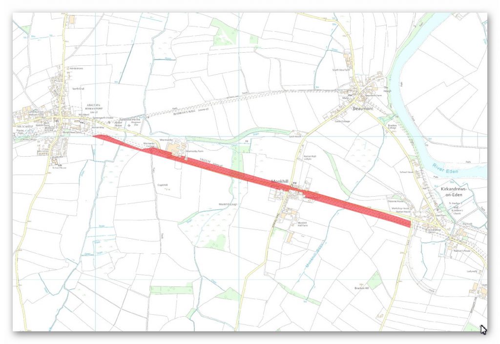
The monument includes the section of Hadrian’s Wall vallum between the dismantled railway west of Kirkandrews Farm in the east and the dismantled railway to the south east of Burgh by Sands in the west. The vallum survives intermittently as a feature visible on the ground. However, its surface remains are generally slight and most of the remains survive as buried features. Where visible, the ditch is generally a slight depression averaging 15m wide. However to the west of Greathill Beck it survives up to 2.5m deep. All field boundaries, buildings and road surfaces are excluded from the scheduling, but the ground beneath them is included.
Investigation
Analysis of this section shows that the Wall and Vallum disappear for a 2.6 mile stretch without explanation in section B until we add the probably river shorelines as we did with section A. Once these shorelines are added at 8m above todays Esk river height we find a simple explanation for the lost of both the Wall and Vallum – the area is flooded.
This change in the landscape would explain this reappearance of the Wall and Vallum on the raised hillside of NY35NW Section C. Moreover, this raised shoreline would also explain why the wall has not built straight and seems to bend (in two places) with the contours of the landscape as either the valley was waterlogged or extremely marshy and would not support a heavy wall.
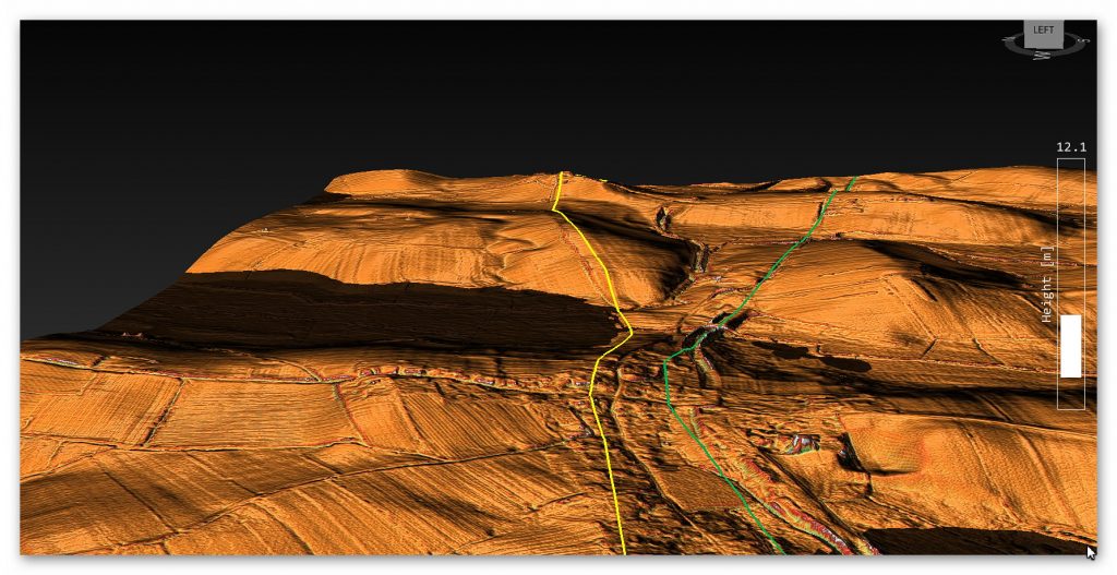
Again as shown in section A and B the Vallum seems very independent of the wall and only mimics its alignment in a few places. This would indicate that it predates the wall and may have been used to bring the stone to the Wall as there is no evidence of any Roman roads being present in this section.
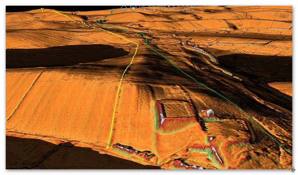
The flyover shows that the predicted path of the Wall is probably incorrect as shown in both the Scheduled Monument and OS Maps as more obvious locations for the defensive ditch are close by. One of these ditches at the end of Section C is known as Milldikes Lane, which is clearly from the name and depth of the ditch was once a prehistoric Dyke, which would have been a natural ditch for the Wall?
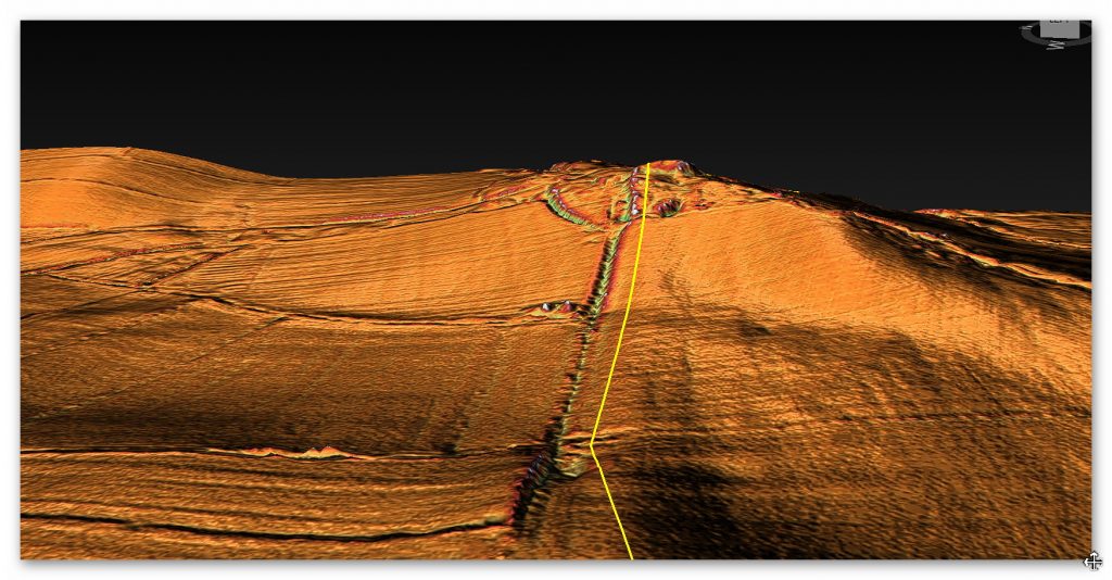
Vallum
The Vallum is equally poorly defined in OS and the Scheduled Monuments register which can again be seen in the LiDAR maps. The railway confuses this process as it reused an old Canal – which may have been the original. The Excavations in this area suggest the WALL was made of Turf before stone was introduced – but you have already have a ‘turf’ barrier in the form of the Vallum? So are we looking at the Wall being built in the alignment of a prehistoric Dyke linear ditch and Bank?? This alignment seems to be confirmed at the Western point of the Vallum as it starts at a town called ‘Dykesfield’.
To understand the problem with Hadrian’s Walls history read our article HERE.
Further Reading
For information about British Prehistory, visit www.prehistoric-britain.co.uk for the most extensive archaeology blogs and investigations collection, including modern LiDAR reports. This site also includes extracts and articles from the Robert John Langdon Trilogy about Britain in the Prehistoric period, including titles such as The Stonehenge Enigma, Dawn of the Lost Civilisation and the ultimate proof of Post Glacial Flooding and the landscape we see today.
Robert John Langdon has also created a YouTube web channel with over 100 investigations and video documentaries to support his classic trilogy (Prehistoric Britain). He has also released a collection of strange coincidences that he calls ‘13 Things that Don’t Make Sense in History’ and his recent discovery of a lost Stone Avenue at Avebury in Wiltshire called ‘Silbury Avenue – the Lost Stone Avenue’.
Langdon has also produced a series of ‘shorts’, which are extracts from his main body of books:
For active discussions on the findings of the TRILOGY and recent LiDAR investigations that are published on our WEBSITE, you can join our and leave a message or join the debate on our Facebook Group.

Pingback: Hadrian’s Wall LiDAR investigation - Prehistoric Britain