The Stonehenge Enigma: What Lies Beneath? – Debunked
The problem with the interpretation of Stonehenge and its environment is that archaeologists do not understand the basic building blocks of our prehistoric society. In the same fashion as a future historian without access to historical data may find the network of roads confusing (as they are not straight and of different scale and sizes) and therefore will remain unaware of the necessity of these structures to empower our society. (The Stonehenge Enigma: What Lies Beneath? – Debunked)
Furthermore, this misconception of the past is based on the presumption that the landscape has been relatively unchanged for the last ten thousand years, which is fundamentally incorrect.
This misinterpretation can easily be seen in the new Channel 5 documentary: The Stonehenge Enigma: What Lies Beneath? Which I have great pleasure debunking here as they had the audacity to steal the title of my best seller to promote their documentary, which comprehensively disproves most of the claims within the programme.
The programme synopsis states: “Every few years a Stonehenge documentary arrives to tell us the stones aren’t what we thought at all: new evidence shows they were in fact a burial ground or a primitive hospital or a Neolithic outlet village or something.
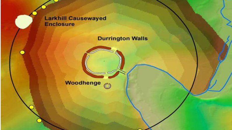
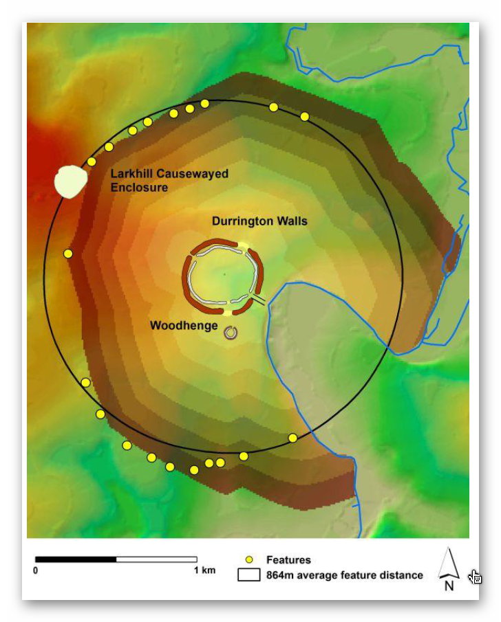
But archaeologists keep digging and probing and finding new parts of the puzzle. This time Bell looks at research on the chalkland landscape that has revealed an arc of huge pits under nearby fields that were part of a two-kilometre ring, with the feasting settlement of Durrington Walls (which might have comprised up to 1000 houses) at its centre.
“This was a party city,” says the lead archaeologist. And cleverly, they can tell from bones and arrowheads that it was focused not on midsummer celebrations, but on midwinter.“
At the centre of this ‘new’ claim is that an area around Durrington Walls – “that this group represents an elaboration of the monument complex at a massive, and unexpected, scale.
Analysis indicates that the surviving pits may have been laid out with respect to the recently discovered Larkhill causewayed enclosure. The data also hint at the evidence for the maintenance of this monumental structure into the Middle Bronze Age, which, if correct, would have significant implications for our understanding of the history and development of monumental structures across the Stonehenge landscape.“
But if you understood the landscape at the time of construction, such a conclusion would prove to be fundamentally flawed in its assumptions. Furthermore, as pointed out in conclusion, the Larkhill causewayed Enclosure is included in this so-called ‘boundary marker’ without a detailed or logical explanation. All this connection linked by association only shows that the reasons for the construction of Causewayed Enclosure sites are currently incorrectly perceived.
Let’s look in detail at Larkhill Causewayed Enclosure using the best scientific tool available to archaeologists yet discovered – LiDAR (not used in the original paper – ‘A Massive, Late Neolithic Pit Structure associated with Durrington Walls’, Gaffney, V. et al. 2020). With LiDAR we see something entirely different that disproves this assumption of a collective circle around Durrington Walls.
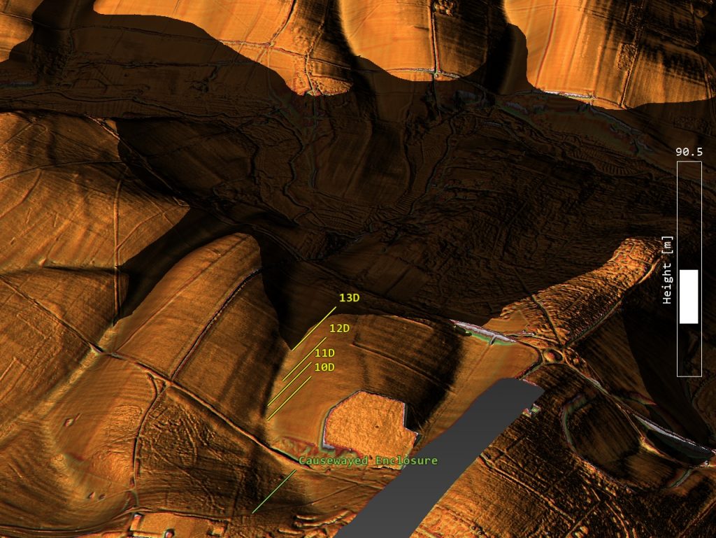
These pit features are sitting in what is known as a palaeochannel (dry river valley) and are in line with the Mesolithic shoreline of the river Avon as illustrated. They do not form any circular outer ring but a well defined straight line. Moreover, this river connection to Larkhill Causewayed enclosure is reinforced when a linear earthwork (Dyke) was added at a later date in time when I would imagine these shallow pits were added to keep the moated ditch supplied with water as they would be cut into the ground to tap into the lower water tables of the Neolithic Period and maybe even the early Bronze Age.
The reason for this river connection is because Causewayed enclosures are ‘trading sites’ and boats would have been used to visit the site and transfer goods – hence the design of the camps which has confused archaeologists as they have not connected the fact that the ditches, although dry today – would be moated in the past.
Moreover, this is not the only ‘Dyke’ to appear in the programme and paper on this ‘structure’ as within the Durrington wall henge; there is a Linear Earth Feature (Dyke) that once joined the River Avon to the Ditch/moat of the henge. This feature is marked within the report as a ‘modern lynchet’ – sadly, for the authors ‘lynchets are farming features that run parallel to the contours of the hilltops. This feature does the exact opposite; it runs down the hill to the River Avon some 30m below. This is because it’s a Dyke which is again clearly shown on LiDAR maps not used within the report.
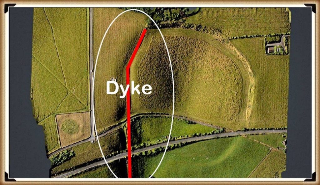
Linear Earthworks (Dykes) are the most prolific prehistoric feature in our landscape, and the least understood. There are over 1500 ‘scheduled’ sections of Dykes in Britain alone, with more than 500 miles of Linear Earthwork scattered from The Isles of Scilly to Skye. My own research has found an additional 3000 Dykes through LiDAR, which have yet to be classified by the nation’s historic depts, which will give Britain over 2,000 miles of Dykes a greater length than the entire Roman Road complex in Britain. Yet archaeologists are just guessing at their function.
If we now remove the Northern section of the ‘structure’ as it is an explainable Dyke feeding water to the Lankhill Causewayed enclosure was left with a random collection of pits to the south of Durrington Walls – Again using LiDAR can look at this collection of pits and see how they link into the shoreline of the Mesolithic and the raised shoreline of the River Avon. However, some of these features are below water levels at this period. One would imagine questions this hypothesis – but the report supports and dates this shoreline as we find carbon dating of these pits ranging from the Mesolithic (pit 7A & 8A – 6080 – 5990 BCE and 4710 – 4550 BCE) until to the Bronze Age (5A – 1390 – 1340 BCE) these dates match the revealing these other post holes as the water table reduced over this period until the level we see today.
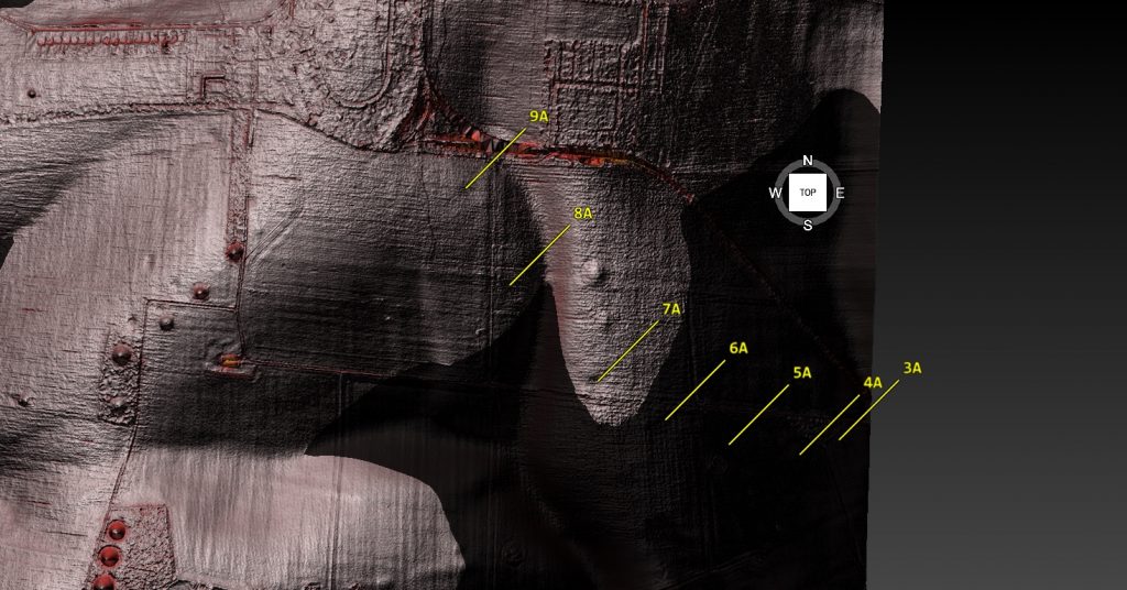
These carbon dating fragments further compound this pit structure theory as the dates are inconsistent.
Conclusion
We are experiencing in archaeology today is a collection of unscientific nonsense and general mythology that is being credible through academic publishing and network broadcasting to the masses, who perceive the ideas as ‘facts’ rather than ideas or working hypotheses’. With social media dominating the publishing world, we are now entering the ‘post-truth era’ where accurate scientific methods have been abandoned for populist concepts, and the once scientific disciplines have turned into bastions of pseudoscience. So is it no wonder that archaeological courses are being downgraded from the the ‘science’ category into ‘humanities’ of historical speculation? This has led to a reduction and cancelling of funds and resources, compounding the decline of archaeology into pure speculation and mythology discipline that replaces scientific evidence with cliché phrases such as ‘ceremonial’ and ‘religious’ to explain complex solutions?
For more information about Linear Earthworks (Dykes) see our other BLOG POSTS or our LiDAR Investigations on our YOUTUBE channel.
Further Reading
For information about British Prehistory, visit www.prehistoric-britain.co.uk for the most extensive archaeology blogs and investigations collection, including modern LiDAR reports. This site also includes extracts and articles from the Robert John Langdon Trilogy about Britain in the Prehistoric period, including titles such as The Stonehenge Enigma, Dawn of the Lost Civilisation and the ultimate proof of Post Glacial Flooding and the landscape we see today.
Robert John Langdon has also created a YouTube web channel with over 100 investigations and video documentaries to support his classic trilogy (Prehistoric Britain). He has also released a collection of strange coincidences that he calls ‘13 Things that Don’t Make Sense in History’ and his recent discovery of a lost Stone Avenue at Avebury in Wiltshire called ‘Silbury Avenue – the Lost Stone Avenue’.
Langdon has also produced a series of ‘shorts’, which are extracts from his main body of books:
For active discussions on the findings of the TRILOGY and recent LiDAR investigations that are published on our WEBSITE, you can join our and leave a message or join the debate on our Facebook Group.

