Avebury Ditch – Avebury Phase 2
Transcript from the Video Langdon – investigates Avebury Ditch Phase Two
My name is Robert John Langdon and you’re watching my video channel this video cast is one of my 10 minute shorts which looks at sites around Britain using LiDAR in a strange sense this is my version of landscape archaeology for the 21st century I hope you enjoy. Last week we looked at phase one of the Avebury site site which was windmill Hill which we discovered was a island in the Mesolithic. This week we’ll look at the main site Avebury to see how that developed and why.
First thing we need to do is have a look at how Avebury looked in the Mesolithic and here we are back again with the Mesolithic high waters this is the Kennet this is Windmill Hill and as you we saw last week Windmill Hill are causewayed enclosure or what I call concentric Circle site which is much more accurate which is actually orientated towards the water so boats will come in and come more around the edge
Now as the Mesolithic continued in the rivers fell in high what would have happened this site would become more and more inaccessible so much so that at some point they would have to actually have a new site and this is where Avebury will phase two as I call it was built if we zoom in a bit into Avebury you can see it’s quite unique with its large ditches and the River Kennet actually flowing but this is the river Kennet here today very small obviously much larger in the past.
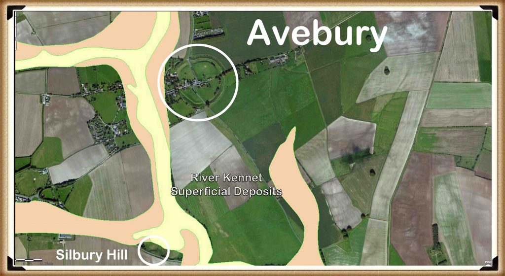
When it was that size and that large and I’ll show you a picture of the tick off the of the alluvium from the British Geological Society with their fanned around here it shows that once upon a time the Kennet was this size and would have touched the edge of the Avebury site which gives you a bit of a clue of what they were doing with it because the boats will now be able to come in and more inside Avebury in these gigantic ditches which I would imagine actually would joined we now got roads there this was just been one large ditch
I think it actually was there would have been a gap here because we’ve got the stone Avenues coming out this side but I would imagine the ditches would have continued here and were continued on that side as well and it’s only recently since the roads have been put in that these ditches have been filled in for obvious reasons.
Now what’s interesting if we can pan in and tilt this just a little bit is having a look at the west side which has been lowered for the Kennet. Now archaeologists have seemed to miss this completely for some reason.
As we can see there very clearly and what I’ll do I’ll take the water off because it’s a bit distracting that’s better well you can see here very clearly is that this bank has been tapered it’s been rounded here and tapered there now that and obviously on this side has been tapered here there is no logical reason that it’s been should have been tapered and if you look at some of the if you look at some of the icon drawings they will show you it has been completely round at some point which is a nonsense it was never that way these tapered edges have always been there and as we have a closer look we could go around the back and have a look
We can show you that basic there you go can’t get more clear there this was this was made to be tapered this was not natural there is nothing here… most people think that it was tapered or cut down because it’s in a way off part of the tap well there’s no town there and as you see from the LiDAR there’s never been we can see we see walls and buildings and bits here and here and here here nothing so why would you take down this gigantic bank if you have no reason to it’s a bit of a nonsense really.
So this tapered effect of the bank has never been explained by archaeologists unfortunately but it is a main key feature and if we put the water back in again it becomes painfully obvious and that’s a bit too high and we it will drop a bit here we go painfully obvious that this is where the water were coming to fill the ditches of Avebury – archaeological conundrum 101 Avebury resolved
Okay for we go and take a look at the number bank here we also see that that’s been this rounded obviously it’s not squared it’s been tapered as well and that’s because it was never meant to be there and I imagine once upon a time that the river probably came in here and would have come in here it’d be very hard to see this now because this is now raised ground due to the fact that you’ve got a cricket ground and you’ve got buildings and you can see this is this is natural ground – this has been built upon in recent years with bits and pieces which have changed the level and therefore we don’t see as we see on this side it’s nice clear aspect of where the River would have come in in the past .
We see here very clear River would have been here boats would have come here and trading would have been on here very much like Windmill Hill in the past so a very clear indication of Avebury phase two the other aspect which archaeologists sadly don’t really go into much detail about is why did they dig the ditches are so deep. They don’t need to be 12 meters deep do they?
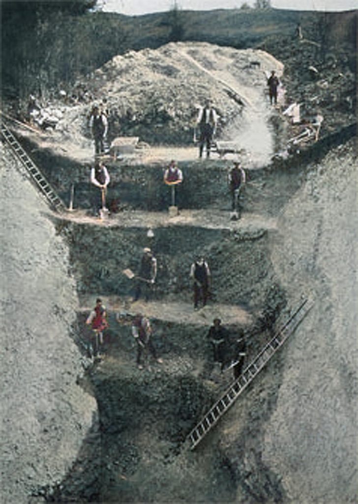
Unless there this is a really good reason now sadly I watched Carenza on Time Team once and she told me on the television that these ditches were so deep it was to keep out evil spirits…wow!
How can I question that that is such a scientific proof with such great evidence who wanted to question that logical scientific conclusion to why these ditches are 12 meters deep unless of course it’s wrong what we have found is that as the river and let’s see if I can illustrate this by showing the River as as the river went further and further away the water table would have got lower and lower as you see here it’s dropped another three meters if it drops another three meters here and not touching to keep this has water and I would imagine again because we can’t see there might be still a connection roughly here to here because again you’ve got buildings here it’s referring the landscape so it’s almost impossible to tell surfaced original surface area was it’s all been built up since then.
But clearly from this illustration here we can see there is there is a a hint that the river continued to touch the edge of the the site here and it’s dropped from one five seven to one five four so that’s three metres now if it’s dropped three metres in water level these would have to be three metres deep deeper to contain water that’s the logical aspect of the water table.
So let’s say it started up as a two metre ditch which is what we see in Stonehenge and other rare and other sites start up as a two metre ditch with water as you start to dry up they would have to then dig so it would on this hand this occasion they’re out of it a number three metres to it so that’s a minimum of five metres which is a very very big ditch.
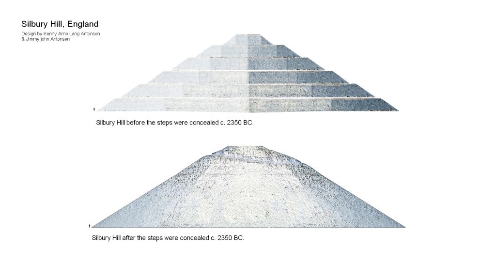
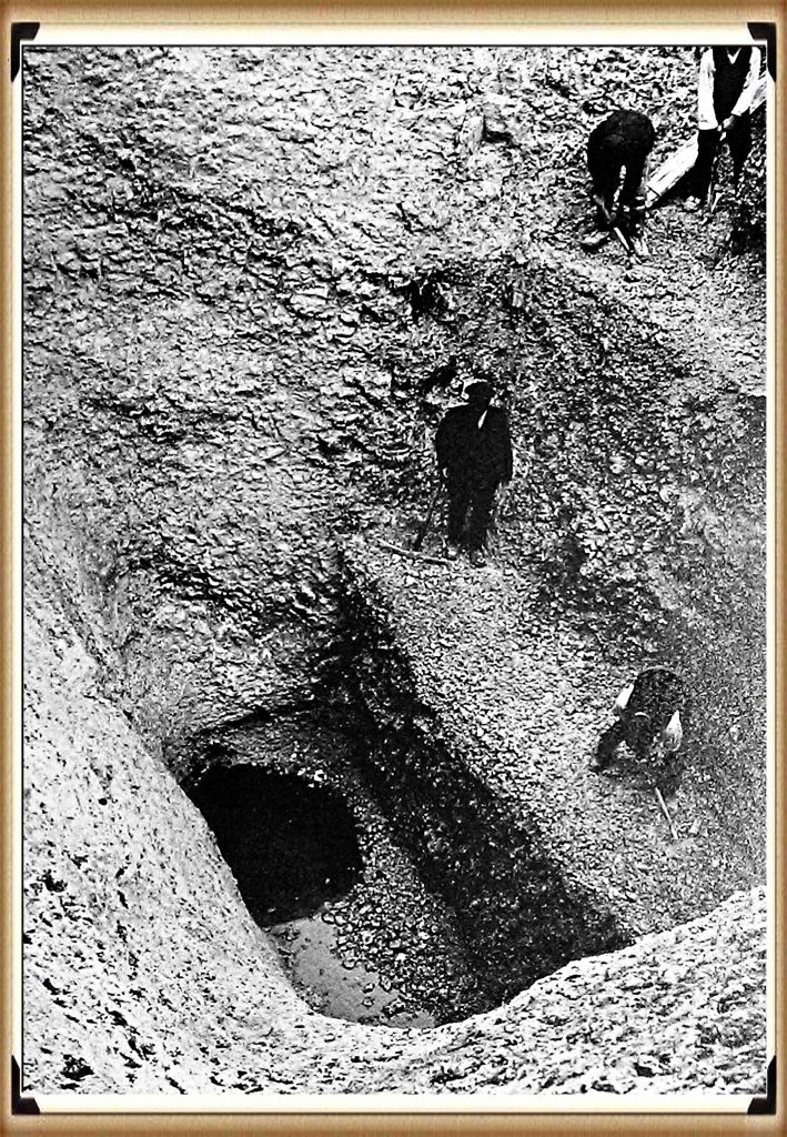
So what we see here is that Avebury was actually built in stages and then we see this later on in phase three when we start looking at Silbury Hill and the fire Beacon there and how that was built we see it started low and it built up high over hundreds of years very good reason for that is for visibility on this occasion with a brief phase two is because the groundwater dropped and they tried to keep up with the drop of the groundwater by digging the ditch deeper until it got to 12 metres and if I can just lob in a picture here when we done an excavation or when archaeologists done the excavation in 1922 (2014) when it got when they got to the bottom of this ditch which was at the same height as the eight of the same height as the cross so you can see the picture we’ve been at the same height of as the Kennet which is this river here they actually had to stop because it failed full of water one we might have to say a bit of a clue what it was when it filled full of water but clearly archaeologists don’t want to know the truth because they’ll have to rewrite the books.
Anyway that is Avebury phase two next week we’ll look at Avebury phase three which we’ll be looking at the very famous Silbury Hill and where that was built and again it’s to do with water levels
Well that’s all we’ve got time for this week tune in next week for another edition of Langdon investigates where we look at another ancient site until then subscribe below to make sure you’re informed when new videos come on the video channel until then thank you for watching.
For more information about British Prehistory and other articles/books, go to our BLOG WEBSITE for daily updates or our VIDEO CHANNEL for interactive media and documentaries. The TRILOGY of books that ‘changed history’ can be found with chapter extracts at DAWN OF THE LOST CIVILISATION, THE STONEHENGE ENIGMA and THE POST-GLACIAL FLOODING HYPOTHESIS. Other associated books are also available such as 13 THINGS THAT DON’T MAKE SENSE IN HISTORY and other ‘short’ budget priced books can be found on our AUTHOR SITE. For active discussion on the findings of the TRILOGY and recent LiDAR investigations that is published on our WEBSITE you can join our FACEBOOK GROUP.


