Silbury Hill
Extract from the book – Chapter 2 Silbury Hill – Avebury’s lost stone circle
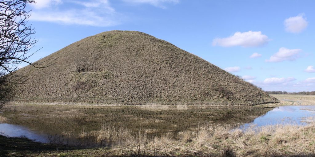
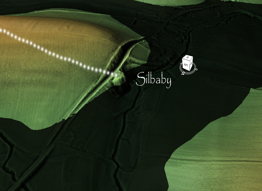
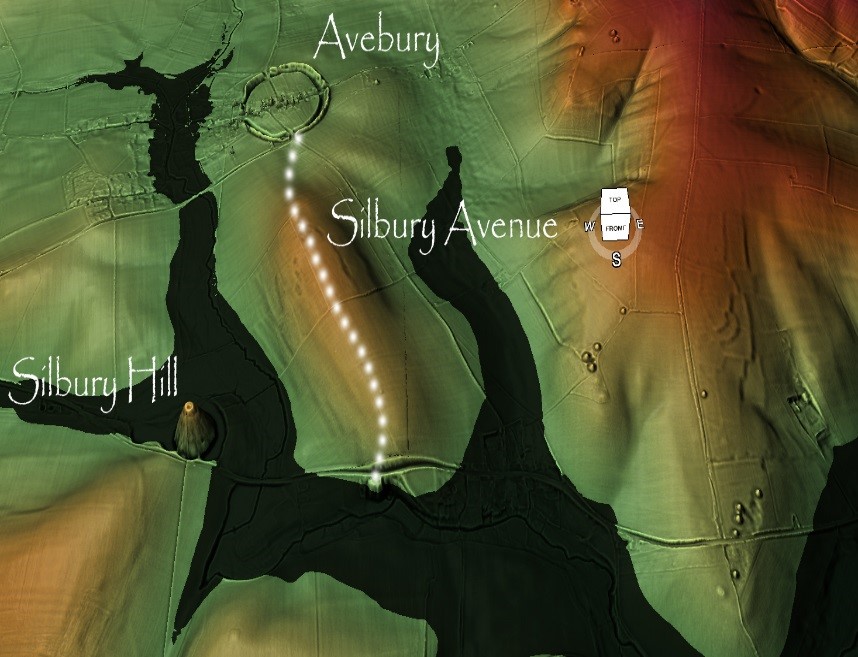
The barrows on the left of Silbury Avenue indicate that these features were built after the Avenue was constructed and not because of them, as the path passes the barrows to one side without termination. Although the new Avenue would have led towards Silbury Hill, it did not terminate at the monument. As it was inaccessible due to it being surrounded by deep water, which can still be seen today during the winter seasons.
The topology shows that Silbury Hill would have been built on a natural peninsula as part of the River Kennet. This high groundwater table causes this flooding due to springs that have recently been located. (Whitehead, P. and M. Edmunds. 2012. Palaeohydrology of the Kennet, Swallowhead Springs and the Sitting of Silbury Hill, English Heritage, Research Report Series 12-2012).
My radical ‘Post-Glacial Flooding’ hypothesis (now clearly supported by Whitehead) is that Britain was flooded directly after the latest ice age due to the raised river levels; consequently, these ancient sites were built on the shorelines of these ‘wetlands’. The springs identified by Whitehead are a consequence of Ice age groundwater, which would naturally disappear over time, as the levels fall.
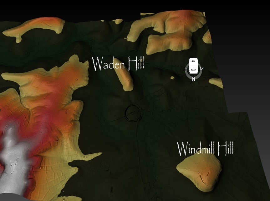
After the ‘great melt’ of the last ice age this area would have been almost completely flooded at the start of the ‘Mesolithic Period’ – about 10 000 BCE. The only part of Avebury above this ‘initial water level’ would have been Windmill Hill – which is NW of the current Avebury site. This site shows evidence of occupation as it is what archaeologists call a ‘Causewayed Enclosure’ as they (incorrectly) imagine the moats that were built to accommodate ships and boats were, in fact, dry ditches in an attempt to contain cattle.
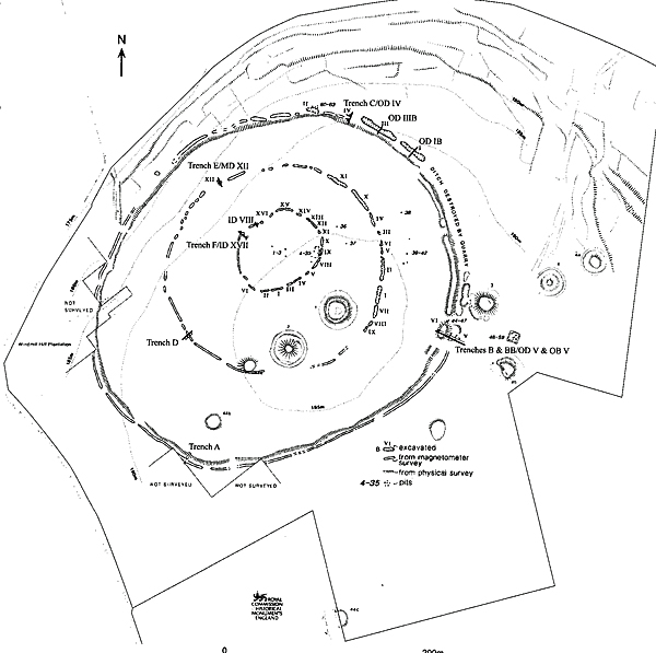
The construction of this kind of site for the use of cattle is nonsense, as the time, effort, organisation and workforce required to dig a ditch rather than build a fence make it unfeasible (otherwise, we would have done it in the recent past and even today with modern JCB’s). Although, I have no doubt that after their original use, many thousands of years later, they did serve the purpose of farmers who could not afford nor had the time to build fences.
I have renamed these monuments’ Concentric Circle sites’ as they are a product of an earlier civilisation whose construction practice produces this distinctive feature, which the Greek philosopher and writer Plato wrote about in his dialogues about a culture that lived in the 10th millennium BCE.
Once the waters of the Mesolithic subsided, a couple of thousand years later, Windmill Hill would not have been accessible by boat; therefore, another site closer to the new water’s edge would have been required – this is the Avebury we know today. The ditches were built to accommodate (like Windmill Hill) the ships and boats of this trading civilisation.
Unfortunately for our ancestors, the groundwater levels continued to recede, as they have consistently since the end of the last ice age. Consequently, the waters failed to reach the moats of Avebury (even as they dug deeper into the ditch to find the groundwater – and hence the 12m canal/ditches), and consequently, they faced the same option they had two thousand years earlier to abandon or replace.
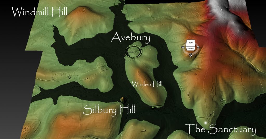
Again, they decided to replace, but this time keep the original site as it had assets which were not only historic but almost impossible to transport – the gigantic megalithic stones which we will discuss later.
Our ancestors moved to a natural harbour slightly downriver from Avebury at a place we call Silbury Hill. The River Kennet would have been much smaller in the Neolithic Period (4500 BCE to 2500 BCE) but still three to four times larger than today. Mariners could find prehistoric harbours relatively easily without maps by following the ‘Long Barrow’ markers that acted like giant direction finders and are found all over on the hillsides of Britain.
I understand some readers will find this ‘Long Barrow’ idea somewhat ‘far-fetched’, but not surprisingly, this type of navigational aid is commonplace and was used less than a hundred years ago at the birth of the aeronautical industry.
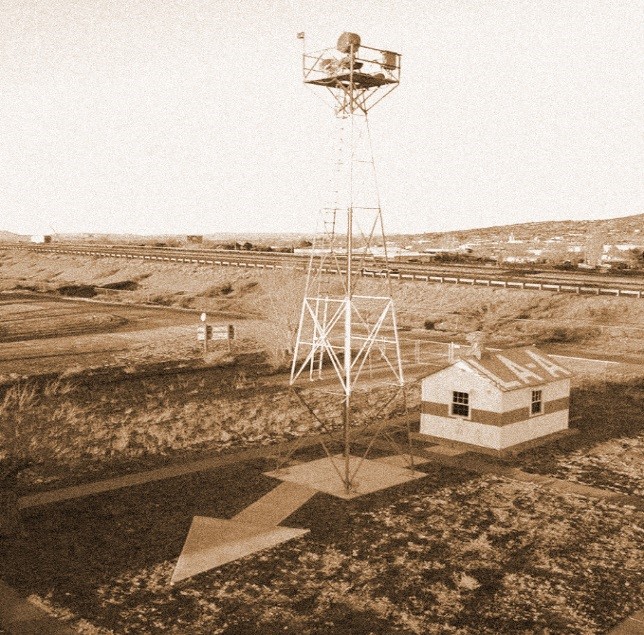
In 1924, the federal government of the United States of America funded enormous 70-foot concrete arrows to be built every 10 miles or so along an established airmail route to help the pilots trace their way across America in lousy weather conditions and particularly at night, which was a more efficient time to fly. Painted in bright yellow, they were each built alongside a 50-foot tall tower with a rotating gas-powered light. And each station had a little rest house for the folks that maintained the generators and the lights. These airway beacons are said to have been visible from a distance to 10 miles high.
Not only did they build seventy-foot bright yellow arrows, but they also illuminated them at night and during bad weather. Strangely, this is no different to what our ancestors did in the past with the introduction of the boat. Long barrows are over 300 feet long, built with a higher back end and a smaller front end (in height), so they will look like a gigantic pointer from a distance as it was made of bright white chalk. In addition, the harbours had fire beacons to assist navigation further (just like the aeroplane arrows), and this is the secret of Silbury Hill – it is a fire beacon.
For more information about British Prehistory and other articles/books, go to our BLOG WEBSITE for daily updates or our VIDEO CHANNEL for interactive media and documentaries. The TRILOGY of books that ‘changed history’ can be found with chapter extracts at DAWN OF THE LOST CIVILISATION, THE STONEHENGE ENIGMA and THE POST-GLACIAL FLOODING HYPOTHESIS. Other associated books are also available such as 13 THINGS THAT DON’T MAKE SENSE IN HISTORY and other ‘short’ budget priced books can be found on our AUTHOR SITE. For active discussion on the findings of the TRILOGY and recent LiDAR investigations that is published on our WEBSITE you can join our FACEBOOK GROUP.
Other post suggestions:
Avebury’s Lost Stone Avenue – Flipbook
Linear Earthworks are Canals (Dykes)


