Linear Earthworks are Canals (Dykes)
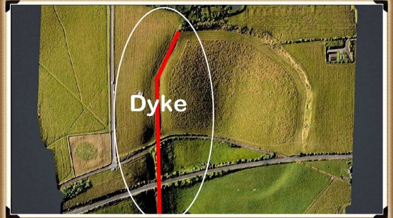
When it comes to the use of ‘linear earthworks’ (we call ‘Dykes’), there is massive confusion amongst both professionals and amateur archaeologists about how such structures could function when they are dry today? (Linear Earthworks).
The incorrect perception of these ‘Dykes’ is either they are ‘rivers’ (like the Thames) that flow uphill or Victorian Canals with locks and wooden gates regulating the flow of the water – which are equally nonsensical as a prehistoric structures. Basic Hydrology that most people (should be but not necessarily ALL) learnt at school is that water is under the ground – not just a little water but 30% of all the fresh water on the planet.
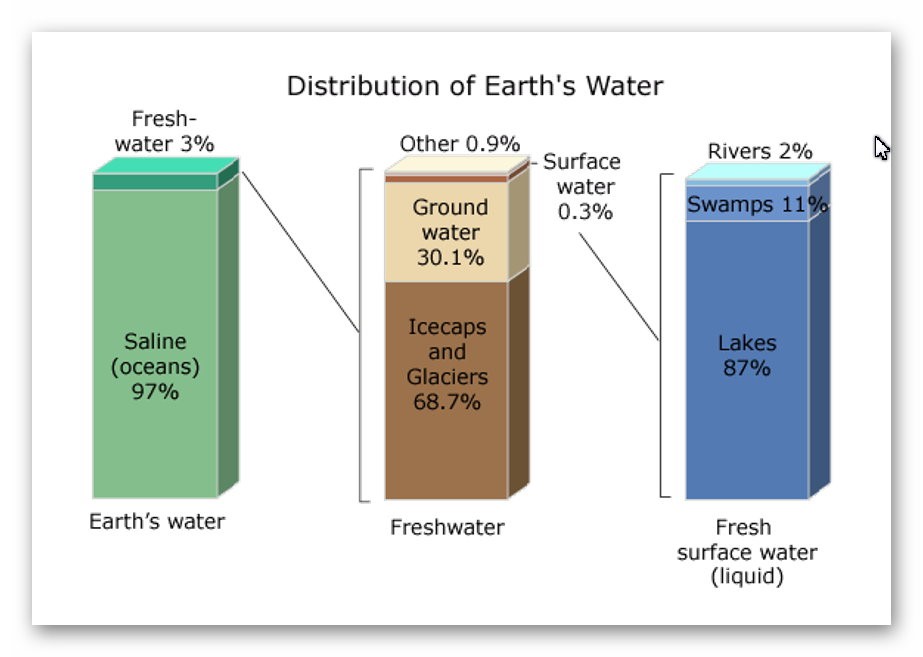
This abundance of ‘groundwater’ is evident as it is the source of ALL rivers and supplies the Wells that have been dug since the beginning of time when rivers were absent. Even today, if you go into your garden and dig a hole, it will eventually fill with groundwater, whether in a valley or on top of a hill or mountain.
How and why water is on hills is very challenging for individuals as most people have a simplistic view of water being flat and sitting at ground level – but the earth is a far more complicated structure as this is the reason that it took centuries for people to recognise that we lived on a sphere and not a ‘flat-earth’ as such complex concepts such as gravity are hard to comprehend.
The reality is that ‘streams’ of water are encapsulated within the bedrock allowing ‘springs’ to start rivers at a great height as the groundwater is under pressure and erupts to the surface from BELOW and does not flow up or down the hill internally – but can flow downhill AFTER it escapes from the soil, because at the point of escape gravity then becomes the greater force overcoming the water pressure when within the bedrock – which stops it flowing down the landscape and can push it up to the top of hills and mountains.
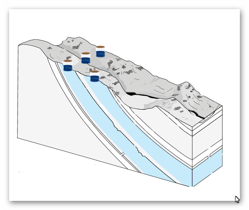
Consequently, wells work even on hills as the groundwater is encapsulated in the bedrock and soil. The above illustration shows that if wells are dug halfway up a hill where there is a groundwater pocket, they will fill – if we join up these wells, the entire ditch will also fill with water – sourced from the ground.
The central aspect that must be remembered when considering the reasons behind the construction and maintenance of these earthworks (Dykes) is that the environment was so much different in the Mesolithic Period, which changed rapidly when entering the Neolithic and then even more changes in the Bronze and Iron Ages.
Once the ice sheets had melted and the climate began to warm, the landscape gradually changed from open tundra to dense woodland. By around 8000 BC, pine and birch dominated the woodland cover. These were slowly replaced by lime, elm and oak with some hazel. By 6500 BC, pine and birch woodland would only have been found on the thinner limestone soils of the uplands.

With up to 90% of the land covered in woodland or another, the Mesolithic people needed all the open ground they could find to hunt larger animals like deer using their flint-tipped bows and arrows. The lakes also provided plenty of minor game, such as birds and fish.
We know that the hunters were here because archaeologists have collected thousands of their flint artefacts from sites around both lakes and rivers. Recent fieldwork and excavation by Bradford University around Malham Tarn have thrown more light on the people who used it as a hunting base. In the later Mesolithic, people were camping out on areas of slightly raised ground close to the shore of the Tarn. Geophysical survey work has shown several possible hearths at one of these campsites.
Charcoal has also been found in Mesolithic contexts in the wetlands above the Tarn. It seems likely that the hunters burned back the edge of the woodland to create more open ground for their prey to graze on. This would also have favoured the growth of hazel since, unlike other woodland trees, hazel grows back quickly from a burnt stump. With hazelnuts being a significant winter food source at this time, the people may have had this aim in mind too. People had begun to alter their environment, and it was the beginning and end of the wildwood in the Neolithic Period.
Consequently, at the time of the construction of Dykes the water table was still high, and rivers and wetlands dominated the landscape. When looking at the landscape of these Dykes (particularly our case studies of Offa and Wansdyke), we notice that the earthworks are not consistent or continuous. Fell walkers who have followed these features on foot have trouble accepting that these were canals abandoned long ago and hence are just a shadow of their former selves.
If we compare other known abandoned canals from just a mere 100 years since their abandonment, we see there look remarkably the same, and even today, people find it difficult to accept these empty hollows were once part of a massive ‘super highway’ of the Victorian era that linked cities of trading together – like our ancestors Dykes.
The gradients of some of the valleys these features follow have also given walkers great concern as if water had been within the ditch, they perceive, it would all run away to the bottom of the valley, leaving the canal ditch dry and a large lake at the bottom.
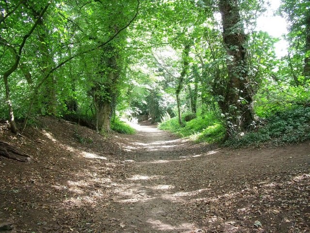
The problematic conclusion with this analysis is that the walkers rely on OS maps (for accuracy), and they show these Dykes as continuous features – but the reality, if we look at the ‘scheduling of these monuments’ through Historic England, this is far from the truth. As we have shown in case studies on my web site, most of these earthworks stop at the top of the valley hill and continue on the other side as if there was something in between?
We find that there is indeed something in between these breaks, and it’s called water, as, at the time of construction, the river levels were higher, and these valleys would have been flooded. So, they would paddle across the riven.
Moreover, what we see added at a later date are extensions to the original Dyke to follow the falling river levels down the valley in sections and to a different specification to the above initial earthwork. This can be shown in the area of Offa’s Dyke just outside Chepstow, where the Dyke enters the valley but seems to stop at the top and then other partitions are added later.
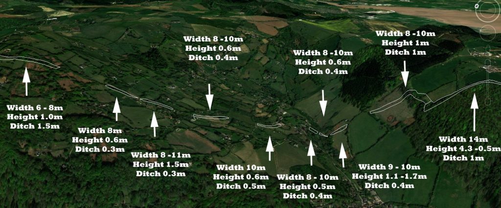
In the above GE photo, we see that the extracts of Offa’s Dyke that enters the dry river valley change in character except for one aspect – the width of the bank.
This evidence suggests that when the rivers fell in the Neolithic/Bronze Age, they may have adapted the route to place ‘ponds’ (small lengths of Dyke with water) to allow boats to cross the dried river channel. If we look at the far Right connection between the main Dyke and the first Pond, we can see that they may have been a small channel (1m) connecting the 10m wide ditches, which would have been fed by water between the ponds without over spilling and emptying the pond – a prehistoric lock system.
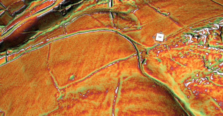
So, what makes the width of the bank so important?
The width gives us a clear view of how the use of this earthwork changed over time. What we see today is not what was initially built in prehistoric times – then the ditch was of greater importance, and then as the water table fell over many millenniums, the bank became of great significance and adapted.
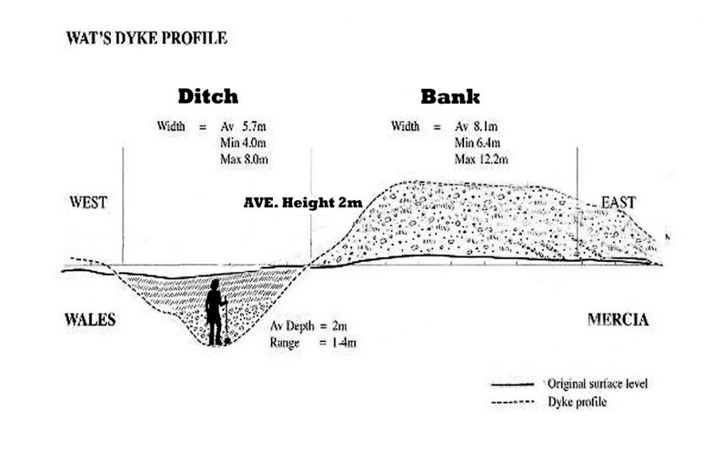
The bank needs not to be so vast unless it has changed from being a towpath (only 2 – 3m wide) to a road that took two-way traffic.
Interestingly, Dyke banks have developed to become the same width as a standard Roman Road (5m – 10m). However, our Offa example shows that the road (bank) is 6m – 14m and only 0.4m to 1m in height. This suggests that the Dykes purpose changed in later use, and looking at the 1800 OS map; this is confirmed as Offa’s Dyke is marked as an ‘ancient road’.
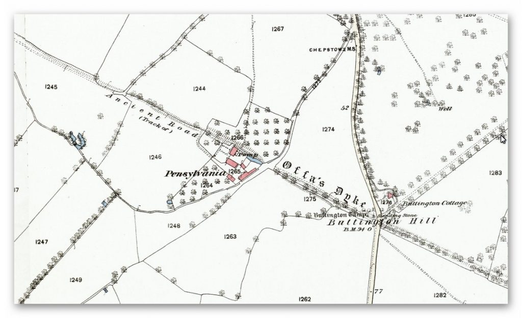
This would explain why the ditch became more shallow down the dry valley, and on the Historic England monument reports, a copious number of ‘Pits’ were found next to Bank, indicating that the contents of these pits were used to widen the road later than the original ditch.
We can only speculate that the ditch, which is only half to a third of the size of the ditch outside the dry river valley area, was still used as a canal initially and then was entirely abandoned for a road when the water table diminished.
Looking at how the Victorian engineers used locks to go up and down hills does give us an alternative possibility to how our ancestors regulated the flow of the canals allowing them to cross hills with minimal fuss.
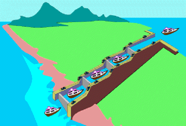
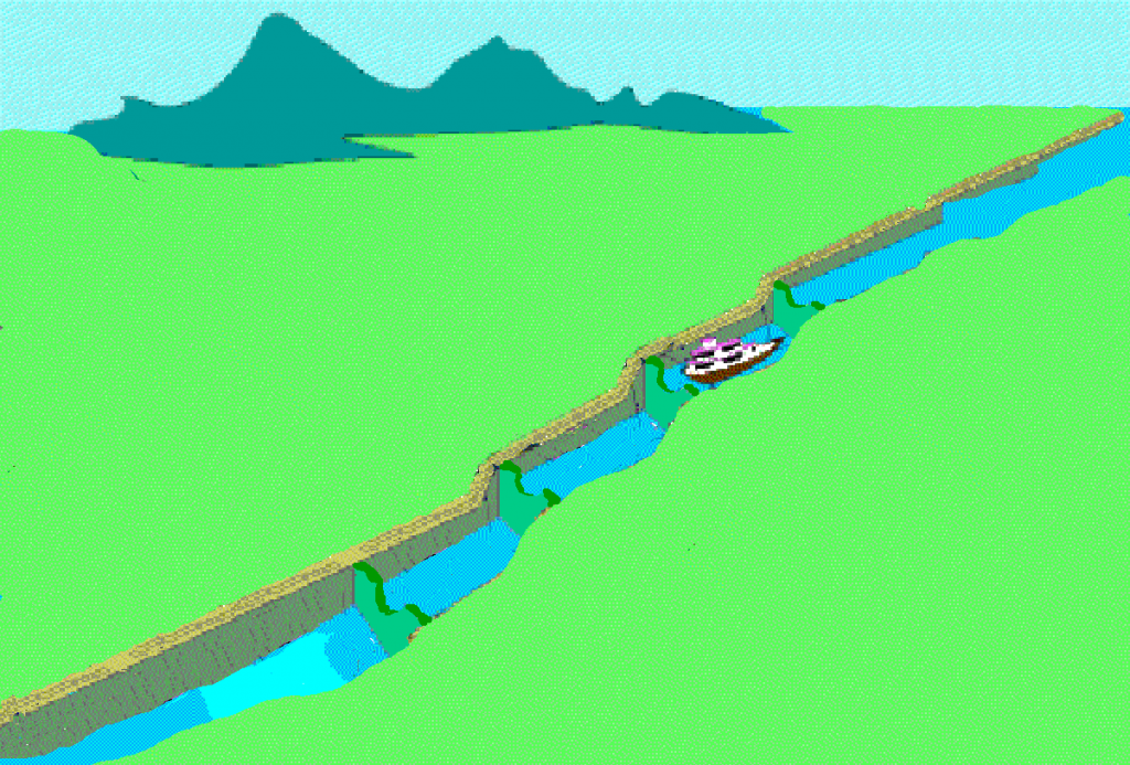

We have seen with Offa’s Dyke (fig. 13) that if you cut small unconnected ditches, the water will remain inside the channel and not flow downhill. Therefore, you can access this channel by cutting a small connecting ditch which is very shallow – this allows boats to move between channels without the large ditches losing water.
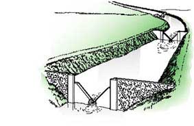
This same principle can be seen with wooden weirs that have a small grove or cut, allowing only a tiny amount and a boat to move from channel to channel, or a combination of both with ponds with narrow ditch channel connections and Weirs on vast stretches to regulate the flow.
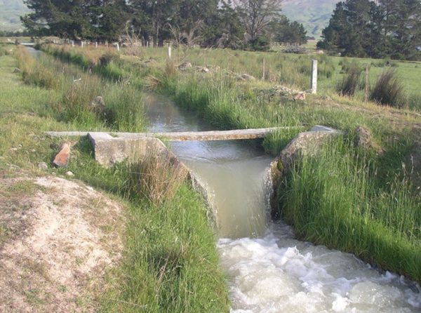
Where ‘Springs ‘ do sprung!!
My recent investigations into another prehistoric Dyke that the Romans reused, called the Vallum by Hadrian’s Wall, have shown that Dykes can not only trap water, but they can also place the Dyke over or close to ‘Springs’ to allow the ditch to replenish its loss of water due to the gradient losses.
Rivers are formed from ‘springs’ and gain greater volume from ‘runoff’ from surface water (rain) or other interacting rivers. What we have found with the Vallum (and we believe this occurs in both Offa and Wansdyke) is that the Dyke was constructed on top of some ‘Springs’ or within 200m of other springs (which would indicate that the water table was just under the surface) and so a ditch of 1m to 2m would fill with groundwater – but under pressure that would naturally replenish if it moved downhill like a river.
The speed of the replenishment would depend on the depth of the ditch – the more deep the ditch, the more the water as the soil/rock is removed, lessening the resistance to the water. Springs give out a massive amount of water depending on their closeness to the surface:
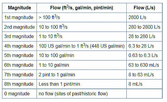
As you can see, a significant spring can pump out as much as 2,800 litres PER SECOND, and you might tap into several spring on a canal length – this water would naturally run downhill, and on a steep incline, the water will have to be managed. The simplest way of dealing with fast downhill currents (so you can take your boat up the opposite way with ease) is to create a series of weirs (artificial barriers); these can be either by narrowing the sides or under the water to slow the flow rate and dam up the water stream.
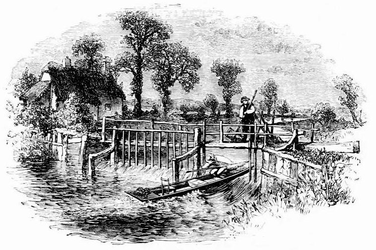
The early Victorian Canals had no locks but weirs. These weirs regulated the flow downhill by placing a wooden barrier (weir) in the canal and leaving a small gap to one side to allow boats to either go up (with the assistance of a winch) or down, keeping a majority of the water upstream of the canal by a gate that could make panels of wood of ‘paddles’ depending on the volume of the water flow. These are more effective than Locks as the boat needs not to stop to pass – but are required to have the weir almost manned full-time and therefore at a higher cost in Victorian times, not necessarily in prehistoric times.
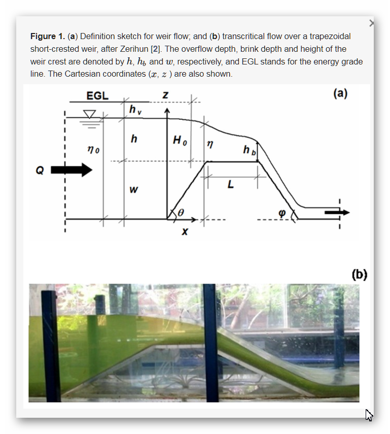
What has surprised us about this technique is the number of ‘springs’ that are in the vicinity or under the Dyke (Vallum) – the construction is about 70 miles long, and we have found over 65 springs associated with the struct (about one spring per mile), but these are TODAY’S reported springs – we have not taken into account (because there are no maps) the more significant number of ‘Springs’ that would have been in that Dyke construction area at the time of construction (so we could be looking at 100+ springs if not more!!) this volume of water would keep any structure supplied with water at whatever gradient it took.
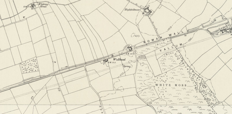
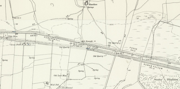
To understand how these canals worked in hillsides of Britain, where today they are dry and barren, you need to appreciate the landscape after the last ice age. As we have already started, the environment was primarily covered (90%) with woodland and trees. This is because the water was abundant on the land as the water table was incredibly high.
This made the landscape almost like a latter-day tropical rainforest rather than the grassy plains we see today.

The high-water table is a direct consequence of the last ice age, which, at its maximum about 30k years ago, had most of Britain under two miles of the ice cap. The melting of this 361.8 gt of water, or 67,000 inches of water per square inch, flooded the soil, which it could not absorb, so it leaked out for thousands of years at all elevation levels.
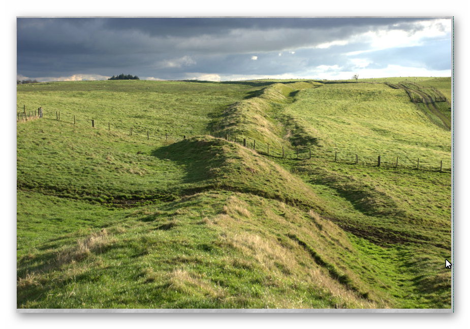
This shows why rivers were at their highest level in history in the Mesolithic period and how easily it would be to find the water table if you dug a well or in this case a ditch some 7,000 years ago – which is the current estimated date of the construction of these Dykes.
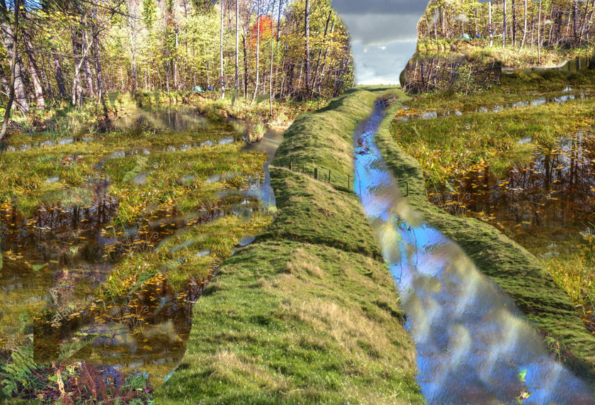
This leaking of ground water into the environment can be found in SEA LEVEL CHANGES, but (Table 1) this constant flow and replenishment of groundwater are shown in another measurement, such as the age of water in the groundwater aquifers.
These dates show that water entered the groundwater table in vast quantities in the Ice Age – but stopped for six thousand years – so did it stop raining for 9,000 years? Or was more water coming out than entering the ground at this time and beyond?
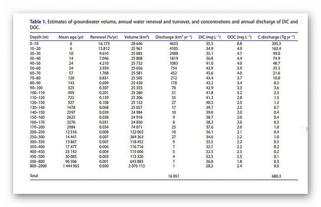
The Age of Water table shows that most waters were placed in the landscape soils during the ice age, and it seeped out for 9,000 years before the rainfall penetrated the land again.
The reason for the construction of Dykes in the past is shown by the sheer volume of ‘Linear Earthworks’ found in the Northern Hemisphere. There are 1497 Scheduled Dyke sites found covering the entire British landscape – from the known Offa and Wansdyke to the East Coast, Ireland and Wales and now we have even found that the Vallum connected to Hadrian’s Wall was also once a prehistoric Dyke that the Romans reused to convey the stone to the Walls.
The idea that these features are Medieval (although they may have been reused at that period) in origin is impossible as they are found as far as field as Southern Ireland (a mere 147 Dykes) and on both the Shetland and Scilly Isles – too widespread to be these so-called ‘Saxon’ boundary/ defensive markers.
Why do archaeologists and geologists have so much trouble understanding past river and water levels?
We have shown in our trilogy ‘Prehistoric Britain’ that other ancient ditches contained water from the high water tables of the past that also fed local active ‘springs’ which flowed into the local rivers – like the River Avon next to Stonehenge, which consequently raised the River’s water level that flooded the area by ‘The Avenue’ known as Stonehenge Bottom.
Archaeologists who have attempted to investigate this possibility, like Julian Richards in his book ‘The Stonehenge Environs Project’ concluded that it could not be possible or was at a much earlier date, as their expert Geologist has assured them that the amount of ‘alluvium’ (sandy silt) found at the site was insufficient in volume. Sadly, this was ‘Bad Science’ as any true expert in ‘Hydrology’ would have told them – for alluvium is only produced when a river flows rapidly (due to surface runoff), cutting down rocks and stones that create this sandy, silty substance.
Water from a spring does not create ‘alluvium’ as it is from ‘Aquifers’ and not rainfall runoff – as this article from Wikipedia on chalk streams qualifies.
Chalk Streams (Wikipedia)
Chalk streams are rivers that rise from springs in landscapes with chalk bedrock. Since chalk is permeable, water percolates easily through the ground to the water table and chalk streams therefore receive little surface runoff. As a result, the water in the streams contains little organic matter and sediment and is generally very clear. The beds of the rivers are generally composed of clean, compacted gravel and flints, which are good spawning areas for Salmonidae fish species.
Since they are fed primarily by aquifers, the flow rate, mineral content and temperature range of chalk streams exhibit less seasonal variation than other rivers. They are mildly alkaline] and contain high levels of nitrate, phosphate, potassium and silicate.] In addition to algae and diatoms, the streams provide a suitable habitat for macrophytes (including water crowfoot) and oxygen levels are generally supportive of coarse fish populations.
Of the 210 rivers classified as chalk streams globally, 160 are in England.
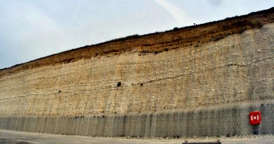
Chalk is a highly porous and permeable rock, and rain falling onto chalk topography percolates directly into the ground, where the chalk layer acts as an aquifer. The groundwater flows through the chalk bedrock, re-emerging lower down the slope in springs. The chalk acts as a temporary reservoir by regulating the amount of water supplied to the springs.
This is why many chalk streams in the UK have stable flow regimes that vary only slightly over time. The temperature of the emerging surface water is fairly stable and rarely deviates from 10 °C (50 °F). On cold winter mornings, water vapour from the relatively warm stream condenses in the cold air above to form fog.
Chalk is slightly soluble in rainwater because rain is naturally slightly acidic. The products of chalk weathering are dissolved in rainwater and are transported in stream flow. Chalk streams transport little suspended material (unlike most rivers), but are considered “mineral-rich” due to the dissolved calcium and carbonate ions.
The surface water of chalk streams is commonly described as “gin clear”. The channel bed consists of angular flint gravel derived from the natural flint deposits found embedded within the chalk geology that contains relatively low amounts of clay and silt deposits.
The unique characteristics of chalk stream ecology are due to stable temperature and flow regimes combined with highly transparent water and lack of sand grade sediment particles.
Chronology
The dating of these linear earthworks can only be achieved by looking at the rivers these features interact with and connect to that form the Dykes we observe today – which are now just dried up ‘Dry River Valleys’ also known as ‘Paleochannels’ by geologists. However, a recent publication by Historic England also admits that these features are much older than first believed because older dated items are being found on each new excavation.
Prehistoric Linear Boundary Earthworks: Introductions to Heritage Assets. Swindon. Historic England 2018.
Linear earthworks are not always easy to date: often, they contain little dateable material and in many cases they are likely to have been repeatedly cleaned out or refashioned so that evidence for their origins has potentially been removed. Superficially, their form is not often diagnostic, so prehistoric examples can be confused with medieval or later ones. For this reason, amongst others, associations with other monuments are extremely important.
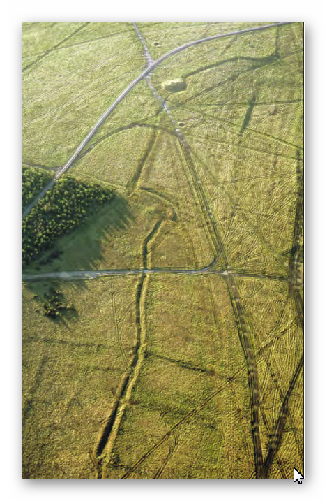
In some cases, survey can demonstrate that linear earthworks are aligned on, or even impinge upon, pre-existing monuments such as burial mounds and hillforts.
A number of other hillforts, such as Woolbury, Danebury and that on Quarley Hill, all in Hampshire, or Sidbury in Wiltshire, were established at the junctions or terminals of pre-existing linear earthworks. In these cases, understanding of the associated monuments can make a vital contribution to the understanding of the function and date of the linear earthworks.
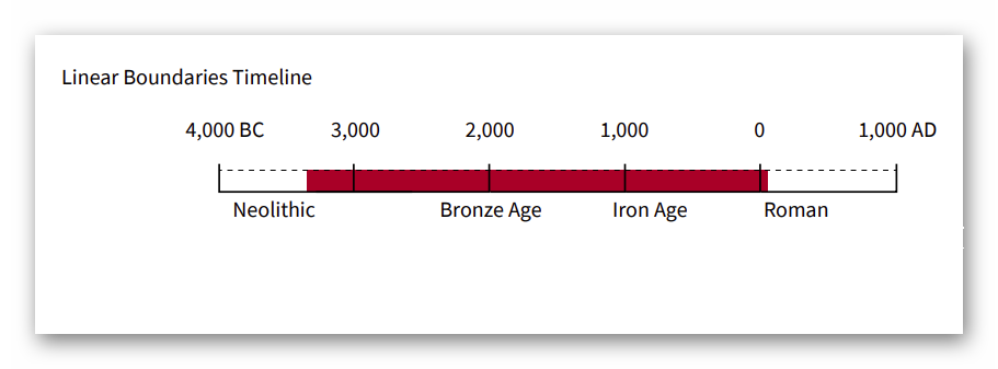
Overall, it would seem that boundaries were constructed, in one form or another, from the early Neolithic onwards. The earliest ‘conventional’ linear earthwork so far confirmed, dating to around 3600 BC, follows the crest of the western escarpment of Hambleton Hill, Dorset, for perhaps as much as 3 km. It comprises an almost continuous bank and segmented ditch, thus similar in form to two causewayed enclosures on the adjacent summits.
Land boundaries appear in greater numbers from the middle of the Bronze Age, around 1500 BC, apparently coinciding with pressure on land brought about by increasing population levels and perhaps with the rise of powerful rulers who were able to command large workforces. Some of these early boundaries, as well as newly constructed ones, continued to structure the social and economic landscape through the Iron Age and into the Roman period. Indeed, some have seen continuous use, or repeated re-use, from prehistory to the present day.
The construction and initial use of pit alignments may have spanned a somewhat shorter period, though a number were re-used subsequently.
On Chapperton Down, Wiltshire, within Salisbury Plain Training Area (Fig. 30) , a linear earthwork is aligned on a Neolithic long barrow, cuts through earlier fields, and changes direction sharply to avoid a pre-existing settlement.
Some of the earliest seem to date to the later Neolithic period: on Ebberston Common the latest of the sequence of at least six pit alignments appears to predate the construction of a round barrow which would typically date to the earlier Bronze Age, around 2000 BC. Relatively few pit alignments seem to have been created after the Early Iron Age. Excavations elsewhere have discovered other anomalies, however, constructed in the Roman period and even in the 18th century. So-called ‘multiple ditch systems’ appear to have originated in the late 2nd to early 1st centuries BC and to have continued in use into the Roman period. This makes them broadly contemporary with the oppida with which they share various characteristics.
Case Study Wansdyke – Morgan’s Hill West
The steepest aspect of Wansdyke is the rise over Morgan’s Hill, which is an incline from 182m OD to 252m OD.
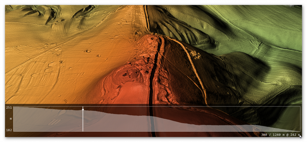
If we are correct with our assumption, we need to show that you can transverse this massive incline using natural springs and basic wooden weirs. If we split the gradient into four parts, we can see better the profile and problems our ancestors faced.
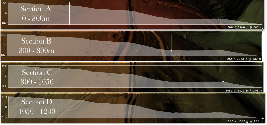
Section A – 0 to 300 downhill
Length is 300m, and the inclination lowers from 251m OD to 242m OD at a ratio of 3% or 1:33 – If we accept that within this section, we had four cat A ‘springs’ that would release 11.2 cu. metres of water PER SECOND (11,200 litres per second) would fill a 10m ditch that is 1.5 deep by one-metre width of the Dyke’s ditch every SECOND.
According to the mathematical formula (v = k * C * R0.63 * S0.54 ), water at the end of section A would be travelling at 5 MPH – the speed of the Thames at Henley (so quite navigable) and, therefore, no need for any Weirs to reduce the water flow.
Section B – 300 to 800m downhill
This section would receive water at one metre per second from Section A, travelling at 5 MPH – The length of this section is 500m in length, and the inclination lowers from 242m OD to 200m at a ratio of 8% or 1:12 this would accelerate the water to 15 mph which is too fast the navigate uphill. Therefore, a series of weirs would have been placed either under the water or, as the early Victorians achieved, by a paddle weir or both.
An underwater weir (blocking 50% of the water but allowing boats to move over the top without hindrance) would reduce the flow by 50% – so if placed at the End of Section A (at 5 MPH) would reduce the water flow to 2.5 MPH and down to 12.5 MPH at the End of Section B. Consequently, if we place one of these 50% reduction weirs at 100m intervals the water flow would not go over the 5-mph mark and would probably be in the region of 3 – 5 MPH which again is easily navigable.
Section C – 500 to 1050m downhill
The length of this Section is 550m at an inclination of 0% – its flat the only water flow movement will be from the residue movement from Section B – another 50% weir could kill this if they wanted 550m of dead water to allow the animals or people dragging the boats to rest before the next incline?
Section D – 1050 to 1240m downhill
The length of this section is 190m at an inclination of 200 to 182m at a ratio of 9.5% or 1:9.5 – the length of this section in the Mesolithic would be questionable as the river Kennet during this time may have covered this section, and so not a problem. But at a later date, if this section was required (i.e. during the Roman period), then like section B a 50% weir every 100m would slow the water flow below five mph.
For more information about British Prehistory and other articles/books, go to our BLOG WEBSITE for daily updates or our VIDEO CHANNEL for interactive media and documentaries. The TRILOGY of books that ‘changed history’ can be found with chapter extracts at DAWN OF THE LOST CIVILISATION, THE STONEHENGE ENIGMA and THE POST-GLACIAL FLOODING HYPOTHESIS. Other associated books are also available such as 13 THINGS THAT DON’T MAKE SENSE IN HISTORY and other ‘short’ budget priced books can be found on our AUTHOR SITE or on our PRESS RELEASE PAGE. For active discussion on the findings of the TRILOGY and recent LiDAR investigations that is published on our WEBSITE you can join our FACEBOOK GROUP.

