Silbury Hill / Sanctuary – Avebury Phase 3
Video Transcript (Silbury Hill / Sanctuary – Avebury Phase 3)
This week we look at Avebury phase 3 which is the construction of Silbury Hill the largest man-made mound in Europe, and the Avenues that led to it. Before we do this, we need to do a quick recap just in case you haven’t looked at the previous two videos on this area; now, this is Avebury and the site around Avebury, and here, you can see quite clearly Windmill Hill which in the first video we show that these ditches around the edge at an angle met the river connects this is the river Kennet this is not sea level people get baffled this is a river. This river which runs over the contours of the landscape, ran down here towards the Avon and this way towards the Bristol Channel; this is the Kennet as it was in the Mesolithic period, and you can see; therefore, Windmill Hill would have been constructed in the Mesolithic period as it was built on the edge of the river as we know it then.
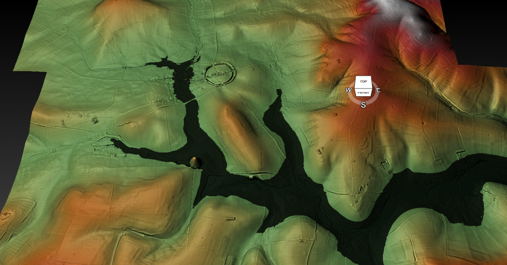
That’s roughly about 180 meters high at this point here; we then saw that during the Mesolithic, the rivers would have dropped, and we get to a position in the Neolithic period where all the early, very early Neolithic period where the waters would have dropped to about we’ve got about 56 meters here.
Now that’s this point, access to this site was impossible, and therefore they built a new location here, which we know as Avebury with its massive ditches and its massive ditches would have been filled with water because the river Kennet which runs this way would have cut into the west of the site into the large ditches, and this is what we showed in great detail on video number two phase two as I call it
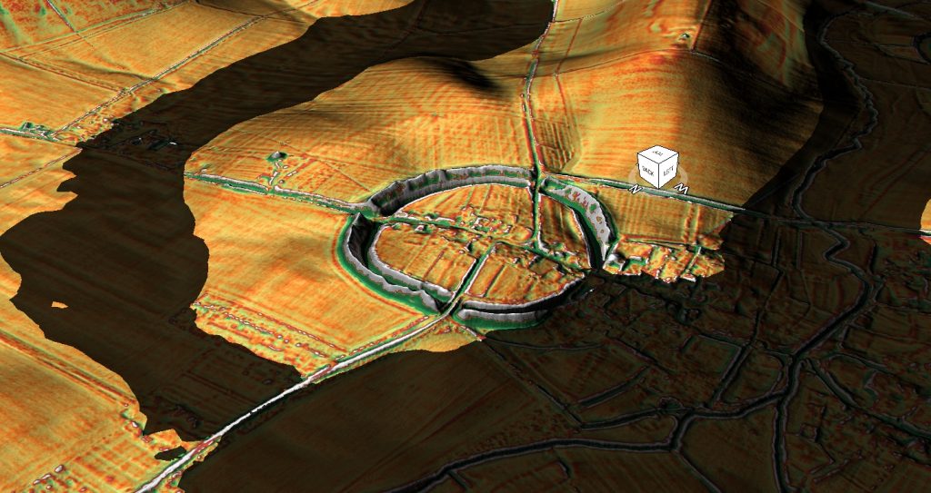
This week we’re going to look at Silbury Hill and phase three because what happened during the Neolithic and probably maybe the early Bronze Age -dating is complicated, the rivers would have dropped even lower, and so this access point would have finished, you can’t get boats into Avebury and so we have to find another route.
Now logically you say well why don’t you just uh it’s probably a little bit lower than this model it’s gone too far why don’t you drag the boats across land now this will be pretty marshy this would have been there they may have once upon a time a Dyke coming across and I’ll imagine that there would have been a Dike here which is now covered by the road which would try to keep the access open as long as possible but eventually as you see here it dries up rather rapidly and now we’re looking at just that 152 meters this landscape dries up quickly and therefore when the river’s dropped access to this site would have been limited and so what they’ve done they’ve actually built the harbour which needs deep water it’s not it’s not a little bit of water obviously ample water therefore we can surmise that the boats may actually be ships these could be pretty big now if you’re the the boats or ships that took the large stones to a rather must be quite massive they’re not canoes and therefore what we have a look what we see here is that a new site was created about here we know this is all being channelled out by hand and this is what’s called Silbury Hill.
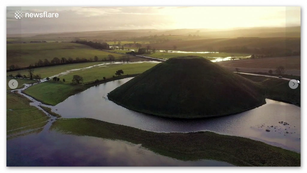
Now, what do we do we’ll have a quick look at this Silbury; this is Silbury Hill Mound here; as you see, it’s quite prominent and what we see underneath here is the effort was which was made to dig out this area to make sure that this was a natural hub for boots if I now change the angle of this to give it a bit a better representation. What we find is that the best way to get to this mooring site here would be directly over the top of what’s known as Waden Hill, or now there’s been a stone Avenue that goes this way, but it would have gone through this marshy ground which makes you believe that this was actually headed at a much later date.
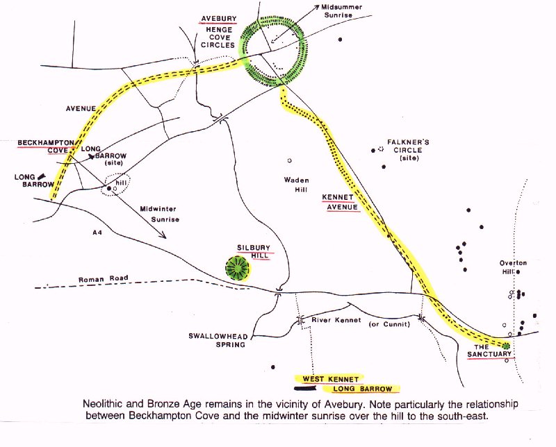
It’s entirely possible, and I wouldn’t ignore the fact that once this had dried up, you would have had a procession, a sort of causeway procession of stones going from this point here to Avebury, as you know and because they still exist. One or two stones through it say there, but unfortunately, they’re all being dug up by, but the ones that did happen have all been dug up by the town that we know along this path here is the famous West Kennet Avenue of huge stones.
But the logic you say you’ve got the most significant man-made structure in Europe here now it’s been made for a particular reason now archaeology seem to ignore the connection between Silbury Hill and Avebury which I find rather annoying because it’s in the same see the same locality for goodness sake, so it’s not rocket science to believe that one is connected to the other back to date well up to nine up to 2014 archaeologists have failed to find a connection between the two and so it’s been left very separate.
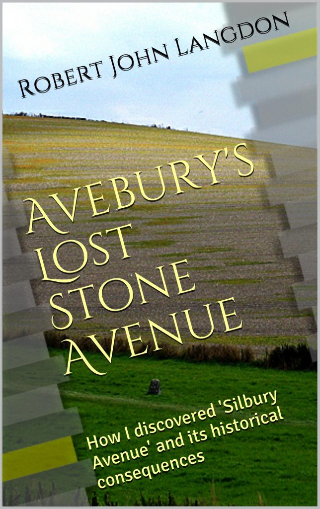
Fortunately, on one of my summer trips, I actually found Lost Stone Avenue, and there’s a book which is up here which you can see, and I published pictures. But unfortunately, I didn’t have my drone available; several years later, I’ve been going back to try and find the stones, and I’ve been I’m successful but what I found is that there is a pathway of stones well stone holes – the stone houses have left their mark which is usually a green surface against a yellow background which you see in the photographs that’s because they’re deeper. They’re deeper holes, obviously because they’ve taken these large assassins when they’ve been filled in there’s more because it’s a very short background there’s more subsoil in the holes, which makes them go greener and shows up as a crop mark.
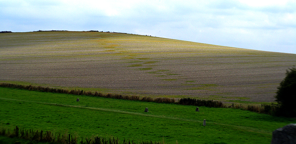
Now, these go across as you see here and down Waden Hill, which is cool because what we have found from my discovery is that if we turn this round, if we go down to the natural end, I don’t know. So hence, it leaves here it goes over one hill there’s all there’s all at the top here barrows so let’s go and have a look at that here so a closer look at the barrows we’ve got we’ve got going across this hill here we know it’s been used because here are empty barrows they’ve been ploughed through this is all someone’s big field and has spent the last I don’t know 5 000 years ploughing it up. Hence, there’s not a lot left; we got a little remember something there; who knows what that is you’re not allowed to its private property.
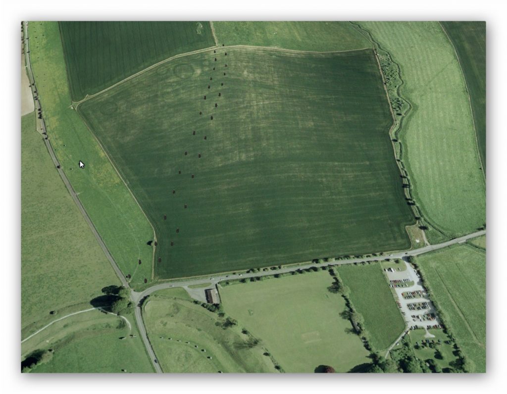
In fact, quite interesting, a friend of mine, Bob was walking here up here, and he found people excavating this area here, and he thinks they found a recumbent stone that’s flat in the ground; he did ask about it, but they refused to tell him anything because they want to claim the discovery some ten years after I found it – but then again that’s archaeology for you.
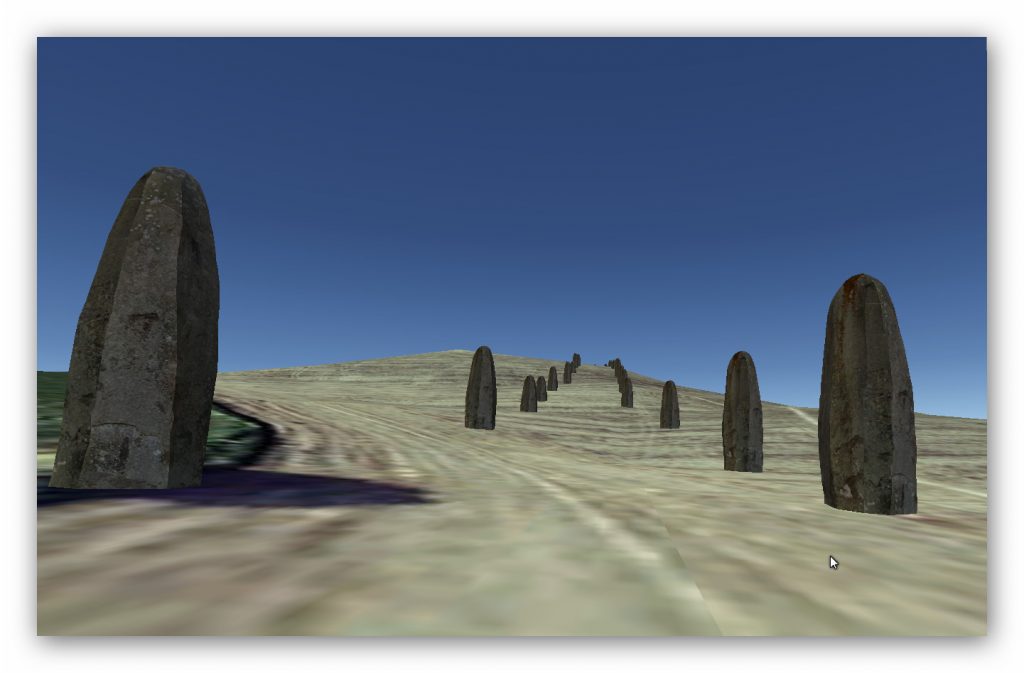
Eventually, when they published their paper, you’ll find there was a path that went across there and down there. What I find interesting about this pathway because it could have gone this way that’s steep, and if you’re taking goods by the cart, which it would have been, it’d be like a cart if you’re taking in goods by a cart going down you know you’ll need ABS brakes it’s not going to happen – this is a much sensible longer but more shallow root and it this comes down it’s a nice little bump there oh turn this off again there’s a nice little bump there don’t know where that is it’s pretty interesting but we find that it all comes down and it ends here now this as I put in the book is quite interesting this was always believed to be a this is the Roman Road A4
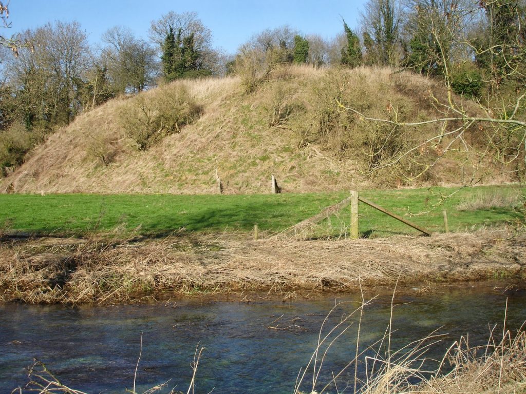
This was what’s being seen as a rubbish dump for the road apparently this that was the logic it’s clearly very large you know it’s not small as we see from Silbury Hill this is not a tiny little landscape feature this is quite big now in 2012 a photographer sent details he took photographs and sent details off this is a river Kennet underneath here so this is the Kennet so there’s all springs around here huge springs which was a filled in the Bronze Age Neolithic and the Mesolithic age this mound here he called Silbaby because it’s baby of Silbury which is it’s fine and he put forward the proposition that is actually historically prehistoric which was pooh pooh’d because they said no it’s just just a mound but what we find that it’s actually on of the old maps Stukeley’s maps he shows these this this mount so it’s been around longer than the A4 certainly and it’s probably very unlikely that the Romans were piled all their rubbish in a big heap to the side of one road like that because it’s just it’s pure nonsense really.
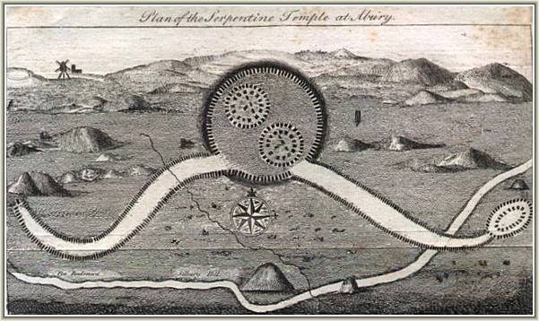
So they’ve taken core samples they haven’t excavated it which is a shame because that the only way you’re going to get proper dates is through excavator it they took core samples and they’re now freely admit that it’s at least medieval at least maybe why because you know at the end of the day the only way you’re going to find out the date of this is to actually get to the put a core sample from here all the way down the base they’ve been putting ones into the side which is lovely but this base has clearly if this has been around for 5 000 years some of this will get eroded some bits will have been dumped on with people who’ve had campfires on top and you know full hardy archaeology the only way you’re gonna get a proper real scientific date is to take that all the way down to the bottom find out where the original level is and take a core sample from there and get that radio carbon dated that has not been done and until that is done we’ll never get a real date for this but clearly clearly we see we have already seen one of these on would you believe Old Sarum if you go and look at my my Langdon investigates on Old Sarum you find identical and with the river around it landing it’s a landing point for ships.
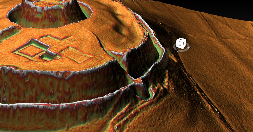
Ships would have come in landed here unloaded their goods and take it via what I call Silbury Avenue which I’m sure the archaeologists will renamed because they don’t like me – for obvious reasons can’t have that sceptic naming something – so they would have unloaded take that across all the way down to Avebury and that saved them obviously when this river dried up they couldn’t get their boats this these would have dried up as well and be the large dishes we see today and and that’s that’s the problem when you start dating these ditches you’re dating ditches when they were last used and the last used at the end of the Neolithic so you’re gonna get at best at best late neolithic date it’s rather than the dates when they were first constructed because the only way you can do that is same as Silbury is to take excavation through that that mound and find the bottom of where they the original land surface is and you date stuff from there do not date bits from ditches their their modus operandi of archaeologists is fundamentally flawed because they date sites from what’s in a ditch and the ditch has been open for so many years it’s going to have a multitude of dates it’s a it’s a complete nonsense sadly.

So that’s Silbury Hill and Silbury Avenue that went over Silbury Hill, so what’s this thing then – why is this here well you know I’ve left it to last because it’s obvious fire beacon what we’ve now found and this you know from time to time when we have to we do proper archaeology fantastic what we found is this looked a lot different in the past it was like a layer cake it was we’ve just down the road is another one called a Marlborough Mound now that’s done in like a layer cake effective it’s something later on in history probably the Christians didn’t like it because I don’t like anything that was pretty quick anything pre-Christian was the work of the devil and so what they’ve probably done in Christian times is made it round they’ve covered up the layers that were in it, but we now know there’s been proper archaeology done this was built over hundreds of years in different layers
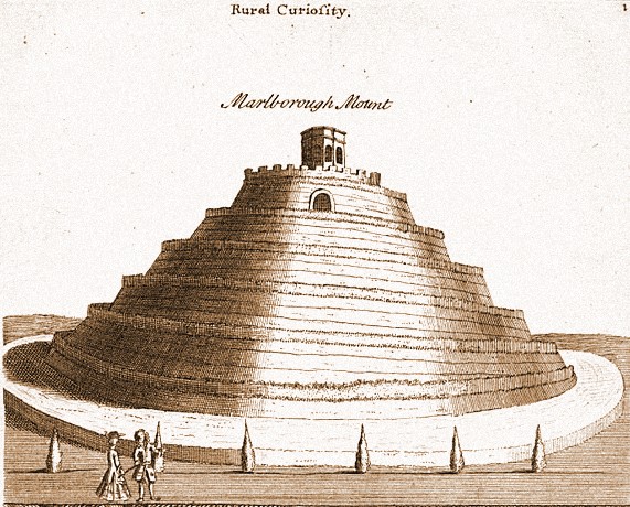
Okay so what do you do what what is built by the edge of a river in different layers to make it go higher and the logic is it’s a fire beacon at the end of the day you start low you light your fight you’ll get people from the vicinity where the the fire shows you know how do you know that the the car boot sale you know local car boot sales on well if if you’ve got a calendar you know it’s on a Sunday fantastic probably didn’t have calendars in them days just guessing on that one but what you can do is look for smoke and if this is smoke you go ah the village The Village car boot sale is on you know the the market is on people have come to sell their wares I’ll get my wares and we go and barter and buy tools or food so the the idea of a fire beacon is to tell people some events happening come along and when they do they were heading for the fire now the fire is on this side they were parked their boats on the deeper waters here they will unload their boats here and wore their boats here and they’ll take their boat their goods to market it’s pretty straightforward.
So Silbury Hill fire Beacon now even during the Neolithic a period the waters would have dropped and certainly by the Bronze Age – Silbury Hill may not being able to be used the water Kennet was carried on but these water levels would have got lower and you can see exactly the the problem you would have you wouldn’t be able to unload your boat unless you want to climb a mountain you know it’s just impractical so they moved themselves to another site and we call that site The Sanctuary and this is the Sanctuary probably in the Bronze Age like maybe later maybe I it could be Iron Age they could maybe use this site up to the eye it’s almost impossible to tell at the moment because there’s such little archaeology but here you’ve got the Sanctuary and the Sanctuary as I said lies at the end lies at the end of the West Kennet now what I find interesting with is the West Kennet really doesn’t go although it’s there it sort of disappears around this area now that’s not a great surprise because this would have been probably the area you would have actually you never go from top down makes life easier.
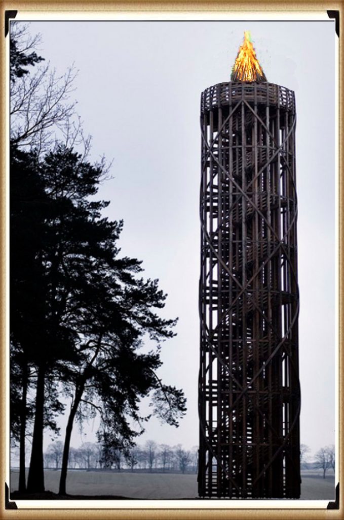
This is the area that you would have probably brought your boat; there was this the Sanctuary would have been a mini lighthouse simple enough I’ve done a I’ve done a another Langdon Investigates on Woodhenge if you want details of how they built this structure and the and the the size of the timbers take a look at that but basically you’ve got unnecessary 24 inch two foot wide timbers which take a long time to to chop down unless you’ve got metal tools but even though if you’ve got 24 feet a two meter wide pillars you’re building something high you’re not building something that looks like a little one-story house which I’ve seen as a representation of the Sanctuary it’s just nonsense.
If you’ve got a 24, you know you could do that if you want a 12-foot house, you can do a bit of four by two. I mean, the biggest tree trunk you need is six inches, not two feet if it’s two feet, it’s going to be a lot higher than a single-story house; it’s common sense; there’s no common sense in archaeology.
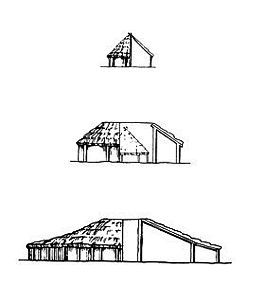
It’s just speculation people say what the Sanctuary is? They go, oh it’s ceremonial it’s nonsense absolute it’s a little bit like the ditches at Avebury let me tell you it’s ceremony they do they dug down for 30 35 foot part of the ceremonial you know what’s that ceremony is it the ceremony of the digging of the ditch is that one you know we’ve got nothing better to do in life like hunting food or looking after the kids let’s dig a ditch that is 35 foot because you know yeah it appeases the Gods what a lot of rubbish.
But that’s archaeology today; sadly no common sense. The Sanctuary was probably a mini lighthouse to show people where to park their boat, particularly at night. Avebury if you go through every you’re a grounded your boat too late you you wouldn’t have a boat anymore you just pull it on on on the on the on the wasteland marsh and you’ll never get it off you know a bit of a waste of a boat so what you do you would have bought they were built the Sanctuary they might have actually kept that uh them out of you know why not they might have lit this um to get because it’s higher to get a greater view this is quite high as well by the way this is this is almost on on top of the Ridgeway so this this is probably about the same height so actually light in the Sanctuary if the Sanctuary will say I don’t know 50 100 foot high would probably be equivalent of Silbury Hill but people would know because it was lit that they would have to park their boats here or just around the corner from here which is probably this beach here I would imagine if I if that because we can’t get an exact representation of how the river looked in the past I would reckon that what what you have and this is quite interesting because you’ve actually got a lot of uh going on here in LiDAR so it’s always been sort of used at one point.
I imagine that would probably be the river level at the time of the Sanctuary. Don’t you don’t use the Sanctuary. The interesting thing is there is little to no evidence of West Kenner Avenue past at this point here you’ve got them up to here everybody’s walked to this part it stops here you’ve got one over here somewhere you’ve got this sort of little pathway here which is quite interesting I would imagine people would have beached their boats all along here and then walked to Avebury and walked to Avebury from this beached area. That beached area would have been highlighted by the Sanctuary the boats would come in you would see that all we here were parked as close as this as possible the the the large stones will show them this is the way to Avebury you know, so it’s not rocket science.
So you park your boat, use the West Kennet, and go to your trading point at Avebury, which kept it alive for another maybe a thousand years. So I mean, we’re talking about a long extended period there. Okay well that’s it; this is we’ve now given you Avebury phase one, Windmill Hill phase two the main site phase three Silbury Hill and The Sanctuary with Commandments one because the same thing these are mooring points for uh beacons ones one’s a land Beacon and one will probably be one of the first lighthouses in the world.
For more information about British Prehistory and other articles/books, go to our BLOG WEBSITE for daily updates or our VIDEO CHANNEL for interactive media and documentaries. The TRILOGY of books that ‘changed history’ can be found with chapter extracts at DAWN OF THE LOST CIVILISATION, THE STONEHENGE ENIGMA and THE POST-GLACIAL FLOODING HYPOTHESIS. Other associated books are also available such as 13 THINGS THAT DON’T MAKE SENSE IN HISTORY and other ‘short’ budget priced books can be found on our AUTHOR SITE or on our PRESS RELEASE PAGE. For active discussion on the findings of the TRILOGY and recent LiDAR investigations that is published on our WEBSITE you can join our FACEBOOK GROUP.

