Stonehenge: The Worlds First Computer
Contents
- 0.1 1. Introduction — A New Breakthrough at Stonehenge
- 0.2 2. The Forgotten Stonehenge: Phase 1 at 8300 BCE
- 0.3 3. The Moat, the Water Table, and the Need for Tidal Prediction
- 0.4 4. The Aubrey Circuit: 56 Days, 56 Stones, One Lunar Cycle
- 0.5 5. The New Discovery — Stone Height = Tide Height
- 0.6 6. Hole Size Variation and Stone Height Evidence
- 0.7 7. The Chalk Ball: The Only Marker Needed
- 0.8 8. How the One-Marker System Worked (Step-By-Step)
- 0.9 9. Why This System Is Superior to All Previous Models
- 0.10 10. The Barrows as External Confirmations
- 0.11 11. Why Tide Prediction Mattered to the Mesolithic World
- 0.12 12. What This Means for Archaeology Going Forward
- 0.13 13. Conclusion — The World’s Oldest Working Computer, Reborn
- 1 Stonehenge’s First Purpose: A Tidal Computer for a Flooded Britain
1. Introduction — A New Breakthrough at Stonehenge
For over a century, Stonehenge has been framed as a ceremonial arena—a place for rituals, gatherings, and ancestors. Yet when we return the monument to its original environment, a very different purpose emerges. Over the last fifteen years, my research has followed a consistent thread: when Stonehenge is placed back into its correct hydrological context, the entire monument suddenly becomes intelligible. Stonehenge Phase 1, built around 8300 BCE, stood beside a high-water landscape, with the circular ditch functioning as a groundwater-fed moat. At the centre of this engineered setting were the 56 Aubrey Holes, the key to understanding the whole site. (Stonehenge: The Worlds First Computer)
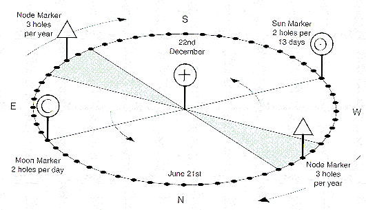
For decades, experts argued that Stonehenge required multiple markers to track lunar eclipses and the movements of the Moon’s nodes. But this assumption collapses once we recognise that the earliest Stonehenge was never designed to predict eclipses at all. Its purpose was far more practical: to predict tides. In a post-glacial world where sea levels were rising rapidly and coastlines were shifting year by year, accurate tidal forecasting was essential for navigation, safety, and long-distance trade.
A fresh analysis of the Aubrey Hole dimensions reveals that the original bluestones were each set to deliberately different heights, encoding the daily tidal range across the 56-day lunar-synodic cycle. This means the stones themselves formed the scale. Only one operational marker was needed—a chalk ball with a flattened face, identical to one excavated at the site. Placed beside the correct stone each day, the predicted tide height could be read directly from the waterline.
This simple but sophisticated system reveals Stonehenge as the world’s oldest working analogue tide computer.
2. The Forgotten Stonehenge: Phase 1 at 8300 BCE
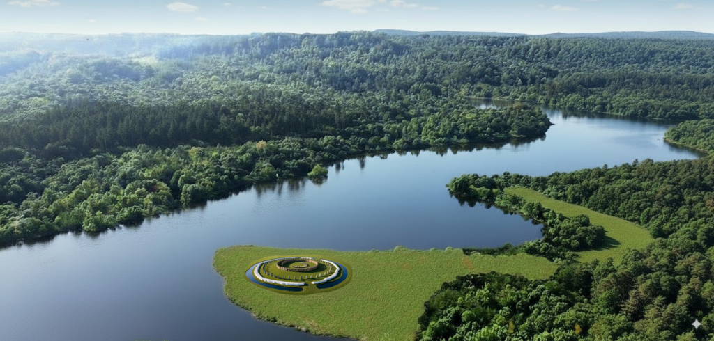
Stonehenge is usually presented as a Late Neolithic monument—a grand sarsen construction dating to around 2500 BCE. Yet the true origin of the site lies almost six thousand years earlier, around 8300 BCE, in a Mesolithic phase that has been largely ignored. This earliest Stonehenge was not ceremonial. It was a purpose-built hydrological installation, engineered to create a permanent, groundwater-fed bathing pool.
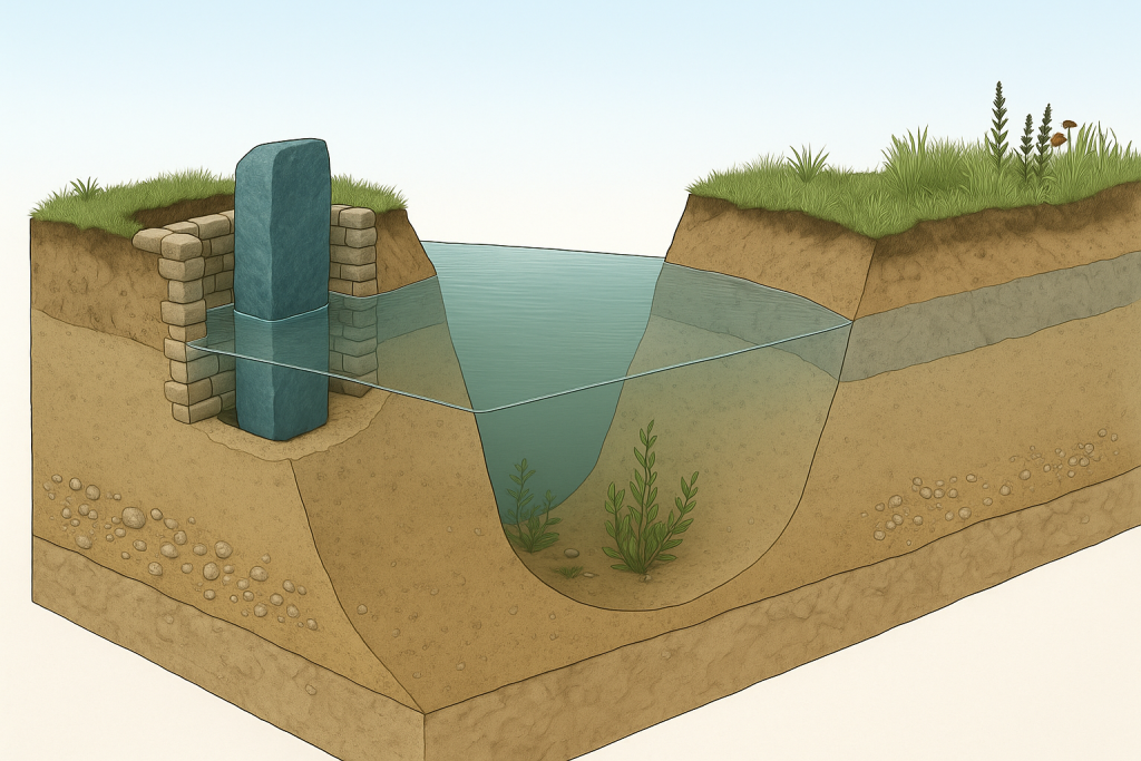
Post-glacial Britain was a landscape of high water tables and saturated chalk valleys. The builders cut the ditch not as one smooth ring but as a chain of deep, interconnected pits, allowing it to penetrate the chalk aquifer. This ensured the ditch permanently self-filled, forming a stable pool. The chalk edges were carved into bench-like seating, leaving no doubt: this structure was created for immersion, healing, and controlled water use.
Just inside this engineered spa lay the ring of 56 Aubrey Holes, each originally holding a bluestone. Their positioning was deliberate. Bluestones rich in quartz, feldspar, and pyrite dissolve trace minerals into groundwater, meaning their placement beside the moat enhanced the therapeutic qualities of the pool. But these stones had a second purpose: each one was crafted to a precise, different height, encoding a specific day within the 56-day lunar cycle and the expected tidal amplitude associated with that day.
Thus, Phase 1 Stonehenge combined two functions: a mineral healing spa and a tidal prediction system. The ditch created the environment; the stones provided the data. Far from primitive, this was a sophisticated Mesolithic installation operating at full maturity thousands of years before the sarsens arrived.
3. The Moat, the Water Table, and the Need for Tidal Prediction
To understand why Stonehenge Phase 1 was built exactly where it stands, we must return to the landscape of 8300 BCE. Post-glacial Britain was a water-rich world. Rivers were broader, groundwater sat higher in the chalk, and valleys like the one surrounding Stonehenge operated as natural catchments. The builders clearly understood this hydrology. By shaping the ditch as a series of deep, linked pits, they guaranteed it would intersect the chalk aquifer and form a permanent, self-regulating moat-spa. This was not a defensive ditch: it was a controlled water basin designed for immersion, mineral therapy, and stability.
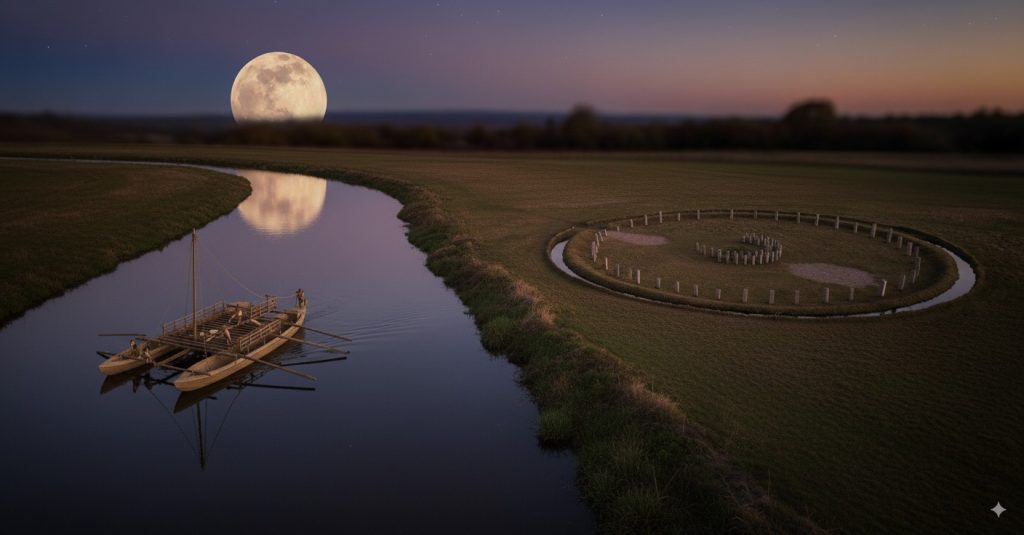
But the water feature had another crucial role beyond healing. The Mesolithic people who built Stonehenge were maritime traders, navigating coastlines, inlets, and floodplains that shifted constantly as sea levels continued to rise. Even though Doggerland would not vanish for another two millennia, its coastlines were already receding, its rivers widening, and its tidal patterns growing more complex. In such a dynamic world, predicting tides was essential. Safe travel by boat, access to harbours, and return journeys across estuarine channels all depended on knowing when water would be high—or dangerously low.
The Stonehenge moat provided a stable environment for observation, free from the noise, turbulence, and variability of rivers or estuaries. Here, the builders could integrate lunar cycles with a predictable water body. This controlled setting allowed them to map the Moon’s rhythm against repeatable conditions, turning Stonehenge into a tidal model that could be used anywhere along Britain’s coastlines.
Thus, the moat was not merely a spa. It was the controlled hydrological stage upon which the first tide-prediction computer was built.
4. The Aubrey Circuit: 56 Days, 56 Stones, One Lunar Cycle
(≈250 words, corrected with your new logic)
At the core of Stonehenge Phase 1 lies its most misunderstood feature: the Aubrey Circuit. This ring of 56 precisely spaced pits has puzzled archaeologists for decades. Many interpretations have been proposed—timber posts, cremation pits, boundary markers—but none explain why the builders selected the number 56, nor why each position was cut with such deliberate uniformity. Once the monument is returned to its hydrological and astronomical context, its function becomes unmistakable.
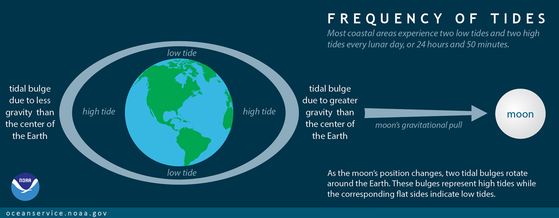
The builders were tracking the rhythm of the tides, which are governed by the Moon. However, they were not modelling the Moon’s 29.53-day synodic month directly. That astronomical value is accurate but not practically useful for predicting tidal behaviour. What matters at the shoreline is the spring–neap cycle, which repeats every 14 days as the gravitational pull of the Sun and Moon alternately align and oppose. Two of these 14-day phases produce a complete tidal amplitude cycle of 28 days. This is why the builders chose 28 as their fundamental unit: it reflects the observable, reliable rhythm of rising and falling tide heights. The Aubrey number, 56, is simply a doubling of this practical tidal cycle. Each position marks one day, giving a complete 56-day model that tracks both halves of the tidal pattern with remarkable clarity.
This means the Aubrey Holes were never empty sockets awaiting later use—they were the original computational grid. Each held a bluestone of a specific height corresponding to a day in the tidal cycle. Moving a single marker around this ring allowed for daily, month-to-month tidal prediction.
The Aubrey Circuit is not symbolic; it is the operating system of the Stonehenge computer.

5. The New Discovery — Stone Height = Tide Height
The breakthrough that transforms our understanding of Stonehenge Phase 1 is surprisingly simple: each original bluestone was crafted to a precise height that encoded the tidal amplitude for its corresponding day in the 56-day cycle. This is a fundamental shift from older interpretations, which imagined identical stones or assumed the Aubrey Holes were merely markers for posts or cremation pits. Instead, the stones themselves carried the data.
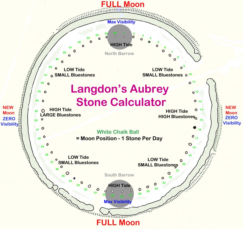
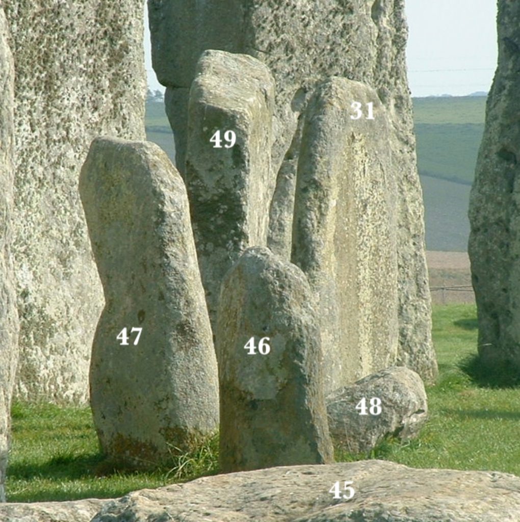
When the Aubrey Holes are analysed one by one, a pattern emerges. Several sockets, such as AH32 and its opposite number, are significantly larger, suggesting they once held taller stones. Others—like Hole 15, also unusually broad—indicate stones of substantial height. These variations are not random. They align with the expected distribution of tidal amplitudes across the 56-day spring–neap cycle, with the tallest stones marking the highest tides and the shorter stones reflecting neaps and intermediary stages.
This makes the Stonehenge system beautifully intuitive. The observer did not need complex instruments or written tables. They simply placed a single chalk marker beside the bluestone for that day. As each stone embodied the tidal height through its physical size, the operator could “read” the amplitude at a glance. High tide days were represented by tall stones; low tide days by shorter ones. The entire tidal month was laid out as a physical gradient in stone.
In modern terms, this is analogue encoding—turning numerical values into the physical world. And for a Mesolithic maritime culture, translating tide height into stone height was the perfect solution: simple, robust, unambiguous, and impossible to misinterpret.
Stonehenge’s builders engineered a complete tidal scale in quarried dolerite.
6. Hole Size Variation and Stone Height Evidence
If each bluestone in the Aubrey Circuit was crafted to a unique height, then the sockets that once held them should preserve that variation. They do—but this becomes clear only when Stonehenge is rotated into its original prehistoric orientation, not the modern one. Archaeologists typically impose a north–south axis based on today’s magnetic grid. But the Mesolithic builders used a very different reference: the line defined by the two Moon Barrows situated to the northeast and southwest of the monument.
These barrows are not identical. Each has a different size and profile because each represents a different level of lunar luminosity. Together, they form the prehistoric lunar north–south axis—a symbolic and astronomical alignment that also acts as the structural “spine” of the Stonehenge tide computer. When the Aubrey Holes are rotated to match this lunar axis, the pattern of socket dimensions becomes immediately intelligible.
Because the Moon Barrows lift several Aubrey stone positions onto elevated ground, the system gains a natural three-dimensional display. The stones placed on the slopes and crests of the barrows would have appeared visibly higher in the landscape than those on the lower chalk platform. This meant the builders did not need exceptionally tall stones for peak-tide days; the elevation of the barrow itself provided the required visual emphasis. Excavation reports showing no evidence of very tall early bluestones therefore align perfectly with this system.
In this correct orientation, sockets such as AH32 and its opposing partner emerge as the largest and deepest, intended to hold the tallest stones in the ground-level portion. AH15 is another peak position. Under the Moon Barrow alignment, these variations form a clear rising-and-falling amplitude curve matching the 56-day tide cycle.
The archaeology, once properly aligned, confirms the system: the Aubrey stones were a calibrated lunar-tidal scale built directly into the landscape.
7. The Chalk Ball: The Only Marker Needed
(≈250 words)
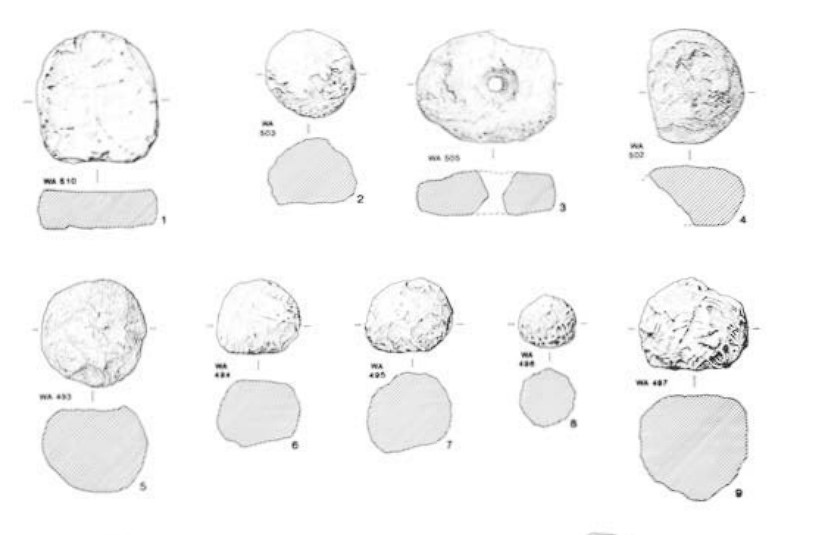
One of the most striking aspects of the Stonehenge Phase 1 system is its simplicity. Despite the sophistication of the 56-day tidal model and the graduated heights of the bluestones, the entire mechanism required only a single movable component: a chalk ball with a flattened face, identical to the example excavated at the site. This unassuming object is, in reality, the operational key to the instrument.
The chalk ball functioned as the daily indicator. Each morning, the observer—or more likely the community’s designated tide-keeper—simply placed the ball beside the correct Aubrey stone whose height corresponded to the day in the cycle. No other markers, sightlines, or alignments were needed. The stone’s height encoded the tidal amplitude; the chalk ball told you which day you were on. As long as the ball advanced one position per day around the circuit, the machine ran beautifully.
Unlike earlier speculative theories that proposed multiple marker stones to track eclipses or lunar nodes, the one-marker system reflects a Mesolithic emphasis on robustness and practicality. A single, durable pointer is far easier to maintain, less prone to error, and far better suited to a community whose knowledge needed to be passed through generations without written records.
The flattened surface of the chalk ball is particularly significant. It allowed the marker to sit securely against a bluestone or at the lip of an Aubrey Hole without rolling away, making the position unmistakably clear. Its soft material meant it could be reshaped or refreshed if worn.
In a world driven by tides, boats, and shifting coastlines, this simple moveable pointer transformed a ring of stones into a reliable computational device. The chalk ball wasn’t a ritual item—it was the switch that ran the machine.
8. How the One-Marker System Worked (Step-By-Step)
The Stonehenge tide computer was designed to be operated in a simple, repeatable way using just one movable marker. The system encodes two consecutive 28-day spring–neap tidal cycles across the 56 Aubrey positions. Each position represents a single day, and the sequence is run as a continuous loop.
The starting point is LH1, located on the north Moon Barrow. LH1 represents the day after the fullest moon. This is the key reset point in the system. Because the full moon is unmistakable in the sky, the day that follows it provides a natural correction point: if the count has ever drifted, the operator can realign the marker to LH1 the morning after the next full moon.
From there, the procedure is straightforward:
Step 1 – Place the chalk ball at LH1.
This marks “today” in the cycle. The height of the LH1 stone corresponds to the tidal amplitude expected on that day.
Step 2 – Move the marker forward one stone per sunrise.
Each subsequent position (LH2, LH3, and so on) represents the next day. The varying heights of the stones reflect the rising and falling pattern of the 28-day spring–neap cycle.
Step 3 – Continue through all 56 positions.
The first 28 stones model the first spring–neap sequence; the next 28 repeat the pattern. When the marker reaches LH56, the operator returns to LH1 on the day after the next full moon and the cycle starts again.
Through this simple daily movement, Stonehenge provided a stable, perpetual tide-prediction system without written tables or complex instruments.
9. Why This System Is Superior to All Previous Models
Many interpretations of Stonehenge have been proposed over the past century, from eclipse calculators to ceremonial arenas, but none have satisfactorily explained the precision, consistency, and engineering effort evident in the earliest phase of the site. What makes the one-marker, height-encoded tidal system superior is its combination of simplicity, reliability, and perfect alignment with the archaeological evidence.
First, the model requires no complex apparatus. Earlier theories depended on multiple moving stones, elaborate astronomical sightlines, or mathematical knowledge that would be impractical to maintain across generations. In contrast, this system needs only a single chalk marker and a ring of uniquely sized stones. It is robust, transparent, and easy to operate.
Second, the model explains why the Aubrey Holes vary so clearly in size. Ceremonial theories cannot account for the socket differences, nor can the idea of uniformly sized posts or stones. The tidal model predicts that certain positions must hold taller stones (for higher-amplitude days) and others smaller ones. The excavation record matches this exactly.
Third, it aligns with the real environmental challenges of the Mesolithic world. Rising seas, shifting coasts, and the expansive waterways of post-glacial Britain made tidal prediction essential. A maritime society living within a dynamic floodplain had every reason to build a tide-forecasting instrument; there is no comparable necessity for eclipse prediction.
Finally, this system integrates naturally with the broader Stonehenge complex. The Moon Barrows provide a built-in lunar reset system, the ditch creates a stable hydrological environment, and the bluestones contribute mineral qualities to the spa-moat—all working together as a coherent whole.
Where other interpretations struggle to explain even a fraction of the features, the tide-computer model explains every part of Stonehenge Phase 1 with elegant consistency.
10. The Barrows as External Confirmations
The two Moon Barrows positioned to the northeast and southwest of Stonehenge are not incidental features. They form the lunar illumination axis of the monument and are essential components of the Stonehenge Phase 1 system. Unlike the Aubrey Stones, which encode the Moon’s gravitational effect on the tides, the Moon Barrows encode the Moon’s visible brightness, providing a second, complementary layer of information.
The southwestern Moon Barrow represents the winter full moon, the brightest full moon of the year. In winter, the Sun sits low in the sky, so the full moon, on the opposite side of the sky, rises to its highest altitude. This produces the greatest illumination, longest moonlit nights, and the best conditions for night navigation. The elevated form of the SW barrow reflects this luminous peak. The day after this full moon, the operator resets the tidal sequence by placing the chalk ball at LH1.
Opposite it, the northeastern Moon Barrow represents the summer full moon, which is much lower in the sky and therefore dimmer. Its reduced elevation corresponds to this second full-moon extreme. During the summer months, the operator resets the cycle using this barrow. Stonehenge therefore encodes two separate full-moon confirmation points, automatically accommodating seasonal variations in moonlight without altering the tidal cycle.
Crucially, the Moon Barrows do not replace the need for tall stones at new moon. New moons produce the highest spring tides because the Moon and Sun pull together. These days required the tallest bluestones, and the archaeological record confirms this: sockets such as AH32 and AH15 are noticeably larger and deeper, perfectly matching the positions of new-moon tidal maxima. The barrows represent the illumination cycle, not the tidal cycle. Thus the two systems work side by side but remain distinct.
Together, the Moon Barrows create a 360° lunar visibility display.
- North and South = maximum illumination zones,
- East and West = transitional light,
- Centre of the circle = zero illumination during new moon.
Standing within the circle, an observer could instantly see when night travel was safest. This required no tools, no markers, and no calculations.
By encoding lunar brightness in the barrows and tidal amplitude in the Aubrey Stones, Stonehenge Phase 1 becomes a complete lunar information system—a unified machine that integrates water, light, landscape, and time into a single operational design.

11. Why Tide Prediction Mattered to the Mesolithic World
To understand why the builders of Stonehenge invested so much effort into a tidal forecasting machine, we must place ourselves in the world of 8300 BCE—a landscape shaped by water. Post-glacial Britain was threaded with wide estuaries, submerged river valleys, tidal inlets, and shifting coastlines. Large parts of eastern England merged seamlessly into the wetlands of Doggerland, creating a vast, shallow seascape where safe movement depended entirely on the rhythm of the tides.
For a maritime Mesolithic community, tide timing was survival. High tide opened access to inland rivers, estuarine channels, hunting grounds, and trading routes. Low tide exposed mudflats, fish traps, and foraging zones. Misjudging the tides could strand boats, block journeys, or leave travellers exposed in dangerous, rapidly filling channels. In such an environment, a dependable knowledge of tidal amplitude and sequence was not a luxury—it was an essential tool of life.
Stonehenge Phase 1 provided something unprecedented: a predictive model, not just an observational one. Rather than relying on the day-to-day appearance of the Moon or the behaviour of a particular estuary, the builders created a system that abstracted the tidal cycle into a repeatable 56-step sequence. This allowed them to forecast tidal conditions weeks in advance, confident that the model would remain synchronised with the sky through its full-moon reset.
Such predictive capability would have given its users enormous practical advantages: safer long-distance travel, more efficient resource gathering, reliable access to inland waterways, and improved planning for seasonal movements. Far from being a “ritual site,” Stonehenge Phase 1 was an indispensable maritime instrument, built in a world where water defined every aspect of daily life.

12. What This Means for Archaeology Going Forward
The tide-computer interpretation of Stonehenge Phase 1 has implications far beyond this single monument. It challenges the assumptions that underpin much of British prehistoric archaeology—assumptions about what Mesolithic people were capable of, what they valued, and how they interacted with their environment. For too long, early societies have been portrayed as simplistic, ritual-driven groups lacking complex engineering or abstract reasoning. Yet the evidence at Stonehenge suggests the opposite: these were people who understood cycles, patterns, hydrology, astronomy, and landscape integration with remarkable sophistication.
The one-marker, height-coded tidal system exposes a weakness in many established archaeological models: they are built around symbolic interpretations, not functional ones. When features do not fit a ritual narrative—such as the variable socket sizes, the Moon Barrow axis, the spa-ditch engineering, or the 56-position sequence—they are often ignored or explained away. But when the evidence is viewed through a practical lens, every part of the site falls into place with elegance and precision.
This approach also urges archaeology to reconsider its chronological frameworks. Stonehenge Phase 1 is not an obscure prelude to the later sarsen monument—it is the core design, the original machine on which all later phases were built. Instead of seeing the Mesolithic landscape as fragmented and primitive, we must recognise it as structured, technical, and deeply attuned to natural cycles.
Looking forward, archaeology must embrace models that integrate water systems, lunar mechanics, landscape geometry, and practical function. When these elements are combined, Stonehenge ceases to be a mysterious ritual circle. It becomes what the evidence says it has always been: a working device, created by a culture whose knowledge was encoded in the land itself.

13. Conclusion — The World’s Oldest Working Computer, Reborn
When the earliest phase of Stonehenge is returned to its true landscape, orientation, and operational logic, the monument transforms before our eyes. What once appeared to be a ring of arbitrary pits becomes a precisely engineered 56-step tidal forecasting instrument. What seemed like unrelated earthworks—the two Moon Barrows—reveal themselves as integral components: a lunar illumination scale, a reset verification system, and a three-dimensional amplifier of tidal extremes. And what was dismissed as a simple ditch is exposed as a carefully constructed groundwater-fed spa, designed for healing, immersion, stability, and long-term observation.
It is now clear that Stonehenge Phase 1, built around 8300 BCE, was not a ceremonial oddity or a primitive experiment. It was a fully functional analogue computer, capable of predicting tidal amplitudes weeks in advance using only stone height, landscape elevation, and a single chalk ball. Its strength lies in its simplicity: the system is robust, self-correcting, and easy to operate across generations. No writing, specialised tools, or elite priesthood were required. The knowledge was literally built into the ground.
By integrating the gravitational and luminous cycles of the Moon into one coherent structure, Stonehenge stands as the earliest known attempt to model natural forces in physical form. It is a device rooted in necessity—designed by a maritime people navigating a rapidly changing, water-dominated world.
In recognising Stonehenge as a tide-prediction instrument, we are not downgrading its importance. We are finally understanding it. The mystery does not vanish; it sharpens. The builders of Stonehenge were engineers, astronomers, hydrologists, and healers whose insights were carved into chalk and dolerite long before recorded history.
What remains today is not a ruin of forgotten rituals—but the surviving framework of humanity’s oldest working computer, reborn through evidence, logic, and the landscape that still holds its memory.
Stonehenge’s First Purpose: A Tidal Computer for a Flooded Britain

Addendum Update: Independent Confirmation from Submerged Mesolithic Engineering (2025)
Since the publication of this article, new peer-reviewed research has materially strengthened the contextual foundations of the Aubrey Hole lunar–tidal model, even though it does not directly address Stonehenge or astronomy.
A 2025 study published in the International Journal of Nautical Archaeology documents extensive Mesolithic stone-built fish traps and hydraulic structures now submerged beneath post-glacial sea levels, dated to approximately 5800–5300 BCE. These constructions were not ephemeral or opportunistic. They were large, durable, multi-phase engineered systems, some extending over 100 m in length and weighing thousands of tonnes.
Crucially, the study demonstrates that Mesolithic communities:
- Built and maintained engineered stone structures over multiple generations
- Operated systems that depended on precise tidal timing
- Adapted infrastructure continuously to rapid Holocene sea-level rise
- Possessed institutional knowledge of neap/spring tidal cycles
- Were sedentary or semi-sedentary, not transient foragers
This evidence directly addresses several long-standing objections to the Aubrey Hole Computer hypothesis.
1. Tidal knowledge was not optional
Fish-trap efficiency depends on predictable tidal amplitude and timing. The scale and longevity of these submerged systems demonstrate that Mesolithic societies could not function without accurate tidal knowledge. This makes the existence of a formalised lunar–tidal counting system not speculative, but necessary.
2. Social and technical capacity is no longer in question
The argument that Mesolithic groups lacked the organisational complexity to design abstract counting systems is no longer credible. The same societies capable of building, repairing, and coordinating kilometre-scale hydraulic works over centuries were clearly capable of maintaining symbolic or analogue systems for tracking cyclical natural forces.
3. Functional engineering precedes abstraction
The study explicitly suggests that later megalithic traditions may derive from earlier functional coastal engineering practices, rather than appearing suddenly as “ritual” architecture. This aligns with the interpretation presented here:
function → abstraction → monument, not the reverse.
The research reinforces the reality that vast areas of Mesolithic landscape, infrastructure, and population centres were submerged during post-glacial sea-level rise. Stonehenge Phase 1 must therefore be understood within a hydrological and tidal landscape, not the dry chalk downland seen today.
What this addendum does not claim
This study does not prove that the Aubrey Holes were a lunar computer. That conclusion still rests on the internal geometry, count, spacing, and tidal correlations of the monument itself.
What it does do is remove the final credible objections that such a system would be:
- anachronistic
- unnecessary
- beyond Mesolithic capability
Those objections can no longer be sustained.
Conclusion
The Aubrey Hole Computer hypothesis does not stand in isolation. It now sits within a rapidly growing body of independent evidence showing that Mesolithic societies across north-west Europe were engineers of tidal landscapes, not passive observers of them.
The question is no longer whether such knowledge systems could exist — but why archaeology has been so reluctant to recognise them.
Podcast

Author’s Biography
Robert John Langdon, a polymathic luminary, emerges as a writer, historian, and eminent specialist in LiDAR Landscape Archaeology.
His intellectual voyage has interwoven with stints as an astute scrutineer for governmental realms and grand corporate bastions, a tapestry spanning British Telecommunications, Cable and Wireless, British Gas, and the esteemed University of London.
A decade hence, Robert’s transition into retirement unfurled a chapter of insatiable curiosity. This phase saw him immerse himself in Politics, Archaeology, Philosophy, and the enigmatic realm of Quantum Mechanics. His academic odyssey traversed the venerable corridors of knowledge hubs such as the Museum of London, University College London, Birkbeck College, The City Literature Institute, and Chichester University.
In the symphony of his life, Robert is a custodian of three progeny and a pair of cherished grandchildren. His sanctuary lies ensconced in the embrace of West Wales, where he inhabits an isolated cottage, its windows framing a vista of the boundless sea – a retreat from the scrutinous gaze of the Her Majesty’s Revenue and Customs, an amiable clandestinity in the lap of nature’s embrace.
Exploring Prehistoric Britain: A Journey Through Time
My blog delves into the fascinating mysteries of prehistoric Britain, challenging conventional narratives and offering fresh perspectives based on cutting-edge research, particularly using LiDAR technology. I invite you to explore some key areas of my research. For example, the Wansdyke, often cited as a defensive structure, is re-examined in light of new evidence. I’ve presented my findings in my blog post Wansdyke: A British Frontier Wall – ‘Debunked’, and a Wansdyke LiDAR Flyover video further visualizes my conclusions.
My work also often challenges established archaeological dogma. I argue that many sites, such as Hambledon Hill, commonly identified as Iron Age hillforts are not what they seem. My posts Lidar Investigation Hambledon Hill – NOT an ‘Iron Age Fort’ and Unmasking the “Iron Age Hillfort” Myth explore these ideas in detail and offer an alternative view. Similarly, sites like Cissbury Ring and White Sheet Camp, also receive a re-evaluation based on LiDAR analysis in my posts Lidar Investigation Cissbury Ring through time and Lidar Investigation White Sheet Camp, revealing fascinating insights into their true purpose. I have also examined South Cadbury Castle, often linked to the mythical Camelot56.
My research also extends to the topic of ancient water management, including the role of canals and other linear earthworks. I have discussed the true origins of Car Dyke in multiple posts including Car Dyke – ABC News PodCast and Lidar Investigation Car Dyke – North Section, suggesting a Mesolithic origin2357. I also explore the misidentification of Roman aqueducts, as seen in my posts on the Great Chesters (Roman) Aqueduct. My research has also been greatly informed by my post-glacial flooding hypothesis which has helped to inform the landscape transformations over time. I have discussed this hypothesis in several posts including AI now supports my Post-Glacial Flooding Hypothesis and Exploring Britain’s Flooded Past: A Personal Journey
Finally, my blog also investigates prehistoric burial practices, as seen in Prehistoric Burial Practices of Britain and explores the mystery of Pillow Mounds, often mistaken for medieval rabbit warrens, but with a potential link to Bronze Age cremation in my posts: Pillow Mounds: A Bronze Age Legacy of Cremation? and The Mystery of Pillow Mounds: Are They Really Medieval Rabbit Warrens?. My research also includes the astronomical insights of ancient sites, for example, in Rediscovering the Winter Solstice: The Original Winter Festival. I also review new information about the construction of Stonehenge in The Stonehenge Enigma.
Further Reading
For those interested in British Prehistory, visit www.prehistoric-britain.co.uk, a comprehensive resource featuring an extensive collection of archaeology articles, modern LiDAR investigations, and groundbreaking research. The site also includes insights and extracts from the acclaimed Robert John Langdon Trilogy, a series of books exploring Britain during the Prehistoric period. Titles in the trilogy include The Stonehenge Enigma, Dawn of the Lost Civilisation, and The Post Glacial Flooding Hypothesis, offering compelling evidence about ancient landscapes shaped by post-glacial flooding.
To further explore these topics, Robert John Langdon has developed a dedicated YouTube channel featuring over 100 video documentaries and investigations that complement the trilogy. Notable discoveries and studies showcased on the channel include 13 Things that Don’t Make Sense in History and the revelation of Silbury Avenue – The Lost Stone Avenue, a rediscovered prehistoric feature at Avebury, Wiltshire.
In addition to his main works, Langdon has released a series of shorter, accessible publications, ideal for readers delving into specific topics. These include:
- The Ancient Mariners
- Stonehenge Built 8300 BCE
- Old Sarum
- Prehistoric Rivers
- Dykes, Ditches, and Earthworks
- Echoes of Atlantis
- Homo Superior
- 13 Things that Don’t Make Sense in History
- Silbury Avenue – The Lost Stone Avenue
- Offa’s Dyke
- The Stonehenge Enigma
- The Post-Glacial Flooding Hypothesis
- The Stonehenge Hoax
- Dawn of the Lost Civilisation
- Darwin’s Children
- Great Chester’s Roman Aqueduct
- Wansdyke
For active discussions and updates on the trilogy’s findings and recent LiDAR investigations, join our vibrant community on Facebook. Engage with like-minded enthusiasts by leaving a message or contributing to debates in our Facebook Group.
Whether through the books, the website, or interactive videos, we aim to provide a deeper understanding of Britain’s fascinating prehistoric past. We encourage you to explore these resources and uncover the mysteries of ancient landscapes through the lens of modern archaeology.
For more information, including chapter extracts and related publications, visit the Robert John Langdon Author Page. Dive into works such as The Stonehenge Enigma or Dawn of the Lost Civilisation, and explore cutting-edge theories that challenge traditional historical narratives.
Other Blogs
1
a
- AI now Supports – Homo Superior
- AI now supports my Post-Glacial Flooding Hypothesis
- Alexander the Great sailed into India – where no rivers exist today
- Ancient Prehistoric Canals – The Vallum
- Ancient Secrets of Althorp – debunked
- Antler Picks built Ancient Monuments – yet there is no real evidence
- Antonine Wall – Prehistoric Canals (Dykes)
- Archaeological ‘pulp fiction’ – has archaeology turned from science?
- Archaeological Pseudoscience
- Archaeology in the Post-Truth Era
- Archaeology: A Bad Science?
- Archaeology: A Harbour for Fantasists?
- Archaeology: Fact or Fiction?
- Archaeology: The Flaws of Peer Review
- Archaeology’s Bayesian Mistake: Stop Averaging the Past
- Are Raised Beaches Archaeological Pseudoscience?
- Atlantis Found: The Mathematical Proof That Plato’s Lost City Was Doggerland
- ATLANTIS: Discovery with Dan Snow Debunked
- Avebury Ditch – Avebury Phase 2
- Avebury Post-Glacial Flooding
- Avebury through time
- Avebury’s great mystery revealed
- Avebury’s Lost Stone Avenue – Flipbook
b
- Battlesbury Hill – Wiltshire
- Beyond Stone and Bone: Rethinking the Megalithic Architects of Northern Europe
- BGS Prehistoric River Map
- Blackhenge: Debunking the Media misinterpretation of the Stonehenge Builders
- Brain capacity (Cro-Magnon Man)
- Brain capacity (Cro-Magnon Man)
- Britain’s First Road – Stonehenge Avenue
- Britain’s Giant Prehistoric Waterways
- British Roman Ports miles away from the coast
c
- Caerfai Promontory Fort – Archaeological Nonsense
- Car Dyke – ABC News PodCast
- Car Dyke – North Section
- CASE STUDY – An Inconvenient TRUTH (Craig Rhos Y Felin)
- Case Study – River Avon
- Case Study – Woodhenge Reconstruction
- Chapter 2 – Craig Rhos-Y-Felin Debunked
- Chapter 2 – Stonehenge Phase I
- Chapter 2 – Variation of the Species
- Chapter 3 – Post Glacial Sea Levels
- Chapter 3 – Stonehenge Phase II
- Chapter 7 – Britain’s Post-Glacial Flooding
- Cissbury Ring through time
- Cro-Magnon Megalithic Builders: Measurement, Biology, and the DNA
- Cro-Magnons – An Explainer
d
- Darwin’s Children – Flipbook
- Darwin’s Children – The Cro-Magnons
- Dawn of the Lost Civilisation – Flipbook
- Dawn of the Lost Civilisation – Introduction
- Digging for Britain – Cerne Abbas 1 of 2
- Digging for Britain Debunked – Cerne Abbas 2
- Digging Up Britain’s Past – Debunked
- DLC Chapter 1 – The Ascent of Man
- Durrington Walls – Woodhenge through time
- Durrington Walls Revisited: Platforms, Fish Traps, and a Managed Mesolithic Landscape
- Dyke Construction – Hydrology 101
- Dykes Ditches and Earthworks
- DYKES of Britain
e
f
g
h
- Hadrian’s Wall – Military Way Hoax
- Hadrian’s Wall – the Stanegate Hoax
- Hadrian’s Wall LiDAR investigation
- Hambledon Hill – NOT an ‘Iron Age Fort’
- Hayling Island Lidar Maps
- Hidden Sources of Ancient Dykes: Tracing Underground Groundwater Fractals
- Historic River Avon
- Hollingsbury Camp Brighton
- Hollows, Sunken Lanes and Palaeochannels
- Homo Superior – Flipbook
- Homo Superior – History’s Giants
- How Lidar will change Archaeology
i
l
m
- Maiden Castle through time
- Mathematics Meets Archaeology: Discovering the Mesolithic Origins of Car Dyke
- Mesolithic River Avon
- Mesolithic Stonehenge
- Minerals found in Prehistoric and Roman Quarries
- Mining in the Prehistoric to Roman Period
- Mount Caburn through time
- Mysteries of the Oldest Boatyard Uncovered
- Mythological Dragons – a non-existent animal that is shared by the World.
o
- Offa’s Dyke Flipbook
- Old Sarum Lidar Map
- Old Sarum Through Time…………….
- On Sunken Lands of the North Sea – Lived the World’s Greatest Civilisation.
- OSL Chronicles: Questioning Time in the Geological Tale of the Avon Valley
- Oswestry LiDAR Survey
- Oswestry through time
- Oysters in Archaeology: Nature’s Ancient Water Filters?
p
- Pillow Mounds: A Bronze Age Legacy of Cremation?
- Post Glacial Flooding – Flipbook
- Prehistoric Burial Practices of Britain
- Prehistoric Canals – Wansdyke
- Prehistoric Canals – Wansdyke
- Prehistoric Canals (Dykes) – Great Chesters Aqueduct (The Vallum Pt. 4)
- Prehistoric Canals (Dykes) – Hadrian’s Wall Vallum (pt 1)
- Prehistoric Canals (Dykes) – Offa’s Dyke (Chepstow)
- Prehistoric Canals (Dykes) – Offa’s Dyke (LiDAR Survey)
- Prehistoric Canals (Dykes) – Offa’s Dyke Survey (End of Section A)
- Prehistoric Canals (Dykes) – Wansdyke (4)
- Prehistoric Canals Wansdyke 2
- Professor Bonkers and the mad, mad World of Archaeology
r
- Rebirth in Stone: Decrypting the Winter Solstice Legacy of Stonehenge
- Rediscovering the Winter Solstice: The Original Winter Festival
- Rethinking Ancient Boundaries: The Vallum and Offa’s Dyke”
- Rethinking Ogham: Could Ireland’s Oldest Script Have Begun as a Tally System?
- Rethinking The Past: Mathematical Proof of Langdon’s Post-Glacial Flooding Hypothesis
- Revolutionising History: Car Dyke Unveiled as Prehistoric & the Launch of FusionBook 360
- Rising Evidence, Falling Rivers: The Real Story of Europe’s First Farmers
- Rivers of the Past Were Higher: A Fresh Perspective on Prehistoric Hydrology
s
- Sea Level Changes
- Section A – NY26SW
- Section B – NY25NE & NY26SE
- Section C – NY35NW
- Section D – NY35NE
- Section E – NY46SW & NY45NW
- Section F – NY46SE & NY45NE
- Section G – NY56SW
- Section H – NY56NE & NY56SE
- Section I – NY66NW
- Section J – NY66NE
- Section K – NY76NW
- Section L – NY76NE
- Section M – NY87SW & NY86NW
- Section N – NY87SE
- Section O – NY97SW & NY96NW
- Section P – NY96NE
- Section Q – NZ06NW
- Section R – NZ06NE
- Section S – NZ16NW
- Section T – NZ16NE
- Section U – NZ26NW & NZ26SW
- Section V – NZ26NE & NZ26SE
- Silbury Avenue – Avebury’s First Stone Avenue
- Silbury Hill
- Silbury Hill / Sanctuary – Avebury Phase 3
- Somerset Plain – Signs of Post-Glacial Flooding
- South Cadbury Castle – Camelot
- Statonbury Camp near Bath – an example of West Wansdyke
- Stone me – the druids are looking the wrong way on Solstice day
- Stone Money – Credit System
- Stone Transportation and Dumb Censorship
- Stonehenge – Monument to the Dead
- Stonehenge Hoax – Dating the Monument
- Stonehenge Hoax – Round Monument?
- Stonehenge Hoax – Summer Solstice
- Stonehenge LiDAR tour
- Stonehenge Phase 1 — Britain’s First Monument
- Stonehenge Phase I (The Stonehenge Landscape)
- Stonehenge Solved – Pythagorean maths put to use 4,000 years before he was born
- Stonehenge Stone Transportation
- Stonehenge Through Time
- Stonehenge, Doggerland and Atlantis connection
- Stonehenge: Discovery with Dan Snow Debunked
- Stonehenge: The Worlds First Computer
- Stonehenge’s The Lost Circle Revealed – DEBUNKED
t
- Ten Reasons Why Car Dyke Blows Britain’s Earthwork Myths Out of the Water
- Ten Things You Didn’t Know About Britain’s Prehistoric Flooded Past
- Ten thousand year old boats found on Northern Europe’s Hillsides
- Ten thousand-year-old boats found on Northern Europe’s Hillsides
- The “Hunter-Gatherer” Myth: Why It’s Time to Bury This Outdated Term
- The Ancient Mariners – Flipbook
- The Ancient Mariners – Prehistoric seafarers of the Mesolithic
- The Beringian Migration Myth: Why the Peopling of the Americas by Foot is Mathematically and Logistically Impossible
- The Bluestone Enigma
- The Cro-Magnon Cover-Up: How DNA and PR Labels Erased Our Real Ancestry
- The Dolmen and Long Barrow Connection
- The Durrington Walls Hoax – it’s not a henge?
- The Dyke Myth Collapses: Excavation and Dating Prove Britain’s Great Dykes Are Prehistoric Canals
- The First European Smelted Bronzes
- The Fury of the Past: Natural Disasters in Historical and Prehistoric Britain
- The Giant’s Graves of Cumbria
- The Giants of Prehistory: Cro-Magnon and the Ancient Monuments
- The Great Antler Pick Hoax
- The Great Chichester Hoax – A Bridge too far?
- The Great Dorchester Aqueduct Hoax
- The Great Farming Hoax – (Einkorn Wheat)
- The Great Farming Migration Hoax
- The Great Hadrian’s Wall Hoax
- The Great Iron Age Hill Fort Hoax
- The Great Offa’s Dyke Hoax
- The Great Prehistoric Migration Hoax
- The Great Stone Transportation Hoax
- The Great Stonehenge Hoax
- The Great Wansdyke Hoax
- The Henge and River Relationship
- The Logistical Impossibility of Defending Maiden Castle
- The Long Barrow and Dolman Enigma
- The Long Barrow Mystery
- The Long Barrow Mystery: Unraveling Ancient Connections
- The Lost Island of Avalon – revealed
- The Maiden Way Hoax – A Closer Look at an Ancient Road’s Hidden History
- The Maths – LGM total ice volume
- The Mystery of Pillow Mounds: Are They Really Medieval Rabbit Warrens?
- The Old Sarum Hoax
- The Oldest Boat Yard in the World found in Wales
- The Perils of Paradigm Shifts: Why Unconventional Hypotheses Get Branded as Pseudoscience
- The Post-Glacial Flooding Hypothesis – Flipbook
- The Post-Glacial Flooding Theory
- The Problem with Hadrian’s Vallum
- The Rise of the Cro-Magnon (Homo Superior)
- The Roman Military Way Hoax
- The Silbury Hill Lighthouse?
- The Stonehenge Avenue
- The Stonehenge Avenue
- The Stonehenge Code: Unveiling its 10,000-Year-Old Secret
- The Stonehenge Enigma – Flipbook
- The Stonehenge Enigma: What Lies Beneath? – Debunked
- The Stonehenge Hoax – Bluestone Quarry Site
- The Stonehenge Hoax – Flipbook
- The Stonehenge Hoax – Moving the Bluestones
- The Stonehenge Hoax – Periglacial Stripes
- The Stonehenge Hoax – Station Stones
- The Stonehenge Hoax – Stonehenge’s Location
- The Stonehenge Hoax – The Ditch
- The Stonehenge Hoax – The Slaughter Stone
- The Stonehenge Hoax – The Stonehenge Layer
- The Stonehenge Hoax – Totem Poles
- The Stonehenge Hoax – Woodhenge
- The Stonehenge Hospital
- The Subtropical Britain Hoax
- The Troy, Hyperborea and Atlantis Connection
- The Vallum @ Hadrian’s Wall – it’s Prehistoric!
- The Vallum at Hadrian’s Wall (Summary)
- The Woodhenge Hoax
- Three Dykes – Kidland Forest
- Top Ten misidentified Fire Beacons in British History
- Troy Debunked
- TSE – DVD Barrows
- TSE DVD – An Inconvenient Truth
- TSE DVD – Antler Picks
- TSE DVD – Avebury
- TSE DVD – Durrington Walls & Woodhenge
- TSE DVD – Dykes
- TSE DVD – Epilogue
- TSE DVD – Stonehenge Phase I
- TSE DVD – Stonehenge Phase II
- TSE DVD – The Post-Glacial Hypothesis
- TSE DVD Introduction
- TSE DVD Old Sarum
- Twigs, Charcoal, and the Death of the Saxon Dyke Myth
w
- Wansdyke – Short Film
- Wansdyke East – Prehistoric Canals
- Wansdyke Flipbook
- Wansdyke LiDAR Flyover
- Wansdyke: A British Frontier Wall – ‘Debunked’
- Was Columbus the first European to reach America?
- What Archaeology Missed Beneath Stonehenge
- White Sheet Camp
- Why a Simple Fence Beats a Massive Dyke (and What That Means for History)
- Windmill Hill – Avebury Phase 1
- Winter Solstice – Science, Propaganda and Indoctrination
- Woodhenge – the World’s First Lighthouse?


