The Stonehenge Hoax – The Ditch
Contents
Introduction
When is a ditch not really a ditch? …………………………………
The Problem
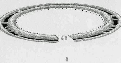
The Stonehenge ditch is something the archaeologists don’t frequently (if at all) discuss or publicise as it is not a ditch as we commonly know it, which has baffled them since its first excavation. The fact that this Ditch is ‘unique’ in the world, which you would imagine would be promoted as such, but they prefer to hide their lack of understanding of this feature and say nothing, for the Stonehenge Ditch is not a ditch but a series of pits with walls, seats and stone holes in the base that goes against the current theories about the site.
The Solution
If groundwater was contemporary in the past, then some evidence should still be present. Consequently, one of the more fascinating facts found when studying any prehistoric site is that the constructors spent disproportionate time digging ditches to surround their monuments, whether around henges or barrows.
This practice would be considered strange, even if the prehistoric builders had practical, modern, labour-saving tools. But unfortunately, our ancestors only benefited from stone tools, bones, and antlers, making such excavation exceptionally slow, cumbersome, and even more bewildering.
Looking at Avebury (a henge monument) as an example, the most conservative archaeological estimation suggests that the ditches surrounding Avebury would have taken 1.5 million-working hours to build. That’s equivalent to 100 people working 12 hours daily, every day, for 3.5 years. On the other hand, making a wooden palisade using the same tools would have taken less than one month – merely 2% of the time and exhaustion.
Current archaeological theories surrounding these ditches maintain that they were used either as defensive fortification and/or a landscape feature to keep in/out animals or, even more recently, bizarre interpretations such as a ‘ceremonial’ feature to ward off evil spirits.
This shows the levels of desperation the archaeologists have descended into in recent years in an abortive attempt to understand basic structures, such as a moat. Moreover, these quaint ideas strike me as somewhat flawed as a ditch is significantly less effective than a palisade (a long line of sharpened wooden stakes planted into the ground), which would have been considerably more straightforward, quicker to construct and more effective. As for evil spirits, would not a tiny 6-inch channel achieve the same symbolic purpose as a huge five-metre ditch? (The Stonehenge Hoax – The Ditch)
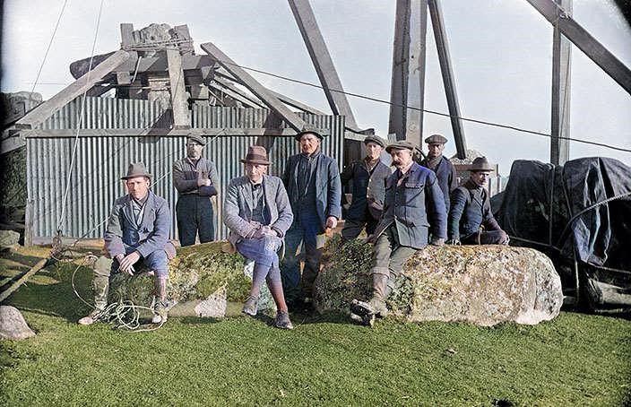
Lt-Col William Hawley, was one of the amateur archaeologists employed by the Ministry of Works to undertake excavations at our famous monuments Stonehenge and Avebury in the 1920s. But unfortunately, he was not the most ‘careful’ of archaeologists. This was a view shared by colleagues such as Atkinson in his book, ‘Stonehenge’ 3rd edition, London 1979 – where he suggests that Hawley’s methods were somewhat ‘inadequate’.
Despite this accusation of carelessness, he could still find some strange features, which can be seen as evidence of a moat. For example, below a layer of chalk rubble infill (chalk which would have fallen naturally into the Moat when it was disused) under a layer of flint, he discovered ‘foot-trampled mud’ (Cleal et al., 1995,p.68) – found in an area of chalkland which has no natural mud/clay, with an associated ‘layer of struck flint’ – which he found in many segments.
Now, this sounds quite interesting, if not conclusive as evidence of the existence of a moat, until you look for other landscape features with similar foundations, which, when analysed, start to build up a much more conclusive picture. Such landscape features can be found in ‘dew ponds’. (The Stonehenge Hoax – The Ditch)
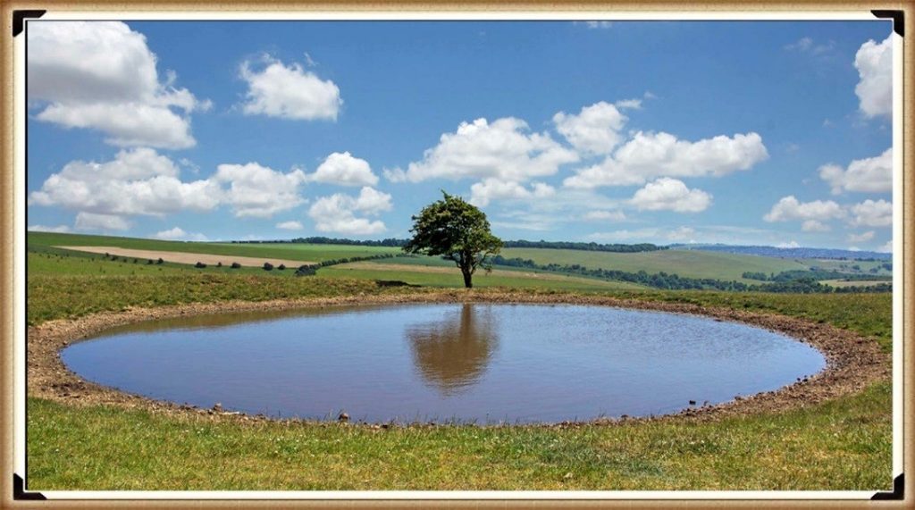
A dew pond is an artificial pond usually sited on the top of a hill, intended for watering livestock. Dew ponds are used in areas where a natural supply of surface water may not be readily available. The name dew pond (sometimes cloud pond or mist pond) is first found in the Journal of the Royal Agricultural Society in 1865. Despite the name, their primary source of water is believed to be rainfall rather than dew or mist.
The mystery of dew ponds has drawn the interest of many historians and scientists, but until recent times there has been little agreement on their early origins. It was widely believed that the technique for building dew ponds had been understood from the earliest times, as Kipling tells us in Puck of Pook’s Hill. The two Chanctonbury Hill dew ponds were dated, from flint tools excavated nearby and similarity to other dated earthworks to the Neolithic period.
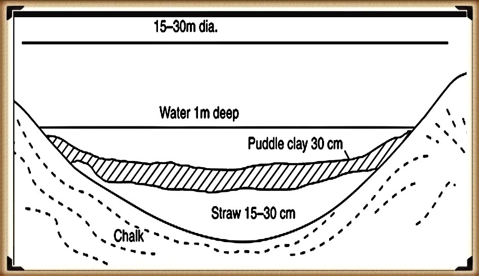
Profile of a typical dew pound construction – (The Stonehenge Hoax – The Ditch)
They are usually shallow, saucer-shaped, lined with puddled clay, chalk or marl on an insulating straw layer over a bottom layer of chalk or lime. To deter earthworms from their natural tendency of burrowing upwards, which would in a short while make the clay lining porous, a layer of soot would be incorporated or lime mixed with the clay. The clay is usually covered with straw to prevent cracking by the Sun and a final layer of chalk rubble or broken stone to protect the lining from the hoofs of sheep or cattle.
In 1877 Mr H. P. Slade discarded the term ” dew-ponds ” in favour of ” artificial rain-ponds” and scouted the idea that dew had any part in filling ponds. His remarks dealt practically with one pond, the greatest diameter of which was 69½ feet, which was constructed in 1836 at the cost of £40. It was bedded in the Thorpe Downs, near Loughborough, on the Berkshire Hills, at the height of 450 feet above the sea level. Being ” fed from the heavens,” this fact probably gave rise to its being classed as a dew-pond. The base of this pond was a layer of thick clay (mixed with lime to prevent the working of earthworms, a coating of straw “to prevent the Sun cracking the clay,” and, thirdly, a layer of loose rubble. Moreover, for 40 years, till 1876, the pond had only been dry once.
Nonetheless, Hawley can be forgiven for not recognising that this clay lining feature was being used to stop the water from being absorbed through the porous chalk back into the bedrock, as he was not looking for a moat, as he was ‘reliably’ informed by his geologists, that the surrounding area, (Stonehenge Bottom) has been dry for over half a million years and therefore did not have a raised water table in the past.
Hawley also found evidence of what he called a strange ‘dark soil layer’ which existed within the primary fill; in many parts of the ditch, I would strongly suggest that this ‘dark soil layer’ consisted of decayed remains and sediment, possible the hay which is traditionally lined with the clay to stop cracking. Moreover, organic matter would have naturally floated to the bottom (like a pond) over time, especially if it had not been cleaned regularly. This would naturally have left a lining of dark soil at the bottom of the Moat was it fell into disuse and became dry
By 1923 Hawley reported that this ‘ubiquitous dark layer’ was found throughout his excavations, sometimes up to 8″ thick, suggesting its existence in water would have been for some considerable length of time, and it was resting directly at the bottom of the moated ditch. This ‘Dark Layer’ was also observed by Atkinson in 1954 when they recut a piece of Hawley’s trench (segment 98) and found the same dark layer – not flint this time, but a stone layer. Moreover, he described the soils above as loamy (sand and clay) (Evans et al., 1984, 7-30) and that this layer (like the construction of dew ponds) was “often associated with a ‘layer’ of struck flint, which was found in many segments” (Cleal et al., 1995, p.68), to protect the clay lining. (The Stonehenge Hoax – The Ditch)
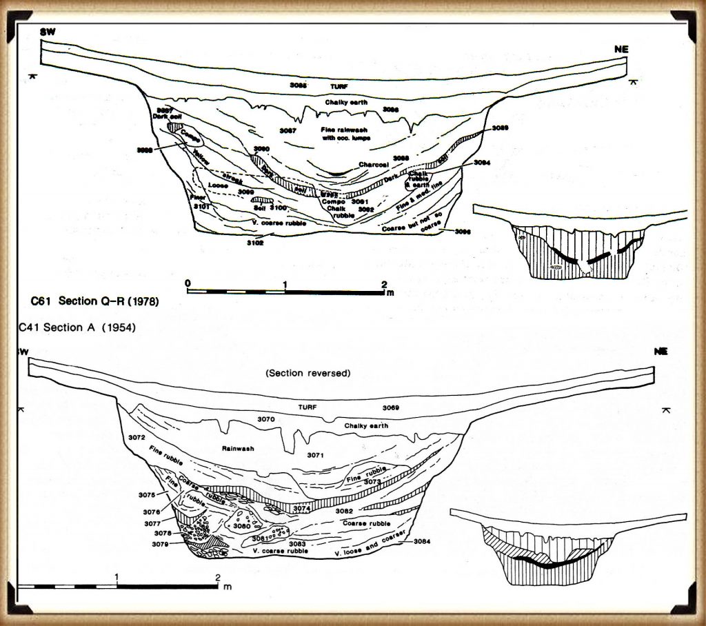
It has now been established that Stonehenge had, at some stage, a layer of waterproofing, the ‘layer of foot-trampled mud’ plus a ‘layer of struck flint’ added to the ditch. It’s also been established that this ditch was, at some point, filled with water for quite some considerable amount of time, as evidenced by the deep ‘dark layer’ sediment.
The Ditch is really a series of Pits
It is commonly agreed amongst both geologists and archaeologists that ‘dew ponds’ could be used in areas without natural springs for drinking water so why didn’t our ancestors build a “dew pond”– why go through the enormous and challenging task of building a 100-foot ring ditch full of freshwater pits?
Moreover, from the archaeological evidence I would suggest that the active moat from the start of the Phase 1 period at Stonehenge (when the water table was at its highest) and the river Avon was 30m higher than today, changed as the river levels dropped in the Neolithic Period, so did consequently, the height of the Moat. Therefore, this civilisation decided to line the moat with clay and flint to keep the waters high and preserve its use until eventually, it was impossible to preserve at this point Phase 2 of the site, involving the introduction of the massive sarsen stones and construction of the avenue, as they adaption the site and purpose began.
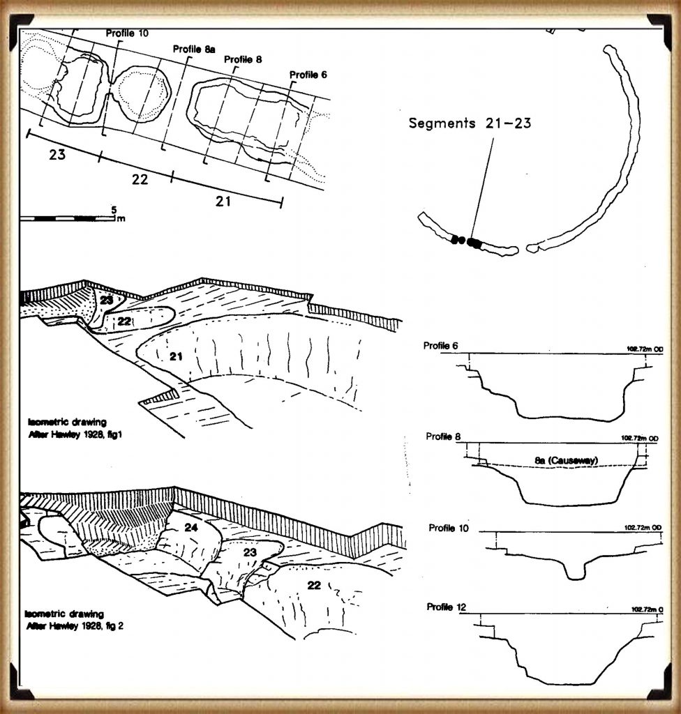
However, the mystery of this ring ditch/moat deepens when you look at the other ditches in the prehistoric world, which shows that the ditch is not a single cut, but a series of individual pits interlinking to each other, with walls and seats cut into the chalk – which is not seen anywhere in the prehistoric world.
Hawley’s finding of other moats that surrounded the north and south mounds, which ‘connected’ to the Stonehenge moated ditch, escalated this use of the ditch as a moat.
On the shallow associated banks of the ditches, he finds lots of what he calls ‘yellow marl’ – “there was a quantity of the yellowish marl within the ditch and about the site of the palisade” (Cleal et al., 1995, p.278) – Marl was originally an old term loosely applied to a variety of materials, most of which occur as loose, earthy deposits consisting chiefly of an intimate mixture of clay and calcium carbonate, formed under freshwater conditions; specifically an earthy substance containing 35–65% clay and 65–35% carbonate. (Pettijohn, F. J. (1957). p.410)
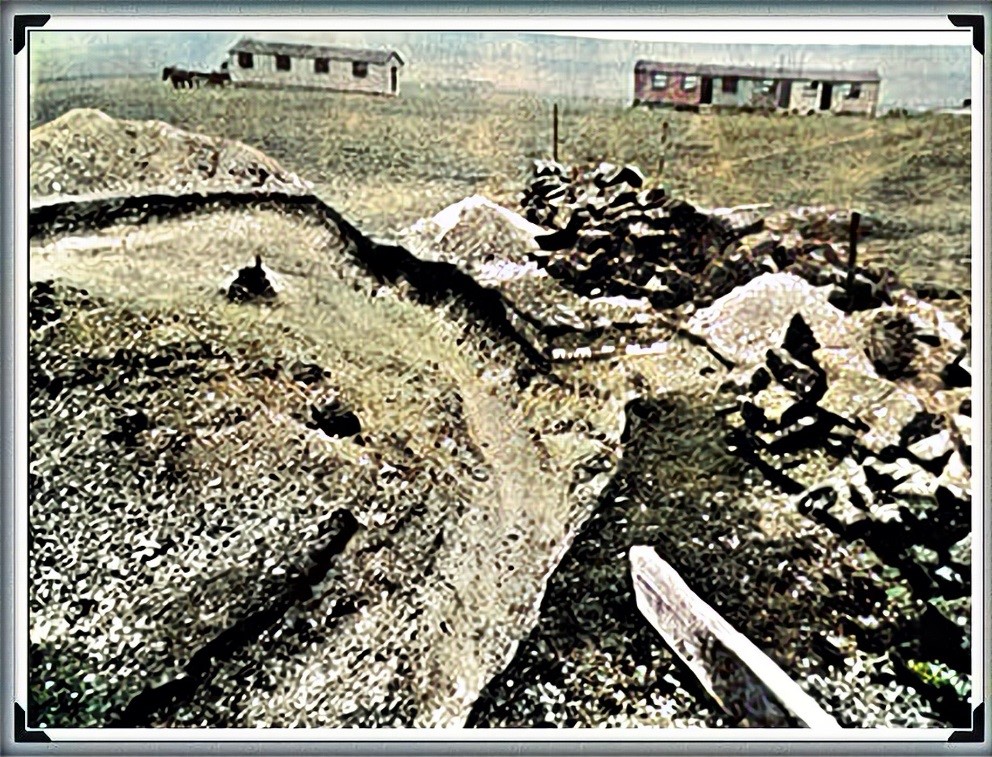
As this marl had fragments of Blue and Sarsen stones within it – this clearly shows that ‘freshwater’ was in the moat and present at the time of construction.
If you look at the remains of the Stonehenge moat today, it appears very shallow and uneven, but when excavated, it looks very different. It is, in fact, a series of ‘individual pits’, which, in places, are connected by shallow walls.
This opens up a series of fascinating unanswered questions:
- Was the ditch half-finished, for the pits differ in size, shape and depth, or perhaps they were ‘dodgy Welsh builders’ who did not know what they were doing?
- If the ditch is defensive or symbolic, as some archaeologists suggest, why not pile the chalk on one side rather than both sides?
- Why are their seats or shelves left in the ditch?
- Why are there stone holes at the bottom of the moated ditch?
The ability to build defensive structures was available to our ancestors. Still, they decided not to use it on this occasion, as clearly it was made for another purpose, and that purpose was as a groundwater-filled moat.
The only reason you would cut the ditch down to different levels is to search for the groundwater level under the chalk bedrock. As chalk is a porous substance and water travels freely through it, the groundwater table over an area like Stonehenge can vary by a metre or so depending on the makeup of the chalk, as water runs through the fault lines in the chalk strata, leading to varying groundwater levels over an area.
This variation of groundwater tables would also explain why the builders left shallow walls and why none of the walls went up to the surface – so the water could flow between the individual pits.
Why did the builders then chosen Stonehenge area to build a site?
CHALK
Our ancestors needed a place with a chalk sub-soil as it has two exceptional properties – it’s porousness and its resistance to dissolving in water.
The problem with chalk is that it’s difficult to excavate, almost impossible. So, if Mesolithic Man wanted an easy time and needed a large defensive ditch, he would have chosen a site with soft soil, unless he’s insane or had nothing better to do for the next few years!
These builders were attracted to chalk and its unique characteristics. Not only is it porous, but it is SLOW porous, which means that a pit or hole below the local groundwater table would gradually fill with or empty with water at a consistent rate. In addition, because it’s part of the limestone family, it would not crumble and dissolve.
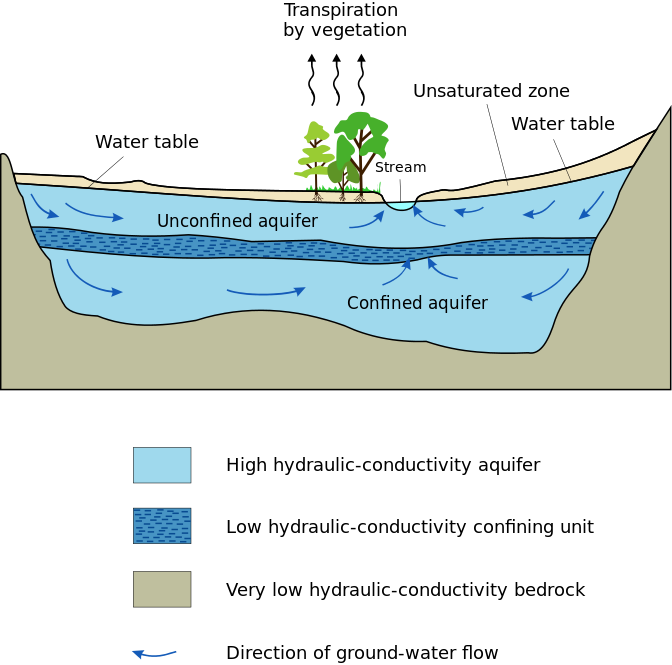
If these moats are used in conjunction with natural groundwater reeds (Phragmites australis is one of the main wetland plant species used for phytoremediation water treatment) and placed on the shelves within the ditch, the result is pure, clean freshwater good enough to drink comparable to modern tap water. This type of water purification would not be seen in Britain for another 8,000 years. It would also leave Hawley’s unidentified ‘dark layer’.
Ground Water
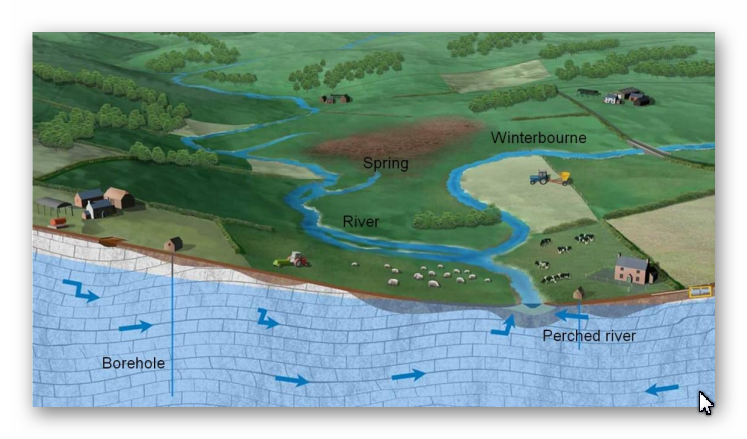
Groundwater tables were far higher than we experience today due to the meltwater of the last ice age raising the water table. For a site like Stonehenge, this would mean that the monument would have been surrounded by groundwater on three sides, as the springs in Stonehenge’s bottom would have leaked thousands of litres per spring water per second over thousands of thousands of thousands of years.
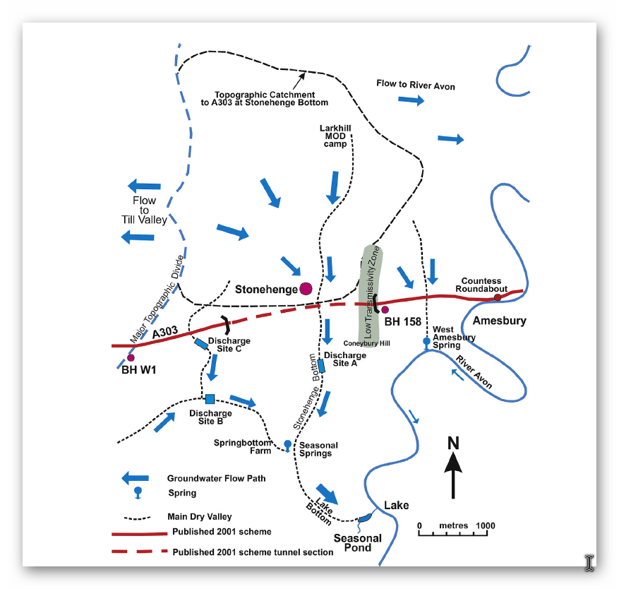
Recent geological studies have recognised the multitude of Springs and groundwater in this area “Geology has a great influence on landscape including shape of the ground, vegetation and groundwater in terms of potential springs and water sources….. Stonehenge is located on a plateau area with groundwater draining east towards the River Avon and south towards and beneath dry valleys including Stonehenge Bottom (Fig. 28). Water supply would have been plentiful… Having discovered this new geology in the Chalk at Stonehenge further studies are required to assess its implications for landscape evolution and habitation.” Rory N. Mortimore, et. al. Stonehenge—a unique Late Cretaceous phosphatic Chalk geology: implications for sea-level, climate and tectonics and impact on engineering and archaeology, Proceedings of the Geologists’ Association, Volume 128, Issue 4, 2017
So much groundwater was found the pa[per pointed out that: “Cancellation of the original proposed A303 Stonehenge Tunnels and the Amesbury to Winterbourne Stoke improvements was in large part due to the unexpected geology and unexpected groundwater conditions around Stonehenge which led to construction costs more than doubling to £470 million in July 2005.
”
| Fig. 28. A303 Stonehenge tunnel area conceptual groundwater flow regime. Stonehenge Bottom acts as a drain to the area with a spring located downstream at Spring bottom. Farm and a seasonal pond in Lake Bottom close to the River Avon. During the rapid rise in groundwater levels in 2002 the floor of Stonehenge bottom became flooded up to the A303 crossing and Trial Pits on the west side partly filled with water |
This high groundwater would permeate into any pits or ditches dug below the water table, and this water would be FILTERED by the chalk; as recent findings at Blick Mead have found, the water temperature is fixed at a constant 50F throughout the seasons, even in the coldest winters, where the water would steam in the colder atmosphere. Therefore, the ditches surrounding Stonehenge were deliberately cut by our ancestors below the groundwater table to allow them to fill with warm, filtered, clean drinkable water.
It is commonly agreed amongst both geologists and archaeologists that ‘dew ponds’ could be used in areas without natural springs for drinking water, so why didn’t our ancestors build a “dew pond”– why go through the enormous and challenging task of building a 100-foot ring ditch full of freshwater pits?
Moreover, from the archaeological evidence, I would suggest that the active moat from the start of the Phase 1 period at Stonehenge (when the water table was at its highest) and the river Avon was 30m higher than today, changed as the river levels dropped in the Neolithic Period, so did consequently, the height of the moat. Therefore, this civilisation decided to line the moat with clay and flint to keep the waters high and preserve its use until, eventually, it was impossible to protect, and at this point, Phase 2 of the site involved the introduction of the massive sarsen stones and construction of the Avenue, as they adapted the site for a new purpose.
However, the mystery of this ring ditch/moat deepens when you look at the other ditches in the prehistoric world, which shows that the ditch is not a single cut, but a series of individual pits interlinking to each other, with walls and seats cut into the chalk – which is not seen anywhere in the prehistoric world.
Unearth the Astonishing Secrets of Stonehenge (The Stonehenge Hoax)
Introduction
Video
Synopsys
Stonehenge, a timeless enigma etched in stone and earth, has stood as a formidable puzzle challenging the intellects of archaeologists and historians alike. Despite the myriad attempts, including books, TV programs, and academic conferences, the secrets of these ancient stones and their encircling ditches have proven elusive. Against this backdrop, we scrutinise the existing thirteen hypotheses, each presenting its narrative but collectively lacking a coherent thread.
In adopting the deductive reasoning akin to Sherlock Holmes, we endeavour to weave these disparate threads into a unified tapestry that not only unravels the mystery of Stonehenge but also shakes the foundations of established academic narratives. This intellectual journey may induce some discomfort as we challenge conventional perceptions and invite a reevaluation of our understanding of the past. Apologies are extended in advance for any cognitive dissonance, but the pursuit of truth and reason mandates an unfiltered presentation of the facts.
So, fasten your seatbelts for an expedition into the archaeological unknown.
As we navigate this intellectual rollercoaster, be prepared for a revelation that might reshape our understanding of Stonehenge and question the foundations of our historical narratives. The dawn of a new archaeological era awaits promising insights that could leave even the most curious minds astonished. As we delve into this intellectual rabbit hole, be ready for a revelation that could make Alice astonished.
Robert John Langdon (2023) – (The Stonehenge Hoax)
The Journey
Langdon’s journey was marked by meticulous mapping and years of research, culminating in a hypothesis that would reshape our understanding of prehistoric Britain. He proposed that much of the British Isles had once been submerged in the aftermath of the last ice age, with these ancient sites strategically positioned along the ancient shorelines. His groundbreaking maps offered a fresh perspective, suggesting that Avebury had functioned as a bustling trading hub for our ancient ancestors. This audacious theory challenged the prevailing notion that prehistoric societies were isolated and disconnected, instead highlighting their sophistication in trade and commerce.
In the realm of historical discovery, the audacious thinkers, the mavericks who dare to question established narratives, propel our understanding forward. Robert John Langdon is undeniably one of these thinkers. With a deep passion for history and an unyielding commitment to his research, he has unearthed a hidden chapter in the story of Avebury that transcends the boundaries of time and offers fresh insights into our shared human history.
As Langdon’s trilogy, ‘The Stonehenge Enigma,’ continues to explore these groundbreaking theories, it beckons us to embark on a journey of discovery, to challenge our assumptions, and to embrace the possibility that the past is far more complex and interconnected than we ever imagined. With its ancient stones and enigmatic avenues, Avebury continues to whisper its secrets to those who dare to listen, inviting us to see history through a new lens—one illuminated by the audacious vision of Robert John Langdon.
(The Stonehenge Hoax – The Ditch)
The Book
Further Reading
For information about British Prehistory, visit www.prehistoric-britain.co.uk for the most extensive archaeology blogs and investigations collection, including modern LiDAR reports. This site also includes extracts and articles from the Robert John Langdon Trilogy about Britain in the Prehistoric period, including titles such as The Stonehenge Enigma, Dawn of the Lost Civilisation and the ultimate proof of Post Glacial Flooding and the landscape we see today.
Robert John Langdon has also created a YouTube web channel with over 100 investigations and video documentaries to support his classic trilogy (Prehistoric Britain). He has also released a collection of strange coincidences that he calls ‘13 Things that Don’t Make Sense in History’ and his recent discovery of a lost Stone Avenue at Avebury in Wiltshire called ‘Silbury Avenue – the Lost Stone Avenue’.
Langdon has also produced a series of ‘shorts’, which are extracts from his main body of books:
Other Blogs
1
a
- AI now Supports – Homo Superior
- AI now supports my Post-Glacial Flooding Hypothesis
- Alexander the Great sailed into India – where no rivers exist today
- Ancient Prehistoric Canals – The Vallum
- Ancient Secrets of Althorp – debunked
- Antler Picks built Ancient Monuments – yet there is no real evidence
- Antonine Wall – Prehistoric Canals (Dykes)
- Archaeological ‘pulp fiction’ – has archaeology turned from science?
- Archaeological Pseudoscience
- Archaeology in the Post-Truth Era
- Archaeology: A Bad Science?
- Archaeology: A Harbour for Fantasists?
- Archaeology: Fact or Fiction?
- Archaeology: The Flaws of Peer Review
- Archaeology’s Bayesian Mistake: Stop Averaging the Past
- Are Raised Beaches Archaeological Pseudoscience?
- Atlantis Found: The Mathematical Proof That Plato’s Lost City Was Doggerland
- ATLANTIS: Discovery with Dan Snow Debunked
- Avebury Ditch – Avebury Phase 2
- Avebury Post-Glacial Flooding
- Avebury through time
- Avebury’s great mystery revealed
- Avebury’s Lost Stone Avenue – Flipbook
b
- Battlesbury Hill – Wiltshire
- Beyond Stone and Bone: Rethinking the Megalithic Architects of Northern Europe
- BGS Prehistoric River Map
- Blackhenge: Debunking the Media misinterpretation of the Stonehenge Builders
- Brain capacity (Cro-Magnon Man)
- Brain capacity (Cro-Magnon Man)
- Britain’s First Road – Stonehenge Avenue
- Britain’s Giant Prehistoric Waterways
- British Roman Ports miles away from the coast
c
- Caerfai Promontory Fort – Archaeological Nonsense
- Car Dyke – ABC News PodCast
- Car Dyke – North Section
- CASE STUDY – An Inconvenient TRUTH (Craig Rhos Y Felin)
- Case Study – River Avon
- Case Study – Woodhenge Reconstruction
- Chapter 2 – Craig Rhos-Y-Felin Debunked
- Chapter 2 – Stonehenge Phase I
- Chapter 2 – Variation of the Species
- Chapter 3 – Post Glacial Sea Levels
- Chapter 3 – Stonehenge Phase II
- Chapter 7 – Britain’s Post-Glacial Flooding
- Cissbury Ring through time
- Cro-Magnon Megalithic Builders: Measurement, Biology, and the DNA
- Cro-Magnons – An Explainer
d
- Darwin’s Children – Flipbook
- Darwin’s Children – The Cro-Magnons
- Dawn of the Lost Civilisation – Flipbook
- Dawn of the Lost Civilisation – Introduction
- Digging for Britain – Cerne Abbas 1 of 2
- Digging for Britain Debunked – Cerne Abbas 2
- Digging Up Britain’s Past – Debunked
- DLC Chapter 1 – The Ascent of Man
- Durrington Walls – Woodhenge through time
- Durrington Walls Revisited: Platforms, Fish Traps, and a Managed Mesolithic Landscape
- Dyke Construction – Hydrology 101
- Dykes Ditches and Earthworks
- DYKES of Britain
e
f
g
h
- Hadrian’s Wall – Military Way Hoax
- Hadrian’s Wall – the Stanegate Hoax
- Hadrian’s Wall LiDAR investigation
- Hambledon Hill – NOT an ‘Iron Age Fort’
- Hayling Island Lidar Maps
- Hidden Sources of Ancient Dykes: Tracing Underground Groundwater Fractals
- Historic River Avon
- Hollingsbury Camp Brighton
- Hollows, Sunken Lanes and Palaeochannels
- Homo Superior – Flipbook
- Homo Superior – History’s Giants
- How Lidar will change Archaeology
i
l
m
- Maiden Castle through time
- Mathematics Meets Archaeology: Discovering the Mesolithic Origins of Car Dyke
- Mesolithic River Avon
- Mesolithic Stonehenge
- Minerals found in Prehistoric and Roman Quarries
- Mining in the Prehistoric to Roman Period
- Mount Caburn through time
- Mysteries of the Oldest Boatyard Uncovered
- Mythological Dragons – a non-existent animal that is shared by the World.
o
- Offa’s Dyke Flipbook
- Old Sarum Lidar Map
- Old Sarum Through Time…………….
- On Sunken Lands of the North Sea – Lived the World’s Greatest Civilisation.
- OSL Chronicles: Questioning Time in the Geological Tale of the Avon Valley
- Oswestry LiDAR Survey
- Oswestry through time
- Oysters in Archaeology: Nature’s Ancient Water Filters?
p
- Pillow Mounds: A Bronze Age Legacy of Cremation?
- Post Glacial Flooding – Flipbook
- Prehistoric Burial Practices of Britain
- Prehistoric Canals – Wansdyke
- Prehistoric Canals – Wansdyke
- Prehistoric Canals (Dykes) – Great Chesters Aqueduct (The Vallum Pt. 4)
- Prehistoric Canals (Dykes) – Hadrian’s Wall Vallum (pt 1)
- Prehistoric Canals (Dykes) – Offa’s Dyke (Chepstow)
- Prehistoric Canals (Dykes) – Offa’s Dyke (LiDAR Survey)
- Prehistoric Canals (Dykes) – Offa’s Dyke Survey (End of Section A)
- Prehistoric Canals (Dykes) – Wansdyke (4)
- Prehistoric Canals Wansdyke 2
- Professor Bonkers and the mad, mad World of Archaeology
r
- Rebirth in Stone: Decrypting the Winter Solstice Legacy of Stonehenge
- Rediscovering the Winter Solstice: The Original Winter Festival
- Rethinking Ancient Boundaries: The Vallum and Offa’s Dyke”
- Rethinking Ogham: Could Ireland’s Oldest Script Have Begun as a Tally System?
- Rethinking The Past: Mathematical Proof of Langdon’s Post-Glacial Flooding Hypothesis
- Revolutionising History: Car Dyke Unveiled as Prehistoric & the Launch of FusionBook 360
- Rising Evidence, Falling Rivers: The Real Story of Europe’s First Farmers
- Rivers of the Past Were Higher: A Fresh Perspective on Prehistoric Hydrology
s
- Sea Level Changes
- Section A – NY26SW
- Section B – NY25NE & NY26SE
- Section C – NY35NW
- Section D – NY35NE
- Section E – NY46SW & NY45NW
- Section F – NY46SE & NY45NE
- Section G – NY56SW
- Section H – NY56NE & NY56SE
- Section I – NY66NW
- Section J – NY66NE
- Section K – NY76NW
- Section L – NY76NE
- Section M – NY87SW & NY86NW
- Section N – NY87SE
- Section O – NY97SW & NY96NW
- Section P – NY96NE
- Section Q – NZ06NW
- Section R – NZ06NE
- Section S – NZ16NW
- Section T – NZ16NE
- Section U – NZ26NW & NZ26SW
- Section V – NZ26NE & NZ26SE
- Silbury Avenue – Avebury’s First Stone Avenue
- Silbury Hill
- Silbury Hill / Sanctuary – Avebury Phase 3
- Somerset Plain – Signs of Post-Glacial Flooding
- South Cadbury Castle – Camelot
- Statonbury Camp near Bath – an example of West Wansdyke
- Stone me – the druids are looking the wrong way on Solstice day
- Stone Money – Credit System
- Stone Transportation and Dumb Censorship
- Stonehenge – Monument to the Dead
- Stonehenge Hoax – Dating the Monument
- Stonehenge Hoax – Round Monument?
- Stonehenge Hoax – Summer Solstice
- Stonehenge LiDAR tour
- Stonehenge Phase 1 — Britain’s First Monument
- Stonehenge Phase I (The Stonehenge Landscape)
- Stonehenge Solved – Pythagorean maths put to use 4,000 years before he was born
- Stonehenge Stone Transportation
- Stonehenge Through Time
- Stonehenge, Doggerland and Atlantis connection
- Stonehenge: Borehole Evidence of Post-Glacial Flooding
- Stonehenge: Discovery with Dan Snow Debunked
- Stonehenge: The Worlds First Computer
- Stonehenge’s The Lost Circle Revealed – DEBUNKED
t
- Ten Reasons Why Car Dyke Blows Britain’s Earthwork Myths Out of the Water
- Ten Things You Didn’t Know About Britain’s Prehistoric Flooded Past
- Ten thousand year old boats found on Northern Europe’s Hillsides
- Ten thousand-year-old boats found on Northern Europe’s Hillsides
- The “Hunter-Gatherer” Myth: Why It’s Time to Bury This Outdated Term
- The Ancient Mariners – Flipbook
- The Ancient Mariners – Prehistoric seafarers of the Mesolithic
- The Beringian Migration Myth: Why the Peopling of the Americas by Foot is Mathematically and Logistically Impossible
- The Bluestone Enigma
- The Cro-Magnon Cover-Up: How DNA and PR Labels Erased Our Real Ancestry
- The Dolmen and Long Barrow Connection
- The Durrington Walls Hoax – it’s not a henge?
- The Dyke Myth Collapses: Excavation and Dating Prove Britain’s Great Dykes Are Prehistoric Canals
- The First European Smelted Bronzes
- The Fury of the Past: Natural Disasters in Historical and Prehistoric Britain
- The Giant’s Graves of Cumbria
- The Giants of Prehistory: Cro-Magnon and the Ancient Monuments
- The Great Antler Pick Hoax
- The Great Chichester Hoax – A Bridge too far?
- The Great Dorchester Aqueduct Hoax
- The Great Farming Hoax – (Einkorn Wheat)
- The Great Farming Migration Hoax
- The Great Hadrian’s Wall Hoax
- The Great Iron Age Hill Fort Hoax
- The Great Offa’s Dyke Hoax
- The Great Prehistoric Migration Hoax
- The Great Stone Transportation Hoax
- The Great Stonehenge Hoax
- The Great Wansdyke Hoax
- The Henge and River Relationship
- The Logistical Impossibility of Defending Maiden Castle
- The Long Barrow and Dolman Enigma
- The Long Barrow Mystery
- The Long Barrow Mystery: Unravelling Ancient Connections
- The Lost Island of Avalon – revealed
- The Maiden Way Hoax – A Closer Look at an Ancient Road’s Hidden History
- The Maths – LGM total ice volume
- The Mystery of Pillow Mounds: Are They Really Medieval Rabbit Warrens?
- The Old Sarum Hoax
- The Oldest Boat Yard in the World found in Wales
- The Perils of Paradigm Shifts: Why Unconventional Hypotheses Get Branded as Pseudoscience
- The Post-Glacial Flooding Hypothesis – Flipbook
- The Post-Glacial Flooding Theory
- The Problem with Hadrian’s Vallum
- The Rise of the Cro-Magnon (Homo Superior)
- The Roman Military Way Hoax
- The Silbury Hill Lighthouse?
- The Stonehenge Avenue
- The Stonehenge Avenue
- The Stonehenge Code: Unveiling its 10,000-Year-Old Secret
- The Stonehenge Enigma – Flipbook
- The Stonehenge Enigma: What Lies Beneath? – Debunked
- The Stonehenge Hoax – Bluestone Quarry Site
- The Stonehenge Hoax – Flipbook
- The Stonehenge Hoax – Moving the Bluestones
- The Stonehenge Hoax – Periglacial Stripes
- The Stonehenge Hoax – Station Stones
- The Stonehenge Hoax – Stonehenge’s Location
- The Stonehenge Hoax – The Ditch
- The Stonehenge Hoax – The Slaughter Stone
- The Stonehenge Hoax – The Stonehenge Layer
- The Stonehenge Hoax – Totem Poles
- The Stonehenge Hoax – Woodhenge
- The Stonehenge Hospital
- The Subtropical Britain Hoax
- The Troy, Hyperborea and Atlantis Connection
- The Vallum @ Hadrian’s Wall – it’s Prehistoric!
- The Vallum at Hadrian’s Wall (Summary)
- The Woodhenge Hoax
- Three Dykes – Kidland Forest
- Top Ten misidentified Fire Beacons in British History
- Troy Debunked
- TSE – DVD Barrows
- TSE DVD – An Inconvenient Truth
- TSE DVD – Antler Picks
- TSE DVD – Avebury
- TSE DVD – Durrington Walls & Woodhenge
- TSE DVD – Dykes
- TSE DVD – Epilogue
- TSE DVD – Stonehenge Phase I
- TSE DVD – Stonehenge Phase II
- TSE DVD – The Post-Glacial Hypothesis
- TSE DVD Introduction
- TSE DVD Old Sarum
- Twigs, Charcoal, and the Death of the Saxon Dyke Myth
w
- Wansdyke – Short Film
- Wansdyke East – Prehistoric Canals
- Wansdyke Flipbook
- Wansdyke LiDAR Flyover
- Wansdyke: A British Frontier Wall – ‘Debunked’
- Was Columbus the first European to reach America?
- What Archaeology Missed Beneath Stonehenge
- White Sheet Camp
- Why a Simple Fence Beats a Massive Dyke (and What That Means for History)
- Windmill Hill – Avebury Phase 1
- Winter Solstice – Science, Propaganda and Indoctrination
- Woodhenge – the World’s First Lighthouse?


