Section D – NY35NE
Contents
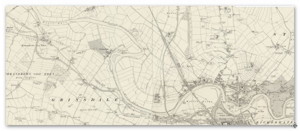
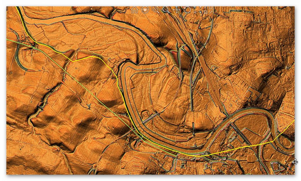
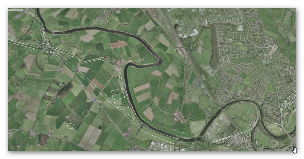
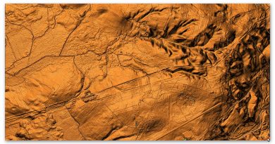
Section D – NY35NE – this is a section of Hadrian’s Wall showing the LiDAR, Google Earth and 1800 Maps of the Area covered by Historic England
Historic England Sections:
Hadrian’s Wall – between the east end of Davidson’s Banks and road to Grinsdale and vallum between Davidson’s Banks and dismantled railway in wall miles 66, 67 and 68
List UID: 1018309, 1007248
Old OS Map
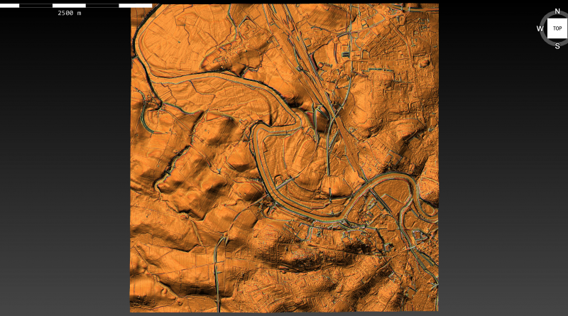
LiDAR Map
Google Earth Map
Historic England Scheduled Monuments within Section D
Name: Hadrian’s Wall between the east end of Davidson’s Banks and road to Grinsdale and vallum between Davidson’s Banks and dismantled railway in wall miles 67 and 68
Designation Type: Scheduling
Grade: Not Applicable to this List Entry
List UID: 1018309
Name: Hadrian’s Wall and vallum in wall mile 66, Stanwix Bank to Stainton
Designation Type: Scheduling
Grade: Not Applicable to this List Entry
List UID: 1007248
Analysis of the GE map and English Heritage scheduled monuments confirms the termination point of the Vallum. Their report of these monuments suggests that:
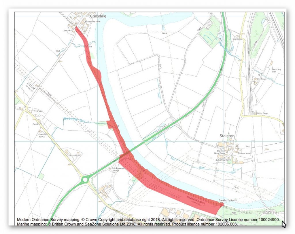
The monument includes the section of Hadrian’s Wall and it’s associated features between the eastern end of Davidson’s Banks in the east and the road to Grinsdale in the west and the vallum and it’s associated features between Davidson’s Banks in the east and the dismantled railway, north of Knockupworth Cottage in the west.
Hadrian’s Wall survives as a buried feature throughout the whole of this section with no remains visible above ground. Its course as depicted on Ordnance Survey maps is based on MacLauchlan’s 1857 survey. The course follows the crest of the river cliff overlooking the River Eden to the north. There was probably no wall ditch along this section as the steep river cliff, which is now being eroded back by the river, would have rendered a ditch here superfluous.
The exact location of milecastle 68 has not yet been confirmed. However, on the basis of the usual spacing, it is expected to be located in the wood to the north of Boomby Gill. Surface remains of robber trenches were noted here in 1972 but these have not been confirmed since.
The exact locations of turrets 67a, 67b and 68a have also not yet been confirmed. On the basis of the usual spacing they are anticipated to lie on the line of the wall about 100m west of the path at the east end of Davidson’s Banks, below the electricity transmission lines which cross Davidson’s Banks and 240m ESE of the Recreation Hall on the road to Grinsdale respectively.
The course of the vallum is known throughout most of this section. It survives as a slight intermittent earthwork visible on the ground as a low depression averaging 30m wide. The north mound survives up to 0.5m high at the east end of this section with crossings still evident.
The course of the Roman road known as the Military Way, which ran along the corridor between the Wall and the vallum linking turrets, milecastles and forts, has not yet been confirmed in this section.
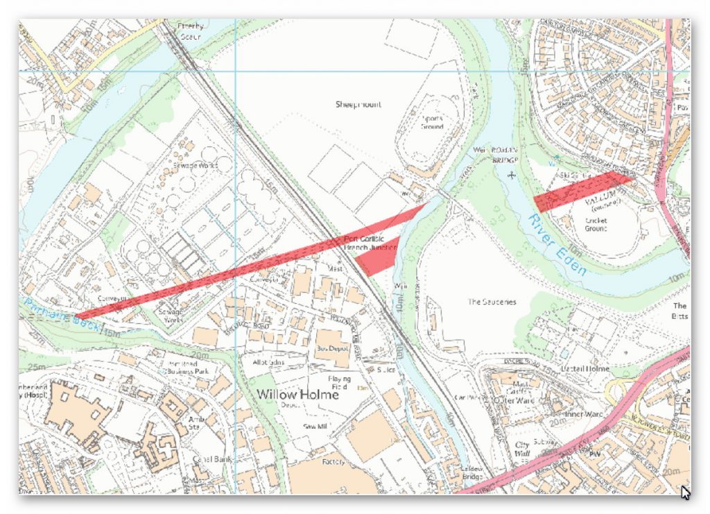
Milecastle 67 (Stainton) is a conjectured – Milecastle of the Roman Hadrian’s Wall. The location of the mile fort was determined by measuring the distance from neighboring mile forts. In 1861, some Roman coins were recovered from this point at the southern end of the railway viaduct over the Eden. However, upon follow-up, no remains or other evidence of its existence could be found.
Investigation
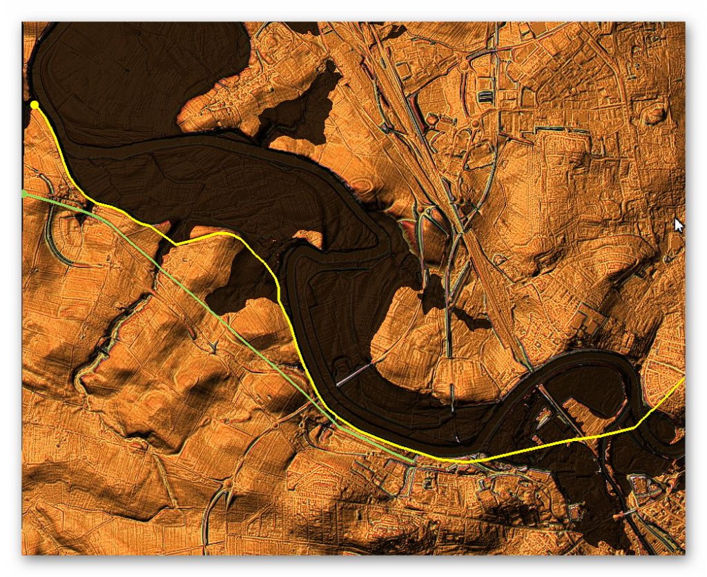
Analysis of this section shows that the Wall follows the shoreline of the enlarged River Eden, as shown in section A, B and C. As supported by the lack of any entry details in the Scheduled Monuments description – to the East of the section, the raised waters of the past reveal no evidence of any wall or the expected Mile 66 station post.
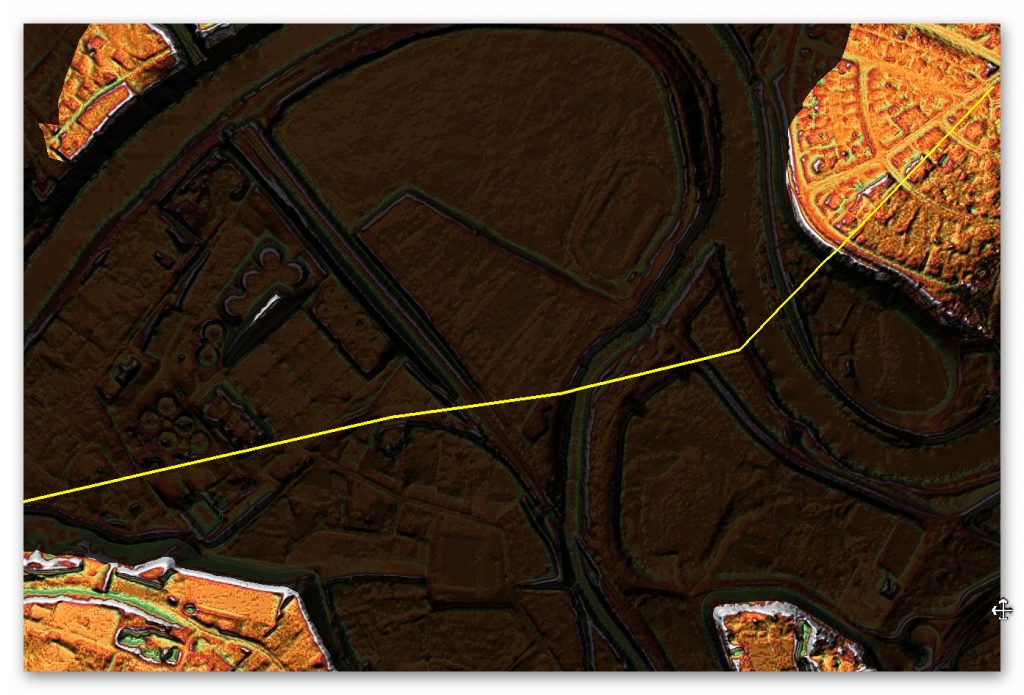
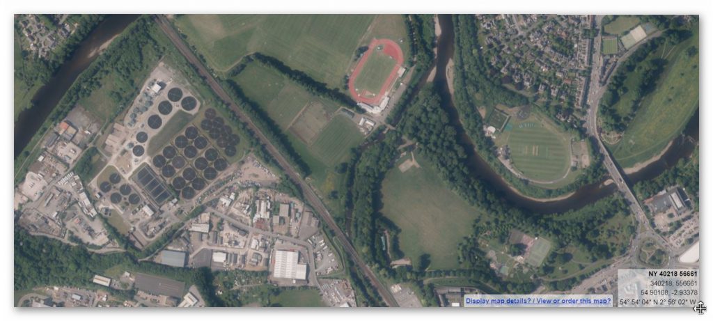
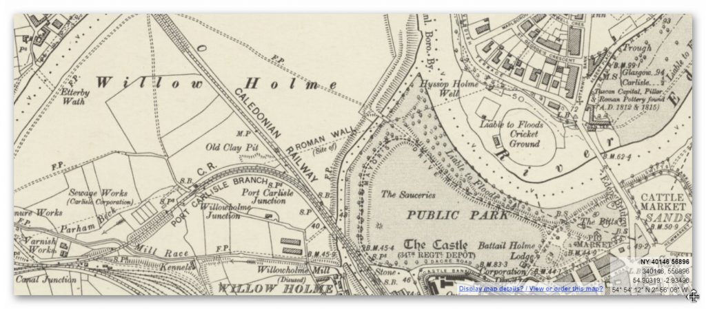
The path of The Wall in this section and the dissapearance of the Wall in the West is a clear indication that ‘Post-Glacial Flooding’ occured diirectly after the last ice age and kept rivers high even during the Roman period only 2,000 years ago.
The Roman Shoreline of the River Eden
Vallum
The Vallum in this section seems to dissapear long before the current River Eden. As we have already shown the River Eden was larger than today during the building of the Wall as it follows the path of the heightened river. This is not the case for the Vallum, as we can see from the large distances between the Wall and the Vallum. This can only be explained by the Vallum being built some time before the Wall and on a shoreline more flooded.
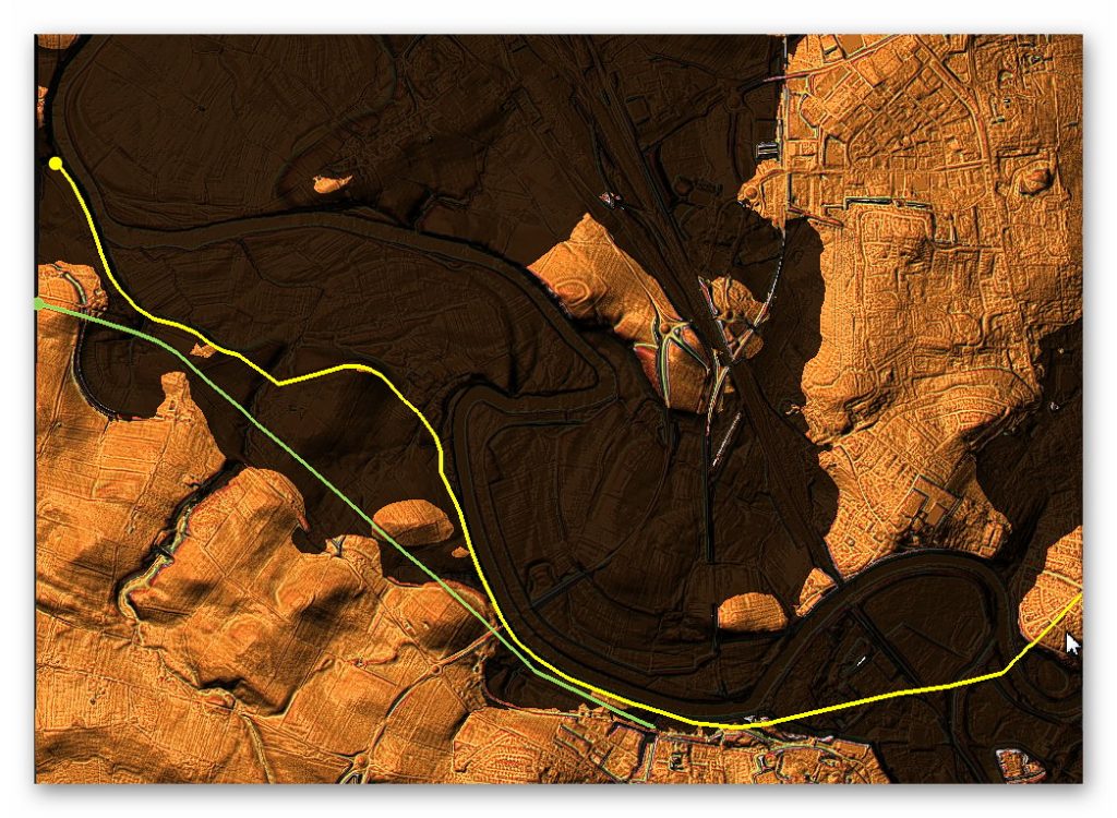
The above LiDAR map shows the Vallum not only terminating at the edge of the River Eden but going through the shorelines of the heightened river. This again is a clear indication that the Vallum was a canal that required frequent ‘topping up’ by rivers and stream feeding directly into the ditch.
To understand the problem with Hadrian’s Walls history read our article HERE.
Further Reading
For information about British Prehistory, visit www.prehistoric-britain.co.uk for the most extensive archaeology blogs and investigations collection, including modern LiDAR reports. This site also includes extracts and articles from the Robert John Langdon Trilogy about Britain in the Prehistoric period, including titles such as The Stonehenge Enigma, Dawn of the Lost Civilisation and the ultimate proof of Post Glacial Flooding and the landscape we see today.
Robert John Langdon has also created a YouTube web channel with over 100 investigations and video documentaries to support his classic trilogy (Prehistoric Britain). He has also released a collection of strange coincidences that he calls ‘13 Things that Don’t Make Sense in History’ and his recent discovery of a lost Stone Avenue at Avebury in Wiltshire called ‘Silbury Avenue – the Lost Stone Avenue’.
Langdon has also produced a series of ‘shorts’, which are extracts from his main body of books:
For active discussions on the findings of the TRILOGY and recent LiDAR investigations that are published on our WEBSITE, you can join our and leave a message or join the debate on our Facebook Group.


Pingback: Hadrian’s Wall LiDAR investigation - Prehistoric Britain