Battlesbury Hill – Wiltshire
According to Wikipedia Battlesbury Hill is a ‘Iron Age’ Fort’ and traditional dated archaeologists –
Battlesbury occupies the summit of an irregular point of down, with its defences following the natural contours of the hill; by nature of the site it is almost inaccessible on the west and northeast sides. It has triple ditches and ramparts for the most part, doubled on the southeast side. The site encloses 23.5 acres in all. There are entrances at the northeast and northwest corners.[4]
Pits found within the fortifications contained late Iron Age pottery, the hub of a chariot wheel, an iron carpenter’s saw, a latch-lifter for a hut door, querns, whetstones, sling stones, and animal bones. These all indicate a permanent occupation and date from the 1st century BC. A group of graves containing men, women and children outside the east entrance has been interpreted as war burials, possibly from the Roman conquest.[5]
The southwest area of the hill fort is apparently built over and around preceding Bronze Age burial mounds or tumuli. Part of the inner ditch is occupied by a large circular barrow, which was excavated, but was found empty. A few feet further to the west are two other barrows, over which the great inner rampart passes; these on opening, proved to be sepulchral: in the largest was found a cist containing burned human bones at the depth of two feet; and in the smallest, two skeletons were found, lying from south to north, the head of the smallest reclining on the breast of the other. On the breast of the largest skeleton there was a small ring or bead of stone, which was probably worn as an amulet.[6]
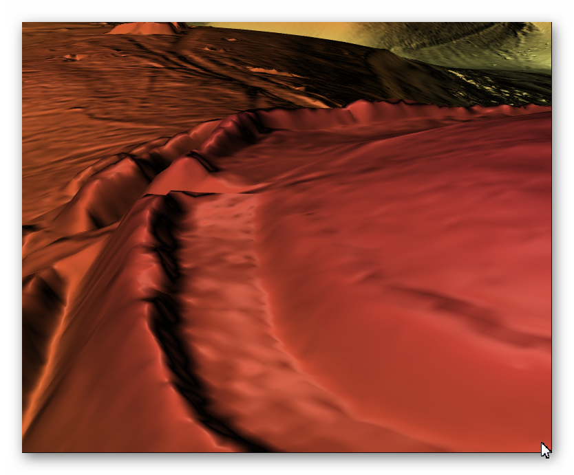
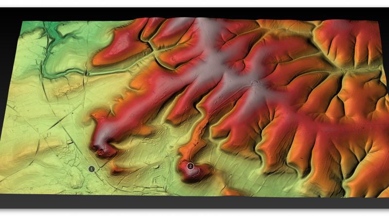
3D view of the digital terrain model
Later excavations and surveys adjacent to Battlesbury Camp hill fort in 1998 have also uncovered late Bronze Age to middle Iron Age settlement activity including for ditches, roundhouses, four-post structures and numerous pits. Some of the pits contained human burials, and other deposits of artefacts and animal[which?] bones which appear to have been formally placed.[7][8][9].
However…..
One of the reasons I have produced these comprehensive LIDAR maps is to show how ridiculous previous archaeologists observations have been. Not only are they totally incorrect and a complete misinterpretation of the side as can be seen with: “with its defences following the natural contours of the hill; by nature of the site it is almost inaccessible on the west and northeast sides” the reality is that a ditch is on the inside of the highest bank making it impossible to defend the site inside the site without being in a ditch….. and if the ditch was to defend – it’s too flat and wide……………… not exactly an advantage for all that effort was it? But Moreover, they fail to comprehend that there is another ‘Hill Fort’ less than a mile away (WHY?) and that this other site has HUNDREDS of quarry pits within 100 metres of the site. (Battlesbury Hill)

For more information about British Prehistory and other articles/books, go to our BLOG WEBSITE for daily updates or our VIDEO CHANNEL for interactive media and documentaries. The TRILOGY of books that ‘changed history’ can be found with chapter extracts at DAWN OF THE LOST CIVILISATION, THE STONEHENGE ENIGMA and THE POST-GLACIAL FLOODING HYPOTHESIS. Other associated books are also available such as 13 THINGS THAT DON’T MAKE SENSE IN HISTORY and other ‘short’ budget priced books can be found on our AUTHOR SITE. For active discussion on the findings of the TRILOGY and recent LiDAR investigations that is published on our WEBSITE you can join our FACEBOOK GROUP.
Use mouse and Left hand click to PAN – Mouse and RIGHT hand Click to move UP and Down – and Wheel to zoom in the 3D Image BELOW!

