13 Things that don’t make sense in History – AI (GPT4)View
We have given the most advanced AI intelligence engine a chance to read the above book and condense it from 70K to just 5k words to simplify it for the common reader – what do you think?
Contents
- 1 Ancient Boats in Britain
- 2 Long Barrows
- 3 Stonehenge
- 4 Submerged Mesolithic Sites
- 5 Dykes
- 6 Offa’s Dyke and Wansdyke Earthworks
- 7 Wansdyke Earthwork as Trading Network
- 8 Roman Ports and Sea Level Changes
- 9 Ephesus
- 10 Mesolithic Period
- 11 Raised Beaches and Isostasy
- 12 Tsunami Theory
- 13 Brighton Raised Beach
- 14 Giant Skeletons
- 15 Misinterpretations of Prehistoric Remains
- 16 Neanderthals
- 17 Crossbreeding between Neanderthals & Cro-Magnons
- 18 Early Human Art & Creativity
- 19 Cro-Magnon Artists and Mathematics
- 20 Foot as a Unit of Measurement
- 21 UK Media’s Reporting
- 22 Geological Evidence
- 23 Magnetometer Surveys
- 24 Avebury Monument
- 25 Souterrains
- 26 Severe Storms
- 27 Mythological Dragons
- 28 Feathered Serpent Deity
- 29 African Dragons
- 30 Doggerland and Atlantis
- 31 Plato’s Account of Atlantis
- 32 Time Frame of Plato’s Accounts
- 33 Other Ancient Civilisations
- 34 Alexander The Great
- 35 Alexander’s Lost World
- 36 Use of Antler Picks
- 37 Antler Picks at Stonehenge
- 38 Carbonised Wood Findings
- 39 Contested First European to Reach America
- 40 Indigenous Peoples in the Americas
- 41 Origin of Europeans in America
- 42 Archaeological Evidence for Human Migration
- 43 Cro-Magnon People
- 44 Influence of Habitat Temperature on Body Extremities in Mammals
- 45 Crossing Oceans During the Ice Age
- 46 Mutation of the Human Species
- 47 Havana Harbour & Homer’s Odyssey
- 48 Baltic Origins of Homer’s Epic Tales
- 49 Plato & Aristotle on Atlantis
- 50 Location & Size of Atlantis
- 51 New Hypothesis on Location
- 52 Causewayed Enclosures
- 53 Greek Mythology
- 54 Atlantis
- 55 Scientific Sources
- 56 River Alluviation
- 57 Contamination Assessment
- 58 Holocene River Instability
- 59 Ancient Metalwork
- 60 Alluvial Archaeology
- 61 Sea-Level Changes
- 62 Climate Reconstructions
- 63 Ice Sheet Melt
- 64 Peatland Development
1. Ten thousand year old boats found on Britain’s hillsides – 7,000 years before they were invented – (13 things that don’t make sense book).
A small body of determined spirits fired by an unquenchable faith in their mission can alter the course of history. – Mahatma Gandhi
Ancient Boats in Britain
The discovery of ten thousand-year-old boats in Britain challenges current assumptions about the history of boat construction. Furthermore, radiocarbon dating evidence suggests that sea travel may have been invented much earlier than previously thought. The article discusses coracles, a type of boat made of willow rods and animal skin, in Ireland and Wales. It also questions the feasibility of early mariners using such flimsy crafts to cross the Irish Sea and explores the motivations behind early sea exploration.
Long Barrows
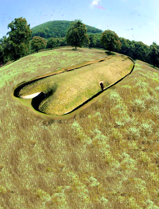
Long Barrows are unique and the oldest monuments in Northern Europe. They are boat-shaped mounds and are only found in the region. The bones inside suggest a marine society that lived and traded upon water existed during that time. Long Barrows were ancient boats with sails, and advanced designs built parallel to significant rivers. They were visible for miles due to their size and construction materials and were covered in bright white chalk. These were created by a marine civilisation, evidenced by myths, wooden planking, and wall paintings.
Stonehenge
Stonehenge was built using Bluestones from the Preseli Mountains in Wales, transported by boat, indicating a connection between the monument and a water-based funeral ritual. Excarnation ceremonies were held within Stonehenge’s crescent-shaped stone holes before the bones were taken by boat to Long Barrows for final burial.
Submerged Mesolithic Sites
Submerged Mesolithic sites near Yarmouth in the Isle of Wight suggest that our ancestors constructed boats there. The site is 5,000 years older than the current construction date of Stonehenge. Archaeological discoveries in Wales suggest that the Welsh may have built double-hulled catamarans 4,000 years before the Greeks and may have used them to transport Bluestones from Wales to Stonehenge. The true history of Britain is still being discovered.
2. Gigantic Canals – that are technically superior to even Victorian engineering.
A scientific truth does not triumph by convincing its opponents and making them see the light, but rather because its opponents eventually die and a new generation grows up that is familiar with it. – Max Planck
Dykes
Dykes were initially built in The Netherlands in the 12th century to prevent flooding, but similar earthworks in Britain have no clear purpose unless considering their water connection. Offa’s Dyke, attributed to a Saxon King, could have been constructed by the Romans.
Offa’s Dyke and Wansdyke Earthworks
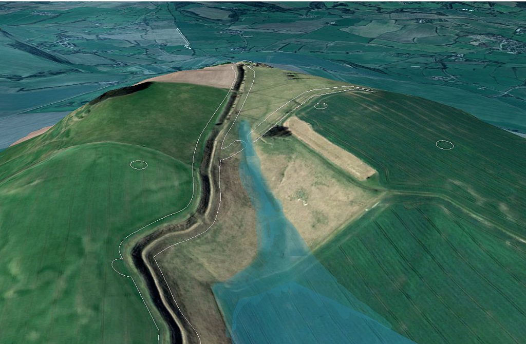
The origins of Wansdyke are uncertain, but archaeological data suggests it was built in the 5th or 6th century as a defence against West Saxons. Scholars have questioned descriptions of its size and attributed purpose. It was likely a political boundary marker facing post-Roman Britons. The
Wansdyke defence/boundary has a gap in the middle with no explanation. Excavations suggest the eastern half of the dyke passed through a pasture and nearby woodland. Empirical evidence indicates dykes date before the
Roman invasion.
Wansdyke Earthwork as Trading Network
Wansdyke, an ancient ditch in England, has puzzled archaeologists as it doesn’t seem to be a defensive structure. It is a prehistoric waterway, close to a possible the Kennet and Avon Canal. The ditch’s construction suggests it was not a defensive feature. The ancient canal ditch discovered in Wansdyke earthwork is twice as big as the Victorian canal and is believed to have been built over 6,000 years ago, indicating a more excellent knowledge of hydrology and engineering. It was likely made for boat travel for trade and relied on natural groundwater table levels. The Wansdyke earthwork was not built as a defensive boundary but as a complex trading network, with a canal connecting two ends and evidence of prehistoric groundwater rivers.
3. Roman ports miles away from the coast – when sea levels are apparently rising.
The difference between science and the fuzzy subjects is that science requires reasoning, while those other subjects merely require scholarship – Robert A Heinlein
Roman Ports and Sea Level Changes
Some Roman ports are located far from the coast, possibly due to tidal havens. The history of Brading, a natural harbour on the Isle of Wight, includes evidence of settlement by Mesolithic, Neolithic, Bronze, and Iron Age peoples and Roman influence. The harbour silted up, and the town changed due to land reclamation. Lewes, a town in England, was once a major port due to its sheltered location but is now inland due to rising sea levels. It has a rich history, including prehistoric dwellers,
Roman settlements and a Saxon castle. The River Ouse, which runs through the town, was once a tidal inlet, but drainage issues caused flooding and the conversion of meadowland into a permanent fishery. The article discusses the history of the Ouse Valley, including draining the Levels and creating a canal to access the harbour at Newhaven. The article also questions whether the Lewes harbour was fed by freshwater rather than seawater in the past.
Ephesus
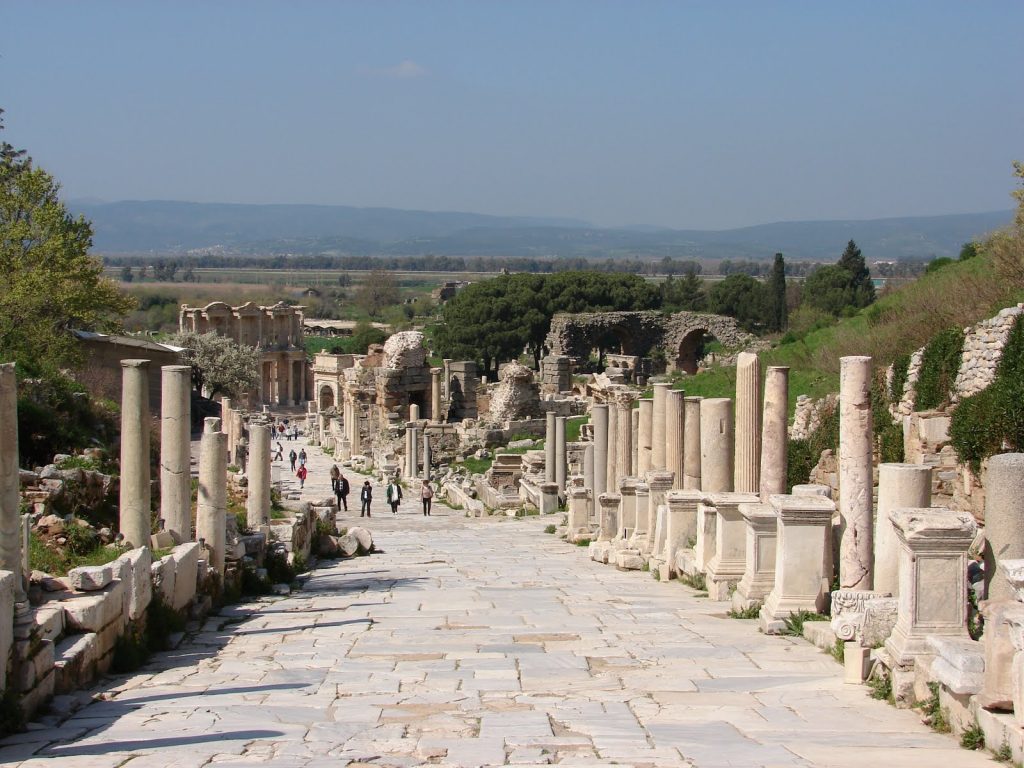
Ephesus in Turkey was once a major Roman city with a famous temple, but its harbour is far inland due to a slow siltation process. However, this phenomenon is not unique to Ephesus, as other ports in freshwater locations experience similar changes.
Mesolithic Period
The sea level was much lower during the Mesolithic period, allowing ancient harbours to exist farther from the shore. Post-glacial flooding caused by the last Ice Age affected river levels and freshwater shorelines, leading to the development of trading sites and ports. Groundwater reduction due to agriculture and drainage has contributed to rising sea levels, while population growth has led to groundwater depletion and the loss of rivers and streams.
4. Raised Beaches – that have never met the sea.
Science is a way of thinking much more than a body of knowledge. – Carl Sagan
Raised Beaches and Isostasy
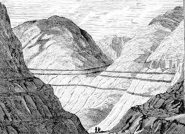
Raised beaches, marine terraces, and perched coastlines are emergent coastal landforms formed by rising sea levels. Theories explain their presence in hill sediments, with the best-represented terrace worldwide being correlated to the last interglacial maximum (MISS 5e). Geologists have come up with a complex explanation for raised beaches, but a more straightforward reason is that they form when sea levels fall, leaving beaches exposed and stranded above the new sea level. The process of post-glacial rebound, or isostasy, has caused Scottish raised beaches to be 60m lower than previously thought, and this rebound will continue for another 10,000 years. Glacial isostatic adjustment involves more than just upward rebound, including downward land movement, horizontal crustal motion, sea level changes, gravity field alterations, induced earthquakes, and rotational changes.
Tsunami Theory
Only one beach at a certain level contradicts the hypothesis of shoreline washing. The Tsunami Theory proposes that a tsunami created the beach as alternative explanation. Tsunamis caused by events like the Storegga slide has occurred in Scotland in the past. Doggerland, a low-lying land bridge connecting Denmark and The Netherlands, was considered a prime hunting and fishing ground until a tsunami hit. However, geologists now believe that deposits found 20m above sea level cannot be attributed to the tsunami but result from post-glacial flooding.
Brighton Raised Beach
The Brighton Raised Beach provides a record of changing environments over millennia. It is thought to date back 250,000 years, but modern geologists struggle to understand what happened that long ago. The discovery of ice age archaeology in the cliffs at Brighton Marina has confused the dating of the raised beaches. The article discusses the scientific research conducted by UCL’s Archaeological South East division on the Black Rock area, which dates the Brighton-Norton formation to around 200,000 years BP and suggests Neanderthals and cold-climate mammals occupied it. The article also raises questions about peculiar chalk formations and deposits of sand, silt, and pebbles in Sussex. Post-glacial flooding affected Britain, creating aquifers and rising beaches, including the Cliffs of Brighton.
5. Giant skeletons – found by French archaeologists now dismissed by today’s scientists.
Your theory is crazy, but it’s not crazy enough to be true. – Niels Bohr
Giant Skeletons
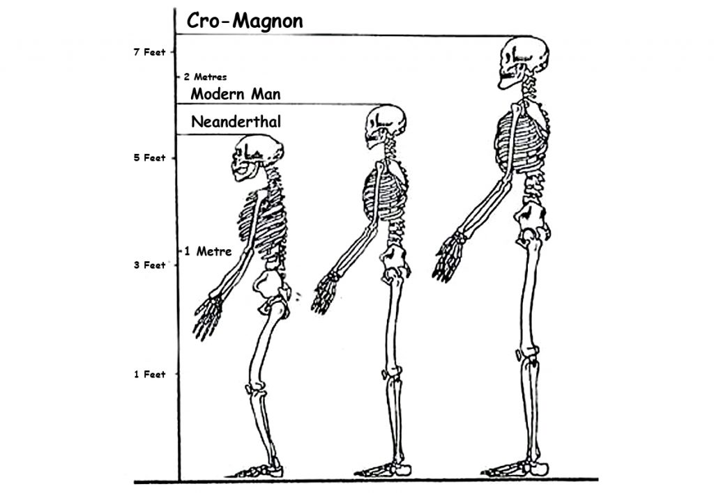
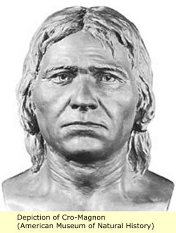
The discovery of giant skeletons was believed in the Victorian era but dismissed by modern historians. Cro-Magnon is the name given to the first early modern humans of the European Upper Paleolithic, who had brains 15% larger than their discoverers and lived in complex societies. They were robustly built and lived in a rock shelter 28,000 years ago, where three prehistoric skeletons were found showing signs of illness and injury and had cared for each other. They were not significantly different from modern humans, and the term ‘cavemen’ does not help us understand their complex societies.
Misinterpretations of Prehistoric Remains
DNA mapping of a 7,000-year-old skeleton in Spain revealed blue eyes and disease-resistance genes in ancient hunter-gatherers. Blue eyes originated
Ten thousand years ago, in the region near the Black Sea, due to a genetic mutation.
A study found that all blue-eyed people share a single ancestor. Prehistoric Spaniards had genes linked to immunity and musculoskeletal ailments. A genetic mutation affecting the OCA2 gene creates a “switch” that limits the production of melanin, causing the brown colour of the eye to be diluted to blue. All blue-eyed individuals are linked to the same ancestor, and the mutation has no adverse effect on the human body. Blue eyes are familiar in Germany, the Netherlands, Scandinavia, and the Baltic States. Blue-eye colour shows a mutational impact on Homo sapiens.
Neanderthals
Neanderthals are an extinct species of human closely related to modern humans, with remains found in Europe and Central Asia. Their cranial capacity and physical features differ from modern humans, and genetic evidence suggests interbreeding between Neanderthals and modern humans. Neanderthal genes makeup 1-4% of modern humans’ genome and may make up around 20% of non-African human genes. Cro-Magnons may have been crossbreeds with Neanderthals, and a cave discovery in Romania gives an approximate date of 35,000 years ago. Cro-Magnon’s physical characteristics include a large brain, a long head, and tall stature.
Crossbreeding between Neanderthals & Cro-Magnons
Cro-Magnon man, humanoids genetically mutated to create Haplogroups
M173 and M343, about 50,000 years ago, had notable differences between the Eastern and Western types, including physical appearance, toolkits, and artistic abilities. Crossbreeding between migrating Sapiens from Africa and Neanderthals took place on many occasions and locations before their travels into Europe from Siberia. The context discusses the prevalence of infanticide in some societies, the possible reasons for the extinction of
Neanderthals, and the positive attributes of crossbreeding between Neanderthals and Cro-Magnons. Neanderthals had well-developed temporal lobes responsible for emotions, love, and religious experiences.
They lacked complex language but communicated on a fundamental level. They buried their dead with flowers, while their offspring were intellectual giants with impressive skills.
Early Human Art & Creativity
Early humans used fire and tools to create pottery, bread, and other art forms for ritual, spiritual, aesthetic, and practical purposes, revealing a direct link between art, structure, creativity, and society. They also created the first musical instruments, weaved baskets, and sewed clothes. Cro-Magnons were skilled artists who created elaborate paintings and designs on their clothes, tools, and weapons. They utilised the natural contours of cave walls and created 3-dimensional effects, including realistic and life-like movements of animals. They used natural earth pigments to create multiple hues and colours and employed various lubricants to mix the paints. Their paintings depicted different everyday life scenes, including the hunting and mating of animals.
6. Quantum of Solstice – Pythagorean maths put to use four thousand years before he was born
If an elderly but distinguished scientist says that something is possible, he is almost certainly right, but if he says that it is impossible, he is very probably wrong. – Arthur C. Clarke
Cro-Magnon Artists and Mathematics
Cro-Magnon artists demonstrated an artistic mastery that rivals modern masters like Picasso, utilising abstract impressionism, geometric forms, and concentric shapes. Additionally, advanced mathematics and trigonometry were employed in designing Stonehenge, a construction that dates back
10,000 years. Stonehenge’s original ditch, built in 8,500 BCE, was used with
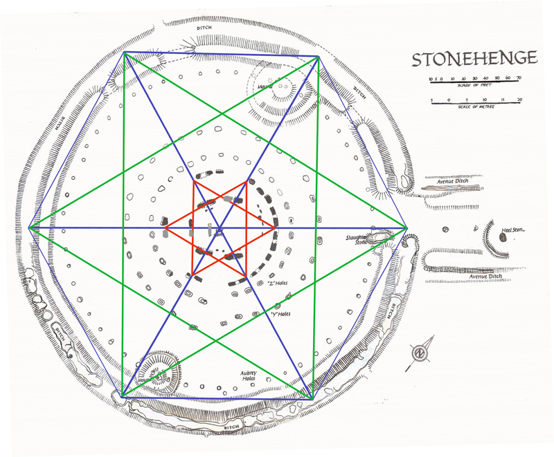
Bluestones to bathe infections, while the diameter of the moat was precisely 360 ft, and it served as a very accurate moon and eclipse calendar. The ancient calendars were 12 x 30 = 360 days long, and the monument also shows an understanding of mathematics with the discovery of the number 3.14, PI. The context discusses using a symbol for Pi and the importance of the number 360 for circles. It also explores the construction and significance of Stonehenge, including its connection to a 360-day lunar calendar and the alignment of its entrance causeway with the Summer
Solstice. Stonehenge, built around Doggerland’s demise in 4,200 BCE, may have been constructed with a mandala symbol, satkona yantra, representing the balance between Man and God. The monument was also built using a hexagram design and was later adapted by the Druids.
Foot as a Unit of Measurement
The history of the foot as a unit of measurement is explored, with its origin believed to be from the physical attributes of early humans. The size varied among different countries, and it is proposed that the Cro-Magnon man may have been the source of the oldest measurement scale. Neanderthals existed before Homo Sapiens and were more robust and more intelligent. The chance meeting of the two species led to the creation of the first Cro-Magnon, who were vastly intelligent and built boats to sail to Europe. They settled, communicated, and made the first monuments of this world, including Atlantis. The lost city of Atlantis flooded during the last Ice Age, and remnants of this civilisation integrated with local Homo Sapiens to create today’s society.
7. Recent Landscape Flooding & Storms – the secret our ancestors knew about Britain’s weather

UK Media’s Reporting
Historical measurements such as the foot and inch have confused current historians. UK media reporting extreme weather often refers to false “record-busting” events due to limited meteorological records. The UK’s wettest Summer in 2007 does not prove man-made climate change; rainfall has fluctuated for centuries. Severe weather events, like the “Grote Mandrenke” in 1362, have occurred throughout history.
Geological Evidence
The landscape of the UK bears evidence of more severe weather conditions during the Mesolithic period. The context discusses how ancient rivers created flood plains that we see today, including in areas where monuments like Stonehenge were built. Geologists study the dry river valleys left behind and theorise how and when they were formed, which has implications for archaeologists studying these locations. For example, geological evidence suggests massive flooding occurred at the end of the last ice age, cutting dry river valleys in the South Downs. Evidence of flooding can also be seen in the construction of ancient monuments. However, the dating of prehistoric riverbeds and dry river valleys is debated.
Magnetometer Surveys
Magnetometer surveys reveal a ditch under the surface on the eastern side of Durrington Walls that don’t match the original specifications. Archaeologists believe it was a settlement, but the site’s terrain suggests it may have been a natural harbour with a receding shoreline over 5,000 years. Woodhenge has two entrances that lead to Durrington Walls camp and its ancient shoreline. Excavations in Durrington Walls revealed post holes for mooring boats, indicating a landing area for visitors to Stonehenge and Old
Sarum.
Avebury Monument
Avebury monument, built over centuries, sits on a low chalk ridge with a large freshwater river running to the West. Historians remain uncertain about the site’s construction and working hours. The article discusses the construction of a chalk bank near the ditch and offers possible reasons for its creation.
Souterrains
It also provides information on “souterrains” and their associations with the Atlantic Iron Age. Souterrains were underground galleries associated with settlements, possibly used as food stores or hiding places during strife. They do not have a clear purpose and are categorised differently in different locations, making it difficult to understand why they were built. The article discusses the structure and purpose of underground subterranean tunnels, called fogous, which are found in Cornwall, Wales, Scotland, and Ireland. The author questions their usage and reclassification by archaeologists and speculates on their historical significance.
Severe Storms
The context discusses the construction of subterranean shelters in response to intense storms and tornadoes, with evidence of such events occurring in prehistoric Britain and historical records of a severe tornado in
1091 in London.

Look deep into nature and then you will understand everything better. – Albert Einstein
Mythological Dragons
The context also delves into the topic of mythological dragons and their presence in various cultures across the globe. Dragons are mythical beasts on every continent and are depicted differently in multiple cultures. They have spiritual significance and often involve being killed by a hero. The article explores the origins and descriptions of dragons across continents, questioning if they are real or mythological creatures. It includes information on their historical and modern depictions and their cultural significance.
Dragons appear in various cultures and religions, like Zmey Gorynych in Russia, Vritra in India, and Long in China. They symbolise different things and have multiple characteristics. Diverse cultures worldwide have myths and legends about dragons that symbolise power, prosperity, and nature, often associated with water or wind deities. Dragons are depicted as winged serpents with different numbers of claws and feathers, and are considered the most powerful beings, often deified and celebrated with sacrifices and festivals.
Feathered Serpent Deity
Quetzalcoatl was one of the most significant gods within the Aztec pantheon, with origins traced back to the first century BCE/CE in
Teotihuacan. Feathered serpent iconography was prominent in Maya and Aztec cultures, with the cult of the feathered serpent spreading to various religious and political centres in central Mexico.
African Dragons
African dragons have two or four legs, notably larger than dragons from other continents. Unfortunately, no remains exist, leading theories to suggest that dragons may be based on natural phenomena like tornadoes. Tornadoes are visible funnels of air that touch the ground and can occur on any continent but mainly occur in the United States. Other natural phenomena resembling tornadoes include waterspouts, dust devils, and fire whirls. The Great Kanto Earthquake displayed a dangerous phenomenon known as a “dragon twist” tornado of fire which caused many deaths.
9. On Sunken land of the North Sea – was this the world’s oldest and greatest civilisation?
“The sea, once it casts its spell, holds one in its net of wonder forever”. – Jacques Yves Cousteau
Doggerland and Atlantis
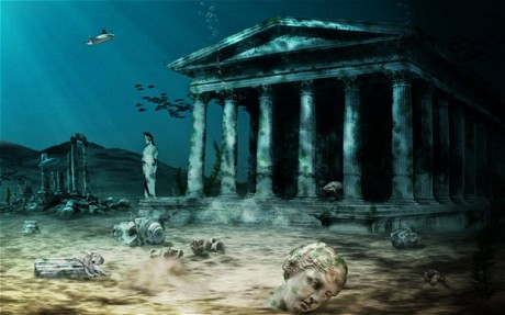
Doggerland, a lost continent in the North Sea, is revealing a glimpse into prehistoric habitats and climate through archaeological finds. Plato’s account of Atlantis is debated due to its potential connection to the flooded land of Doggerland. The location and size of Atlantis, as described by Plato, are still discussed concerning the “pillars of Hercules”, suggesting it was in the Atlantic. The search for Atlantis has failed due to the lack of evidence for a sunken landmass. A new theory suggests that Atlantis was the North
European Peninsula (NEP), which connected to islands such as Iceland and
Greenland. This could account for ancient skeletons in North America with European features and stone tool kits.
Plato’s Account of Atlantis
Plato’s account of a civilisation known as Atlantis in the North, home to mountains, abundant flora and fauna, including elephants and meadows, suggests that this lost civilisation could have been Britain. Stonehenge was built to commemorate a great flood, and the crescent shape and the altar stone have symbolic meanings related to death and rebirth. Laser technology has shown that the stone was carved with contours depicting the mythical land of Atlantis. The connection between
Stonehenge’s Slaughter Stone and Avenue may point to the location of Atlantis in Doggerland.
Time Frame of Plato’s Accounts
Plato’s accounts of Atlantis suggest two different times, confusing the original Atlanteans. Plato’s description of the Atlanteans in “Timaeus” means they were Nordic and had a written language. They established Greek and Egyptian civilisations 9,000 and 10,000 years ago, respectively. Atlantis sinking and the invasion of Greece and Egypt are separate events. The time frame is unclear, but geologists suggest it could be around 4,000 BCE.
Other Ancient Civilisations
The article discusses other ancient civilisations and myths, including Hyperborea. Some clues in ancient writings suggest these lands could have been located in what is now Britain. Hyperborea was a mythical land in the far North, described as a wondrous realm of eternal spring, inhabited by a blessed, long-lived race. Some believe it was the original ‘Garden of Eden’, the home of the original Man and the beginning of civilisation’s terrestrial and celestial existence. The memory or imagination of a Golden Age is significant in various ancient traditions and myths, primarily in cultures that cover the area from India to Northern Europe.
10. Alexander the Great sailed into India – where no rivers now exist.
I came, I saw, I conquered – Julius Caesar
Alexander The Great
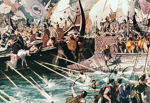
The Indian campaign of Alexander the Great is discussed briefly. He faced war elephants in India and did not continue to conquer the headwaters of the Indus River. Instead, he founded Alexandria Nikaia and Alexandria Bucephalus, but his army mutinied at the Hyphasis River. In addition, the Macedonians were hesitant to cross the Ganges River, fearing the massive Indian troops with elephants. Traditionally, Alexander’s route was seen as a march over barren land, but a photojournalist suggests he used waterways that were larger in the past.
Alexander’s Lost World
David Adams embarks on a journey through Alexander’s Lost World to find the mysterious River Oxus and Alexander’s fabled Central Asian Capital, uncovering evidence of a different climate and early civilisations. He also discovers a surprising connection between Jason and the Argonauts. The Ice Age influenced the Greek and Roman periods, making the Oxus River deep and accessible. Alexander the Great used this route to access India, with conquered towns along the way named Alexandria. Alexander also founded the city of Alexandria at a strategic junction in Afghanistan, populated it with Macedonians and locals, and built forts in the area.
11. Antler Picks that built ancient monuments – although only one has been found at the largest stone circle in the world.
Science never solves problems without creating ten more – George Bernard Shaw
Use of Antler Picks
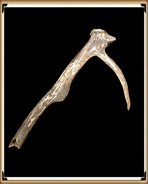
Antler picks were used by prehistoric people more as levers than pickaxes. There is confusion among archaeologists about the use of antler picks. Antler picks were believed to be the main tool used to construct prehistoric monuments in Britain. However, recent findings from Stonehenge suggest previous interpretations were oversimplified and varied forms of picks and modifications were used.
Antler Picks at Stonehenge
Antler picks were used to construct the Avebury monument, with the average size being 190mm and the largest being 410mm. Excavations suggest that red deer antlers were the primary digging tool, although evidence shows that only minimal antlers were found. This offers a challenge in collecting and selecting them and questions the current archaeological theories and dates EH supports regarding Stonehenge.
Carbonised Wood Findings
Recent findings on carbonised wood suggest the site is thousands of years older than previously thought. This could mean that metal axes may have been used much earlier than believed, potentially before the Mediterranean, challenging cultural immigration theories.
12. Columbus was the first Western Man to reach America – Yet bones and tools suggest that Europeans sail there ten thousand years earlier.
“We would like to live as we once lived, but history will not permit it” – John F. Kennedy
Contested First European to Reach America
The first European to reach America is contested. Inherited antigenic substances on the surface of red blood cells determine blood type. The two most important blood group systems are ABO and RhD. Maternal antibodies against fetal RBCs can cause erythroblastosis fetalis. However, the origin of A Rh neg blood groups in North America is a mystery.
Indigenous Peoples in the Americas
Indigenous peoples in the Americas have diverse cultural practices and languages, with some still living in relative isolation. The migration of human populations to the Americas and the origins of indigenous peoples are still debated. Sea levels were lower, allowing for easy passage across the
Atlantic to America. Reed boats were used for sea travel, as demonstrated by Thor Heyerdahl, using a Sunstone device for navigation.
Origin of Europeans in America
Who were the first Europeans to find America? The idea that Neanderthal morphed into Cro-Magnon and modern humans is flawed. Cro-Magnon man was different from other modern humans and likely originated from the West. They were skilled toolmakers, hunters, and artists known for their cave paintings. Cro-Magnons were virtually identical to modern humans but slightly more robust. They also had a high cranial capacity and were as tall as 6 feet. There are theories that they originated in Sub-Saharan Africa and spread to South America, where a Cro-Magnon skeleton was found. Neanderthal Man was likely the proto-European.
Archaeological Evidence for Human Migration
The Poverty Point culture of the eastern US worked with non-local raw materials and showed distinct material cultures with clear indications of European Cro-Magnon influence. Archaeological evidence suggests that humans may have arrived in the Southern Hemisphere at least 15,000 years ago, and there are indications of a human presence in North and South America earlier than previously thought.
Archaeological sites in South America, specifically the Säo Raimundo Nonato region, have revealed human occupation dating back at least 32,000 years, with numerous cave paintings and over 300 sites discovered. The traditional theory of North American human migration is no longer supported. Recent discoveries suggest that the Solutrean culture may have entered America from the Atlantic earlier than the Clovis culture, with artefacts found bridging the chronological gap. These discoveries challenge traditional theories about the first humans in North America. New archaeological findings, including the Gault site, suggest human populations have lived in the Americas for at least 40,000 years. Some ancient skulls found exhibit European-like features. The origin of these people remains debated.
Cro-Magnon People
The Cro-Magnon people were innovative hunters and inventors who created tools, marked time, practised elaborate death rituals and were the first to domesticate animals and leave extensive works of art, including cave paintings. Upper Paleolithic cave art and sudden advancements in human culture and technology challenge the understanding of evolution. The emergence of Cro-Magnon man suggests a “second biological event,” but the lack of incremental developments in the archaeological record complicates this theory. The emergence of culture in Upper Paleolithic times was thought to be due to a neurological event, but this theory is unsupported. Neanderthals did not have art or technology and did not trade goods, while Cro-Magnon man did, likely using boats and ships. Their legs were also longer than expected, according to evolutionary biology.
Influence of Habitat Temperature on Body Extremities in Mammals
Cro-Magnons seem to contradict this rule, with their appearance possibly related to megaliths in Europe and their DNA growth suggesting potential issues with archaeological dating.
Crossing Oceans During the Ice Age
The possibility of ice-age humans crossing oceans raises questions about their technology and logistics. The article suggests the presence of a mid-Atlantic mainland during the ice age that could explain the origin of Upper Palaeolithic cultures.
13. Was Troy really located in Turkey – if so why did it take Odysseus ten years to travel 200 miles get home to Greece.
The very ink with which history is written is merely fluid prejudice. – Mark Twain
Mutation of the Human Species
It also discusses the human species’ mutation and Troy’s location. Wilkens believes that the Trojan War and Troy’s location was in England and that the Celts were the participants. He uses etymological and archaeological evidence to support his theory. However, professional scholars have criticised his work.
Havana Harbour & Homer’s Odyssey
The topography of Havana’s harbour resembles the description of Telepylos in the Odyssey, leading some to believe that the Trojan War may have occurred in a different location, possibly in northwest Europe. Geoffrey of Monmouth’s Historia Regum Britanniae traced the foundation of Britain back to the Trojans.
Baltic Origins of Homer’s Epic Tales
The Baltic Origins of Homer’s Epic Tales proposes a revolutionary idea about the Iliad and Odyssey’s origins. Felice Vinci suggests that Homer’s tales of the Achaeans and the Trojan War took place in Northern Europe and the Baltic and Northern Atlantic seas. He supports his theory with evidence such as Mycenaean graves containing Baltic products and the incongruence between Homer’s description of the geography and
Mediterranean lands. The article proposes that locations in Homer’s
Odyssey, such as Scheria and Aeaea, could be identified with areas in
Norway, and suggests an ancient counterclockwise circumnavigation of Scandinavia may have occurred. The climate described in the story also fits better with the Baltic region than the Aegean. Similarities between Nordic and Homeric cultures include references to the midnight sun in battle, shared traditions, mythology, literature, and comparisons of Achaean and Viking ships and mythological figures.
Contradictions Found in Geography
Contradictions are found in the geographic location of events in Homer’s works.
Plato & Aristotle on Atlantis
Plato’s writings about Atlantis are the oldest known source of information and must be considered credible evidence of an ancient civilisation that existed, though its location is still debated among scholars. Aristotle believed that Atlantis and Troy might have been connected, while other ancient philosophers thought the story of Atlantis to be factual. The story of Atlantis was supposedly told to Solon by Egyptian priests who had access to secret records about the lost civilisation. The city of Sais in Egypt survived a supposed deluge that destroyed Athens and other Greek cities.
Location & Size of Atlantis
The location and size of Atlantis, as described by Plato’s writings, have caused much debate. Some theories suggest it was a Greek island, while others point to the Atlantic Ocean. The mention of “Asia” likely refers to Asia Minor. The search for the lost city of Atlantis failed due to the belief that it was located in the middle of the Atlantic Ocean.
New Hypothesis on Location
However, a new hypothesis suggests that Atlantis was a peninsula that included the British Isles, Scandinavia, and Northern European countries that were once connected during the Ice Age.
Causewayed Enclosures
Whitehawk Camp is one of England’s most important Neolithic sites, featuring a causewayed enclosure with evidence of newborn and human bones, flint tools, pot shards, and animal bones. This gave rise to the local legend of Troy Town and the three surviving historic turf mazes in England with “Troy” names.
Greek Mythology
Evidence suggests that Troy was located in a much colder climate than Greece, and the Achaeans were generally blond, while the Trojans were dark-haired. Scholars debate the hair colour of crucial characters in The Iliad and The Odyssey, including Achilles, Agamemnon, Odysseus, Menelaus, Idomeneus, and Helen. Other characters like Briseis, Meleager, and Agamede are also described. Additionally, Aphrodite, Apollo, Athena, Hera, and Zeus are described with physical attributes and roles attributed to them. Blonde or blue-eyed features are also noted for several of these figures.
Atlantis
Plato’s dialogues mention the advanced nation of Atlantis, which reportedly had over 1,200 warships, an unseen number for any other country in history.
Scientific Sources
The context includes various sources discussing archaeological surveys, environmental change, and geological research. It specifically explores floodplains, river terraces, and carbon storage in Southeast Europe, the Lower Thames Valley, and Somerset Levels. The context is a collection of scientific papers and field guides covering topics such as climate change, the Pleistocene era, and several archaeological surveys and excavations in the UK. It also contains a list of sources related to geological and archaeological topics, including Holocene river activity, Pleistocene deposits, and submerged forests. Finally, it provides references for studying past environments, such as archaeological landscapes, sedimentation patterns, peatlands, glaciations, and alluvial systems.
River Alluviation
Studies have found that rivers in the UK are subject to alluviation due to climate change. This process affects both the physical structure of the river and the sediment it contains.
Contamination Assessment
The contamination of rivers in the UK is a growing concern due to climate change and other environmental factors. As a result, scientists have conducted studies to assess the extent of contamination in the rivers and identify potential sources of contamination.
Holocene River Instability
The Holocene period has seen significant changes in the stability of rivers in the UK. These changes have had a significant impact on the environment, including changes to sedimentation patterns, erosion rates, and flooding patterns.
Ancient Metalwork
Archaeological studies have identified ancient metalworking sites in various parts of the UK. These sites provide essential evidence about ancient metalworking practices and technologies and insight into the broader cultural context of metalworking during this period.
Alluvial Archaeology
Alluvial archaeology is a field of study dedicated to understanding the archaeological record preserved in river sediments. This includes examining artefacts such as pottery fragments, tools, and other materials rivers have deposited over time.
Sea-Level Changes
Recent studies have shown that sea levels in the UK have risen due to climate change. This has significantly impacted coastal areas, including changes to landforms, erosion patterns, and flooding patterns.
Climate Reconstructions
Climate reconstructions are a field of study dedicated to understanding past climate conditions in various parts of the world. Scientists use multiple methods, such as ice core and tree ring analyses, to reconstruct past climate conditions and predict future trends.
Ice Sheet Melt
Ice sheets worldwide are melting at an unprecedented rate due to climate change. This has led to increased sea levels and changes to weather patterns, ocean currents, and other natural phenomena.
Peatland Development
Peatlands are essential ecosystems for storing carbon and providing habitat for various species. In recent years, there has been an increased focus on restoring and conserving peatlands in the UK due to their importance in combating climate change.
These are the synopsis from the Book ’13 Ancient Things that don’t make sense in History’ for further extracts from the book go to our dedicated WEBSITE or if you wish to purchase the book either in softback FULL COLOUR or HARDBACK black and white from Amazon. For further information about our work on Prehistoric Britain visit our WEBSITE or VIDEO CHANNEL.


