Chapter 2 – Stonehenge Phase I
Book Extract…………………………….. The Stonehenge Enigma (Chapter 2 – Stonehenge Phase I )
Looking at the most important prehistoric site in Britain, Stonehenge, we are asked by archaeologists to consider that it is an astronomical calendar showing the rising and setting of the Sun, Moon, etc. This assumption may be partially correct, but why would you place the site in an area were trees would obscure your view – if you wish to study the sunrise and sunset, with any great accuracy, would you not locate your site at the highest point available? – (Stonehenge Phase I)
So why was Stonehenge built where it is, rather than at the top of the hill just 500 metres away that is 30 metres higher – especially considering that the builders took the trouble to get stones from 200 miles away in Wales, for what possible reason would they stop short of obtaining the best setting?
As there is no observational advantage to placing the site in this location, we must therefore conclude that it was access to the area that was of paramount importance. If we look at a standard Ordnance Survey (OS) map of Stonehenge, it outlines the landscape and topology of the surrounding area by showing the contours of the hillsides. But it does not give you a clear idea of how Stonehenge sits in the landscape; for that, we need to look at a profile of the area.
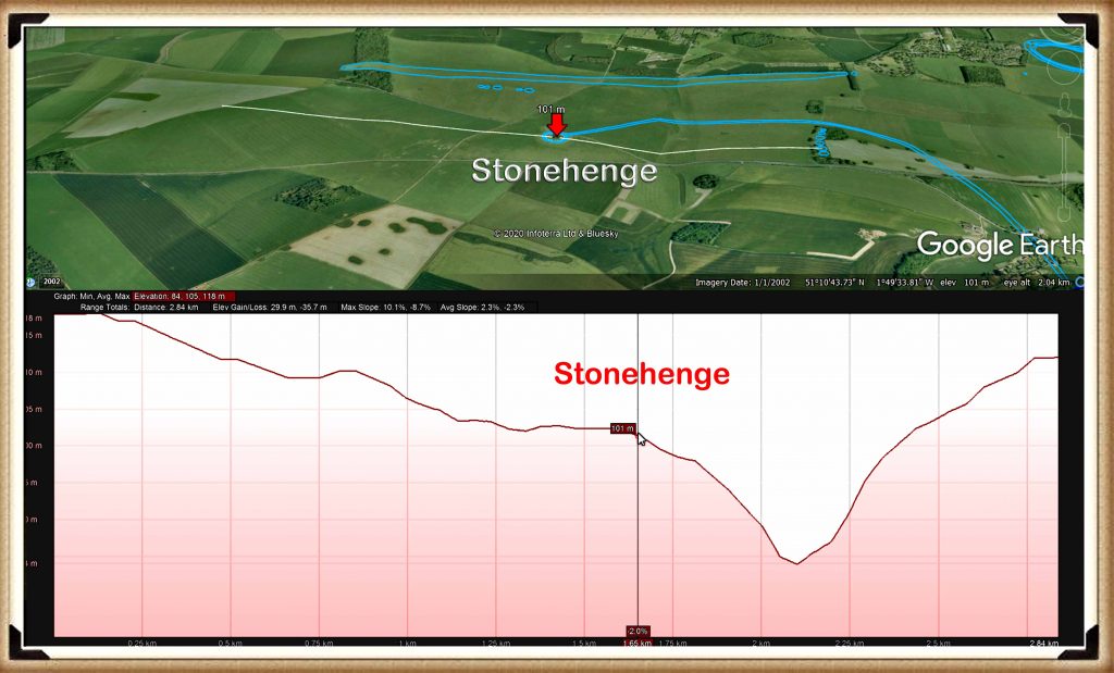
| Figure 9 – Profile of Stonehenge (east to west) and the Palaeochannel that it sits beside – (Stonehenge Phase I ) |
Amazingly these profiles of Stonehenge show that it was built on the shoreline of a vast river complex. We can see this evidence on any elevation map, where we find that Stonehenge is sited halfway up a ‘Dry River Valley’ (Palaeochannel) known as ‘Stonehenge Bottom’.
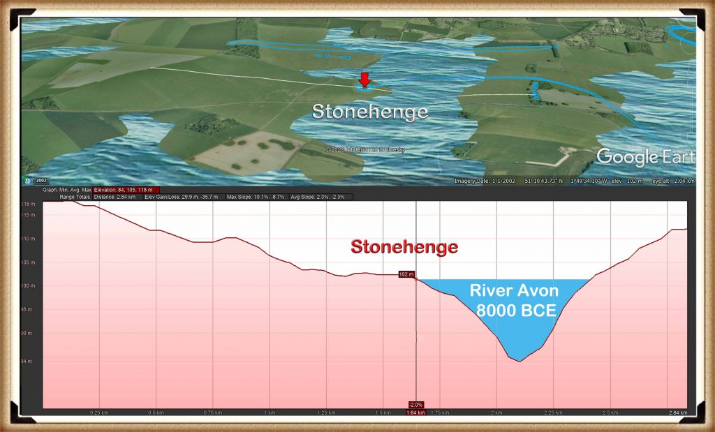
| Figure 10 – Stonehenge with the River Avon as it would have looked in 8000BCE – (Stonehenge Phase I) |
Our hypothesis and case study on the river Avon indicates that the groundwater tables during the Mesolithic and Neolithic periods were as high as river terrace T9 (Egberts et al., 2019), which was 100m high. This would mean that the river Avon would have filled the dry river valley with groundwater 30m above the existing groundwater table – when this happens, the profile changes dramatically.
And so suddenly, the impossible becomes possible, the implausible becomes credible, and myth becomes fact, for these profiles can only indicate one conclusion – Stonehenge was built on the side of a hill surrounded by water!
These amazing features are not just found on a single side of the monument; we can go around the whole circle to see these watery features. I believe these profiles tell the entire story of Stonehenge. A picture is said to paint a thousand words; these pictures show that our most famous ancient monument was once a magnificent feature in the landscape on the edge of a peninsula, surrounded by water. Now that we have shown that water existed at the Stonehenge site during Mesolithic and Neolithic times, we can re-sequence the events and building phases.
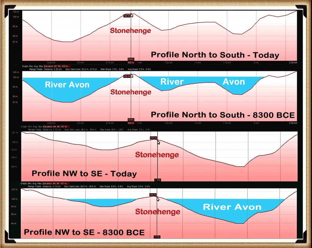
| Figure 11– Profiles of Stonehenge showing the River Avon around the Stonehenge Peninsula – (Stonehenge Phase I) |
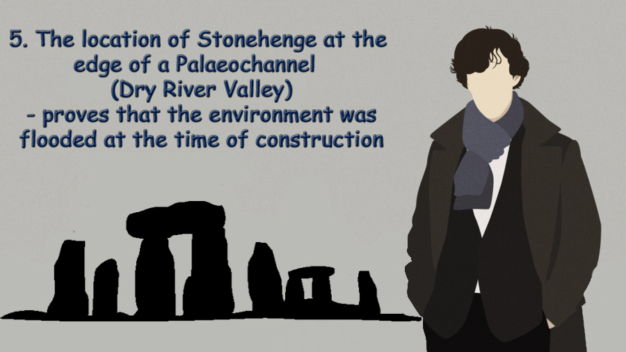
The Ditch / Moat
If groundwater was contemporary in the past, then some evidence should still be present. Consequently, one of the more interesting facts found when studying any prehistoric site is that the constructors seemed to spend a disproportionate amount of time digging ditches to surround their monuments, whether around henges or barrows.
This practice would be considered strange, even if the prehistoric builders had practical and modern, labour saving tools. However, our ancestors only had the benefit of stone tools, bones and antler – making such excavation exceptionally slow, cumbersome and therefore even more bewildering.
Looking at Avebury (a henge monument), as an example, the most conservative archaeological estimation, suggests that the ditches surrounding Avebury, would have taken 1.5 million-working hours to build. That’s equivalent to 100 people working 12 hours a day, every day, for 3.5 years. In comparison, building a wooden palisade using the same tools, would have taken less than one month – merely 2% of the time and exhaustion.
Current archaeological theories surrounding these ditches maintain that they were used either as defensive fortification and/or a landscape feature to keep out/in animals or and even more recently, bizarre interpretations such as a ‘ceremonial’ feature to ward off evil spirits.
All this shows is the levels of desperation the archaeologists have descended into in recent years in an abortive attempt to understand such basic structures, such as a moat. These quaint ideas strike me as somewhat flawed as a ditch is significantly less effective than a palisade (a long line of sharpened wooden stakes planted into the ground), which would have been considerably more straightforward, quicker to construct and more effective. As for evil spirits would not a neat little 6-inch channel achieve the same symbolic purpose as a huge five metre ditch?
Lt-Col William Hawley, was one of the amateur archaeologists, employed by the Ministry of Works to undertake excavations at our famous monuments Stonehenge and Avebury in the 1920s. Unfortunately, he was not the most ‘careful’ of archaeologists. This was a view shared by colleagues such as Atkinson, in his book, ‘Stonehenge’ 3rd edition, London 1979 – where he suggests that Hawley’s methods were somewhat ‘inadequate’.
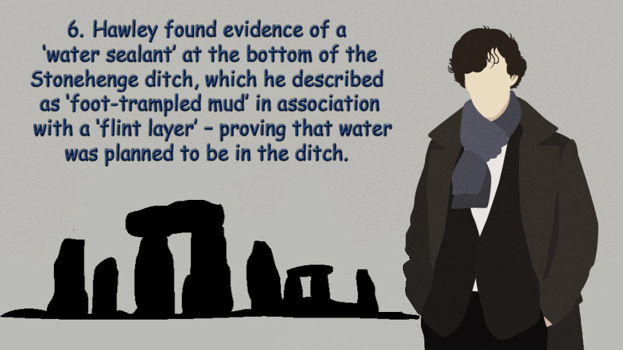
Despite this accusation of carelessness, he was still able to find some strange features, which can clearly be seen as evidence of a moat. For example, below a layer of chalk rubble infill (chalk which would have fallen naturally into the moat when it was disused) under a layer of flint, he discovered ‘foot-trampled mud’ (Cleal et al., 1995,p.68) – found in an area of chalkland which has no natural mud/clay, with an associated ‘layer of struck flint’ – which he found in many segments.
Now this, in itself, sounds quite interesting, if not conclusive as evidence of the existence of a moat, until you look for other landscape features with similar foundations which when analysed, start to build up a much more conclusive picture. Such landscape features can be found in ‘dew ponds’.
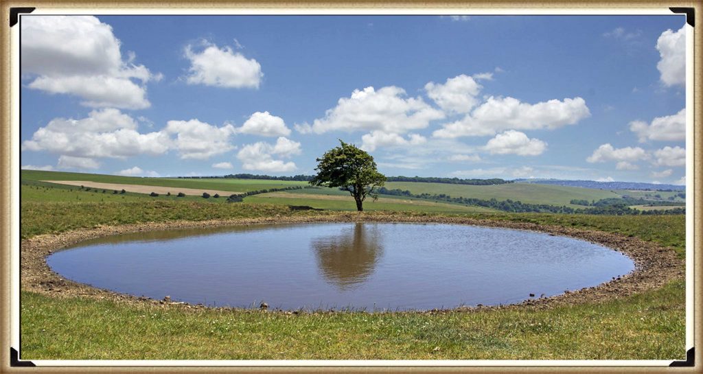
| Figure 12 – Typical Dew Pond as found in Wiltshire – (Stonehenge Phase I) |
A dew pond is an artificial pond usually sited on the top of a hill, intended for watering livestock. Dew ponds are used in areas where a natural supply of surface water may not be readily available. The name dew pond (sometimes cloud pond or mist pond) is first found in the Journal of the Royal Agricultural Society in 1865. Despite the name, their primary source of water is believed to be rainfall rather than dew or mist.
The mystery of dew ponds has drawn the interest of many historians and scientists, but until recent times there has been little agreement on their early origins. It was widely believed that the technique for building dew ponds had been understood from the earliest times, as Kipling tells us in Puck of Pook’s Hill. The two Chanctonbury Hill dew ponds were dated, from flint tools excavated nearby and similarity to other dated earthworks to the Neolithic period.
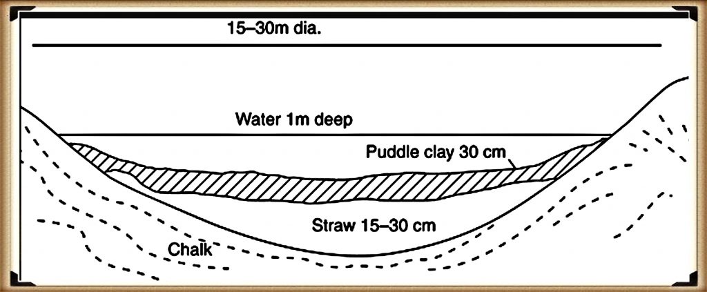
| Figure 13– Profile of a typical dew pond construction – (Stonehenge Phase I) |
They are usually shallow, saucer-shaped and lined with puddled clay, chalk or marl on an insulating straw layer over a bottom layer of chalk or lime. To deter earthworms from their natural tendency of burrowing upwards, which would in a short while make the clay lining porous, a layer of soot would be incorporated or lime mixed with the clay. The clay is usually covered with straw to prevent cracking by the sun and a final layer of chalk rubble or broken stone to protect the lining from the hoofs of sheep or cattle.
In 1877 Mr H. P. Slade discarded the term ” dew-ponds ” in favour of ” artificial rain-ponds,” and scouted the idea that dew had any part in filling ponds at all. His remarks dealt practically with one pond, the greatest diameter of which was 69½ feet, which was constructed in 1836 at the cost of £40. It was bedded in the Thorpe Downs, near Loughborough, on the Berkshire Hills, at the height of 450 feet above the level of the sea. Being ” fed from the heavens,” this fact probably gave rise to its being classed as a dew-pond. The basis of this pond was stated to be, first a layer of thick clay (mixed with lime to prevent the working of earth-worms), second, a coating of straw, ” to prevent the sun cracking the clay,” and, thirdly, a layer of loose rubble. Moreover, during an interval of 40 years, till 1876, the pond had only once been dry.
I believe so. Nonetheless, Hawley can be forgiven for not recognising that this clay lining feature being used to stop the lying water being absorbed through the porous chalk into the bedrock. Because he was not looking for a moat, as he was incorrectly informed by his geologists, that the surrounding area, was perceived to have been dry for over half a million years and therefore did not have a raised water table in the past.
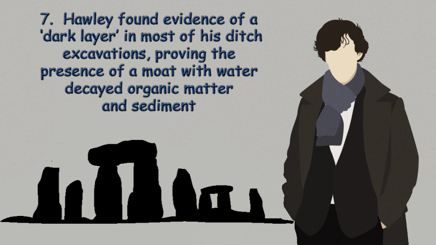
Hawley also found evidence of what he called a strange ‘dark soil layer’ which existed within the primary fill, in many parts of the ditch I would strongly suggest that this ‘dark soil layer’ consisted of decayed remains and sediment, possible the hay which is traditionally lined with the clay to stop cracking. Moreover, over time, organic matter would have naturally floated to the bottom (like a pond), especially if they had not been cleaned regularly. This would naturally have left a lining of dark soil at the bottom of the moat was it fell into disuse and became dry
By 1923 Hawley reported that this ‘ubiquitous dark layer’ was found throughout his excavations, sometimes up to 8” thick, suggesting its existence in water would have been for some considerable length of time, and it was resting directly at the bottom of the moated ditch. This ‘Dark Layer’ was also observed by Atkinson in 1954 when the recut a piece of Hawley’s trench (segment 98) and found the same dark layer – not flint this time, but a stone layer. Moreover, he described the soils above as loamy (sand and clay) (Evans et al., 1984, 7-30) and that this layer (like the construction of dew ponds) was “often associated with a ‘layer’ of struck flint, which was found in many segments” (Cleal et al., 1995, p.68), to protect the clay lining.
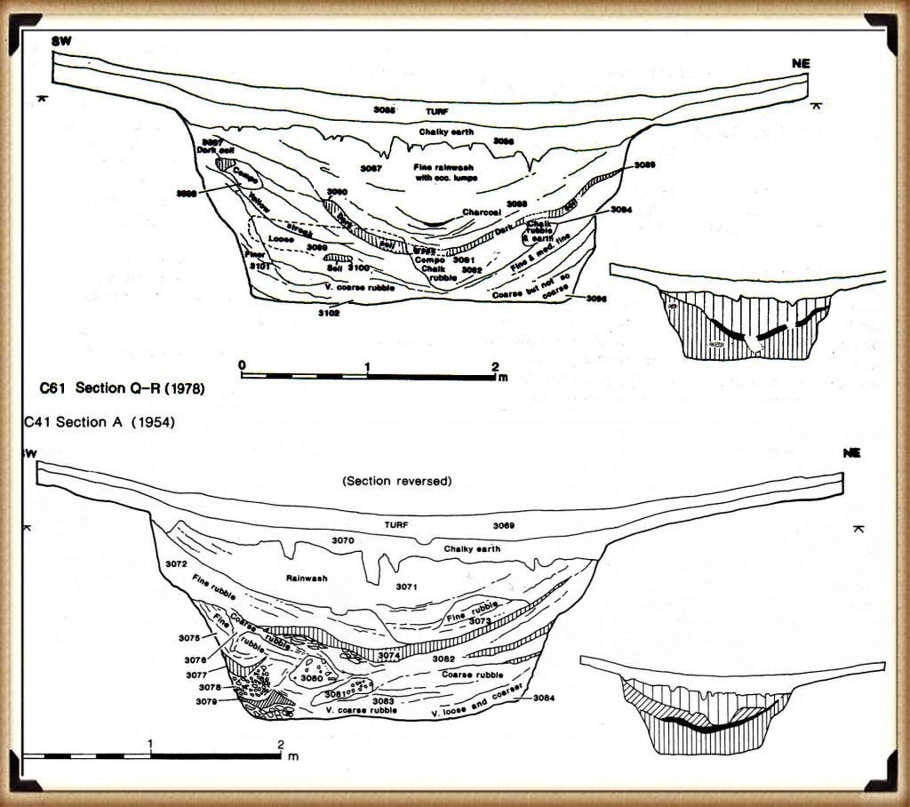
| Figure 14– Hawley’s Ditch excavation and the ‘dark matter’ – (Stonehenge Phase I) |
There it has now been established that Stonehenge had, at some stage, a layer of waterproofing, the ‘layer of foot-trampled mud’ plus a ‘layer of struck flint’ added to the ditch. It’s also been established that this ditch was, at some point, filled with water for quite some considerable amount of time, as evidenced by the deep ‘dark layer’ sediment.
This use of the ditch as a moat is escalated in Hawley’s finding of other moats that surrounded the north and south mounds, which ‘connected’ to the Stonehenge moated ditch. On the shallow associated banks of the ditches, he finds lots of what he calls ‘yellow marl’ – “there was a quantity of the yellowish marl within the ditch and about the site of the palisade” (Cleal et al., 1995, p.278) – Marl was originally an old term loosely applied to a variety of materials, most of which occur as loose, earthy deposits consisting chiefly of an intimate mixture of clay and calcium carbonate, formed under freshwater conditions; specifically an earthy substance containing 35–65% clay and 65–35% carbonate. (Pettijohn, F. J. (1957). p.410)
As this marl had fragments of Blue and Sarsen stones within it – this clearly shows that ‘freshwater’ was in the moat and present at the time of construction.
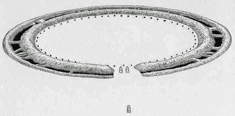
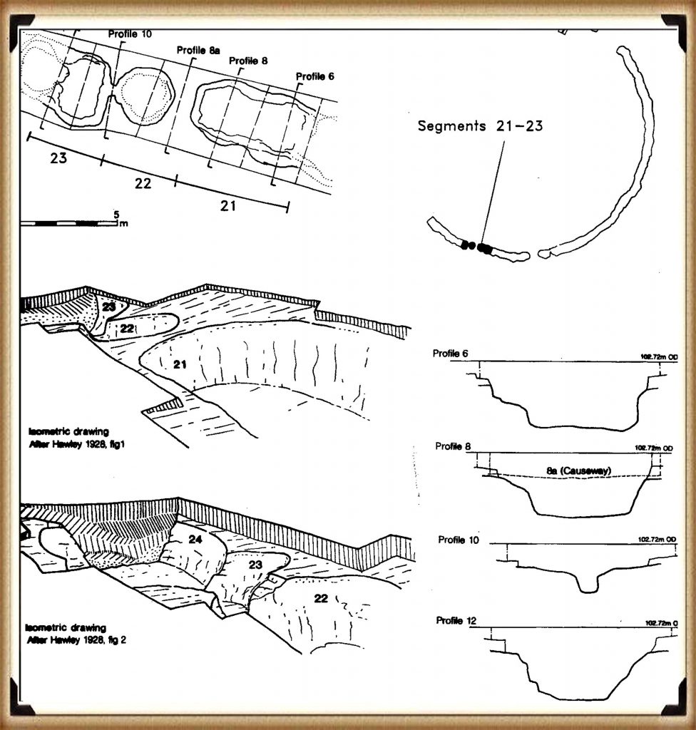
If you look at remains of the Stonehenge moat today, it appears very shallow and uneven, but when excavated, it looks very different. It is, in fact, a series of ‘individual pits’, which, in places, are connected by shallow walls.
This opens up a series of fascinating unanswered questions:
- Was the ditch half-finished, for the pits differ in size, shape and depth, or perhaps they were ‘dodgy Welsh builders’ who did not know what they were doing?
- If the ditch is indeed defensive or symbolic as some archaeologists suggest, why not pile the chalk on one side rather than both sides?
- Why are their seats or shelves left in the ditch?
- Why are there stone holes at the bottom of the moated ditch?
The ability to build defensive structures was available to our ancestors. Still, on this occasion, they decided not to use it, as clearly it was made for another purpose, and that purpose was as a groundwater filled moat.
The only reason you would cut the ditch down to different levels is to search for the groundwater level under the chalk bedrock. As chalk is a porous substance and water travels freely through it, the groundwater table over an area like Stonehenge can vary by a metre or so depending on the makeup of the chalk, as water runs through the fault lines in the chalk strata, leading to varying groundwater levels over an area.
This variation of groundwater tables would also explain why the builders left shallow walls and why none of the walls goes up to the surface – so the water could flow between the individual pits.

There are TWO answers to this question.
First, CHALK
Our ancestors needed a place with a chalk sub-soil as it has two exceptional properties – it’s porousness and its resistance to dissolve in water.
The problem with chalk is that it’s difficult to excavate, in fact almost impossible. So, if Mesolithic Man wanted an easy time and needed a large defensive ditch, he would have chosen a site with soft soil, unless he’s insane or had nothing better to do for the next few years or so!
These builders were attracted to chalk and its unique characteristics. Not only is it porous, but it is SLOW porous, which means that a pit or hole below the local groundwater table would gradually fill with or empty with water at a consistent rate. In addition, because it’s part of the limestone family, it would not crumble and dissolve.
If these moats are used in conjunction with natural groundwater reeds (Phragmites australis is one of the main wetland plant species used for phytoremediation water treatment) placed on the shelves within the ditch, the result is pure, clean, freshwater good enough to drink comparable to modern tap water. This type of water purification would not be seen in Britain for another 8,000 years. It would also leave Hawley’s unidentified ‘dark layer’.
Further Reading
For information about British Prehistory, visit www.prehistoric-britain.co.uk for the most extensive archaeology blogs and investigations collection, including modern LiDAR reports. This site also includes extracts and articles from the Robert John Langdon Trilogy about Britain in the Prehistoric period, including titles such as The Stonehenge Enigma, Dawn of the Lost Civilisation and the ultimate proof of Post Glacial Flooding and the landscape we see today.
Robert John Langdon has also created a YouTube web channel with over 100 investigations and video documentaries to support his classic trilogy (Prehistoric Britain). He has also released a collection of strange coincidences that he calls ‘13 Things that Don’t Make Sense in History’ and his recent discovery of a lost Stone Avenue at Avebury in Wiltshire called ‘Silbury Avenue – the Lost Stone Avenue’.
Langdon has also produced a series of ‘shorts’, which are extracts from his main body of books:
For active discussions on the findings of the TRILOGY and recent LiDAR investigations that are published on our WEBSITE, you can join our and leave a message or join the debate on our Facebook Group.

