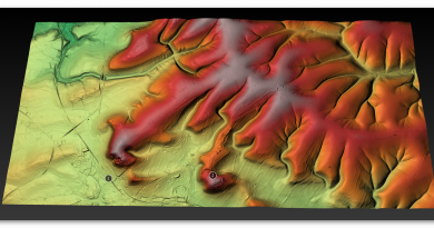
Prehistoric Canals (Dykes) – Offa’s Dyke (Chepstow)
Promotional Video – Ancient Prehistoric Canals (Dykes) – Offa’s Dyke ( Offa’s Dyke Chepstow)
Extract From Book……………………… Ancient Prehistoric Canals (Dykes) – Offa’s Dyke
Contents
The Introduction
Offa’s Dyke is seen as one of the two significant Linear Earthworks (of Britain) as it is supposed to be over 200 miles from Coast to coast dividing England from Wales and, consequently, was once one of the greatest battle grounds in history with this massive defence required to tame the barbaric hordes (like the Picts in Scotland) from the home of civilisation.
The problem with this flight of fancy is its complete nonsense, which this book can now testify. Sir Cyril Fox, in the 1950s, was most famous for producing his classic book ‘Offa’s Dyke – A field survey of the Western-Works of Mercia in the Seventh and Eight Centuries A.D.”, which detailed his field walking and observations on this most historic of Earth Battlements, which we have now seen from more scientific evidence available from LiDAR was nothing more than misinterpretations of the landscape to justify hypotheses that ‘didn’t hold water’ – but sadly for him, it did!
The harsh reality is that this ‘swiss cheese’ hypothesis was, as suggested, full of holes – over 200 of them, to be more exact, covering nearly 60% of this supposed Mercia defensive barrier with gaps large enough for people to walk through with ease.
Later archaeologists have attempted to remedy this false claim, yet it still is quoted by the likes of English Heritage, Historic Britain and CADW to fill the void of ignorance and lack of study. Consequently, this FIRST LiDAR study of Offa’s Dyke in detail has revealed many new truths which should progress our understanding of the past.
History
According to Historic England – Offa’s Dyke is the longest linear earthwork in Britain, approximately 220km, running from Treuddyn, near Mold, to Sedbury on the Severn estuary.
It was constructed towards the end of the eighth century AD by the Mercian king Offa, and is believed to have formed a long-lived territorial, and possibly defensive, boundary between the Saxon kingdom of Mercia and the Welsh kingdoms. The Dyke is not continuous and consists of a number of discrete lengths separated by gaps of up to 23km.
It is clear from the nature of certain sections that differences in the scale and character of adjoining portions were the result of separate gangs being employed on different lengths. Where possible, natural topographic features such as slopes or rivers were utilised, and the form of Offa’s Dyke is therefore clearly related to the topography. Along most of its length it consists of a bank with a ditch to the west.
Excavation has indicated that at least some lengths of the bank had a vertical outer face of either laid stonework or turf revetment. The ditch generally seems to have been used to provide most of the bank material, although there is also evidence in some locations of shallow quarries. In places, a berm divides the bank and ditch, and a counterscarp bank may be present on the lip of the ditch. Offa’s Dyke now survives in various states of preservation in the form of earthworks and, where sections have been levelled and infilled, as buried features.
Although some sections of the frontier system no longer survive visibly, sufficient evidence does exist for its position to be accurately identified throughout most of its length. In view of its contribution towards the study of early medieval territorial patterns, all sections of Offa’s Dyke exhibiting significant archaeological remains are considered worthy of protection.
The reality is that Offa’s Dyke is a complete mystery to archaeologists and historians as it is incomplete and varies from section to section. This is the first LiDAR survey of this ‘Earthwork’ undertaken for its entire length and every metre that’s supposedly marked in the Landscape.
The consequences of this survey changes the nature and understanding of this ‘Dyke’ to such an extent that it re-invents the history of this Scheduled Monument, which will have repercussions for decades to come.
But first, we must lay the ground to allow readers to understand what we are seeing in Offa’s Dyke, and so the following three chapters have been written to give the reader this background of understanding.
Offa’s Dyke (Chepstow – A5 to A15)
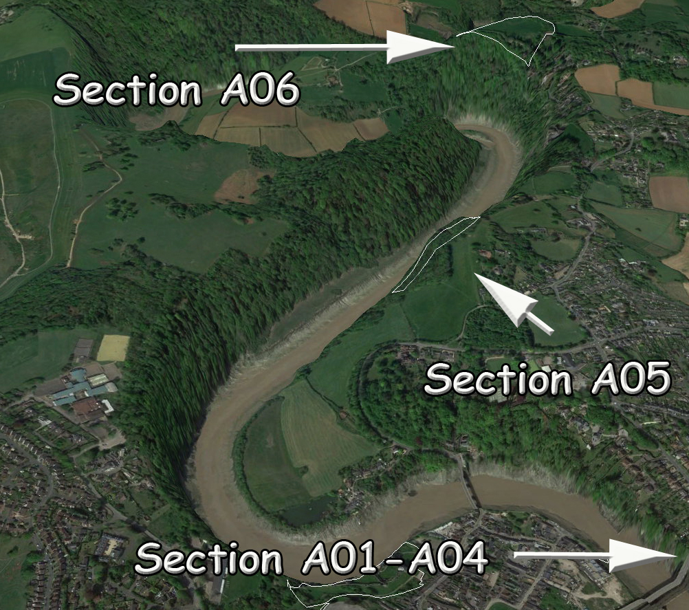
| Name (Section) | Chapelhouse Wood, 240m west of the Recreation Ground (A05) | ||
| HE:1020639 | Width(m) | Hght/Dth(m) | Length(m) |
| Bank | 10 – 12 | 0.5 – 1.6 | 376 |
| Ditch (facing) | 1 | 0.4 | NW & SE |
| Gap/Spring/Quarry | 1 | 0 | 4 |
GE Map
OS Map
LiDAR Map
1800s Map
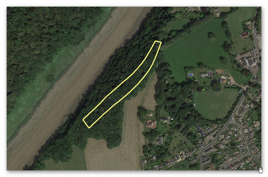
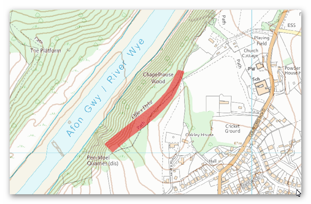
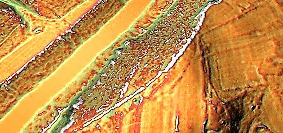
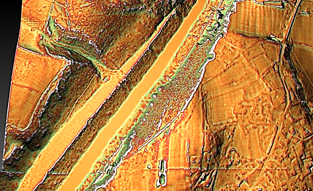
In this 376m long section, the Dyke is visible as a bank with a ditch and counterscarp bank to the west and shallow quarry pits to the east.
The bank is between 10m and 12m wide at its base and stands to a maximum height of 1.6m on its western face and 0.5m on its eastern face. To the west of the bank is a ditch, approximately 1m wide and up to 0.4m deep.
The ditch is only visible at the southern end of the section, the stretch to the north having become infilled over time. It will, however, survive as a buried feature.
To the west of the ditch is a counterscarp bank, also only visible at the southern end of the section, which is about 4m wide and 0.4m high.
To the east of the main bank, a contiguous row of quarry pits is visible, surviving to a maximum depth of 1.5m and to a width of 6m. – Historic England.
Conclusion
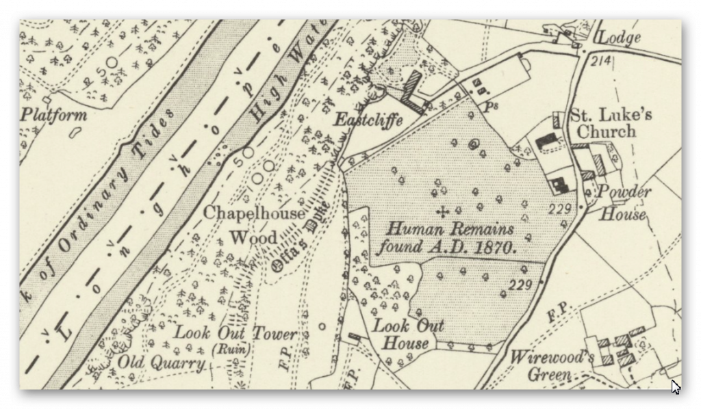
The ditch is almost non-existent at this point, although the bank is extensive and of standard width. This is compounded as the 1800 OS map places the Dyke heading for the two large quarry pits south of the LiDAR map.
The “contiguous row of quarry pits” suggests that this is a later connecting road used to connect the Dykes banks following the path of the river to the quarry pits, which in turn become part of the even later Roman Road, which intersects the earthwork’s bank further south of this Section.
Are we seeing why the Dyke was built initially – to connect to the Quarry pits, which then became a road when the canal dried up?
HE:1004858 – Lancaut Promontory Fort
| Name (Section) | Lancaut promontory fort, 60m ditch and bank (A06) | ||
| HE:1004858 | Width(m) | Hght/Dth(m) | Length(m) |
| Bank | 10 – 12 | 2 | 267 |
| Ditch (facing) | 18 | 2.5 | ENE |
| Gap/Spring/Quarry | 1 | 0 | 3 |
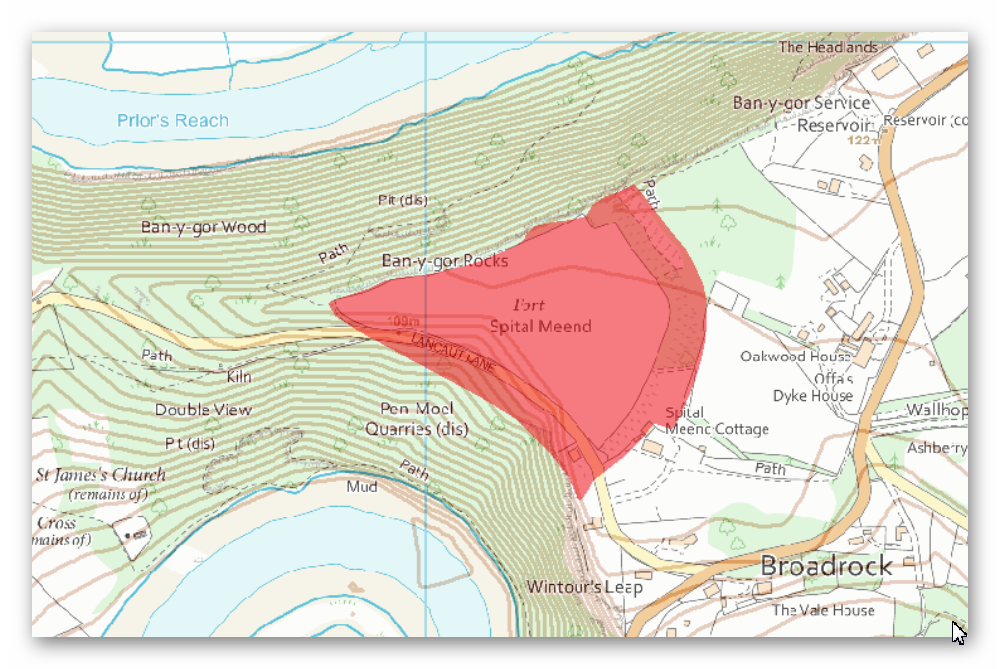
GE Map
OS Map
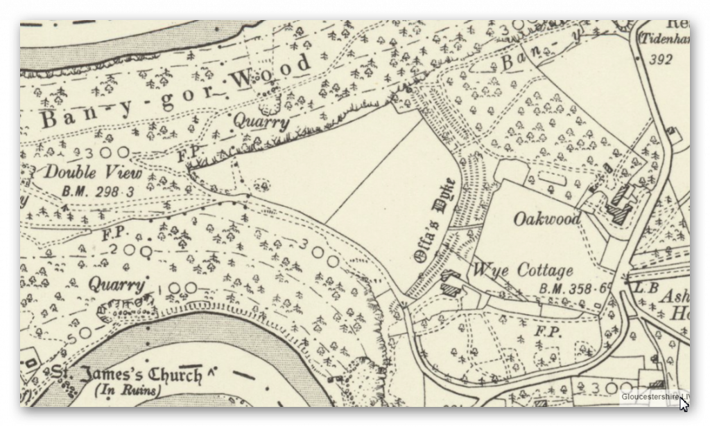
1800 Map
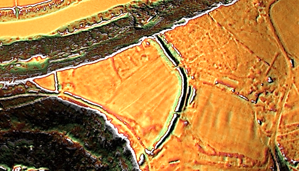
Lidar Map
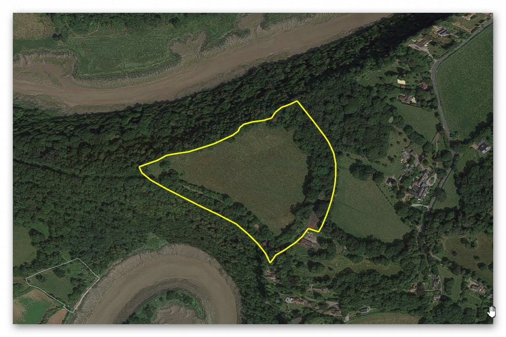
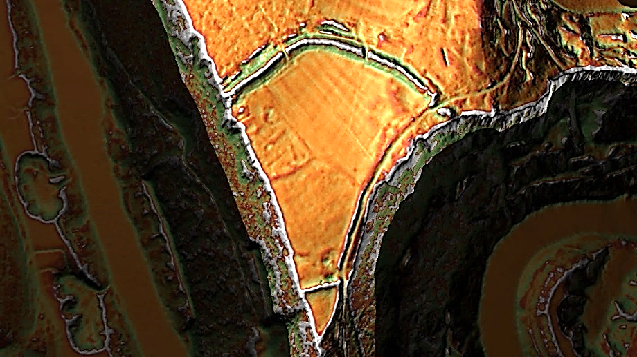
“The monument includes a promontory fort and part of the medieval frontier defence known as Offa’s Dyke situated on an extremely steeply sloping spur formed by a meander in the River Wye.
The fort survives as a roughly triangular shaped enclosure defined on two sides by steep natural valley scarps and on the landward side by an outer multivallate defence of two concentric rampart banks standing up to 2m high with accompanying ditches up to 2.5m deep and with an outer partial counterscarp bank.
These earthworks are of Iron Age origin but were re-used to form part of Offa’s Dyke in the early medieval period. An inner rampart lies to the west at the narrowest point across the promontory and survives as a bank standing up to 1.4m high with a largely buried outer ditch”. – Historic England
Other sources Suggest:
“300m further to the west is the possible earlier phase of defences to the fort, or perhaps a second line of defence. This can be seen as an earthwork bank on aerial photographs, and measures 50m long. Other features were visible on aerial photographs between the two sets of possible defences. These included a roughly north-south aligned bank, 60m long.
Two further banks aligned NW-SE, each with an ditch on the east side and measure 20m and 18m long respectively. It is possible that these banks are simply Medieval or Post Medieval boundaries, but they could have earlier, possibly late prehistoric, origins and could relate to the fortifications. A small quarry, of uncertain date, and measures 17m across. A large roughly triangular mound is visible along the north side of Lancaut Lane just to the west of where the lane passes through the defences.
The mound measures 65m by 24m at its widest and longest parts and may relate to the construction of the road.
Although, the eastern aspect and the construction of the defences suggest that it has late prehistoric origins it is still likely that they formed part of the defence line known as Offa’s Dyke.
Conclusion
It is quite possible that an additional bank was added at a later date – but looking at the 1800s OS Map, it looks like a classic ‘cross-dyke’ cutting the corner of the River Wye – whether that could be called a part of Offa’s Dyke as we are seeing is questionable, as the northern end of the Dyke heads directly for the River and not around the cliff edge as ‘suggested’.
1020607 – Danehill Wood
| Name (Section) | Danehill Wood, 300m west of East Vaga (A07) | ||
| 1020607 | Width(m) | Hght/Dth(m) | Length(m) |
| Bank | 16 | 3.5 | 903 |
| Ditch (facing) | 6 – 8 | 1 | ENE – SE |
| Gap/Spring/Quary | 1 | 2 | 3 |
GE Map
OS Map
1800 Map
Lidar Map
“In this 903m long section the Dyke is visible as a bank with a berm and short section of counterscarp bank to the west and contiguous quarry pits to the east.
The bank is a maximum of 16m wide at its base, standing to 3.5m high on its western face and 1m high on its eastern face. The berm marks a break in slope between the western face of the bank and the natural slope of the hill and is up to 4m wide.
Towards the southern end of the section a counterscarp bank approximately 0.4m high is visible. The quarry pits are between 6m and 8m wide and about 1m deep.
There is a drystone wall to the east of this scheduling, thought to have been built during the 19th century, which marks the line of an old boundary and which now revets part of the monument.
There is a gap in the monument at the northern end of the scheduling at Ordnance Survey NGR ST55069833, which allows access for vehicles to Tintern Quarry to the west of the Dyke. Although the bank has been levelled, evidence for the Dyke’s quarries is visible to the east of the cut. The break is not thought to be the site of an original access point through the monument. To the south of this section, below Dennel Hill, the line of the Dyke has been destroyed by post-medieval quarrying”. – Historic England
Conclusion
We see again the connection of the Dyke with quarry pits in this section – the idea of it being a border marker is also called into question as it’s a cliff face by the River, and the River would have been a better marker than a bank on top of a hill.
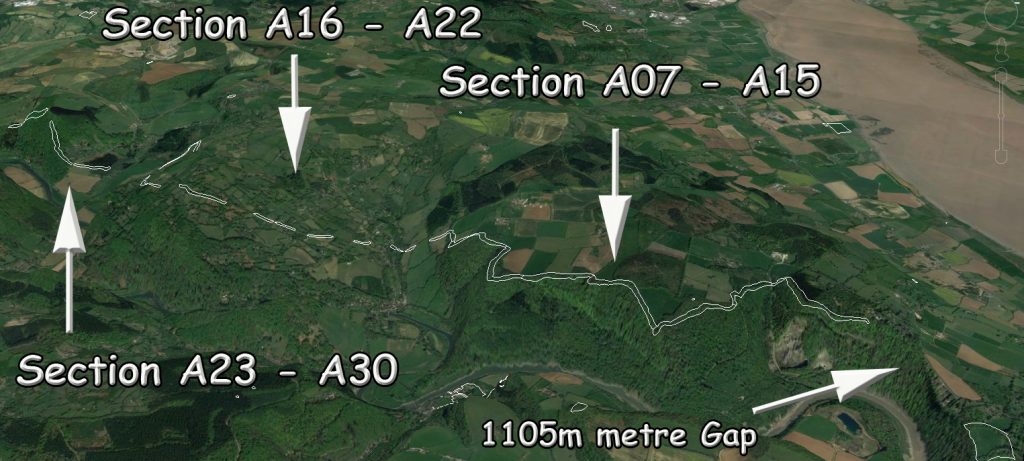
The massive gaps should also be noticed in this section as there was a gap of 1.1 km between the two sections of Offa’s Dyke, which again suggests that this was never constructed as a ‘defensive’ earthwork as presented by revered archaeologists of the past such as Fox.
1020606 – Boatwood Plantation
| Name (Section) | Boatwood Plantation, 320m south west of Chase Farm (A08) | ||
| 1020606 | Width(m) | Hght/Dth(m) | Length(m) |
| Bank | 17 | 0.8 – 3.5 | 364 |
| Ditch (facing) | 10 | 1 | NNE |
| Gap/Spring/Quarry | 0 | 0 | 11 |
GE Map
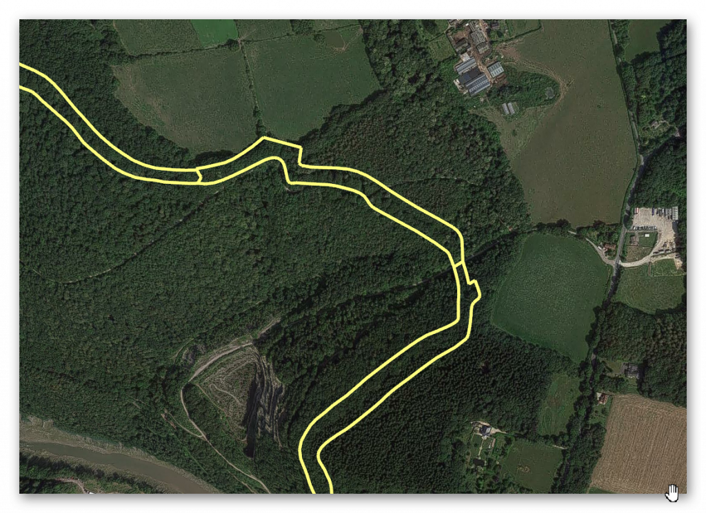
OS Map
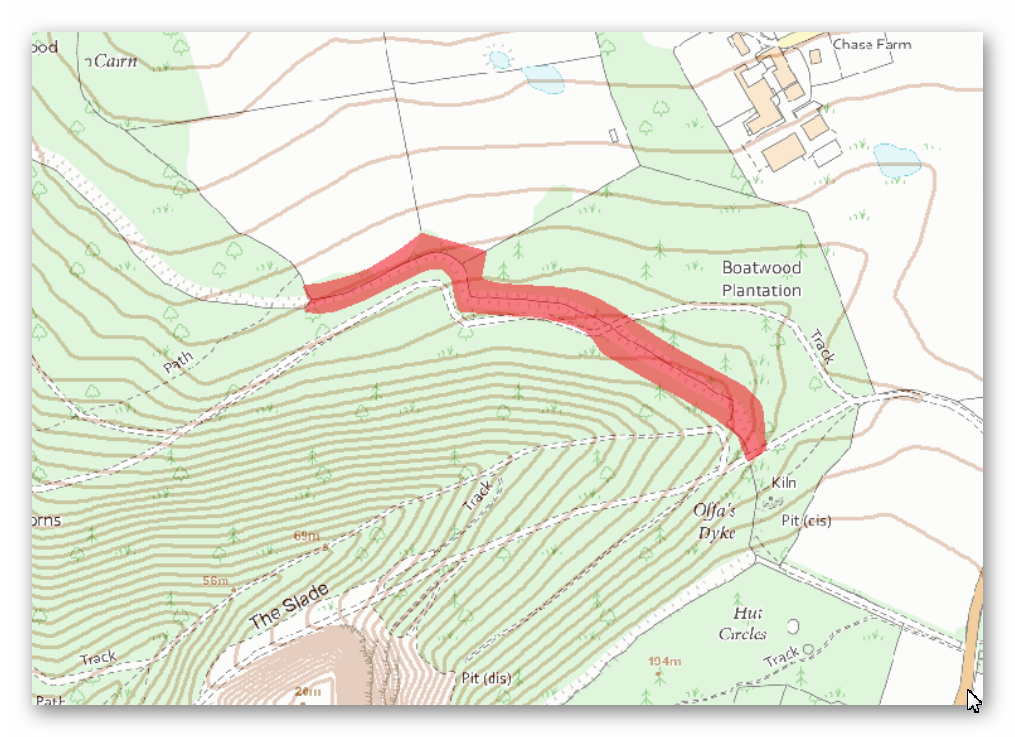
LiDAR Map
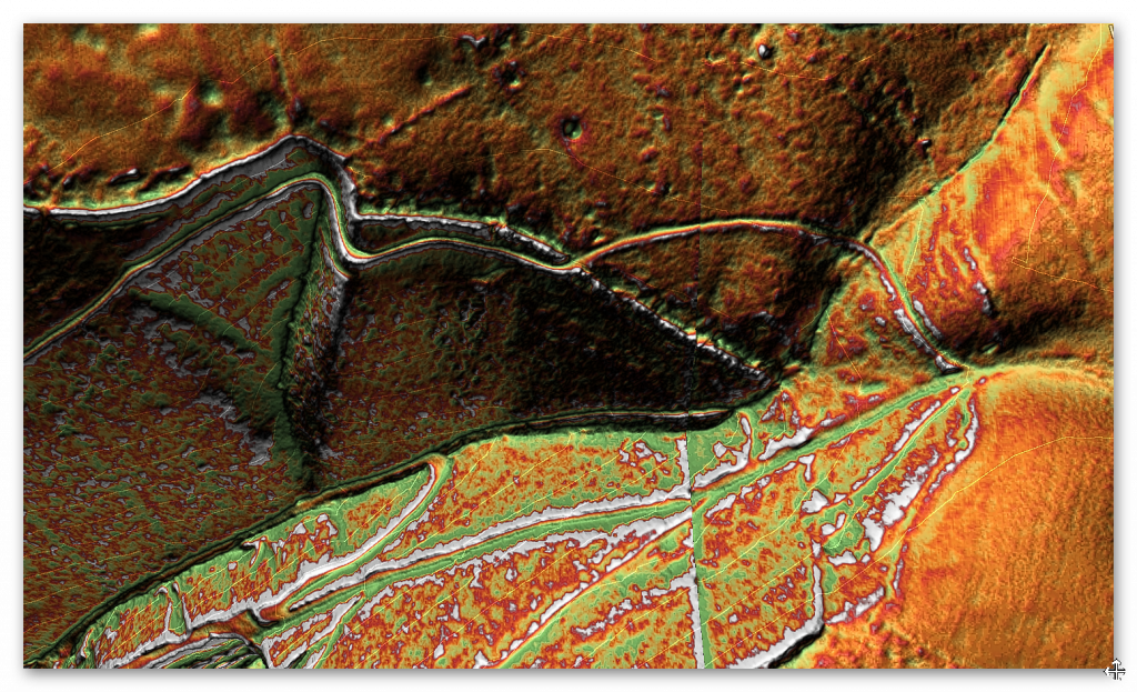
1800 Map
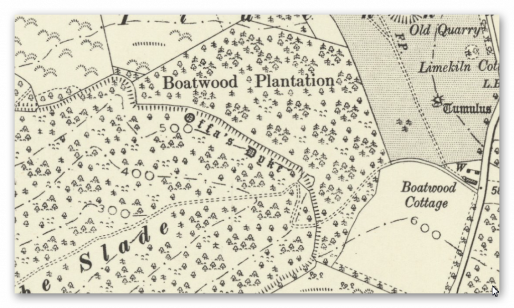
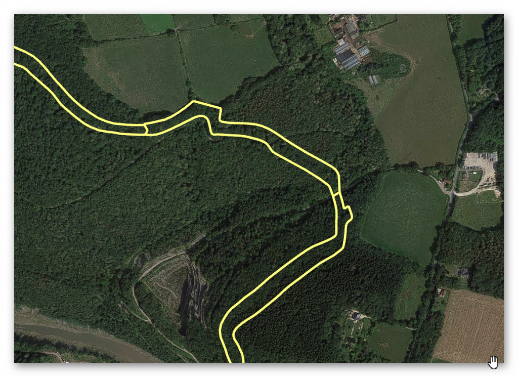
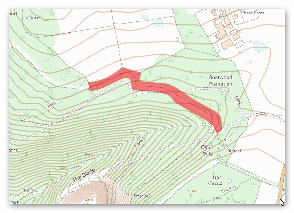
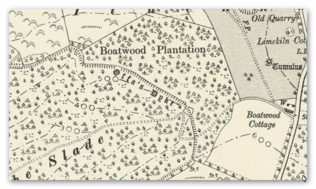
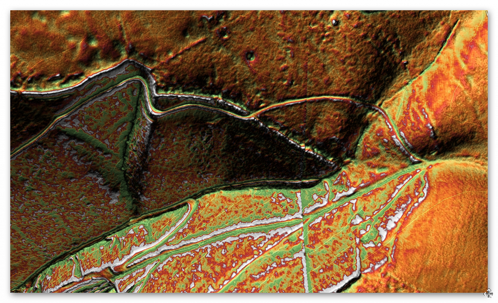
“This 364m long section of the Dyke turns from its usual alignment to run north west-south east. It is visible as a bank with a berm on its south side and contiguous quarry pits to the north.
The bank is up to 17m wide at its base and stands to between 2.5m and 3.5m high on its southern face and to between 0.8m and 1.8m on its northern face.
The berm is about 2m wide and represents an artificial break in slope at the base of the earthen bank. The quarries are up to 10m wide and about 1m deep.
A stone boundary wall, which is thought to date from the mid to late 19th century, runs along the top of the bank throughout the length of this scheduling.
There is a gap in the Dyke at Ordnance Survey NGR ST54929845 formed by the cutting of a forestry access road, material from which was thrown up to form a bund. It is not thought to represent an original crossing point through the monument.” – Historic England
Conclusion
The Dyke loses its structure down the river valley, and the ditch moves to the other side of the Dyke, again indicating that it was not used as a defensive earthwork.
Quarries are all around this section indicating the use and function of this Dyke in the past – further investigation needs to be made to understand the dates of these quarries to see if they are Prehistoric, Roman or both.
To survey this Offa’s Dyke successfully, we need to link to other historic providers’ information and maps. To do this with relevant accuracy, we need to establish a grid system that looks at all the LiDAR, Satellite photography, Old OS maps and excavation evidence to draw new conclusions about the construction of Offa’s Dyke.
Therefore, we have subdivided Offa’s Dyke into five sections and named them A to E – each Section is not equally divided but edited by the breaks within the Dyke. We have named these sections from South to North, which is a bit different from the norm, but in archaeology, information is the best way to approach Offa’s Dyke as you will find when you get to Section E.
These grid sections include the OS 1800 Map edition (for historical accurately, as new developments are not included), Google Earth Maps (showing Historic England Scheduled Areas and References) and our LiDAR (hi-resolution) maps, which are unique in their clarity and ease of landscape interpretation.
We will also give you a complete overview of the Dyke by section before the detailed analysis within the appendices. This will provide you with an understanding of the Dykes construction phases and function, allowing you to understand better how we came to our conclusions about Offa’s Dyke and when it was constructed.

This was an extracts from the NEW Book Ancient Prehistoric Canals (Dykes) – Wansdyke available on Amazon as a FULL COLOUR HARD BACK (£49.95) or a ECONOMY (£9.99) SOFTBACK black and white VERSION – it is also available as a KINDLE (£2.99) book. For further information about our work on Prehistoric Britain visit our WEBSITE or VIDEO CHANNEL.
Product details
- ASIN : B0BQG7G6CJ
- Publisher : Independently published (24 Nov. 2022)
- Language : English
- Hardcover : 443 pages
- ISBN-13 : 979-8370198236
- Dimensions : 15.24 x 3.33 x 22.86 cm
- Illustrations: 350+
Further Reading
For those interested in British Prehistory, visit www.prehistoric-britain.co.uk, a comprehensive resource featuring an extensive collection of archaeology articles, modern LiDAR investigations, and groundbreaking research. The site also includes insights and extracts from the acclaimed Robert John Langdon Trilogy, a series of books exploring Britain during the Prehistoric period. Titles in the trilogy include The Stonehenge Enigma, Dawn of the Lost Civilisation, and The Post Glacial Flooding Hypothesis, offering compelling evidence about ancient landscapes shaped by post-glacial flooding.
To further explore these topics, Robert John Langdon has developed a dedicated YouTube channel featuring over 100 video documentaries and investigations that complement the trilogy. Notable discoveries and studies showcased on the channel include 13 Things that Don’t Make Sense in History and the revelation of Silbury Avenue – The Lost Stone Avenue, a rediscovered prehistoric feature at Avebury, Wiltshire.
In addition to his main works, Langdon has released a series of shorter, accessible publications, ideal for readers delving into specific topics. These include:
- The Ancient Mariners
- Stonehenge Built 8300 BCE
- Old Sarum
- Prehistoric Rivers
- Dykes, Ditches, and Earthworks
- Echoes of Atlantis
- Homo Superior
- 13 Things that Don’t Make Sense in History
- Silbury Avenue – The Lost Stone Avenue
- Offa’s Dyke
- The Stonehenge Enigma
- The Post-Glacial Flooding Hypothesis
- The Stonehenge Hoax
- Dawn of the Lost Civilisation
- Darwin’s Children
- Great Chester’s Roman Aqueduct
- Wansdyke
For active discussions and updates on the trilogy’s findings and recent LiDAR investigations, join our vibrant community on Facebook. Engage with like-minded enthusiasts by leaving a message or contributing to debates in our Facebook Group.
Whether through the books, the website, or interactive videos, we aim to provide a deeper understanding of Britain’s fascinating prehistoric past. We encourage you to explore these resources and uncover the mysteries of ancient landscapes through the lens of modern archaeology.
For more information, including chapter extracts and related publications, visit the Robert John Langdon Author Page. Dive into works such as The Stonehenge Enigma or Dawn of the Lost Civilisation, and explore cutting-edge theories that challenge traditional historical narratives.(Blackhenge: Debunking the Media misinterpretation of the Stonehenge Builders)
Other Blogs
1
a
- AI now Supports – Homo Superior
- AI now supports my Post-Glacial Flooding Hypothesis
- Alexander the Great sailed into India – where no rivers exist today
- Ancient Prehistoric Canals – The Vallum
- Ancient Secrets of Althorp – debunked
- Antler Picks built Ancient Monuments – yet there is no real evidence
- Antonine Wall – Prehistoric Canals (Dykes)
- Archaeological ‘pulp fiction’ – has archaeology turned from science?
- Archaeological Pseudoscience
- Archaeology in the Post-Truth Era
- Archaeology: A Bad Science?
- Archaeology: A Harbour for Fantasists?
- Archaeology: Fact or Fiction?
- Archaeology: The Flaws of Peer Review
- Archaeology’s Bayesian Mistake: Stop Averaging the Past
- Are Raised Beaches Archaeological Pseudoscience?
- Atlantis Found: The Mathematical Proof That Plato’s Lost City Was Doggerland
- ATLANTIS: Discovery with Dan Snow Debunked
- Avebury Ditch – Avebury Phase 2
- Avebury Post-Glacial Flooding
- Avebury through time
- Avebury’s great mystery revealed
- Avebury’s Lost Stone Avenue – Flipbook
b
- Battlesbury Hill – Wiltshire
- Beyond Stone and Bone: Rethinking the Megalithic Architects of Northern Europe
- BGS Prehistoric River Map
- Blackhenge: Debunking the Media misinterpretation of the Stonehenge Builders
- Brain capacity (Cro-Magnon Man)
- Brain capacity (Cro-Magnon Man)
- Britain’s First Road – Stonehenge Avenue
- Britain’s Giant Prehistoric Waterways
- British Roman Ports miles away from the coast
c
- Caerfai Promontory Fort – Archaeological Nonsense
- Car Dyke – ABC News PodCast
- Car Dyke – North Section
- CASE STUDY – An Inconvenient TRUTH (Craig Rhos Y Felin)
- Case Study – River Avon
- Case Study – Woodhenge Reconstruction
- Chapter 2 – Craig Rhos-Y-Felin Debunked
- Chapter 2 – Stonehenge Phase I
- Chapter 2 – Variation of the Species
- Chapter 3 – Post Glacial Sea Levels
- Chapter 3 – Stonehenge Phase II
- Chapter 7 – Britain’s Post-Glacial Flooding
- Cissbury Ring through time
- Cro-Magnon Megalithic Builders: Measurement, Biology, and the DNA
- Cro-Magnons – An Explainer
d
- Darwin’s Children – Flipbook
- Darwin’s Children – The Cro-Magnons
- Dawn of the Lost Civilisation – Flipbook
- Dawn of the Lost Civilisation – Introduction
- Digging for Britain – Cerne Abbas 1 of 2
- Digging for Britain Debunked – Cerne Abbas 2
- Digging Up Britain’s Past – Debunked
- DLC Chapter 1 – The Ascent of Man
- Durrington Walls – Woodhenge through time
- Durrington Walls Revisited: Platforms, Fish Traps, and a Managed Mesolithic Landscape
- Dyke Construction – Hydrology 101
- Dykes Ditches and Earthworks
- DYKES of Britain
e
f
g
h
- Hadrian’s Wall – Military Way Hoax
- Hadrian’s Wall – the Stanegate Hoax
- Hadrian’s Wall LiDAR investigation
- Hambledon Hill – NOT an ‘Iron Age Fort’
- Hayling Island Lidar Maps
- Hidden Sources of Ancient Dykes: Tracing Underground Groundwater Fractals
- Historic River Avon
- Hollingsbury Camp Brighton
- Hollows, Sunken Lanes and Palaeochannels
- Homo Superior – Flipbook
- Homo Superior – History’s Giants
- How Lidar will change Archaeology
i
l
m
- Maiden Castle through time
- Mathematics Meets Archaeology: Discovering the Mesolithic Origins of Car Dyke
- Mesolithic River Avon
- Mesolithic Stonehenge
- Minerals found in Prehistoric and Roman Quarries
- Mining in the Prehistoric to Roman Period
- Mount Caburn through time
- Mysteries of the Oldest Boatyard Uncovered
- Mythological Dragons – a non-existent animal that is shared by the World.
o
- Offa’s Dyke Flipbook
- Old Sarum Lidar Map
- Old Sarum Through Time…………….
- On Sunken Lands of the North Sea – Lived the World’s Greatest Civilisation.
- OSL Chronicles: Questioning Time in the Geological Tale of the Avon Valley
- Oswestry LiDAR Survey
- Oswestry through time
- Oysters in Archaeology: Nature’s Ancient Water Filters?
p
- Pillow Mounds: A Bronze Age Legacy of Cremation?
- Post Glacial Flooding – Flipbook
- Prehistoric Burial Practices of Britain
- Prehistoric Canals – Wansdyke
- Prehistoric Canals – Wansdyke
- Prehistoric Canals (Dykes) – Great Chesters Aqueduct (The Vallum Pt. 4)
- Prehistoric Canals (Dykes) – Hadrian’s Wall Vallum (pt 1)
- Prehistoric Canals (Dykes) – Offa’s Dyke (Chepstow)
- Prehistoric Canals (Dykes) – Offa’s Dyke (LiDAR Survey)
- Prehistoric Canals (Dykes) – Offa’s Dyke Survey (End of Section A)
- Prehistoric Canals (Dykes) – Wansdyke (4)
- Prehistoric Canals Wansdyke 2
- Professor Bonkers and the mad, mad World of Archaeology
r
- Rebirth in Stone: Decrypting the Winter Solstice Legacy of Stonehenge
- Rediscovering the Winter Solstice: The Original Winter Festival
- Rethinking Ancient Boundaries: The Vallum and Offa’s Dyke”
- Rethinking Ogham: Could Ireland’s Oldest Script Have Begun as a Tally System?
- Rethinking The Past: Mathematical Proof of Langdon’s Post-Glacial Flooding Hypothesis
- Revolutionising History: Car Dyke Unveiled as Prehistoric & the Launch of FusionBook 360
- Rising Evidence, Falling Rivers: The Real Story of Europe’s First Farmers
- Rivers of the Past Were Higher: A Fresh Perspective on Prehistoric Hydrology
s
- Sea Level Changes
- Section A – NY26SW
- Section B – NY25NE & NY26SE
- Section C – NY35NW
- Section D – NY35NE
- Section E – NY46SW & NY45NW
- Section F – NY46SE & NY45NE
- Section G – NY56SW
- Section H – NY56NE & NY56SE
- Section I – NY66NW
- Section J – NY66NE
- Section K – NY76NW
- Section L – NY76NE
- Section M – NY87SW & NY86NW
- Section N – NY87SE
- Section O – NY97SW & NY96NW
- Section P – NY96NE
- Section Q – NZ06NW
- Section R – NZ06NE
- Section S – NZ16NW
- Section T – NZ16NE
- Section U – NZ26NW & NZ26SW
- Section V – NZ26NE & NZ26SE
- Silbury Avenue – Avebury’s First Stone Avenue
- Silbury Hill
- Silbury Hill / Sanctuary – Avebury Phase 3
- Somerset Plain – Signs of Post-Glacial Flooding
- South Cadbury Castle – Camelot
- Statonbury Camp near Bath – an example of West Wansdyke
- Stone me – the druids are looking the wrong way on Solstice day
- Stone Money – Credit System
- Stone Transportation and Dumb Censorship
- Stonehenge – Monument to the Dead
- Stonehenge Hoax – Dating the Monument
- Stonehenge Hoax – Round Monument?
- Stonehenge Hoax – Summer Solstice
- Stonehenge LiDAR tour
- Stonehenge Phase 1 — Britain’s First Monument
- Stonehenge Phase I (The Stonehenge Landscape)
- Stonehenge Solved – Pythagorean maths put to use 4,000 years before he was born
- Stonehenge Stone Transportation
- Stonehenge Through Time
- Stonehenge, Doggerland and Atlantis connection
- Stonehenge: Discovery with Dan Snow Debunked
- Stonehenge: The Worlds First Computer
- Stonehenge’s The Lost Circle Revealed – DEBUNKED
t
- Ten Reasons Why Car Dyke Blows Britain’s Earthwork Myths Out of the Water
- Ten Things You Didn’t Know About Britain’s Prehistoric Flooded Past
- Ten thousand year old boats found on Northern Europe’s Hillsides
- Ten thousand-year-old boats found on Northern Europe’s Hillsides
- The “Hunter-Gatherer” Myth: Why It’s Time to Bury This Outdated Term
- The Ancient Mariners – Flipbook
- The Ancient Mariners – Prehistoric seafarers of the Mesolithic
- The Beringian Migration Myth: Why the Peopling of the Americas by Foot is Mathematically and Logistically Impossible
- The Bluestone Enigma
- The Cro-Magnon Cover-Up: How DNA and PR Labels Erased Our Real Ancestry
- The Dolmen and Long Barrow Connection
- The Durrington Walls Hoax – it’s not a henge?
- The Dyke Myth Collapses: Excavation and Dating Prove Britain’s Great Dykes Are Prehistoric Canals
- The First European Smelted Bronzes
- The Fury of the Past: Natural Disasters in Historical and Prehistoric Britain
- The Giant’s Graves of Cumbria
- The Giants of Prehistory: Cro-Magnon and the Ancient Monuments
- The Great Antler Pick Hoax
- The Great Chichester Hoax – A Bridge too far?
- The Great Dorchester Aqueduct Hoax
- The Great Farming Hoax – (Einkorn Wheat)
- The Great Farming Migration Hoax
- The Great Hadrian’s Wall Hoax
- The Great Iron Age Hill Fort Hoax
- The Great Offa’s Dyke Hoax
- The Great Prehistoric Migration Hoax
- The Great Stone Transportation Hoax
- The Great Stonehenge Hoax
- The Great Wansdyke Hoax
- The Henge and River Relationship
- The Logistical Impossibility of Defending Maiden Castle
- The Long Barrow and Dolman Enigma
- The Long Barrow Mystery
- The Long Barrow Mystery: Unravelling Ancient Connections
- The Lost Island of Avalon – revealed
- The Maiden Way Hoax – A Closer Look at an Ancient Road’s Hidden History
- The Maths – LGM total ice volume
- The Mystery of Pillow Mounds: Are They Really Medieval Rabbit Warrens?
- The Old Sarum Hoax
- The Oldest Boat Yard in the World found in Wales
- The Perils of Paradigm Shifts: Why Unconventional Hypotheses Get Branded as Pseudoscience
- The Post-Glacial Flooding Hypothesis – Flipbook
- The Post-Glacial Flooding Theory
- The Problem with Hadrian’s Vallum
- The Rise of the Cro-Magnon (Homo Superior)
- The Roman Military Way Hoax
- The Silbury Hill Lighthouse?
- The Stonehenge Avenue
- The Stonehenge Avenue
- The Stonehenge Code: Unveiling its 10,000-Year-Old Secret
- The Stonehenge Enigma – Flipbook
- The Stonehenge Enigma: What Lies Beneath? – Debunked
- The Stonehenge Hoax – Bluestone Quarry Site
- The Stonehenge Hoax – Flipbook
- The Stonehenge Hoax – Moving the Bluestones
- The Stonehenge Hoax – Periglacial Stripes
- The Stonehenge Hoax – Station Stones
- The Stonehenge Hoax – Stonehenge’s Location
- The Stonehenge Hoax – The Ditch
- The Stonehenge Hoax – The Slaughter Stone
- The Stonehenge Hoax – The Stonehenge Layer
- The Stonehenge Hoax – Totem Poles
- The Stonehenge Hoax – Woodhenge
- The Stonehenge Hospital
- The Subtropical Britain Hoax
- The Troy, Hyperborea and Atlantis Connection
- The Vallum @ Hadrian’s Wall – it’s Prehistoric!
- The Vallum at Hadrian’s Wall (Summary)
- The Woodhenge Hoax
- Three Dykes – Kidland Forest
- Top Ten misidentified Fire Beacons in British History
- Troy Debunked
- TSE – DVD Barrows
- TSE DVD – An Inconvenient Truth
- TSE DVD – Antler Picks
- TSE DVD – Avebury
- TSE DVD – Durrington Walls & Woodhenge
- TSE DVD – Dykes
- TSE DVD – Epilogue
- TSE DVD – Stonehenge Phase I
- TSE DVD – Stonehenge Phase II
- TSE DVD – The Post-Glacial Hypothesis
- TSE DVD Introduction
- TSE DVD Old Sarum
- Twigs, Charcoal, and the Death of the Saxon Dyke Myth
w
- Wansdyke – Short Film
- Wansdyke East – Prehistoric Canals
- Wansdyke Flipbook
- Wansdyke LiDAR Flyover
- Wansdyke: A British Frontier Wall – ‘Debunked’
- Was Columbus the first European to reach America?
- What Archaeology Missed Beneath Stonehenge
- White Sheet Camp
- Why a Simple Fence Beats a Massive Dyke (and What That Means for History)
- Windmill Hill – Avebury Phase 1
- Winter Solstice – Science, Propaganda and Indoctrination
- Woodhenge – the World’s First Lighthouse?


