Section R – NZ06NE
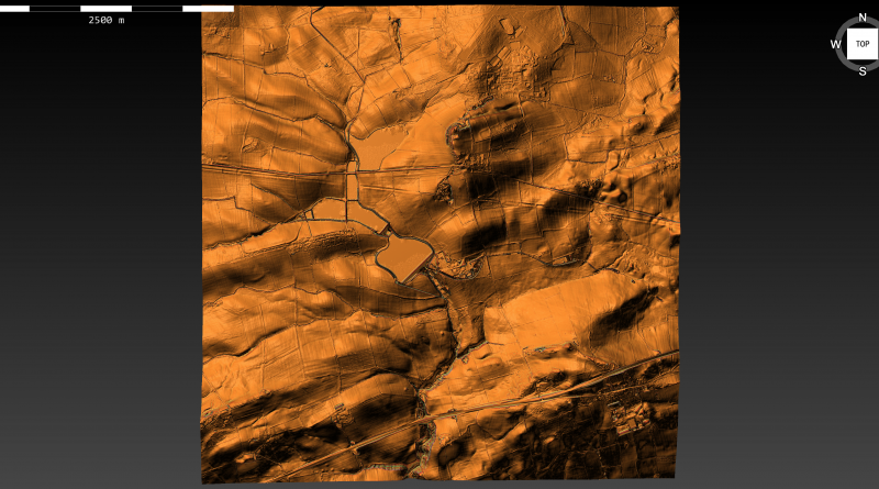
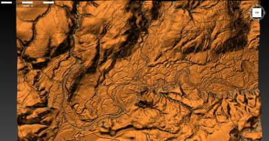
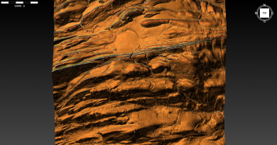
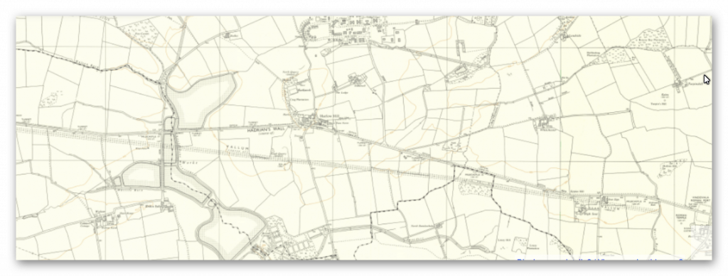
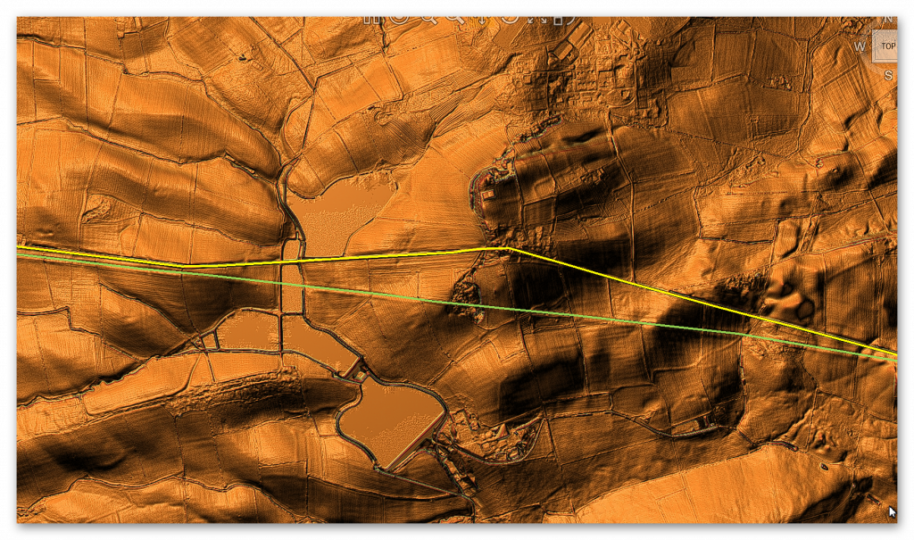
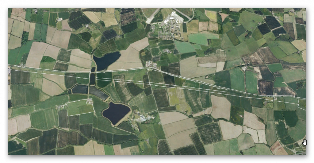
Section R – NZ06NE – this is a section of Hadrian’s Wall showing the LiDAR, Google Earth and 1800 Maps of the Area covered by Historic England
Historic England Sections:
Name: Name: Hadrian’s Wall and vallum between the March Burn and the B6309 in wall miles 13,14,15,16,17 and 18.
List UID: 11010618, 010622, 1010621, 010620,
Old OS Map
LiDAR Map
Google Earth Map
Historic England Scheduled Monuments within Section R
Name: Hadrian’s Wall and vallum between the B6309 and the B6321 in wall miles 16, 17 and 18
Designation Type: Scheduling
Grade: Not Applicable to this List Entry
List UID: 1010622
Name: Hadrian’s Wall from Oatens Bank, Harlow Hill, to Whittle Dene Watercourse in wall mile 16
Designation Type: Scheduling
Grade: Not Applicable to this List Entry
List UID: 1010620
Name: The vallum between Oatens Bank, Harlow Hill, and Whittle Dene Watercourse in wall mile 16
Designation Type: Scheduling
Grade: Not Applicable to this List Entry
List UID: 1010621
Name: Hadrian’s Wall and vallum between the March Burn and Oatens Bank, Harlow Hill in wall miles 13,14 and 15
Designation Type: Scheduling
Grade: Not Applicable to this List Entry
List UID: 1010618
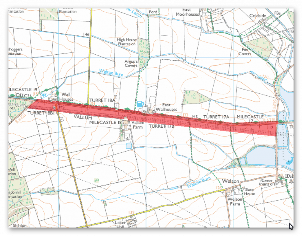
The monument includes the section of Hadrian’s Wall, vallum and associated features between the B6309 in the east and the B6321 in the west. The ground slopes gently upwards towards the west throughout this section of the monument.
There are wide views to the north, east and south. However, the rising ground to the west restricts the outlook in this direction. Hadrian’s Wall survives as buried remains below the road surface of the B6318 road throughout the length of this section. The wall ditch survives as an earthwork to the north of the road for most of the length of this section. It averages about 1.4m deep throughout, though it reaches a maximum of 3m in places. Milecastle 17 is positioned on sloping ground to the west of the Northern Reservoir. It survives as a low platform with a scarp to the east and a slight stone scatter. It was partly excavated in 1931 and its walls were shown to be about 2.5m thick. Milecastle 18 occupies a position on a gentle west facing slope on the south side of the B6318 road at East Wallhouses. There are no visible remains above ground; however, its site is known as it was partly excavated in 1931 when its walls were found to be almost 2.5m thick. Turret 17a survives as a buried feature located 310m to the east of the track which runs south to Welton from the B6318 road, on a ridge of level ground.
It was excavated in 1931 and was shown to have a door in the south west corner and a ladder platform in the south east corner. Turret 17b is located 320m east of the Robin Hood Inn, surviving as a buried feature beneath the B6318 road. The ground slopes upwards to the west while to the east the ground is fairly level. This turret was also partly excavated in 1931 and like turret 17a it was shown to have a door in the south west corner and a ladder platform in the south east corner. Turret 18a is located at the junction of the minor road to West Moorhouses off the B6318 on an east facing slope. There are no visible remains apart from a rise in the hedgeline. Part excavation in 1931 showed that the surviving buried remains are very well preserved. Its ladder platform stood to its full height with six stone steps. Turret 18b is located 50m to the east of Welton Burn on an east facing slope. There are no visible remains. It was partly excavated in 1959 when animal bones and pottery were found.
The course of the Roman road, known as the Military Way, linking turrets, milecastles and forts, which ran along the corridor between the Wall and the vallum, is not yet confirmed in this section. It is known to exist here as Horsley noted in the 1730s that it ran along the north mound of the vallum for a short distance where the Wall and vallum are very close and then, `A little after it has passed by the Wall houses, it runs almost parallel both to the Wall and the north agger’. Its remains now survive as buried features.
The vallum continues on the same straight alignment as its neighbouring sections throughout its course. It is visible as an upstanding earthwork except for the first kilometre west of the Northern Reservoir where it has been reduced by cultivation and its ditches silted up. The north mound averages about 0.25m in height whereas the south mound averages about 0.6m high. The vallum ditch averages about 0.8m in depth, though it reaches a depth of 1.4m in places.
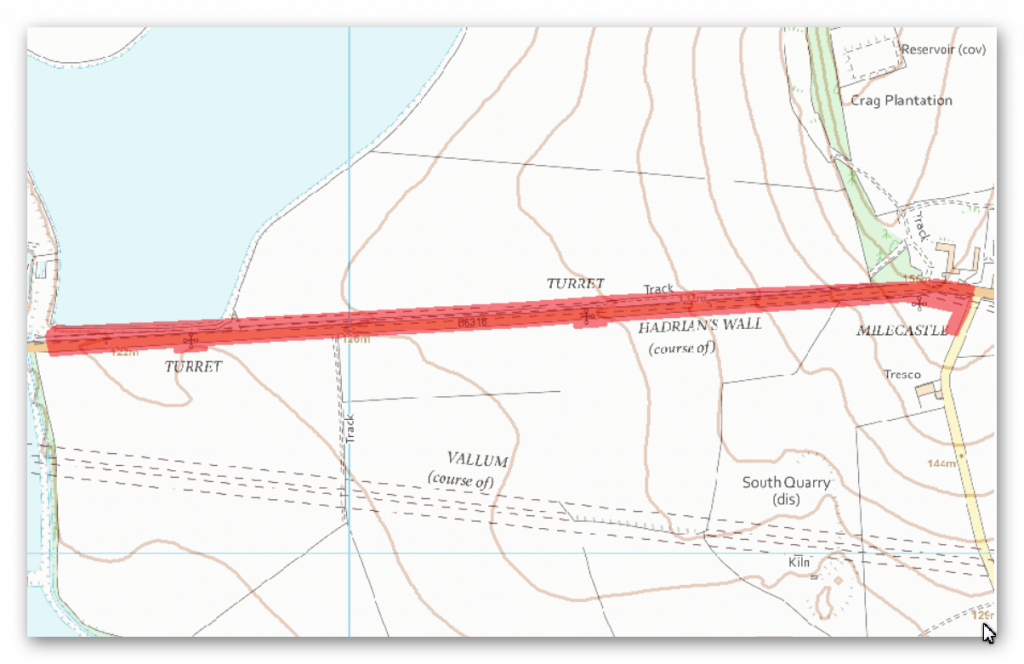
The monument includes the section of Hadrian’s Wall and its associated features between Oatens Bank, Harlow Hill, in the east and Whittle Dene Watercourse in the west.
This section of Wall runs downslope towards the west from Harlow Hill. There is gently rising ground to the north, whereas to the south the ground slopes away. The Wall survives as a buried feature beneath the B6318 road throughout this section. The external ditch on the north side of the Wall is silted up for most of this section although traces of its north scarp are still visible about 200m west of Harlow Hill. The exact location of turrets 16a and 16b has not yet been confirmed.
The course of the Roman road known as the Military Way, linking turrets, milecastles and forts, which ran along the corridor between the Wall and the vallum, is not yet confirmed in this section of the corridor. However, during the 1730s Horsley noted its existence a little west of Harlow Hill describing it as `about thirteen foot’ in width.
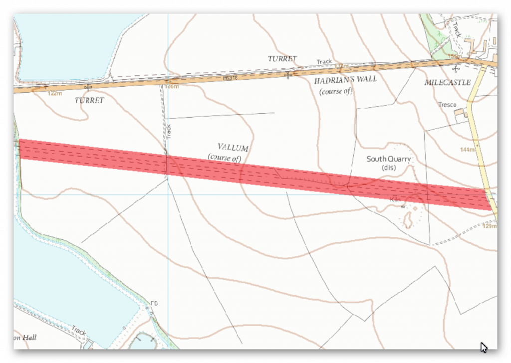
The monument includes the vallum and its associated features between Oatens Bank, Harlow Hill, in the east and Whittle Dene Watercourse (part of the Northern Reservoir) in the west.
It follows a straight course along the south side of Harlow Hill and survives as a series of buried features. Its course can be determined by the slight undulations in the arable land which denote the banks and ditches. The banks have been ploughed flat.
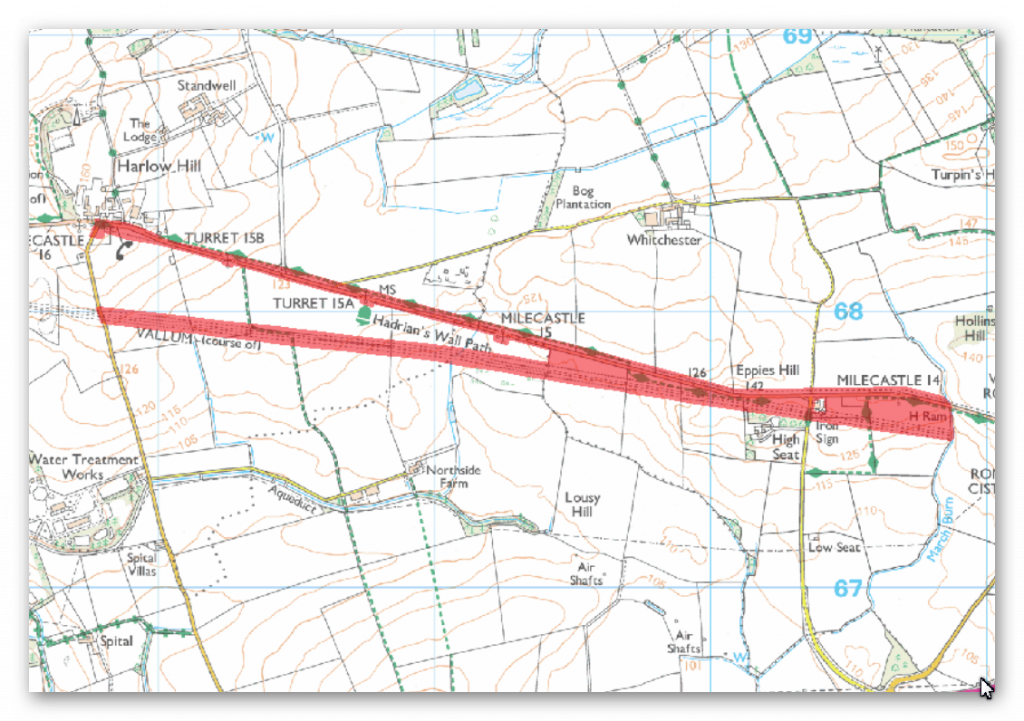
The monument includes Hadrian’s Wall and vallum and associated features between the March Burn in the east and the west side of Oatens Bank, Harlow Hill the west.
This section of the Wall runs gently downhill from the March Burn to milecastle 15 before running up a steep gradient to the summit of Harlow Hill. The Wall commands wide views to the north and south along this section, but the undulating terrain to the east and west means that views are restricted in these directions. Hadrian’s Wall aims for the high points throughout this section which includes the summits of Eppies Hill and Harlow Hill, unlike the vallum which takes a lower course skirting to the south of Harlow Hill. The Wall survives beneath the B6318 road throughout the whole length of this section. East of Harlow Hill antiquarians including Horsley, Brand and Skinner, recorded the width of the wall as being 7 feet and 4 inches, indicating that the Wall was of narrow type. The Wall ditch survives intermittently as an earthwork.
It survives best to the west of Eppies Hill to depths of between 2m and 3m. Elsewhere the ditch is silted up and survives only as a buried feature. Milecastle 14 is situated on the crest of a slight knoll to the west of the March Burn. It survives as a low, turf-covered platform 0.4m high. It has been heavily ploughed, which has resulted in the platform being spread. The site was partly excavated in 1946. Milecastle 15 is situated east of a stream on a gentle east-west slope with a restricted view to the north east. It survives as a turf-covered platform approximately 1m high over most of its area. There are robber trenches around the crest of the platform on the east, south and west sides. Milecastle 16 is situated on the crest of Harlow Hill with wide views in all directions. It survives as a buried feature in the field to the south of the road. The only upstanding feature is the scarp on the east side of the reduced platform.
The milecastle was excavated by Hepple and Richmond in the 1950s. The exact site of turret 14a is unknown. However, Horsley recorded that he saw the remains on top of the knoll known as Eppies Hill to the west of Iron Sign House. This would be a logical position for a turret as it would have commanded the best vantage between Rudchester and Harlow Hill. Similarly the exact site of turret 14b also remains unknown. Its presumed site is an area equidistant between the summit of Eppies Hill and milecastle 15. There are no visible remains of turret 15a which is located 115m east of the junction between the B6318 and the minor road to Whitchester. It was located during 1931 by Hepple, although little was found. Its remains lie partly below the surface of the B6318 road. There are no visible remains of turret 15b which is located 200m to the west of the minor road to the disused airfield at Ouston. As with turret 15a it was located during 1931 by Hepple. Its remains lie partly beneath the surface of the B6318 road.
The vallum runs in a straight line for most of this section. West of Eppies Hill, where the Wall and vallum are within about 30m of each other, the vallum diverges from the course of the Wall and takes a lower and straighter line to the south of Harlow Hill. It survives intermittently as an upstanding earthwork. The south mound is between 0.3m and 0.4m high where extant while the north mound is between 0.4m and 0.5m. Where extant the vallum ditch varies between 1m and 1.6m deep. Elsewhere it survives as a series of silted ditches buried below the turf.
The course of the Roman road known as the Military Way, which runs along the corridor between the Wall and the vallum linking the turrets, milecastles and forts, is not yet confirmed in this section of the corridor.
Investigation
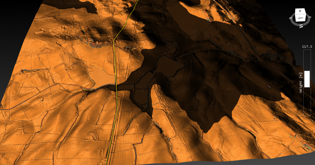
The Vallum in this section is shown as a smaller canal than previous section – the vallum goes through a modern Reservoir at one point and there is no archaeological evidence to it during construction in the 19th century which would suggest that it did not exist through the river valley the lidar map shows when the prehistoric waters are added.
Further Reading
For information about British Prehistory, visit www.prehistoric-britain.co.uk for the most extensive archaeology blogs and investigations collection, including modern LiDAR reports. This site also includes extracts and articles from the Robert John Langdon Trilogy about Britain in the Prehistoric period, including titles such as The Stonehenge Enigma, Dawn of the Lost Civilisation and the ultimate proof of Post Glacial Flooding and the landscape we see today.
Robert John Langdon has also created a YouTube web channel with over 100 investigations and video documentaries to support his classic trilogy (Prehistoric Britain). He has also released a collection of strange coincidences that he calls ‘13 Things that Don’t Make Sense in History’ and his recent discovery of a lost Stone Avenue at Avebury in Wiltshire called ‘Silbury Avenue – the Lost Stone Avenue’.
Langdon has also produced a series of ‘shorts’, which are extracts from his main body of books:
For active discussions on the findings of the TRILOGY and recent LiDAR investigations that are published on our WEBSITE, you can join our and leave a message or join the debate on our Facebook Group.

