Stonehenge Through Time
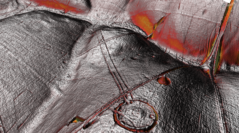
This is Stonehenge as we see it today on a plane of chalky grass, farmers fields and small, shallow woods – (Stonehenge through time)
But it hasn’t always looked like this in the past.10,000 years ago, at the end of the last ice Age, the rivers such as the Avon were overflowing from the melted water of the ice sheet that laid over Britain for 30,000 years.And the old dry river valleys such as Stonehenge Bottom, were active rivers again.
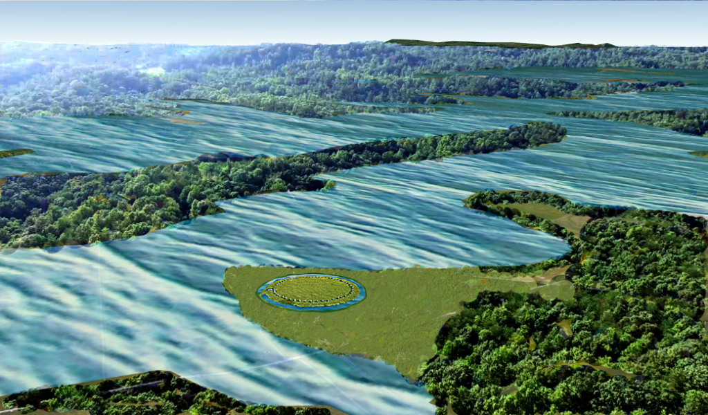
Moreover, a thick and lush pine forest covered the entire land.Within this environment, the first phase of Stonehenge was built. First, the moat that surrounds the site and then 56 blue stones from a quarry now identified as Craig Rhos y-felin, was constructed inside the Stonehenge mode because of man made hearths left at the quarry site.
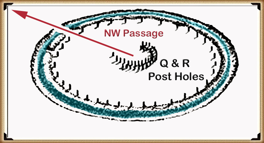
We can now, for the first time date the first phase of Stonehenge, which is between 8850 to 8330 BCE, some 50 years before the date quoted by most archaeologists.They suggest that because Stonehenge does not have similar carbon dates on site, but they are incidental.
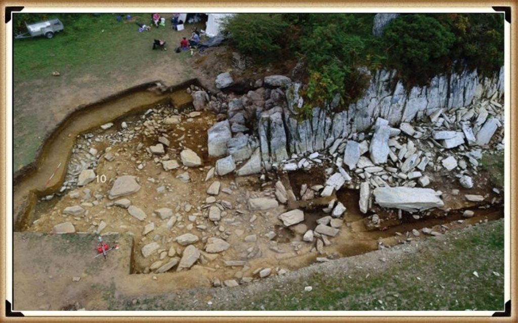
But that is not true.
If we return to when the visitor’s centre at Stonehenge was by the monument and look at the old car park, we find something quite amazing. On the shoreline of the old Holocene River, we find three large white circles on the tarmac of the car park.These circles are the exact position of the oldest evidence of human existence at Stonehenge.
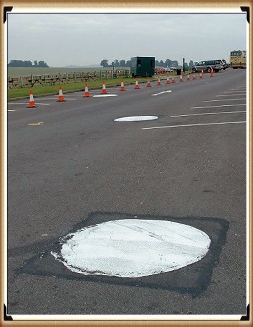
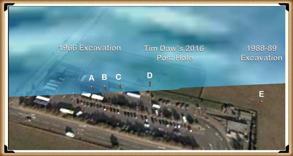
The experts would have you believe that these post holes were not associated with Stonehenge and are randomly constructed totem poles, as their dates do not match the current estimations by archaeologists. What we now see from the carbon dating is that not only the oldest hearth of the quarry matches post hole A at Stonehenge, but the other hearths of the quarry, also match post holes B and E.
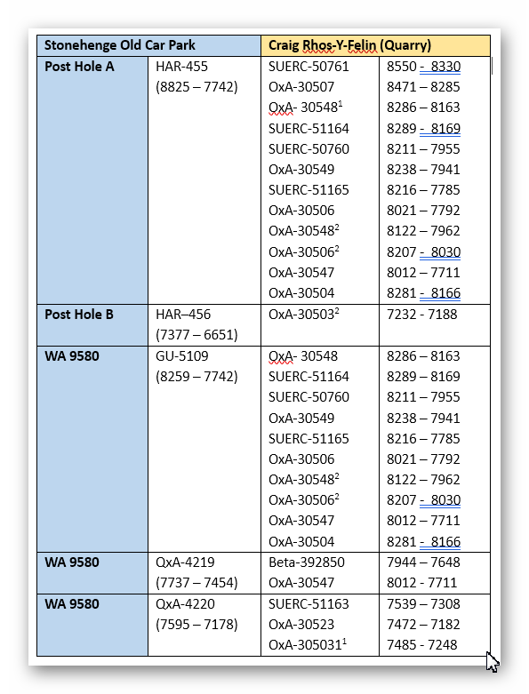
This is a mathematical improbability, unless both sites were connected in some form, but the most compelling and absolute evidence for the construction data.Phase one of Stonehenge can be seen in post hole E known as pit 9580 by archaeologists, where we find not just one carbon dated correlation with the quarry, but three dates.Moreover, 20 CM down this same pit, we find a piece of Rhyolite, commonly known as bluestone, and the date of this deposit can be estimated by the soil layer it was sitting upon 7560 to 7335 BCE, overlapping with the date of hearth number three found at the quarry site.
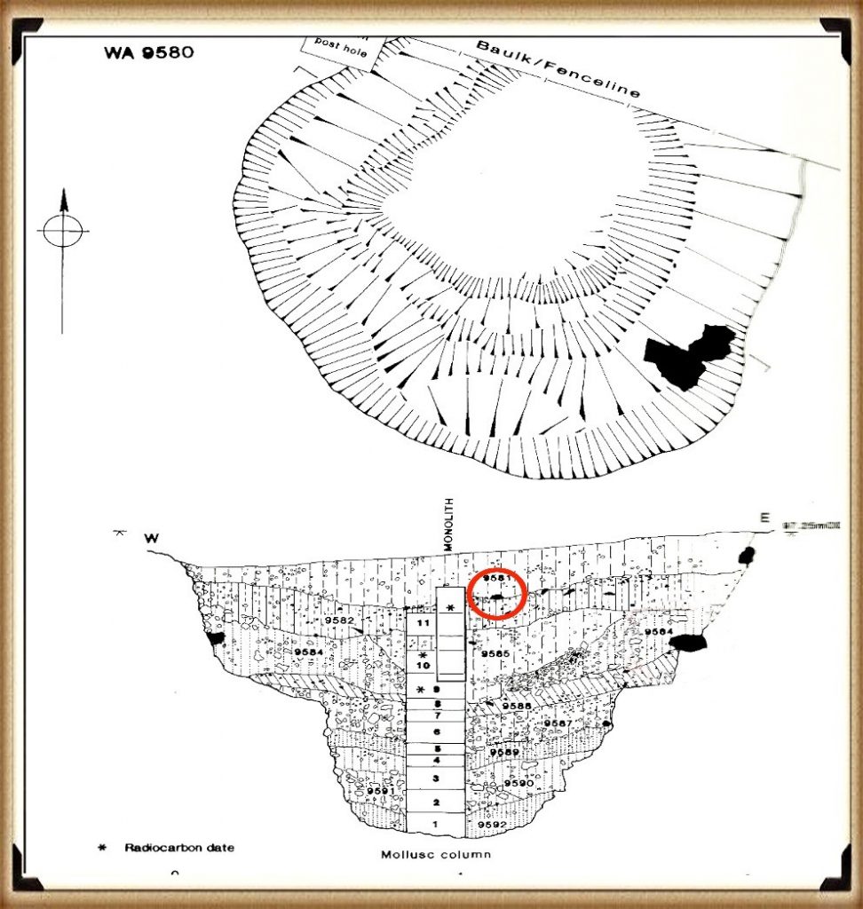
The question archaeologists refuse or find impossible to answer is:
How could a piece of bluestone used in the construction of the monument, which came from a quarry over 200 miles away, get into a pit at Stonehenge 5000 years before it was supposedly built?
These posts were placed at the edge of the Mesolithic waters to unload the boats loaded with blue stones, as the raised waters of the Holocene period would have also flooded the quarry site at Craig Rhos-Y-Felin.This has been confirmed by archaeologists who have found high levels of alluvium silt within the excavations.This same silt also exists in the post holes of Stonehenge, indicating the edges of the river levels during this time period, moreover showing the obvious method of transportation from the shoreline of the quarry 200 miles away to the Mesolithic shoreline of Stonehenge.
For this was a boat using civilisation and not the hunter gatherers, as past archaeologists had previously imagined hunting with spears over grassy plains, which gives us a clue to the second phase of Stonehenge, with the erection and construction of the gigantic Sarsen stones and the need for even larger boats 4000 years after phase one of Stonehenge was first completed, the even water levels had dropped to such an extent that its original purpose and function contained within the moat became obsolete.
This civilisation then embarked in changing the site’s purpose and therefore transported the gigantic Sarsen stones from a location just 20 miles away at West Woods by the River Avon to the site, again by boat. If we look down on Stonehenge from the air,it becomes clear the new location of the mooring site and how they were transported to the monument.
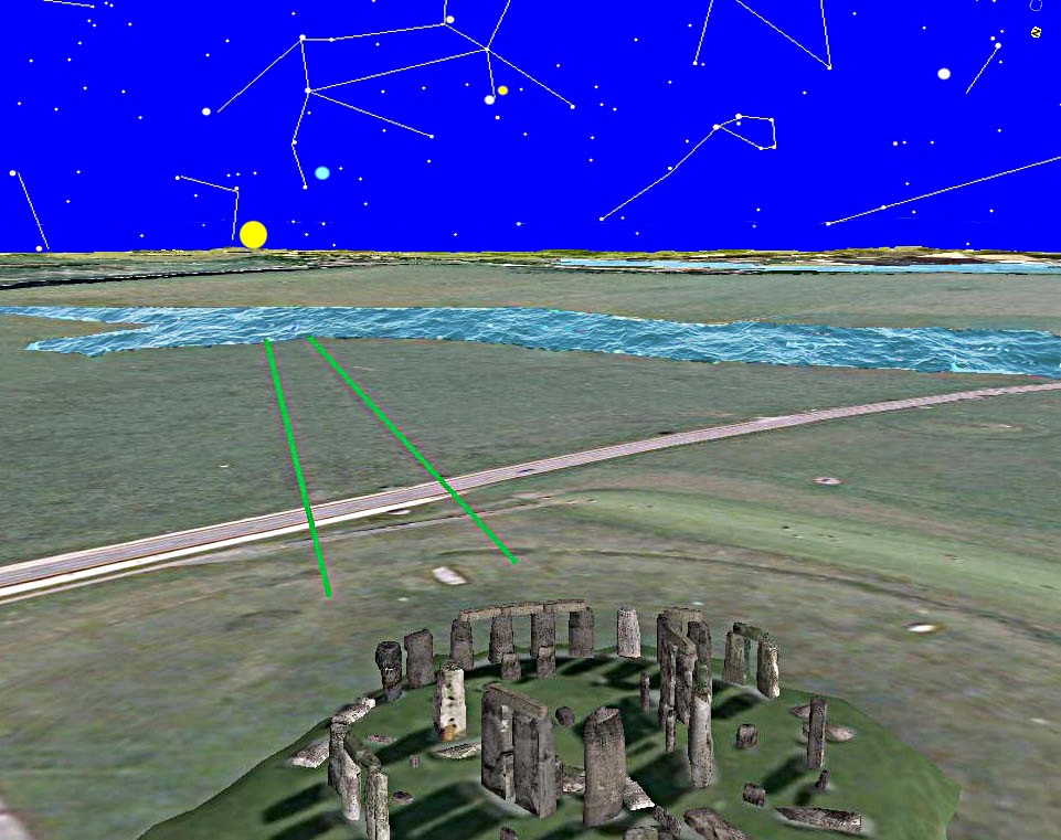
In the landscape you can see two parallel ditches 12 meters wide leading from the motor Stonehenge to a landing point archaeologists call Stonehenge Bottom.This is the lowest point in the landscape and therefore would have had the deepest water level in the early Neolithic period.This is Britain’s first road and would have been used to transport the large Sarsen stones from the boats moored at Stonehenge Bottom to the main site.
The feature is called the Avenue and it has always been a mystery to archaeologists where the road with ditches ends so abruptly and without reason.We now can see it is because it meet the river Avon during the phase two construction period.Once the Avon had completely retreated in the Bronze Age, a more simple footpath without the ditches continued across the landscape to again end at the Avenue, as was its original purpose.
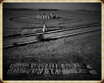
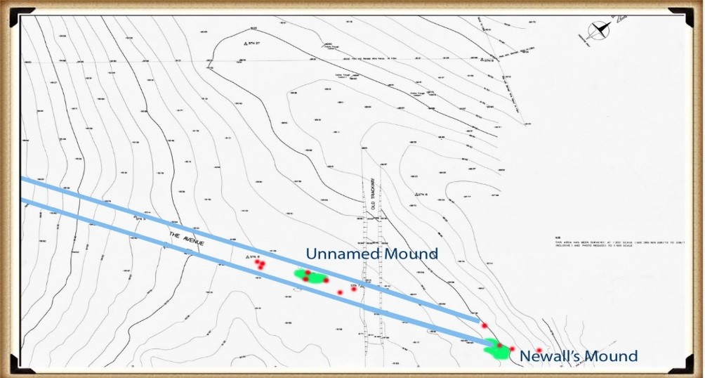
In a detailed magnetometer survey of the Avenue in 1990, 14 post holes were discovered located inside the Avenue, just like phase one, the post holes supported wooden uprights and pairs, allowing them to be used as prehistoric rains with the ability to move heavy stones from boats to carts. Sitting on the Avenue, archaeologists have identified and excavated part of the Newell’s mound, which is made from clay and flint and is therefore manmade. But the second unnamed mound, which is clearly identified on the contour maps like the 14 post holes, are unexcavated and so we have no dates of construction.
Fortunately, as most observers know, the Avenue was constructed in an alignment to the summer solstice sunrise. We can therefore measure the alignment and discover the exact date of construction as the sun moves one degree along the horizon every 50 years.Currently the sun rises one two degrees from the centre of the Avenue.
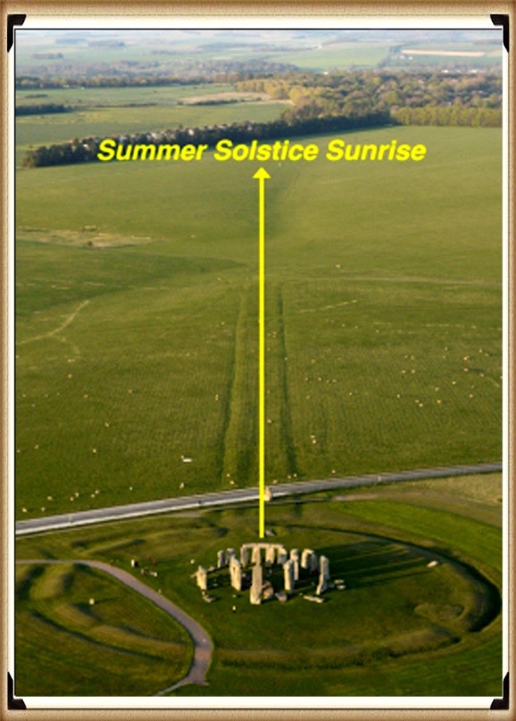
This shows us that the Avenue in phase two of the Stonehenge monument was started 6000 years ago and not before 5000 years ago, the archaeologists currently believe. This date can be confirmed by carbon dating with the packing foundations of Stone 27 – Atkinson, who lead the excavation around the base o fthe stone, was very keen to have this piece of antler bone carbon dated on the grounds that it was the first fined in situ that could give them their best date of construction.
But the date was so not what they wanted that it was disregarded.Although it fits the solar alignment of the avenue,to date, archaeologists have still to fully explain how a piece of undergraded animal bone, which was supposedly at the time 1700 years old, got to be used to wedge a gigantic standing stone into position.
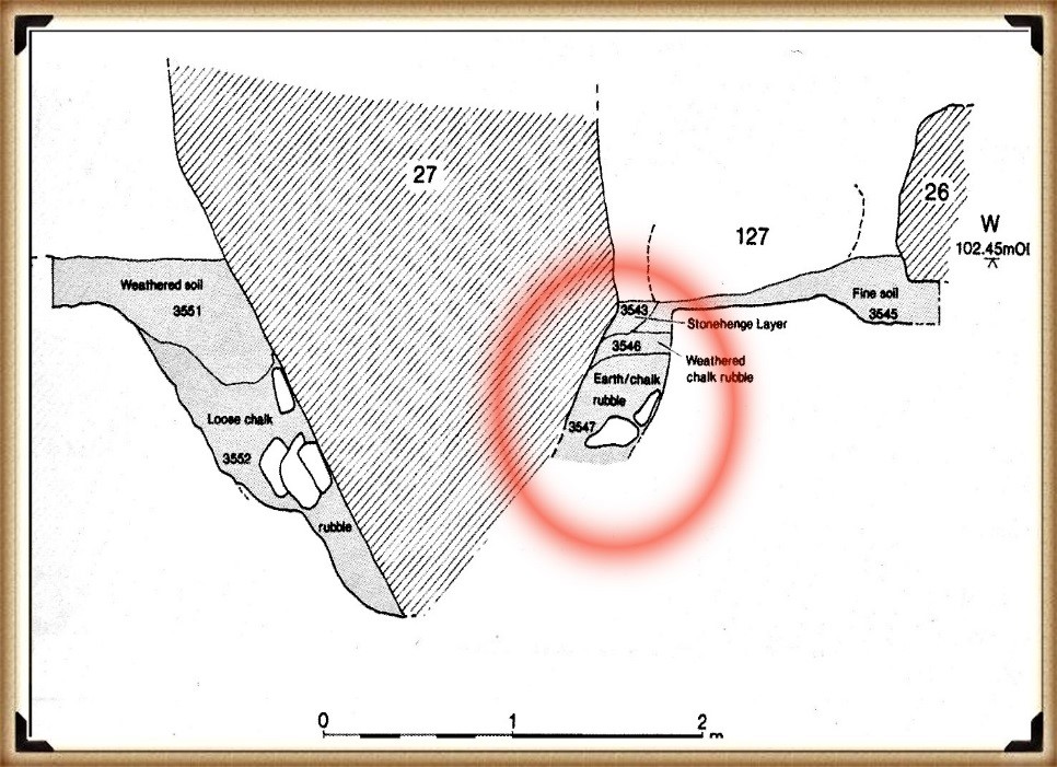
This scientific evidence now allows us to predict the date of Stonehenge phase Two as 4200 BCE, 1700 years earlier than the current hypothesis and consequently the rewriting of our history.
Further Reading
For information about British Prehistory, visit www.prehistoric-britain.co.uk for the most extensive archaeology blogs and investigations collection, including modern LiDAR reports. This site also includes extracts and articles from the Robert John Langdon Trilogy about Britain in the Prehistoric period, including titles such as The Stonehenge Enigma, Dawn of the Lost Civilisation and the ultimate proof of Post Glacial Flooding and the landscape we see today.
Robert John Langdon has also created a YouTube web channel with over 100 investigations and video documentaries to support his classic trilogy (Prehistoric Britain). He has also released a collection of strange coincidences that he calls ‘13 Things that Don’t Make Sense in History’ and his recent discovery of a lost Stone Avenue at Avebury in Wiltshire called ‘Silbury Avenue – the Lost Stone Avenue’.
Langdon has also produced a series of ‘shorts’, which are extracts from his main body of books:
For active discussions on the findings of the TRILOGY and recent LiDAR investigations that are published on our WEBSITE, you can join our and leave a message or join the debate on our Facebook Group.

