Section K – NY76NW
Contents
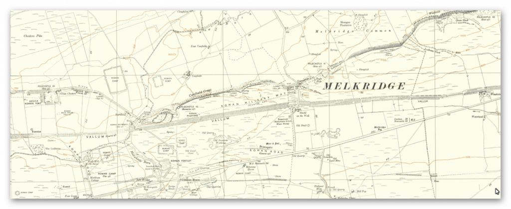
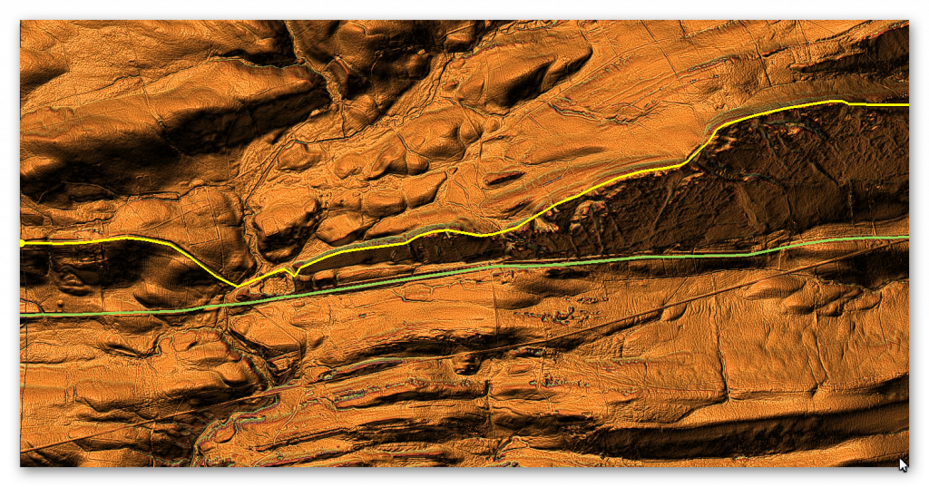
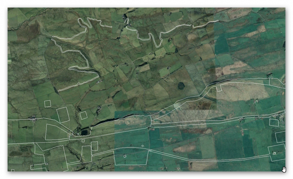
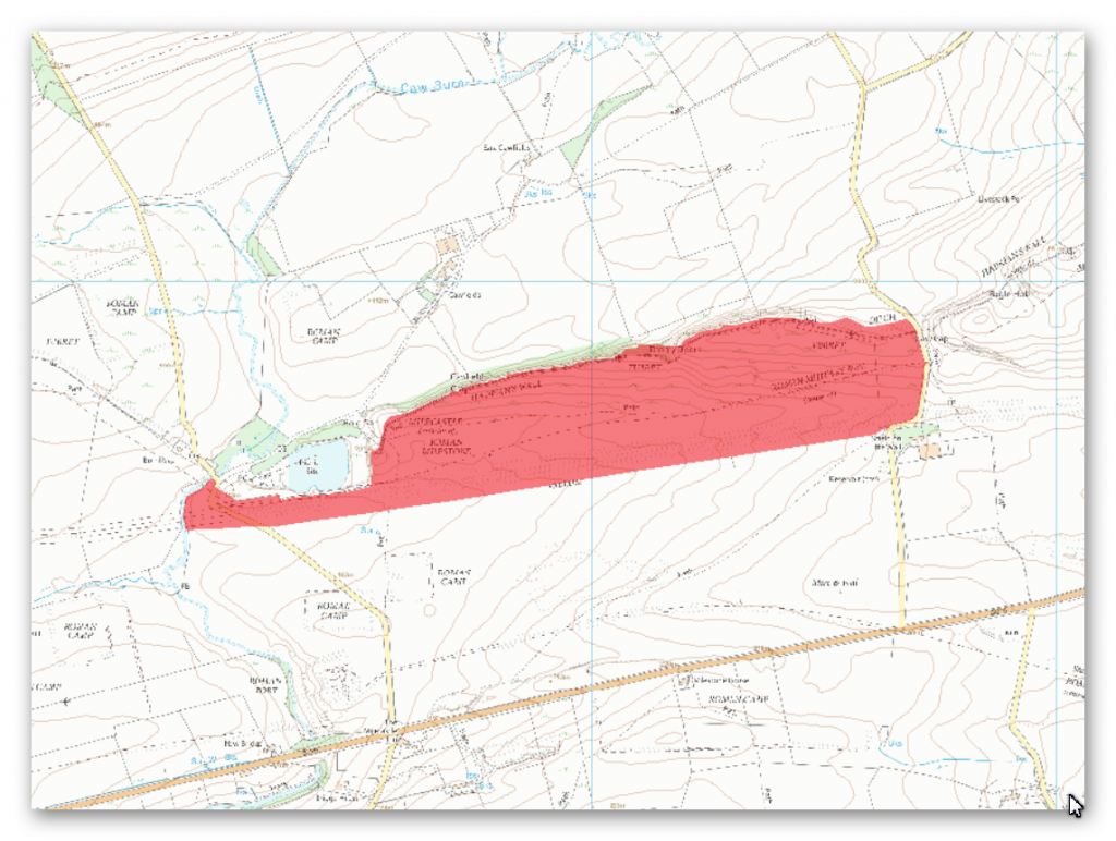
Section K – NY76NW – this is a section of Hadrian’s Wall showing the LiDAR, Google Earth and 1800 Maps of the Area covered by Historic England
Historic England Sections:
Name: Hadrian’s Wall and vallum between field boundary west of turret 37a and the Caw Burn in wall miles 37, 38, 39, 40, 41 and 42
List UID: 1010975, 1010974, 1010973, 1010932, 1010940, 1010966
Old OS Map
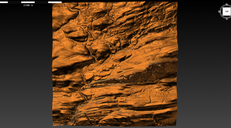
LiDAR Map
Google Earth Map
Historic England Scheduled Monuments within Section K
Name: Hadrian’s Wall and vallum between the road to Caw Gap and the Caw Burn in wall miles 41 and 42
Designation Type: Scheduling
Grade: Not Applicable to this List Entry
List UID: 1010975
Name: The vallum between the road to Steel Rigg car park and the road in Caw Gap in wall miles 39, 40 and 41
Designation Type: Scheduling
Grade: Not Applicable to this List Entry
List UID: 1010974
Name: Hadrian’s Wall, associated features and a Romano-British settlement between the road to Steel Rigg car park and the road through Caw Gap in wall miles 39 to 41
Designation Type: Scheduling
Grade: Not Applicable to this List Entry
List UID: 1010973
Name: Milestone House Roman temporary camp and section of the Stanegate Roman road
Designation Type: Scheduling
Grade: Not Applicable to this List Entry
List UID: 1010932
Name: Seatsides 1 Roman temporary camp and section of the Stanegate Roman road from the west side of the road from Once Brewed to the south side of the B6318
Designation Type: Scheduling
Grade: Not Applicable to this List Entry
List UID: 1010940
Name: Hadrian’s Wall and associated features between the field boundary west of turret 37a and the road to Steel Rigg car park in wall miles 37, 38 and 39
Designation Type: Scheduling
Grade: Not Applicable to this List Entry
List UID: 1010966
The monument includes the section of Hadrian’s Wall and vallum and their associated features between the road to Caw Gap in the east and the Caw Burn in the west. All the upstanding remains of Hadrian’s Wall, the milecastle and turrets in this scheduling are Listed Grade I.
Hadrian’s Wall runs along the crest of Cawfields Crags in this section and commands wide views to the north, south and west. The Wall survives well as an upstanding feature throughout the whole of this section, except for where it has been destroyed by Cawfields Quarry in the west. A number of changes in the thickness of the Wall are evidenced as offsets along this section. These may be the product of separate work gangs building up to each other. The Wall is consolidated for 1240m and averages 1.8m to 2.3m in width and 1.2m to 1.6m in height. It reaches a maximum height of 2.8m near Thorny Doors where it is 12 courses high. Both the north and south face are almost complete with only occasional gaps in the outer face. The Wall in this section is in the care of the Secretary of State. The wall ditch was only constructed in the areas between the crags which otherwise make a ditch superfluous.
Where extant the ditch survives on the ground as an earthwork measuring between 1.1m and 2.8m in depth. The ditch upcast mound, usually referred to as the `glacis’, also survives to the north of the ditch averaging 10.5m in width. Milecastle 42, or Cawfields, is situated on the crest of Cawfields Crags at the west end and commands wide views in all directions. It survives well as an upstanding stone feature which has been consolidated and is in the care of the Secretary of State. The milecastle straddles a steep south facing slope, 8m to 10m south of the steep north facing crags, and overlooks Hole Gap to the west. The internal dimensions of this milecastle are 17.8m east to west by 14.4m north to south. The walls are 2.8m thick and average 1.4m high. Both gateways of the milecastle are built in massive masonry. Excavations by Clayton in 1848 produced amongst other finds two inscribed stones, one an inscription dedicated to Hadrian and the other a reused tombstone.
Further excavations by Simpson took place in 1936. Turret 41a is located on the west side of Caw Gap with views to the north and south. It survives as an upstanding stone feature which has been consolidated and is in the care of the Secretary of State. Excavation by Simpson in 1912 located the doorway in the east side of the south wall. It had been dismantled and the Wall built across it during the reign of the Roman emperor Severus. Charlesworth’s excavations in 1967 confirmed the deliberate dismantling of the turret and the rebuilding of the Wall across its recess. Turret 41b is situated on Cawfield Crags west of Thorny Doors. It survives as a buried feature. It was located and excavated in 1912 by Simpson. The turret is included as part of the Wall in the care of the Secretary of State. Turret 42a was located at the west end of Cawfields Crags near to the Caw Burn. However, the large quarry has destroyed the section of Wall, including turret 42a, between Hole Gap and the Caw Burn. The former course of the Wall and position of the turret in this area is however known from the first edition Ordnance Survey map.
The course of the Roman road known as the Military Way, which ran along the corridor between the Wall and the vallum linking the turrets, milecastles and forts is known throughout this section except around Cawfields Quarry where its precise course has not yet been confirmed. It survives as a linear causeway which is most prominent at the east end of this section. Here it measures between 3.5m and 5.2m wide with a revetment containing large stones on the south side and with evidence of a stone kerb. Further west the causeway, where extant, averages about 0.1m in height and 7m in width.
Where there is no trace of the causeway the line of the road has been identified by changes in vegetation growth with grass growing less well above the former road surface. Around Cawfields Quarry the remains of the Military Way may have been destroyed by the quarry, however it is possible that here the Military Way was built on the line of the vallum, as it was further to the east at the crossing site of the Caw Burn and thus survives. About 200m east of milecastle 42 and 10m to the south of the Military Way is a fallen Roman milestone. It measures 1.38m high by 0.4m by 0.3m. It is oblong in shape and crudely rounded at the corners. This uninscribed milestone now lies in long grass. Two other milestones from this vicinity have been removed and are now in Chesters museum.
The vallum survives very well in this section as an upstanding turf-covered earthwork. It follows a straight course all through this section. The ditch averages 3m deep with a maximum depth of 3.8m in places. The north and south mounds average 2m in height with a maximum of 2.8m in places. They still follow a very straight course and can be seen to include large boulders in their make up. This is one of the best preserved continuous stretches of vallum.
The remains of a Roman watermill are situated on the east bank of the Caw Burn to the south of the Military Way. It is now covered by the Cawfields Quarry spoil heap and as a result there are no visible remains. Excavation by Simpson in 1907-8 showed that an artificial wood-lined channel had been cut across a bend in the stream and a weir constructed to direct water into it. A rectangular stone building measuring 7m by 4.8m was situated above the channel with its north west wall forming one side of the widened channel. Millstones and pottery were recovered during the excavation which allowed this undershot water mill to be dated to the third century AD. The millstones are now in Chesters museum. The whole complex was surrounded on three sides by a rampart and ditch. It was probably associated with the fort 750m to the west at Great Chesters.
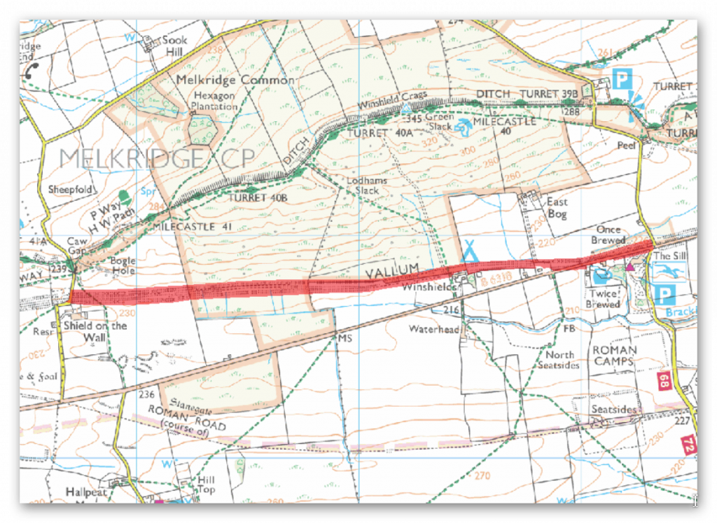
The monument includes the section of vallum between the west side of the road to Steel Rigg car park in the east and the west side of the road to Caw Gap in the west.
The vallum follows an almost level course throughout this section in the low ground south of Windshields Crags and north of the ridge which carries the Stanegate Roman road. The vallum survives well and is visible as an upstanding earthwork. The ditch averages 1m in depth, while the north and south mounds, which have been substantially reduced, average 0.3m in height.
Near Shield on the Wall the ditch has a maximum depth of 2m and the north and south mounds are 1m high. At Twice Brewed the B6318 overlies the vallum, running between the ditch and the southern mound. Parts of the north mound and ditch here have been destroyed by quarrying. About 1km west of Winshields farm a building platform is recesed into the vallum. It measures 22m long by 4m wide. The date and function of this building platform is not yet fully understood.
At Winshields farm the south mound and ditch have been destroyed by the farm buildings which overlie them. For this reason Winshields farmhouse and farm buildings are not included in the scheduling. All field boundaries, road surfaces and road signs are excluded from the scheduling, but the ground beneath them is included.monument includes the Roman fort at Carvoran and Hadrian’s Wall and vallum and their associated features between the road to Old Shield in the east and the field boundary west of Carvoran fort in the west.
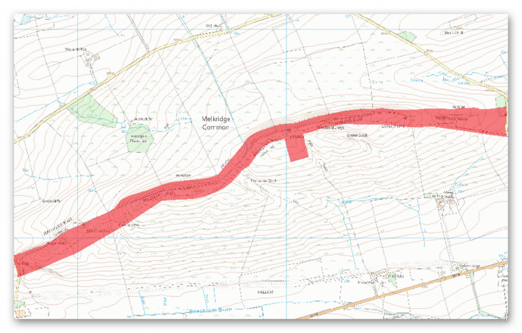
The monument includes the section of Hadrian’s Wall and its associated features between the west side of the road to Steel Rigg car park in the east and the west side of the road in Caw Gap to the west.
This section of Wall runs along the crest of the Whin Sill and commands extensive views to the north and south. All the upstanding remains of Hadrian’s Wall, the milecastles and the turrets in this scheduling are Listed Grade I. In this section Hadrian’s Wall survives intermittently as an upstanding stone wall. It has an average width of 2.2m and the wall face averages 1m high. Sections of wall core still stand up to 1.7m high. A 335m section of upstanding Wall 124m of which has been consolidated on Windshields Crags, including the turf-covered site of milecastle 40, is in the care of the Secretary of State. Elsewhere the Wall survives as a low stony mound with a field wall overlying its course. The steep crags render a defensive ditch superfluous and so the wall ditch was only constructed in the gaps between the crags. East of Winshields Crags the ditch is visible, surviving between 1.3m and 2.7m deep. The upcast mound from the ditch, usually known as the glacis, measures between 0.3m and 1m high here. In Lodhams Slack the ditch has a maximum depth of 1.8m. The glacis here is visible, but it has been heavily eroded. Milecastle 40 is situated to the east of Windshields Crags with wide views to the north, south and east. It survives as an upstanding feature with walls surviving as rubble and turf-covered banks, up to 1m high.
The milecastle measures 18.5m north to south by 15m across. Excavations by Simpson in 1908 found the south wall to be standing ten courses high. The excavations also demonstrated that the milecastle had undergone a number of rebuilding episodes. Traces of internal buildings were found in the west half together with an oven discovered in the south east angle. Milecastle 41 is situated to the east of Caw Gap on a west facing slope with wide views to the north and south. It survives as a turf-covered feature. The turf banks covering the walls are 0.5m high internally with an external scarp of up to 1.2m. The remains of robber trenches are marked by depressions. A post-medieval cottage was built on the site of milecastle 41. The remains of an enclosure associated with this cottage and visible as an upstanding feature still abut the east side of the milecastle. Its walls are 1m wide and 0.2m high. Two further platforms to the east may be the remains of buildings. A sub rectangular enclosure is located to the east of the milecastle and also survives as an upstanding feature. The enclosure measures 8.5m by 6m with walls 1m wide and 0.2m high. Earth and stone banks, up to 0.3m high, overlie the Military Way to the south east of the milecastle. All these features are probably part of the same settlement.
Turret 39b is located on the west side of the road to Steel Rigg car park at the foot of an east facing slope. It commands views across the hollow to the north and to the line of the Stanegate Roman road to the south. The turret survives as a buried feature. Excavation in 1912 by Simpson showed that it measured 5.75m north to south by 5m across. The turret was built with broad wing walls attaching it to the main Wall line. These wing walls were shown to have been built over with narrow wall. At some point the north wall of the turret was demolished and Hadrian’s Wall rebuilt across it to its full width. Turret 40a, which survives as a buried feature, is situated on almost the highest point along Hadrian’s Wall. It commands panoramic views in all directions. It was located in 1912 by Simpson. Excavation in 1946 by Stevens showed that it had been deliberately destroyed during the Roman period. It had narrow walls and a doorway in its east side. Turret 40b is situated on the summit of the hill to the west of Lodhams Slack. This site commands wide views in all directions. It too survives only as a buried feature. It was located in 1912 by Simpson. Excavation in 1946 by Stevens showed that the turret had narrow walls and that it was unusually wide, being 5.85m across internally.
The course of the Roman road known as the Military Way, which ran along the corridor linking turrets, milecastles and forts, is known throughout the length of this section even though for the most part there are few visible remains. Its course is marked usually by a slight causeway, up to 0.2m high, or by differing vegetation marks seen in grass colour. This differentiation in vegetation cover reflects differing growing conditions on the compacted road surface. It is best preserved where it crosses a gully running into Green Slack. Here it survives as a built up causeway, 1.7m high and 2m wide. South of milecastle 41 the causeway survives up to 0.7m high with kerb stones on its south side.
A shieling survives as an upstanding feature about 140m east of turret 40b. The walls of this triple-celled shieling exist as stony banks averaging 0.2m high. Its south side was built directly over the south kerb of the Military Way. Shielings are small huts used by shepherds on a seasonal basis usually during upland grazing in the summer months. They are characteristic of the medieval period in this area. An important group of shielings is known around Bogle Hole. They survive as rectangular structures averaging 4m across and of variable length. The stone walls survive as turf-covered mounds, 0.2m high. The remains of at least three probable Romano-British huts and associated features survive on the south side of Windshields Crags to the west of Green Slack. They were first noted by MacLauchlan in the 1850s. These rectangular buildings measure 5m by 2m internally with boulder walls between 0.5m and 1m wide and 0.5m high. All field boundaries, except those constructed directly on the line of Hadrian’s Wall, and road surfaces are excluded from the scheduling, but the ground beneath is included.
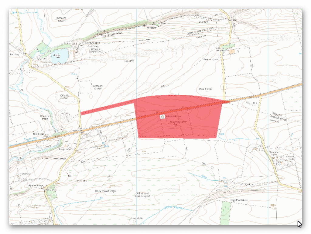
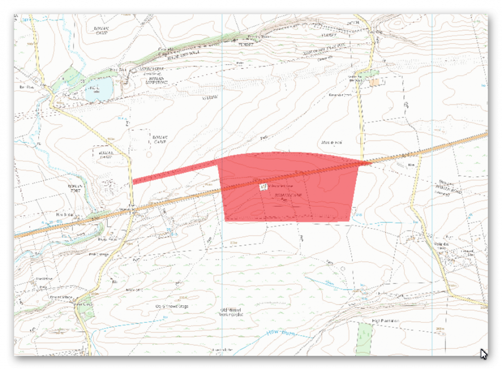
The The monument includes the Milestone House Roman temporary camp and a stretch of the Stanegate Roman road. They survive as upstanding earthworks. The road lies 340m south of Hadrian’s Wall vallum at its nearest point.
The camp occupies a low point between a succession of north facing limestone escarpments, and it is these which account for its irregular layout. The defences enclose an area of 7ha and are best preserved on the west side and the west end of the south side where the ramparts reach a maximum height of 1.2m above the bottom of the external ditch, which is 0.3m deep. There is no rampart visible on the north side, which is delimited by the edge of a natural crag, making a rampart superfluous. There are gateways in the central points of the south and west ramparts, each with external defence banks.
A gateway on the north east side is indicated by the presence of an external defence bank, though there is now no visible trace left of the adjacent rampart in this section. A later rectangular enclosure was constructed in the south east corner; its origin and purpose are not yet fully understood. Its internal dimensions are 37m from north to south by 75m east to west. A number of small, circular earthworks occur inside and outside the camp, ranging in diameter from 4m to 10m and about 0.3m high. These structures are probably the remains of simple limekilns, known locally as `sow’ kilns, used as recently as the beginning of the 20th century to produce lime for fertilizer.
To the immediate north of the camp lie the remains of a stretch of the main Roman east-west road, the Stanegate. Although disturbed by later hollow ways and stone robbing, its course is clear on the ground. The road runs along the high ground in the east, and then runs just to the south of the crest of the gentle ridge occupied by the Mare and Foal standing stones (the subject of a separate scheduling) and then along the ridge itself as it runs west towards Haltwhistle Burn. The road measures on average about 8m across throughout its course. Buried ditches flank the road on either side.
The monument includes the section of Hadrian’s Wall and its associated features between the field boundary west of turret 37a in the east and the west side of the road to Steel Rigg car park in the west. Hadrian’s Wall follows the crest of the Whin Sill throughout this section, which includes the steep rock outcrops of Hotbank Crags, Highshield Crags and Peel Crags. There are extensive views to north and south all along this section. The upstanding remains of Hadrian’s Wall, the milecastles and turrets are Listed Grade I, from Milking Gap to the road to Steel Rigg car park.
Hadrian’s Wall survives well as an exposed and consolidated wall for the larger part this section averaging 2m wide and 1.4m high. It reaches a maximum height of 2.75m at Sycamore Gap where there are 11 courses extant. Here there are also traces of original mortar and whitewash along the north face and in the wall core. Above Sycamore Gap on its west side is a section of bypassed broad wall foundations which measure 2.75m wide and two courses high on the east side and a single course high on the west side and is now consolidated and on display. Above Peel Crags the Wall is in poor condition though it stands up to 2.7m on its north side and up to 1.7m on the south side. Elsewhere in this section the Wall survives as a turf-covered mound averaging 2m wide and 1m high. Modern field walls overlie these turf-covered stretches of Wall.
The wall ditch was only constructed in the gaps between the crags, as the steep craggy scarps render a ditch superfluous here. Where it was constructed the ditch survives as a visible feature. At Milking Gap the ditch averages 10m wide and 1m deep. Excavations by Crow in 1986 to the west of the Roman tower at Peel Gap showed the ditch to be 9m wide and 2.3m deep with a level berm 9.5m across. At Peel Gap the ditch is less well preserved as a surface feature, though it averages 1m in depth. The ditch upcast mound, usually known as the `glacis’, is here visible only as a slight counterscarp. The glacis is better preserved at Milking Gap where it averages 6m wide. Milecastle 38 is situated on a west facing slope with views to the north and south. It is visible as a series of turf-covered mounds and it measures 18m north east to south west by 17.4m across. The turf-covered remains of the north east wall are 2.6m wide and 1.2m high. On the south and east sides robber trenches mark where the walls were located. These measure 3.6m wide and up to 1.4m deep.
There are traces of a rectangular building in the south west corner. The milecastle was partly excavated during 1935 by Simpson. Pottery found indicated occupation continued into the fourth century AD. Milecastle 39, known as Castle Nick, is positioned in a steep sided gap between Highshield Crags and Peel Crags with views to the north and south. It survives well as an upstanding stone feature and is now consolidated. It measures 19m long and about 15.5m across, though its overall width varies slightly at each end. The walls stand up to 1.75m high. The milecastle was partly excavated by Clayton and later by Simpson. However, excavations by Crow between 1985 and 1987 produced a detailed understanding of the milecastle and its internal structures and their development over time. Early barrack blocks were later replaced by individual small buildings with curved porches, probably designed as wind breaks. The pottery sequence showed that the occupation of the milecastle was continuous and ended probably sometime in the fourth century AD. An 18th century milking parlour was later constructed in the north west part of the milecastle.
The milecastle excavation produced many small finds including pottery, coins, and metalwork which included short swords and lances, together with gaming boards and pieces. Turret 37b is located on the crest of Hotbank Crags with very extensive views in all directions. It survives as a turf-covered platform. The platform measures 6.3m north to south and 10m across and is up to 1.4m high. There is a small enclosure on the east side of the platform which appears to abut both the south side of the Wall and the east side of the turret wall. It could therefore be contemporary with the Wall and may have served as a small stable. It was located in 1911 by Simpson. Turret 38a is located on the west side of Milking Gap on an east facing slope. It commands extensive views to the south and directly overlooks Crag Lough to the north. It survives as a buried feature below the turf. It was located in 1911 by Simpson. Turret 38b is located on Highshield Crags and also has extensive views in all directions. It survives as a turf-covered platform. The platform measures 6.8m north to south and 13.4m across. There is an internal scarp up to 0.3m high. This turret was also located by Simpson in 1911.
Turret 39a is located on the crest of Peel Crags and commands wide views in all directions. It is visible as a slight rectangular hollow about 0.2m deep. The turret was located in 1909 and excavated in 1911 by Simpson. Its walls were of narrow gauge and were found to have been demolished and the Wall built over its entrance indicating that it fell out of use during the Roman period. A platform, probably for a ladder, was positioned in the south west corner. The remains of a man and a woman were found buried in the north west corner. Burial in such a place was against Roman law and as such these could be the remains of an unlawful event. A Roman tower is positioned in Peel Gap on Hadrian’s Wall with limited views to the north and south. Unusually it is located between the two turrets 39a and 39b. It survives as consolidated stone foundations. It was discovered by Crow during investigation and clearance of the Wall in this section in 1986. This additional tower was later than the Hadrianic narrow wall. Finds from inside and outside the tower showed that it had a similar structural history and use to the neighbouring turrets. Hearths and a ladder platform were found in the interior. Wall mile 39 is a particularly long one as the distance between turrets 39a and 39b exceeds by over 200m the normal spacing of 494m from turret to turret.
The Peel Gap tower lies exactly midway between these turrets implying that spacing was the most important factor determining its location. As an observation post it is in a very poor position. A medieval tower is located in Peel Gap abutting Hadrian’s Wall. It was probably part of the original pele tower which gave its name to the modern farmhouse and adjacent crag. It survives as a slight platform with excavation trenches and spoil heaps, up to 0.4m high. It was excavated by Simpson in 1911 who recovered medieval green glazed pottery from the interior.
The course of the Roman road known as the Military Way, which ran along the corridor between the Wall and the vallum linking turrets, milecastles and forts, survives well as a linear causeway throughout this section. Some stone is visible on the south scarp where it has been built up to make a level surface. This scarp appears to have had a stone revetment. The south scarp averages 0.4m in height, although it reaches up to 1.2m high in places. West of Peel Farm the Military Way is overlain by the road to Steel Rigg car park. To the south of Sycamore Gap are the remains of a prehistoric field boundary running roughly from north to south, probably dating to the Bronze Age.
The Roman Military Way overlies this boundary which indicates that it is certainly pre-Roman in date. The peat bog, which has grown over remains of this boundary further to the south, is of Bronze Age origin. A second boundary is located running transversely to the Sycamore Gap boundary, to the west of it, south of the Military Way. Their assumed junction is masked by the peat bog which has built up to the south.
These boundaries survive as sinuous linear features of low stone banks, averaging 1.2m wide and 0.5m high. A small irregular field system is situated to the south of milecastle 39. It takes the form of two roughly rectangular paddocks linked by an axial boundary. The boundaries survive as upstanding features. They are constructed from roughly coursed boulders standing up to 1m wide and 0.45m high. They are of a form usually considered to be medieval.
The axial boundary runs up to the south east corner of the milecastle showing that it is later than the milecastle in date. There are ten shielings located within this section of the Wall. Shielings are small shepherds’ huts which were used on a seasonal basis usually during upland grazing in the summer months. They are characteristic of the medieval period in this area. There are five free standing shielings located between Castle Nick and Sycamore Gap. Their dry stone walls average 1m in width and 0.4m high. A group of three shielings with multiple phases are located 50m east of milecastle 39 abutting the south face of Hadrian’s Wall. These were discovered during excavations between 1985 and 1987 by Crow. Their walls average 0.6m wide and 0.4m high. They are now consolidated and are visible as stone features. Two further shielings are situated 120m east of turret 38a. They survive as low stone structures and are situated to the immediate south of Hadrian’s Wall. The largest and easternmost of the two measures 9m by 3m with traces of an entrance in its south wall. The walls of both shielings stand up to 0.3m high. On either side of the last pair of shielings is an irregular enclosure abutting the south face of Hadrian’s Wall. They survive as upstanding stone features. The larger and westernmost of the two enclosures measures 28m east to west by 5m wide. Its walls are constructed from roughly coursed boulders which stand up to 0.4m high.
The much smaller enclosure to the east also has walls made from roughly coursed boulders up to 1.5m wide and 0.4m high monument includes the Milestone House Roman temporary camp and a stretch of the Stanegate Roman road. They survive as upstanding earthworks. The road lies 340m south of Hadrian’s Wall vallum at its nearest point. The camp occupies a low point between a succession of north facing limestone escarpments, and it is these which account for its irregular layout. The defences enclose an area of 7ha and are best preserved on the west side and the west end of the south side where the ramparts reach a maximum height of 1.2m above the bottom of the external ditch, which is 0.3m deep. There is no rampart visible on the north side, which is delimited by the edge of a natural crag, making a rampart superfluous.
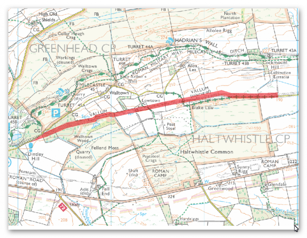
The monument includes the section of vallum between Cockmount Hill in the east and the west side of Walltown Wood in the west. For most of its length the vallum survives as an upstanding earthwork.
However, south of Allolee where its remains are not generally visible above ground, traces have recently been identified by the Royal Commision on the Historical Monuments of England. The presumed course as shown on Ordnance Survey maps is thus now known to be incorrect.
The scheduling respects the new known alignment here. Where it survives as an earthwork the vallum ditch averages 1m deep with a maximum depth of 2.7m in places. The north mound averages 0.8m high and the south mound 0.4m. Good examples of crossing points positioned at 37m intervals are visible throughout this section.
Where the ditch was cleaned out during the Roman period a marginal mound, formed of the removed ditch silts, was built up in places. It survives intermittently in this section, averaging 1m high. South of Allolee Farm ploughing has reduced the vallum earthworks to slight undulations. The ditch here is completely silted up.
An excavation trench was cut across the vallum in 1939 by Simpson and Richmond at Cockmount Hill, but the precise location of this trench is not known. This work indicated that a causeway across the vallum was revetted with turves, and that the sides of the ditch had already weathered back prior to the building of the causeway, indicating that the building of the causeway was later. The area of vallum within Walltown Woods is situated on a spring line with drainage channels cut across the banks. Otherwise it survives well in the woodland.
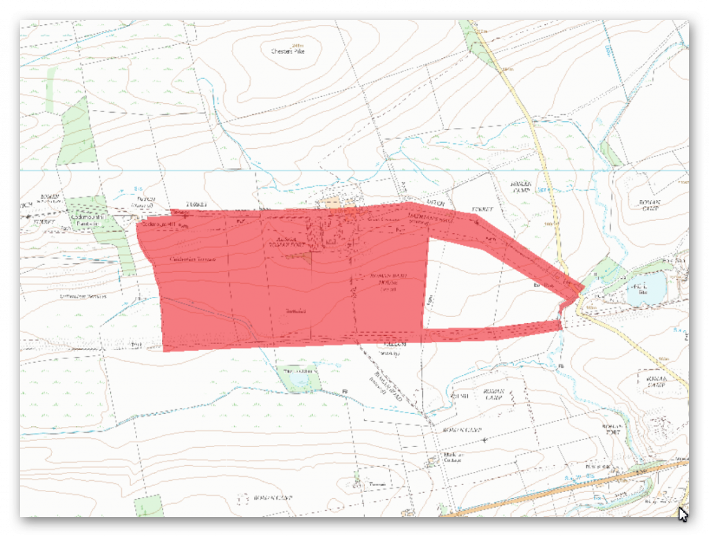
The monument includes the section of Hadrian’s Wall and vallum and the Roman fort at Great Chesters and their associated features between the Caw Burn in the east and the track to Cockmount Hill farm in the west. All the upstanding remains of Hadrian’s Wall, the milecastle and turrets are Listed Grade I.
Hadrian’s Wall survives as a low stony mound throughout much of this section. It is visible as a turf-covered scarp 0.2m high with a modern field wall overlying its course. The farm buildings at Great Chesters east of milecastle 43 partly overlie the Wall in this area. West of Great Chesters fort the course of the narrow wall survives as an amorphous rubble strewn mound 3m to 4.8m wide and 1.1m high. In addition the line of the broad wall here survives as a separate north facing scarp. Excavations here in 1925 revealed that the narrow wall runs south of the broad wall foundation from Great Chesters as far as turret 43a where they converge. Beyond turret 43a they run parallel again as far as Cockmount Hill Wood where their courses again converge. To the west of Burnhead camp a section of unconsolidated exposed Wall, 38m long and 1.8m wide, stands between two to six courses high being up to 1.5m high on the inner face.
The wall ditch survives a visible earthwork throughout most of this section. It averages between 0.8m and 2m in depth with near vertical sides in places. Large boulders protrude from the scarps intermittently along its length. The ditch at Great Chesters is overlain by farm buildings which are excluded from the scheduling, although the ground beneath them is included. The ditch is not visible either side of turret 43a, suggesting that it has silted up leaving no trace on the surface. The ditch upcast mound, usually referred to as the `glacis’, survives to the west of Great Chesters fort as a broad low mound, 0.3m high and 8m wide, on the north side of the wall ditch. Milecastle 43 is situated on a ridge later occupied by the fort of Great Chesters which commands views to Chesters Pike in the north, the Stanegate Roman road to the south and the Caw Burn to the east. The milecastle survives as a buried feature below the turf cover. It was located during excavation at Great Chesters in 1939 by Simpson and Richmond. Turret 42b is situated on a gentle east facing slope to the west of the Caw Burn. It survives as an uneven turf-covered platform, up to 0.6m high. The surface remains show evidence of digging and stone robbing. The turret was first located in 1912 by Simpson. Turret 43a is thought to be situated about 150m east of Cockmount Hill farm. There are quantities of wall debris strewn over the grass-covered bank of the Wall at this location which may obscure any slight surface remains of the turret.
The site of the turret was first suggested in 1912 by Simpson, but its position has not yet been verified. The course of the Roman road known as the Military Way, which ran along the corridor between the Wall and the vallum linking the turrets, milecastles and forts, survives intermittently as an upstanding feature throughout this section. Its course from the Caw Burn is known where it survives as a low turf-covered mound, 6m to 8m wide and 0.2m to 0.5m high. Occasional sections of this low turf-covered causeway reappear on the line up to the east gateway of Great Chesters fort. Beyond the field boundary west of the fort the Military Way is visible again as a discontinuous terrace with a slightly sinuous course which avoids the rock outcrops. Field gates are positioned on its course at the east and west end of this stretch. A road linking the Military Way and the Stanegate Roman road to the south via Great Chesters fort is overlain by the modern trackway to Great Chesters Farm which enters the fort through the south gateway.
The vallum survives as an upstanding earthwork in the west half of this section, but in the east half it is only recognisable as an intermittent mound and ditch and by occasional discolourations in the vegetation. In the west half of the section the north mound averages 0.8m high, the ditch 0.5m to 0.9m deep and the south mound 1.2m high. Here crossings of the vallum are still to be seen at approximately 37m intervals. An excavation trench was cut across the vallum in 1939 by Simpson and Richmond at Cockmount Hill, but the precise location of this trench is not known. It was revealed that a causeway across the vallum was revetted with turves, and that the sides of the ditch had already weathered back prior to the building of the causeway, indicating that the causeway was later.
Between Great Chesters fort and turret 43a are the remains of three separate shielings abutting the south side of the narrow wall, which survives here as a turf-covered mound. The shielings are visible as turf-covered dry stone foundations. Their walls measure between 0.6m and 2.1m wide and up to 0.3m high. Shielings are small shepherds’ huts usually associated with upland grazing during the summer months. They are characteristic of the medieval period in this area. Great Chesters Roman fort, known to the Romans as Aesica, is situated on a low ridge overlooking the Caw Burn to the west. It measures 129m by 109m across its ramparts and encloses an area of 1.36ha. It was one of the last forts to be built, being attached to the rear of the Wall, like Carrawburgh, and was completed between AD 128 and AD 138. It is visible as a series of upstanding turf-covered remains.
The most obvious features are the turf- covered ramparts and the defence ditches, there being no less than four on the most vulnerable west side. The buildings of Great Chesters farm overlie the north east corner of the fort. There have been a number of excavations of the fort, all of which have now been backfilled leaving amorphous mounds and depressions on the ground surface. These excavations have recorded the remains of the headquarters building, commanding officer’s house, barrack blocks and lean-to structures against the inside of the fort walls. A vaulted chamber was discovered in the headquarters building which is on display in the centre of the fort. The west tower of the south gate has yielded an important hoard of jewellery which includes an enamelled brooch shaped as a hare and a gilded bronze brooch considered to be a masterpiece of Celtic art. A number of stone ballista balls were found beside the north west angle-tower when first excavated in 1894. A number of building inscriptions have also been discovered.
Traces of the civil settlement outside the fort, usually referred to as the vicus, have been identified to the south and east of the fort. Horsley, writing in 1732, mentioned that, `the outbuildings are most considerable to the south side….there are vast ruins of buildings in this field’. There is a series of building platforms terraced into the slope to the south east of the fort either side of a long scarp running from the south east corner of the fort to the bath house. The most prominent platform contains a section of upstanding exposed walling. The field to the south of the fort has been ploughed for many years and there are no upstanding features visible except for a slight platform close to the field wall south of the fort. However, bearing in mind the examples of the better known vicus sites at Housesteads and Vindolanda it is expected that the vicus remains at Great Chesters will survive as buried features in the field to the south of the fort and possibly more extensively. The remains of a bath house 110m due south of the south east angle of the fort were visible until the end of 1987 when they were back filled to the surrounding ground level by English Heritage to avoid further deterioration. The bath house was excavated in 1897 by Gibson and again in 1908 by Simpson and Gibson. The excavations showed that it conformed to the usual design of military bath houses with the various hot, cold and intermediate rooms, together with furnaces, flues and a hypocaust system. It survives as a buried feature.
The exact location and extent of the cemeteries directly associated with this fort are not yet confirmed with certainty. There are two cemeteries to the south of the vallum; one at Wall Mill and one at Four Laws, both of which are the subject of separate schedulings. However, a burial mound is located approximately 240m south west of the fort. This round burial mound is similar in form to burial mounds found near Housesteads and Vindolanda. Together with a number of inscribed tombstones found during excavation of the fort interior it seems that there was a cemetery associated with Great Chesters to the south of the vicus and north of the vallum in addition to the known cemeteries at Wall Mill and Four Laws.
There is a series of cultivation terraces running parallel with the contours approximately 350m west of the fort. There are at least six terraces identifiable in this group all of which survive as upstanding turf-covered earthworks. They are directly comparable to the examples at Housesteads which have been confirmed as Roman in date, which like these are also situated on a south facing slope. Some of these cultivation terraces are overlain by post- medieval narrow ridge and furrow indicating a succession of land use in this area over time.
Investigation
The Vallum in this section changes from a simple ditch with two banks into a double ditch with three banks then back again into a single double banked structure totally unnoticed it seems by archaeologists?
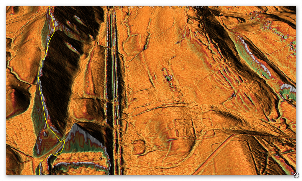
The arguments for this third bank are limited – it could be a defensive barrier initially before the construction of the Wall that is in entirely a different altitude and location. But the location is bad as it is at the bottom of a hill giving it a week defensive position. The alternative is that two ditches were required due, which suggest a more practical aspect of the Vallum as a transport structure from the massive quarry which lies just at the start of the enlarged Vallum which may have been a canal before one of its banks was converted to a roadway at a later date, which the discovery of milestones on the line of the Vallum my support.
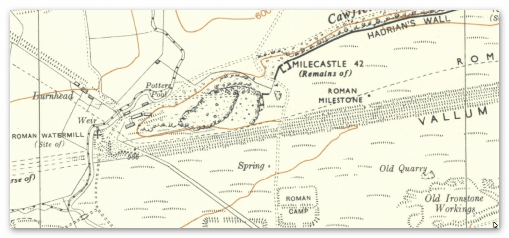
The mystery around Military Way ends in this section as it for once becomes evident from Great Chesters to the extreme. While Stanegate confuse on this section as it seems to miss all the Roman Camps and is positioned 1/3 down the high ground rather than in top of the hills?
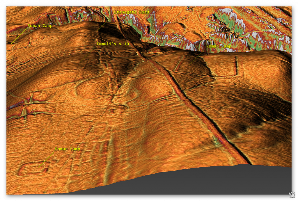
Stanegate also gets very close to the multiple barrows of ‘Four Laws’:
Summary : The earthwork remains of a probable Roman barrow cemetery of 13 barrows, in various states of preservation, part of a much larger cemetery. Centred NY 7042 6595 – remains of 8 tumuli, varying in diameter from 3.0 to 8.0m., and in height from 0.2 to 0.8m. All have a surrounding ditch, or shows traces of a ditch. All have an outer bank 1.0 to 2.0 m wide, and 0.1 to 0.5m in height. Many bear evidence of having been dug into from the side. All are turf covered. None show retaining circles of stone. At least two, probably all, are constructed of earth and small stones. Five tumuli centred at NY 7047 6595 have been ploughed out, and no trace remains.
They could also have been prehistoric barrows from their location and the fact they are so far away from the Wall and Vallum where Roman Barrows have been found (next to Military Way) which would seem more archaeological sound? If these are Prehistoric Barrows then it can be assumed that Stanegate is a prehistoric Dyke that was reused by later societies like the Romans by utilising its bank as a road.
What we find from the LiDAR maps is that there is absolutely no real evidence of Military Way – which is reflected in the fact that it doesn’t exist in the original large scale OS maps and was added in the 1920’s as a theory with real archaeological support as we now see – this is the same in both East and West of this 5km section of the wall.
As for Stanegate Road – after it missed the Fort and went into the River Valley (although OS maps have continuing to the next Fort in the area – LiDAR catches it coming out of the River Valley AFTER the Fort and then going off East.
We have also investigated the scheduled Roman Aqueducts that is report to feed water into the Geat Chester fort on this stretch of the wall:
Great Chester Aqueduct part II
To understand the problem with Hadrian’s Walls history read our article HERE.
Further Reading
For information about British Prehistory, visit www.prehistoric-britain.co.uk for the most extensive archaeology blogs and investigations collection, including modern LiDAR reports. This site also includes extracts and articles from the Robert John Langdon Trilogy about Britain in the Prehistoric period, including titles such as The Stonehenge Enigma, Dawn of the Lost Civilisation and the ultimate proof of Post Glacial Flooding and the landscape we see today.
Robert John Langdon has also created a YouTube web channel with over 100 investigations and video documentaries to support his classic trilogy (Prehistoric Britain). He has also released a collection of strange coincidences that he calls ‘13 Things that Don’t Make Sense in History’ and his recent discovery of a lost Stone Avenue at Avebury in Wiltshire called ‘Silbury Avenue – the Lost Stone Avenue’.
Langdon has also produced a series of ‘shorts’, which are extracts from his main body of books:
For active discussions on the findings of the TRILOGY and recent LiDAR investigations that are published on our WEBSITE, you can join our and leave a message or join the debate on our Facebook Group.


Pingback: Hadrian’s Wall LiDAR investigation - Prehistoric Britain