Stonehenge Solved – Pythagorean maths put to use 4,000 years before he was born
Contents
Introduction
Suppose we examine the skills of what traditional archaeologists call the ‘Megalithic People’ – the civilisation that created the first stone monuments. We notice that to achieve such grand constructions, they would have required advanced mathematics, which to date has been credited to the ancient Greeks. By undertaking a closer, detailed analysis of monuments such as Stonehenge and, more importantly, the mathematics used to design them, we can see that these constructions, which are approximately ten thousand years old, were based on sound and accurate trigonometrical theory.(Stonehenge Solved)
How was Stonehenge planned, and what can we infer from the ‘blueprint’ about the knowledge of mathematics that they possessed?
The Stonehenge Blueprint
Firstly, Stonehenge was built in two distinct phases. Current archaeologists are confused by the monument and the dating of the structure; therefore, if you read or browse the internet, you will see the ‘traditionalist’ quote referring to three to five phases. Moreover, these phases occurred AFTER the original monument was abandoned, and thousands of years later, the ritualistic Celts occupied the memorial and used it to worship the Sun and the Summer Solstice, as we see re-enacted today during the summer solstice.
The First Phase took place around 8300 BCE, when our ancestors built the original ditch, composed of individual pits cut below the ancient groundwater table level to create a moat. This moat was used with the Bluestones to bathe away infections from cuts and bites, which would have turned into gangrene and lethal fevers if left untreated. Bluestones (when wet) release chemicals, including the most potent natural antiseptic – rock salt..(Stonehenge Solved)
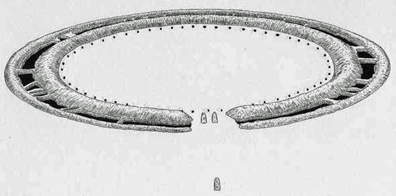
The most remarkable aspect is the accuracy of the diameter of this moat, which is precisely 360 ft (109.73m). This length is no accident or coincidence; it is the reason that our angular and trigonometrical system revolves around 360!
We have 12 months a year, and each has a lunar cycle that lasts (from New Moon to New Moon) 29.53 days. There were 56 Bluestones (2 x 28), and we can demonstrate that this was used as a highly accurate (99.8%) moon and eclipse calendar, which could compensate for the 0.47-day discrepancy between the moon cycle and a 30-day standard cycle. It is, therefore, no surprise that the most ancient of calendars are 12 x 30 = 360 days in length.
In history, we know that in the eighth century BCE, civilisations worldwide either discarded or modified their old 360-day calendars. The 360-day calendars had been in use for the majority of the past millennium. In many places, month lengths immediately after that change were not fixed but were based instead upon observing the sky.
Priest-astronomers were assigned the duty of declaring when a new month began – it was usually said to have started at the first sighting of a new moon. The length of a month at that time was simply the number of days that passed from one new lunar crescent to the next.
For example, during those years in Rome, a Pontifex (priest) observed the sky and announced a new moon and, therefore, the new month to the king. For centuries afterwards, Romans referred to the first day of each new month as Kalends, derived from their word calare (meaning “to announce solemnly” or “to call out”). The word calendar is derived from this custom.
The ancient Babylonians, around 4000 BCE, used a calendar with alternating 29-day and 30-day months. This system required the addition of an extra month three times every eight years. As a further adjustment, the king would periodically order the insertion of an additional month into the calendar. However, it is interesting that the monument becomes a ‘time capsule’ from our ancestors, showing us that they understood the mysteries of mathematics. When a circle, a diameter of 360 ft has a moated circumference (the area around the edge of the circle) of 1130 ft in length. So if we divide the measurement around the edge 1130 by the diameter 360, we get a fascinating number 3.14 – why is this absorbing, because it’s what we know as PI or 3.14159!! .(Stonehenge Solved)
Did the builders of Stonehenge leave us a message in stone?
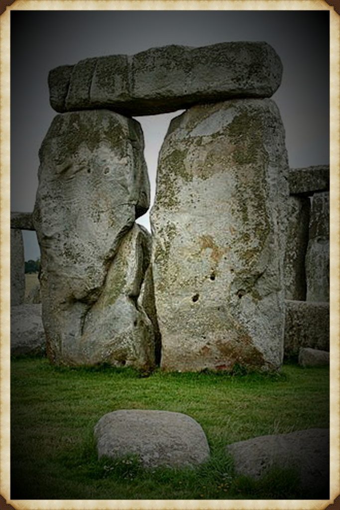
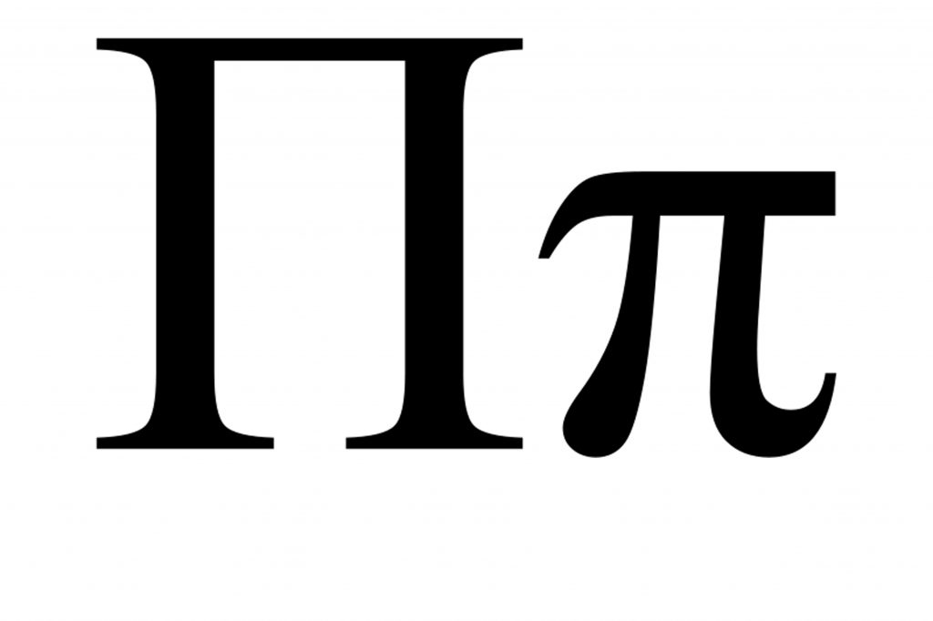
No one knows who invented Pi, yet the Ancient Greeks used this unusual symbol to denote pi – does it remind you of some monument we have been discussing? Why would the Greeks use such a symbol to represent the relationship of a circle to its diameter? Indeed, you would use something round, not a classic trilithon symbol as found at Stonehenge – unless, of course, that’s where it was first used!
Now, 360 is also an exciting number when it comes to circles, as there are 360 degrees in a circle. This is a particular number, for if you were to pick a standard number to determine the degrees in a circle, would you not opt for something more manageable and obvious to remember and use, like 360?
Such a number is not suitable for trigonometry, as a standard right-angle triangle with a 360-degree circle has 90-60-30, which allows for simple mental math calculations, such as determining the sides of a triangle. For if it were based on a 100-degree circle, the triangle angles would be 25 – 16.66 – 8.33, and the ability to calculate angles in your head or as an approximation (no electronic calculators in the Stone Age) would be far more complex.
The logic behind linking the degrees (or days) in a circle or solar year is evident and is reflected in humanity’s earliest stone constructions, such as Stonehenge. However, Pi is only the start of this amazing construction, and the work attributed to Pythagoras in the past must now be questioned..(Stonehenge Solved)
Phase II construction
Four thousand years after the original Phase I Circle was constructed with the 58 Aubrey Holes that held Bluestones from the Preseli Mountains in Wales. These stones were used for mapping the 360-day lunar calendar; they decided to erect an additional central monument.
In the second book of the Prehistoric Trilogy: ‘The Stonehenge Enigma’ – I proved that this monument was a temple to the dead of Doggerland, who died in an earthquake and subsequent tsunami in about 4200 BCE, as recorded within Plato’s dialogues. Like a relief map of Doggerland (Slaughter Stone) and the Altar Stone (both are the only two deliberate recumbent stones), which directly point to the ancient island and were included at the time of construction..(Stonehenge Solved)
Phase II of this construction included a new entrance causeway surrounded by moats known today as ‘The Avenue’, which led to the Neolithic shoreline in the dry river valley at Stonehenge Bottom. This 600 m ‘road’ was used not only to transport people to the monument, but also to move the larger Sarsen stones (weighing up to 16 tonnes) by boat from the Marlborough Downs near Avebury to the new monument at Stonehenge, a distance of between 20 and 25 miles.
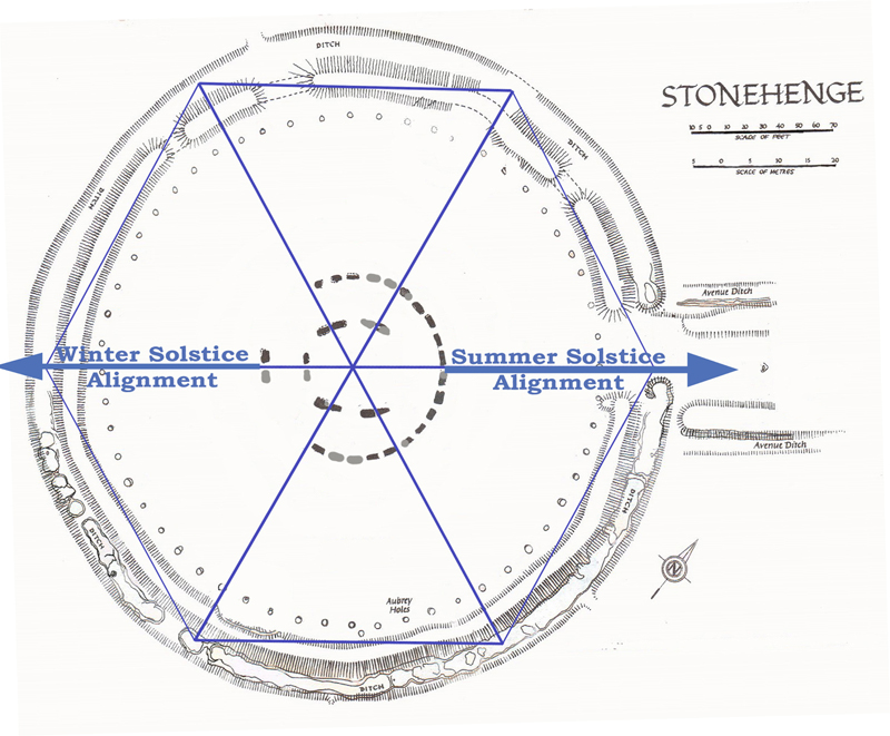
However, rather than just building any road to the shoreline, they decided to make it along an alignment that marks the longest day of the year—the Summer Solstice. This day was significant for our ancestors as it corrected the 360-day lunar calendar to align with the solar calendar, which is five days longer (365 days, which we use today). In the centre of The Avenue, they placed two stones (which are now missing) that are in exact alignment with the sunrise when this monument was first constructed.
This alignment provides us with the ‘best’ date for the construction of Stonehenge (as carbon dating is not possible for the stones or the stone holes) and confirms the date of Doggerland’s demise at 4200 BCE.
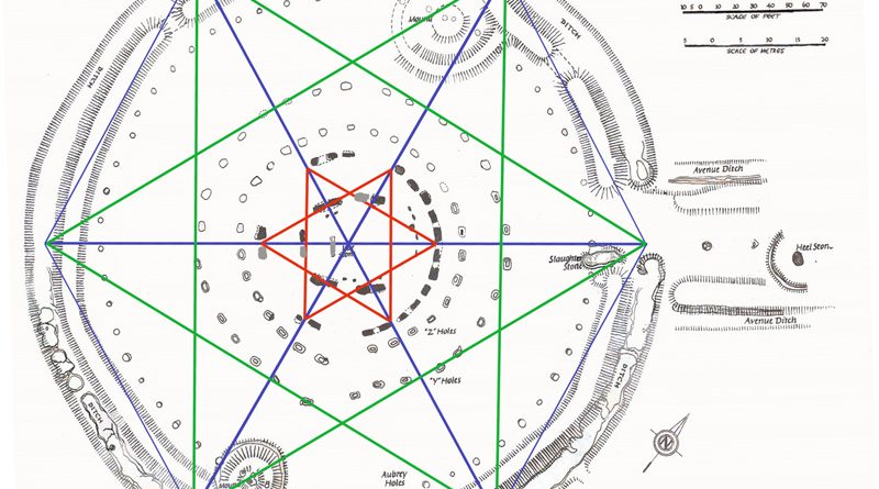
What we have now is our first ‘chord’ alignment, which corresponds to the diameter of the Stonehenge ditch and the starting point of the circle, aligning with The Avenue..(Stonehenge Solved)
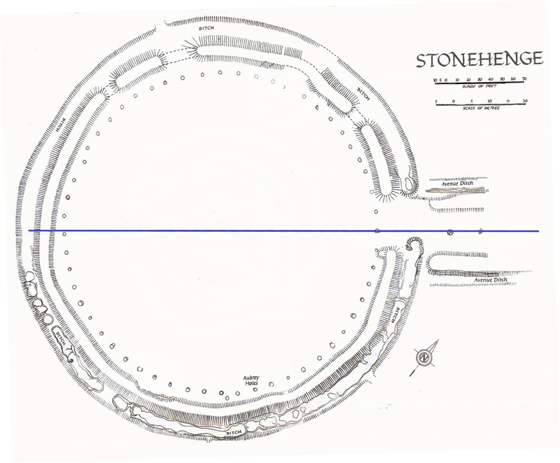
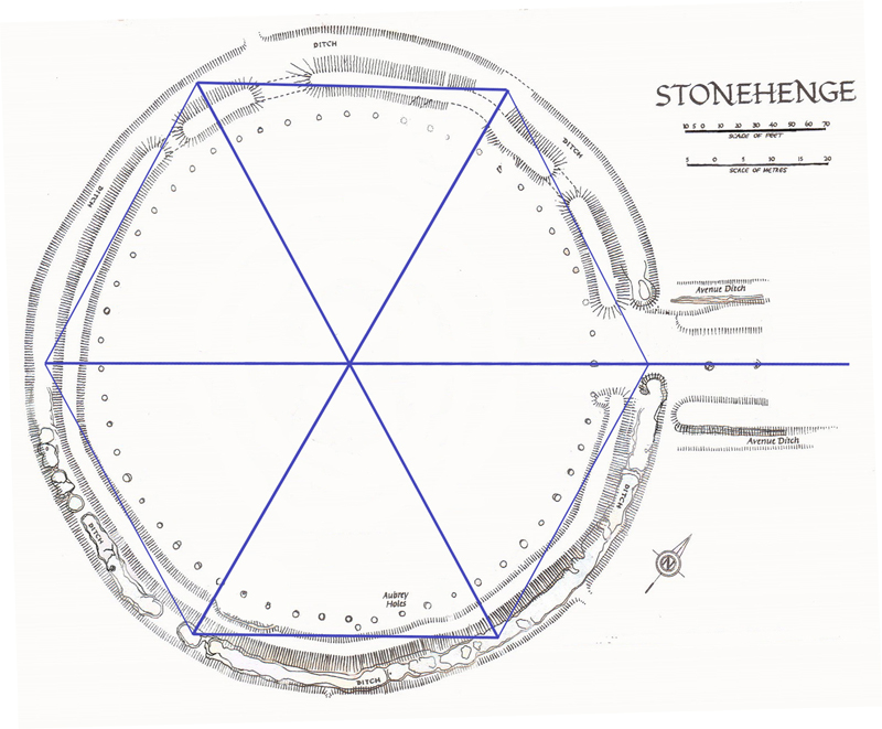
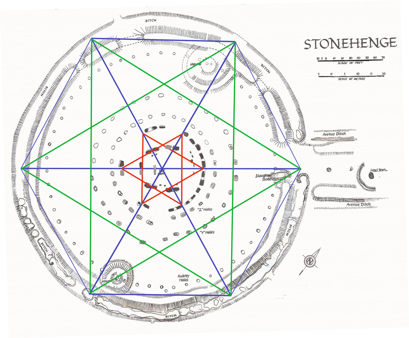
From this start, they then sub-divided the circle up into six portions called a ‘Hexagram’ in mathematical terms for as we will show you in the book ‘Dawn of the Lost Civilisation’, the number six and its multiples are significant to our ancestors.
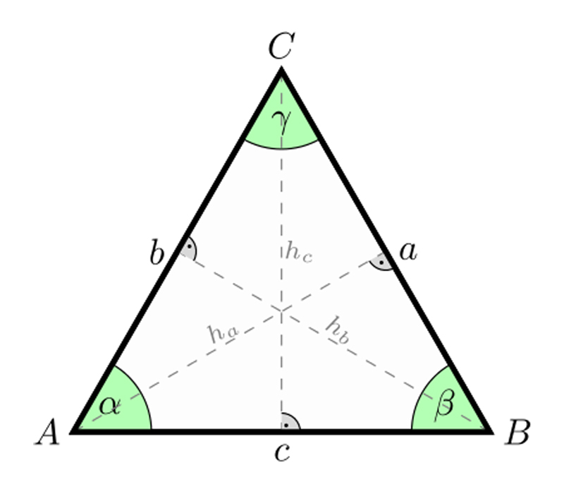
The Hexagram was constructed by a series of strings of the same length (centre of the monument to the ditch), creating six ‘equilateral’ triangles, with all three sides the same length, and therefore all three angles are of 60 degrees.
A crescent of stones was then formed for the monument for the temple was dedicated to the dead and, therefore, would have represented the crescent moon, NOT the Sun as some currently believe, for this adaptation occurred when later Druids altered the site by adding smaller stones and re-positioning the outer circle of bluestones.
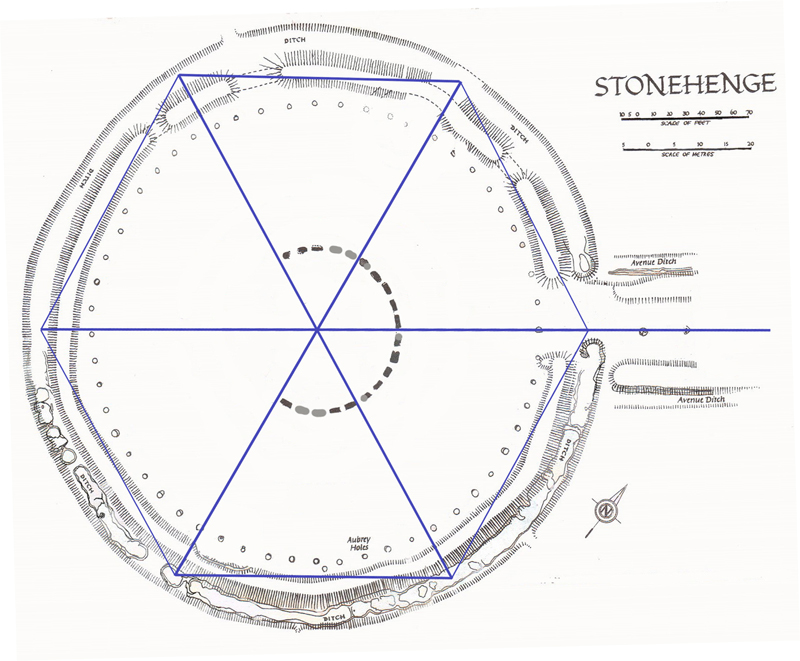
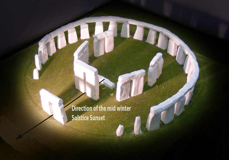
Then the five pairs of the trilithon stones in the inner horseshoe were added, making sure the gaps between the stones followed the alignment corresponded to the hexagram design. Lastly, the smaller outer circle trilithon which was aligned with the winter solstice sunset, was added to complete the monument.
Belief System
The Hexagram is a mandala symbol called satkona yantra or sadkona yantra found on ancient South Indian Hindu temples. It symbolises the nara-narayana, or perfect meditative state of balance achieved between Man and God, and if maintained, results in “moksha,” or “nirvana” (release from the bounds of the earthly world and its material trappings).
Is this what we see in the construction of Stonehenge – humanity’s first religious beliefs of ‘Man’ the bottom triangle pointing up and God or Spirit world the triangle pointing or looking down? .(Stonehenge Solved)
We know about Stonehenge that it was a temple to the dead of Doggerland constructed at the same time that Doggerland was swamped by the rising sea levels we are still experiencing today. This disappearing peninsula started to erode some ten thousand years ago, directly after the last Ice Age had ended and the seas began to rise, which over the course of the next six thousand years left this once mighty land as a small island Plato called Atlantis..(Stonehenge Solved)
So, why is a foot 12 inches and what is the unit of measurement to do with the builders of Stonehenge?
Another ‘Thing that doesn’t make sense in History’ is the ‘Foot’. We call it an ‘imperial unit measurement.’ But where does it come from?
Wikipedia will tell you:
Historically the foot, which was used in Ancient Greece, Ancient Rome, England, Scotland and many Continental European countries and which varied from country to country and in some cases from city to city, was part local systems of units. Its length was usually between 250 mm and 335 mm and was generally, but not always, subdivided into 12 inches or 16 digits.
We know it’s old, but we have no idea who invented it or why they divided the unit into 12 or 16 inches or digits. As we have already stated, the Stonehenge moat is 360 feet wide, and we have demonstrated that it was constructed using a system of simple strings in a hexagonal pattern.
So, how would the first civilisation measure distance?
The most natural way to measure distance is with your own body. How many times do we measure another imperial unit of measurement called a yard quickly, without a ruler or other measuring device? – We take a big step. In sports, we see linemen and referees mark out, say, a 10-yard penalty by taking ten long strides or measuring from the tips of their fingers to the middle of their chest, which is approximately 3 feet (depending on the height of the individual). So, it’s not quite rocket science to understand that physical attributes were the first units of measurement, so let’s go back to the foot. Can we make a good guess where the measurement foot comes from and what physical form it refers to?
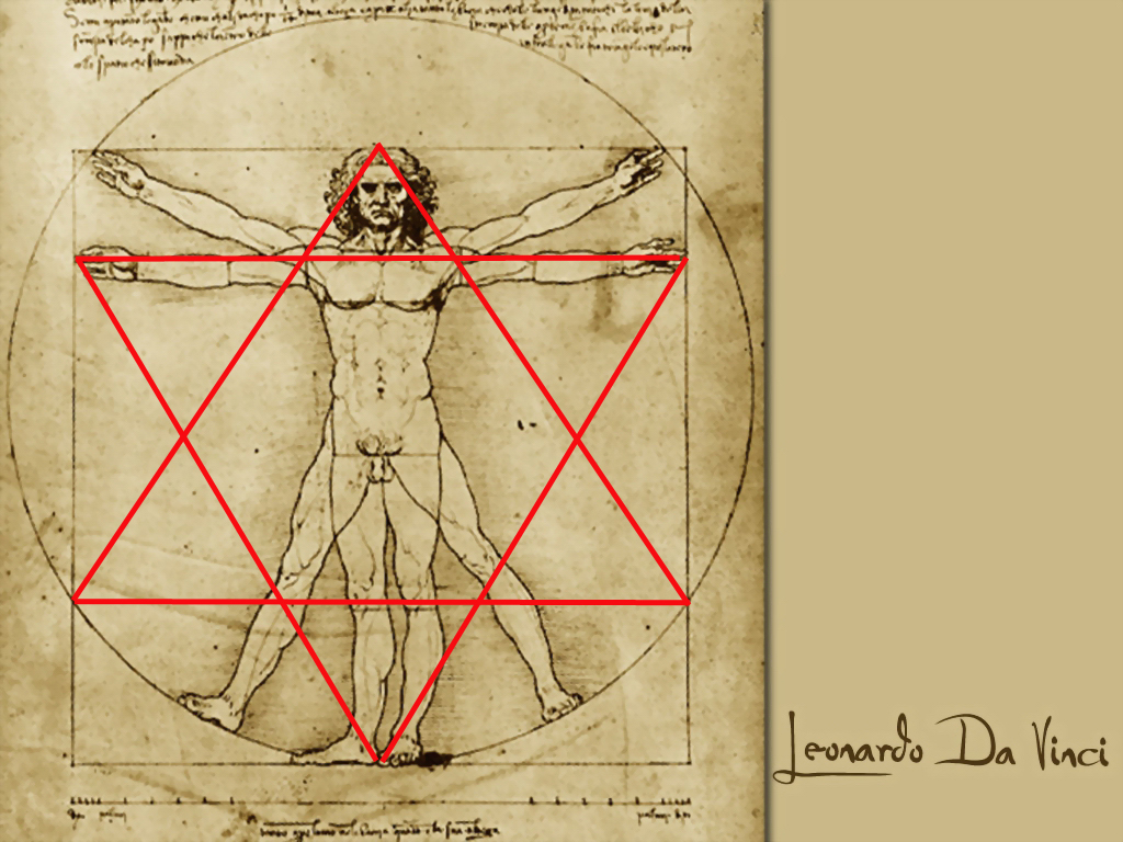
But there is a problem. Who has a foot that is 12inches long, and what is an inch?
An inch of a digit is the width of ‘your digit’ or thumb to be accurate. Therefore, the builders of Stonehenge would and did use two different physical aspects to confirm their measurement, either one foot in front of another or a long stride. The problem for archaeologists and anthropologists is that the Greeks and Romans were only about five to five and a half feet tall, and their feet at best were only 9 inches long, so they cannot be the source of this oldest measurement scale.
The person with a 12-inch foot needs to have a size 15 shoe, and because your shoe size is proportionate to your height, that is an individual over 6 foot 6 inches tall. So, does this give us an indication of whom these people were? Can we now identify the ‘megalithic people’ that constructed the stone monuments of Europe?.(Stonehenge Solved)
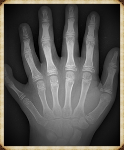
There has only been one identified group of Homo sapiens with this physical attribute in anthropological history – Cro-Magnon man.
Fifty thousand years ago, Homo sapiens emerged from Africa after approximately one million years of evolution. These hunter-gatherers were forced out of their rich tropical rainforests (which we now call the Sahara Desert) as climate change devoured their habitat. So, through necessity and survival, they followed the herds into the Middle East and found a gigantic lake called the Caspian Sea, where they came face-to-face with a species they had never seen before in humanity.
Man’s evolutionary cousins, Homo Neanderthals, had been living in this place even longer than Sapiens existed, for they too had walked ‘out of Africa’ a million years earlier and spread themselves across the known world into small, isolated tribes. However, Neanderthals were very different from their later relatives, as they were bigger, stronger, and more intelligent than the sleeker, faster, and more agile Sapiens. .(Stonehenge Solved)
But then something extraordinary happened!
Cro-Magnons
Something that would change the world for the rest of eternity, for the chance meeting of these two species would revolutionise the evolution process as ‘Stone-Age man’ would become ‘Rocket man’ in just thirty thousand years – a mere twinkle of a Darwinian eye in comparison to the millions of years that humanity had existed. And it all started with the firstborn of a cross-breed between these two species – for this was the first Cro-Magnon.
The Cro-Magnons are over six feet tall; they are upright, fast, and agile, but moreover, they are vastly intelligent and able to adapt quickly and effectively. They have a massive brain capacity and are capable of abstract thought – in reality, they are Homo Superior on the evolutionary scale.
In the Caspian Sea, they and their blonde/red-haired, blue/green-eyed civilisation-built boats from reed banks and sail the inland rivers to a place called Europe. The last ice age slowed their progress as it took effect on the land and wiped out their Neanderthal cousins, who could not adapt as their offspring; however, finally sheltered within the caves of the Dordogne in France, where humanity for the first time learned to paint, play music and weave cloth, while they waited for the long winter to subside.
They then followed the herds north in their boats to a new world created by this ice age, which had vast, fertile land rich in fruits and animals. This is where they finally settled, hunted, traded and communicated to grow a new civilisation of ancient mythology we know today..(Stonehenge Solved)

This society used stone to build the world’s first monuments, such as Stonehenge, Newgrange, and Carnac. They were the ‘Megalithic Builders’ of prehistory, but they also built much greater constructions than temples and stone circles; they ultimately created the most fantastic ancient city known to humankind – Atlantis.
Underneath the North Sea lies the lost city of Atlantis, flooded by the rising tides of the Ice Age as described by Plato. This civilisation travels the whole world in ships of reed to ‘seed’ colonies throughout the earth, including the Mediterranean, Americas, and as far as India, until one day a massive tidal wave wipes out this once great civilisation, leaving just isolated remnants throughout the world, which integrated with the local Homo sapiens to create the society we know today.
Part of this lost civilisation migrated to the Mediterranean, as Plato’s writings suggest, and not only ‘seeded’ their ancient culture, but also gave them knowledge of construction and mathematics, which is the basis of most of Pythagoras’ work. The Greeks did not reinvent the units of measurement, such as the foot or inch; they incorporated them into their society, which is why confusion persists among current historians and archaeologists who are unaware of the units’ origins.
However, this is not science fiction – this story is true and can now be proven by science. The “Truth is stranger than fiction,” as Mark Twain once said.
.(Stonehenge Solved)
Podcast

Author’s Biography
Robert John Langdon, a polymathic luminary, emerges as a writer, historian, and eminent specialist in LiDAR Landscape Archaeology.
His intellectual voyage has interwoven with stints as an astute scrutineer for governmental realms and grand corporate bastions, a tapestry spanning British Telecommunications, Cable and Wireless, British Gas, and the esteemed University of London.
A decade hence, Robert’s transition into retirement unfurled a chapter of insatiable curiosity. This phase saw him immerse himself in Politics, Archaeology, Philosophy, and the enigmatic realm of Quantum Mechanics. His academic odyssey traversed the venerable corridors of knowledge hubs such as the Museum of London, University College London, Birkbeck College, The City Literature Institute, and Chichester University.
In the symphony of his life, Robert is a custodian of three progeny and a pair of cherished grandchildren. His sanctuary lies ensconced in the embrace of West Wales, where he inhabits an isolated cottage, its windows framing a vista of the boundless sea – a retreat from the scrutinous gaze of the Her Majesty’s Revenue and Customs, an amiable clandestinity in the lap of nature’s embrace.
Exploring Prehistoric Britain: A Journey Through Time
My blog delves into the fascinating mysteries of prehistoric Britain, challenging conventional narratives and offering fresh perspectives based on cutting-edge research, particularly using LiDAR technology. I invite you to explore some key areas of my research. For example, the Wansdyke, often cited as a defensive structure, is re-examined in light of new evidence. I’ve presented my findings in my blog post Wansdyke: A British Frontier Wall – ‘Debunked’, and a Wansdyke LiDAR Flyover video further visualizes my conclusions.
My work also often challenges established archaeological dogma. I argue that many sites, such as Hambledon Hill, commonly identified as Iron Age hillforts are not what they seem. My posts Lidar Investigation Hambledon Hill – NOT an ‘Iron Age Fort’ and Unmasking the “Iron Age Hillfort” Myth explore these ideas in detail and offer an alternative view. Similarly, sites like Cissbury Ring and White Sheet Camp, also receive a re-evaluation based on LiDAR analysis in my posts Lidar Investigation Cissbury Ring through time and Lidar Investigation White Sheet Camp, revealing fascinating insights into their true purpose. I have also examined South Cadbury Castle, often linked to the mythical Camelot56.
My research also extends to the topic of ancient water management, including the role of canals and other linear earthworks. I have discussed the true origins of Car Dyke in multiple posts including Car Dyke – ABC News PodCast and Lidar Investigation Car Dyke – North Section, suggesting a Mesolithic origin2357. I also explore the misidentification of Roman aqueducts, as seen in my posts on the Great Chesters (Roman) Aqueduct. My research has also been greatly informed by my post-glacial flooding hypothesis which has helped to inform the landscape transformations over time. I have discussed this hypothesis in several posts including AI now supports my Post-Glacial Flooding Hypothesis and Exploring Britain’s Flooded Past: A Personal Journey
Finally, my blog also investigates prehistoric burial practices, as seen in Prehistoric Burial Practices of Britain and explores the mystery of Pillow Mounds, often mistaken for medieval rabbit warrens, but with a potential link to Bronze Age cremation in my posts: Pillow Mounds: A Bronze Age Legacy of Cremation? and The Mystery of Pillow Mounds: Are They Really Medieval Rabbit Warrens?. My research also includes the astronomical insights of ancient sites, for example, in Rediscovering the Winter Solstice: The Original Winter Festival. I also review new information about the construction of Stonehenge in The Stonehenge Enigma.
Further Reading
For those interested in British Prehistory, visit www.prehistoric-britain.co.uk, a comprehensive resource featuring an extensive collection of archaeology articles, modern LiDAR investigations, and groundbreaking research. The site also includes insights and extracts from the acclaimed Robert John Langdon Trilogy, a series of books exploring Britain during the Prehistoric period. Titles in the trilogy include The Stonehenge Enigma, Dawn of the Lost Civilisation, and The Post Glacial Flooding Hypothesis, offering compelling evidence about ancient landscapes shaped by post-glacial flooding.
To further explore these topics, Robert John Langdon has developed a dedicated YouTube channel featuring over 100 video documentaries and investigations that complement the trilogy. Notable discoveries and studies showcased on the channel include 13 Things that Don’t Make Sense in History and the revelation of Silbury Avenue – The Lost Stone Avenue, a rediscovered prehistoric feature at Avebury, Wiltshire.
In addition to his main works, Langdon has released a series of shorter, accessible publications, ideal for readers delving into specific topics. These include:
- The Ancient Mariners
- Stonehenge Built 8300 BCE
- Old Sarum
- Prehistoric Rivers
- Dykes, Ditches, and Earthworks
- Echoes of Atlantis
- Homo Superior
- 13 Things that Don’t Make Sense in History
- Silbury Avenue – The Lost Stone Avenue
- Offa’s Dyke
- The Stonehenge Enigma
- The Post-Glacial Flooding Hypothesis
- The Stonehenge Hoax
- Dawn of the Lost Civilisation
- Darwin’s Children
- Great Chester’s Roman Aqueduct
- Wansdyke
For active discussions and updates on the trilogy’s findings and recent LiDAR investigations, join our vibrant community on Facebook. Engage with like-minded enthusiasts by leaving a message or contributing to debates in our Facebook Group.
Whether through the books, the website, or interactive videos, we aim to provide a deeper understanding of Britain’s fascinating prehistoric past. We encourage you to explore these resources and uncover the mysteries of ancient landscapes through the lens of modern archaeology.
For more information, including chapter extracts and related publications, visit the Robert John Langdon Author Page. Dive into works such as The Stonehenge Enigma or Dawn of the Lost Civilisation, and explore cutting-edge theories that challenge traditional historical narratives.
Other Blogs
1
a
- AI now Supports – Homo Superior
- AI now supports my Post-Glacial Flooding Hypothesis
- Alexander the Great sailed into India – where no rivers exist today
- Ancient Prehistoric Canals – The Vallum
- Ancient Secrets of Althorp – debunked
- Antler Picks built Ancient Monuments – yet there is no real evidence
- Antonine Wall – Prehistoric Canals (Dykes)
- Archaeological ‘pulp fiction’ – has archaeology turned from science?
- Archaeological Pseudoscience
- Archaeology in the Post-Truth Era
- Archaeology: A Bad Science?
- Archaeology: A Harbour for Fantasists?
- Archaeology: Fact or Fiction?
- Archaeology: The Flaws of Peer Review
- Archaeology’s Bayesian Mistake: Stop Averaging the Past
- Are Raised Beaches Archaeological Pseudoscience?
- Atlantis Found: The Mathematical Proof That Plato’s Lost City Was Doggerland
- ATLANTIS: Discovery with Dan Snow Debunked
- Avebury Ditch – Avebury Phase 2
- Avebury Post-Glacial Flooding
- Avebury through time
- Avebury’s great mystery revealed
- Avebury’s Lost Stone Avenue – Flipbook
b
- Battlesbury Hill – Wiltshire
- Beyond Stone and Bone: Rethinking the Megalithic Architects of Northern Europe
- BGS Prehistoric River Map
- Blackhenge: Debunking the Media misinterpretation of the Stonehenge Builders
- Brain capacity (Cro-Magnon Man)
- Brain capacity (Cro-Magnon Man)
- Britain’s First Road – Stonehenge Avenue
- Britain’s Giant Prehistoric Waterways
- British Roman Ports miles away from the coast
c
- Caerfai Promontory Fort – Archaeological Nonsense
- Car Dyke – ABC News PodCast
- Car Dyke – North Section
- CASE STUDY – An Inconvenient TRUTH (Craig Rhos Y Felin)
- Case Study – River Avon
- Case Study – Woodhenge Reconstruction
- Chapter 2 – Craig Rhos-Y-Felin Debunked
- Chapter 2 – Stonehenge Phase I
- Chapter 2 – Variation of the Species
- Chapter 3 – Post Glacial Sea Levels
- Chapter 3 – Stonehenge Phase II
- Chapter 7 – Britain’s Post-Glacial Flooding
- Cissbury Ring through time
- Cro-Magnon Megalithic Builders: Measurement, Biology, and the DNA
- Cro-Magnons – An Explainer
d
- Darwin’s Children – Flipbook
- Darwin’s Children – The Cro-Magnons
- Dawn of the Lost Civilisation – Flipbook
- Dawn of the Lost Civilisation – Introduction
- Digging for Britain – Cerne Abbas 1 of 2
- Digging for Britain Debunked – Cerne Abbas 2
- Digging Up Britain’s Past – Debunked
- DLC Chapter 1 – The Ascent of Man
- Durrington Walls – Woodhenge through time
- Durrington Walls Revisited: Platforms, Fish Traps, and a Managed Mesolithic Landscape
- Dyke Construction – Hydrology 101
- Dykes Ditches and Earthworks
- DYKES of Britain
e
f
g
h
- Hadrian’s Wall – Military Way Hoax
- Hadrian’s Wall – the Stanegate Hoax
- Hadrian’s Wall LiDAR investigation
- Hambledon Hill – NOT an ‘Iron Age Fort’
- Hayling Island Lidar Maps
- Hidden Sources of Ancient Dykes: Tracing Underground Groundwater Fractals
- Historic River Avon
- Hollingsbury Camp Brighton
- Hollows, Sunken Lanes and Palaeochannels
- Homo Superior – Flipbook
- Homo Superior – History’s Giants
- How Lidar will change Archaeology
i
l
m
- Maiden Castle through time
- Mathematics Meets Archaeology: Discovering the Mesolithic Origins of Car Dyke
- Mesolithic River Avon
- Mesolithic Stonehenge
- Minerals found in Prehistoric and Roman Quarries
- Mining in the Prehistoric to Roman Period
- Mount Caburn through time
- Mysteries of the Oldest Boatyard Uncovered
- Mythological Dragons – a non-existent animal that is shared by the World.
o
- Offa’s Dyke Flipbook
- Old Sarum Lidar Map
- Old Sarum Through Time…………….
- On Sunken Lands of the North Sea – Lived the World’s Greatest Civilisation.
- OSL Chronicles: Questioning Time in the Geological Tale of the Avon Valley
- Oswestry LiDAR Survey
- Oswestry through time
- Oysters in Archaeology: Nature’s Ancient Water Filters?
p
- Pillow Mounds: A Bronze Age Legacy of Cremation?
- Post Glacial Flooding – Flipbook
- Prehistoric Burial Practices of Britain
- Prehistoric Canals – Wansdyke
- Prehistoric Canals – Wansdyke
- Prehistoric Canals (Dykes) – Great Chesters Aqueduct (The Vallum Pt. 4)
- Prehistoric Canals (Dykes) – Hadrian’s Wall Vallum (pt 1)
- Prehistoric Canals (Dykes) – Offa’s Dyke (Chepstow)
- Prehistoric Canals (Dykes) – Offa’s Dyke (LiDAR Survey)
- Prehistoric Canals (Dykes) – Offa’s Dyke Survey (End of Section A)
- Prehistoric Canals (Dykes) – Wansdyke (4)
- Prehistoric Canals Wansdyke 2
- Professor Bonkers and the mad, mad World of Archaeology
r
- Rebirth in Stone: Decrypting the Winter Solstice Legacy of Stonehenge
- Rediscovering the Winter Solstice: The Original Winter Festival
- Rethinking Ancient Boundaries: The Vallum and Offa’s Dyke”
- Rethinking Ogham: Could Ireland’s Oldest Script Have Begun as a Tally System?
- Rethinking The Past: Mathematical Proof of Langdon’s Post-Glacial Flooding Hypothesis
- Revolutionising History: Car Dyke Unveiled as Prehistoric & the Launch of FusionBook 360
- Rising Evidence, Falling Rivers: The Real Story of Europe’s First Farmers
- Rivers of the Past Were Higher: A Fresh Perspective on Prehistoric Hydrology
s
- Sea Level Changes
- Section A – NY26SW
- Section B – NY25NE & NY26SE
- Section C – NY35NW
- Section D – NY35NE
- Section E – NY46SW & NY45NW
- Section F – NY46SE & NY45NE
- Section G – NY56SW
- Section H – NY56NE & NY56SE
- Section I – NY66NW
- Section J – NY66NE
- Section K – NY76NW
- Section L – NY76NE
- Section M – NY87SW & NY86NW
- Section N – NY87SE
- Section O – NY97SW & NY96NW
- Section P – NY96NE
- Section Q – NZ06NW
- Section R – NZ06NE
- Section S – NZ16NW
- Section T – NZ16NE
- Section U – NZ26NW & NZ26SW
- Section V – NZ26NE & NZ26SE
- Silbury Avenue – Avebury’s First Stone Avenue
- Silbury Hill
- Silbury Hill / Sanctuary – Avebury Phase 3
- Somerset Plain – Signs of Post-Glacial Flooding
- South Cadbury Castle – Camelot
- Statonbury Camp near Bath – an example of West Wansdyke
- Stone me – the druids are looking the wrong way on Solstice day
- Stone Money – Credit System
- Stone Transportation and Dumb Censorship
- Stonehenge – Monument to the Dead
- Stonehenge Hoax – Dating the Monument
- Stonehenge Hoax – Round Monument?
- Stonehenge Hoax – Summer Solstice
- Stonehenge LiDAR tour
- Stonehenge Phase 1 — Britain’s First Monument
- Stonehenge Phase I (The Stonehenge Landscape)
- Stonehenge Solved – Pythagorean maths put to use 4,000 years before he was born
- Stonehenge Stone Transportation
- Stonehenge Through Time
- Stonehenge, Doggerland and Atlantis connection
- Stonehenge: Discovery with Dan Snow Debunked
- Stonehenge: The Worlds First Computer
- Stonehenge’s The Lost Circle Revealed – DEBUNKED
t
- Ten Reasons Why Car Dyke Blows Britain’s Earthwork Myths Out of the Water
- Ten Things You Didn’t Know About Britain’s Prehistoric Flooded Past
- Ten thousand year old boats found on Northern Europe’s Hillsides
- Ten thousand-year-old boats found on Northern Europe’s Hillsides
- The “Hunter-Gatherer” Myth: Why It’s Time to Bury This Outdated Term
- The Ancient Mariners – Flipbook
- The Ancient Mariners – Prehistoric seafarers of the Mesolithic
- The Beringian Migration Myth: Why the Peopling of the Americas by Foot is Mathematically and Logistically Impossible
- The Bluestone Enigma
- The Cro-Magnon Cover-Up: How DNA and PR Labels Erased Our Real Ancestry
- The Dolmen and Long Barrow Connection
- The Durrington Walls Hoax – it’s not a henge?
- The Dyke Myth Collapses: Excavation and Dating Prove Britain’s Great Dykes Are Prehistoric Canals
- The First European Smelted Bronzes
- The Fury of the Past: Natural Disasters in Historical and Prehistoric Britain
- The Giant’s Graves of Cumbria
- The Giants of Prehistory: Cro-Magnon and the Ancient Monuments
- The Great Antler Pick Hoax
- The Great Chichester Hoax – A Bridge too far?
- The Great Dorchester Aqueduct Hoax
- The Great Farming Hoax – (Einkorn Wheat)
- The Great Farming Migration Hoax
- The Great Hadrian’s Wall Hoax
- The Great Iron Age Hill Fort Hoax
- The Great Offa’s Dyke Hoax
- The Great Prehistoric Migration Hoax
- The Great Stone Transportation Hoax
- The Great Stonehenge Hoax
- The Great Wansdyke Hoax
- The Henge and River Relationship
- The Logistical Impossibility of Defending Maiden Castle
- The Long Barrow Mystery
- The Long Barrow Mystery: Unraveling Ancient Connections
- The Lost Island of Avalon – revealed
- The Maiden Way Hoax – A Closer Look at an Ancient Road’s Hidden History
- The Maths – LGM total ice volume
- The Mystery of Pillow Mounds: Are They Really Medieval Rabbit Warrens?
- The Old Sarum Hoax
- The Oldest Boat Yard in the World found in Wales
- The Perils of Paradigm Shifts: Why Unconventional Hypotheses Get Branded as Pseudoscience
- The Post-Glacial Flooding Hypothesis – Flipbook
- The Post-Glacial Flooding Theory
- The Problem with Hadrian’s Vallum
- The Rise of the Cro-Magnon (Homo Superior)
- The Roman Military Way Hoax
- The Silbury Hill Lighthouse?
- The Stonehenge Avenue
- The Stonehenge Avenue
- The Stonehenge Code: Unveiling its 10,000-Year-Old Secret
- The Stonehenge Enigma – Flipbook
- The Stonehenge Enigma: What Lies Beneath? – Debunked
- The Stonehenge Hoax – Bluestone Quarry Site
- The Stonehenge Hoax – Flipbook
- The Stonehenge Hoax – Moving the Bluestones
- The Stonehenge Hoax – Periglacial Stripes
- The Stonehenge Hoax – Station Stones
- The Stonehenge Hoax – Stonehenge’s Location
- The Stonehenge Hoax – The Ditch
- The Stonehenge Hoax – The Slaughter Stone
- The Stonehenge Hoax – The Stonehenge Layer
- The Stonehenge Hoax – Totem Poles
- The Stonehenge Hoax – Woodhenge
- The Stonehenge Hospital
- The Subtropical Britain Hoax
- The Troy, Hyperborea and Atlantis Connection
- The Vallum @ Hadrian’s Wall – it’s Prehistoric!
- The Vallum at Hadrian’s Wall (Summary)
- The Woodhenge Hoax
- Three Dykes – Kidland Forest
- Top Ten misidentified Fire Beacons in British History
- Troy Debunked
- TSE – DVD Barrows
- TSE DVD – An Inconvenient Truth
- TSE DVD – Antler Picks
- TSE DVD – Avebury
- TSE DVD – Durrington Walls & Woodhenge
- TSE DVD – Dykes
- TSE DVD – Epilogue
- TSE DVD – Stonehenge Phase I
- TSE DVD – Stonehenge Phase II
- TSE DVD – The Post-Glacial Hypothesis
- TSE DVD Introduction
- TSE DVD Old Sarum
- Twigs, Charcoal, and the Death of the Saxon Dyke Myth
w
- Wansdyke – Short Film
- Wansdyke East – Prehistoric Canals
- Wansdyke Flipbook
- Wansdyke LiDAR Flyover
- Wansdyke: A British Frontier Wall – ‘Debunked’
- Was Columbus the first European to reach America?
- White Sheet Camp
- Why a Simple Fence Beats a Massive Dyke (and What That Means for History)
- Windmill Hill – Avebury Phase 1
- Winter Solstice – Science, Propaganda and Indoctrination
- Woodhenge – the World’s First Lighthouse?
.(Stonehenge Solved)

