Ackling Dyke – A Prehistoric Canal? – FREE Flipbook
Robert John Langdon
Follow the Roman road from Old Sarum to Dorchester and discover where the evidence takes you
At Thorncombe Wood in Dorset, excavators found two wheel tracks about 1.5 metres apart on a deliberately laid road surface. Here we can picture a vehicle travelling along the route. At Moor Crichel, the evidence tells a different story. A substantial cutting leads downhill from old workings towards a former watercourse. When it reaches the valley, the great earthwork appears to end. A much slighter feature carries on towards Badbury Rings.
Both places lie on what we draw on the map as a Roman road. Did the Romans build the whole route, or did they inherit parts of a much older transport system?
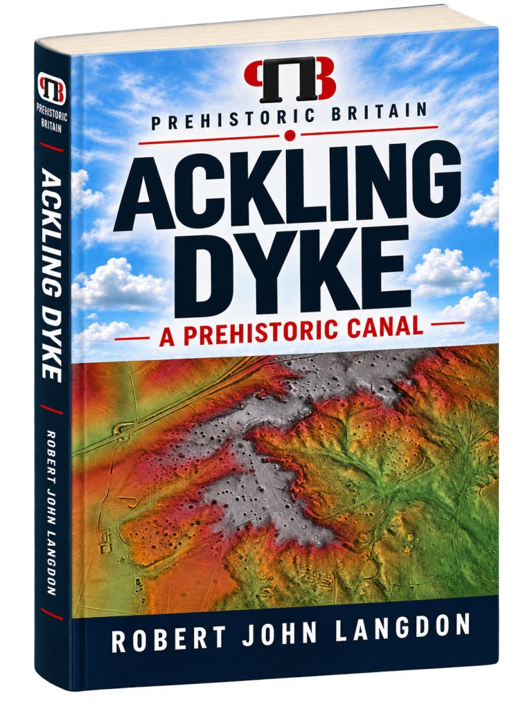
My book, Ackling Dyke – A Prehistoric Canal, follows that question for approximately 64 kilometres, from Old Sarum in Wiltshire, across Cranborne Chase and Badbury Rings, to Dorchester. It brings together the complete investigation in 17 illustrated chapters. Along the way, you can examine the LiDAR maps, compare the profiles and see what the original excavators recorded when they cut through the earthworks.
📖 Read, explore and listen
The complete book is available to read here as a free online flipbook. You can follow the investigation from the beginning or turn straight to a place you know.
Ackling Dyke is part of my Fusion 360 series. In the printed book, scan the QR codes with your mobile phone to open enhanced graphics; in the online book, click on the picture or graphic. This is particularly handy at places such as Wyke Down, where the argument turns on spotting a second alignment. You can also listen to the chapter-by-chapter audiobook and return to the investigation at your own pace.
What does the book examine?
Ackling Dyke is the traditional name for the Roman road between Old Sarum and Badbury Rings. The wider investigation follows its recognised continuation towards Dorchester. One question runs through the book:
If we follow the surviving earthworks on the ground, how much of the road drawn on the map can we actually identify?
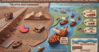
I classified the surveyed corridor by what survives today. About a quarter has a surface wide enough for wheeled traffic. Almost half has no identifiable trace in the survey. The remainder is divided between narrower surfaces and lengths where a ditch or channel is the clearest feature.
| What can be identified along the surveyed corridor | Share of the route |
|---|---|
| Surface wide enough for wheeled traffic | 24.3% |
| Narrow surface | 21.7% |
| Ditch or channel | 6.2% |
| No identifiable surviving trace | 47.8% |
A gap can have several explanations. Ploughing, later development and valley deposits all affect what we can see. The most revealing places are those where two features survive side by side, or where a substantial earthwork changes direction and we can follow both branches.
Five places to look closely
1. The Avon crossing – where did the road go?
From Old Sarum, the accepted alignment heads towards the Avon. A line on a map takes us neatly across the valley. On the ground, identifying where vehicles descended, crossed the water, and climbed the opposite side is harder. The book follows the approaches from each direction and asks where the physical evidence ends, and the projected crossing begins.
2. Woodyates – what did Pitt-Rivers actually excavate?
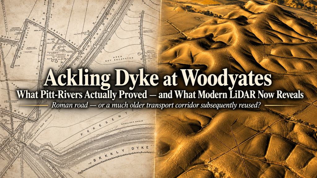
General Pitt-Rivers left something a modern aerial survey can never supply on its own. He cut through the earthworks and recorded what lay underneath. His plans allow us to compare the road construction with the adjacent banks and ditches, right down to the levels of their floors.
One recorded difference is approximately 6.6 feet, or two metres. That measurement matters because water moves downhill. Once we know the levels, we can ask which way water could have travelled, what the ditches could have drained, and how their construction relates to the road. This is where the nineteenth-century drawings earn their place alongside modern LiDAR.
3. Wyke Down – why does the route split?
At Wyke Down, one alignment turns approximately 18 degrees towards the higher ground around Sixpenny Handley. A second follows a straighter course towards the lower landscape around Gussage All Saints. Follow only the straight line, and you miss the turn on which the book’s central argument depends.
I propose that the two routes may have served different landing places as water levels changed. That gives us a specific prediction to test. If the higher destination was used first, its former channel should preserve evidence of accessible water during the period when that branch was in use. The junction is visible. Dating it and establishing the water depth at either destination are the next questions.
4. Sovell Down and Moor Crichel – follow the load
At Sovell Down, the accepted route diverts around a large extraction feature. At Moor Crichel, near The Rookery, a substantial cut and bank descends from an area of old workings towards a former watercourse. The large feature appears to finish just where a connection with water would have been most useful.
Imagine moving a heavy load out of those workings. Where would you take it, and how far would you want to haul it overland? A boat-loading point at the foot of the slope would explain why so much effort went into the descent and why the engineering changes beyond it. The maps and profiles let you examine that possibility for yourself.
5. Thorncombe Wood – what the wheel tracks establish
Within Puddletown Forest, excavation recorded a metalled running surface approximately 3.3 to 3.6 metres wide, with wheel tracks about 1.5 metres apart. It is one of the clearest pieces of evidence for wheeled traffic in the book.
It also gives us a valuable comparison. Once we have the dimensions of an excavated road, we can set them beside the much larger banks and cuttings elsewhere. Between Oakley Down and Handley Down, for example, the raised structure reaches about 13 metres wide and up to 2.5 metres high. What work was all that extra earthmoving intended to achieve?
Why the prehistoric canal interpretation matters
The word road encourages us to look along the bank. The word canal invites us to look into the cutting. At Ackling Dyke, it pays to do both.
The book proposes three broad stages. In the first, communities extracting material from higher ground may have used engineered channels to reach natural waterways. In the second, changing water levels may have led people to extend or divert particular routes towards lower landing places. In the third, Roman road builders could have incorporated useful stretches into a route for wheeled traffic.
That sequence would explain how a genuine Roman road surface, an apparent waterside terminus and two alignments heading towards different elevations could all belong to the history of the same corridor. The outstanding question is whether excavation and dating will put those events in the proposed order.
How the interpretation can be tested
LiDAR reveals a fork in a route. An excavation across the junction could establish which branch cuts or overlies the other. A ground profile shows whether a channel descends towards a valley. Sediments from its floor could tell us whether it held water and under what conditions. At a proposed landing place, dated deposits could establish whether water reached the required elevation while the adjoining earthwork was in use.
These distinctions run throughout the book. A road surface can establish local vehicle use. A former river channel can identify a place worth investigating. The case for a prehistoric canal depends on bringing the construction sequence, water supply, gradient and navigable depth together at the same location.
Where Ackling Dyke fits into the wider research
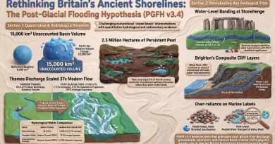
In The Post-Glacial Flooding Hypothesis, I examine how Britain’s river valleys may have changed as groundwater and river levels fell. In the Car Dyke Atlas and my investigation of Wansdyke, I apply that question to surviving linear earthworks. Ackling Dyke offers a particularly interesting comparison because excavators have already documented wheeled traffic along part of its course. Here we can ask how an older water-transport system might have transitioned into later road use, and look for where that transition should have left a physical trace.
You can also read the original illustrated investigation on the website. Ackling Dyke Reconsidered – An Investigation Prehistoric Britain
Who this book is for
If you have walked Ackling Dyke, explored Badbury Rings or followed the straight bank through the Dorset countryside, this book gives you a way to revisit familiar ground. It is also for readers interested in Roman roads, prehistoric waterways, landscape archaeology and using LiDAR to investigate a feature for themselves.
For a first look, turn to page 125 and find the fork at Wyke Down. Follow the turning branch towards Sixpenny Handley, then return to the junction and follow the straighter course towards Gussage All Saints. Those two journeys bring the book’s central question into focus.
Inside the book
| Chapter | Title | Page |
|---|---|---|
| Preface | 5 | |
| 1 | Summary — What the Investigation Found | 7 |
| 2 | The Question — Is Ackling Dyke Really One Road? | 18 |
| 3 | How We Tested It | 23 |
| 4 | The Whole Route at a Glance | 33 |
| 5 | Old Sarum to Woodyates — Following the Accepted Alignment | 41 |
| 6 | Old Sarum to The Avon — Following the Accepted Alignment | 51 |
| 7 | The Avon Crossing — Where the Roman Road Disappears | 62 |
| 8 | Nadder to Woodyates — Searching for the Roman Road | 72 |
| 9 | Woodyates — Pitt-Rivers’ Excavations Revisited | 101 |
| 10 | Wyke Down — Where the Route Splits | 125 |
| 11 | Sixpenny Handley — Three Phases of a Prehistoric Waterway | 138 |
| 12 | Gussage All Saints — Investigating the Roman Road/Dyke Alignment | 158 |
| 13 | Sovell Down and Moor Crichel — When the Roman Road Meets the Quarries | 178 |
| 14 | The Rookery to Badbury Rings — The Witchampton Alignment | 189 |
| 15 | Introduction — Extending Ackling Dyke Beyond Badbury Rings | 198 |
| 16 | Puddletown Forest — When a Roman Road Becomes an Assumption | 217 |
| 17 | Puddletown to Dorchester: The Disappearing Road | 233 |
| Appendix — References | 252 |
Hard Copy Books From Amazon
Black and White Soft Cover
Full Colour Hard Back
Podcast

The Videos
Empirical Archaeological Assessment:
Structural Re-Evaluation of the Old Sarum to Dorchester Earthwork Corridor
1. Baseline Context and Research Framework
Re-evaluating the ~64-kilometre linear corridor from Old Sarum in Wiltshire to Dorchester in Dorset is a critical objective for contemporary landscape archaeology and geo-infrastructural management. For nearly two centuries, archaeological inventories and cartographic authorities have assigned this continuous spatial axis to a single, monolithic origin: a uniform Roman military and civilian highway, historically designated across its northern and central sectors as Ackling Dyke. While field excavation securely attests to Roman-period terrestrial transport along segments of this line, interpreting the entire 64-kilometre earthwork complex as a single-phase Roman engineering project risks obscuring multi-phase infrastructural development. Legacy heritage classifications that group morphologically disparate linear features—such as deep recessed cuttings, massive embanked dykes, cut channels, and quarry-approach earthworks—under a single functional rubric hinder effective resource management and lead to the structural misattribution of complex prehistoric and historic landscapes.
This assessment spans the full ~64-kilometre corridor, from the multi-period hillfort and Roman node of Old Sarum (Sorviodunum), through the chalk uplands of Cranborne Chase, past the major earthwork junction at Badbury Rings (Vindocladia), to Dorchester (Durnovaria). The primary empirical objective is to systematically test traditional, single-phase Roman road construction templates against alternative geo-infrastructural models—specifically, pre-existing material-extraction transport networks and Holocene hydraulic transport models. To achieve this, this assessment synthesises high-resolution Light Detection and Ranging (LiDAR) digital terrain models, historical excavation datasets (including the late 19th-century records of General Pitt-Rivers and mid-20th-century field studies by W. Putnam and M. Fletcher), and recent prospective geophysical surveys conducted by the University of Southampton.
To evaluate ground reality without prior functional bias, physical features along the corridor are categorised into four standardised morphological protocols:
- Wheeled-width Road: A surviving raised surface, agger, or engineered formation broad enough (typically exceeding 3.0 meters in width) to accommodate standard two-way or heavy primary wheeled transport.
- Narrow Surface: An identifiable raised trackway, terrace, or linear formation narrower than primary wheeled-width standards (under 3.0 meters), representing secondary tracks, footpaths, or heavily eroded sub-formations.
- Ditch or Channel: A linear structural depression whose cut-and-bank cross-profile is morphologically consistent with negative earthwork features (such as extraction cuts, linear boundary dykes, or hydraulic channels) rather than elevated running surfaces.
- No Identifiable Surviving Route: Corridor segments where no corresponding physical earthwork feature can be confidently detected in high-resolution terrain mapping due to agricultural truncation, stone robbing, modern development, or an original absence of engineered construction.
Establishing these rigorous morphological baseline definitions allows theoretical landscape models to be tested against empirical, route-wide physical metrics.
2. Route-Wide Morphological Metric Analysis
Cartographic continuity on historical maps frequently masks the physical reality of linear earthworks on the ground. To prevent cartographic assumptions from driving historical interpretation, remote sensing and quantitative spatial analysis must systematically test drawn lines against physical ground survival. High-resolution LiDAR digital terrain modelling provides an unbiased, quantitative baseline for measuring ground surface elevations, allowing critical evaluation of the structural continuity of the Old Sarum to Dorchester corridor across its entire length.
A quantitative breakdown of the ~64-kilometre corridor reveals pronounced structural variability and long stretches where expected Roman road engineering is physically absent. The spatial metrics derived from digital terrain mapping across both the complete corridor and its northern sub-section are detailed below:
Comparative Morphological Metrics across the Corridor
| Morphological Category | Complete Corridor (64 km) % | Complete Corridor Length (km) | Old Sarum to Badbury Rings Sub-Section (35 km) % |
| Wheeled-width Road | 24.3% | 15.6 km | 22.1% |
| Narrow Surface | 21.7% | 13.9 km | — |
| Ditch or Channel | 6.2% | 4.0 km | — |
| Other Identified Features (Combined) | — | — | 14.0% |
| No Identifiable Surviving Route | 47.8% | 30.6 km | 63.9% |
| Total | 100.0% | 64.0 km | 100.0% |
An analysis of these metrics reveals critical spatial implications for landscape development. Across the entire 64-kilometre corridor, less than a quarter (24.3% or 15.6 km) retains a physical formation matching a wheeled-width running surface. Crucially, nearly half (47.8% or 30.6 km) of the total route—and nearly two-thirds (63.9%) of the traditionally emphasised Old Sarum to Badbury Rings sub-section—lacks any identifiable surviving engineered route on the ground. While post-medieval agricultural truncation and modern development account for localised destruction, the sheer scale of missing engineering directly challenges the assumption of a uniform, continuous Roman highway constructed ex nihilo across an open landscape.
Furthermore, structural dimensions recorded across surviving sectors exhibit pronounced profile conflicts:
- Oakley Down to Handley Down Earthwork: Historic England scheduling records document a massive, highly prominent raised structure measuring approximately 13 meters in total width and standing between 1.2 and 2.5 meters above the surrounding terrain.
- Thorncombe Wood (Puddletown Forest) Excavated Surface: Excavations conducted by W. Putnam and analysed by M. Fletcher revealed a compact, metalled gravel running surface measuring only 3.3 to 3.6 meters wide, with distinct parallel wheel ruts spaced precisely 1.5 meters apart.
- Puddletown Forest Neighbouring Earthwork: Adjacent to the metalled track, LiDAR data records a broad bank-and-ditch earthwork complex, 40 to 45 meters wide (including a bank 15 to 20 meters wide and 1.5 meters high, parallel to a ditch 15 to 20 meters wide and 0 to 1.5 meters deep).
These dimensional conflicts highlight a major infrastructural contradiction. Standard Roman road foundations (aggeres) designed to carry a ~3.5-meter metalled running surface do not require mass earthwork embankments 13 meters wide and up to 2.5 meters high, nor flanking ditch-and-bank complexes spanning 40 to 45 meters across. This dimensional variance strongly indicates that narrow metalled road surfaces were overlaid upon, or constructed alongside, pre-existing monumental earthworks.
These macro-level spatial discrepancies demonstrate that generalised cartography fails to capture ground reality, necessitating detailed sector-by-sector field evaluations starting at the corridor’s northeastern terminus.
3. Empirical Re-Evaluation of Key Sectors: Old Sarum to Woodyates
Sector-by-sector stratigraphic and morphological analysis is essential for evaluating whether linear monuments represent unified construction events or composite structures. Examining localized anomalies, cut-profiles, and subsurface geophysical features disrupts traditional cartographic narratives that assume a single origin point and continuous design.
The Old Sarum Terminus & Avon Valley Descent
The conventional model posits that the south-western Roman highway originated directly at Old Sarum (Sorviodunum). However, physical and subsurface evidence at this assumed starting point reveals a far more complex structural picture. Geophysical prospective surveys conducted by the University of Southampton (2015–2017) identified a series of discrete linear subsurface anomalies rather than a single continuous road structure:
- Anomalies m141–m142: A linear trace extending approximately 62 meters, interpreted as a potential road segment or hollow way.
- Anomalies m143–m144: A secondary alignment running at an oblique angle to the primary trajectory.
- Anomalies m145–m147: A parallel linear route traceable for approximately 130 meters adjacent to a modern bridleway.
- Anomalies m219–m220 (Dean’s Park Field): Located in Dean’s Park Field west of Old Sarum, a major linear feature measuring 170 meters long and 5 meters wide, aligned toward an Avon Bridge crossing point.
Crucially, the anomaly m219–m220 is situated within the western survey area approaching an Avon Bridge crossing point and must not be confused with the main south-western alignment traditionally associated with Ackling Dyke near Coldharbour Farm. The presence of m219–m220 demonstrates that Old Sarum possessed multiple, non-contiguous approach routes toward the river margin rather than a single, continuous highway head.
Immediately south-west of Old Sarum, LiDAR profile analysis reveals an enormous recessed feature known as the Old Sarum Cutting. Measuring about 38 meters wide and dropping to ~3 meters below adjacent ground levels, this feature presents a striking morphological contrast to standard Roman highway design. Standard Roman road construction centres on a raised, convex earth embankment (agger) designed to shed surface runoff into modest lateral ditches (fossae). The Old Sarum Cutting, by contrast, is a massive sunken depression.
                  TYPICAL ROMAN AGGER PROFILE
           Metalled Surface (~3.5m)
                 |=======|
        .--------'       '--------.          <-- Convex Raised Bank
_______/                           \_______
  Ditch                             Ditch    <-- Flanking Drainage (Fossae)

====================================================================

               THE OLD SARUM CUTTING PROFILE
Adjoining Ground                             Adjoining Ground
________________                           ________________
                \                         /  <-- Recessed Cut
                 \                       /       (~38m Width)
                  \_____________________/    <-- Depth ~3m
                       Present Route
As this massive trench descends toward the floodplain margins of the River Avon, its structural profile alters, raising significant questions regarding its original engineering function. Rather than maintaining a raised terrestrial highway formation, the earthwork descends directly into the low-lying river margin before changing character, consistent with a major river-approach dyke, water-margin interface, or bulk extraction cut subsequently adapted for road passage.
Woodyates and Bokerley Junction Excavation Metrics
Farther south-west along the corridor, near the Wiltshire–Dorset border at Woodyates, the route intersects the massive defensive linear earthwork of Bokerley Dyke. General Pitt-Rivers subjected this complex junction to detailed stratigraphic excavation between 1888 and 1891 (published in Excavations in Cranborne Chase, Volume III), with subsequent 20th-century chronological re-evaluations by Philip Rahtz.
Pitt-Rivers’ published section plans document complex spatial and elevation relationships between the road-like construction and an elaborate network of subterranean and open drainage cuts, specifically features designated as the Fore Drain, Mid Drain East, Mid Drain South, Boundary Drain, and Cross Drain.
Crucially, Pitt-Rivers recorded precise vertical elevations across these subterranean cuts, documenting an approximately 6.6-foot (~2.0-meter) vertical offset between adjacent ditch-floor bottoms within the immediate earthwork complex.
WOODYATES DITCH-FLOOR ELEVATION DISCREPANCY (PITT-RIVERS 1888-1891)

  Fore Drain Ditch Floor Level
  ----------------------------\
                               \
                                \  ~6.6-foot (~2.0m) Vertical Offset
                                 \ (Inconsistent with single-phase gravity flow)
                                  \
                                   \---------------------- Boundary / Cross Drain Ditch Floor Level
In standard single-phase Roman road engineering, flanking side ditches are excavated to uniform hydraulic gradients to facilitate continuous surface water runoff away from the road foundation. A 6.6-foot vertical offset between adjacent ditch bottoms at a localised junction physically prevents a unified, gravity-fed runoff drainage system. This vertical discrepancy indicates distinct construction horizons and independent engineering phases at Woodyates, prior to or during consolidation of the terrestrial road network.
These granular excavation metrics at Woodyates demonstrate that multi-phase structural modifications occurred along the line, providing context for major geometric divergences observed farther south.
4. Structural Divergences, Hydrological Terminals, and Extraction Landscapes
Landscape-level spatial anomalies—such as pronounced geometric shifts, branching alignments, and direct intersections with raw material source pits—provide physical evidence of changing infrastructural requirements across relative chronological periods.
The Wyke Down Route Divergence
High-resolution LiDAR modelling at Wyke Down captures a major structural divergence where the conventional linear corridor splits into two distinct, diverging tracks:
- Track 3: Diverges from the straight axis, executing a clear turn of approximately 17.8° (or ~18°) toward the north-west, projecting directly toward the high-elevation palaeochannel landscape surrounding Sixpenny Handley (~45m AOD terminal).
- Track 4: Maintains a direct, straighter trajectory continuing south-west toward the lower-elevation palaeochannel landscape of Gussage All Saints (~30m AOD terminal).
WYKE DOWN ALIGNMENT DIVERGENCE

                             (High Terminal Landscape: ~45m AOD)
                            /  Track 3 (Turns ~17.8° toward Sixpenny Handley)
                           /
--- Main Alignment -------<
                           \
                            \  Track 4 (Straight Continuation toward Gussage All Saints)
                             (Low Terminal Landscape: ~30m AOD)
This geometric splitting cannot be explained by terrain avoidance or simple surveying error. Instead, it indicates a deliberate modification of transport infrastructure across distinct chronological phases to access different geographical terminal landscapes as environmental conditions evolved.
Comparative Analysis of Candidate Hydrological Terminals
The Post-Glacial Flooding Hypothesis suggests that shifting Holocene water tables and palaeochannel networks in southern Britain dynamically dictated transport infrastructure during prehistoric periods. As groundwater levels receded throughout the mid-to-late Holocene, water-accessible transport terminals at higher elevations would become dry and unnavigable, forcing route extensions or diversions to access lower water-table margins.
The physical elevations of the two terminal landscapes accessed by the Wyke Down divergence tracks strongly mirror these hydrological thresholds:
| Landscape Parameter | Sixpenny Handley Terminal Landscape (Track 3) | Gussage All Saints Terminal Landscape (Track 4) |
| Route Terminal Elevation | ~45 meters AOD (Above Ordnance Datum) | ~30 meters AOD |
| Candidate Palaeochannel Elevation | ~30 meters AOD | ~20 meters AOD |
| Environmental Landscape Setting | High-elevation terminal environment; upper palaeochannel system. | Low-elevation terminal environment; valley-bottom palaeochannel margin. |
| Hydrological Interpretation | Primary early water-transport terminus active during higher water table stands. | Secondary adapted terminus formed after a regional water-table drop. |
Epistemological Qualification: While the spatial correlation between the geometric alignment shift of Track 3 (17.8°) and Track 4 toward differing AOD contour lines matches receding water-table predictions, this spatial correlation constitutes circumstantial landscape evidence. It represents a working hypothesis that requires direct physical validation through geo-archaeological sediment coring, palynological profiling, and sedimentary analysis to verify Holocene water presence and alluvium deposition.
Extraction Landscape Intersections
Throughout the corridor, large earthwork features consistently intersect major material quarrying and extraction landscapes:
- Moor Crichel / The Rookery: LiDAR imagery reveals a massive cut-and-bank feature descending directly from an extensive upland extraction zone down toward a valley palaeochannel. At the low-lying margin, the heavy earthwork construction abruptly terminates, while a markedly lighter secondary trackway continues along the accepted Roman road line.
- Sovell Down: The conventionally mapped Roman road route displays an unnatural, distinct spatial diversion specifically to navigate around a pre-existing, monumental extraction pit complex.
- Puddletown Forest: Field surveys reveal a dense network of ancient cuttings, quarry terraces, linear hollows, and monumental parallel earthworks measuring 40 to 45 meters wide.
These repeated spatial associations demonstrate an engineered infrastructure originally designed to move heavy, extracted bulk materials (such as stone and flint) from high-ground quarry zones down to natural or engineered watercourses for transport.
These physical sector anomalies demonstrate that the corridor preserves a multi-layered infrastructural landscape, requiring a synthesised multi-phase chronology.
5. Multi-Phase Synthesis & Heritage Management Recommendations
To ensure accurate resource scheduling, field preservation, and archaeological testing, heritage management frameworks must transition away from rigid, single-period designations. Grouping complex linear complexes under monolithic historical labels obscures underlying structural histories and hinders targeted field research.
The Three-Stage Infrastructure Development Model
To account for the observed dimensional discrepancies, route divergences, and extraction associations, this assessment advances a working, testable three-stage development model for the Old Sarum to Dorchester corridor:
               THREE-STAGE INFRASTRUCTURE DEVELOPMENT MODEL
               ============================================

STAGE A: Prehistoric Hydraulic & Extraction Network
   [High Quarry Zone] ===(Cut-and-Bank Earthwork)===> [Sixpenny Handley Terminal (~45m AOD)]

STAGE B: Environmental Adaptation & Realignment
   [Falling Water Tables] ---> Wyke Down Track 4 Realignment ---> [Gussage All Saints (~30m AOD)]

STAGE C: Roman Terrestrial Road Overlay
   [Roman Engineering] ===(3.3-3.6m Metalled Surface / Wheel Ruts)===> Overlaid on Mass Earthworks
- Stage A: Prehistoric Extraction and Hydraulic Transport Network. Initial construction of monumental cut-and-bank linear earthworks, recessed dykes, and engineered channels. This infrastructure linked high-ground quarrying and stone-extraction zones directly to high-water terminal landscapes (e.g., Sixpenny Handley at ~45 m AOD), facilitating bulk material transport via watercraft during periods of elevated Holocene water tables.
- Stage B: Environmental Adaptation and Route Realignment. Regional environmental changes—specifically receding groundwater tables and altered palaeochannel flow—dried out high-elevation terminals. This necessitated infrastructural diversions and extensions (exemplified by Track 4 at Wyke Down) to reach lower water-margin terminals (e.g., Gussage All Saints at ~30m AOD).
- Stage C: Roman-Period Adaptation and Terrestrial Overlay. Roman military and civil engineers recognised the strategic utility of the existing continuous linear earthwork corridors. Engineers cleared, modified, and overlaid metalled gravel running surfaces (3.3 to 3.6 meters wide, with 1.5-meter wheel ruts, as excavated at Thorncombe Wood) directly atop or alongside the massive, pre-existing bank-and-ditch earthworks (such as the 13-meter-wide earthworks at Oakley Down).
Analytical Note: This three-stage structural model is presented as a testable archaeological working hypothesis requiring targeted stratigraphic excavation and absolute dating, not a proven final chronology.
Empirical Baseline Protocol for Heritage Managers & Field Archaeologists
Future field evaluations, development control assessments, and scheduling updates along the Ackling Dyke corridor should adopt the following four standardised protocols:
- Delineate Earthwork Sub-Components in Official Records: Historic Environment Records (HER) and scheduling documentation must formally distinguish between the upper metalled running surface (agger) and the underlying mass earthwork bank-and-ditch foundations. HER entries should cease assuming structural co-evality between superficial metalled capping and underlying earthworks.
- Execute Targeted Stratigraphic Cross-Sections: Prioritise full stratigraphic excavation trenches across critical infrastructural junctions—specifically the Wyke Down Track 3/Track 4 divergence point and Bokerley Junction—to establish relative physical sequences between ditch cuts, bank fill layers, and metalled road caps.
- Systematic Hydrological and Sedimentary Sampling: High-resolution core sampling must be executed along ditch floors and candidate palaeochannel terminals at Sixpenny Handley, Gussage All Saints, and Moor Crichel. Core samples should be evaluated for water-laid alluvial sediments, micro-faunal signatures, and palynological (pollen) data to accurately reconstruct Holocene water table dynamics.
- Re-Evaluate Commercial Excavation Permit Metrics: Development control protocols and archaeological briefs for linear developments crossing the corridor must require researchers to evaluate broad bank-and-ditch structures (>10 meters wide) independently of standardised Roman road construction templates.
Re-evaluating linear earthworks through an empirical, unbiased baseline is essential for advancing our understanding of southern Britain’s multi-period landscape heritage.
Author’s Biography

Robert John Langdon, a polymathic luminary, emerges as a writer, historian, and eminent specialist in LiDAR Landscape Archaeology.
His intellectual journey has included stints as an astute scrutineer in government and major corporate bastions, spanning British Telecommunications, Cable and Wireless, British Gas, and the esteemed University of London.
A decade hence, Robert’s transition into retirement unfurled a chapter of insatiable curiosity. He immersed himself in Politics, Archaeology, Philosophy, and the enigmatic realm of Quantum Mechanics. His academic odyssey took him through the venerable corridors of knowledge hubs such as the Museum of London, University College London, Birkbeck College, The City Literature Institute, and Chichester University.
In the symphony of his life, Robert is a custodian of three progeny and a pair of cherished grandchildren. His sanctuary lies ensconced in the embrace of West Wales, where he inhabits an isolated cottage, its windows framing a vista of the boundless sea – a retreat from the scrutinising gaze of Her Majesty’s Revenue and Customs, an amiable clandestinity in the lap of nature.
Exploring Prehistoric Britain: A Journey Through Time
My blog delves into the fascinating mysteries of prehistoric Britain, challenging conventional narratives and offering fresh perspectives grounded in cutting-edge research, particularly LiDAR technology. I invite you to explore some key areas of my research. For example, I re-examine the Wansdyke, often cited as a defensive structure, in light of new evidence. I’ve presented my findings in my blog post Wansdyke: A British Frontier Wall – ‘Debunked’, and a Wansdyke LiDAR Flyover video further visualises my conclusions.
My work also often challenges established archaeological dogma. I argue that many sites, such as Hambledon Hill, commonly identified as Iron Age hillforts, are not what they seem. My posts Lidar Investigation Hambledon Hill – NOT an ‘Iron Age Fort’ and Unmasking the “Iron Age Hillfort” Myth explore these ideas in detail and offer an alternative view. Similarly, I re-evaluated sites like Cissbury Ring and White Sheet Camp through LiDAR analysis in my posts “Lidar Investigation Cissbury Ring through time” and “Lidar Investigation White Sheet Camp,“ revealing fascinating insights into their true purpose. I have also examined South Cadbury Castle, often linked to the mythical Camelot56.
My research also extends to ancient water management, including the role of canals and other linear earthworks. I have discussed the true origins of Car Dyke in multiple posts, including Car Dyke – ABC News Podcast and Lidar Investigation Car Dyke – North Section, which suggest a Mesolithic origin 2357. I also explore the misidentification of Roman aqueducts, as seen in my posts on the Great Chesters (Roman) Aqueduct. My research has also been shaped by my post-glacial flooding hypothesis, which helps explain landscape transformations over time. I have discussed this hypothesis in several posts, including AI now supports my Post-Glacial Flooding Hypothesis and Exploring Britain’s Flooded Past: A Personal Journey
Finally, my blog also investigates prehistoric burial practices, as seen in Prehistoric Burial Practices of Britain and explores the mystery of Pillow Mounds, often mistaken for medieval rabbit warrens, but with a potential link to Bronze Age cremation in my posts: Pillow Mounds: A Bronze Age Legacy of Cremation? and The Mystery of Pillow Mounds: Are They Really Medieval Rabbit Warrens?. My research also includes astronomical insights into ancient sites, for example, in Rediscovering the Winter Solstice: The Original Winter Festival. I also review new information about Stonehenge’s construction in The Stonehenge Enigma.
Yes. I’d make this far tighter, more inviting and more obviously a gateway into the rest of your work. The present version repeats the website several times and reads more like an author biography than a “what next?” section.
I’d also make the three routes immediately obvious: Explore the Research → Watch the Videos → Read the Books, with Facebook as the discussion/community route.
Further Reading — Explore the Evidence
The investigation doesn’t end with this article.
Prehistoric Britain brings together hundreds of articles, LiDAR investigations, field discoveries, archaeological studies, and original research that explore Britain’s prehistoric landscape from a different perspective.
Follow the evidence across ancient waterways, lost landscapes, Stonehenge and Avebury, prehistoric engineering, submerged Britain, ancient DNA and the effects of post-glacial flooding — comparing established archaeological interpretations with alternative explanations suggested by the physical evidence.
🎬 Watch the Investigations
Prefer to watch rather than read?
The Robert John Langdon YouTube channel has more than 200 documentaries, investigations, and video presentations that bring the research to life through maps, LiDAR, archaeological evidence, and landscape reconstruction.
Discover investigations including 13 Things That Don’t Make Sense in History, Silbury Avenue – The Lost Stone Avenue, Stonehenge, prehistoric waterways, submerged landscapes and many more.
📚 Explore the Book Library
Go deeper into the evidence through Robert John Langdon’s growing collection of books and specialist studies, including:
- The Stonehenge Hoax – 13 Things That Don’t Make Sense in History
- Car Dyke – Prehistoric Dyke
- Wansdyke – Prehistoric Dyke
- Offa’s Dyke – Prehistoric Dyke
- Silbury Avenue – The Lost Stone Avenue
- The Vallum – At Hadrian’s Wall
- Stonehenge: The World’s First Computer
- Avebury’s Lost Stone Avenue
Many of these investigations connect directly with the evidence discussed throughout the website, allowing individual discoveries to be examined as part of the much wider prehistoric landscape.
🔎 Read the Main Trilogy
Three major works bring together the central strands of the research:
The Post-Glacial Flooding Hypothesis — investigates the evidence for radically different water levels, waterways and landscapes in prehistoric Britain.
The Stonehenge Enigma — re-examines the chronology, landscape and purpose of one of the world’s most famous prehistoric monuments.
Dawn of the Lost Civilisation — explores the evidence for sophisticated communities, technology and maritime connections far earlier than traditionally assumed.
💬 Join the Investigation
New discoveries, LiDAR surveys and research are discussed as they happen in the Prehistoric Britain Facebook Group.
Join the discussion, challenge the evidence, offer alternative interpretations and follow new investigations as they develop.
Don’t just read the accepted story. Explore the evidence, compare the interpretations, and decide for yourself.
Other Blogs
1
a
- Ackling Dyke – Facts and the Archaeological Fiction
- Ackling Dyke – A Prehistoric Canal? – FREE Flipbook
- Ackling Dyke – Part II – Puddletown Forest: When a Roman Road Becomes an Assumption
- Ackling Dyke – Part III – The Roman Road Mystery Finally Makes Sense
- AI now Supports – Homo Superior
- AI now supports my Post-Glacial Flooding Hypothesis
- Alexander the Great sailed into India – where no rivers exist today
- Ancient Secrets of Althorp – debunked
- Antler Picks built Ancient Monuments – yet there is no real evidence
- Antonine Wall – Prehistoric Canals (Dykes)
- Archaeological ‘pulp fiction’ – has archaeology turned from science?
- Archaeological Pseudoscience
- Archaeology in the Post-Truth Era
- Archaeology: A Bad Science?
- Archaeology: A Harbour for Fantasists?
- Archaeology: Fact or Fiction?
- Archaeology: The Flaws of Peer Review
- Archaeology’s Bayesian Mistake: Stop Averaging the Past
- Are Raised Beaches Archaeological Pseudoscience?
- Atlantis Found: The Mathematical Proof That Plato’s Lost City Was Doggerland
- ATLANTIS: Discovery with Dan Snow Debunked
- Avebury Ditch – Avebury Phase 2
- Avebury through time
- Avebury’s great mystery revealed
- Avebury’s Lost Stone Avenue – Flipbook
b
- Battlesbury Hill – Wiltshire
- Beyond Stone and Bone: Rethinking the Megalithic Architects of Northern Europe
- BGS Prehistoric River Map
- Blackhenge: Debunking the Media misinterpretation of the Stonehenge Builders
- Brain capacity (Cro-Magnon Man)
- Britain’s Changing Funeral Traditions
- Britain’s First Road – Stonehenge Avenue
- Britain’s Giant Prehistoric Waterways
- British Roman Ports miles away from the coast
c
- Caerfai Promontory Fort – Archaeological Nonsense
- Car Dyke – ABC News PodCast
- Car Dyke – North Section
- Cardigan Bay: The Holocene Evidence the Old Geological Story Has Missed
- CASE STUDY – An Inconvenient TRUTH (Craig Rhos Y Felin)
- Case Study – River Avon
- Case Study – Woodhenge Reconstruction
- Chapter 2 – Craig Rhos-Y-Felin Debunked
- Chapter 2 – Stonehenge Phase I
- Chapter 2 – Variation of the Species
- Chapter 3 – Post Glacial Sea Levels
- Chapter 3 – Stonehenge Phase II
- Chapter 7 – Britain’s Post-Glacial Flooding
- Cissbury Ring through time
- Clement Reid, Doggerland, and the Archaeological Establishment
- Cro-Magnon Brain Capacity
- Cro-Magnon Megalithic Builders: Measurement, Biology, and the DNA
- Cro-Magnons – An Explainer
d
- Darwin’s Children – Flipbook
- Darwin’s Children – The Cro-Magnons
- Dawn of The Lost Civilisation – 1/10
- Dawn of the Lost Civilisation – Flipbook
- Dawn of the Lost Civilisation – Introduction
- Digging for Britain – Cerne Abbas
- Digging for Britain Debunked – Cerne Abbas 2
- Digging Up Britain’s Past – Debunked
- DLC Chapter 1 – The Ascent of Man
- Durrington Walls – Woodhenge through time
- Durrington Walls Revisited: Platforms, Fish Traps, and a Managed Mesolithic Landscape
- Dyke Construction – Hydrology 101
- Dykes Ditches and Earthworks
- DYKES of Britain
e
f
g
h
- Hadrian’s Wall – Military Way Hoax
- Hadrian’s Wall – the Stanegate Hoax
- Hadrian’s Wall Vallum – Prehistoric Canals – FREE Online Book
- Hadrian’s Wall LiDAR investigation
- Hambledon Hill – NOT an ‘Iron Age Fort’
- Hayling Island Lidar Maps
- Hidden Sources of Ancient Dykes: Tracing Underground Groundwater Fractals
- Historic River Avon
- Hollingsbury Camp Brighton – A Hillfort… or a Forgotten Harbour?
- Hollows, Sunken Lanes and Palaeochannels
- Homo Superior – Flipbook
- Homo Superior – History’s Giants
- How Lidar will change Archaeology
- Hydrology 101 Simplified: Why Britain’s Dykes Worked Without Rivers
i
l
m
- Maiden Castle through time
- Mathematics Meets Archaeology: Discovering the Mesolithic Origins of Car Dyke
- Mesolithic River Avon
- Mesolithic Stonehenge
- Minerals found in Prehistoric and Roman Quarries
- Mining in the Prehistoric to Roman Period
- Mount Caburn through time
- Mysteries of the Oldest Boatyard Uncovered
- Mythological Dragons – a non-existent animal that is shared by the World.
o
- Offa’s Dyke Flipbook
- Old Sarum Lidar Map
- Old Sarum Through Time…………….
- On Sunken Lands of the North Sea – Lived the World’s Greatest Civilisation.
- OSL Chronicles: Questioning Time in the Geological Tale of the Avon Valley
- Oswestry LiDAR Survey
- Oswestry through time
- Oysters in Archaeology: Nature’s Ancient Water Filters?
p
- Pillow Mounds: A Bronze Age Legacy of Cremation?
- Pinkery Canal
- Plato Was Right: The Archaeological Evidence the Academics Never Expected
- Post Glacial Flooding – Flipbook
- Prehistoric Burial Practices of Britain
- Prehistoric Canals – Wansdyke
- Prehistoric Canals – Wansdyke
- Prehistoric Canals (Dykes) – Great Chesters Aqueduct (The Vallum Pt. 4)
- Prehistoric Canals (Dykes) – Offa’s Dyke (Chepstow)
- Prehistoric Canals (Dykes) – Offa’s Dyke (LiDAR Survey)
- Prehistoric Canals (Dykes) – Offa’s Dyke Survey (End of Section A)
- Prehistoric Canals (Dykes) – Wansdyke (4)
- Prehistoric Canals Wansdyke 2
- Professor Bonkers and the mad, mad World of Archaeology
r
- Real-World Confirmation of Post-Glacial Flooding
- Rebirth in Stone: Decrypting the Winter Solstice Legacy of Stonehenge
- Rediscovering the Winter Solstice: The Original Winter Festival
- Rethinking Ancient Boundaries: The Vallum and Offa’s Dyke”
- Rethinking Ogham: Could Ireland’s Oldest Script Have Begun as a Tally System?
- Rethinking The Past: Mathematical Proof of Langdon’s Post-Glacial Flooding Hypothesis
- Revolutionising History: Car Dyke Unveiled as Prehistoric & the Launch of FusionBook 360
- Rising Evidence, Falling Rivers: The Real Story of Europe’s First Farmers
- Rivers of the Past Were Higher: A Fresh Perspective on Prehistoric Hydrology
s
- Sea Level Changes
- Section A – NY26SW
- Section B – NY25NE & NY26SE
- Section C – NY35NW
- Section D – NY35NE
- Section E – NY46SW & NY45NW
- Section F – NY46SE & NY45NE
- Section G – NY56SW
- Section H – NY56NE & NY56SE
- Section I – NY66NW
- Section J – NY66NE
- Section K – NY76NW
- Section L – NY76NE
- Section M – NY87SW & NY86NW
- Section N – NY87SE
- Section O – NY97SW & NY96NW
- Section P – NY96NE
- Section Q – NZ06NW
- Section R – NZ06NE
- Section S – NZ16NW
- Section T – NZ16NE
- Section U – NZ26NW & NZ26SW
- Section V – NZ26NE & NZ26SE
- Silbury Avenue – Avebury’s First Stone Avenue
- Silbury Hill
- Silbury Hill / Sanctuary – Avebury Phase 3
- Sky Maps of Prehistoric Britain
- Somerset Plain – Signs of Post-Glacial Flooding
- South Cadbury Castle – Camelot
- Statonbury Camp near Bath – an example of West Wansdyke
- Stone me – the druids are looking the wrong way on Solstice day
- Stone Transportation and Dumb Censorship
- Stonehenge – Monument to the Dead
- Stonehenge Hoax – Dating the Monument
- Stonehenge Hoax – Round Monument?
- Stonehenge Hoax – Summer Solstice
- Stonehenge LiDAR tour
- Stonehenge Phase 1 — Britain’s First Monument
- Stonehenge Phase I (The Stonehenge Landscape)
- Stonehenge Solved – Pythagorean maths put to use 4,000 years before he was born
- Stonehenge Through Time
- Stonehenge, Doggerland and Atlantis connection
- Stonehenge: Borehole Evidence of Post-Glacial Flooding
- Stonehenge: Discovery with Dan Snow Debunked
- Stonehenge: The World’s First Computer – FREE Book
- Stonehenge: The Worlds First Computer
- Stonehenge’s The Lost Circle Revealed – DEBUNKED
- Stonehenge’s Chronological Mirage
t
- Ten Reasons Why Car Dyke Blows Britain’s Earthwork Myths Out of the Water
- Ten Things You Didn’t Know About Britain’s Prehistoric Flooded Past
- Ten thousand year old boats found on Northern Europe’s Hillsides
- Ten thousand-year-old boats found on Northern Europe’s Hillsides
- Testing Plato’s Atlantis Against Reality
- The “Hunter-Gatherer” Myth: Why It’s Time to Bury This Outdated Term
- The Ackling Dyke Smoking Gun
- The Ancient Mariners – Flipbook
- The Ancient Mariners – Prehistoric seafarers of the Mesolithic
- The Ascent of Man — From Survival to Systems
- The Beringian Migration Myth: Why the Peopling of the Americas by Foot is Mathematically and Logistically Impossible
- The Bluestone Enigma
- The Bulford Hoax: The “Simpler, Older Stonehenge” That Wasn’t
- The Cheddar Man Hoax
- The Cro-Magnon Cover-Up: How DNA and PR Labels Erased Our Real Ancestry
- The Dolmen and Long Barrow Connection
- The Durrington Mega-Monument Hoax: What Lies Beneath? – Debunked
- The Durrington Walls Hoax – it’s not a henge?
- The Dyke Myth Collapses: Excavation and Dating Prove Britain’s Great Dykes Are Prehistoric Canals
- The First European Smelted Bronzes
- The Fury of the Past: Natural Disasters in Historical and Prehistoric Britain
- The Giant’s Graves of Cumbria
- The Giants of Prehistory: Cro-Magnon and the Ancient Monuments
- The Great Ancient DNA Illusion: How Statistical Models Became Archaeological “Facts”
- The Great Antler Pick Hoax
- The Great Bell Beaker Migration Myth
- The Great Chichester Hoax – A Bridge too far?
- The Great Dorchester Aqueduct Hoax
- The Great Farming Hoax – (Einkorn Wheat)
- The Great Farming Migration Hoax
- The Great Hadrian’s Wall Hoax
- The Great Iron Age Hill Fort Hoax
- The Great Offa’s Dyke Hoax
- The Great Prehistoric Migration Hoax
- THE GREAT ROMAN ROAD HOAX
- THE GREAT ROMAN ROAD MAP MYTH
- The Great Stone Transportation Hoax
- The Great Stonehenge Hoax
- The Great Wansdyke Hoax
- THE GREAT WEST WOODS HOAX — WHEN ONE STONE BECOMES FIFTY
- The Henge and River Relationship
- The Logistical Impossibility of Defending Maiden Castle
- The Long Barrow and Dolmen Enigma
- The Long Barrow Mystery
- The Long Barrow Mystery: Unravelling Ancient Connections
- The Lost Island of Avalon – revealed
- The Maiden Way Hoax – A Closer Look at an Ancient Road’s Hidden History
- The Maths – LGM total ice volume
- The Mystery of Pillow Mounds: Are They Really Medieval Rabbit Warrens?
- THE ODYSSEY PROBLEM: WHY DID A WEEK-LONG VOYAGE BECOME A TEN-YEAR EPIC?
- The Old Sarum Hoax
- The Oldest Boat Yard in the World found in Wales
- The Perils of Paradigm Shifts: Why Unconventional Hypotheses Get Branded as Pseudoscience
- The Post-Glacial Flooding Hypothesis – 1/11
- The Post-Glacial Flooding Hypothesis – Flipbook
- The Post-Glacial Flooding Theory
- The Problem with Hadrian’s Vallum
- The Rise of the Cro-Magnon (Homo Superior)
- The Roman Military Way Hoax
- The Silbury Hill Lighthouse?
- The Stone Money – Credit System
- The Stonehenge Avenue
- The Stonehenge Avenue
- The Stonehenge Code: Unveiling its 10,000-Year-Old Secret
- The Stonehenge Crescent: A Monument to a Lost World
- The Stonehenge Enigma – Flipbook
- The Stonehenge Enigma: Part 1/6
- The Stonehenge Hoax – Bluestone Quarry Site
- The Stonehenge Hoax – Flipbook
- The Stonehenge Hoax – Moving the Bluestones
- The Stonehenge Hoax – Periglacial Stripes
- The Stonehenge Hoax – Station Stones
- The Stonehenge Hoax – Stonehenge’s Location
- The Stonehenge Hoax – The Ditch
- The Stonehenge Hoax – The Slaughter Stone
- The Stonehenge Hoax – The Stonehenge Layer
- The Stonehenge Hoax – Totem Poles
- The Stonehenge Hoax – Woodhenge
- The Stonehenge Hospital
- The Stonehenge Transportation Mystery
- The Subtropical Britain Hoax
- The Troy, Hyperborea and Atlantis Connection
- The Vallum @ Hadrian’s Wall – it’s Prehistoric!
- The Vallum at Hadrian’s Wall (Summary)
- The Woodhenge Hoax
- Thirty Years of CAU Archaeology Going Nowhere?
- Three Dykes – Kidland Forest
- Thurnam’s 137 Skulls: The Forgotten People Behind Britain’s Megaliths.
- Top Ten Misidentified Fire Beacons in British History
- Troy Debunked – Troy did not exist in Asia Minor, but in fact, the North Sea island of Doggerland
- TSE – DVD Barrows
- TSE DVD – An Inconvenient Truth
- TSE DVD – Antler Picks
- TSE DVD – Avebury
- TSE DVD – Durrington Walls & Woodhenge
- TSE DVD – Dykes
- TSE DVD – Epilogue
- TSE DVD – Stonehenge Phase I
- TSE DVD – Stonehenge Phase II
- TSE DVD – The Post-Glacial Hypothesis
- TSE DVD Introduction
- TSE DVD Old Sarum
- Twigs, Charcoal, and the Death of the Saxon Dyke Myth
w
- Wansdyke – Short Film
- Wansdyke East – Prehistoric Canals
- Wansdyke Flipbook
- Wansdyke LiDAR Flyover
- Wansdyke: A British Frontier Wall – ‘Debunked’
- Was Columbus the first European to reach America?
- What Archaeology Missed Beneath Stonehenge
- White Sheet Camp
- Why a Simple Fence Beats a Massive Dyke (and What That Means for History)
- Windmill Hill – Avebury Phase 1
- Winter Solstice – Science, Propaganda and Indoctrination
- Woodhenge – the World’s First Lighthouse?